Mont Emilius, from Col Carrel

Edited by:
Gian Mario Navillod
Updated at: 22/06/2025
Introduction
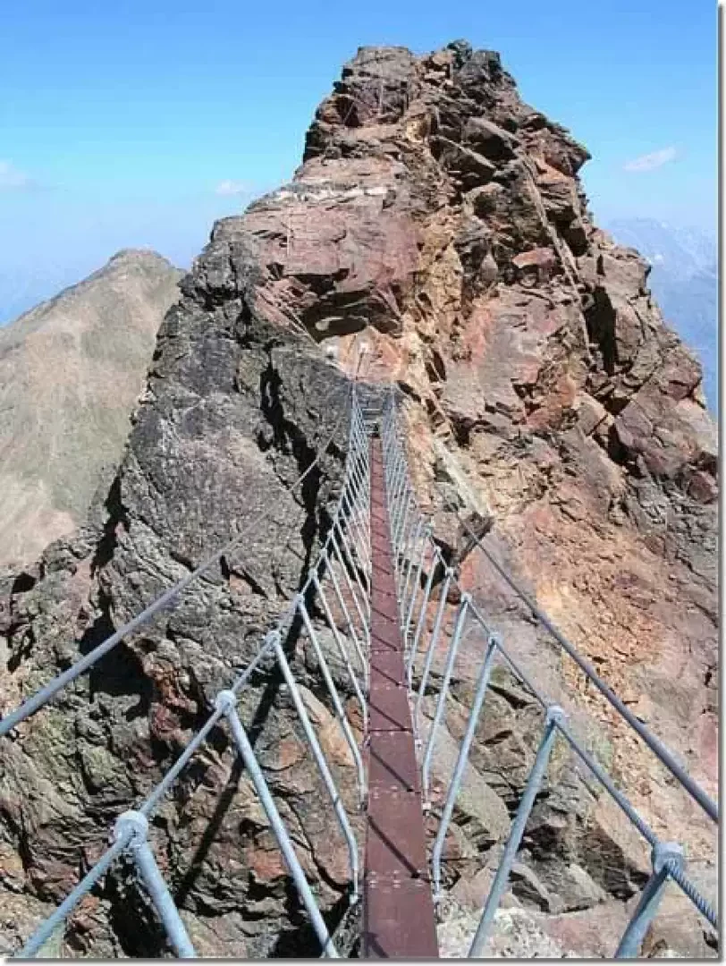
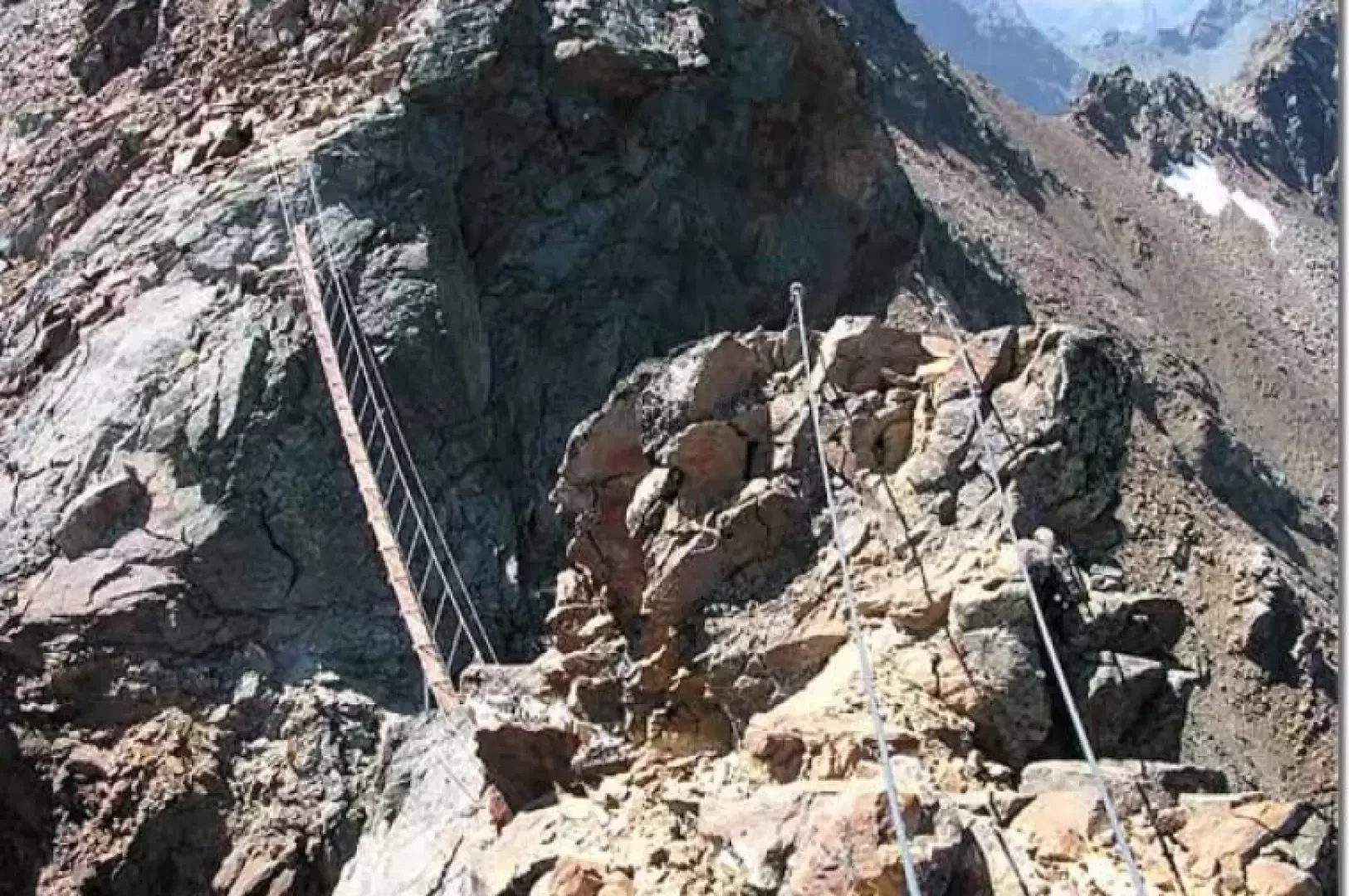
This is undoubtedly the most scenic via ferrata on offer in the entire Valle d'Aosta; the view sweeps over the most beautiful mountains in the Alps and around the summit sparkle a dozen large and small lakes. The difficulties are not excessive, rare vertical sections alternate with long ups and downs on the ridge, almost never exposed. The suspension bridge, some twenty metres long, offers a pinch of adrenalin to a long and undemanding climb. Unfortunately, the last section of the ferrata, just below the summit tower, has a couple of vertical metres that have not been equipped with the usual steps, the rocks on which it climbs are not stable, and there are numerous precariously balanced boulders right at the exit of the key passage.
Description
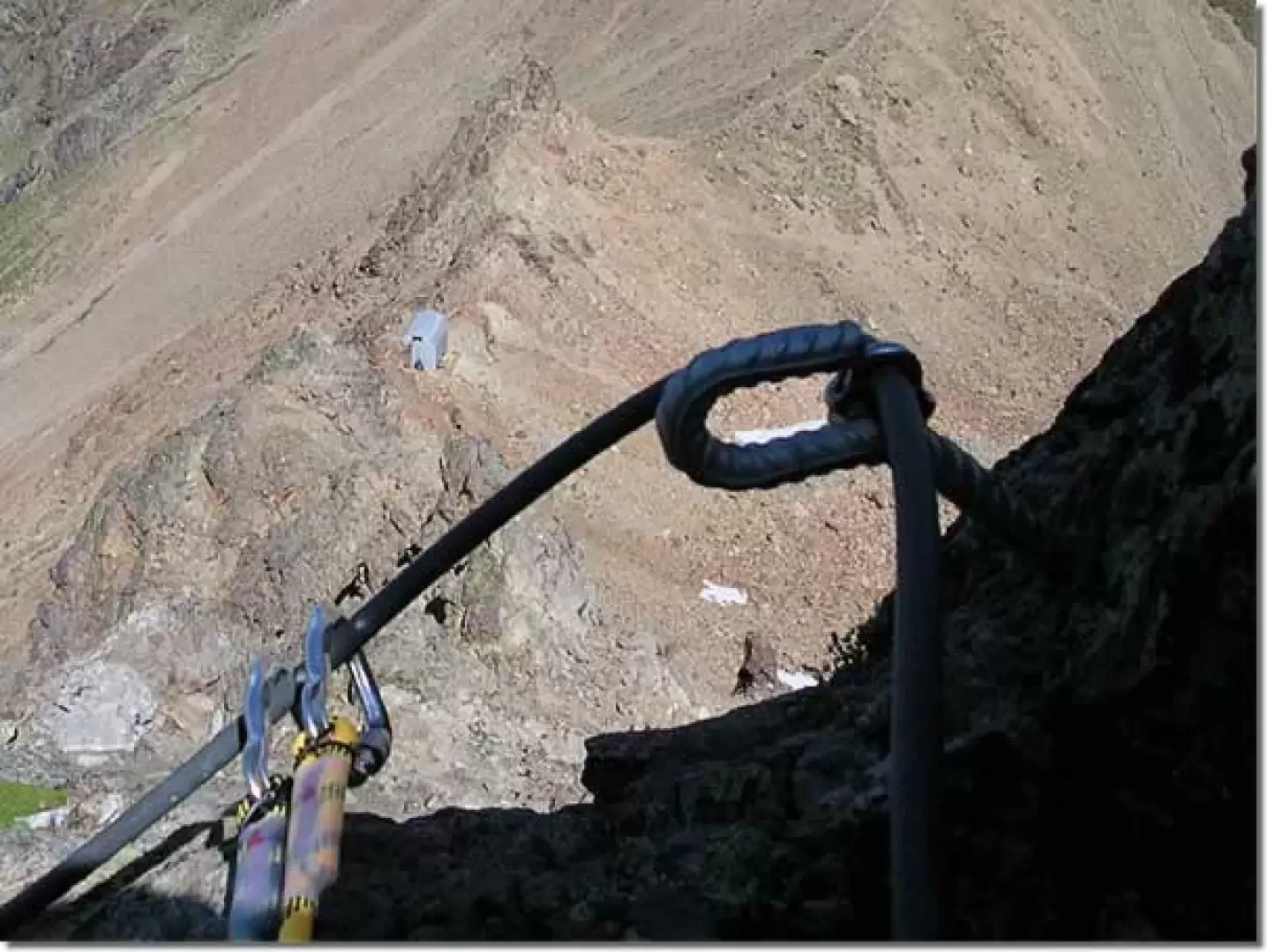
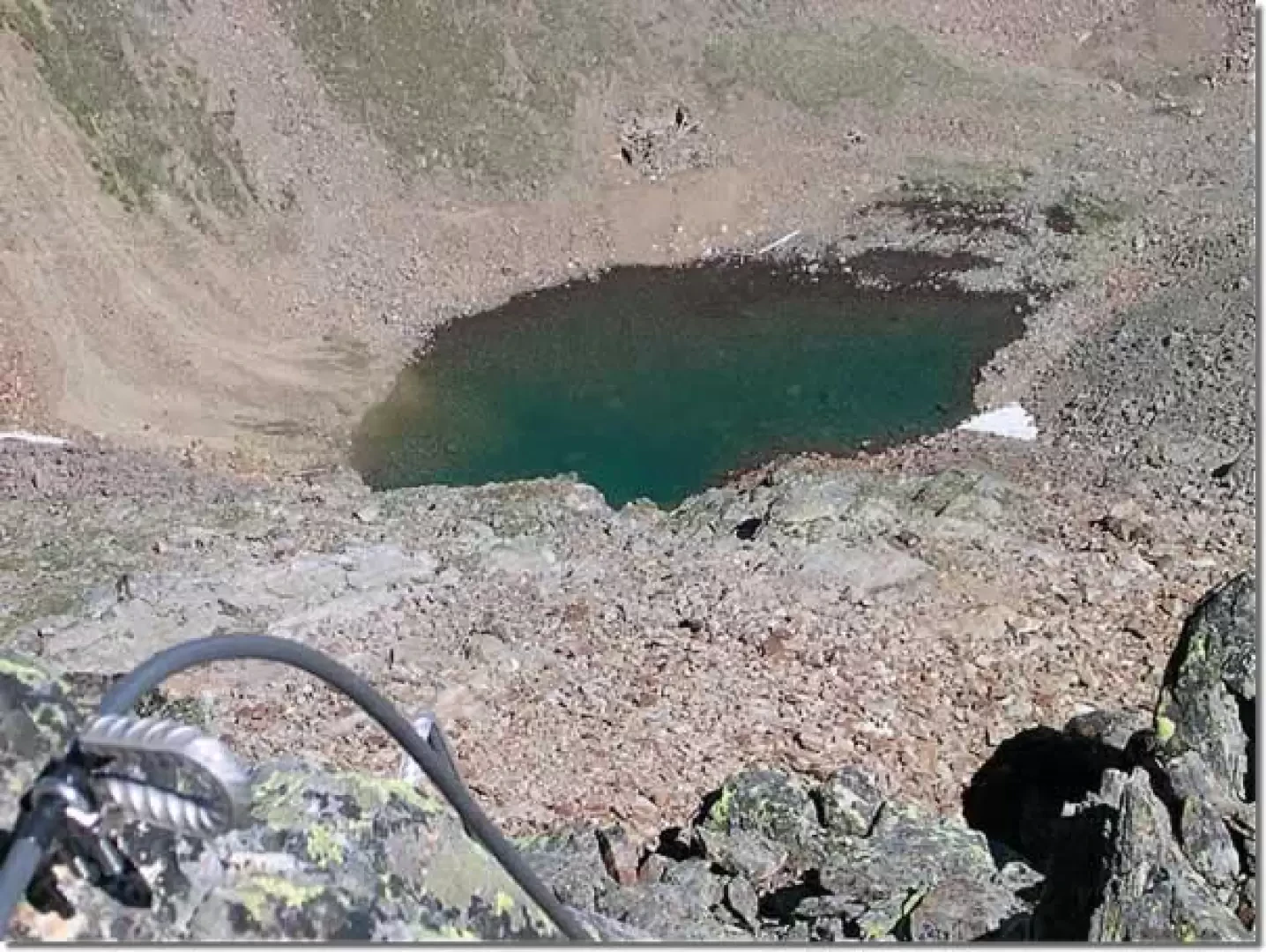
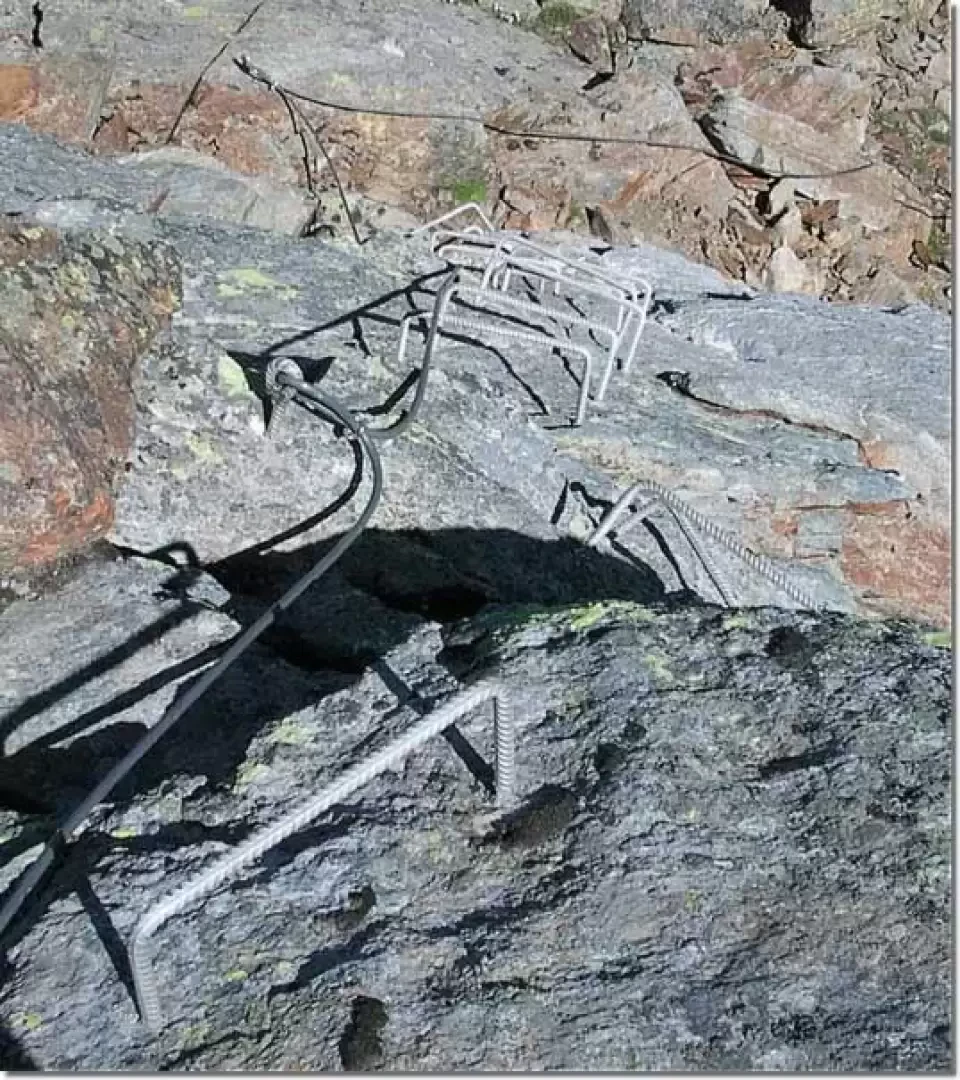
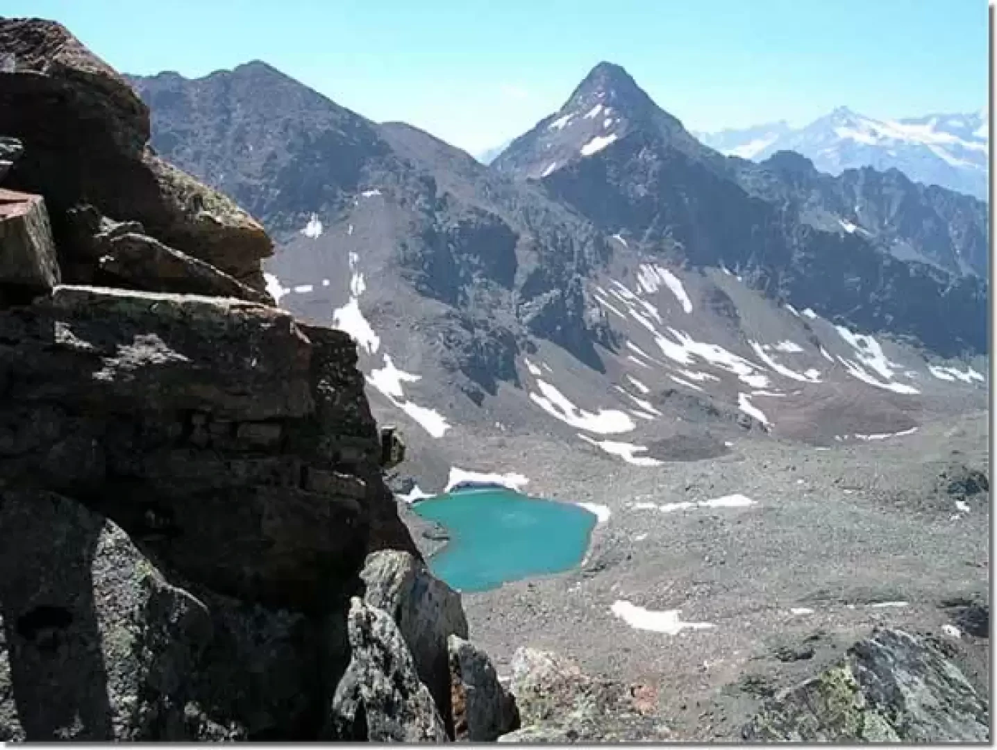
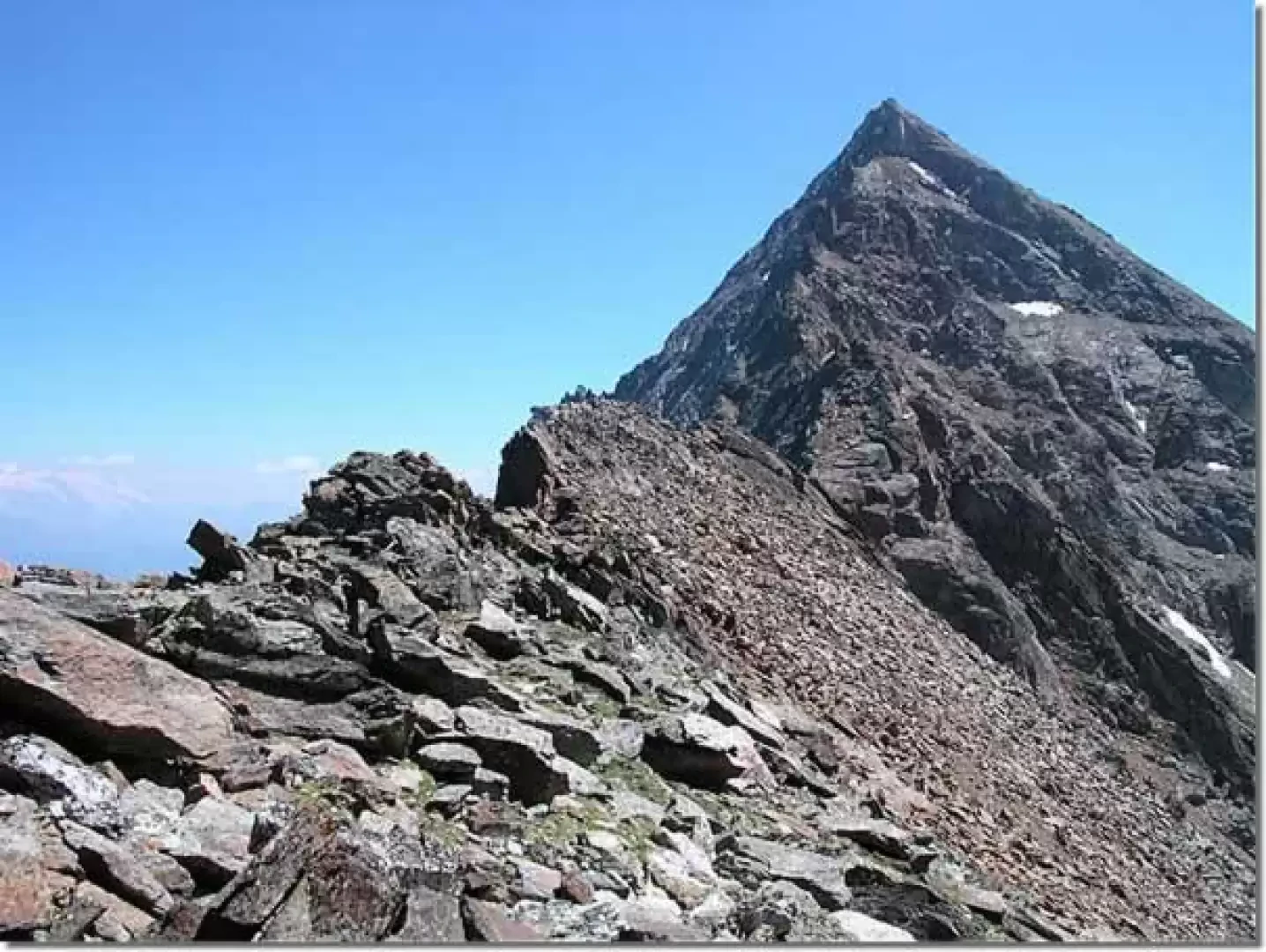
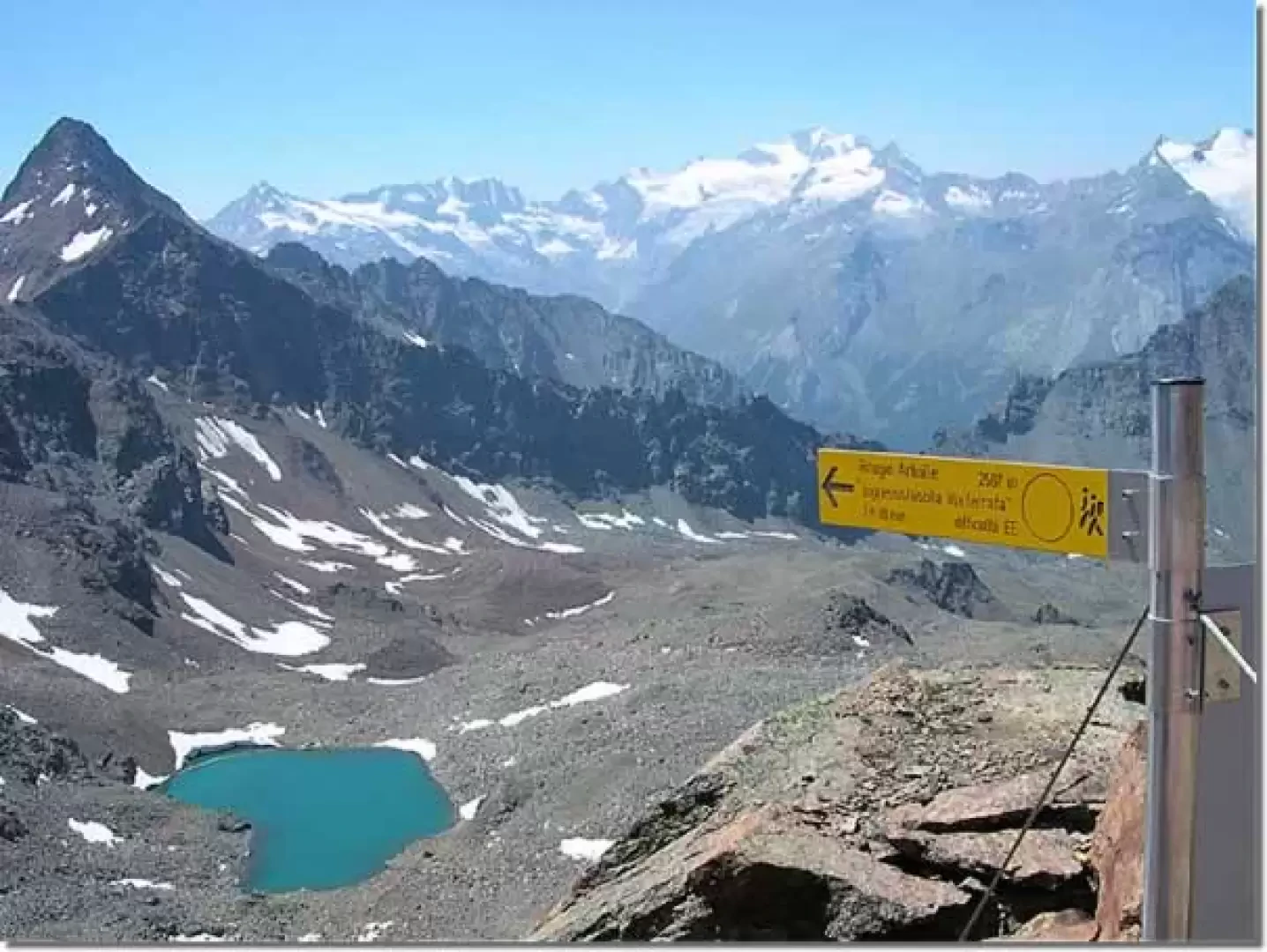
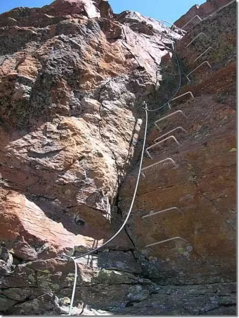
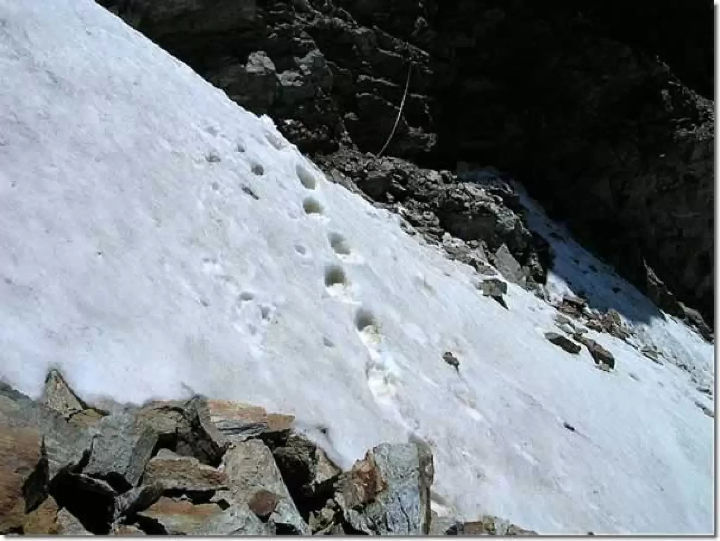
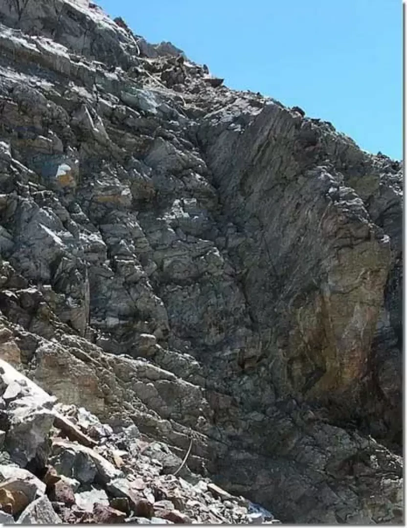
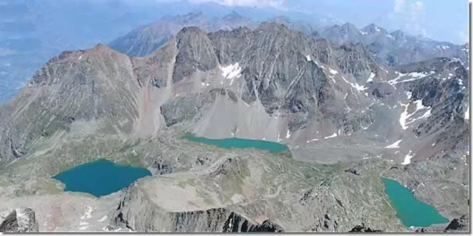
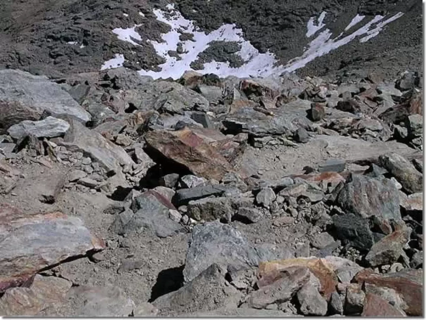
From Col Carrel, walk along the ridge towards the Tibetan bridge, clearly visible during the approach to Bivacco Federigo and now hidden by the rocks. Proceed along an unprotected track for about fifty metres until you reach the start of the equipped section. The cable is made of stainless steel sheathed in plastic; the sheath offers slight resistance to the sliding of the carabiners and makes progression a little more tiring than on ferratas with uncoated cable. You gradually gain height following the edge of the ridge, leaving behind the metal construction of the Federigo bivouac and then the lake Carrel, and after a few steps you arrive at the gendarme from which the Tibetan bridge about twenty metres long starts (1h00'). From this point, the view sweeps over the Trajoz glacier and the Grivola, which stand out against the sky to the right, towards the southwest. Continuing clockwise, the Mont Blanc massif and the Grand Combin, the Matterhorn and the Monte Rosa massif can be seen in the distance. Descend to the Tibetan bridge and walk across it on the wooden planks a span wide, then take the ridge again until reaching the watershed between the Arbolle and Comboé valleys, beyond which Lake Gelé appears with the soaring silhouette of Pic Garin to the right. With a few ups and downs, we pass Mont Ross di Comboé and the little Emilius and reach the exit of the ferrata that descends to the Arbolle hut (2h00'). Up to this point, the difficulties are modest and the route does not present any danger. Continuing towards the summit, there is a short, well-equipped vertical section, after which you arrive just below the summit gendarme of Monte Emilius where you have to cross a few metres of steep, exposed snowfield where, inexplicably, there is no trace of protection. This is followed by a couple of vertical metres that have not been equipped with the usual steps but are protected with a steel cable only. The rocks on which he climbs are well-handled but not yet cleared. There are moving handholds and at the exit of the key passage there are still numerous stones in precarious balance that risk falling on the heads of those climbing. Once this ugly passage has been overcome, the ferrata continues for another ten minutes or so on scree, then, although there are still some exposed passages, it is interrupted and it is necessary to continue for another ten minutes or so along the ridge, without protection, until reaching the summit (3h00'). Mount Emilius is located in the centre of the Aosta Valley and is perhaps the best viewpoint of all the main four-thousand-metre peaks in the Alps. On a clear day, you can see the Gran Paradiso with the Tribolazione glacier at its feet, to its right the Grivola (3969 m) and, continuing clockwise, the Mont Blanc massif, with the Dente del Gigante and the Grandes Jorasses, the Grand Combin, Monte Cervino and the Monte Rosa massif. Looking down you can see the Aosta basin partially hidden by the Becca di Nona and the Laures valley with the lakes of the same name, on the right, separated from the Colle dei Tre Cappuccini the Arbolle valley with the Lago Gelato lake.
Descent to the Arbolle hut
From the summit you descend along the exposed and at times difficult path that leads to the Colle dei Tre Cappuccini (0h30'). From the pass, following the signposts, follow the pleasant path restored by forestry workers that first reaches Lago Gelato then Lake Arbolle and the refuge of the same name. Mount Emilius owes its name to Miss Emilie Argentier, who climbed its summit in the 19th century. The Pic Carrel, so baptised in honour of the famous Canon Georges Carrel, known as the friend of the English for his numerous scientific and mountaineering acquaintances, resumed after a few years the ancient appellation of Becca di Nona that it still bears today. Only Col Carrel, where the Federigo Zullo Bivouac was built by the CAI, remains as a reminder of the distinguished intellectual. Cartography
- [[Conca di Aosta, Pila Mont Emilius]], Carta dei sentieri foglio 4, 1:25000, L'Escursionista Editore, 2008
Photo gallery
Galleria fotografica