Crête Sèche via ferrata, from Ruz


Edited by:
Gian Mario Navillod
Updated at: 25/10/2025
Access
Leaving the motorway at the Aosta Est barrier, turn right and take the dual carriageway to follow for 8.4 kilometres. At Signayes, turn right onto the regional road following the signs for Bionaz/Laravoire. Pass a roundabout and continue on the regional road along the entire length of Valpelline. Pass through the villages of Valpelline and Oyace until, after about 27 kilometres, you reach the hamlet of Dzovennoz. Turn left, following the signs for Chez Leo Merloz Ru, Ley Cretes. Go up the little communal road for 1.3 kilometres until you come to the free car park 🅿️ before the village of Ru.
[0h39'] - [29.2km]
How to get there with GMaps
How to get there with Apple Maps
The directions provided here have been verified as of the date of the route survey. Before setting off, it is advisable to ensure that no substantial changes have occurred on the route to the starting point. We therefore recommend the use of the satellite navigation apps provided by Google or Apple for up-to-date and detailed directions.
Introduction
More than a via ferrata, this itinerary is a beautiful walk between earth and sky straddling the ridge that separates the Bagnes valley (Switzerland) from the Crête Sèche valley. The technical difficulties are reduced to very few steps and a few exposed passages. The landscape is truly superb, full of sharp peaks and glaciers, at the foot of which one walks in a wild environment, far from any trace of civilisation.
Description
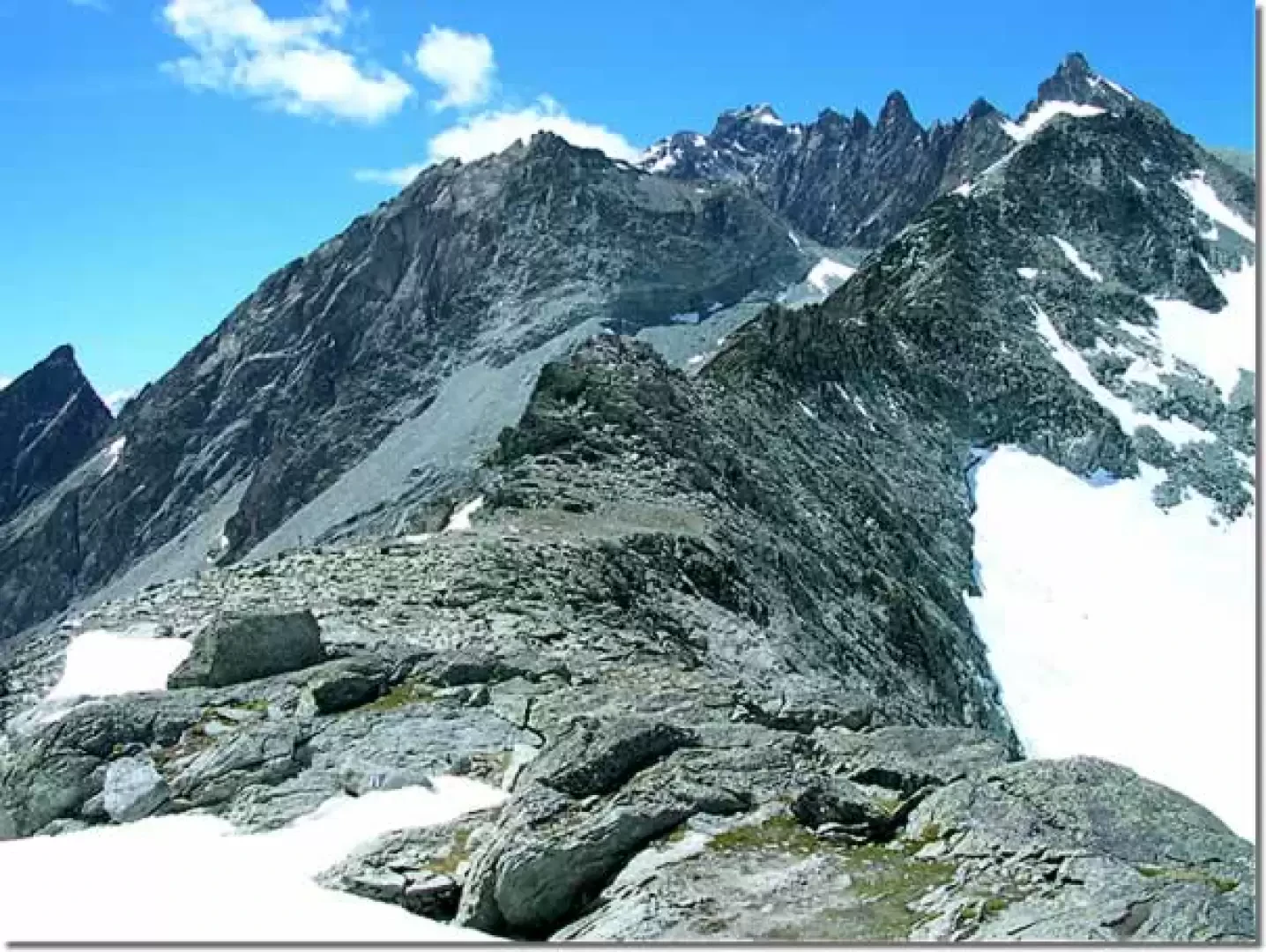
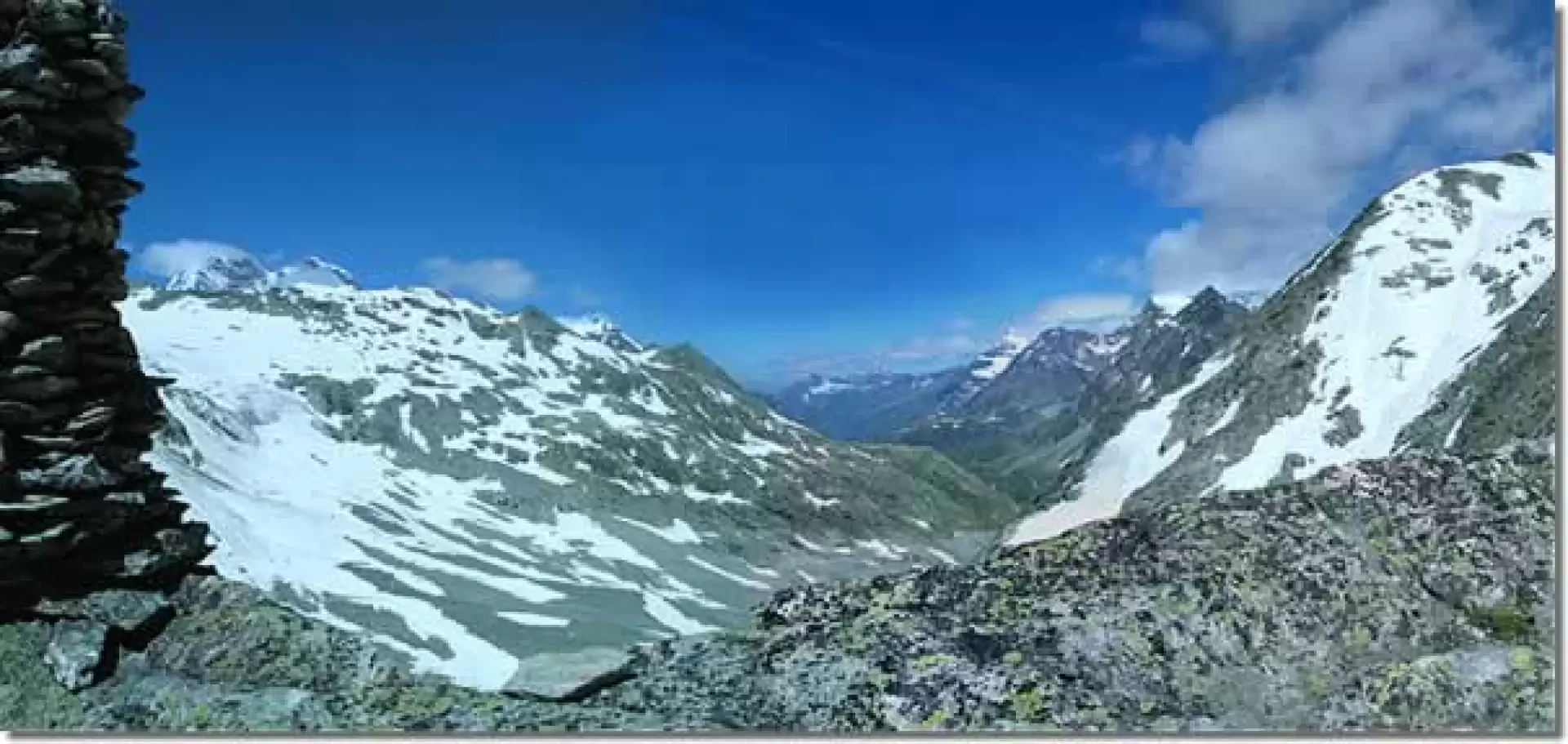
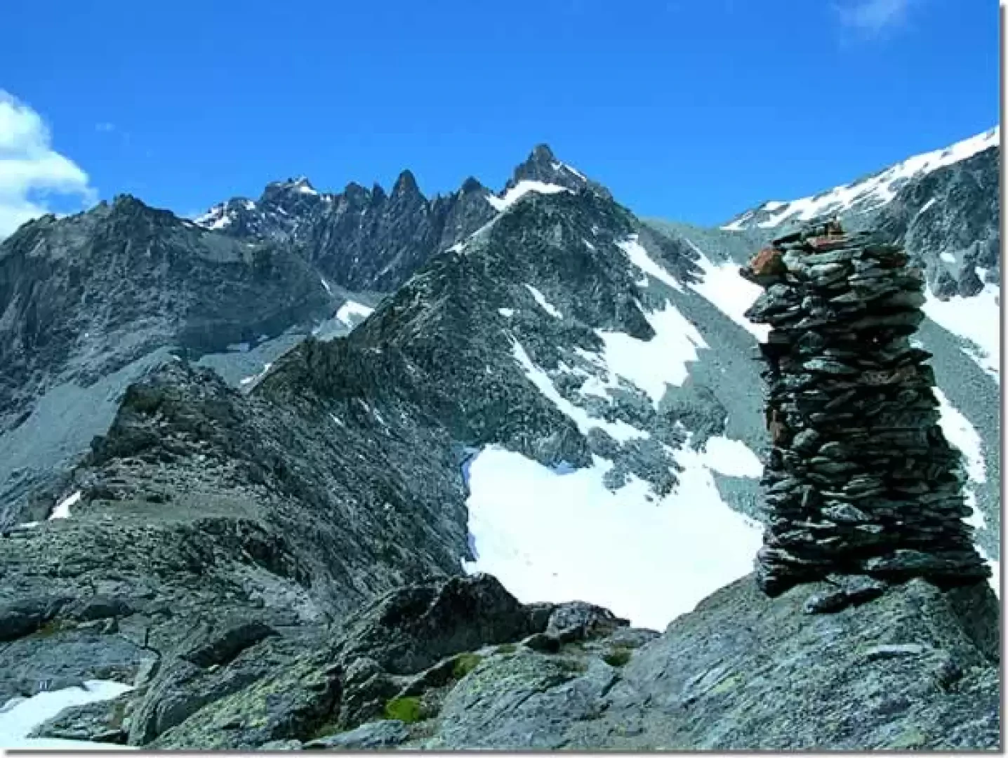
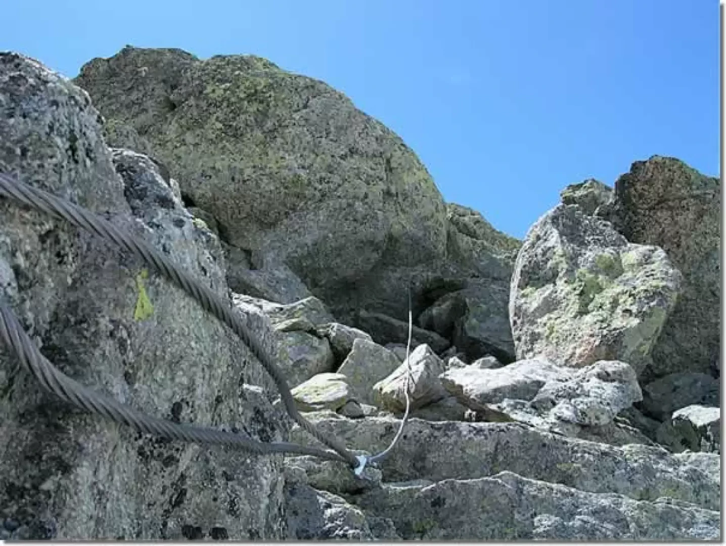
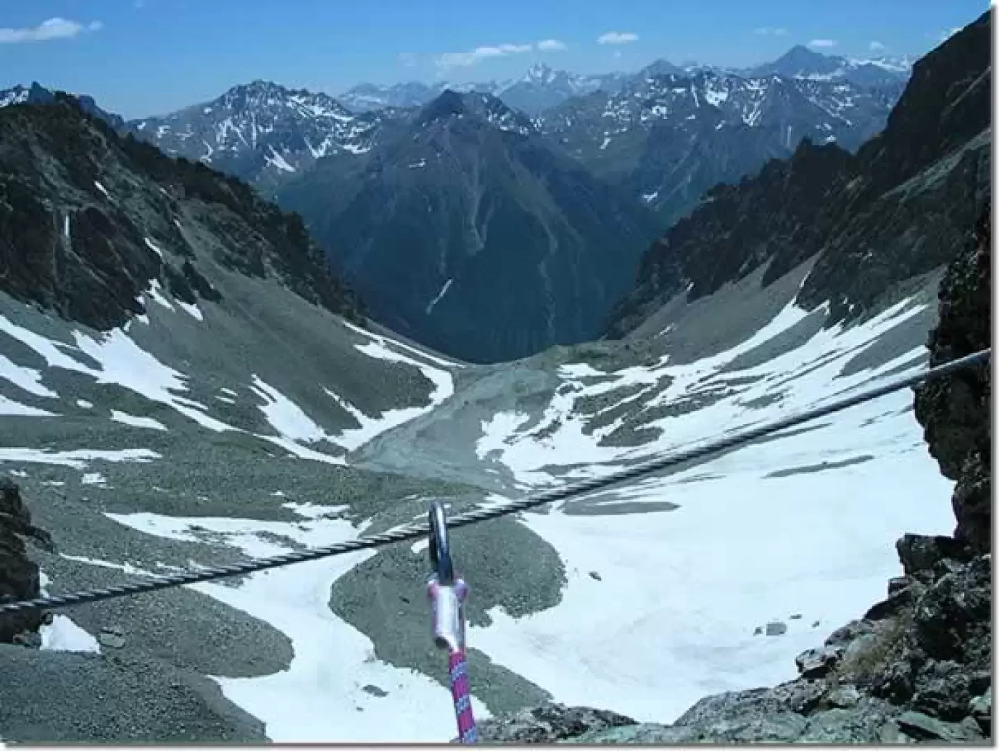
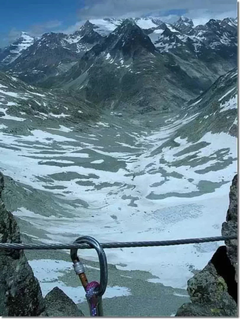
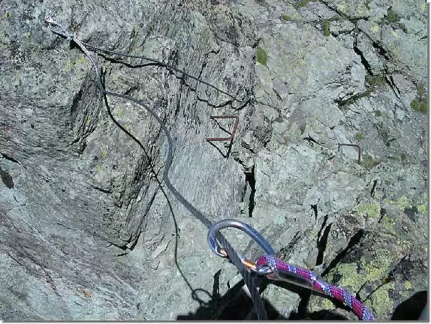
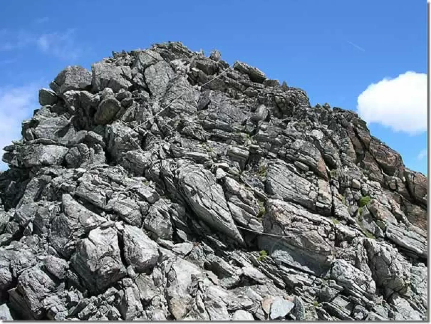
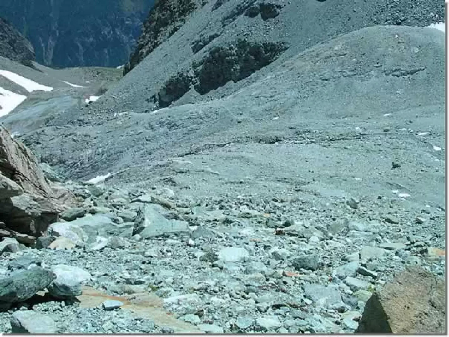
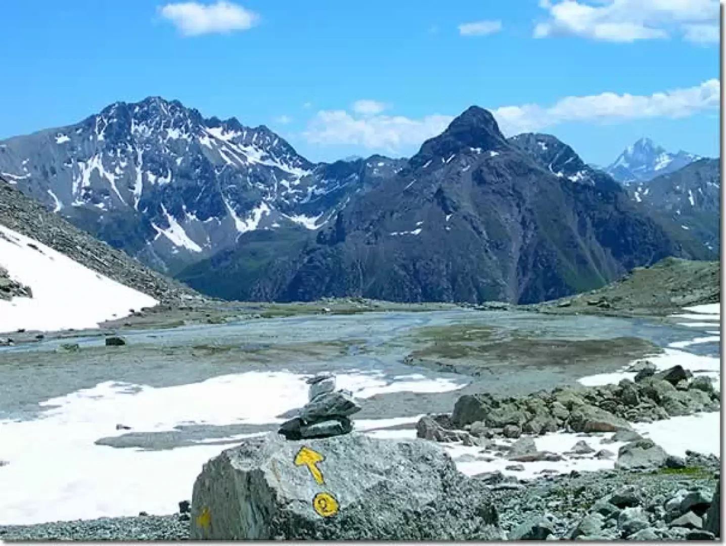
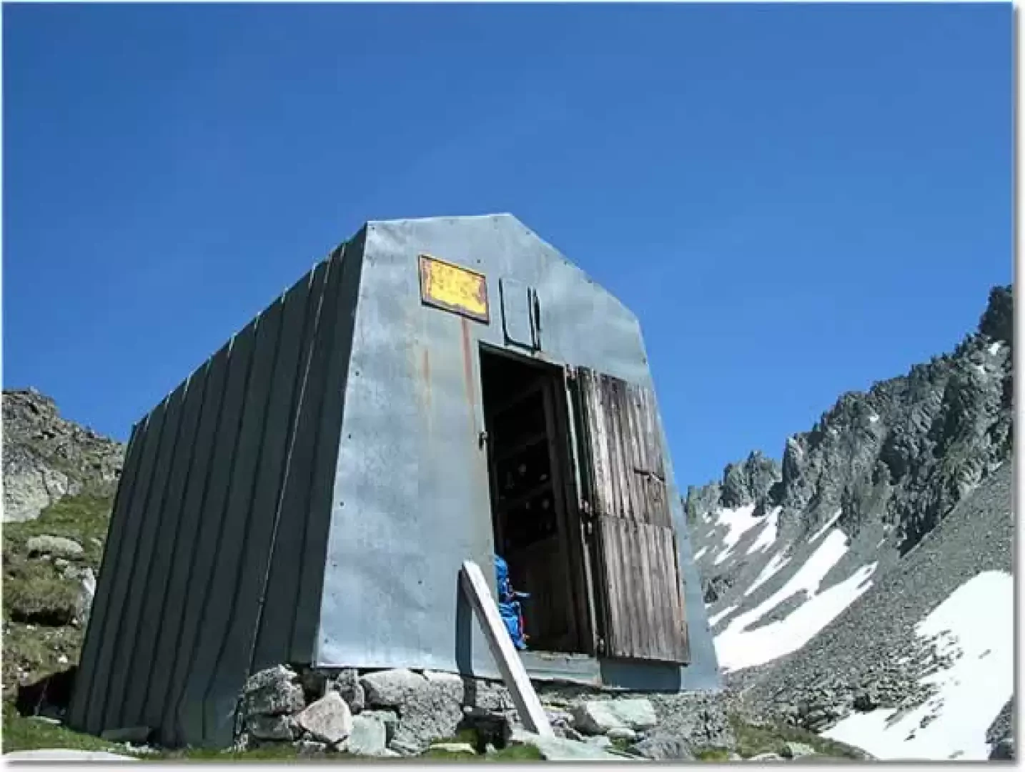
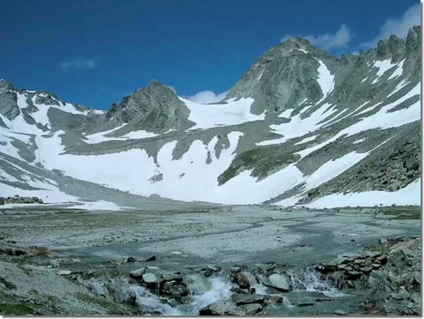
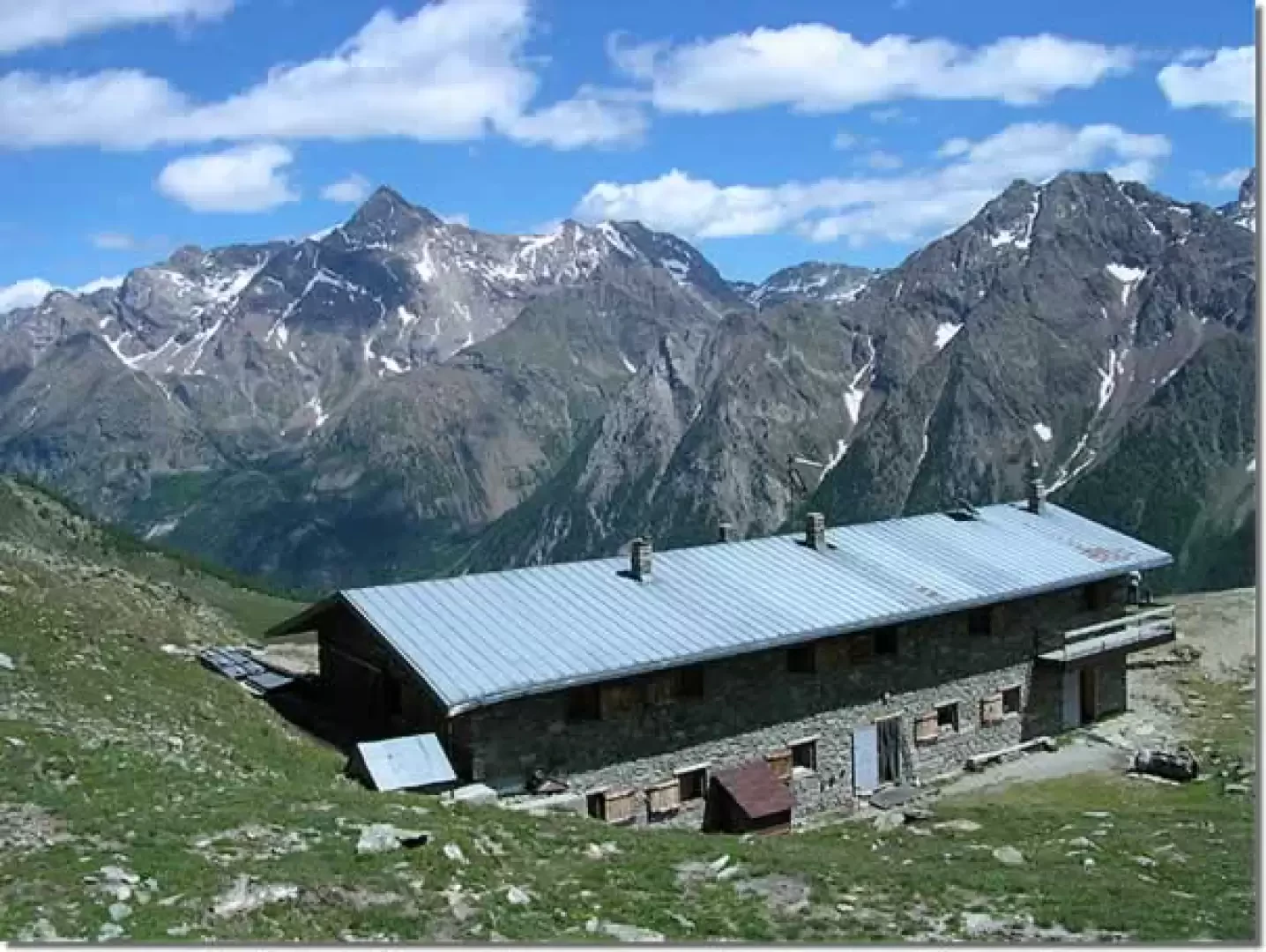
From Ruz (1696 m), start next to a toilet hut with a fountain, go past the village on a dirt road to the grassy terrace of Alpe Promot (1853 m). Now continue between fir and larch trees, go past the intake of an aqueduct and, after a few bends, cross the Comba di Vertosan stream to Alpe Berrier (2192 m). Alternatively, just before the stream, take the obvious path leading to a large wooden cross, just above Alpe Berrier. Now slope slightly to the left and, suddenly, the roof of the Crête Sèche hut (2390 m) can be seen, which is reached near the final ridge of the Crête Sèche mountain. Near the hut, the Spataro bivouac is clearly visible above a rocky drop. We now proceed along a steep path among stones and grass, and avoid a small snowfield. The ascent to the Spataro bivouac ends at the edge of the marshy plateau of Plan de la Sabla, which is bordered by the upper part of the Aroletta ridge and the western slopes of Monte Berlon. One proceeds on the orographic left of the torrents of the plain until one reaches some ford stones, passes on the orographic right side and heads towards the mouth of the gully that receives the melt waters of the Aroletta glacier. One passes a modest snowfield and, following the cairns, amidst scree and broken rocks, one arrives at the cross of the Col du Crête Sèche (2899 m) by a steep and tiring route. Near the pass, there is also a characteristic shelter, used in the past by border guards, and a large stone cairn. Beyond, on the Swiss side, the Glacier de Crête Sèche is clearly visible. From the cairn a couple of metres high on the Crête Sèche pass, head westwards along the ridge until you reach the start of the via ferrata. The stainless steel cables start at the base of the first of several small ridges that mark the watershed line and culminate in the Dents d'Oyace (Ayatse). The equipped sections alternate with short stretches of path along which there are pleasant views of both sides of the alps. Looking south, behind the Plan de la Sabla you can see Mont Faroma, the becca di Nona di Valpelline with the Verdona valley on the right and then the double peak of the Tsaat à Etsena. In the background, the Tersiva and Emilius peep out in the distance. On the other side of the ridge, the Bagnes valley opens up, at the bottom of which Pointe d'Otemma stands out against the backdrop of glaciers. After a few ups and downs and the few steps with which this pleasant ridge traverse has been equipped, you reach the base of the Dents d'Oyace (Ayatse), which stand out sharply against the sky. Cross over to the left just below the peak with the Arolletta glacier dominated by the Faudery becca before descending a rocky mound where the via ferrata ends.
Descent to the Crête Sèche hut
From the Oyace pass (Ayatse), descend towards the bottom of the valley on traces of a path until you reach the little stream that springs from the Arolletta ice. Cross it and follow the path, which is steep in places, down to Plan de la Sabla, first reaching this wide alluvial plain and then the Spataro bivouac. Cross the stream again, passing on the orographic left of the valley, and following the easy path, you soon reach the Crête Sèche hut. The Crête Sèche pass, like the Fenêtre Durand, was for many years one of the transit points for smugglers who transported cigarettes from Switzerland to Italy on their backs. Pietro Giglio reports in his book 'Andar per sentieri in Valle d'Aosta' that more than one mountaineer in those years managed to set up home with the illicit earnings from such trafficking.
Photo gallery
Comments (0)
Sign in to leave a comment