Valdo - Alpe Devero crossing


Edited by:
Maria Grazia Schiapparelli
Updated at: 10/05/2026
Access
Introduction
Beautiful traverse in Val Formazza, part of the Riale - Simplon Pass route, carried out by spending the night at the Rifugio Margaroli al Vannino, and taking advantage of the Bùsin pass and the Bocchetta della Valle, perhaps less frequented than the classic Scatta Minoia. The route leads to Devero or Codelago Lake more or less halfway along its length, then descends to Crampiolo. From the Scatta Minoia you descend to the northern end of the lake and walk along it. The route is very varied and scenic.
Description
First day
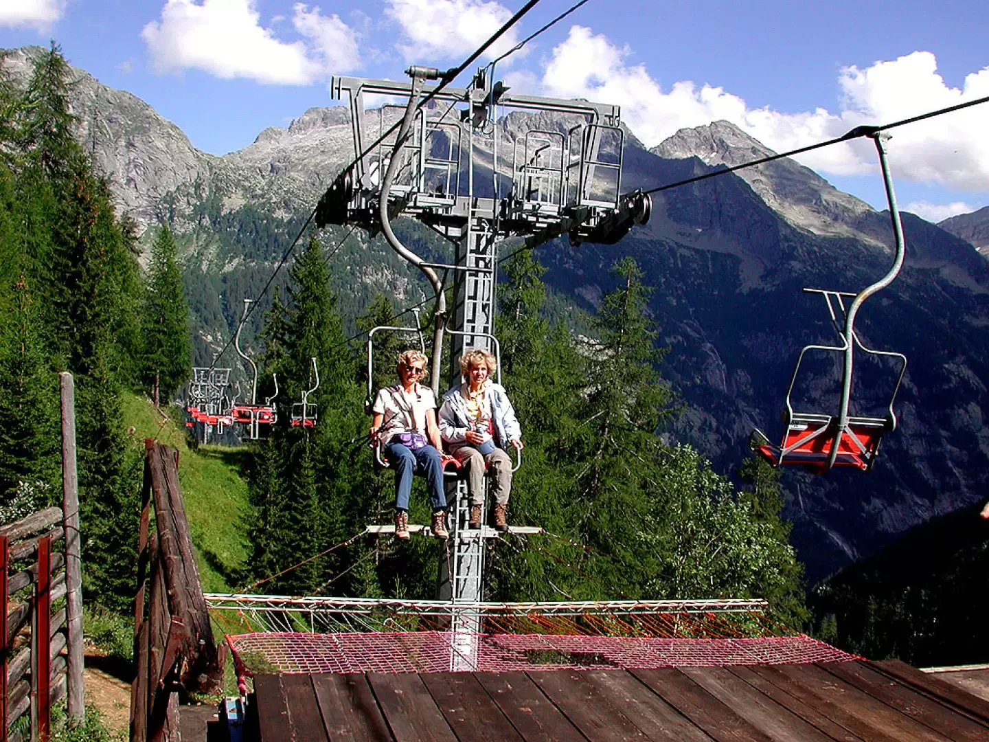
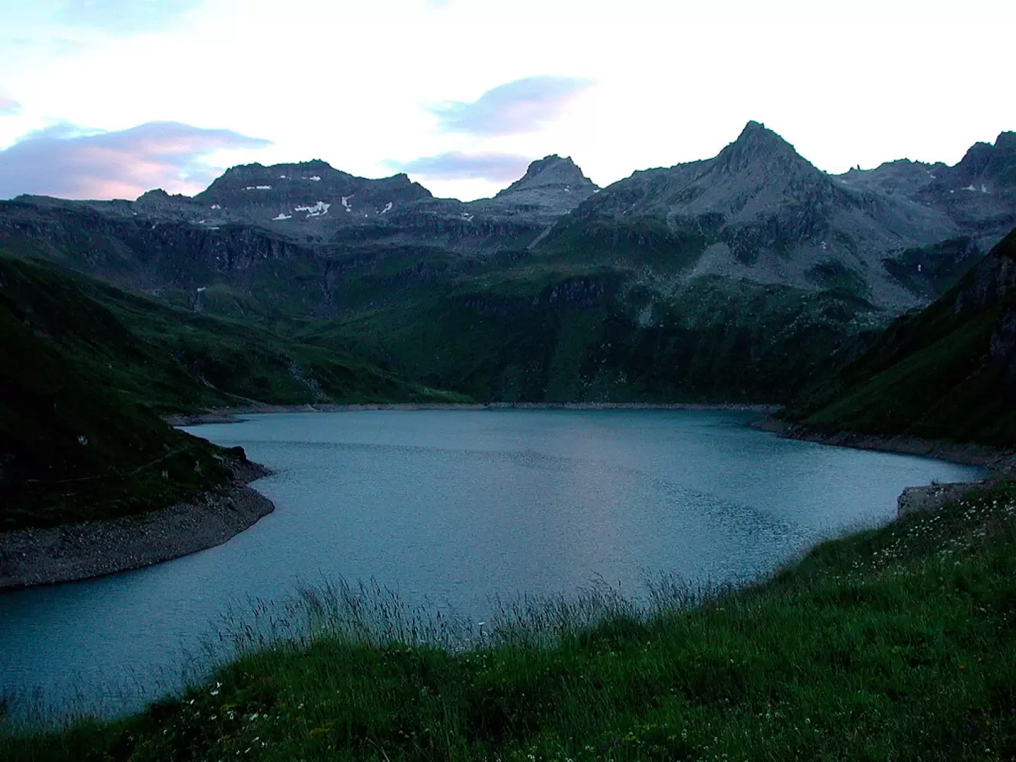
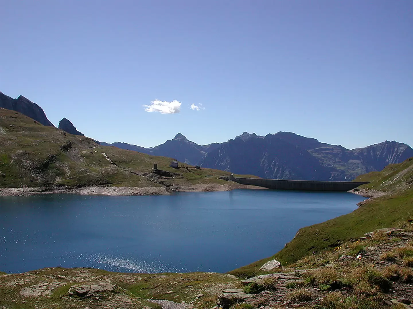
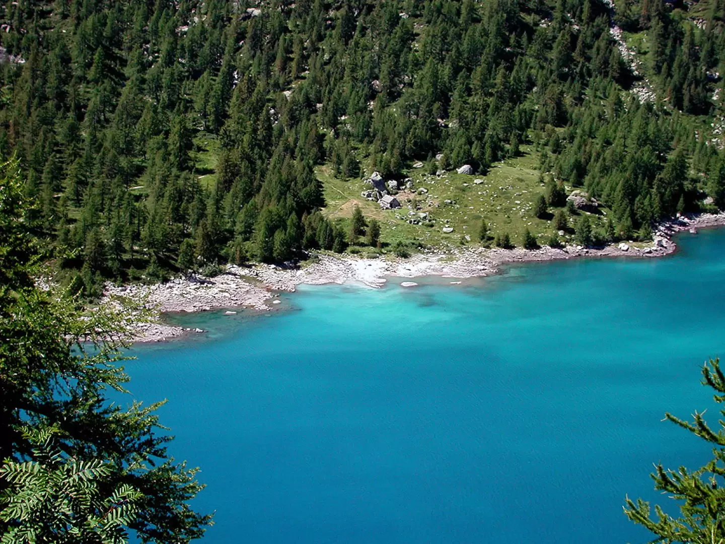
At the arrival of the chairlift at Sagersboden (1774m), continue on the level to the left until you find the signpost for Lago Vannino, Rifugio Margaroli, a marked road [G33] that climbs steeply at first through the forest, with a few hairpin bends, until it becomes almost flat as soon as it enters the little valley that leads to the refuge, skirting the stream. We leave the Myriam hut on the left and continue now slightly uphill and then with a hairpin bend, until we reach the damp plain below the hut, probably the site of a lake now buried; the area is rich in eriophorus. From the plain, you can see the Margaroli hut and the dam (2194m) on a promontory overlooking Lake Vannino, and the dam wall, and you reach it with a final small climb; going around it on the right, you pass the mountain pasture of the same name, which was obviously loaded in August (ds. 420 m, 1h30'). As the sun sets over the surrounding mountains, it colours the waters of the reservoir an incredible blue.
Second day
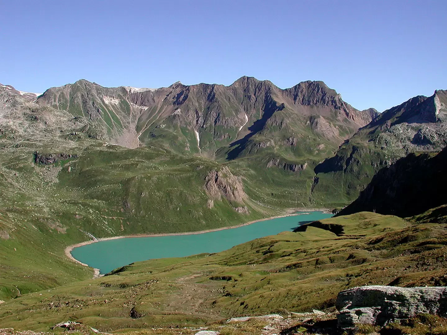
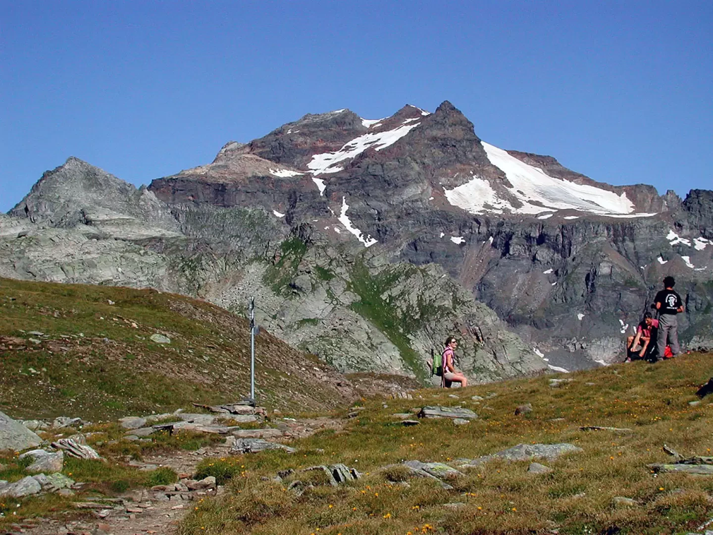
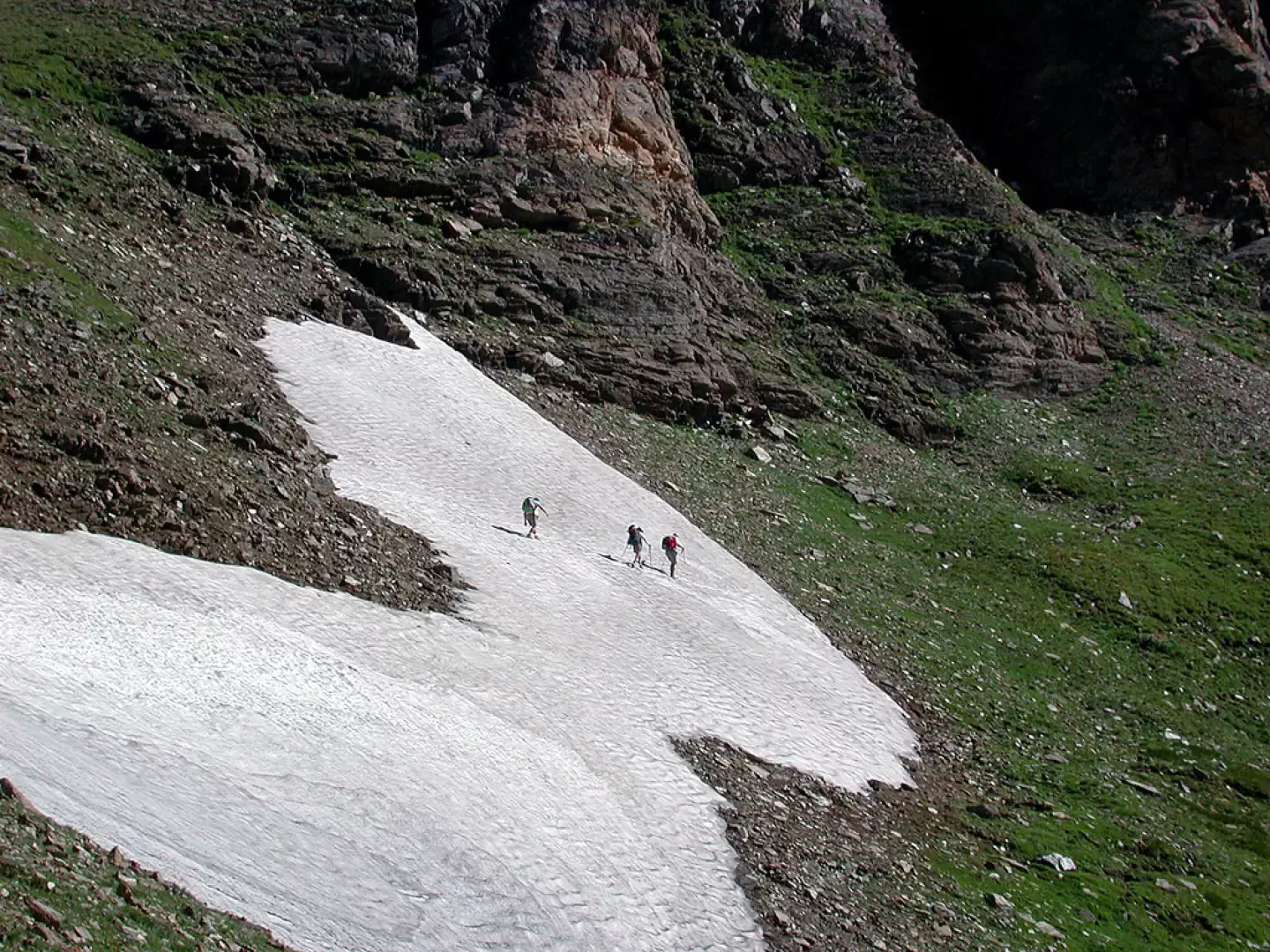
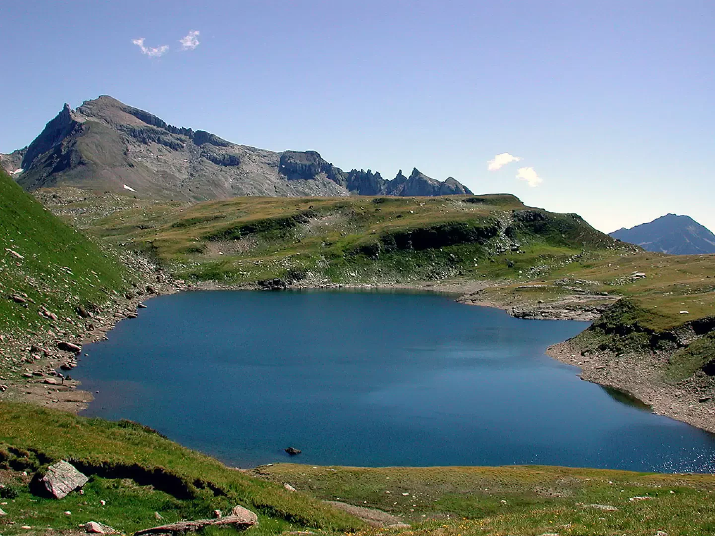
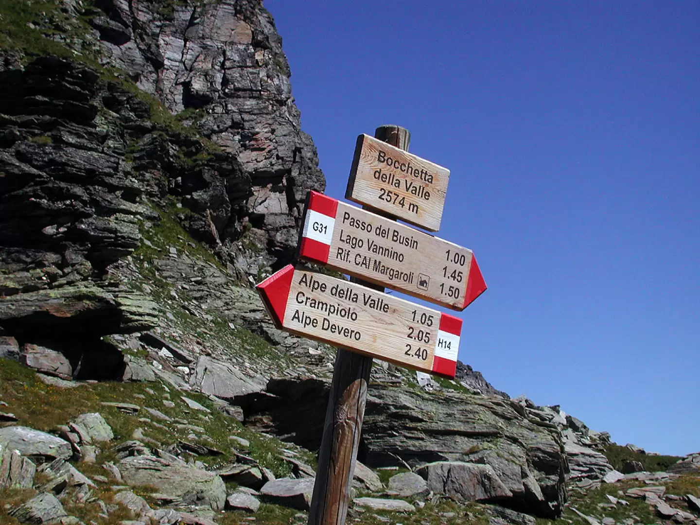
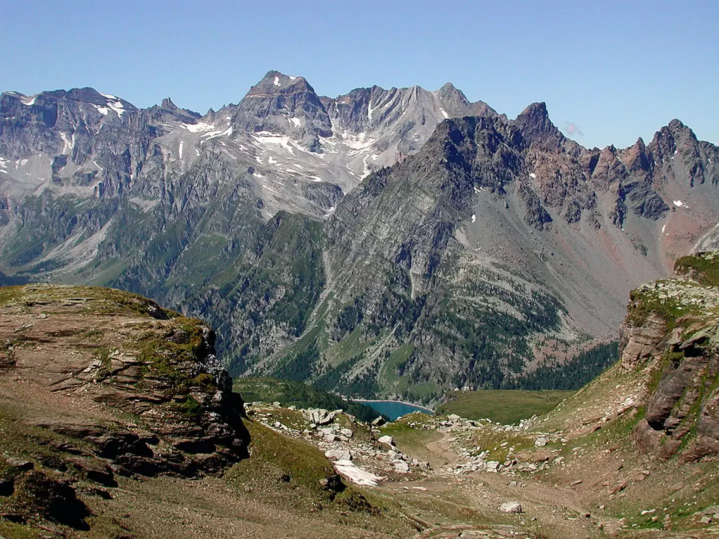
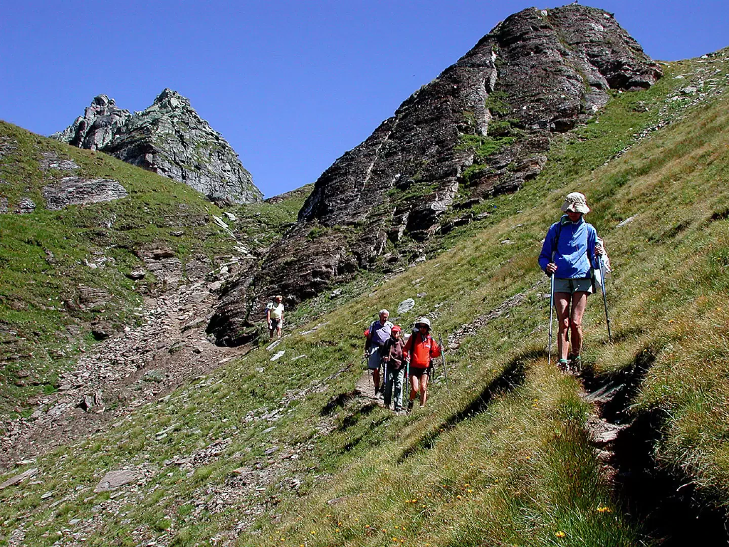
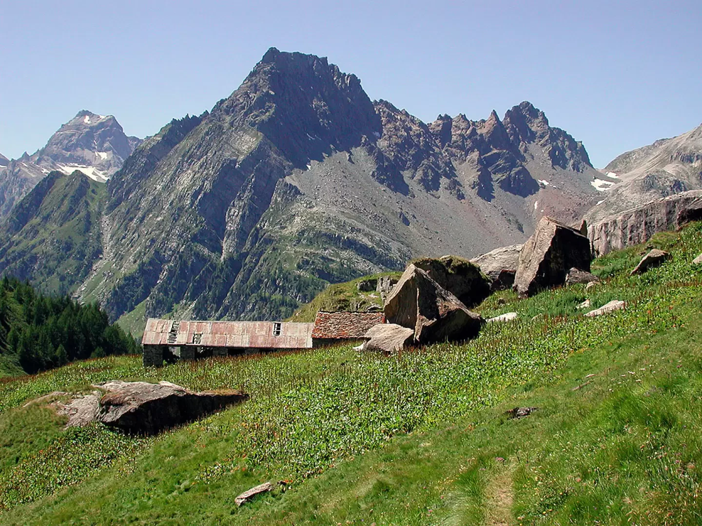
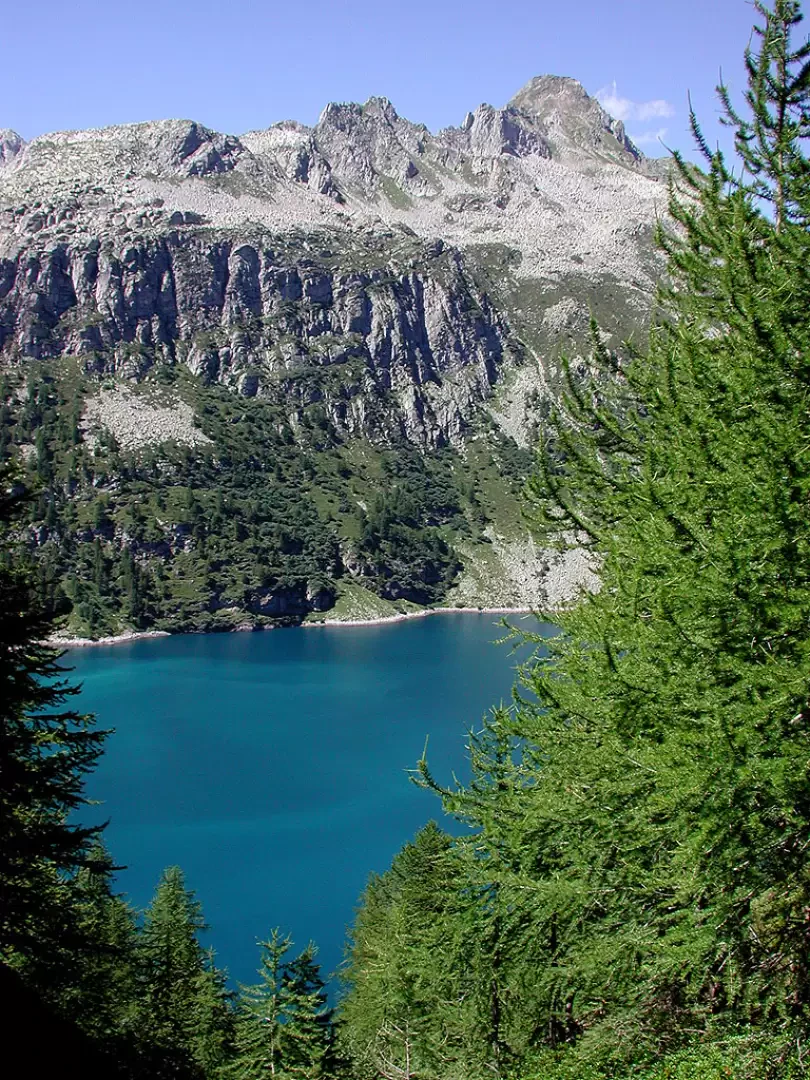
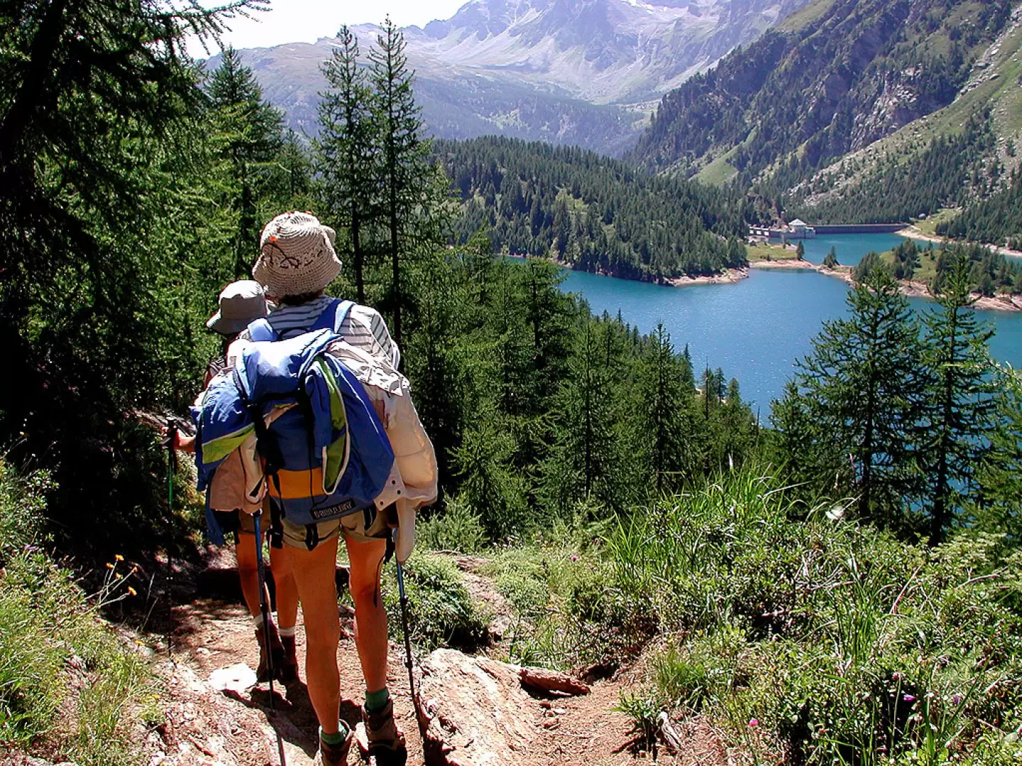
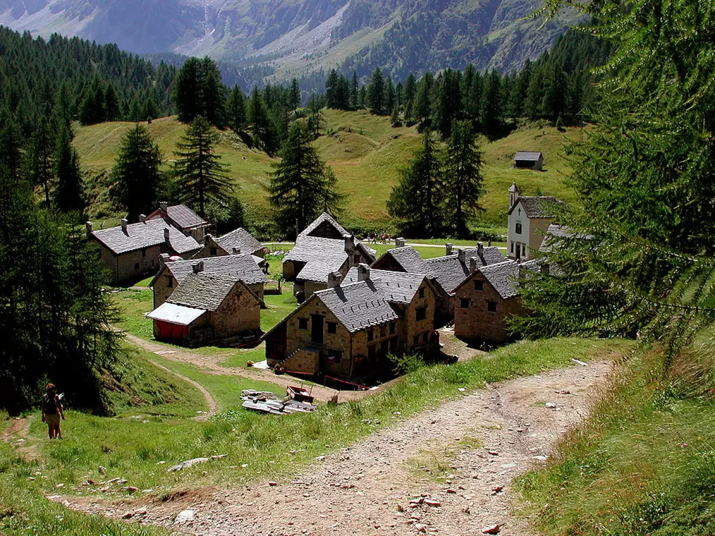
Descend to the dam and cross it; again, the cloudless day lights up the lake waters in all shades of turquoise, and on the dam wall groups of lavender bluebells sway slightly in the wind. On the other side of the dam there are three paths leading to the Bùsin Pass: the first, shortly after passing the reservoir, a second, about halfway across the lake, and a third at the end of the lake; we opted for the second, which climbs gently through the pastures, with slight hairpin bends taking us to the Bùsin Pass (2493m, 1h00'). Behind, the turquoise waters of Lake Vannino, the path to Scatta Minoia, Punta d'Arbola and its glacier; beyond the pass, Monte Giove to the left, below us Lake Bùsin Inferiore, to the left of which is a small bivouac. We descend towards Lake Bùsin Inferiore; despite the late season, there is a small, very steep snowfield, with the snow still hard. It is only a few metres, no more than fifteen, but should be climbed with caution; it is not avoidable, and if you are taking children it is better to have a small lanyard. Immediately after a small snowfield, there are two possibilities: either descend again around the lake to the left, cross it and climb up towards Lago Bùsin Superiore, or take a track to the right that crosses almost flatly around the lake, and climbs up the plateau until you come to the upper lake: at the bottom of this lake, the Bocchetta della Valle appears at the top right. Our route skirts the entire Upper Bùsin Lake and leads below the Bocchetta, to which we ascend with a final steep climb (2574m, dsl 200m approx., taking into account the descent after the Bùsin pass, one hour). Climbing up the ridge to the right of the pass, the view sweeps over the lakes below and the omnipresent Monte Giove. One cannot take one's eyes off the panorama on the ascent path.... After a last glance, your attention shifts to the mountains of the upper Devero valley: Cervandone, Schwarzhorn, La Rossa, the tip of Valdeserta, and further on the trapezium of Monte Leone, all peaks climbed years ago on skis, and a row of snow-covered Swiss peaks, some of which can be reached from the Simplon Pass. At the bottom left, the glaciers of Monte Rosa. At Bocchetta, a sign indicates the direction to Devero: path [H14], 2h40'. We begin the descent southwards, crossing below the peaks beyond the Bocchetta: at the bottom of the valley appears a slice of lake of an incredible turquoise colour; with a series of hairpin bends and diagonal turns, we cross a number of tributaries; here the paths intersect, we must pay attention, and at a certain point deviate decisively to the right and reverse the previous direction of travel (going straight on we climb to the Bocchetta di Poiala), then heading towards the centre of the valley and ignoring the track that goes up towards its orographic right. We soon reach the now-abandoned Alpe Naga, and continuing halfway down the slope, we come to Alpe della Valle. It was probably built here, under an enormous rock that should have protected it. Instead, in times immemorial, part of the rock broke away, plunging down into the buildings, which, no longer safe, were perhaps for this reason abandoned. Below the alp, we cross a small bridge with other indications: a path passes here that skirts the lake halfway up the mountainside; we head down the valley, towards Crampiolo, which is still an hour away. We leave the pastureland and enter a forest of sparse larch trees; below us, ever more turquoise slices of the lake glimpse through the foliage: autumn must be magical here... The path becomes wider and wider, until it becomes a carriage road which, after a while, overlooks the splendid Crampiolo basin. The village is very pretty, perfectly restored. The roofs of the old huts have almost all been redone exactly as they were; only the less 'weathered' stones let us know that they are recent works. The little church is very pretty, the geraniums in the windows and the sun do the rest... After a little stroll among the houses, we move to the orographic left of the stream, ignoring the carriage road that descends to the Devero basin, and continue along a splendid footpath shaded mostly by larch trees, which accompanies us to Devero. The dirt road is replaced by cobblestones, we pass under the delightful little church and reach the car park.
Galleria fotografica