Around Manaslu
Description
Arrival in Gorka
First day: 18/10/01
We all meet up at Linate and begin our journey with a short flight to Rome. We arrive at Leonardo da Vinci at 14.00, and after a short time the first aeronautical problems begin (which in fact turn out to be the only real problems of the holiday); in fact the flight from 18.00 is initially moved to 00.30, only to be cancelled, with a promise (?) from an alleged airline manager that it would definitely be made the following day. The group was transferred to the hotel and Corrado, together with Gigi and Simone, in our company all the way to Kathmandu, found themselves in the company's offices to haggle for a change of date for the return flight (losing a day on the outward journey, I in fact preferred to delay the return flight to allow the group to visit Kathmandu without doing too much running).
Second day: 19/10/01
Finally at 5.30 (twenty-four hours late) we left for the East, and after travelling all night we arrived the next morning at 7.00 a.m. in Dhaka (capital of Bangladesh).
Third day: 20/10/01
A little bit tired from the night on the plane, we had a short breakfast at the airport and at 9.00 a.m. we finally boarded for the last leg to Kathmandu, where we arrived at 10.00 a.m. The surprise for me is great, as the airport has been completely renovated since April and is really up to Western standards, with boarding lounges, large spaces and efficient services. Chonngba, Nundu and all the agency staff are waiting for us as usual with flower necklaces in front of the exit, and we are quickly transferred to the Tibet hotel, in Lazimpath, behind the royal palace. Corrado takes care of administrative matters with Nundu, and in the afternoon we all go to Pumplenicke Bakery for a snack. After some technical shopping (umbrellas, rucksack covers, etc.), in the evening we all went to the Everest Steak House, a legendary Kathmandu restaurant where we usually go after returning from expeditions, and in fact there we found Abele, Adriano and the whole group of Aosta Valley guides who had gone to the Dhaulagiri/index.shtml">Dhaulagiri successfully and were on their way back home.
First stage: from Gorka to Arughat
Fourth day: 21/10/01
Finally we set off on our trek, or rather, by bus, towards Gorka (1000 m approx.), where we arrive at 12 noon. We have our first medical problems, with Attilio having some sort of kidney colic, probably due to the stress of the journey, as well as certainly the smog, the mess and the confusion of early-morning Kathmandu as seen through the windows of a hopping bus, which at every stop starts off with a big black smoke. With a few pills and an injection of sedative things settle down, but with a lot of fear on the part of everyone ... but especially the sick man. We have a short lunch in Gorka, and at 2.30 p.m. we set off on a dirt track for a few kilometres until 5 p.m. when, with great optimism, we all get into a truck (porters included). After a few kilometres, however, the road becomes really winding and uneven, and after several agonising swings down the valley we decide on the footpath, which in about an hour takes us to Khanchok (1000 m approx.), where we arrive in the dark.
This first stage was quite hard overall, but in fact it is usually divided into two parts; with Chonngba we decided to do it in one day to save time and optimise the trekking time.
Positive height gain: 200m
Total walking hours: 3h30'
In the vicinity of Arughat (600m)
Fifth day: 22/10/01
After the first Nepalese-style dinner, the first night in the tent and the consequent first little back pains, we have our gentleman's breakfast with eggs, chapati bread, jam, porridge and many other delicacies that the kitchen staff have prepared for us.
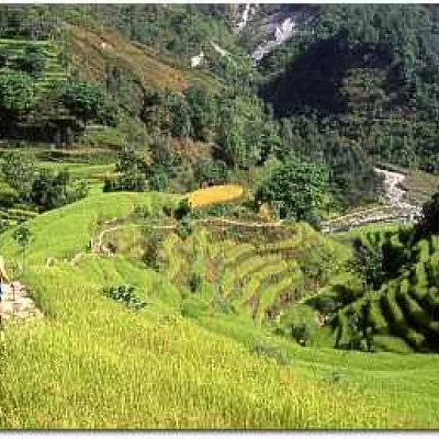
We set off this time slightly downhill through very choreographic rice fields, and around 11.30 a.m. we stop for our lunch break by the river, in which we all take a nice footbath. In the afternoon we arrive at Arughat (570 m), a beautiful village on the Budhi Gandaki river, where we do some afternoon shopping. In this village, it is still possible to make phone calls, and there is no shortage of nostalgics taking advantage of the miracles of science. Indeed, in remote treks such as this one we are travelling through, some small conveniences such as the telephone, which seem obvious and normal to us in everyday life, as well as unfortunately sometimes indispensable, sometimes become pleasant throwbacks to so-called normality. In the village, where there is a police post, we find our liaison officer who will accompany us along the trek, as this area of Nepal is protected and the government is trying to safeguard it as much as possible from the unfortunately excessive tourist invasion in other valleys.
Positive elevation gain: 300 m
Total walking hours: 5h00'
Second Leg: Arughat to Kholarbesi
Sixth Day: 23/10/01
We leave the quiet hamlet of Arughat, full of shops where people from different valleys in the surrounding area gather for market, and amidst rice paddies and millet fields we start up the Budhi Gandaki, in hot and humid weather, which makes us crave lemon-juice for lunch. And still on the riverbank we stop, after passing through Arkhet Bajar, a handful of houses with the ever-present pipal, with a beautiful view of the first big mountains. In the afternoon the trail becomes more winding, and with countless ups and downs in the forest we finally arrive at Liding (860 m), a small, breezy village where we wash at the fountain, and in the evening watch the traditional dances of the women (several times during the tour the local population will give evening shows, in exchange of course for a small donation that benefits the development committees, usually run by the women themselves).
Positive elevation: 
Total walking hours: 5h10'
Up towards Khorlabesi (970 m)
Seventh day: 24/10/01
The trail passes continuously halfway up the hillside, with some truly spectacular views of the river, which we reach in some sections, even walking along the sandy bank of the river. We have lunch near Khanibesi and in the afternoon, with another three hours or so of walking, we arrive at Khorlabesi (970 m). After a few days of running in with great heat during the day, the whole team is going at full speed, despite a few minor passenger discomforts, which are normal in trekking.
Positive height difference: 
Total walking hours: 6h30'
Third stage: from Kholarbesi to Philim
Eighth day: 25/10/01
After about an hour's drive, we arrive at an area where a new lake has formed as a result of a huge landslide, just before the village of Tatopani, where there is a 40°C hot spring. We then pass on the orographic left of the Budhi Gandaki, to Doban, where we have lunch in a nice clearing in the village. Obviously we are taken by storm by the many children, and we manage to take numerous photographs, not least because the bridge out of the village is very spectacular. In the afternoon, we skirt the valley halfway down the Yaru Khola river, which we cross with an acrobatic bridge of around 90m, but where the raw material for the bridge is partially missing, i.e. the base planks! Fortunately, the people are preparing wood to rebuild it and it will certainly be ready by next spring season. After a short stretch by the river again, we arrive at a football field, and then at the pretty village of Jaghat (1370 m), where we spend the night; the main street of this village is all paved in stone, and the field is very nice, with running water and poinsettias all around.
Positive height difference: 
Total walking hours: 6h15'
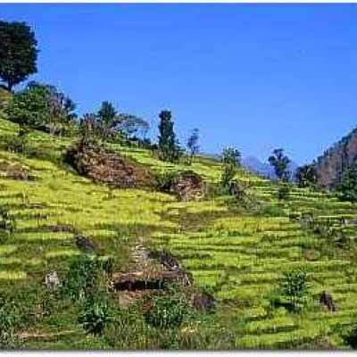
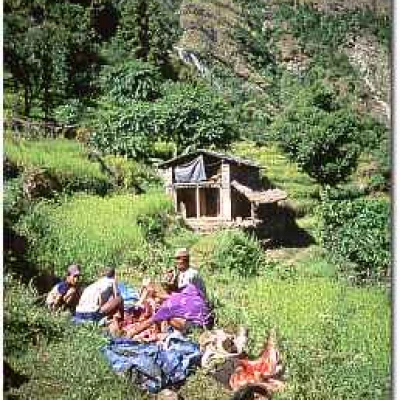
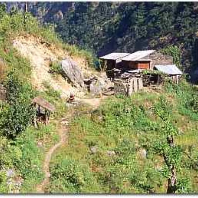
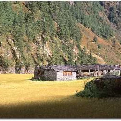
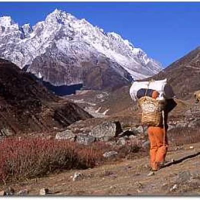
Typical Nepalese mid-altitude landscape
Day nine: 26/10/01
After crossing several streams with suspension bridges, we arrive at the Sirdibas plateaus, where we find the first mani walls, a sign of the Tibetan influence, which by now is beginning to be felt, although the people are still ethnic Gurungs. After crossing a Golden Gate-style bridge, albeit a rather crumbling and sloping one, we arrive at Philim, with Maria Luisa showing clear signs of fatigue on the last ramp. This village, in which we only stop for a drink, is certainly rich, as there are well-cultivated fields, plenty of cattle and even a kerosene shop. In the afternoon, we cross a particularly green and narrow valley, characterised by tall pine trees and marijuana everywhere along the path, until we reach a small hut, near which we make camp, in an unfortunately rather damp and not particularly beautiful place, which the Nepalese call Pewa (1740 m).
Positive height difference: 
Total walking hours: 6h45'
Fourth stage: from Philim to Lho
Day 10: 27/10/01
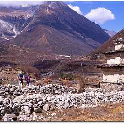
The trail continues to be quite steep, and many sections are really steep on the river. The whole area is still inhabited by Gurung, but the religion has changed from Hindu to Buddhist, and we meet more and more Tibetan people. We have lunch in Rana, and continue to Ghap in the afternoon, passing through a very picturesque area with hand walls, a large wooden prayer roll with Buddha frescoes, and a beautiful kani (i.e. an arched chorten) with richly decorated walls and ceiling. Ghap (2100m) is not marked correctly on the map we have, as it is on the orographic right of the Budhi Gandaki instead of the left.
Positive elevation: 
Total walking hours: 5h35'
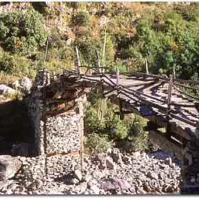
Old wooden bridge in the vicinity of Lho (3180 m)
Day 11: 28/10/01
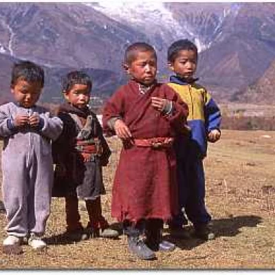
After an initial ascent through a tropical-type forest with bamboo, towering rhododendrons and a few monkeys, we arrive in Namrung for lunch; in this village there is a small monastery and police post, where trekking permits are checked. After the stop, we set off again through an area of wheat fields and pine forests, finally arriving at Lhi, where the stone houses are like small flat blocks with five or six flats each and a communal roof and courtyard; in this village there is also public electricity, which comes from a turbine on the Hinan Khola river. After crossing a winding gorge and a beautiful plateau with fields and a huge prayer wheel, we set up camp just after the village of Lho (3180m), a large cluster of stone houses, now in total Tibetan-influenced territory. The children keep asking for shim shim, which is the Tibetan word for sweets or candy, and the people are wrapped in cloaks called chuba. Today we also encountered the first yack.
Positive height: 
Total walking hours: 6h25'
Trip 5: from Lho to Sama
Day 12: 29/10/01
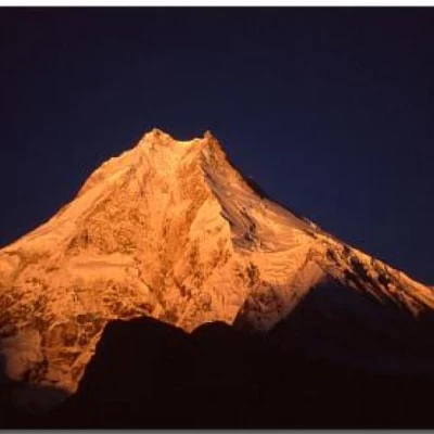
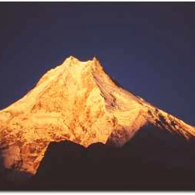
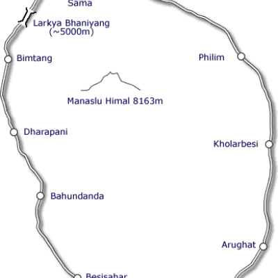
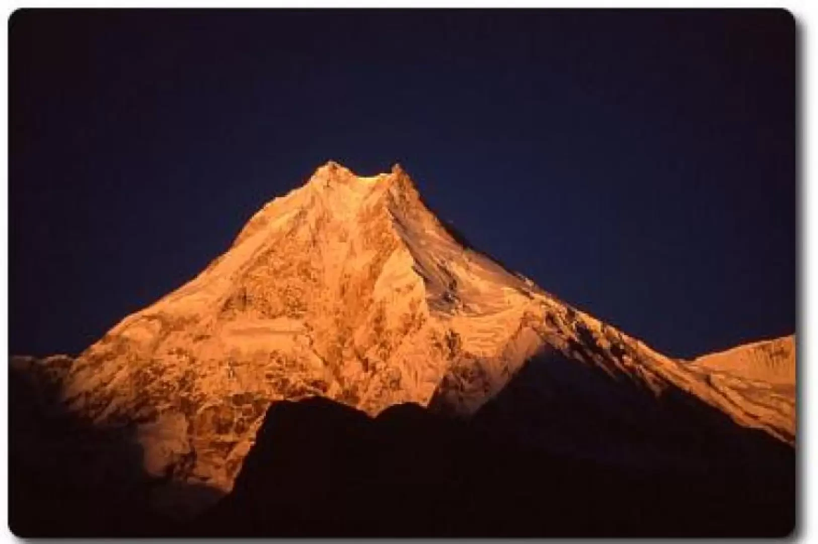
The more willing wake up before dawn to take some wonderful photos of Manaslu (8163m) and the nearby peaks, which are gilded by the first rays of the sun, and then have breakfast in the mess tent, as it starts to get quite cold in the morning, and it is certainly more pleasant to enjoy tea without having too much air in the back. Corrado's programme at this point envisages three relatively short stages compared to the previous ones, so as not to tire the troops too much in view of the pass. We set off downhill and then climb up a gorge which soon leads us to Shyala, a super-panoramic village with a splendid view of Manaslu and the entire surrounding area. After some souvenir shopping, which as usual turns out to be little rip-offs (like Rosilda's cup of supposed yack bone, which is actually moulded synthetic resin), we set off for Sama (3390m), where we arrive for lunch.
At Sama Gaun (3390 m)
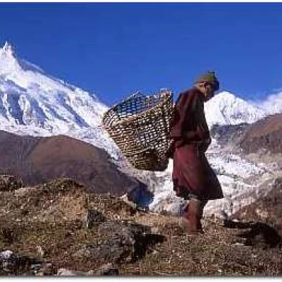
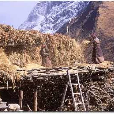
In Sama, one has the impression, even more than in other villages, of going back in time: the inhabitants are all Tibetans and live by herding and weaving, the houses are quite large, but very poor, with roofs covered in wood rather than stone, because the locals believe that very strong winds do not blow here (so the stone roofs found in many other parts of Nepal are not necessary). Upstream from the village there is also an important gompa, which we visit in the afternoon, and then return to camp, close to the village in a wide scenic clearing, with cattle grazing near the tents. As there is a small, very comfortable lodge, we will eat in the warmth and light this evening.
Positive altitude: 
Total walking hours: 3h15'
Tibetan refugee in Sama Gaun
Tap 6: Sama to Samdo
Day 13: 30/10/01
Another fairly short stage, which takes us across shelves dotted with hand walls to Samdo (3780m), a small frontier outpost on the border with Tibet, which would be reached northwards by a few hours' march. This village is also very picturesque and lies along the path leading to Layung Bhaniyang (5098 m), which is one of the passes that allowed passage from the Nupri region (where we are walking) to the arid expanses of Tibet. Today some more important physical problems have begun to arise, and Rosilda has a strong stomach ache, probably due to some medicine against fever that she had taken earlier, while Luisa in the afternoon has a serious headache, which makes us think of a first symptom of mountain sickness; fortunately with the afternoon's rest and careful use of the pharmacy that we have, by the evening they are both quite fit, and we all eat together the shin with potatoes that we have brought from Italy.
Positive height difference: 
Total walking hours: 6h15'
Life in the village of Samdo (3780 m)
Day 14: 31/10/01
After a somewhat cold and windy night, we begin the ascent that will take us to the next camp. Quite long and steep in places, it passes close to the ruins of the mythical Larkya Bajar, once an important trading centre: it was from here that the Namche Bazar Sherpas passed, after a long journey across the Tibetan plateau, to come to trade. We set up camp upstream from Dharamsala, at about 4500 m, in a series of shelves near a small stream. Today the whole troop is very tired, Massimo sleeps all afternoon in the tent and we are all a little tense for tomorrow's stage, which promises to be the hardest of the entire trek; only Giancarlo and Fabrizio are still in good shape.
Positive height difference: 
Total walking hours: 3h35'
Routing to Dharamsala (4500 m)
Tap 7: Samdo to Bimtang
Fifteenth day: 01/11/01
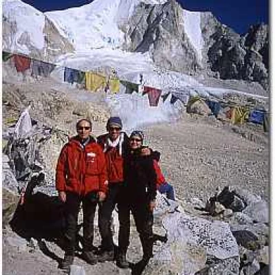
We set off at 4.30, by the light of the headlamps, which we soon switch off, however, as the moon illuminates our path, until dawn breaks, which as usual at these altitudes is spectacular, although very cold. After about 4 hours we finally reach Larkya Bhaniyang (5220 m) where we consume several rolls of photographs, given the exceptional view and the joy of the whole group. Almost everyone's altimeters indicate a lower altitude (5000 m) but, personally, in the mountains I have never chased performance, times to beat or heights to reach, only emotions, so the altitude gap between paper and reality does not worry me. Technically the ascent to the pass was not difficult given the absolute lack of snow, although I imagine that the same, if carried out in more severe conditions such as bad weather or deep snow, could prove to be very hard; physically the whole group was in good shape today, except for Amilcare who actually suffered from the altitude, but who never gave up!
We now began the long descent along the arid moraines which in a few hours would lead us to Bimtang (3630 m), a small settlement of Tibetan refugees on the edge of a bucolic plateau, with a small looped stream and an imposing glacial moraine behind it. Arriving at the camp, Corrado, finally relaxed after having overcome the most challenging stage, also has his moment of crisis, and sleeps all afternoon. After dinner we celebrate the day with a good beer in a Tibetan house, and say goodbye to the cook, Icha, who is descending faster today because he has to get to Kathmandu in just two and a half days, and then leave with another group for the Khumbu area.
Positive height difference: 
Total walking hours: 8h50'
Trip 8: Bimtang to Dharapani
Day 16 - 13th leg: 02/11/01
The night was very cold, and in the morning we find our sleeping bags frozen due to the humidity and frost, but soon, with the first rays of the sun, the temperature becomes milder. We descend through a rhododendron forest along the Dudh Khola to the old settlement of Karche, after which we eat lunch. In the afternoon, after the short but steep ascent of the Karche Pass, we resume our descent through an area that was initially uninhabited, and later cultivated entirely with wheat and maize. We meet up with a few mule caravans and finally arrive in the village of Tilje (2245 m), after a stage that initially seemed relaxing and instead turned out to be yet another little tour de force. We camp slightly outside the village, and in the evening once again the women arrive to party and dance.
Positive height difference: 
Negative height: 
Total walking hours: 6h25'
Dharapani, descending along the Annapurna loop
Day 17: 03/11/01
By early morning we are already in Dharaphani, where our loop joins (in the opposite direction) the more classic Annapurna trek. The impact is quite violent, also because we suddenly pass from a completely peasant reality, where the subsistence of the population is only guaranteed by the perfect union between man and his territory, to a situation typical of the more touristy areas, where the economy is now based on solid and consolidated traditions of hospitality to the thousands of trekkers who every year walk these paths. However, it is also this aspect that makes Nepal fascinating, this continuous contrast between modern and ancient, between technology (it is possible in many places, sometimes even far away, to telephone or even send e-mails) and glimpses of the Middle Ages. By lunchtime we arrive in Tal (1700 m), a beautiful village built on an alluvial plain, where we stop for the night in the garden of a small lodge.
Positive height difference: 
Negative height: 
Total walking hours: 4h25'
Trip 9 - from Dharapani to Bahunanda
Day 18: 04/11/01
Another many ups and downs for this leg which now throws us into the tourist dimension of Nepal. Every village we encounter is a mixture of handicraft shops and souvenirs, sometimes quite ugly, but always with the extraordinary smile and good humour of our Nepalese friends. The stage is however very long, and in the morning we walk for several hours before stopping to rest and eat at a lodge in Ghemu, a charming village on a plateau above the valley cultivated entirely with rice and millet. In the late afternoon we arrive in Bahundanda (1320m) where we spend the night in a lodge, as there is too little land available for tents, and it would be quite difficult to set them up; in this village practically everyone manages to phone and send fresh news home.
Positive height difference: 
Negative height: 
Total walking hours: 7h00'
Trip 10: Bahundanda to Besisahar
Day 19: 05/11/01
The last of the trekking days begins with a long descent to get along the Marsyangandi, which makes us a little nostalgic because, despite the fatigue, sometimes suffering from slight ailments, sometimes minor misunderstandings in the albeit compact group, we are now on the last few steps of our splendid tour. At lunch we stop in the shade of two giant pipals on the banks of the river, and in the afternoon after a short time we arrive at Besisahar (800 m) where we pitch our tents upstream of a sports ground. We don't visit the village, and everyone hides a little within themselves, as if trying to retain and freeze the emotions they have felt over the past few days. In the evening, we have a big party with the cooks, the Sherpas and the porters: we dance, drink and make jokes until late into the night.
Positive height: 
Negative height: 
Total walking hours: 5h35'
Twenty-first day: 06/11/01
We set off again for Kathmandu by bus, and it's still hours and hours of travelling along the rivers, along this road that by now is almost familiar to us. I remember in particular the stop at a sort of village-autogrill where we eat at a Nepalese truckers' place (with all the respect I have always had for truckers) that on the first day surely no one would have considered even to go for a pee. We arrive in town in the early afternoon, and now at last everyone goes wild in search of souvenirs that are more or less beautiful, more or less expensive, more or less gaudy, but which in any case will remind us of the Nepalese atmosphere when we are back in our old Europe
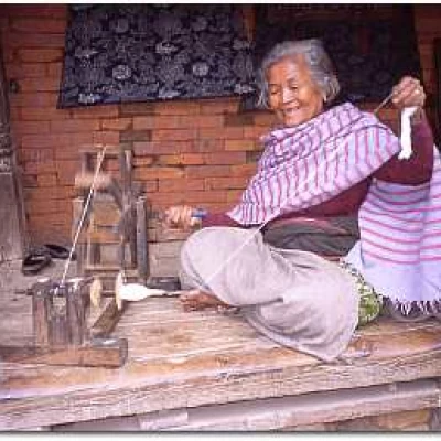
Ethnic Newari woman in Baktapur (Kathmandu Valley)
Day 22: 07/11/01
We visit the imperial cities of Baktapur, Pathan and Durbar Square in Kathmandu. I think that Baktapur (where the exterior shots of Bertolucci's Little Buddha were filmed) is one of the most fascinating ancient cities I have had the opportunity to visit: in recent years it has certainly changed, but the fact alone that in its main square all forms of commerce are absolutely forbidden makes it an absolute must for those who are planning a trip to Nepal. In the evening we had a great meal at the Yack & Yeti Hotel, a spectacular and luxurious hotel with a park, large carved wooden lounges, excellent food both Nepalese and international, with Chonngba as a welcome guest at our table tomorrow he will be leaving for another trek, this time in the Khumbu area, and we all bid him a fond farewell.
Twenty-third day: 08/11/01
We leave the hotel early in the morning to go to Swayambunath (the Monkey Temple) from where there is a view over the entire Kathmandu valley, and later to Pashupatinath (the Hindu city) where we attend two funeral ceremonies. It may seem a little cynical to go poking around in other people's grief, but cremation among the Hindus has a special appeal, and it is perfectly normal for people, both Nepalese and foreigners, to attend the celebrations. The dead are laid on trunks suitably crossed according to the dictates of the local religion, and after a series of offerings that are thrown both into the river and onto the deceased, the ceremony culminates when the first-born male burns the funeral pyre; this is followed by long and expensive feasts at home, to which whole districts of the city are often invited.
Day 24: 09/11/01
Frenzied shopping for carpets and pashminas, a last pizza at Fire & Ice, a legendary pizzeria run by a nice Neapolitan lady, and off to Dhaka, Bangladesh, where we spend 24 hours in a rather squalid hotel (considering that this nation, born only in 1972, is still one of the poorest and most densely populated on Earth). The choice to spend so much time here was dictated by the initial delay due to the airline, but morale is still high despite the holiday being almost over, so we take things as they come and let the weather take its course.
Day 29: 10/11/01
We take the opportunity to visit the city centre, if we can call it that, a unique assemblage of trucks, rickshaw-ridden buses, decaying buildings, with eight million inhabitants who continue to move among thousands of stalls, horns, and smog at the highest level. During the day, we visit several monuments both inside the city and in the surrounding countryside, and the impression is that we are in a huge video game, where the objective is to get through the evening without crashing our minibus into some truck. Around 11 p.m. we finally get on the flight which, this time with perfect timing and a fairly good catering service, takes us to Rome. Thanks to an efficient and nice employee, we then manage to catch the first plane to Linate, and at 13.30 our holiday ends.
Thanks to Amilcare for his determination at the col, Attilio for not giving up on the first day, Claudia for enduring the cold without complaining, Fabrizio for the precision of the data he gave us every evening, Gabriele for his help in writing the notes to the trek, Giancarlo for his sympathy in accepting the jokes, Ivana for her cheeky face at the airport on the way back, Maurizio for the jokes, Maria Luisa for shoving herself into the box, Massimo for not letting up even when he was really down, and Rosilda for giving me the gift of coming on this trek.Note:
The height differences have been calculated on the basis of both direct observations and interpretations of available maps the times have been calculated without counting the hours of lunch breaks. The kilometres covered were approximately 210 - I apologise for any errors and omissions I may have made -


