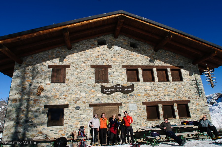
Barbustel Refuge, from Mont Blanc


Edited by:
Gian Mario Navillod
Updated at: 17/02/2025
Access
At the motorway exit at Pont-Saint-Martin, turn left and take the state road as far as Bard; shortly afterwards turn left onto the regional road for Champorcher. Go up the whole of the Champorcher valley and as far as the main town, immediately afterwards take the road on the right to the village of Mont Blanc and continue in the direction of Dondena. Follow the small asphalted road until, after numerous hairpin bends, you reach the large car park where you can leave your car.
For those coming from the upper valley, we recommend exiting the motorway at Verrès, then turning right and taking the main road 26 to the junction for Champorcher.
.Introduction
A pleasant and undemanding excursion ideal for those who enjoy the silence of the snow-covered mountains.
Description
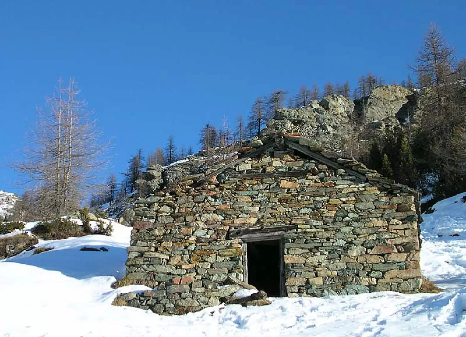
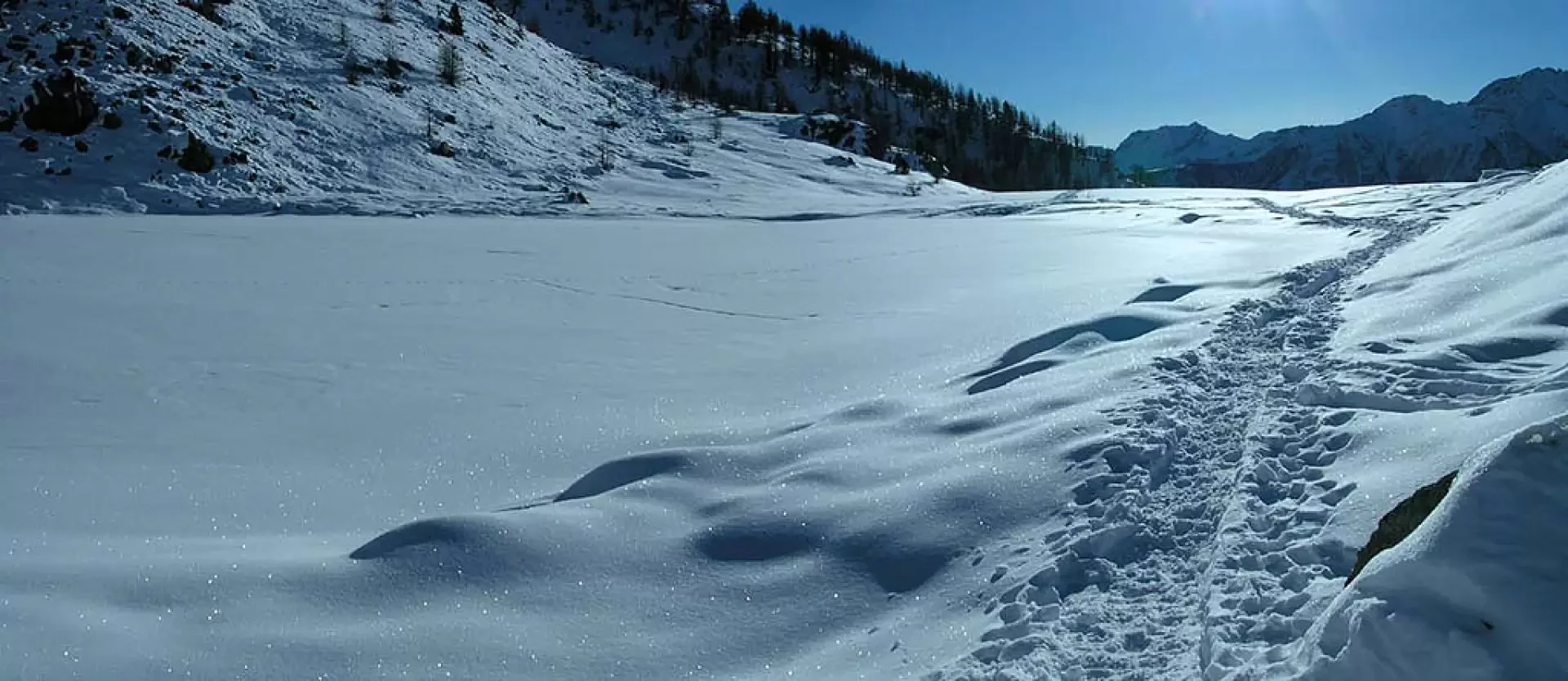
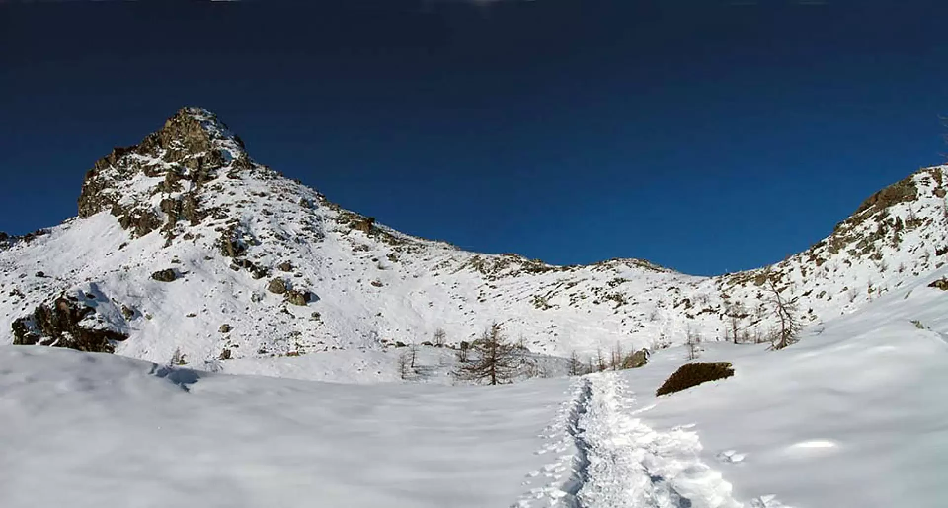
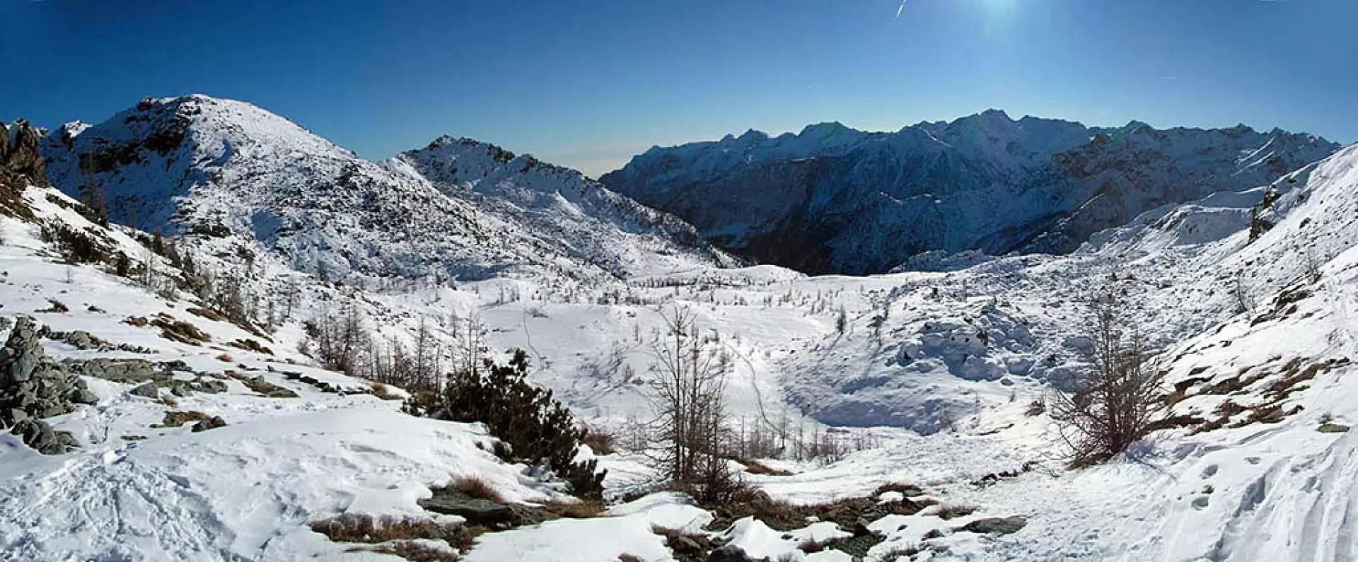
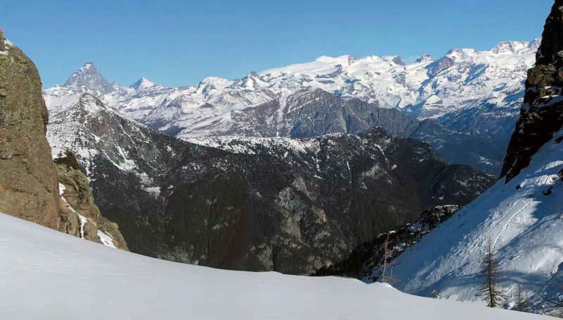
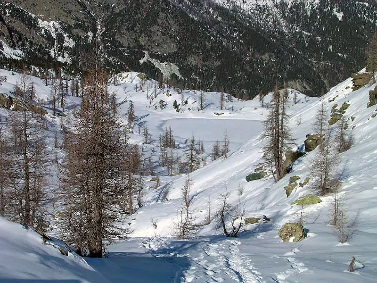
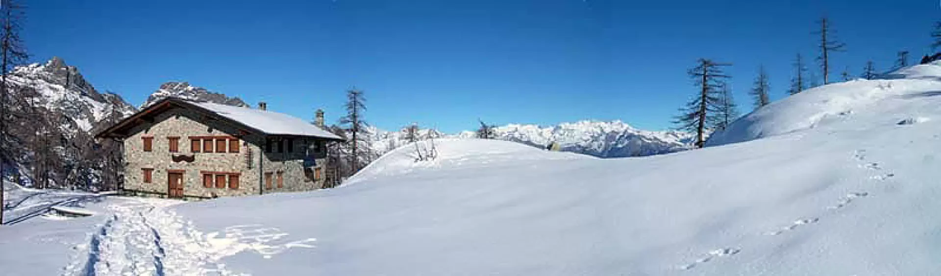
Continue along the dirt road that leads to Dondena until you meet the signs for the refuge and the Lago Bianco pass. Here, take the paved path that climbs steeply following the course of the Muffé stream, the outlet of the lake of the same name. Those who wish to do so, instead of following the summer path that runs at the bottom of the valley and catches less sun, can climb up to the right, passing in front of two old huts, and continue by tackling the steep slope that leads to the plateau that hosts the lake. From the shores of Lake Muffé (2080m) looking north-west, one can clearly see Mont Torretta and to its right the saddle of Colle del Lago Bianco (2309m). We head towards the pass almost in a straight line, cutting across the gentle undulations of the snow-covered terrain, dotted here and there with sparse conifers. In the last 50 metres, the slope becomes steeper, but the very short effort is amply rewarded by the panorama from the saddle: Lake Vallet below on the right, Mont Avic high above with Mont Revi on the right. Descend the valley in the direction of the lake and just before touching its shores head eastwards, reaching the refuge behind the rocky panettone dotted with a few larches in a few minutes.
External links
- www.montavic.it
Riferimenti Bibliografici
- Tracce Lievi - Massimo Martini - Martini Multimedia Editore, 2007
Galleria fotografica
We have been there

Edited by:
Massimo Martini
Rifugio Barbustel, da Mont Blanc
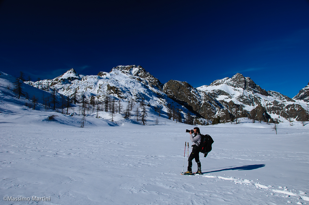
Escursione inalto in compagnia del grande fotografo Mirko Sotgiu. Giornata invernale spettacolare, luci strepitose.

Edited by:
Giancarlo Beretta
Rifugio Barbustel, da Mont Blanc
Giornata simil-primaverile con neve ottima e abbondante e con sprofondamenti notevoli fuori dalla traccia. All'andata traccia ben intuibile ma coperta da un basso strato di neve caduta nella notte mentre al pomeriggio neve bagnata per rialzo termico. Da soli al rifugio e discesa dal colle in neve polverosa con traccia coperta dall'azione del vento. Saliti dal solito cartello sulla strada di Dondena e ritorno tagliando, ormai in basso, per le baite di Cort. La baita al lago Muffé aveva un cartello dei lavori di ristrutturazione con scritto che si sarebbe trattato di un "posto di ristoro": un futuro rifugino? Allego anche uno dei miei soliti panorami.