Piz Arpiglia, from Zuoz

Edited by:
Rita Tarussello
Updated at: 16/11/2025
Access
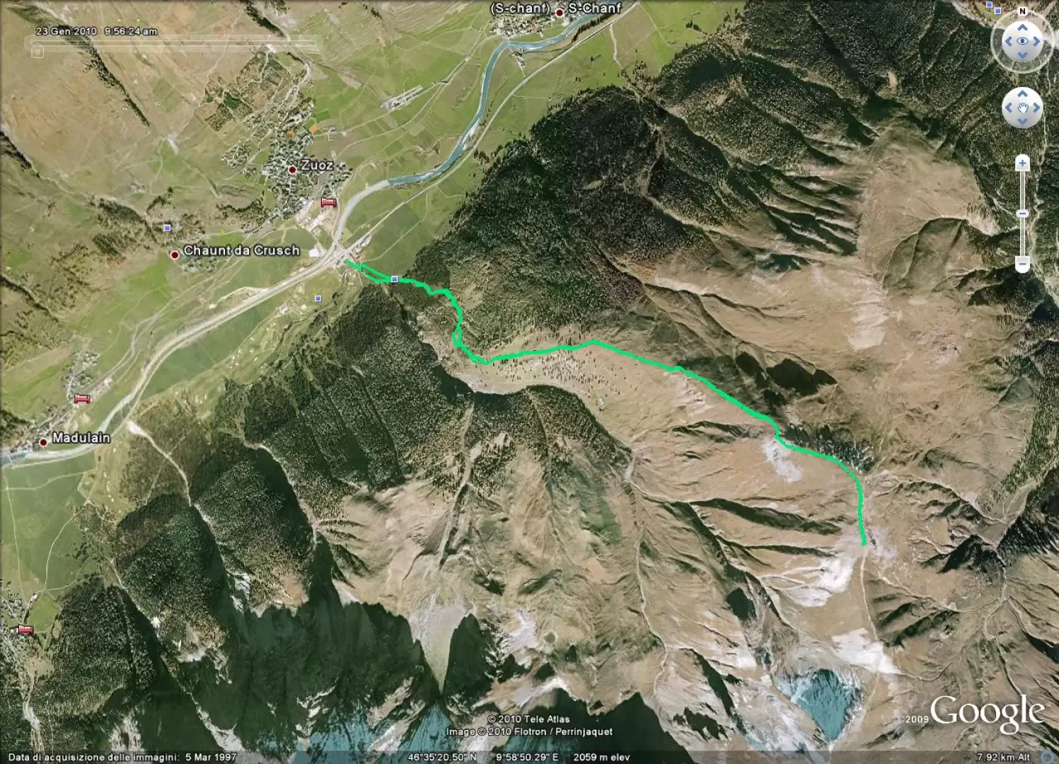
SS36 from Milan to Chiavenna. After a roundabout, on the main road, follow signs for the state border on SS 37. From the entrance to Switzerland, at Castasegna, continue along Strada 3 to St. Moritz, then along Strada 27 towards Zernez/Samedan to Zuoz, where there is a signpost for Resgia on the right. As soon as you turn right, you will find a nice parking area on the left, next to a carpentry shop and near the cross-country ski track.
Introduction
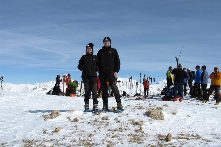
The Piz Arpiglia (2765 m) is a beautiful mountain in the lower Engadine, a popular destination for Swiss and Italian ski mountaineers. The route is on the northern slope of the mountain and this factor, together with the always rather cold temperatures in the area, lends itself to good quality snow until well into the season. Another plus point is that in the event of marked avalanche danger, the hike is usually feasible. However, it is necessary to pay attention to the accumulations of wind-covered snow on the upper part of the route.
.Description
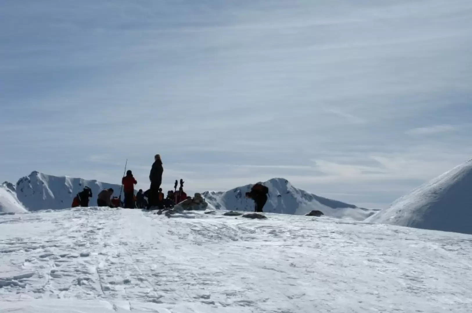
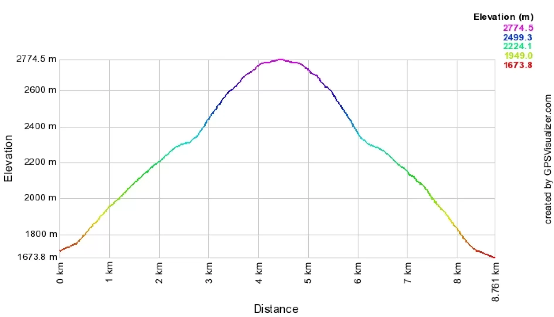
From the Resgia car park, a small road crosses the Ova di Arpiglia on a small wooden bridge. Just after the bridge, a signpost indicates, on the right, the direction to Piz Arpiglia. It is possible to follow the path into the forest or to ascend directly up the steep meadows on the right, which allow you to quickly gain altitude. Clearings and sparse woodland follow one another until you reach an open space in a south-easterly direction, where the path flattens out slightly and where the woodland, which until now consisted of larch and fir, gives way to sparse, atmospheric, centuries-old stone pines. We then reach the base of a ridge that becomes steeper and steeper, and at the top of which we encounter some small rocks outcropping on the snow. From here (2748 m), turn decisively southwards along the ridge that leads to the summit, a plateau marked by a wooden pole.
If you wish, but only if the snow is well bonded, you can continue on to Piz Uter (2907m), but bear in mind that in this case you will have to walk another 40m downhill and climb 200m up a slope with a 45° gradient.
The snowshoe hike is still more than satisfactory, even if it is limited to Piz Arpiglia.
Objective Danger:Accumulations of windblown snow
Exposed Tracts:Traverse under rocks
Maximum slope: 45°
Exposure to Sun: north-west
Galleria fotografica
We have been there

Edited by:
Ermanno Panara
Piz Arpiglia
gita con sviluppo breve ma con dislivello importante. Se si opta per la salita diretta c'è da mettere in conto una bella fatica, comunque appagante. Il tratto terminale in corrispondenza delle roccette è da affrontare con molta attenzione perchè il traverso è ripidissimo. Consigliate delle ciaspole con una buona tenuta laterale perchè si seguono prevalentemente le tracce degli sciatori, che affrontano la salita in diagonale. L'ultimo tratto si affronta invece per la massima pendenza, anche per evitare di rovinare le tracce dei numerosi sciatori, ed al ritorno è impressionante vedere quanto è ripido...