Gran Paradiso, from Breuil

Edited by:
Giancarlo Beretta
Updated at: 04/05/2025
Access
From the motorway barrier at Aosta-West, keep left and follow the signs for Aosta - Saint-Pierre. After one kilometre, at the roundabout, take the second exit to join the main road. Continue on the state road for 4.3 kilometres, passing the village of Saint-Pierre until you reach a new roundabout with the Gran Paradiso National Park sign. Take the first exit and continue on the state road for 1.4 kilometres until you come to the exit for Introd/Rhemes S.G/Rhemes N.D/Valsavarenche. Continue for 700 metres and at the roundabout take the first exit onto for Valsavarenche. Follow the regional road for 3.9 kilometres, pass the village of Introd and, after a series of hairpin bends, you will reach the crossroads for Val di Rhêmes . Continue left on and climb the valley for another 21.8 kilometres, passing the main town Dégioz, the village of Eau Rousse and finally the village of Le Pont, where there is a large free car park 🅿️.
[0h44'] - [33.1km]
How to get there with GMaps
How to get there with Apple Maps
Pont Valsavarenche can also be reached by bus with the company Arriva, leaving from Villeneuve in about 50 minutes.
Introduction
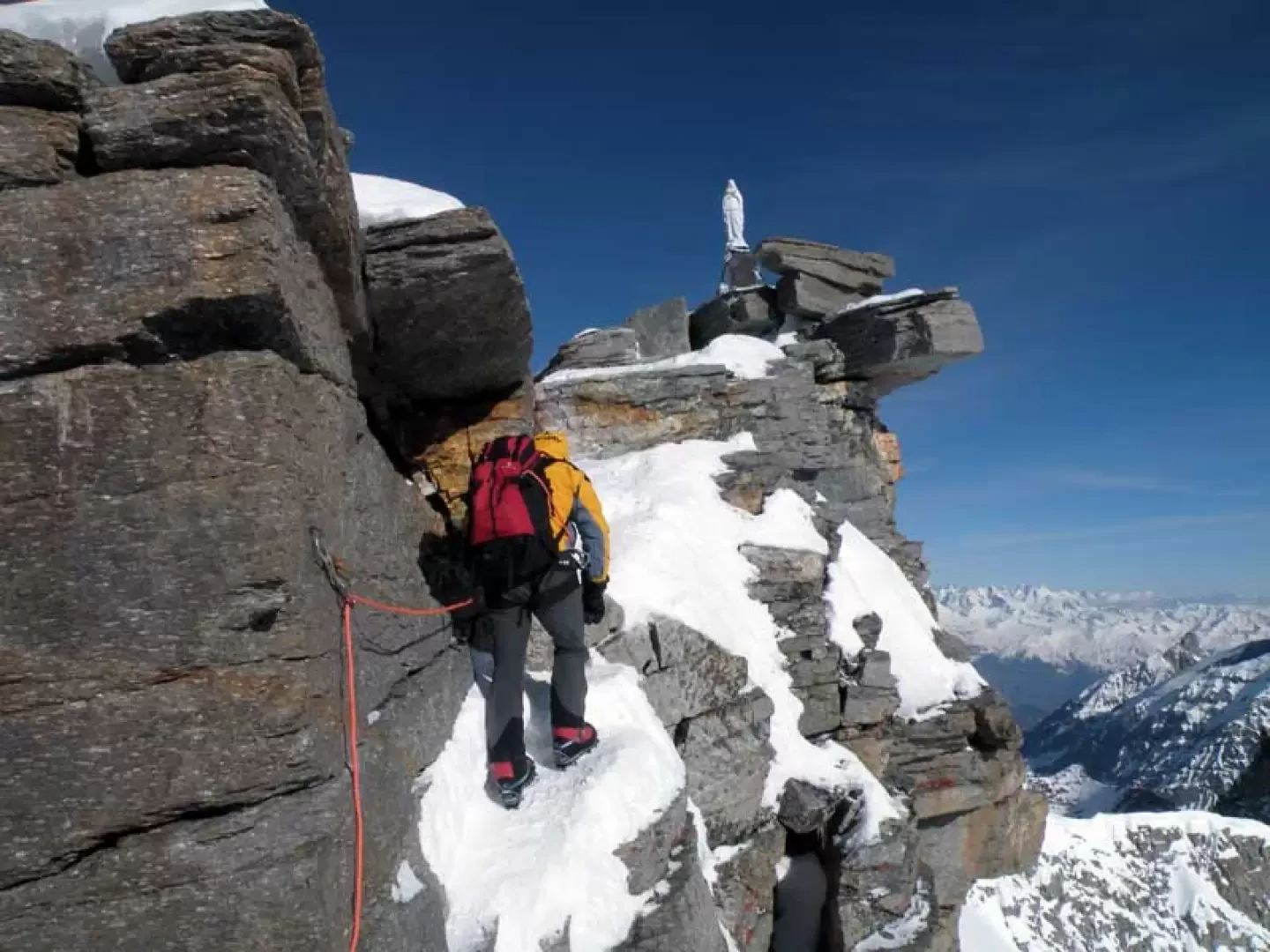
This climb of an alpine nature reaches the summit of the only 4000 m peak entirely on Italian territory and must be tackled in the late season with well-seasoned snow conditions and, given the altitude, suitable weather. The route follows the traditional route of the summer ascent except for the section beyond the moraine of the hut where it is better to climb the bumps on the left and not pass through the central couloir underneath the wide upper slopes. Depending on the snow cover of the upper snowfields, it is necessary to assess whether and when it is necessary to replace the snowshoes with crampons, alternating them for greater safety in the progression on the steep slopes and on the Gran Paradiso glacier; in any case, the last stretch above the terminal to reach the summit should be done with crampons due to the presence of ice on the rocks. The passage to reach the Madonnina is equipped with a fixed lanyard and with bolts where you can put a quickdraw for safety, as well as, of course, being tied from the 'donkey's back' area. A section where the danger must not be underestimated both on the ascent and descent is also a series of exposed bends in a long, very steep gully that begin at an altitude of around 2170 m.
.Description
First day
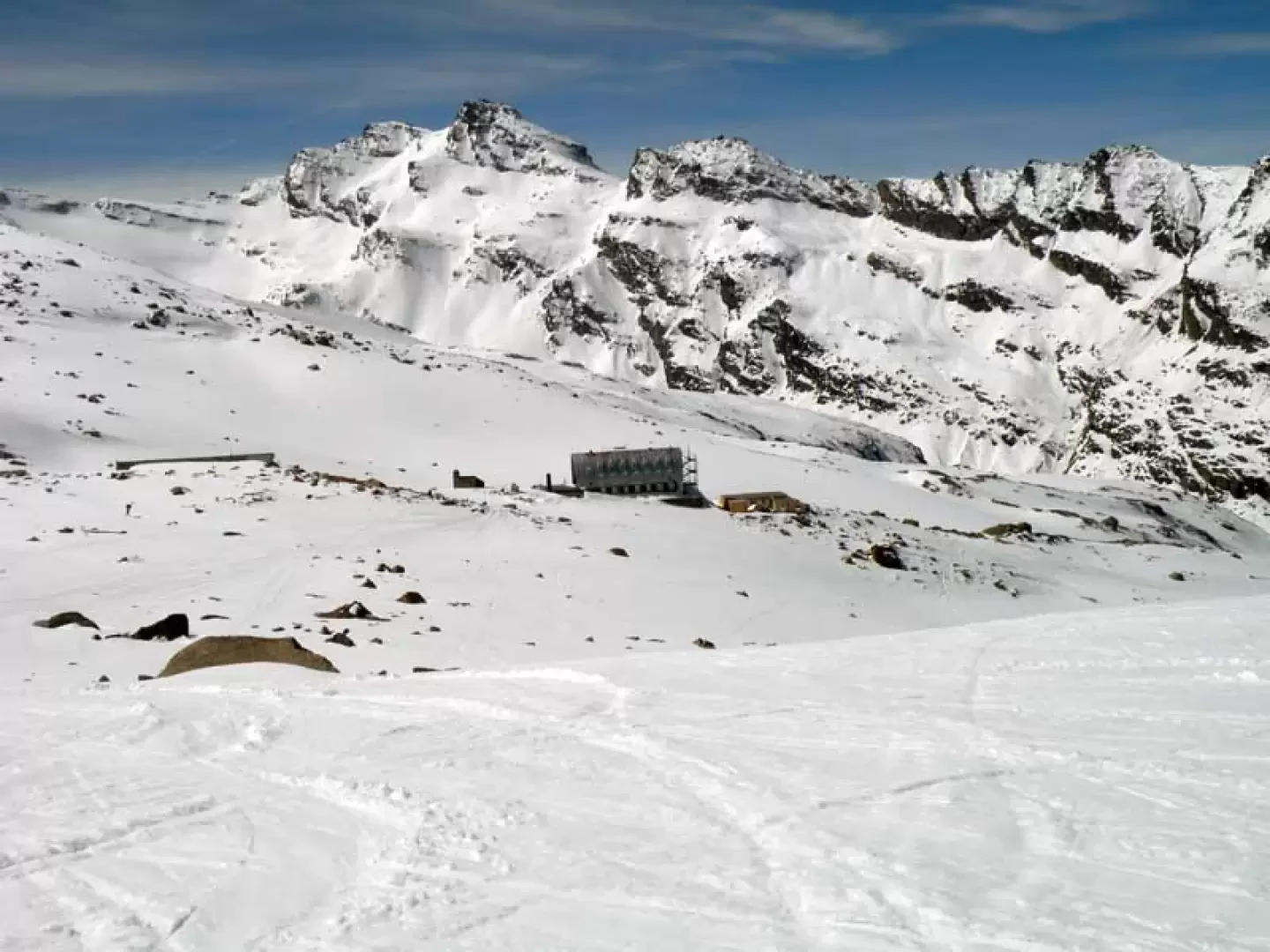
From the car park, reach the little house at the beginning of the cross-country skiing track and follow the signs for the footpath, which runs alongside the summer camping area and continues to the right of the stream. Entering the valley, you reach a bridge on the left that you must cross and begin to climb along the path leading to the Vittorio Emanuele hut, following the almost always present ski-mountaineering tracks. After a stretch of ascent through the sparse forest, you arrive at an altitude of about 2170 m, where you have to negotiate some hairpin bends that cross a long, steep gully and where you have to be extremely careful because of their exposure. Once this section has been passed, the ascent continues more easily on gentle, more open slopes that, depending on the snow cover, alternate between stretches on the ground and vast moraines in the process of melting: the winter trail usually passes a little to the left of the one taken by the summer trail, and in any case, remaining in the middle of the moraines, the Vittorio Emanuele hut can be reached without difficulty.
Second day
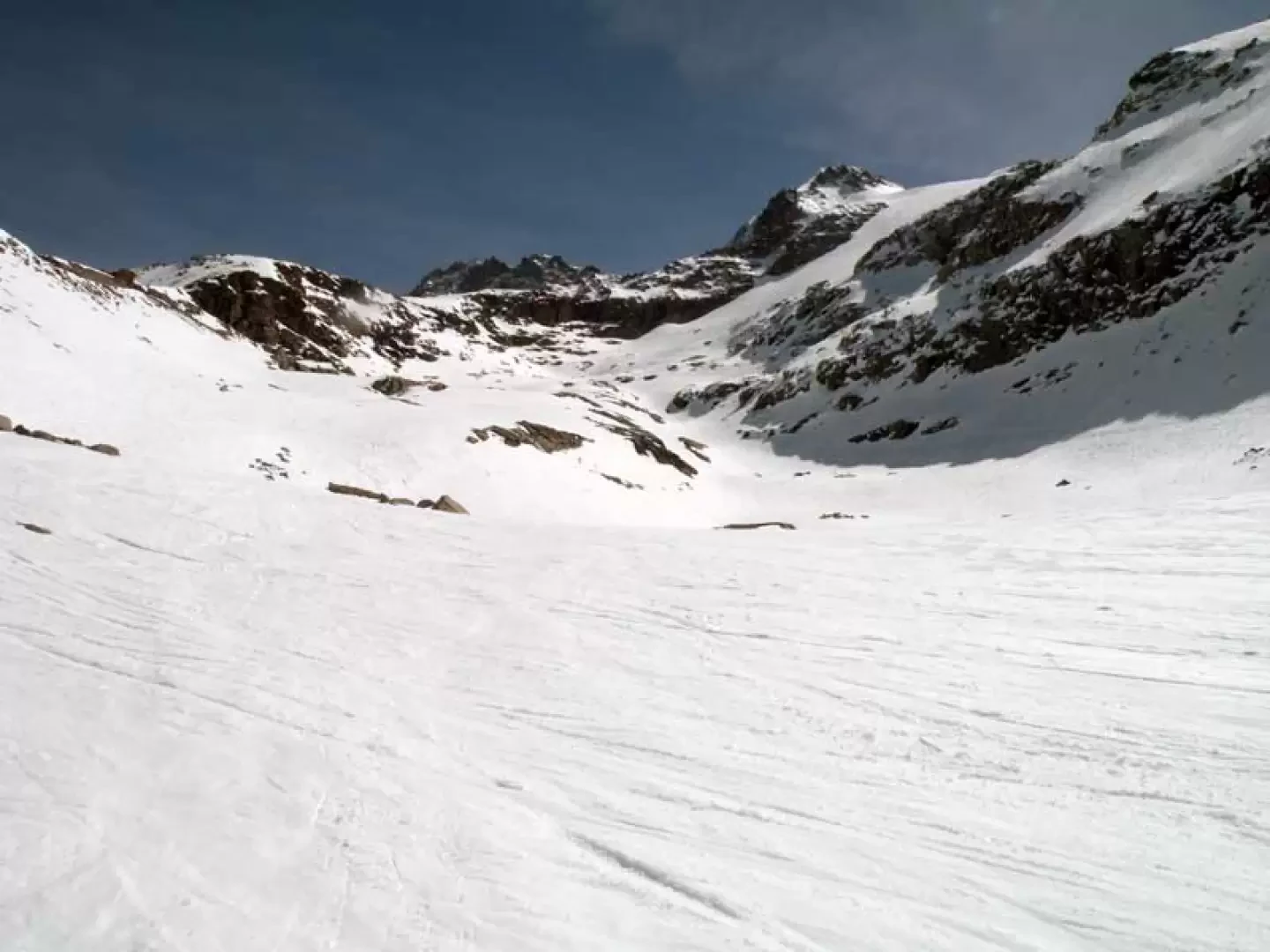
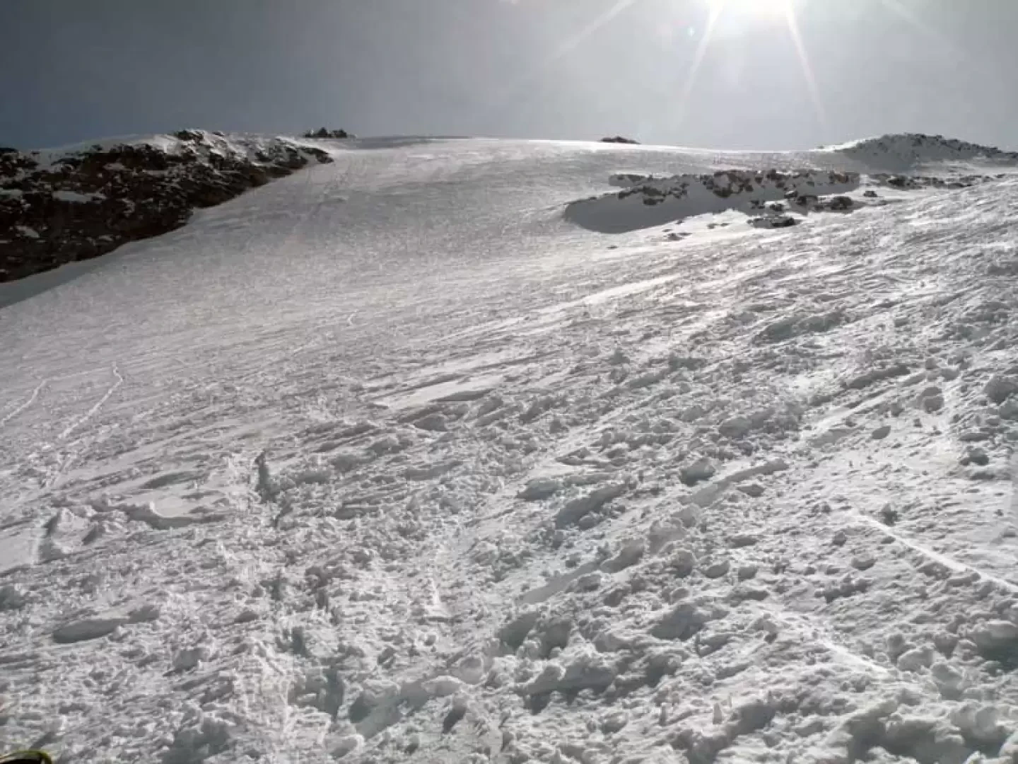
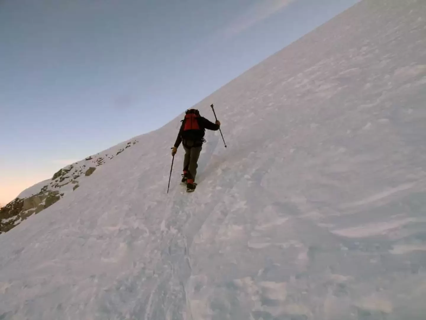
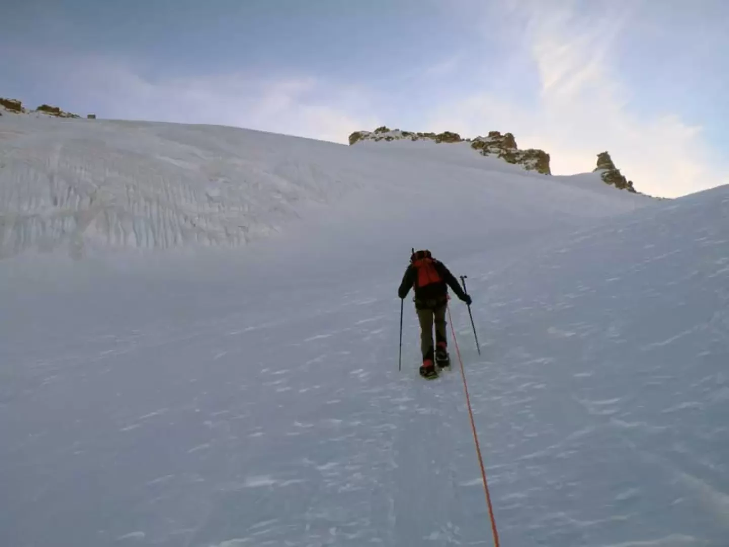
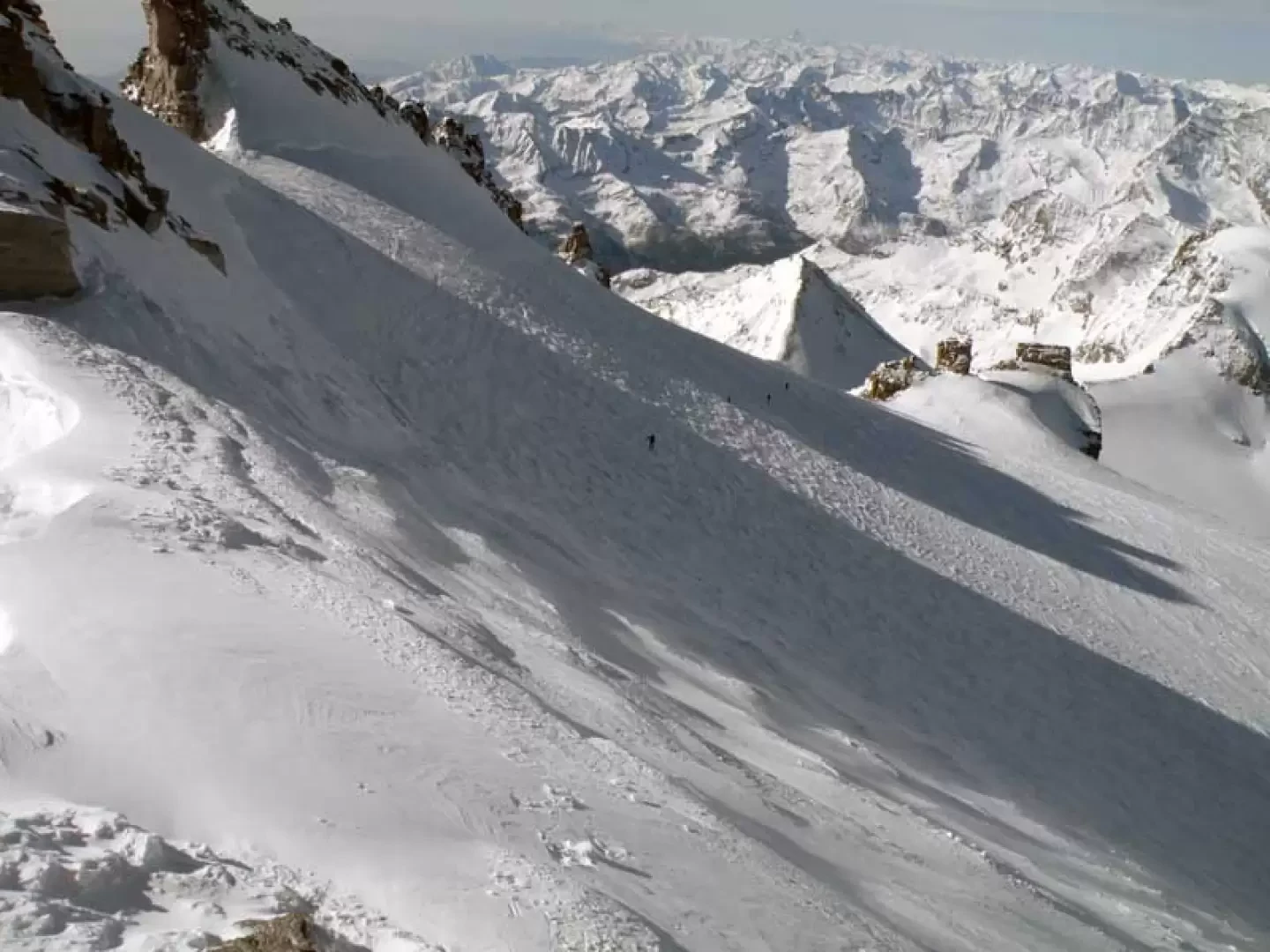
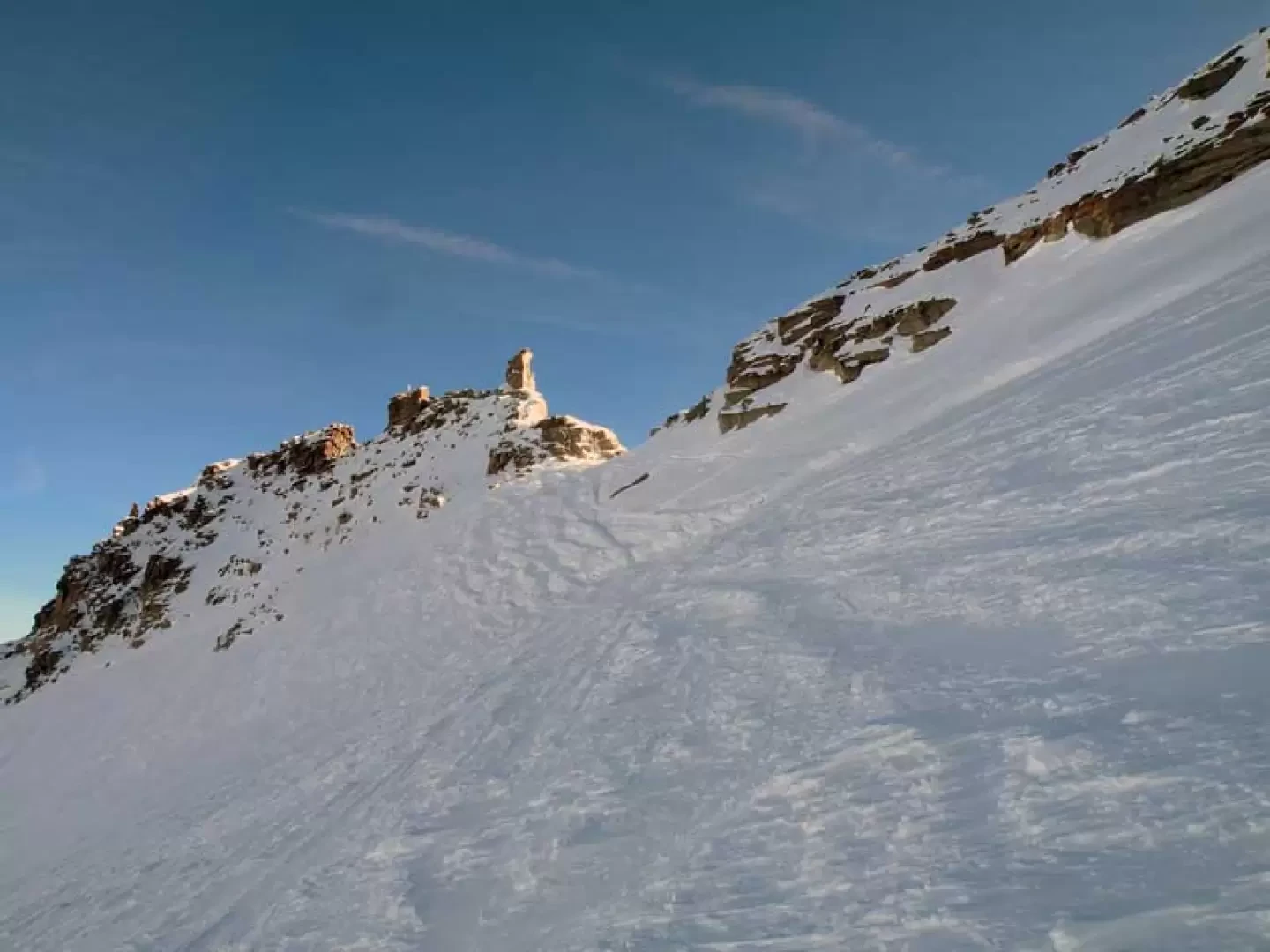
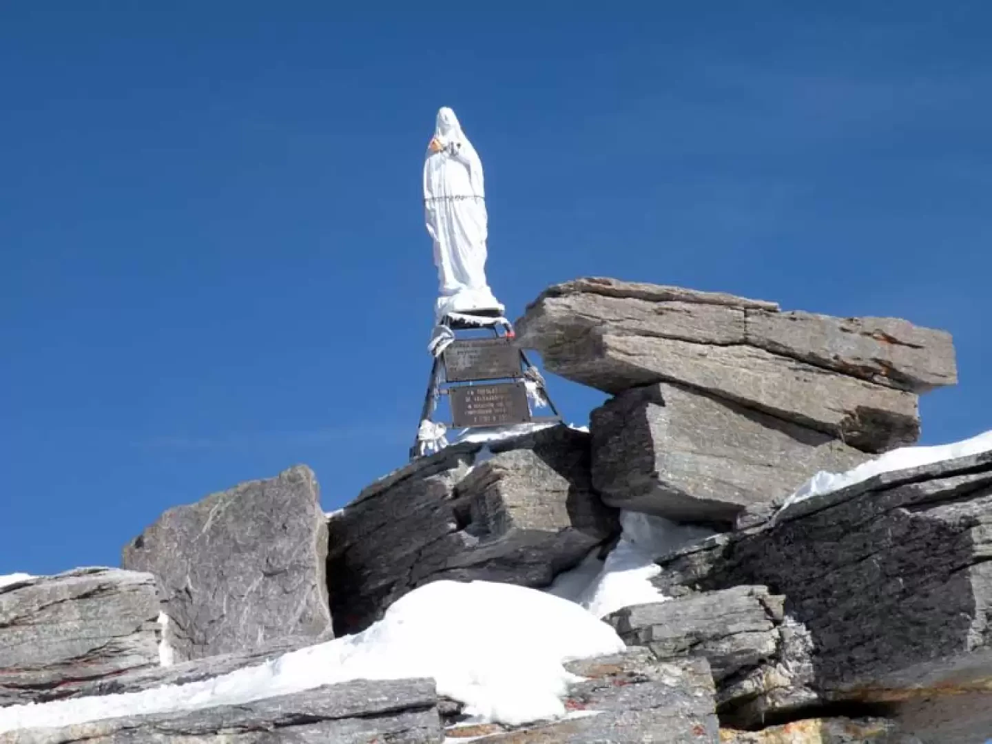
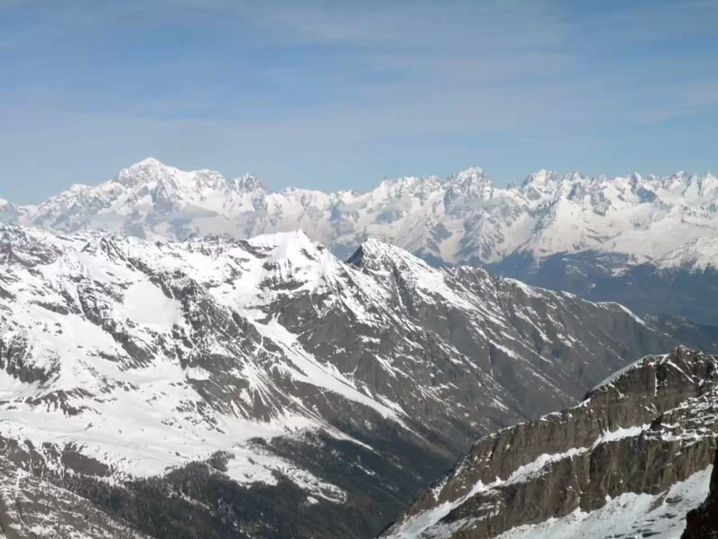
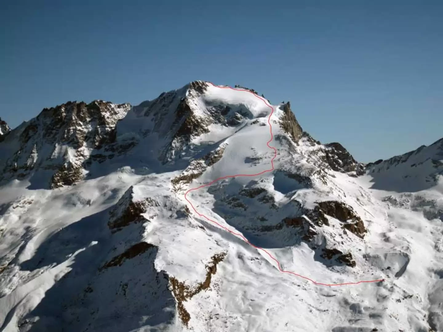
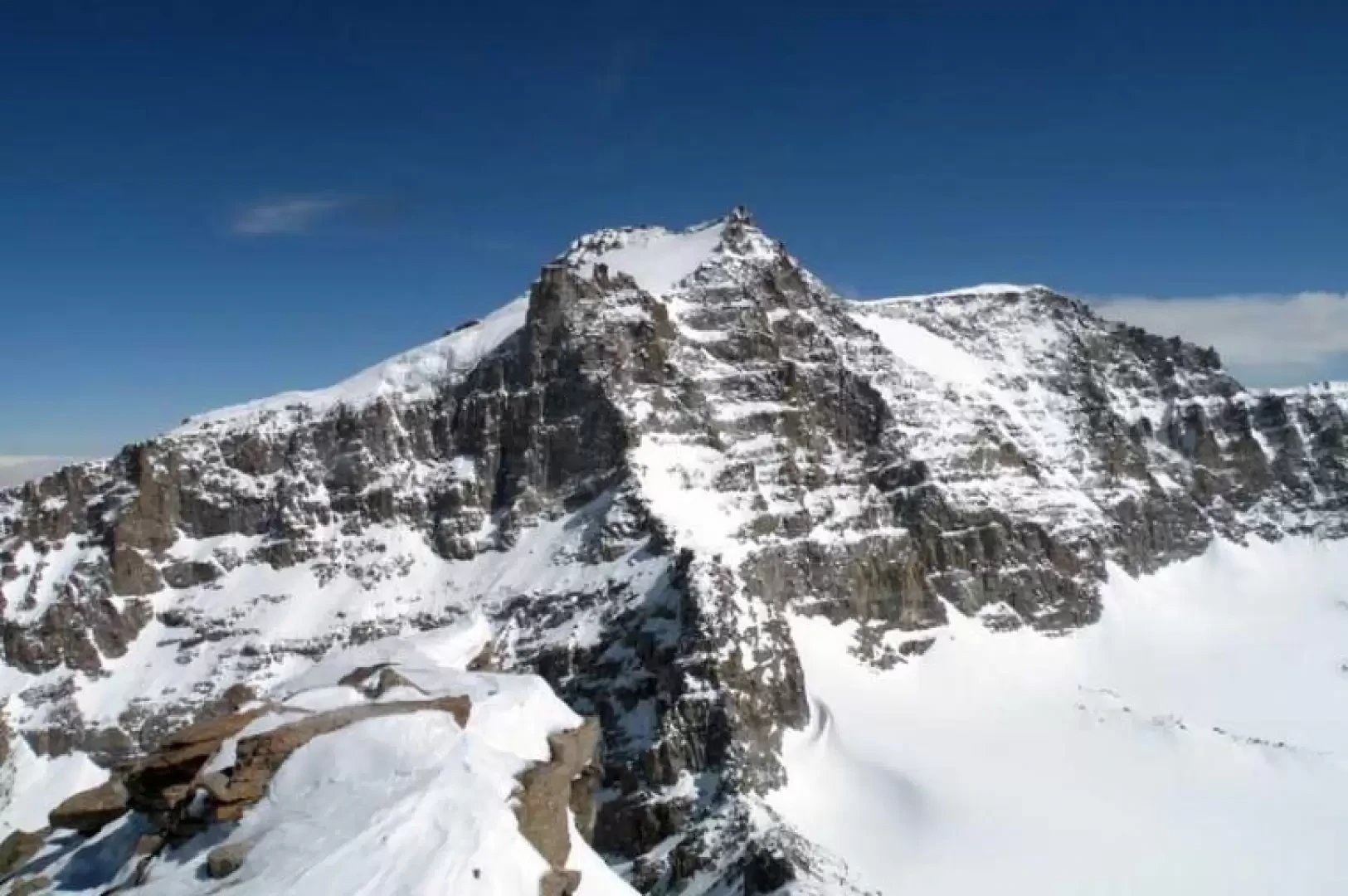
From the hut, go up the moraine slope upstream of it and enter a wide basin where you go back up the bumps on the left to gain the upper part of the gorge; in this section it is not advisable to pass through the centre of the gully, which remains under drainage from the wide slopes above. Continuing on a slight incline, head towards the bottom of the valley and keep to the right to begin to climb with a few zig-zags up the first steep prominence of the glacier (30°), also staying to the right here. Arriving at the point where the slope decreases, we head towards a second glacier prominence that is steeper than the previous one (40°- 45°), which we climb again with difficulty, staying just to the right of its central part. At the end of the steep slope, you can see the characteristic rocky spire of the Becca di Montcorvè and walk for a short distance on a false slope, surrounding a glacier hump on the left and at the same time keeping a good distance from the wide and high front of the glacier that descends from the summit. Passing to the left of the Becca di Montcorvè, one reaches the most comfortable and, if one can say so, least steep point of the latter, almost pushing on towards the rocks of the crest where one turns decisively to the left to ascend it laboriously, being careful of the passage of the terminal glacier, which, depending on the conditions of the glacier, can be delicate. Once past it, head for a collar below a rock gendarme where it is a good idea to leave your snowshoes and put on your crampons in order to follow the slightly sloping rocky ridge to the left and, a little further on, climb up the edge and pass onto the opposite side where the technically more demanding passage is to be found. In fact, here there is a short, very exposed ledge equipped with a bolt and a fixed cord, beyond which are the terminal rocks on which there is a metal statue of the Madonna.
Galleria fotografica