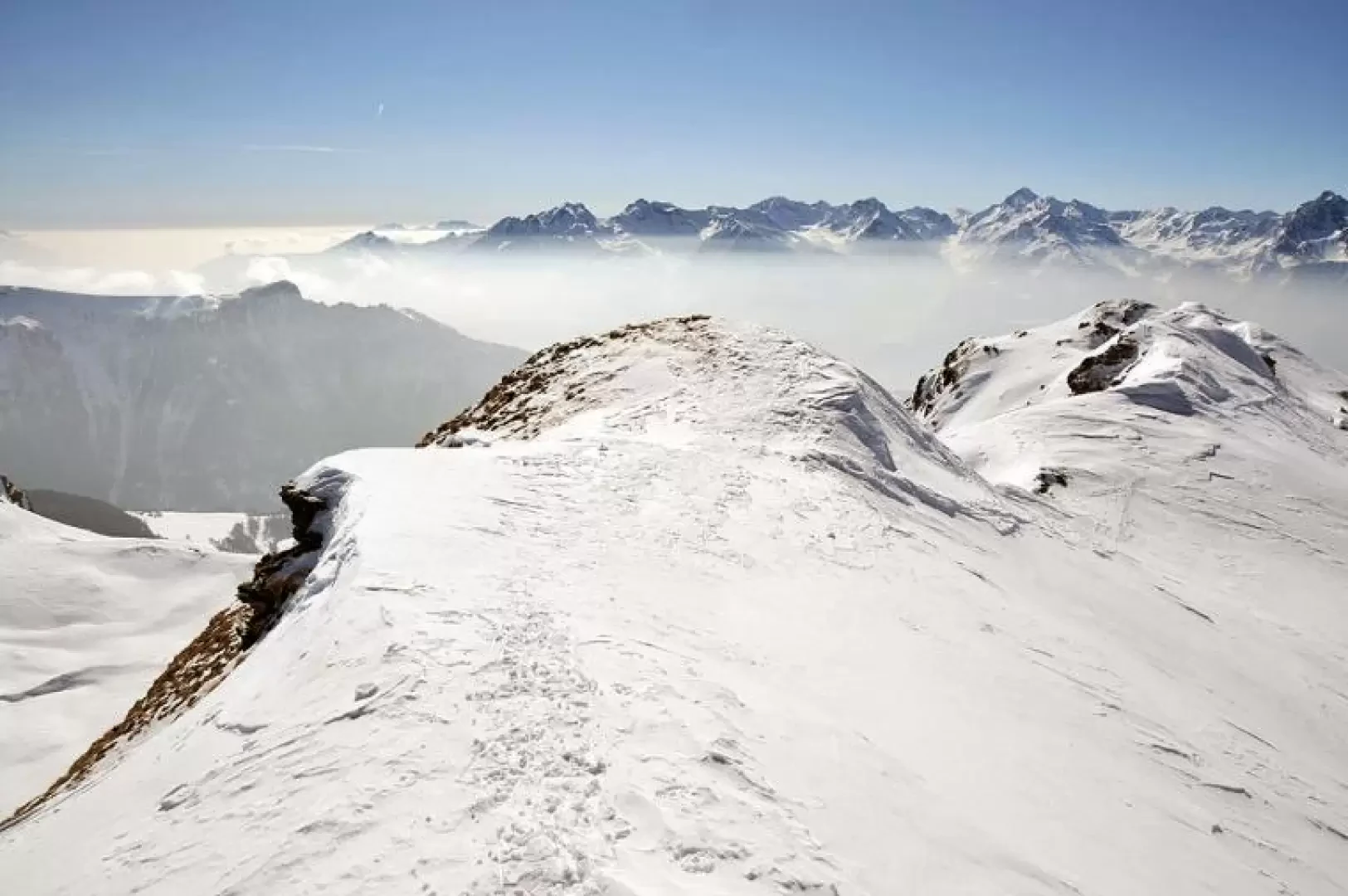
Col de Chaléby, from the Porliod car park

Access
Lasciare lo svincolo autostradale di Nus e svoltare a sinistra immettendosi sulla Strada Statale [SS26]. Proseguire per 850 metri fino al semaforo, dove si svolta a destra seguendo le indicazioni per la Strada Regionale in direzione Saint-Barthélemy. Poco prima del centro storico di Nus, svoltare a sinistra e iniziare a risalire la regionale, superando i villaggi di Petit-Fénis e Blavy, entrambi situati nella zona collinare sopra Nus. Dopo circa 14 chilometri di salita, si raggiunge un bivio in corrispondenza di una curva: qui svoltare a sinistra e proseguire verso Lignan, località nota per l’Osservatorio Astronomico della Valle d’Aosta. Dopo aver oltrepassato il villaggio di Issologne, la strada prosegue fino a Lignan, raggiunto dopo 17 chilometri dalla partenza. Una volta giunti al piazzale del villaggio di Lignan, svoltare nuovamente a sinistra per affrontare l’ultimo tratto di strada. Questa parte attraversa i piccoli villaggi di Saquignod, Vénoz e Crét, caratterizzati da tipiche costruzioni rurali e panorami sulla vallata sottostante. Al termine della salita si raggiunge il parcheggio gratuito “Porliod” (🅿️), situato davanti all’area picnic omonima e facilmente riconoscibile per la sua ampiezza e la posizione panoramica.
Il parcheggio rappresenta un punto strategico per l’avvio di escursioni verso i principali sentieri della conca di Saint-Barthélemy, e offre comode possibilità di sosta. La zona è priva di limitazioni stagionali note e il percorso stradale è generalmente ben mantenuto; tuttavia, si consiglia prudenza in caso di neve o ghiaccio nei periodi invernali. Per raggiungere il punto di partenza dell'itinerario è indispensabile un mezzo privato, poiché non è servito dai trasporti pubblici.
Distanza e tempo di percorrenza
🕒 Tempo di percorrenza: 33 minuti
📏 Distanza: 21,50 chilometri
Navigazione GPS
📍 Come arrivare con Google Maps
📍 Come arrivare con Apple Maps
Nota importante
Le indicazioni fornite sono state verificate alla data del rilievo dell’itinerario. Prima della partenza, è consigliabile verificare eventuali variazioni del percorso. Per ottenere indicazioni aggiornate e dettagliate, si consiglia l’uso di Google Maps o Apple Maps.
Introduction
This trip, a classic of Valdostan ski-mountaineering that is also becoming quite popular with snowshoers, can be the natural complement to the ascent to the nearby Col du Salvè and can be reached from here in just under half an hour. The only difficult and dangerous part of the route is crossing the traverse after Tsa de Fontaney: about 200m cutting a slope that, even after consulting the avalanche bulletin, is best assessed on the spot, especially on the return journey when the southern exposure means that temperatures have risen. From the pass there is an excellent view westwards over the Plan Piscina below, bordered by the Becca di Fontaney and the eastern slope of the Faroma; to the east, the view runs towards the nearby Punta Tsan and the more distant Breithorn and Monte Rosa group, while to the south and west you can see a parade of peaks, passes and valleys worthy of the best views of the southern side of the Aosta Valley.
Description
From the car park, go up the track that starts next to the poles and reach the beginning of the cross-country skiing track just above; go past the ticket office and walk a few dozen metres, taking care not to step on the beaten track, passing the summer path pole and arriving at the well-marked junction on the left with the snowshoeing route sign. Climb at a moderate gradient and after crossing the track, continue on the usually well-trodden track to the Plaisant hut (2038m). Here, to cross the wood, you can faithfully follow the track of the farm track, which with gentle hairpin bends leads to its upper edge, or, if you want to shorten the route and if there are visible tracks, climb right above the hut, entering the wood, which is not very dense but steep, and, crossing the farm track at several points, you will always come out of the wood. Now the spaces widen into gentle slopes that, still on a well-trodden track, lead in about twenty minutes to the alpine pasture of Tsa de Fontaney (2307m). From here, we turn sharply to the right to head towards the evident snowy bumps of the wide valley, which has at its summit the large and recognisable Col du Salvè and is dominated by the imposing mass of Mont Morion. In order to reach this valley, one must take a traverse (the critical point of the climb) that is a little treacherous and very steep in its final part, located under the very exposed slopes of the Côteau above Champorcher. Having passed this key point of the climb, the route now becomes easier and safer. Moving a little to the right, one reaches the centre of the wide valley and ascends the bumps, following the track that may be present or, in the absence of one, now passing without an obligatory path between them, now ascending them directly with a few zig-zags and aiming anyway at the cross on the col. After passing a slightly steeper section below the pass, you arrive near the wooden cross and, without reaching it, go round the first rocky-snowy prominence to the left of Col du Salvè with an easy traverse. Here, too, you pass without any obligatory route between the snowy bumps heading westwards and, after having climbed a few of them aiming at the maximum depression that descends from the Becca de Fontaney, you reach the last climb that leads to the Col de Chaleby and, after a few metres of easy cresting towards the south, you reach the panoramic peak at an altitude of 2709m.
.