Mont Blanc du Tacul, Goulotte Chèré, from the Aiguille du Midi

Edited by:
Giancarlo Beretta
Updated at: 21/09/2024
Access
Leaving the motorway at the Courmayeur exit, drive through the Mont Blanc Tunnel. At the exit in France, follow the signs for Chamonix and the Aiguille du Midi cable car.
.Introduction
Approximately 200 m high Gola Ghiacciata located to the right of the north-west pillar. Very beautiful and athletic ascent on ice with some very steep but short passages. Almost always in good condition but, given the temperature trend in recent years, an ascent in the winter or spring months is recommended. A busy and sometimes crowded route. If you want to reach the summit, it is best to set off very early in order to be in time to take the cable car back.
.Description
Day 1
From the Aiguille du Midi (3795m), the upper station of the cable car from Chamonix, follow the signs for the Vallée Blanche , exit the ice and rock tunnel and descend the snowy, airy ridge. Following the numerous tracks, you reach the glacier plateau on the right, always skirting the base of the east face of the Aiguille du Midi and the subsequent rocks, then climb along an obvious track to the Refuge des Cosmiques (0h45'). From here, you can admire the icy sunset over the Grandes Jorasses and the Dente del Gigante. The Refuge is guarded and sleeps 120 with reservations recommended (given the crowds) by phoning 50544016.
2nd Day
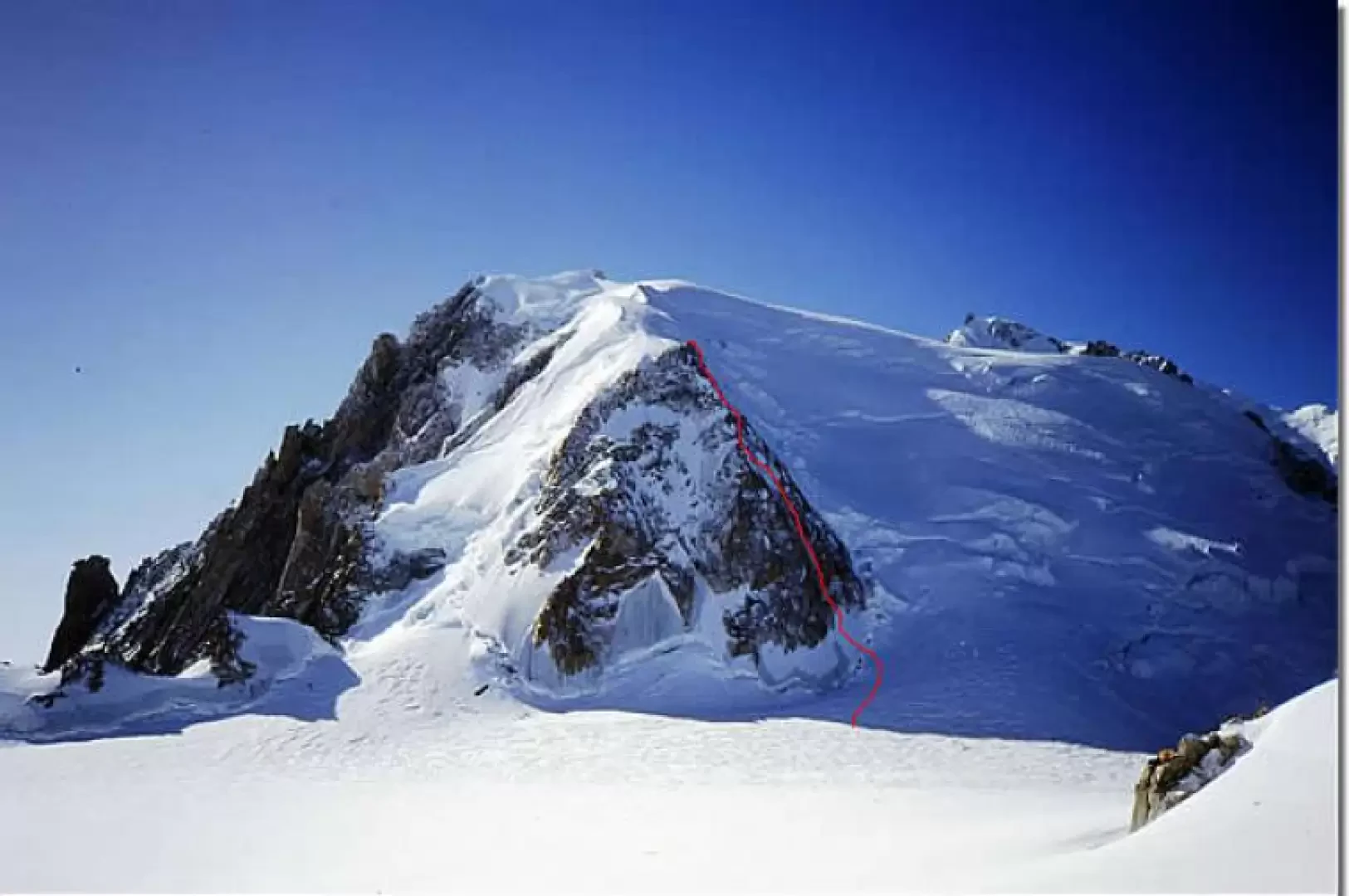
From the Refuge you descend on the glacier and reach the wide crevasse of the Col du Midi (3532m) and head under the right (west) side of the triangular wall (be careful at the attack there is a possibility of falling ice). Once past the terminal crevasse, climb the entire evident goulotte with 5 pitches: first pitch 45° - second pitch 50° - third pitch 60°/75° - fourth pitch 70°/85° - last pitch (before the exit to the ridge) 60°/80°. The route is equipped with belay anchors and intermediate anchors on the two edges in excellent rock. You will then reach the third ridge and with five more rope lengths on mixed ice-rock terrain you will climb up the north-west ridge to the Triangle (4/5 hours).
From here if you follow the north ridge you will reach the summit of Mont Blanc du Tacul (4248m) in 2/3 hours.
Descent
There are various possibilities for the descent, depending on the possible weather or physical conditions:
- After the first 5 pitches you cross to the right, follow a ledge slightly uphill and reach above a serac the normal route to Mont Blanc du Tacul.
- After the belay of the 8th length, already on the north-west ridge, cross to the right and reach a large rock fixed in the ice where there is a bolt from which you abseil for 50 m and then descend obliquely to reach the normal route.
- Go up the north ridge to the hump before the summit to descend along the normal route.
- Go up the first part of the north ridge and with a large traverse halfway up to the right to descend the north-west slopes and reach the normal route.
- On reaching the top of the Triangle you can easily descend along the right (west) ridge and then with 2 abseils you reach the large rock fixed in the ice and descend as at point 2).
In case of critical conditions on the descent slope of the normal route (danger of avalanches), from the rock fixed in the ice, points 2) and 5), traverse to reach the anchorages for the abseils at the 6th belay in the caravan.