Becca di Monciair, from Breuil

Edited by:
capt.crash
Updated at: 18/02/2025
Access
From the motorway barrier at Aosta-West, keep left and follow the signs for Aosta - Saint-Pierre. After one kilometre, at the roundabout, take the second exit to join the main road. Continue on the state road for 4.3 kilometres, passing the village of Saint-Pierre until you reach a new roundabout with the Gran Paradiso National Park sign. Take the first exit and continue on the state road for 1.4 kilometres until you come to the exit for Introd/Rhemes S.G/Rhemes N.D/Valsavarenche. Continue for 700 metres and at the roundabout take the first exit onto for Valsavarenche. Follow the regional road for 3.9 kilometres, pass the village of Introd and, after a series of hairpin bends, you will reach the crossroads for Val di Rhêmes . Continue left on and climb the valley for another 21.8 kilometres, passing the main town Dégioz, the village of Eau Rousse and finally the village of Le Pont, where there is a large free car park 🅿️.
[0h44'] - [33.1km]
How to get there with GMaps
How to get there with Apple Maps
Pont Valsavarenche can also be reached by bus with the company Arriva, leaving from Villeneuve in about 50 minutes.
Introduction
Beautiful route also used as a descent route for those ascending from the north. Very beautiful if in good condition, a bit treacherous due to very steep and slippery terrain otherwise. If in doubt contact a guide!!
Description
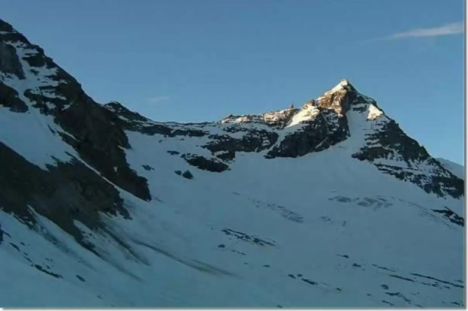
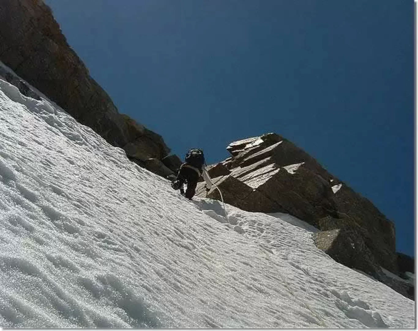
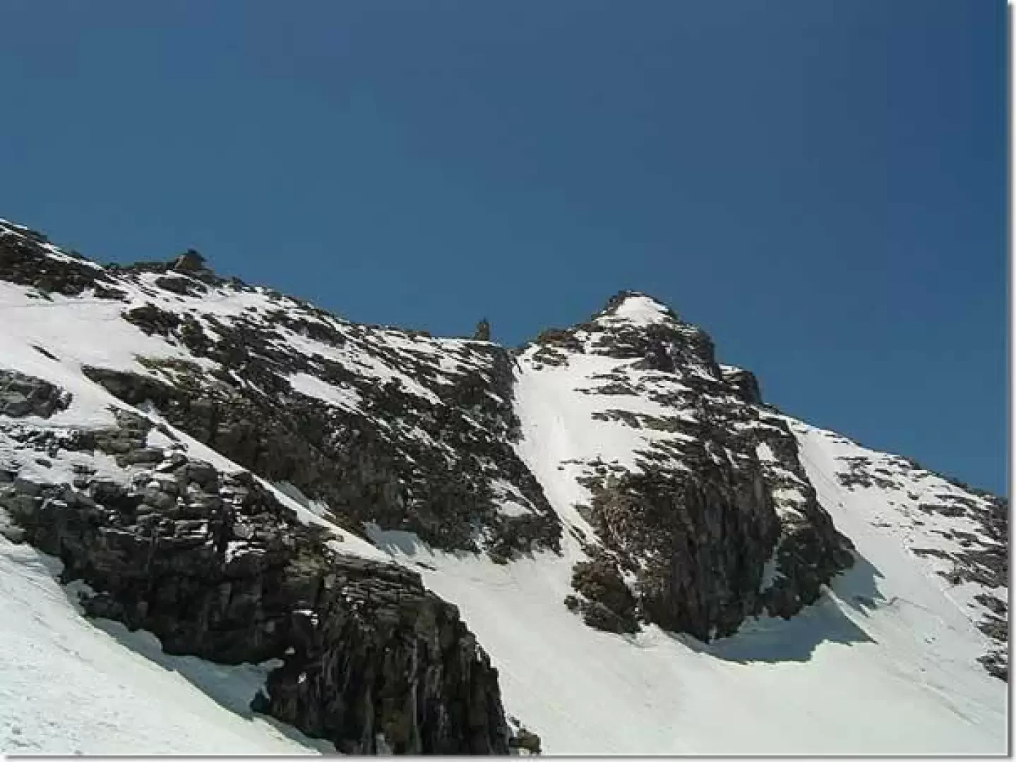
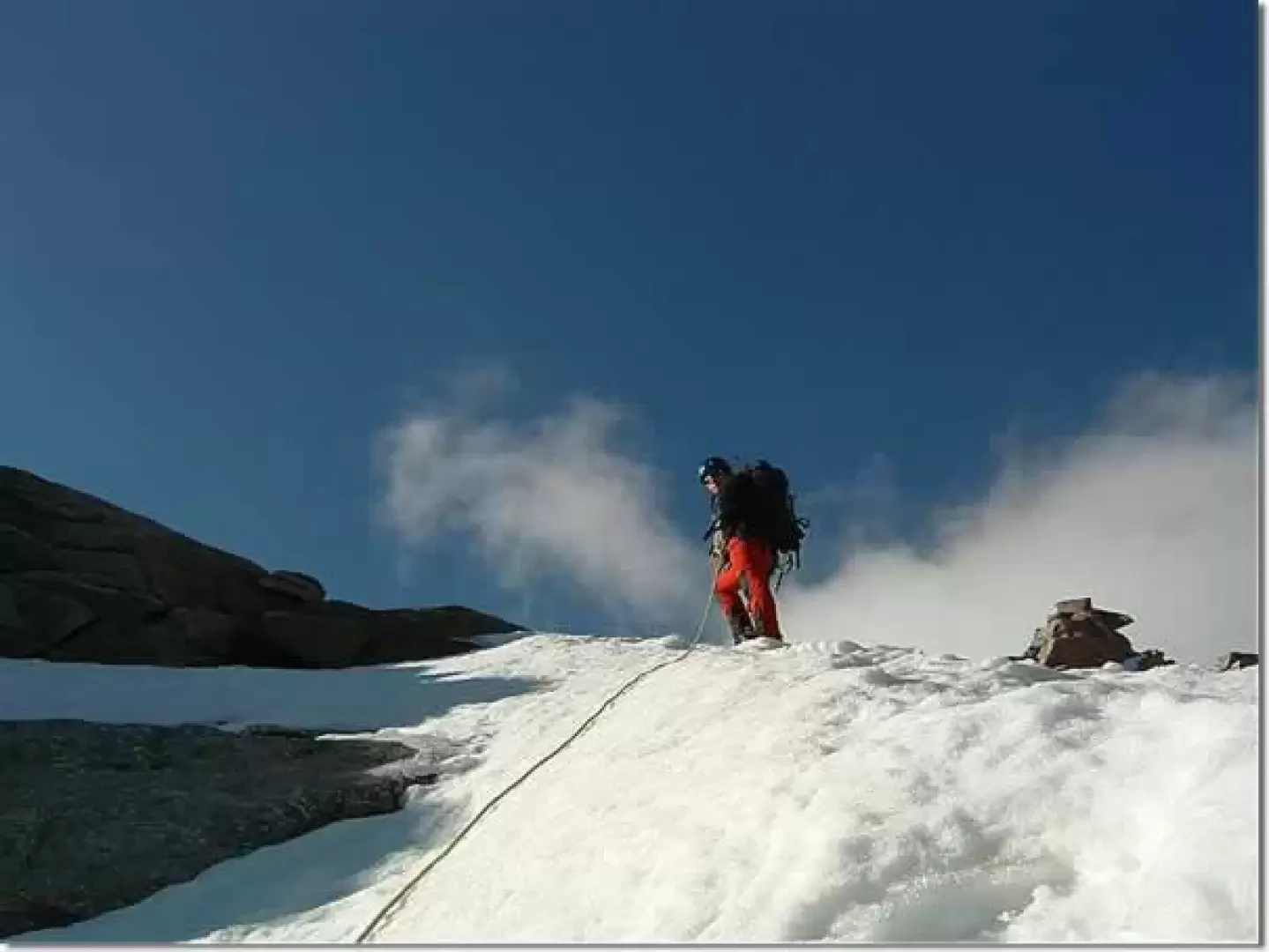
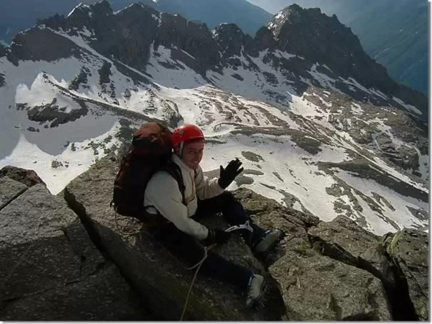
From the Rifugio, leave the evident moraine ridge on the left and continue in the "S" shaped valley (large snowfields until mid-July) following path traces and cairns aiming at the base of the beautiful north-west ridge of the Ciarforon where there are two large stone cairns: here it is best to tie up. Descend into the valley, taking care not to remain below the wall, and set foot on the glacier, aiming for the bastionata that characterises the crest of the 'normal' route where this has a slight outcrop (not the gendarme, which is also visible further to the right from Pont and the Refuge). Here in case of snow the slopes can already be quite interesting, so be careful. With fun passages on rock (max II) you come out on the ridge: the view of the vertical south slope is beautiful. Follow the ridge towards the summit, avoiding some boulders on the side of Valsavarenche until the big gendarme that you can cross (V/V+) or contour always on the side of Valsavarenche. Continue more steeply upwards until descending a very exposed notch of about 7-8 metres (II). From here, ascend aiming for the summit, which is reached by a fun boulder climb (max II). There is also a wonderful view as far as your car parked in Pont.
We strongly recommend booking at the Vittorio Emanuele II Refuge (telephone 0165-95.920)
.Galleria fotografica
We have been there

Edited by:
Dario Tomelini
Becca di Monciair, da Breuil
Escursione alpinistica da preferire quando c'è un buon innevamento. Pendenze di 50°circa e alcuni tratti verticali ma brevi.
Escursione compiuta in giornata da pont, partenza da pont alle 5 poi sosta di 1 ora nel rifugio invernale in attesa di una buona luce. alle 7,30 partiamo dal rifugio e arriviamo in vetta alle 12,30 (noi ce la siamo presa con calma fermandoci a fare parecchie foto). la discesa richiede 3 ore. neve ventata e per lo più resistente fino a metà del ghiacciaio di Monciair, poi si sprofonda fino sopra il polpaccio. in parete la neve è a tratti compatta e a tratti farinosa. percorso abbastanza ripido, nel canale in uscita verso la cima ci sono alcuni tratti verticali ma corti. discesa lungo la via di salita sotto il grosso gendarme fino alle ultime roccette che abbiamo superato facendo sicurezza con la corda, poi in fondo non ci sono problemi con la terminale. cielo limpido fino alle 13 poi nuvoloso, abbiamo anche visto nevicare. giornata nel complesso fantastica, solo io e Edo in tutta la valle. Un altro punto di vista...
Becca di Monciair (3544 m) Autore: Dario Tomelini * Altre escursioni dello stesso autore Sito web Autore: * www.tomelini.com Nessun Commento Non c'è stato nessuno Ultima modifica: 30.08.06 Becca di Monciair (3544 m) - © 2005 Dario Tomelini Becca di Monciair (3544 m) - © 2005 Dario Tomelini Scheda dell'escursione Tipo itinerario: a/r Difficoltà Tecnica : Alpinistico Poco Difficile (PD) Sforzo Fisico: Medio Pericoli oggettivi: Medio (un po' infida a causa scariche e terreno scivoloso) Segnavia: non presenti Attrezzatura: Ramponi, piccozza, corda Tempo complessivo: 5h30' Tempo di salita: 3h00' Tempo di discesa: 2h30' Quota alla partenza: 1960 m Quota all'arrivo: 3544 m Dislivello: Salita 772 m + Salita 812 m Max quota raggiunta: 3544 m Esposizione: Nord-Ovest, Nord Periodo consigliato: giugno, luglio, agosto, settembre, ottobre, novembre Bibliografia: * E.Andreis, R. Chabod, M.C.Santi, Gran Paradiso, Guida dei Monti d'Italia, CAI e TCI, Milano, 1980 Cartografia: * IGC, Foglio 102 Valsavarenche Val di Rhêmes Valgrisenche, 1:25000, Torino * Hapax, AIAT Gran Paradiso Foglio 1, 1:25000, Aosta, 2004
Edited by:
Dario Tomelini