Edited by:
Anna Della Giovanna
Last survey: 28/07/2013
Updated at: 09/12/2024
Description
Park at Passo Rolle near the start of the treadmill that takes skiers to the chairlift in winter.
We follow the road and turn right at the fork towards the Baita Segantini / Trekking del Cristo Pensante.
We pass the Capanna Cervino (2082m) and continue to the Baita Segantini (2170m) to which there is also a shuttle service.
From the hut we follow the obvious path to the left. Beware that this path is on clay soil, and can become "a quagmire" after days of rain.
We go around the Costazza peak and rejoin the path coming from the Capanna Cervino hut.
Note that the diversions to the Segantini hut is completely optional. We did it to........take a photo! My mum spent many happy summers in these parts 'a few years ago' (certainly before they put a shuttle bus to get to the hut!!) so I wanted to take some photos to compare with the ones she has at home.
The most logical path goes straight ahead at the fork after the Capanna Cervino.
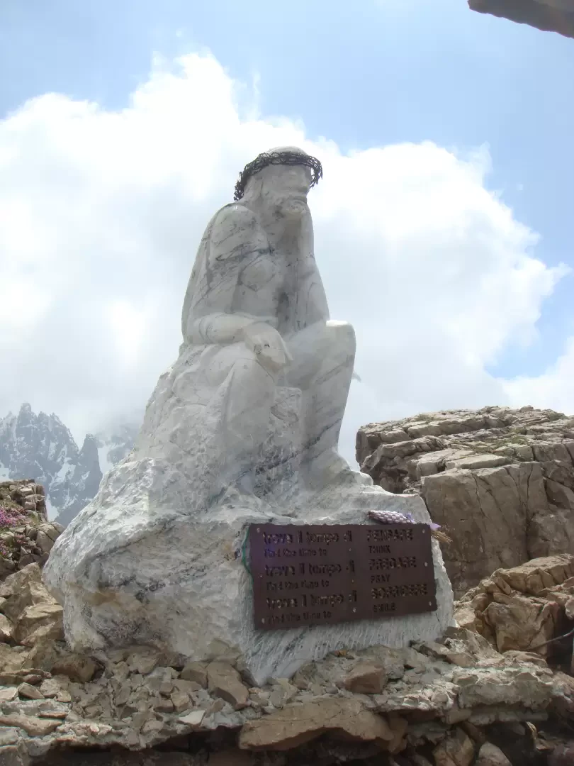
Follow the signs and start climbing towards the cross and the Cristo Pensante statue (2300m) on a comfortable path.
The trek is easy and very well-trodden.
To return to the Segantini hut, follow the same path.
In fact, we wanted to avoid going back to the hut, and take the Sentiero Italia, but after descending from the Castellz, we arrived at the crossroads and turned left to go back towards the Capanna Cervino, but there was no path to the right. After turning a little, we decided to follow the only other alternative, which was to go straight ahead and take the outward path again.
From Segantini, we descended a little on the road and used the various shortcuts to reach the Campignol della Vezzana plateau.
Finally, path 749 branches off from the road on the right for the Forcella Venegia/Passo Valles pass.
We thus begin to climb through the forest, greeting herds of grazing cattle and ignoring a signpost for the Malga Venegia hut, continuing on open meadows towards the Forcella and Cima Venegia, which are now clearly visible.
A second fork in the road indicates our descent route, but if we keep to the right, within 15 minutes we reach the Forcella from which we can see the Valles Pass, Falcade and the northern part of the Pale.
To climb to the summit, follow the grassy ridge.
Unfortunately it was already 16:00, so we decided to descend because the road was still long.
At the fork mentioned above, we descend to the right. The signpost showed us 1hr10 to the Malga Venegia. In fact it takes much less. It took us 30-40 minutes, and we are certainly no sprinters!
You have to be a bit careful on this part of the path because, after the first part well marked by red and white posts, the path gets a bit lost in the grass.
However, you always remain on the right-hand side of the river, enter the forest where the path becomes evident again, and arrive in sight of the Malga Venegia (1778m).
From here, we continue on to the Malga Juribello via a path that starts to the left of the Malga Venegia car park.
We cross the Tavignolo stream on a convenient bridge and ascend through the forest.
At an altitude of about 1928m, we find the junction with indications for the Malga Venegiota (to the left) and the Malga Juribello (to the right). Behind us, among the trees, is the Venegia peak.
We climb a little more. The forest gives way to wide meadows and we begin to descend. We come to a dirt road. The Juribello malga remains to our right, but we continue to the left, following the signs until we reach Passo Rolle.

