Cima Comer, from Sasso

Edited by:
Ivano Ruffoni
Updated at: 15/03/2025
Access
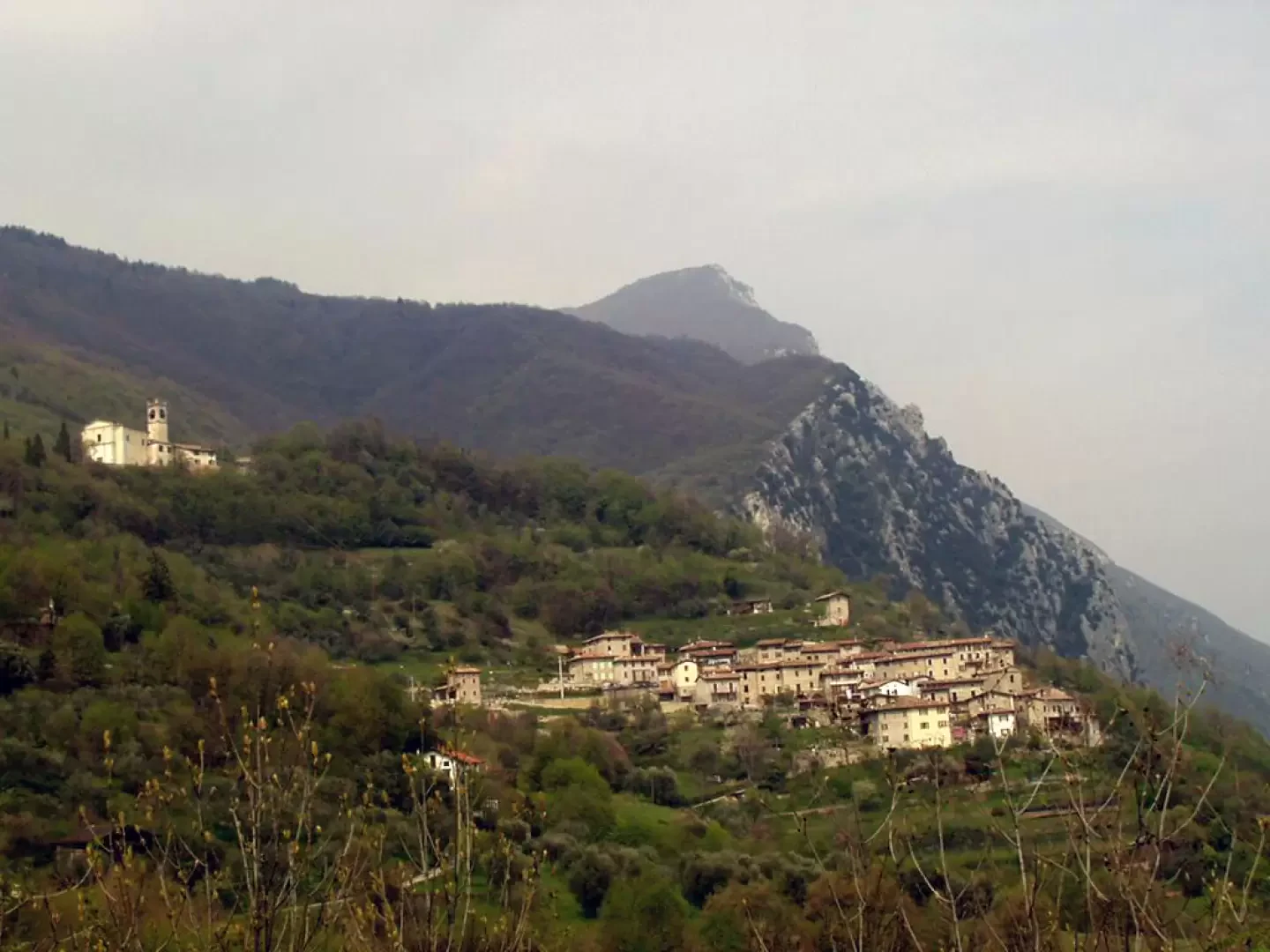
Brescia Ovest exit of the [A4] motorway. Continue east along the Tangenziale Sud/SS11 and then onto the SS45 bis/Gardesana Occidentale. Leave the turnoff for Salò on the right and, along the coast of Lake Garda, pass through Gardone Riviera, Fasano, Maderno, Toscolano, Bogliaco and Villa. Shortly after the junction for Gargnano, the road climbs slightly until it meets, on the left, the SP9 for Capovalle-Lake Idro-Magasa-Valvestino. You climb up the provincial road with numerous bends until you reach the sixth hairpin bend, from where there is a fine view of Musaga and the church of San Antonio di Sasso (with the slopes of Monte Comer as a backdrop). Continue to a fork in the road (486 m), turn right to the next fork in the road (516 m) and right again to Sasso (531 m), where you park.
Introduction
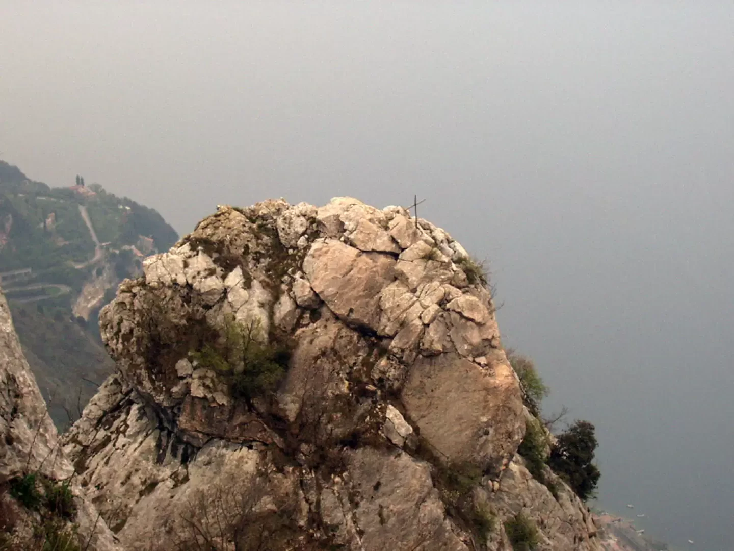
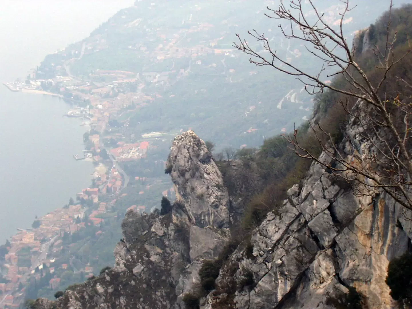
The Cima Comer is a grassy elevation rich in limestone outcrops to the south of Monte Denervo and separated from it by a wooded saddle. The place name probably derives from 'gömer', i.e. 'ploughshare', perhaps because the north-western slopes are arable. The south-eastern slopes, on the other hand, are rocky and very steep, and from them, in the past, a number of large boulders were detached, which then fell onto the SS45bis - Gardesana Occidentale road. To this end, periodically, the slopes upstream of the state road, roughly below the area extending from Amburana to San Gaudenzio, are secured with metal guards. The itinerary, which is entirely in the Alto Garda Bresciano Park, leads to the Hermitage of San Valentino, continues on an equipped path (beware of stone discharges), continues among limestone rocks emerging from the forest and ends at the cross on Cima Comer. On fine days, Cima Comer is an exceptional viewpoint over Lake Garda below.
.Description
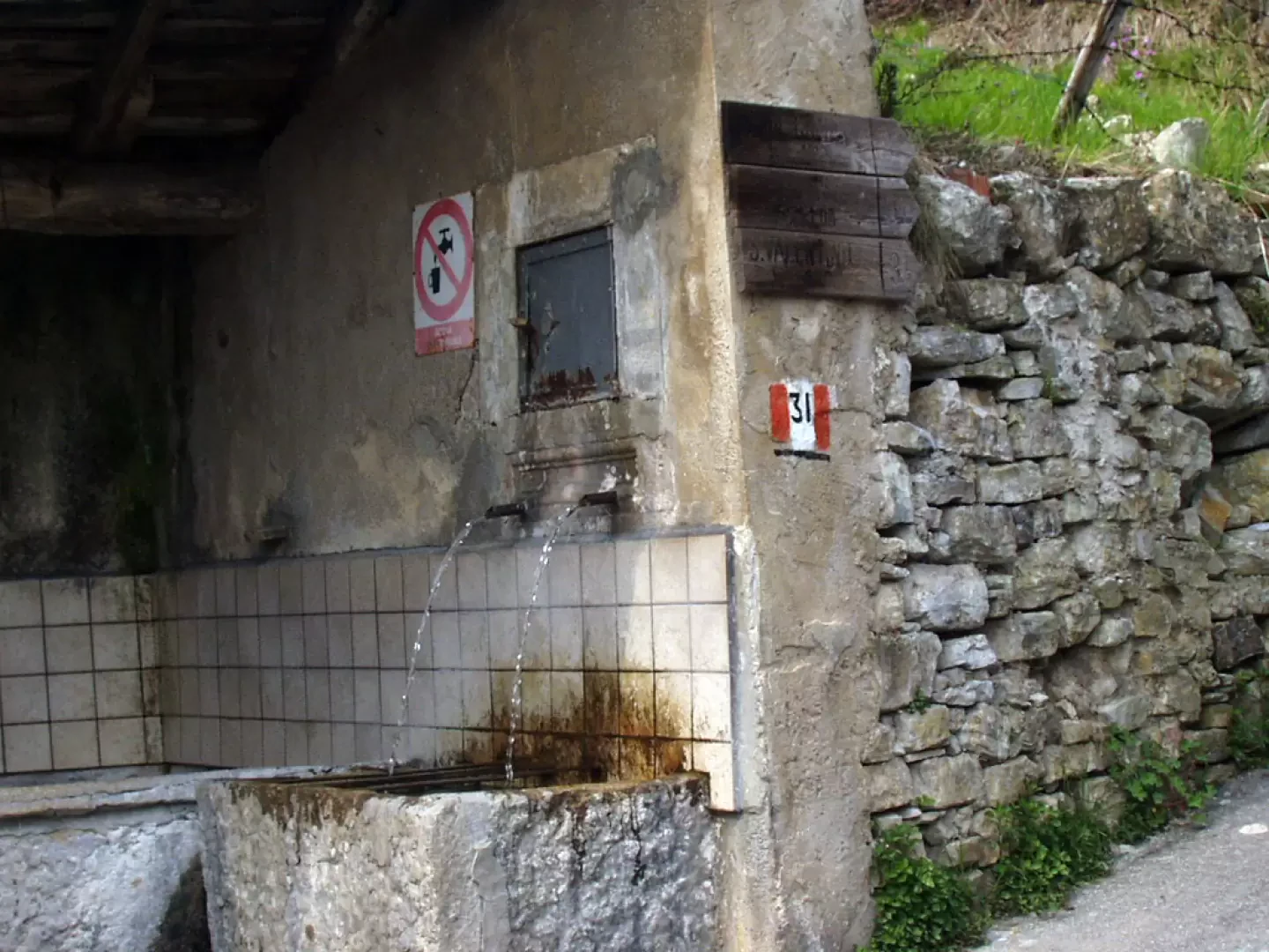
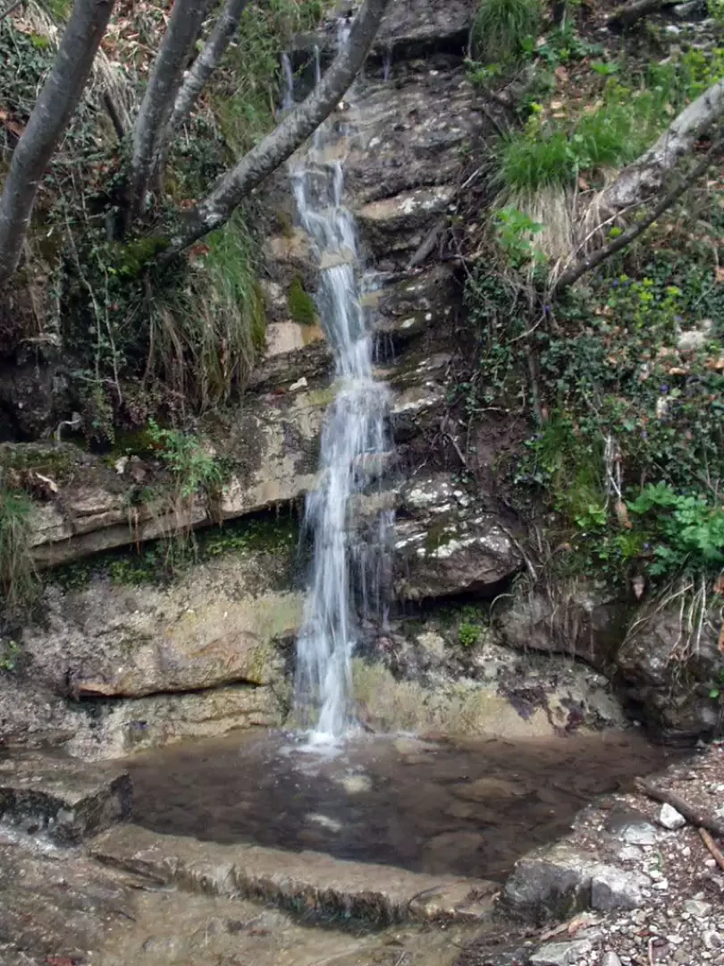
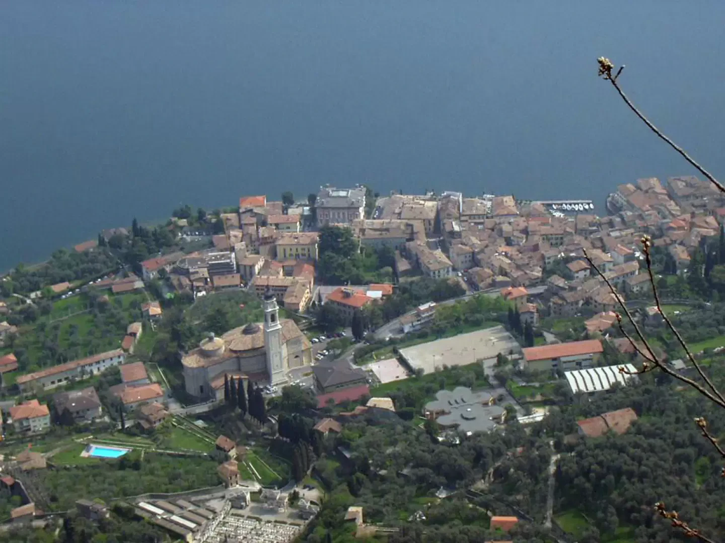
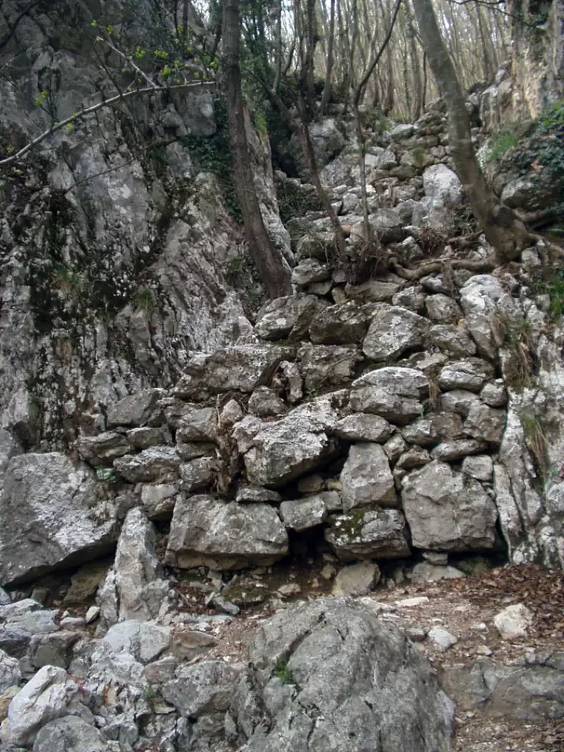
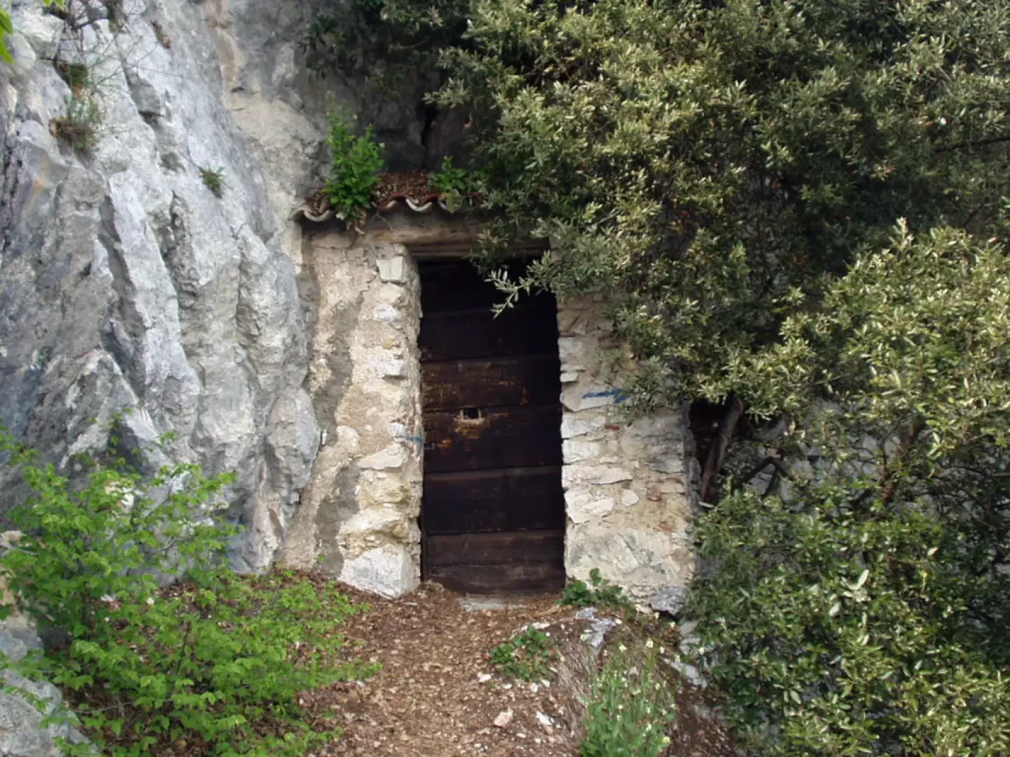
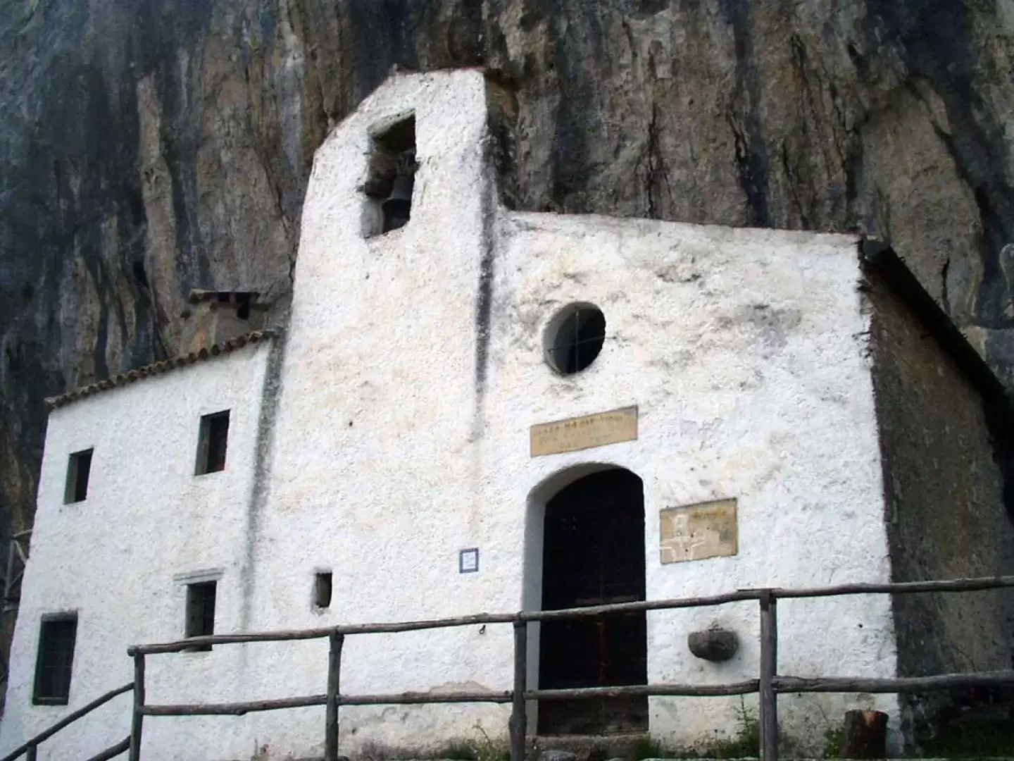
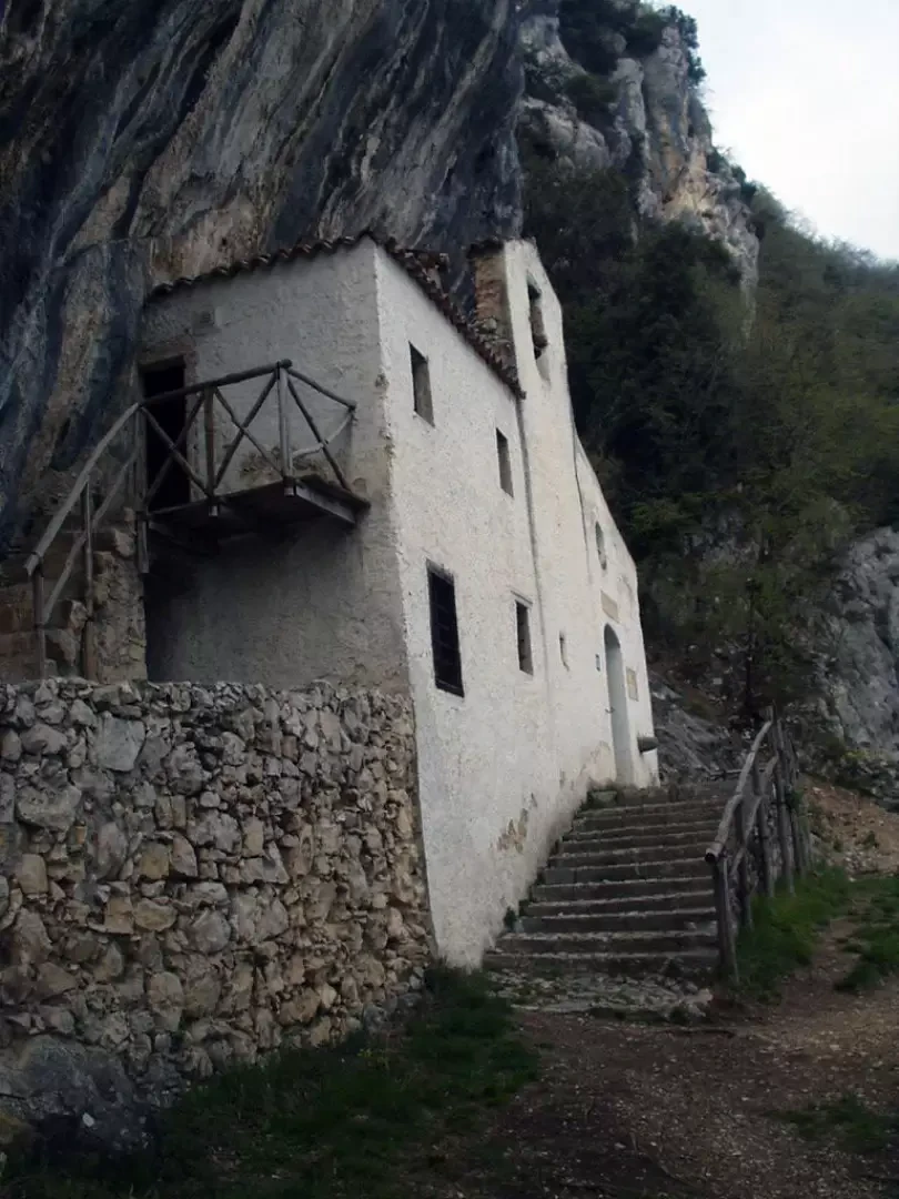
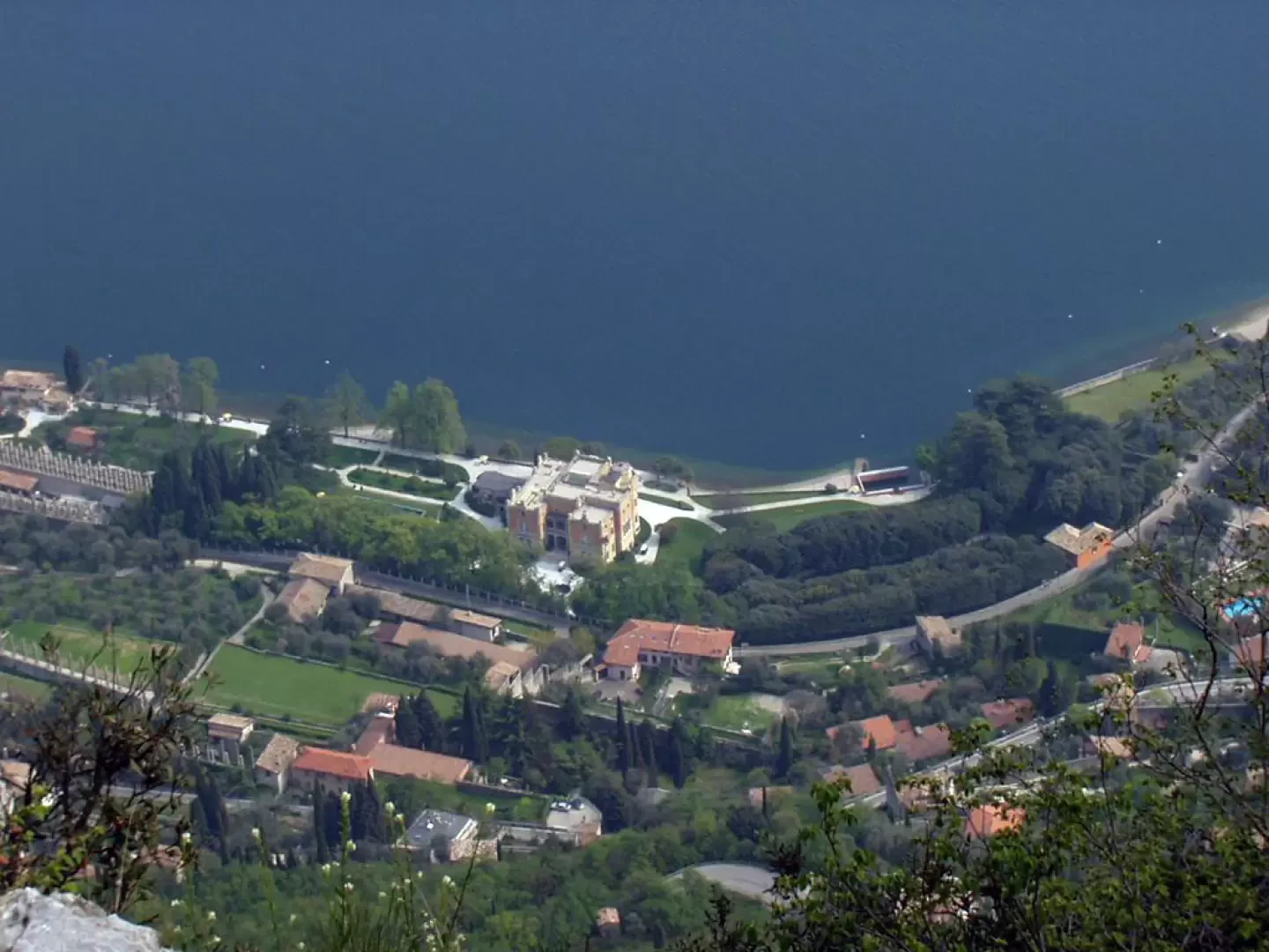
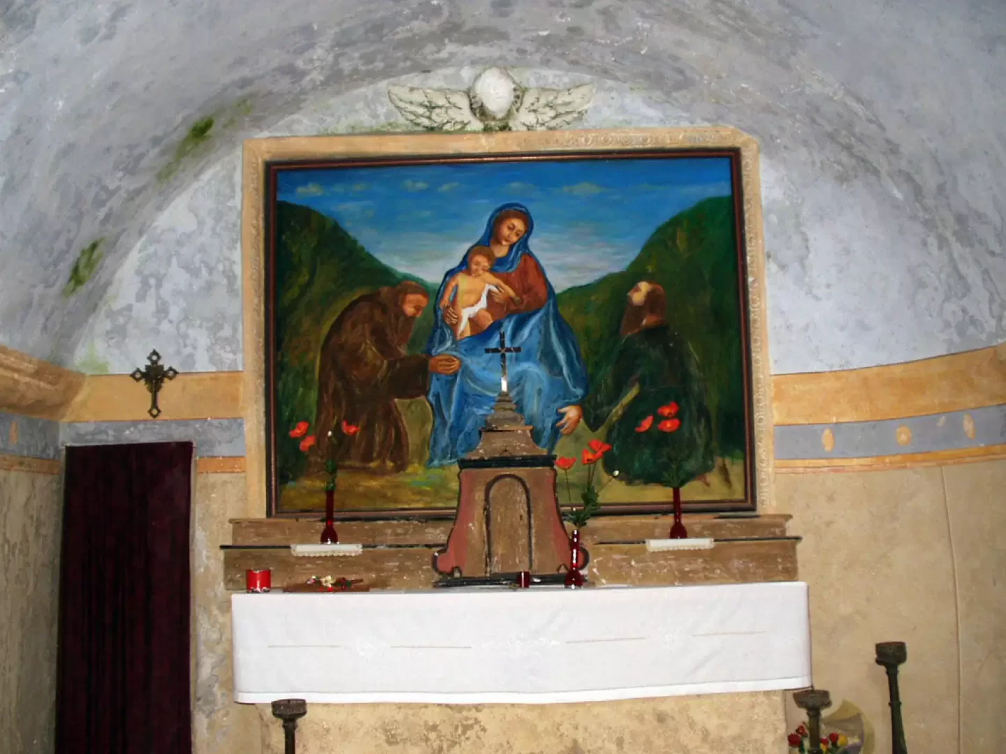
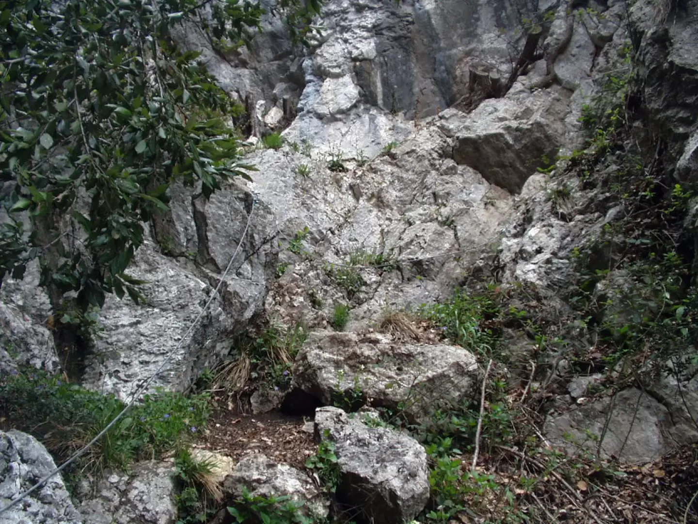
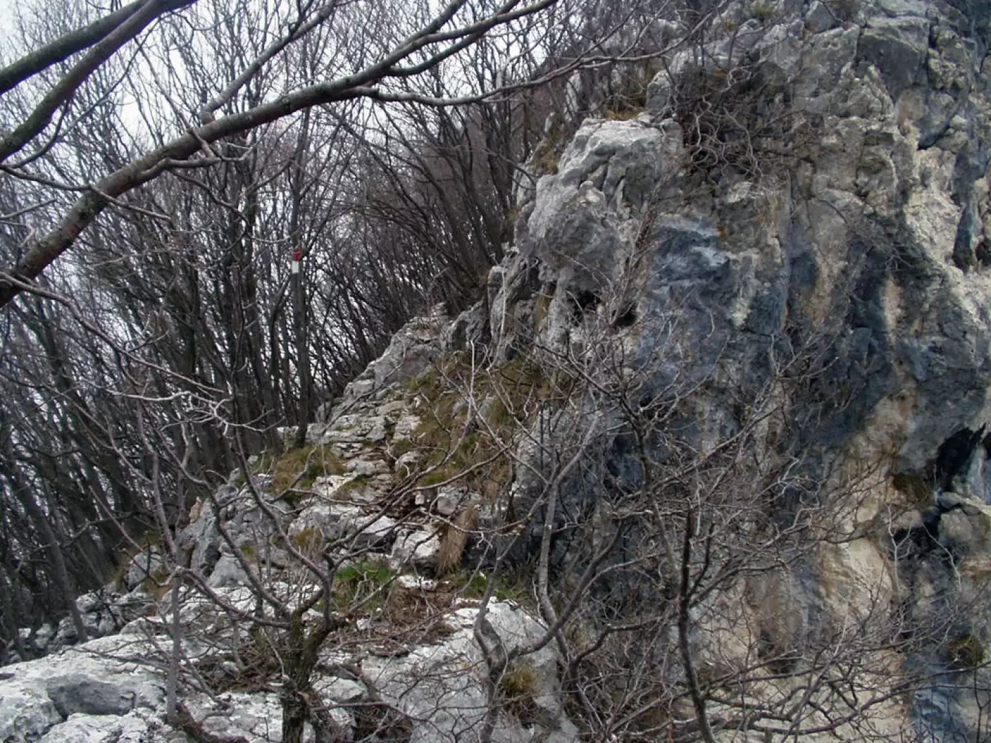
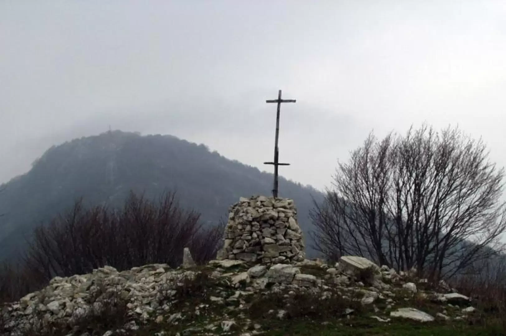
We traverse, on a slight incline, the entire hamlet of Sasso (531m) and arrive at the far end of the hamlet near a nice fountain (be careful, the water is not drinkable) with a wash-house. On one of the walls, the red and white signpost is clearly visible, indicating the mule-track to San Valentino, Briano and Cima Comer. The road, past some vegetable gardens and a chestnut grove, proceeds, initially, practically flat until it reaches a first stream with a small waterfall. The mule track now narrows and begins to climb through a wood of hornbeams, ash trees, oaks and scotani, until it crosses the Valle di San Martino and then continues more steeply until it reaches a rocky crag with a panoramic view of Gargnano, the Monte Baldo chain and Lake Garda. A little further on, leave trail marker 31, which climbs to the left towards the Cima Comer, and go along a level stretch and descend into a steep but short little valley on a stairway of rocky steps. At the bottom of the little valley, on the left, climb up to the door to the Hermitage of St Valentine. Now open the door with a little force and care. In fact, the door is kept closed at the back by a stone tied to a rope that runs in a pulley. A few more bends on a stepped path and you reach the grassy terrace, surrounded by tall cypress trees, where the Hermitage of St Valentine (772 m) stands. Next to the hermitage, closed by a rudimentary wooden door, is a rocky cavity generally filled with water. From the hermitage, the view is truly remarkable: below is clearly visible the town of Gargnano and the 'Villa Feltrinelli' (now converted into a luxurious hotel), called 'Villa del Duce' by the locals for having hosted Benito Mussolini during the period of the Republic of Salò. In the distance, the Monte Baldo chain is reflected in the blue waters of Lake Garda. To the right of the hermitage starts the "Dito" path, equipped with fixed steel ropes. A metal plaque, placed right at the beginning of the gully, reminds us to walk this stretch only if we are experienced hikers and if the weather conditions are good, in the absence of rain and wind. Caution is however recommended due to the danger of falling stones. Remember that dogs are not allowed on this stretch. One rises among limestone rocks and soon reaches the junction with a variant of trail marker 31, abandoned earlier just before the descent into the little valley preceding the hermitage. The path now leads through sparse woodland, past a panoramic viewpoint, the "Pulpito", and crosses to the right two equipped paths leading to the "Dito", a small protruding limestone tower. You rejoin the main path with trail marker 31 and, just before a small valley, leave the track to the left for Briano and the ANA Gargnano hut (also known as the Rifugio Alpini) and follow the path to the right. Now you rise up among limestone rocks in a sparse wood, pass a grassy clearing, where sheep often graze, and leave to the left a new diversions for the Rifugio Alpini, and continue again among small rocks, sometimes flush with the ridge on the overhanging wall. In places, the path is not obvious but is nevertheless well marked by the red white bars painted on the tree trunks. You reach the vicinity of a repeater antenna and, in a short time, you arrive at the boundary stone with a cross marking Cima Comer (1281 m). On fine days, Cima Comer is one of the most panoramic points over Lake Garda in the entire Riviera dei Limoni. The descent is common to the outward itinerary until the junction with the 'Dito' path. Now proceed to the right until you rejoin path no. 31, cross an easy equipped section, descend briefly down a small valley and rejoin the outward path that was abandoned for the diversions to the Hermitage of San Valentino. Now take the path already travelled and reach Sasso.
.Galleria fotografica