Tête Blanche de By, from Glassier

Edited by:
Massimo Martini
Updated at: 25/08/2025
Access
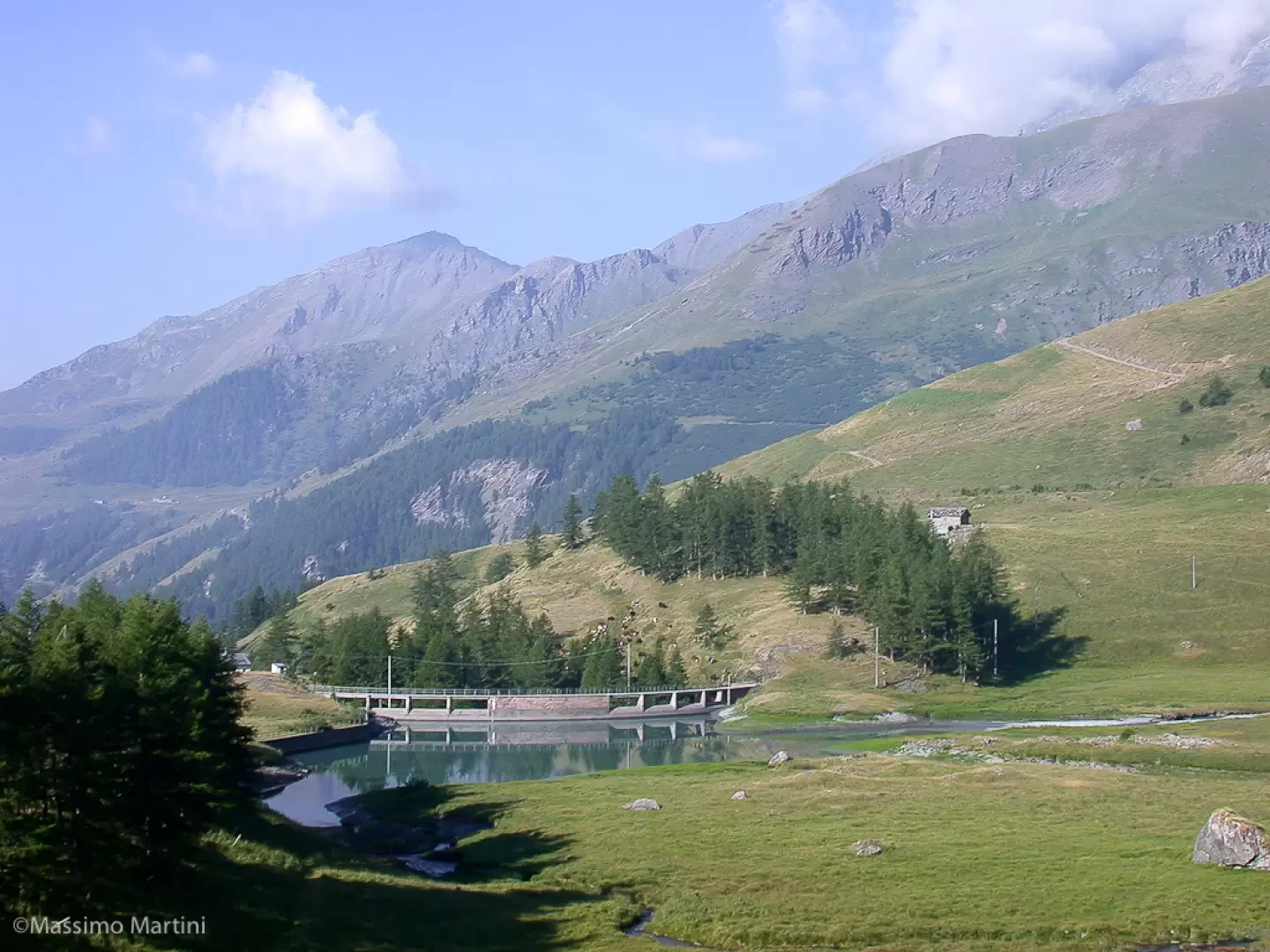
Lasciare l'autostrada alla barriera di Aosta Est, svoltare a destra e imboccare la superstrada , da seguire per 8,4 chilometri. All’uscita della galleria, dopo 130 metri, svoltare leggermente a destra per imboccare la strada regionale per Bionaz. Alla rotonda, prendere la seconda uscita e proseguire lungo la regionale, superando i villaggi di Signayes e Rhins, e l’abitato di Valpelline. Dopo 16,9 chilometri, svoltare a sinistra e prendere la strada regionale per Ollomont. Risalire la regionale attraversando il capoluogo di Ollomont e i villaggi di Voueces e Vaud, fino a giungere, dopo 23,8 chilometri, a Glassier. Poco prima del villaggio, sulla sinistra, si trova un parcheggio 🅿️ gratuito con una stazione di ricarica per veicoli elettrici.
Distanza e tempo di percorrenza
🕒 Tempo di percorrenza: 29 minuti
📏 Distanza: 23,8 km
Navigazione GPS
📍 Come arrivare con Google Maps
📍 Come arrivare con Apple Maps
Nota importante
Le indicazioni fornite sono state verificate alla data del rilievo dell’itinerario. Prima della partenza, è consigliabile verificare eventuali variazioni del percorso. Per ottenere indicazioni aggiornate e dettagliate, si consiglia l’uso di Google Maps o Apple Maps.
Introduction
The Tête Blanche de By falls within the 3,000-metre hiking category and presents no particular technical difficulties. But the 1860m ascent still represents a considerable effort to be tackled with a good workout: obviously all the fatigue accumulated on the ascent vanishes when the visual emotions offered by the summit panorama take over.
Description
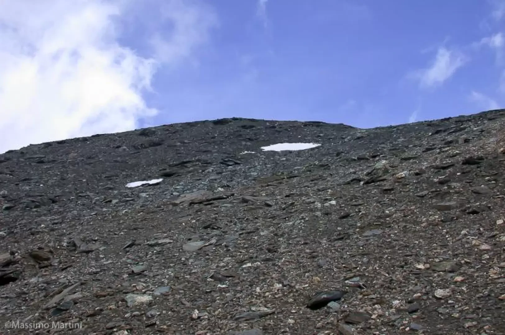
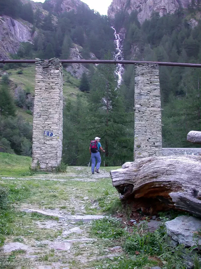
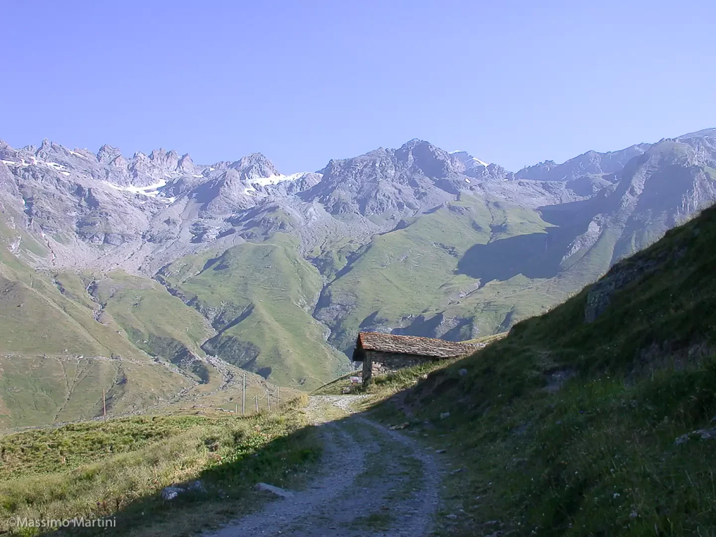
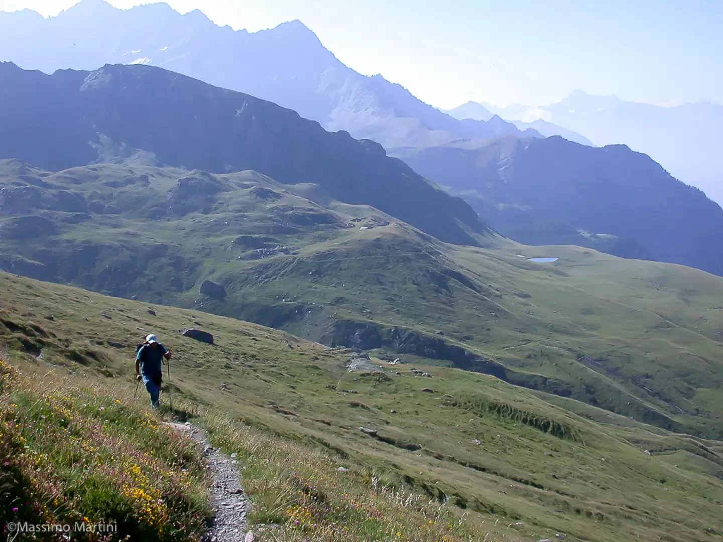
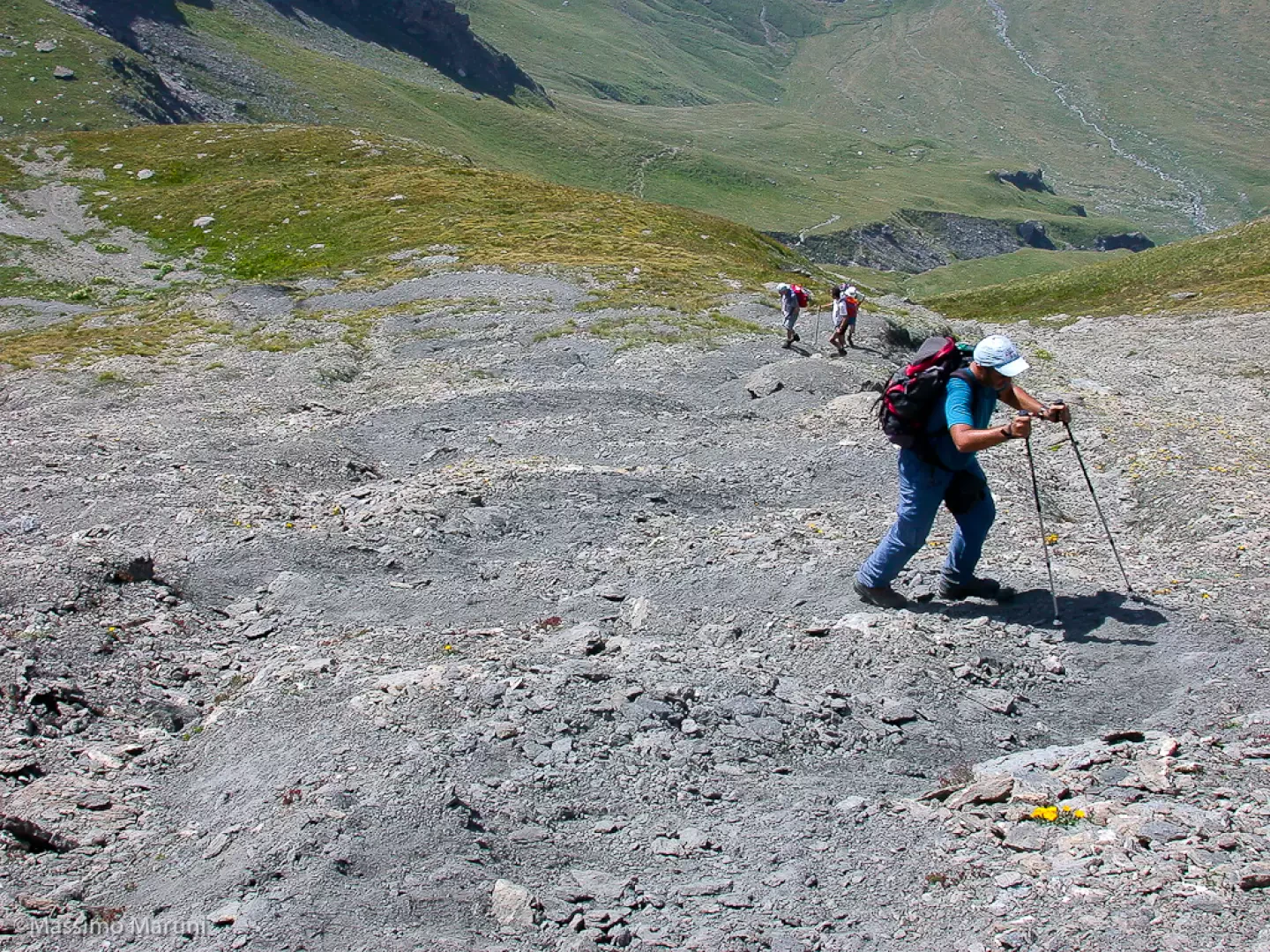
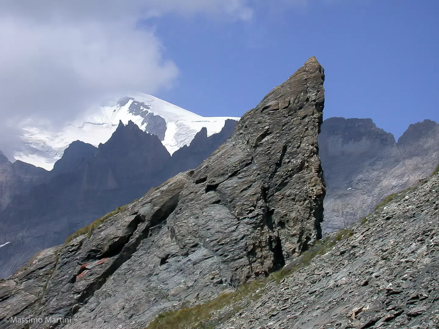
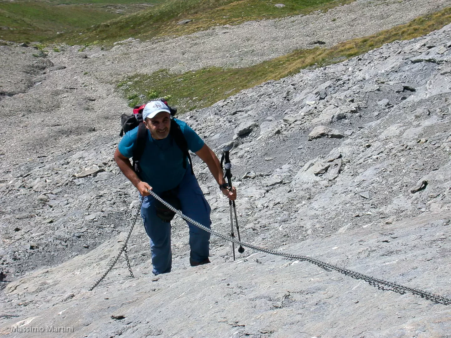
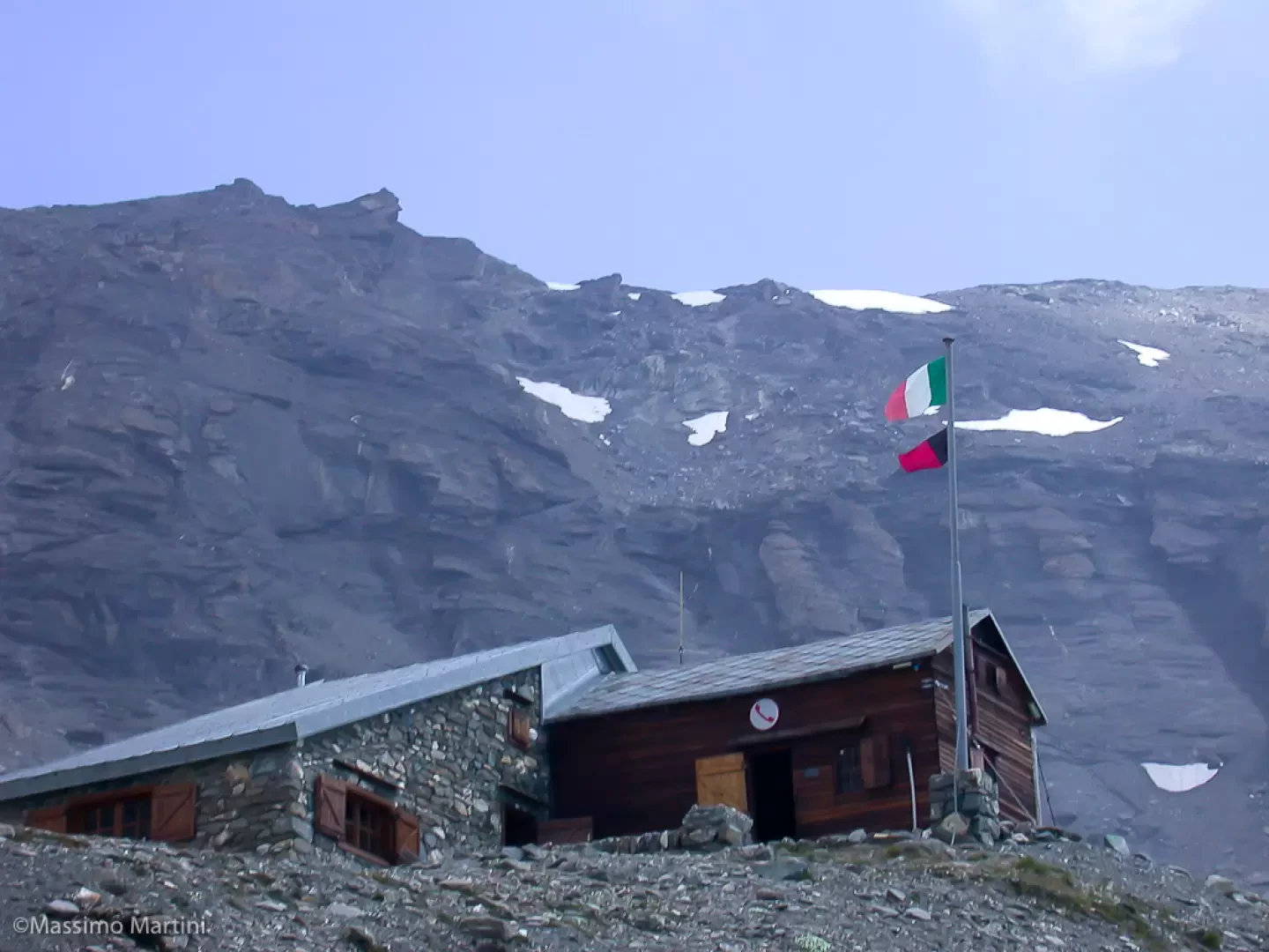
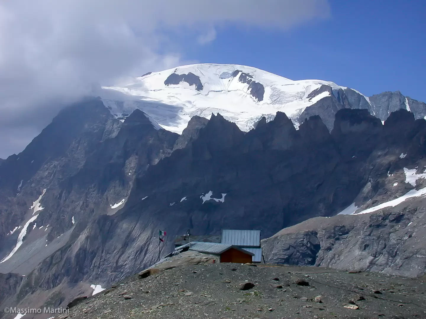
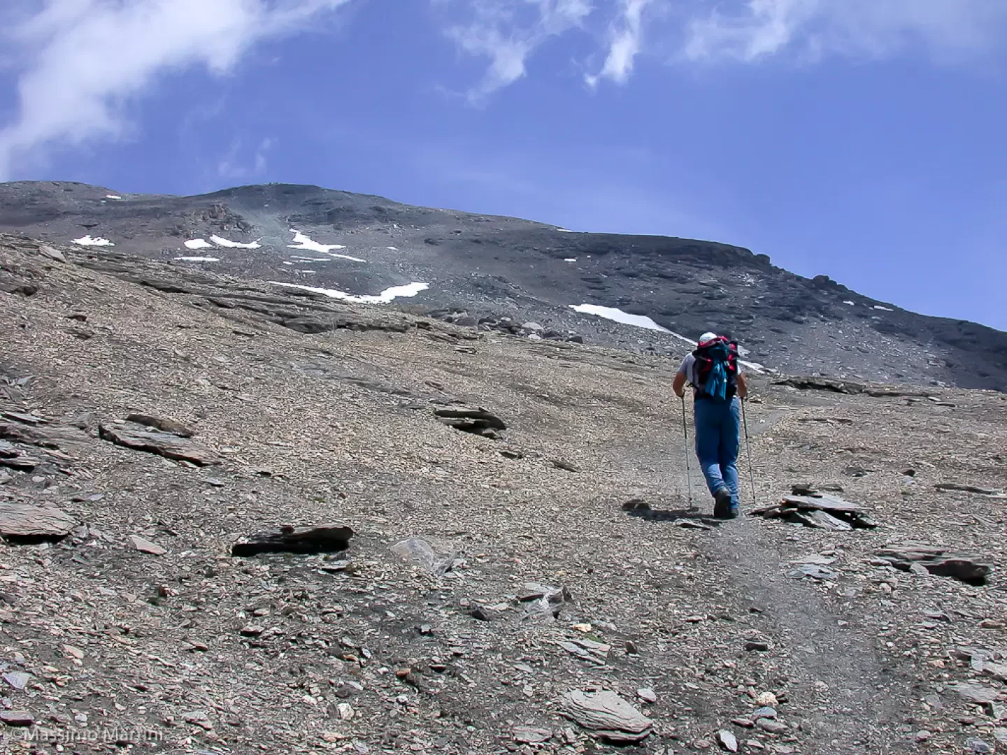
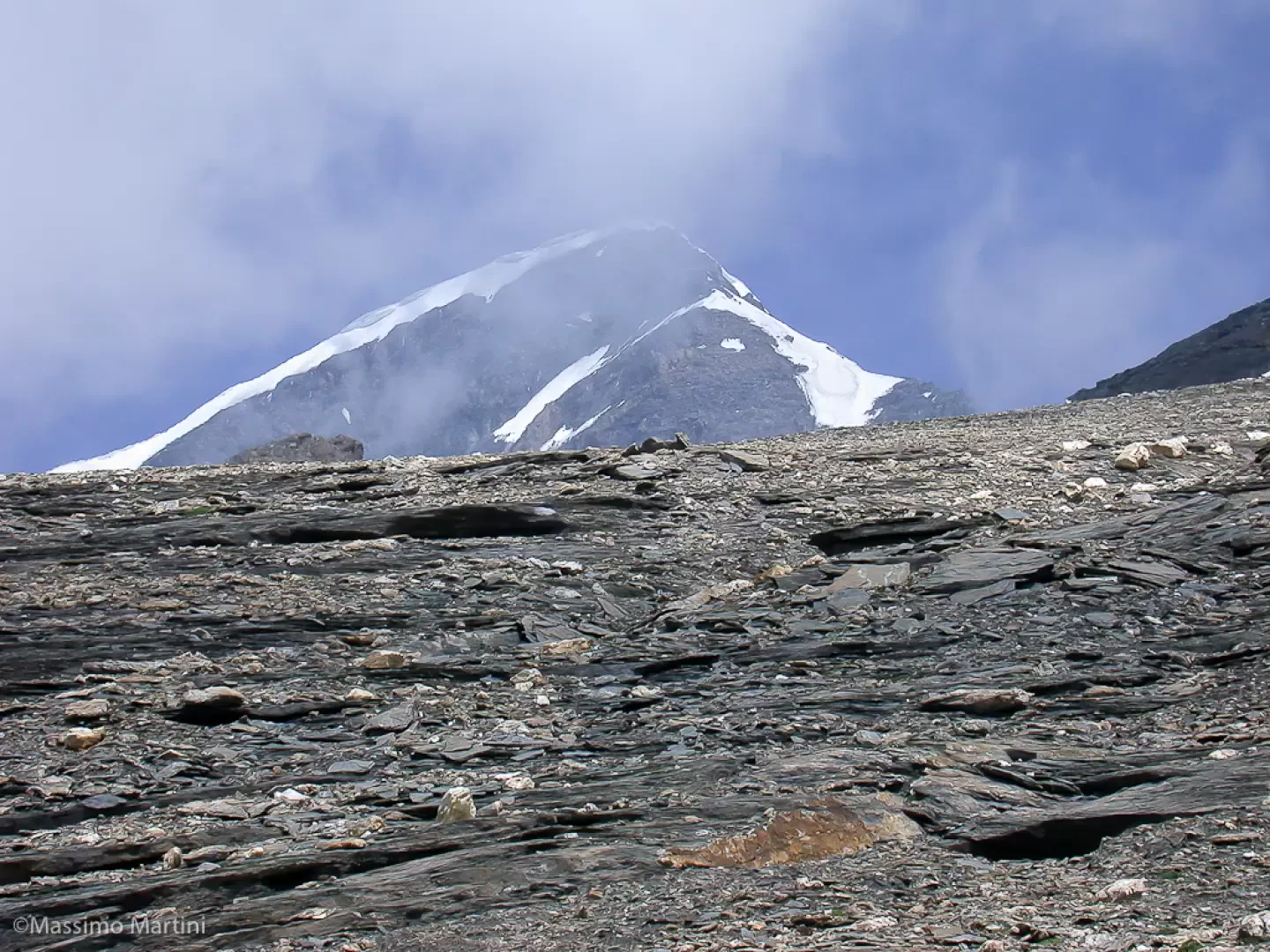
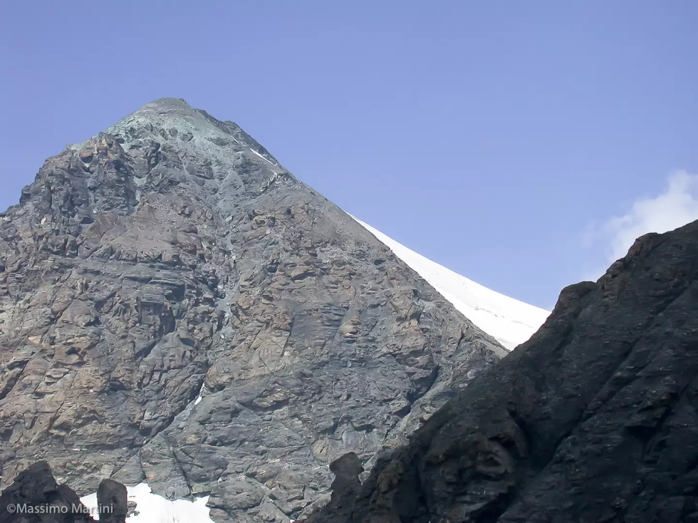
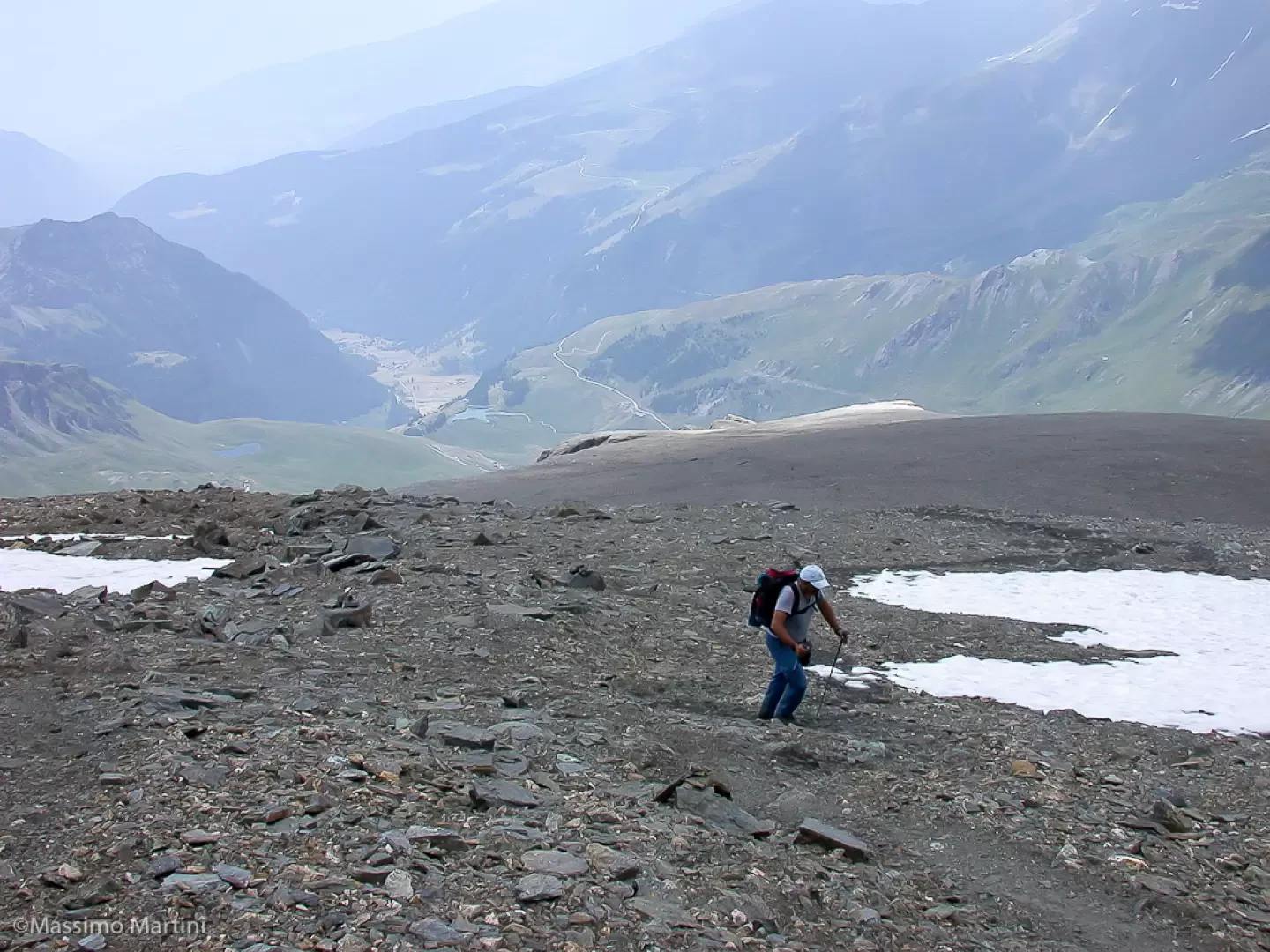
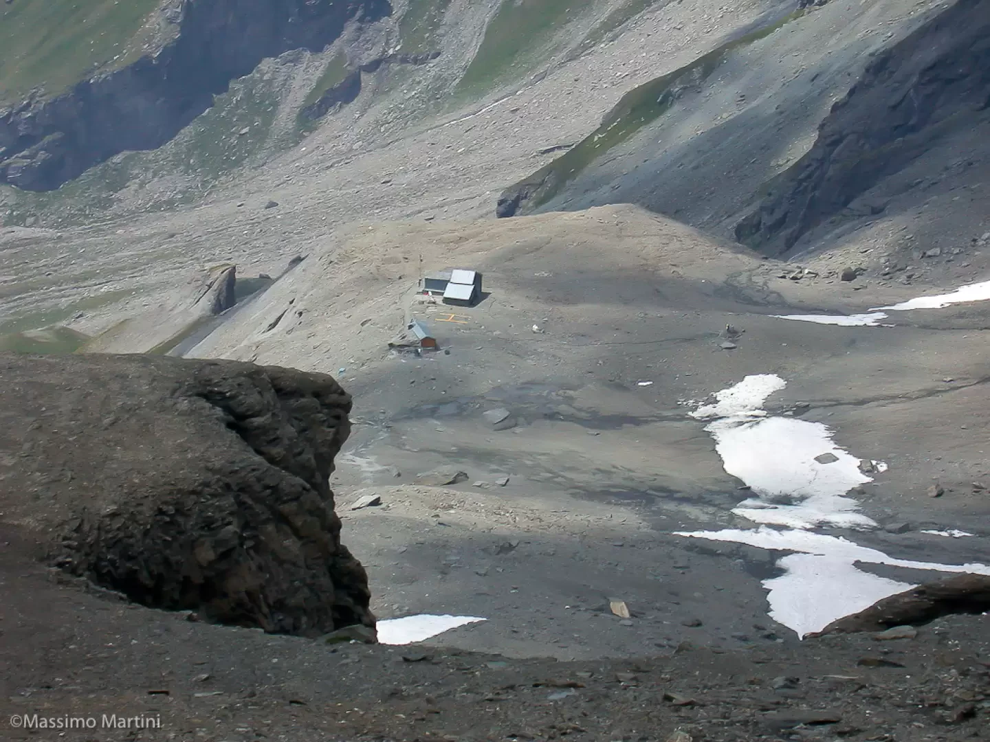
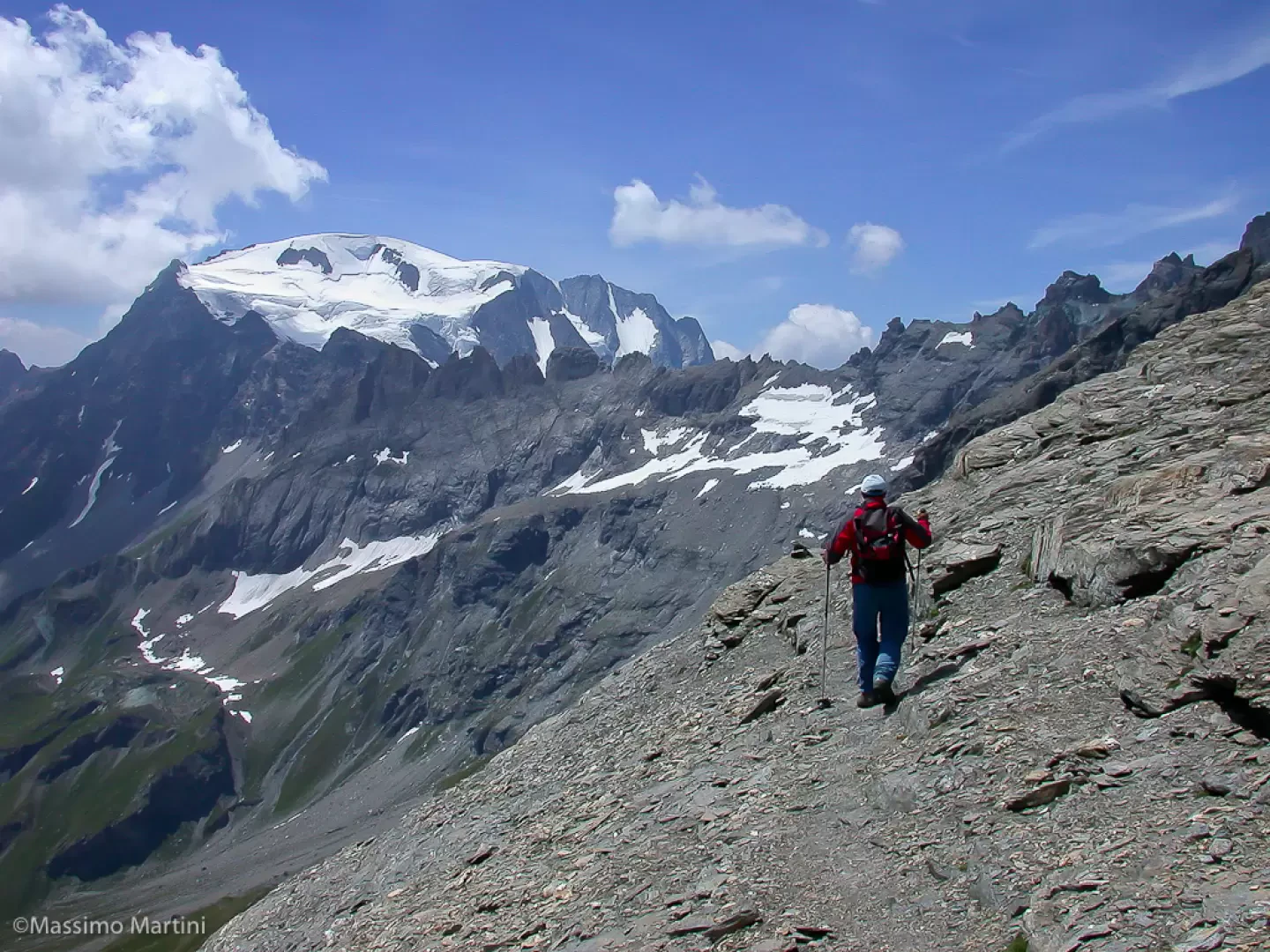
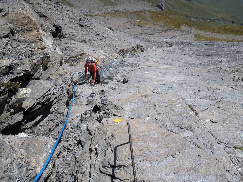
We set off on a nice grassy track bordered by a wooden railing, which soon leads to Pont (1690m, 0h05') where we come across an alpine pasture and a peculiar aqueduct. Pass under the bridge of the aqueduct and start climbing the slope again on the comfortable mule track bordered in places by a wooden railing. With a series of twists and turns, you gain height until reaching a small chapel and, shortly afterwards, Casa Farinet. After a few metres, you reach the track, which you take to the left and follow northwards. Leave the small Lac de By reservoir on the left and reach the village of By (2048m, 1h15'). From By, take the path that climbs up the pastureland until it joins a short plateau; continue towards the impluvium of the Torrent de la Grande-Maison. When you reach the small stream, ford it and proceed to the left and climb up the meadow with a diagonal path until reaching the restored alpine pastures of Tsa Commune (2,404m, 2h00'). Continue the ascent, still on the south slope - in full sun, without vegetation and shade... The path stretches out at the foot of Pointe Ratti (dedicated to the exploits of mountaineer Achille Ratti, better known as Pope Pius XI). At the end of the long diagonal, you reach a stream with a small waterfall, easily ford it and begin an 'interminable' ascent made up of countless twists and turns. The environment changes and from the prairie you pass into the macereto. A sloping rocky slab is reached, an uneasy passage made easier by a pair of chains. The route now comes to an end, and while you can enjoy suggestive views of Mont Velan, Grand Tête de By and Tête Blanche, proceed slightly uphill on scree until you reach the Chiarella hut (2979m, 4h15').
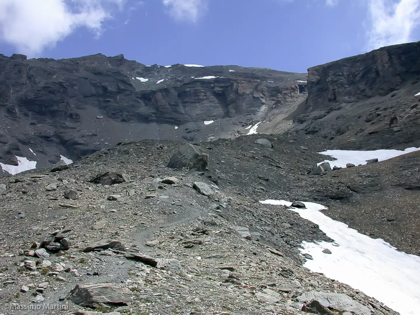
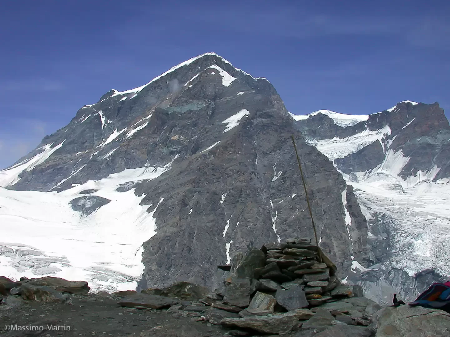
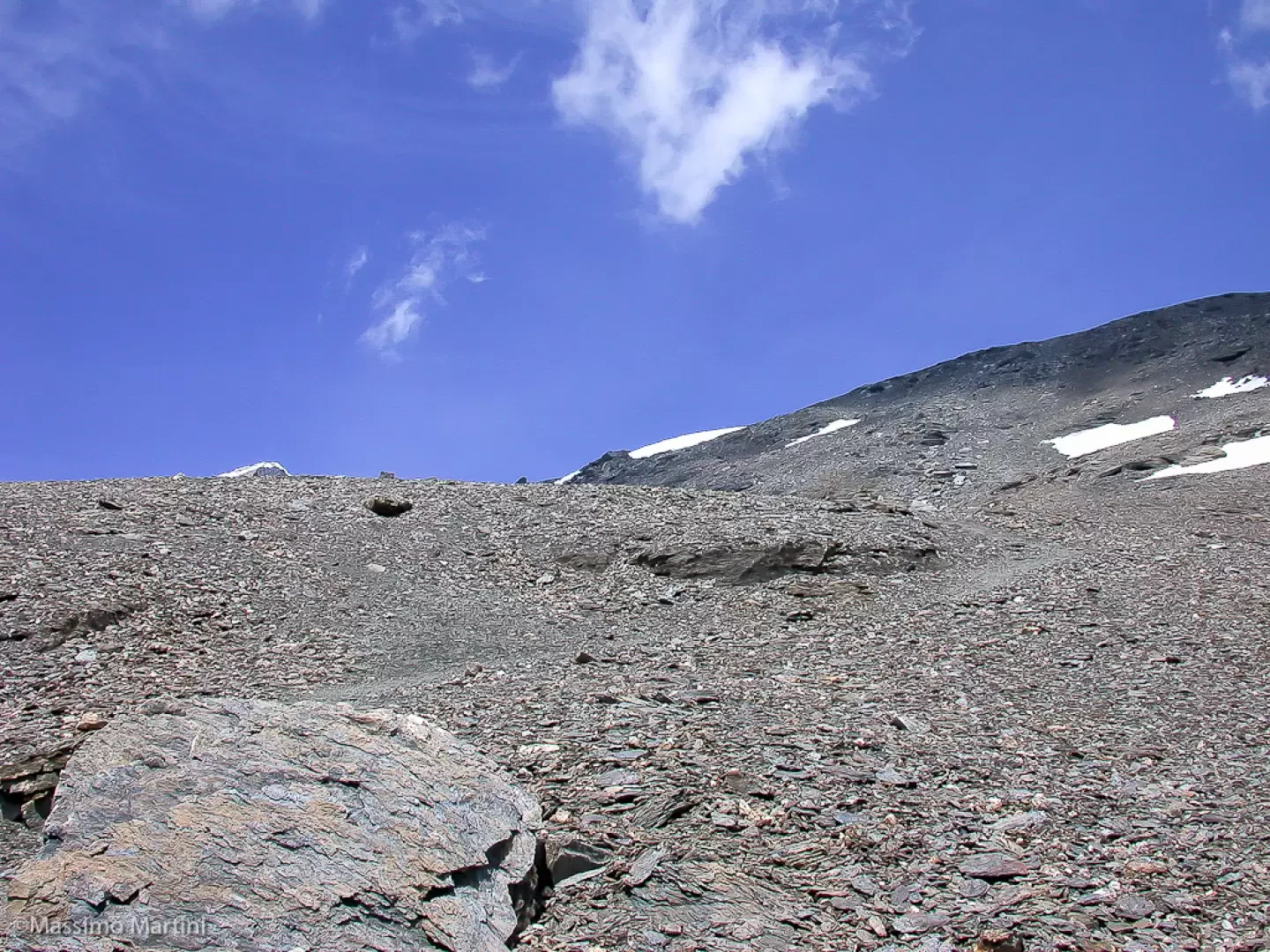
From the hut, continue in a north-easterly direction on the obvious path that crosses the boulder field. Slowly the path steepens, leading towards the rocky slopes of our destination. Climb up onto a detrital terrace, now veering sharply to the right. Go over a section of small rocks before joining the summit ridge; reverse direction and finally reach the summit on the final scree slope until you reach the summit of the Tête Blanche de By (3413m, 5h15'), which is marked by a large stone cairn.
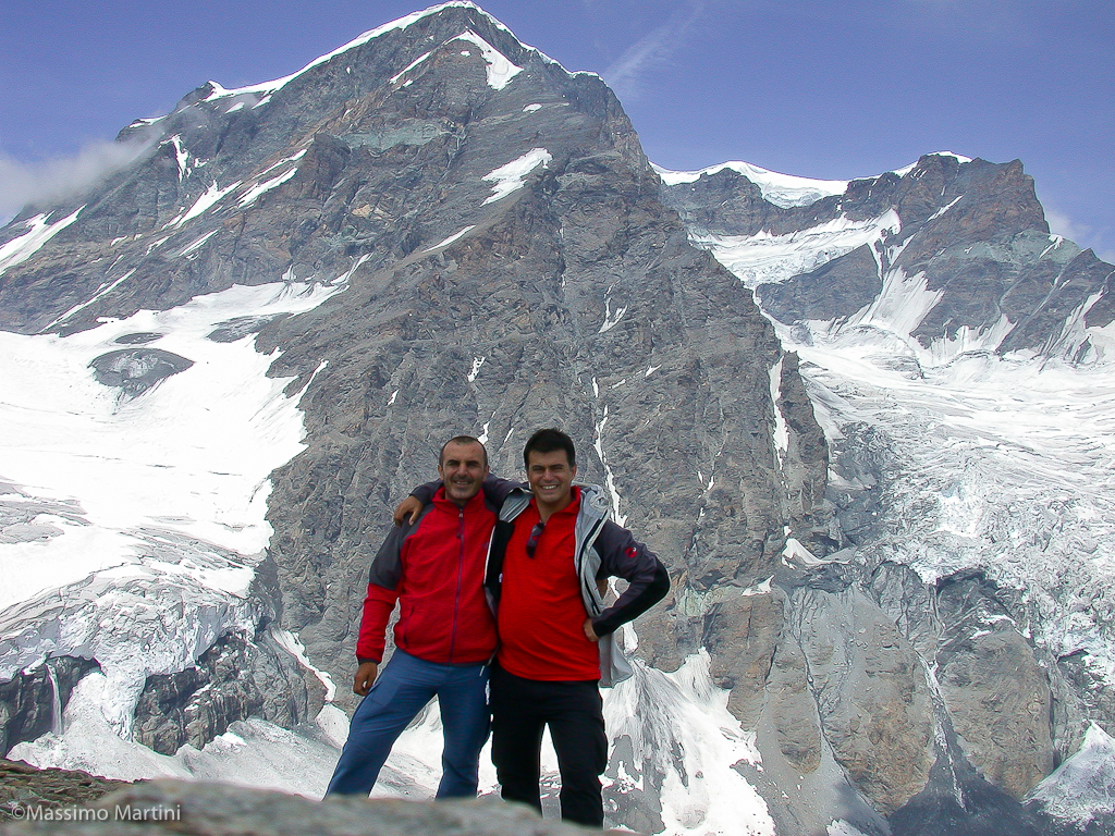
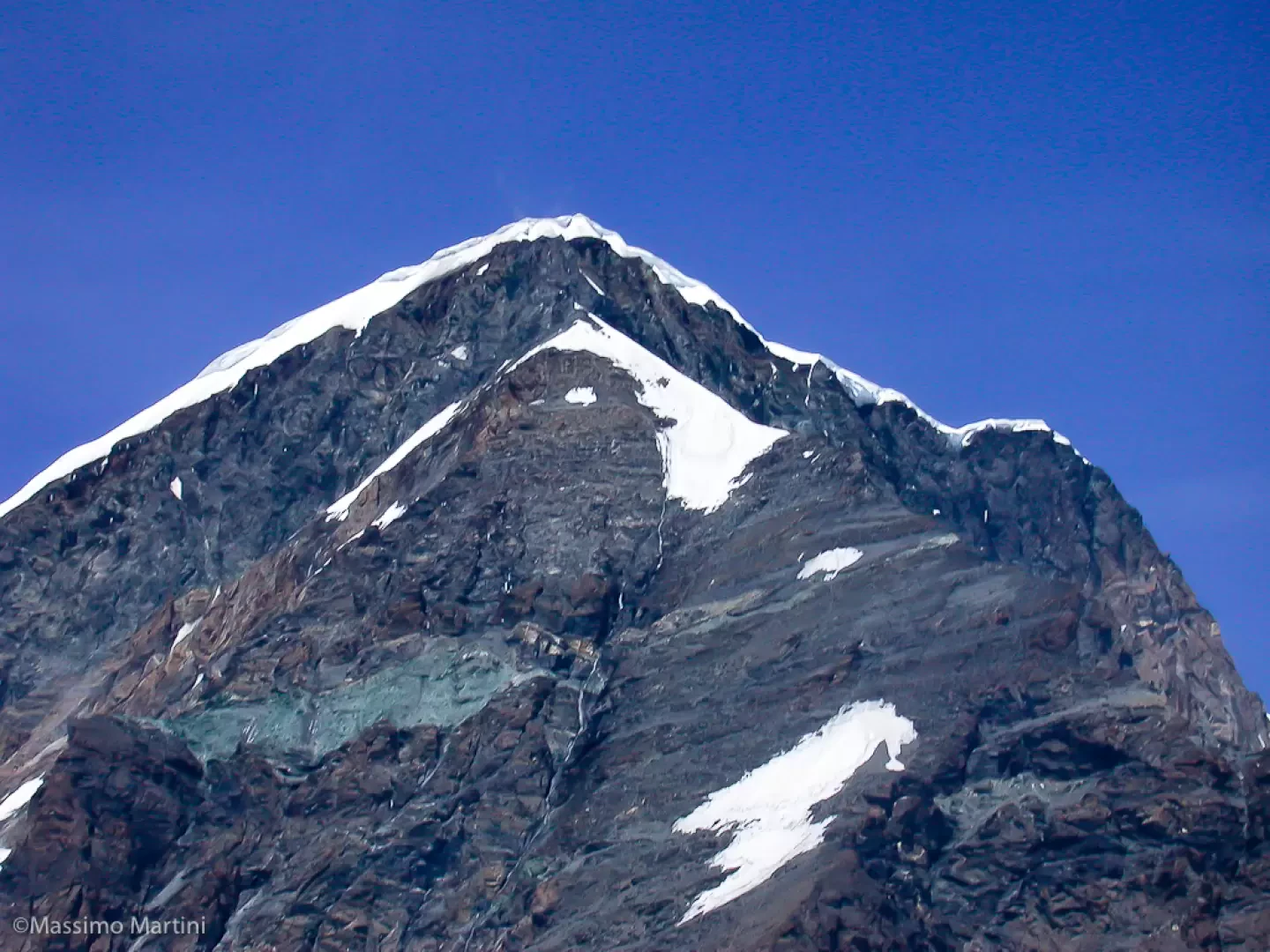
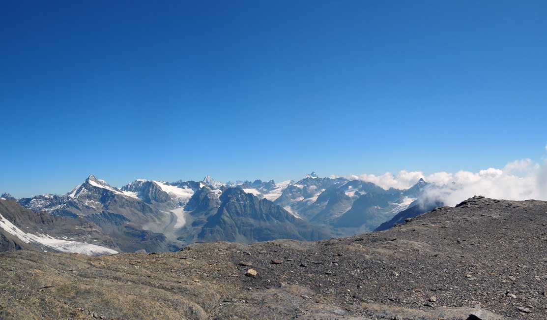
The panorama from the summit is absolutely breathtaking: the view of the Grand Combin is perfect and leaves you speechless.
The descent follows the ascent path (3h15'): be sure to assess the overall effort as this is the main difficulty of the hike.
Galleria fotografica

We have been there
Edited by:
Massimo Martini
Tête Blanche de By, anello da Glassier

Edited by:
Giancarlo Beretta
Tête Blanche de By
buone condizioni generali; la placca con corda fissa si raggiunge più in alto di alcuni anni fa per una traccia che si alza sulla sinistra con qualche piccolo tornante e di conseguenza è più corta e sono stati aggiunti anche alcuni gradini metallici.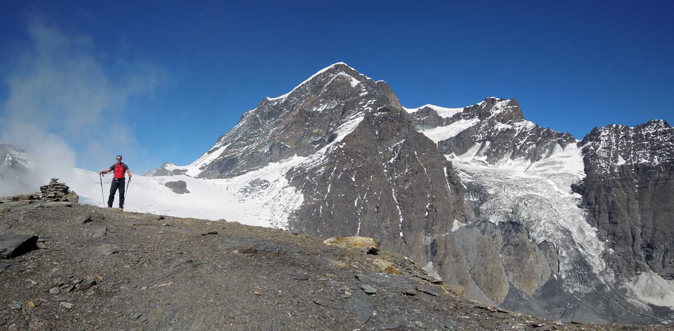
Edited by:
Massimo Martini
Tête Blanche de By