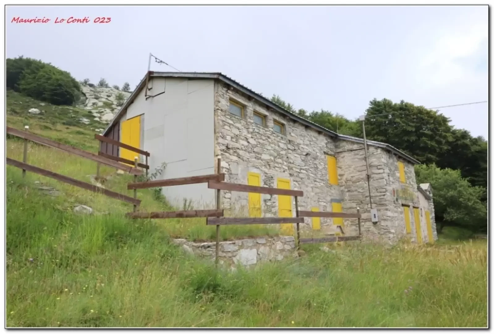
Silvietto Refuge

Access
From Garessio we head towards Ormea along the state road but, as soon as we leave the village, we climb a narrow road to the right (Valdinferno) that leads us in 6 km to the start of the excursion from a square by a church (1213m).
Introduction
The Silvietto refuge is in Valdinferno and is owned by the parish of San Giuseppe di Savona at 1495 m. A short excursion makes it possible to visit it, although the second part of the track is abundant, the grass has suppressed the path, so access is by no means trivial.
Description
We follow a concrete road through the hamlet. After 200 m, the first fork in the road is signposted for the Silvietto refuge, but the 'direct' ascent to the refuge appears to be uneven, so it is not recommended. We continue along the wide track: at a fork, the signposts invite us to take the path to the right, but this is indifferent, even in the absence of the relevant sign. You arrive in the district of Bos (1366 m) and then in the hamlet of Mulattieri (1407 m). where there are two adjacent fountains and a house: in the middle, the path goes to the right, leaving the main road behind. Caution! From here on, there are no more signs! A few metres and, at a subsequent fork, keep to the right. You come out of the forest and the overgrown grass has obliterated everything. Stakes with a wire to hold the cattle can help. A huge boulder with various protrusions emerges from the ground. A little further on, you see a private house with antennas (not the destination!). According to the online maps, the house should be to the left, but, it is repeated, the tracks are all forgotten and so you may as well go further up. Going straight on (east) in less than 5 minutes you will find Rif. Silvietto. It is a nice, medium-sized building. It seems that by climbing the rocky crest of the 'costa Bruciata' you can see Garessio. Even the little path leading to Rif Savona, which should start from the left of the structure, taking a 50-metre climb, is obliterated by vegetation! I return there with the ascent route.
In extreme synthesis: Dif E - disl. almost 300 mt - 6 km - go. 1h15 (+30' x path search) - ret. 1h
In the area: http://www.cralgalliera.altervista.org/GiteValTanaro.htm
If you'd like, here's the pdf photo file, with a bit more news:
http://www.cralgalliera.altervista.org/RifSilvietto023.pdf
... and a few single shots as well:
http://www.cralgalliera.altervista.org/IMG0973E.jpg
http://www.cralgalliera.altervista.org/1907S2PolentaBiancaPollini.jpg
http://www.cralgalliera.altervista.org/altre2023.htm
http://www.cralgalliera.altervista.org/anno2023.htm
NB: In the case of an excursion, always check with FIE, Cai, any park authority or other institutions, pro loco, etc., that there have been no changes that have increased the difficulties! No liability is accepted. This text is purely indicative and not exhaustive.
Info Hiking Section Cral Galliera: http://www.cralgalliera.altervista.org/esc.htm
Trips 2023 at the link: http://www.cralgalliera.altervista.org/gite023.pdf