Retempio Sanctuary, from Crest dessous

Edited by:
Massimo Martini
Updated at: 08/03/2025
Access
After 150 metres from the motorway junction exit at Pont-Saint-Martin, turn left and take the Strada Statale in the direction of Aosta. At the first roundabout, take the second exit to continue on the . Continue for 2.2 km, passing through Donnas, until the next roundabout. At the roundabout, take the second exit to stay on the . Continue for about 3 km until you reach another roundabout near the Bard Fortress. Here, take the third exit and take the Strada Regionale in the direction of Valle di Champorcher. Continue for 6.7 km on , passing through Hône, until you reach Pontboset. Disregard the first fork on the left and take the next fork. Turn left and follow the little communal road for 2.9 km until you reach the car park 🅿️antistante the village of Crest dessous: few places available (about 15).
[0h27'] - [16.4km]
How to get there with GMaps
How to get there with Apple Maps
The directions provided have been carefully checked as of the date the route was taken. However, it is highly recommended to check for any changes that may have occurred since then, especially regarding the route to the starting point. Before embarking on your journey, it is advisable to consult up-to-date navigation tools for accurate and up-to-date directions. We recommend the use of satellite navigation apps, such as Google Maps or Apple Maps, to ensure the most accurate and safe routing.
Introduction
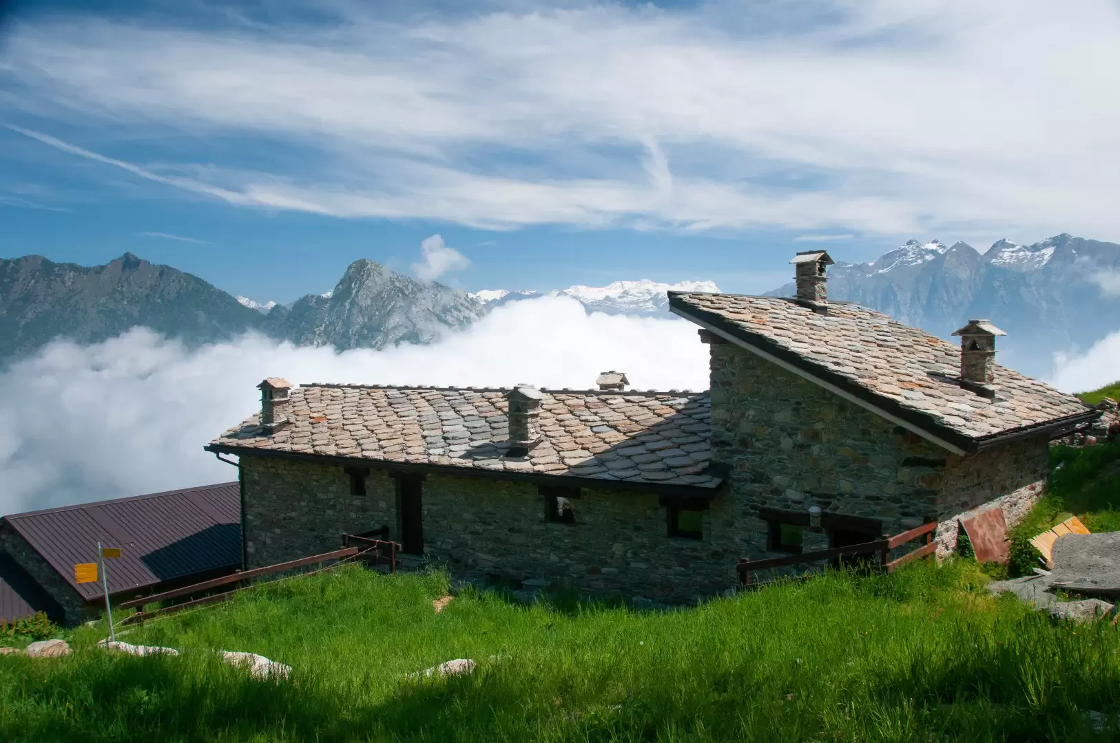
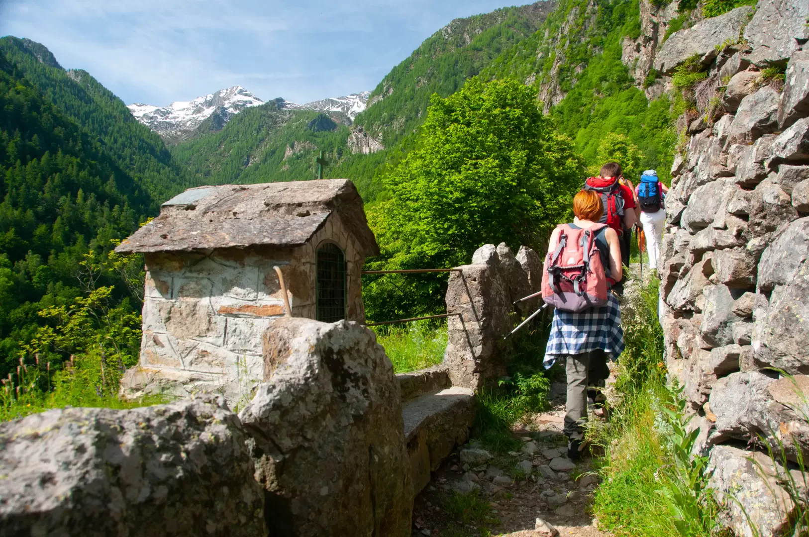
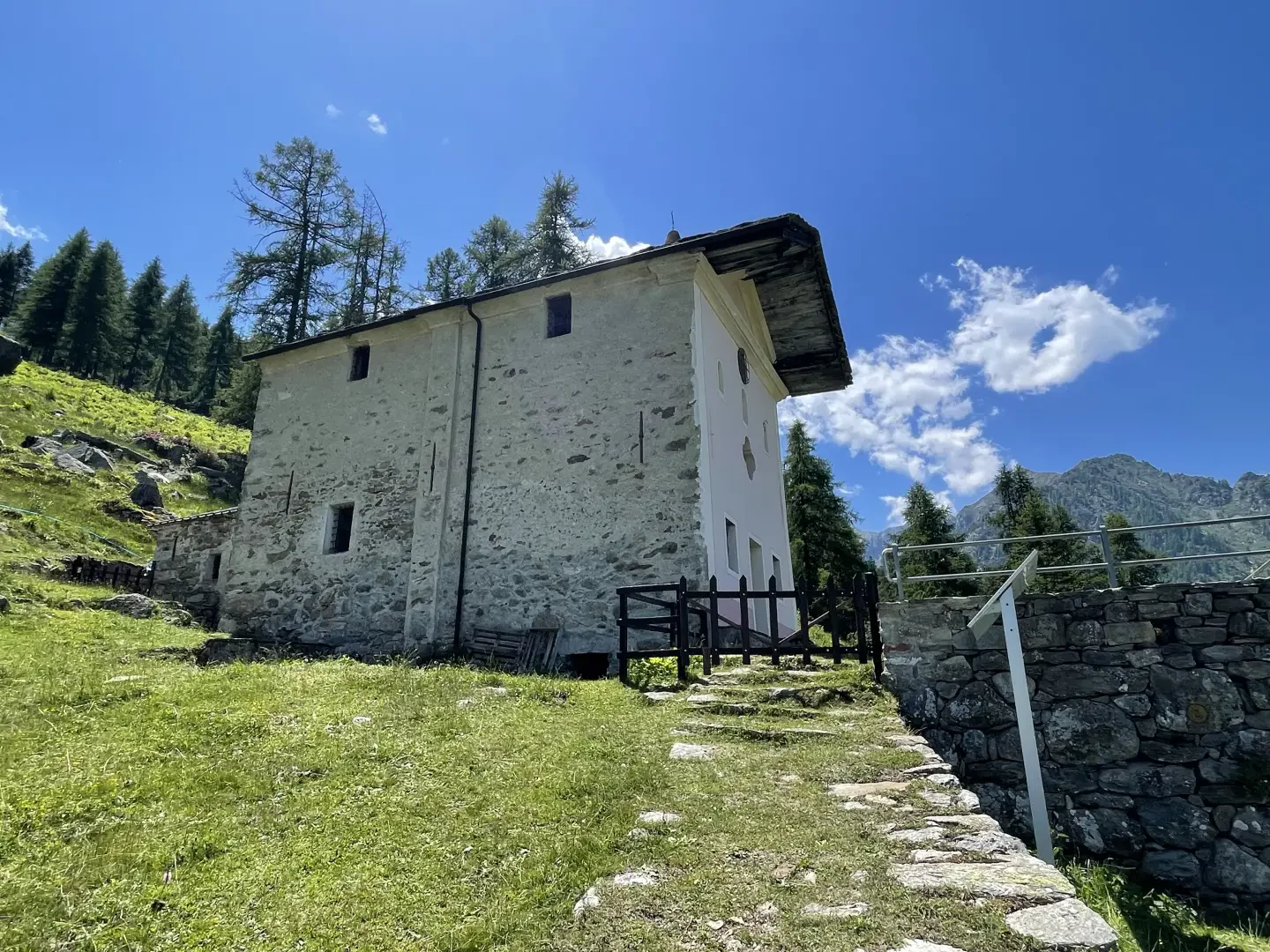
Situated on a terrace on the orographic right of the Comba di Brenve, the Sanctuary of Retempio is a pretty chapel erected back in 1835 and dedicated to Our Lady of the Visitation and Saint-Roch (Saint Roch). On 2 July each year, a pilgrimage leaves Pontboset and climbs the beautiful mule track to Crest and the sanctuary, dotted with numerous votive shrines used as devotional stops. Just before the sanctuary, there is a mountain pasture that has recently been transformed into a dortoir, a new way of enjoying the mountains in close contact with the life of the herdsman. The place-name probably derives from the not so distant Tempioz alpine pasture in the centre of the Comba.
The hike does not present any particular difficulty and allows you to appreciate the so-called "holy staircase" and an unusual panorama of the Monte Rosa massif.
Description
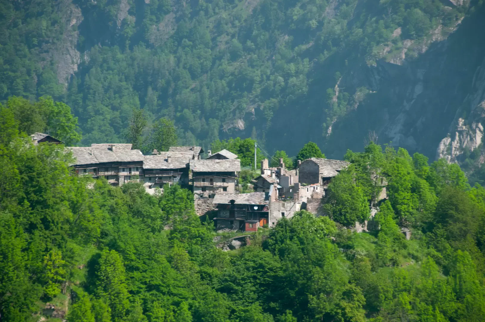
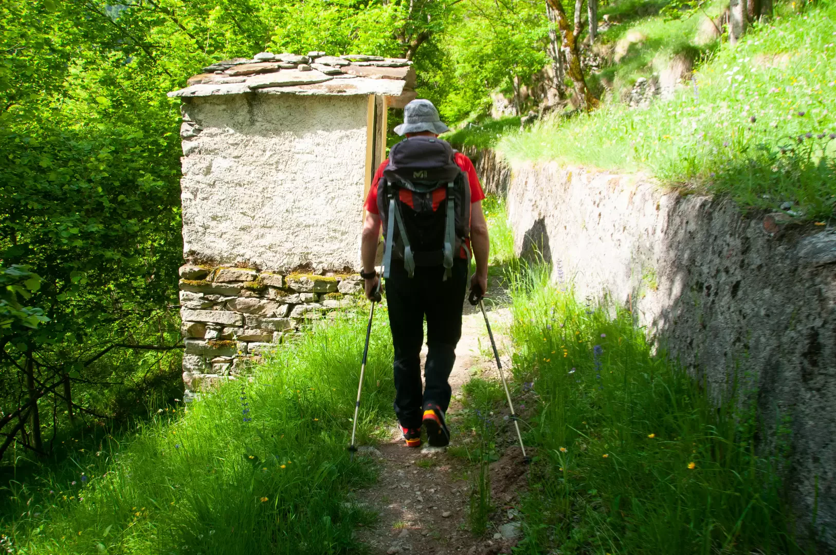
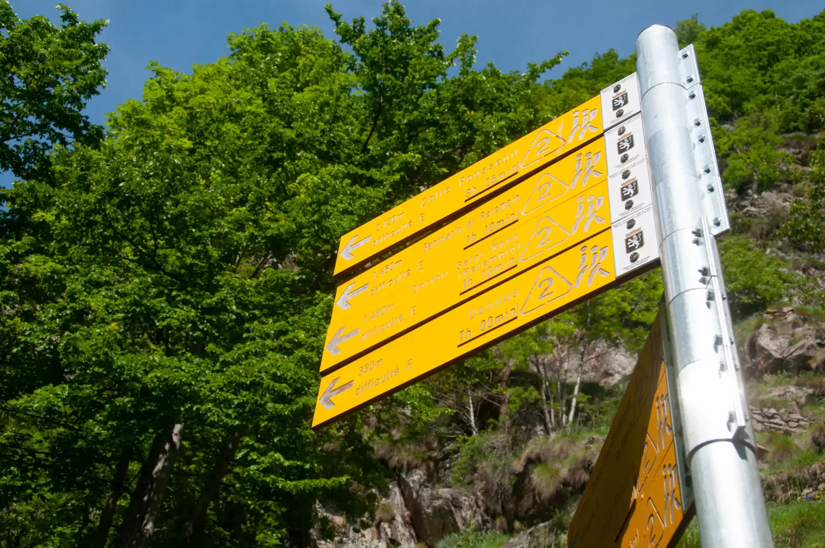
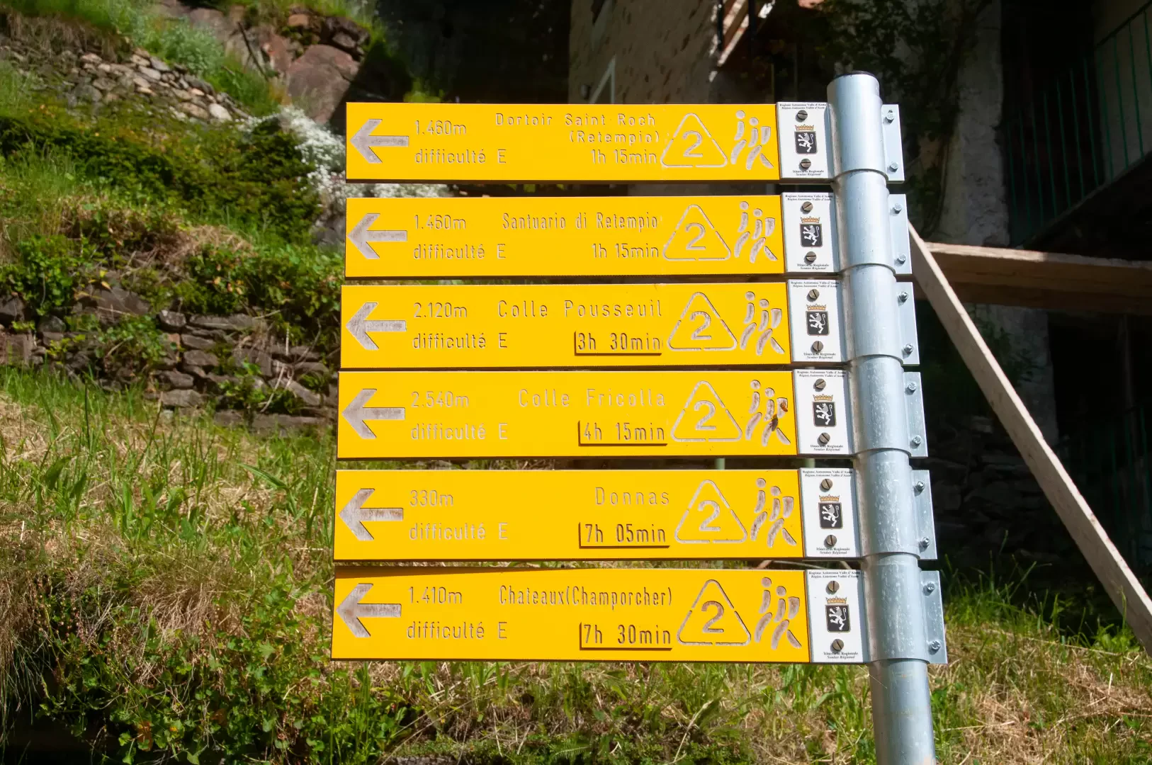
0h00' 0.00km Leaving the car behind, walk a few metres along the asphalt road before turning onto the paved mule track that soon leads to the village of Crest dèsot (1096m) 💧 where the "La Louye su la Goumba" refreshment point is located. Turn left onto the beautiful mule track flanked by splendid stone walls; after passing a characteristic votive shrine, the route proceeds slightly uphill following a wooden railing until you come to a new signpost (1078m).
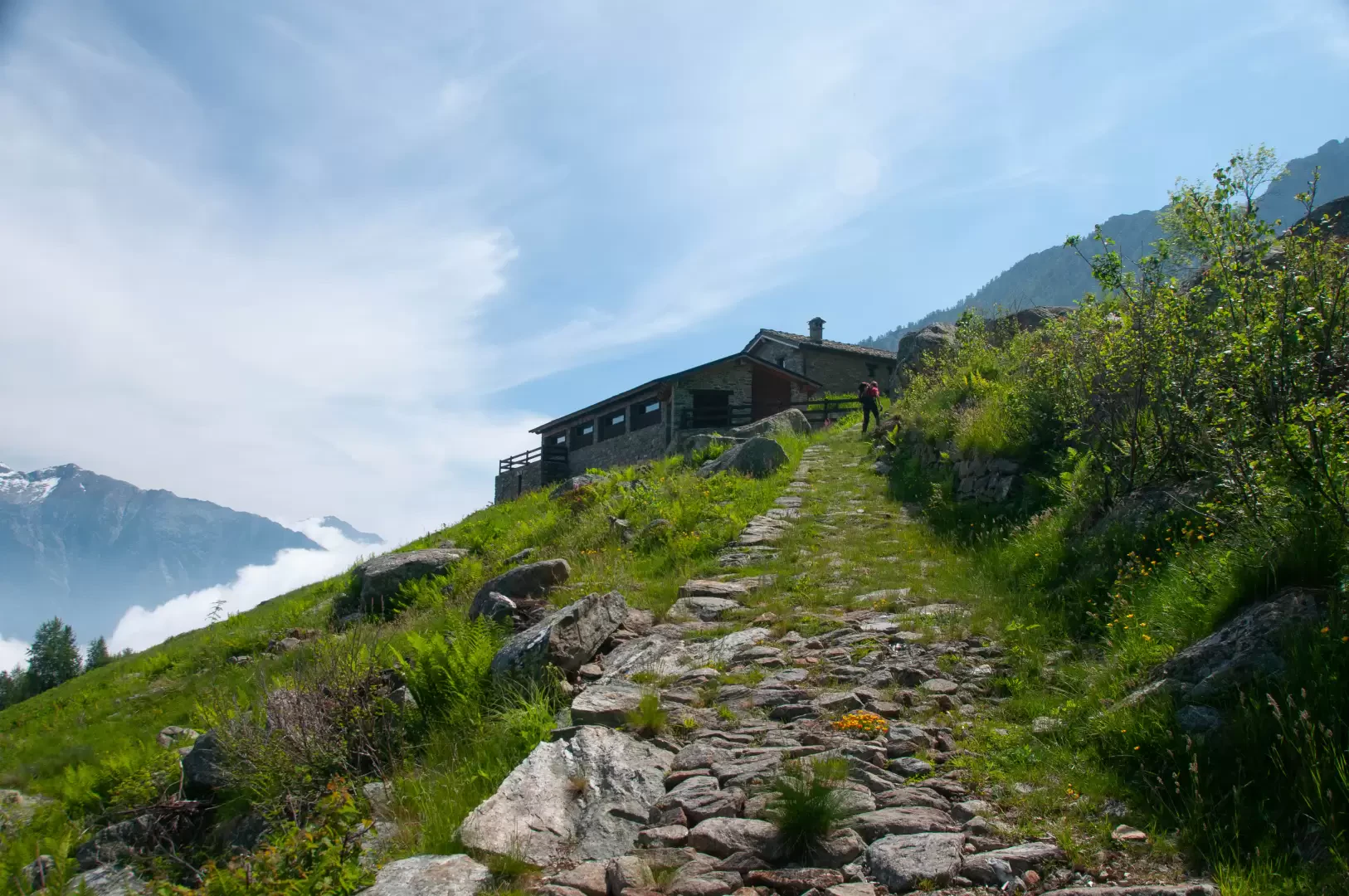
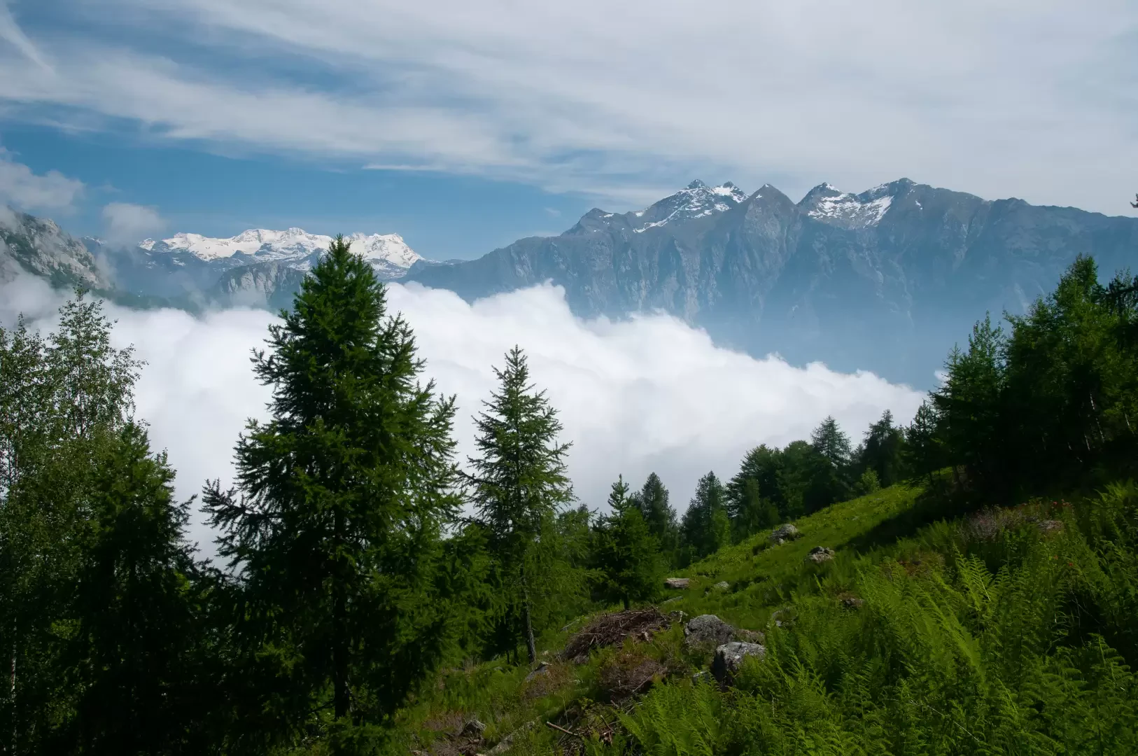
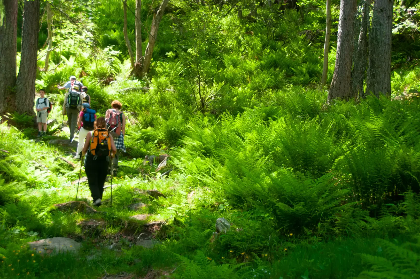
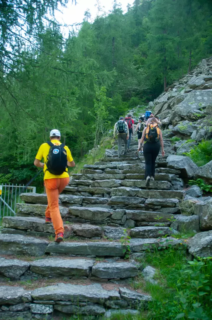
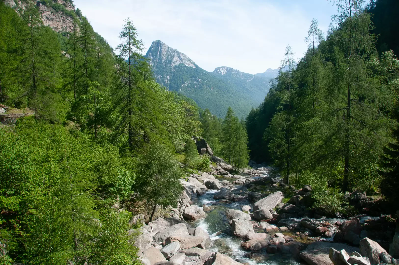
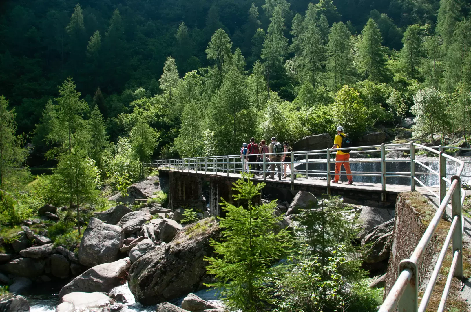
0h10' 0.37km Follow the signs for the sanctuary, signposted at 1h10'T2, turning left onto the Alta Via della Valle d'Aosta Proceed slightly downhill, encountering a new votive shrine before reaching a small wooden bridge with iron railings that makes it easy to cross the Torrent de Brenve (1150m). After crossing the bridge, you come to a beautiful flight of steps with stone treads, called the 'holy staircase' by the locals, which allows you to ascend the orographic right-hand side of the comba, quickly gaining altitude. One enters the larch forest, which gives a few glimpses of the village of Crest dessous below, while the path after a few turns skirts the ruins of an old hamlet nestling among the ferns (Pteridium aquilinum). We emerge from the forest and the panorama of the Monte Rosa massif opens up. The destination is now near and the sanctuary appears before the hiker. One last steep climb leads to the alpine pasture and the Dortoir and shortly afterwards to the Sanctuary of Retempio (1484m) 1h15' 2.63km .
The return is along the same path as on the outward journey 0h45' 2.63km .
Points of interest
Collections
- hikes departing from Crest dessous - on the map
- hikes in Pontboset - on the map
- hiking in the Champorcher Valley - on the map
- hiking to sanctuaries in the Aosta Valley - on the map
Galleria fotografica