Orto di Donna Refuge, from the Val Serenaia Refuge


Edited by:
Maurizio Loconti
Updated at: 18/09/2024
Access
From the Aulla tollgate, turn right and take the SS63 to Fivizzano. After the sign at km 11, turn right for Fivizzano and then right again for Casola, until you pass Minucciano. Beyond a tunnel, turn right for 5 km into the remote Val Serenaia, and park at about 1060 m (38 km from the motorway).
Introduction
The Val Serenaia is in the Apuan Alps and has a typical U-shape, thanks to the slow work of an ancient glacier, with a wide amphitheatre characterised by several peaks. This is where the Orto di Donna hut is located, in a somewhat severe environment and in an area where the paths are never easy... the new building (of 2005) is the result of a recovery of old constructions originally dedicated to the service of the quarries (note that while outside the temperatures are high, inside it is... almost cool!). The excursion should only be undertaken in dry weather and in fine weather, avoiding the hottest days. We did not choose the direct path, but the one that passes by the Foce di Giovo, from which there is a splendid panorama.
Description
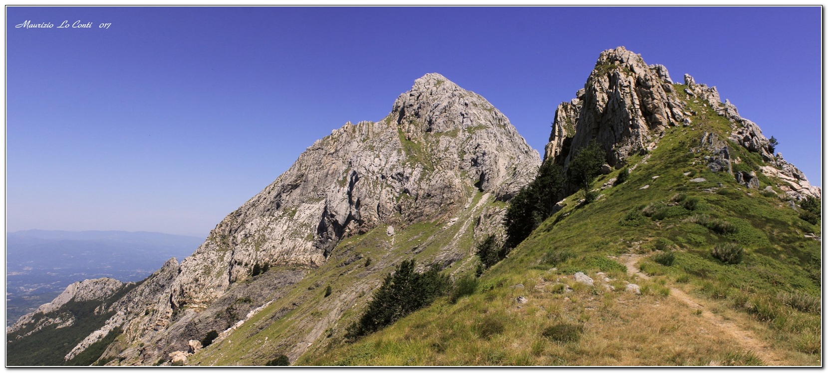
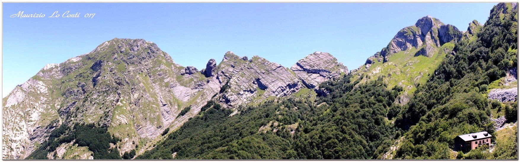
Uphill on tarmac to Rifugio Donegani, from here the route proper begins. During the ascent, you briefly cross a road, pass the marble quarry area ... an unpleasant open wound in the mountain ... and we climb for a long time, ignoring the junction for Giovetto. The effort is rewarded and from Foce Giovo 1500 m (an important crossroads with a signpost), various points of interest can be admired: the village of Vinca, Pizzo Uccello 1781 m and in the foreground Giovetto 1584 m, Monte Sagro 1748 m, Monte Pisanino 1947 m... (1h40 of very hot ascent, 450 m difference in altitude - the route is considered EE, for a couple of points with chains, but no overhead sections and in the end easier than the following ones, only rated E!). Afterwards, we cut into altitude with a path that, in places, is a little difficult and almost exposed, albeit for a few metres... inexplicably, there is no cable that would be useful here (E+). It alternates between sections in the forest and others that are more open, with a development that runs below the Cresta del Garnerone. Difficulties are always just around the corner and never seem to end... Finally, the hut appears and, above it, the Zucchi di Cardeto (1794 m) and Monte Cavallo (1888 m) with Contrario (1790 m) stand out. We thus reach the hut, at an altitude of about 1500 m (1h20). The meal, although simple, is good, as in the shelters of yesteryear (a classic in the area). Info: Rifugio Orto di Donna (tel. 347 3663542 - http://www.rifugialpiapuane.it/ - info@rifugialpiapuane.it ).
The return is by the normal route, which descends next to the structure, and should be done with care: the track literally plunges between the beech trees (E+), then, after about 30', finally becomes quieter (touching a series of enormous boulders at the edge of the beech forest that are the result of quarry dumps - ravaneti). In another hour, ignoring a branch-off, you find your car again. Afterwards, we calmly return home.... Looking at some points of interest along the road: Gramolazzo and its lake (from a distance), the village of Minucciano, the completely stone church of Pieve di San Lorenzo, the Pieve dei Santi Cornelio e Cipriano is a sacred building in Codiponte, in the municipality of Casola in Lunigiana. Here, along the road, a drinking fountain (5 cents per litre) allows you to take a litre of very cold and very useful water, given the temperatures...
All in all: an excellent day but very hot, better when crossing the woods; difference in height 500 m Dif. E+/EE for about 4h / 4h30 Tot. (3h And. and 1h30 Rit.) + breaks to see the various places that we encounter
Photos:
http://cralgalliera.altervista.org/RifOrtoDiDonna017.pdf
All trips to Garfagnana, Alpi Apuane, Alta Toscana:
http://cralgalliera.altervista.org/GiteApuaneAltaToscana.htm
http://cralgalliera.altervista.org/altre2017.htm
individual shots, partly different from the pdf:
http://www.cralgalliera.altervista.org/1707B1PizzoUccelloDaFoceGiovo.jpg
http://www.cralgalliera.altervista.org/1707B2DaPisaninoAlRifOrtoDiDonna.jpg
http://www.cralgalliera.altervista.org/1707B3FaggioMonumentale.jpg
NB: In the case of an excursion, always check with FIE, Cai, any park authorities or other institutions, pro loco, etc, that there have been no changes that have increased the difficulties! No liability is accepted. The present text is purely indicative and not exhaustive.
Info Hiking Section Cral Galliera: http://www.cralgalliera.altervista.org/esc.htm
Trips 2017 at the link: http://www.cralgalliera.altervista.org/gite2017.pdf
Comments (0)
Sign in to leave a comment