Monte Aiona Refuge for the Porceletti Pass

Edited by:
Maurizio Loconti
Updated at: 16/09/2024
Access
From Rezzoaglio (from the Lavagna motorway exit), go up towards Santo Stefano without reaching it. You turn right for Amborzasco and proceed further on. You leave your car at the large car park of the Casa forestale del Penna (1394 m).
How to get there with GMaps
How to get there with Apple Maps
Introduction
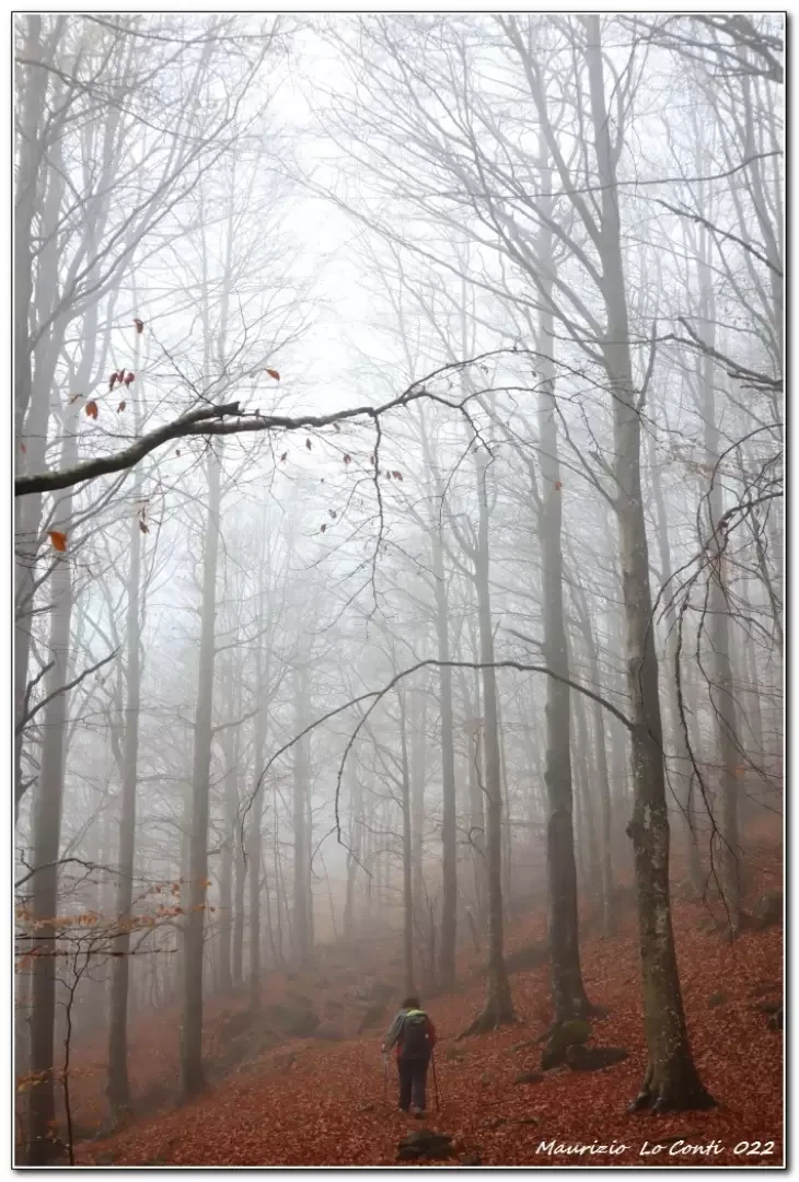
Excursion into the heart of the forests around Mount Aiona with the colours of autumn. The hut reopened in October 2022.
.Description
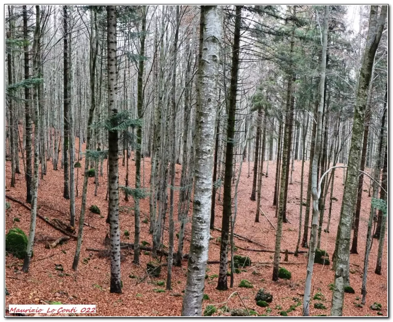
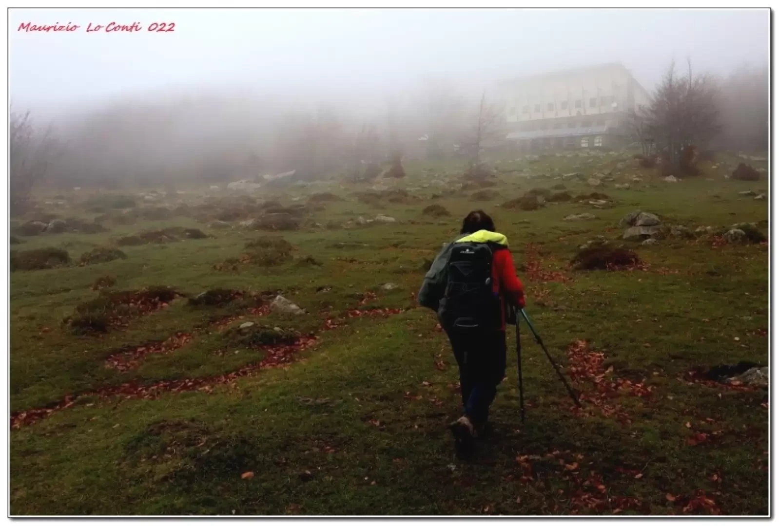
The wide track chosen is comfortable up to the Incisa pass (1463 m). It is necessary to descend to the left on a track that descends through dense forest in the fog! The trails are well marked. You cross no less than 8 streams (eight!), two of them not very trivial because they are wide! A few ups and downs characterise the itinerary, which is a little uncomfortable and one proceeds slowly: past the Becio fountain sign (by the way... where is it?), there is the Porcelletti pass (1460 m), an important junction. Here you keep to the right, leaving the Av, which follows a complicated stretch (in the sign, handwritten: not to be tackled in strong winds or rain). A Madonnina in the beech forest is touched and further on the anomaly of the Fie symbols simultaneously red and yellow stands out (why?). From the Porcelletti rock (1375 m), we turn left uphill. Once in the Pratomollo area, there are some signposts to direct you, but they are a little too spaced out. The plateau reached has no reference points and if there is fog, it is disorienting. The refuge building (1504 m) is reached and the lunch break is at hand (2h15).
A tasty polenta with cheese awaits and quenches the hunger, together with a tasty sweet (structure reopened in October 2022 - info: Laura Capato 3389992250). Return the way you came or via the Ophiolite path (see https://www.inalto.org/it/relazioni/escursionismo/rifugio_monte_aiona_al_pratomollo ). Actually, first, we descend (a few minutes) to admire the Pietra Borghese. It is a remarkable rock mass with an irregular shape: it is an outcrop from the subcontinental mantle, which emerged over 2 billion years ago! It is among the oldest in Italy! It attracts lightning and if struck by a hammer it emits peculiar sounds. The view is therefore unique and well worth the short detour (15' A/R)...
In summary. Dif. E - disl. 300 m - approx. 4/4h30.
if you want here is the pdf photo file, with a little more information:
http://www.cralgalliera.altervista.org/AionaBis022.pdf
http://www.cralgalliera.altervista.org/anno2022.htm
http://www.cralgalliera.altervista.org/altre2022.htm
NB: in the case of an excursion, always check with FIE, Cai, any park authority or other institutions, pro loco, etc., that there have been no changes that have increased the difficulties! No liability is accepted. The present text is purely indicative and not exhaustive.
Info Hiking Section Cral Galliera: http://www.cralgalliera.altervista.org/esc.htm
Gite 2022 at the link: http://www.cralgalliera.altervista.org/gite022.pdf
Galleria fotografica