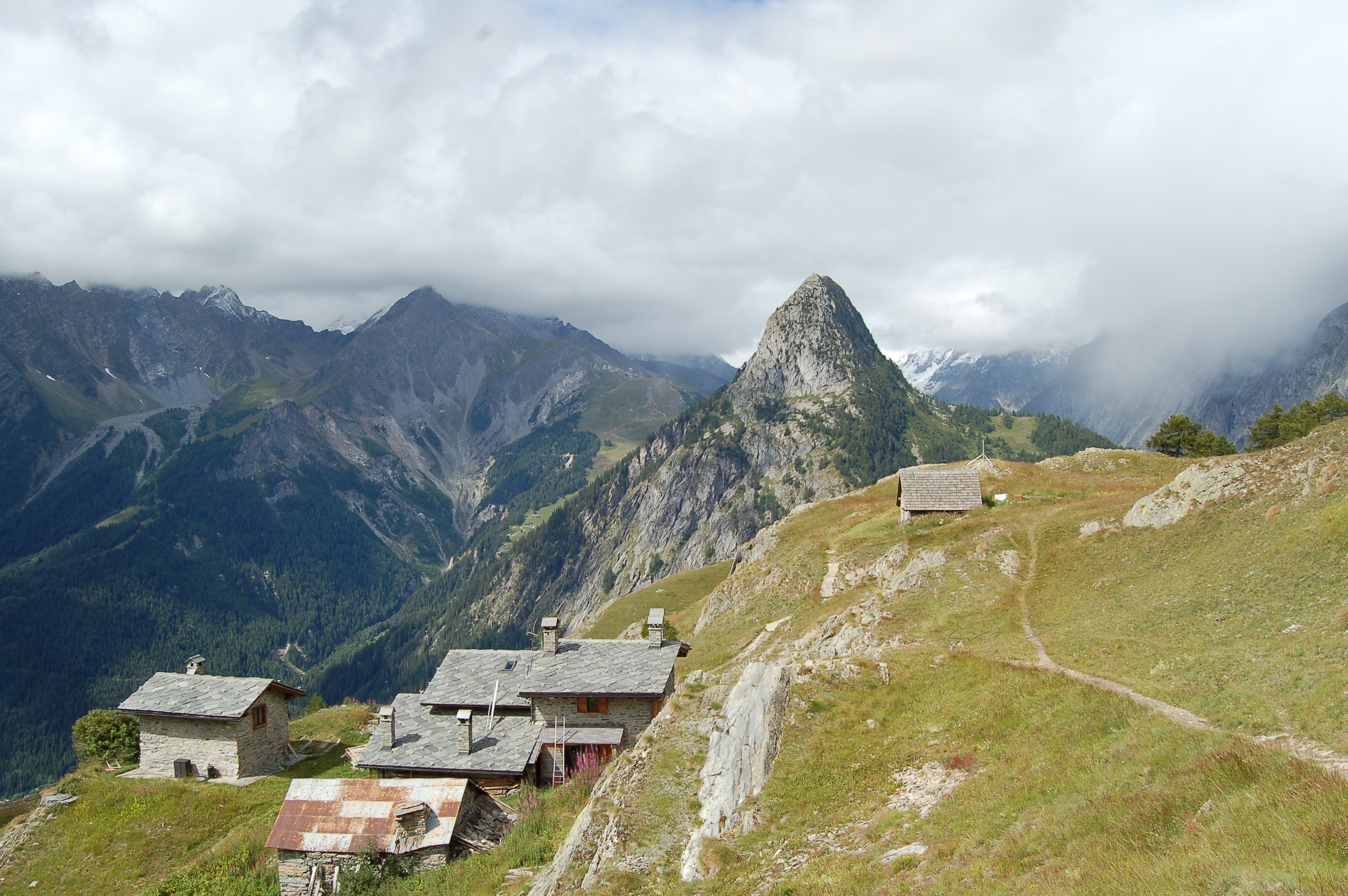
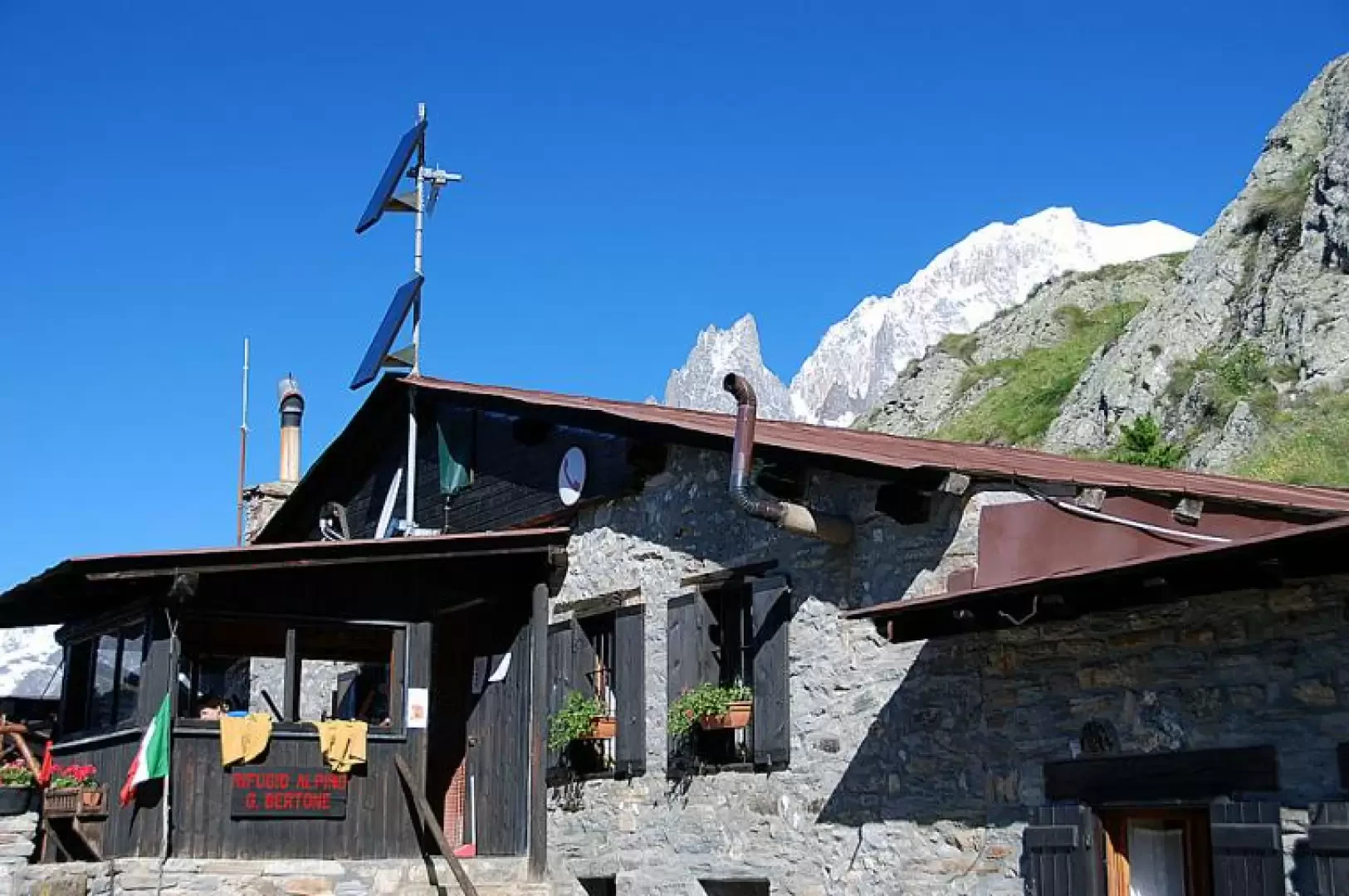
Bertone Refuge, from the Villair

Edited by:
Massimo Martini
Updated at: 11/02/2026
Access
Navigazione stradale
Lasciare lo svincolo autostradale di Aosta Ovest e procedere in direzione nord-est per 35m (0,04km). Prendere lo svincolo per la e proseguire per 900m (0,94km) fino alla rotatoria. Alla rotatoria, prendere la seconda uscita e imboccare la strada statale della Valle d’Aosta. Proseguire per 4,3km (5,24km) fino alla successiva rotatoria. Alla rotatoria, prendere la prima uscita e rimanere sulla per 550m (5,79km). Svoltare leggermente a destra per rimanere sulla e proseguire per 3,7km (9,49km). Alla rotatoria, prendere la prima uscita e continuare sulla per 2,2km (11,69km). Alla rotatoria successiva, prendere la seconda uscita e rimanere sulla per 14,1km (25,79km). Proseguire dritto sulla e continuare per 4,4km (30,19km) fino a raggiungere una rotatoria. Alla rotatoria, prendere la seconda uscita e rimanere sulla per 800m (30,99km). Svoltare leggermente a destra e imboccare Vicolo Dolonne, proseguire per 140m (31,13km) attraversando la rotatoria. Mantenere la sinistra e continuare su Strada Margherita per 42m (31,17km). Svoltare a sinistra e imboccare Via Circonvallazione, proseguire per 210m (31,38km). Continuare su Viale Monte Bianco per 300m (31,68km). Alla rotatoria, prendere la seconda uscita e imboccare Strada Sergio Viotto, proseguire per 170m (31,85km). Svoltare a destra e imboccare Strada Adolphe Rey, proseguire per 160m (32,01km). Continuare su Strada Grand Ru per 260m (32,27km). Svoltare a sinistra e imboccare Strada del Villair, proseguire per 600m (32,87km). Continuare su Via – Rue Val Sapin per 550m (33,42km) fino a raggiungere la località Raffort, dove si trova il parcheggio.
Descrizione del parcheggio
In località Raffort si trova un parcheggio 🅿️ gratuito al termine della strada comunale, nei pressi dell’abitato. Il parcheggio costituisce il punto di partenza dell’itinerario. La disponibilità di posti è limitata; si raccomanda di parcheggiare senza intralciare la viabilità locale.
Accesso con mezzi pubblici
La località di Courmayeur è servita da autobus di linea gestiti da Arriva Valle d’Aosta. Raffort non è tuttavia direttamente servita da fermate dedicate; prevedere un trasferimento a piedi dal centro di Courmayeur. Verificare preventivamente orari e frequenze, che possono variare nei periodi festivi o stagionali.
Distanza e tempo di percorrenza
🕒 Tempo di percorrenza: 42 minuti
📏 Distanza: 33,42km
Navigazione GPS
📍 Come arrivare con Google Maps
📍 Come arrivare con Apple Maps
ℹ️ Nota importante
Le indicazioni fornite sono state verificate alla data del rilievo dell’itinerario. Prima della partenza si consiglia di verificare possibili variazioni del percorso o delle condizioni stradali. Per informazioni aggiornate si raccomanda di consultare Google Maps o Apple Maps.
Introduction
A recent but certainly popular destination for tourists who enjoy a healthy holiday in Courmayeur. The non-excessive difference in altitude and the absolute absence of difficulty make it an attractive excursion for families. A catering service is provided at the refuge.
Description
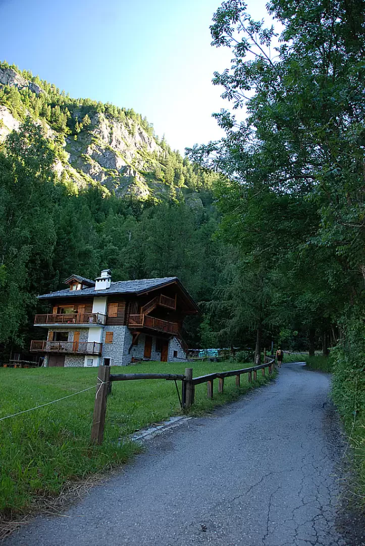
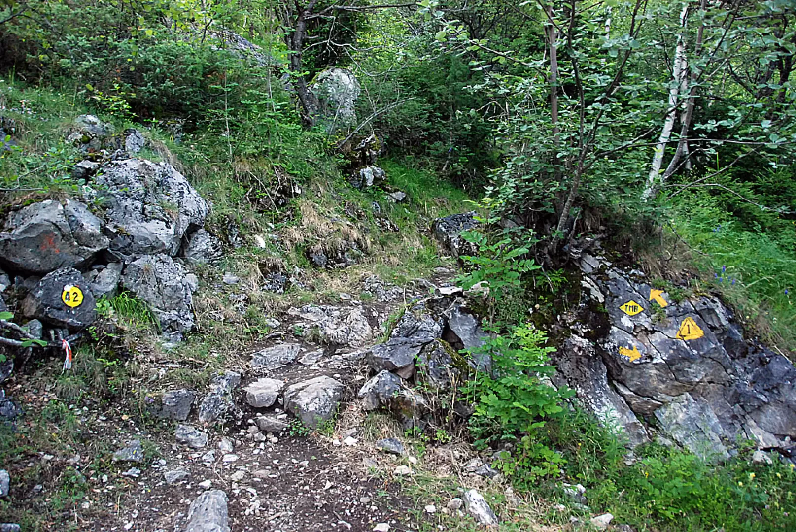
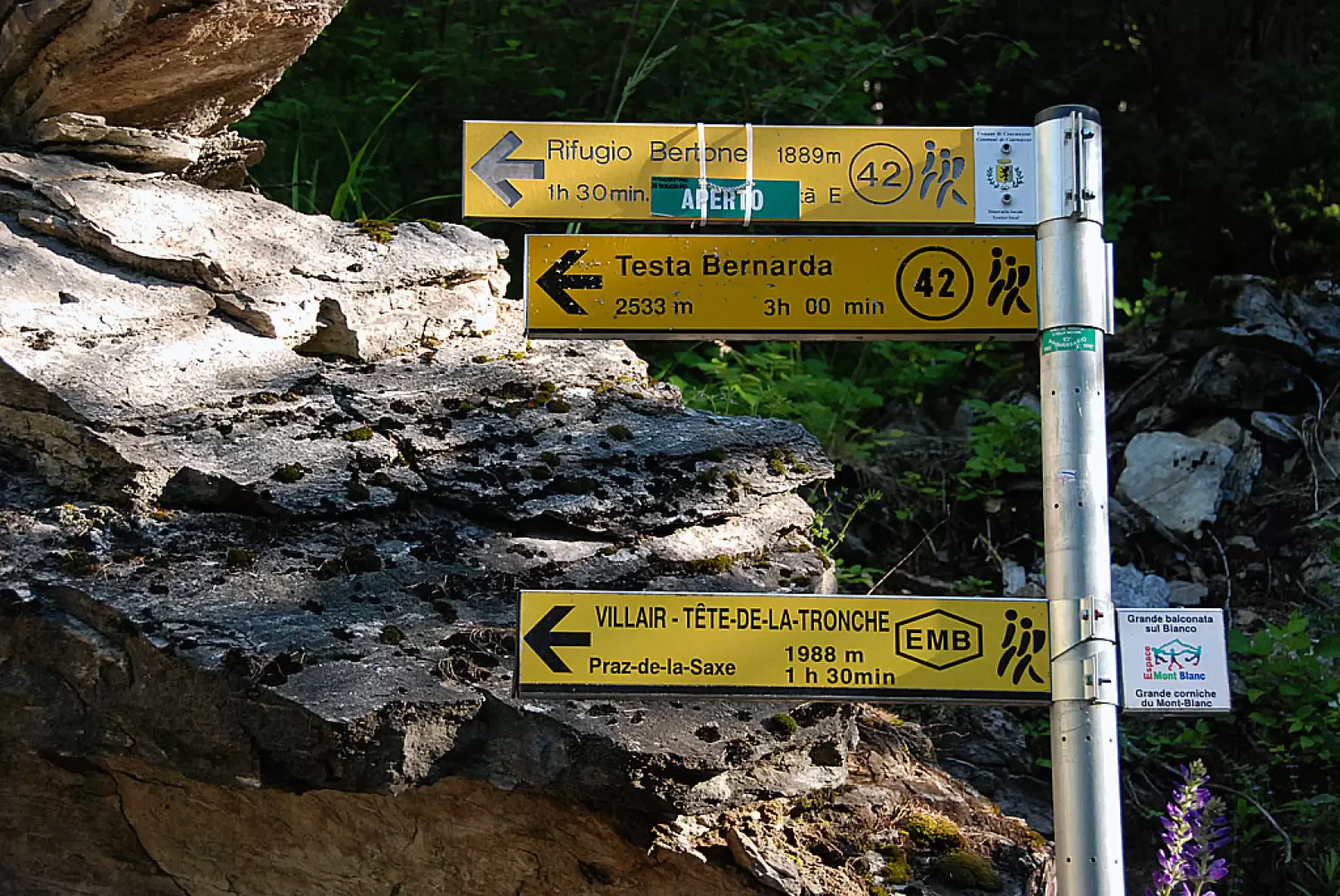
0h00' Leaving the car in a small car park after the village (note: there are not many parking spaces, so it is advisable to park further down to avoid obstructing residents), continue along a small road that is first asphalted and then, at a chalet on the left, unpaved. Take a tree-lined lane up the orographic left of the Val Sapin stream. After about 5 minutes, you come to a panel with a thematic map of the paths in the Espace Mont Blanc and a signpost indicating the itinerary to follow to reach your destination: path
.
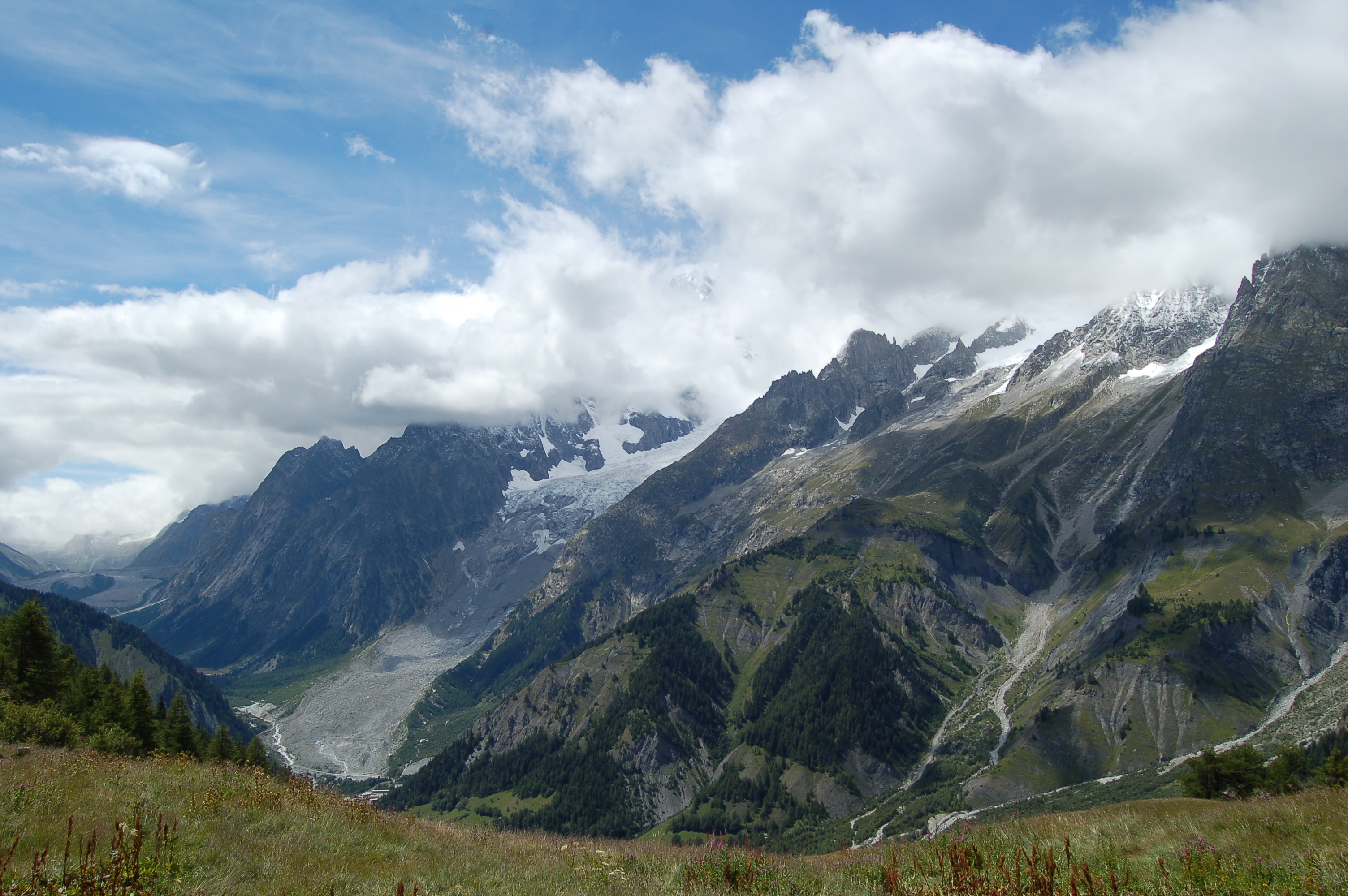
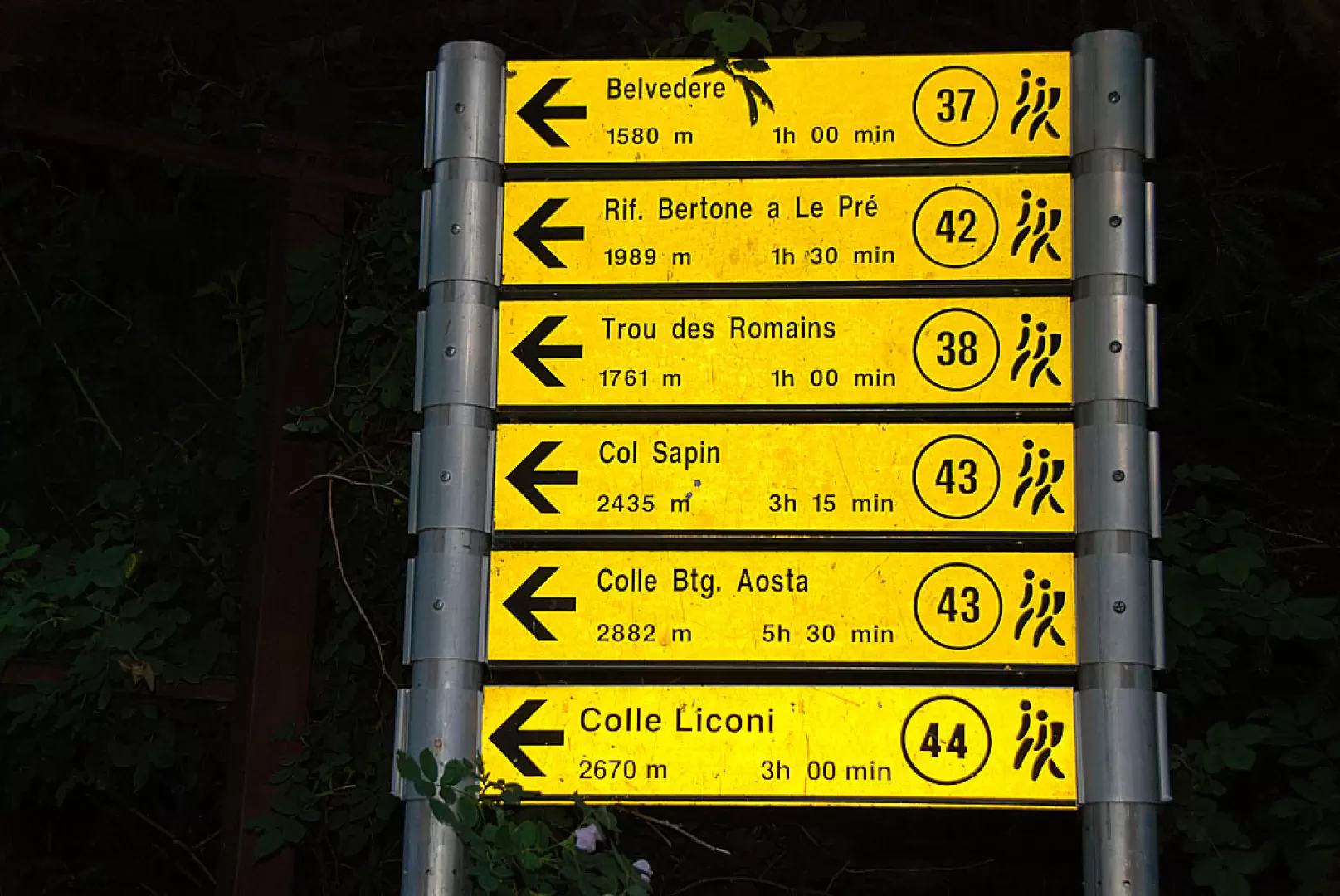
Go past a bar and continue on the dirt road; after a few metres, cross the stream on a small concrete bridge and climb up this stretch of road without too much of a slope, which offers beautiful views of Mont Blanc, the Aiguille Noire de Peuterey and Mont Chetif. After a 20-minute walk, on the bend in the farm road, we come to the crossroads for Belvedere (1580m, 0h45'), trail (37), and for La Saxe (1226m, 0h30'), trail (34). We continue along the road, which crosses a Scots pine and birch forest without any particular difference in altitude and enters the Val Sapin. After about 25 minutes we come to the crossroads for the hut, following path (42).
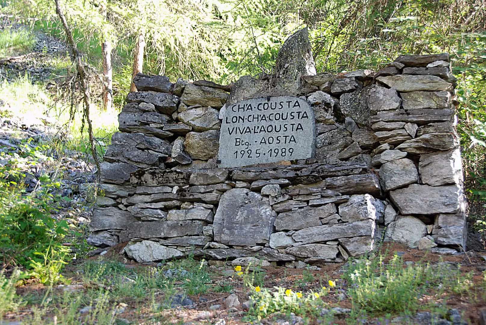
We turn left and begin to climb up a beautiful path through a green forest; after 0h40' we come to a monument dedicated to the Aosta Battalion and its unmistakable motto!
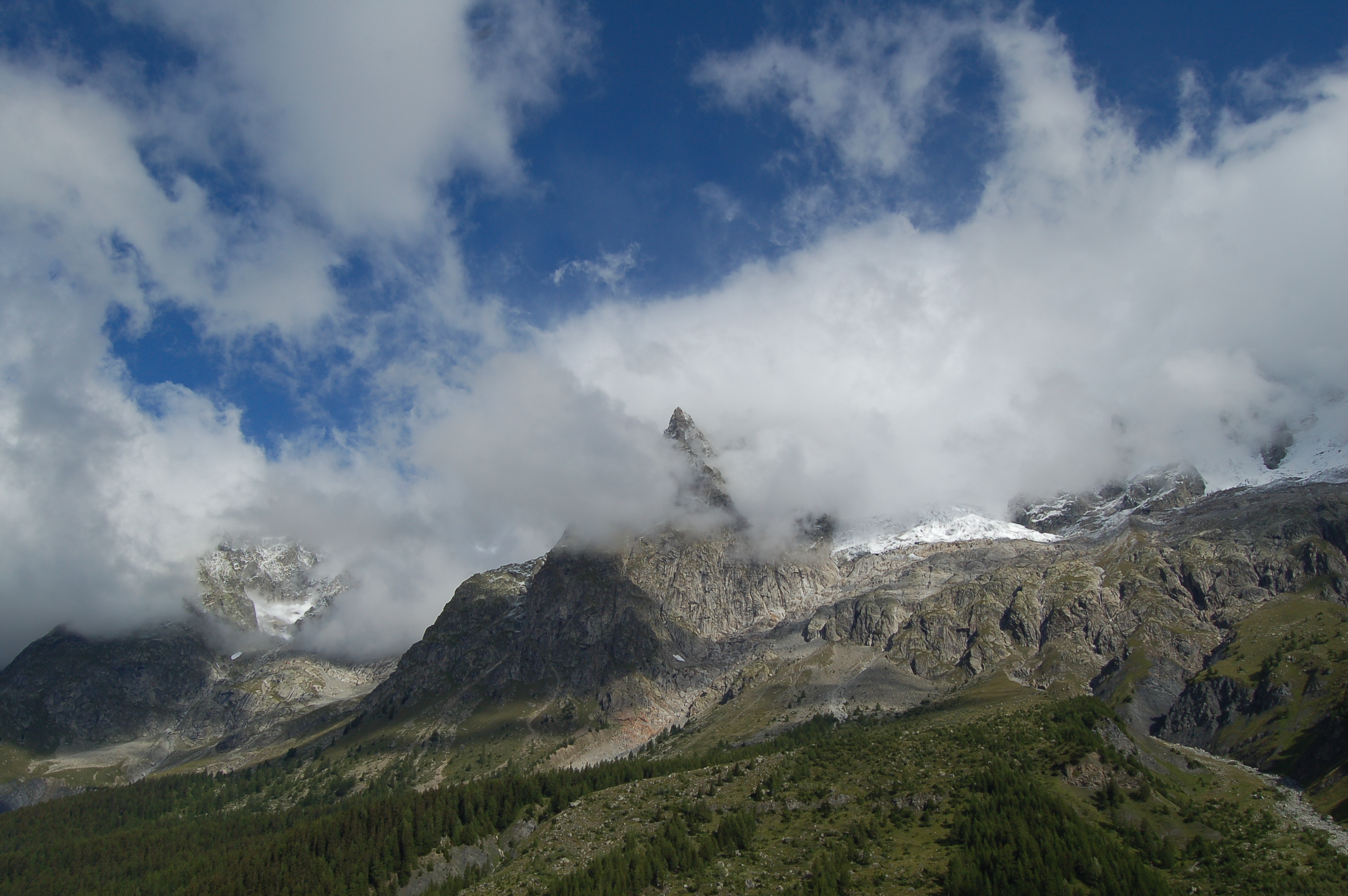
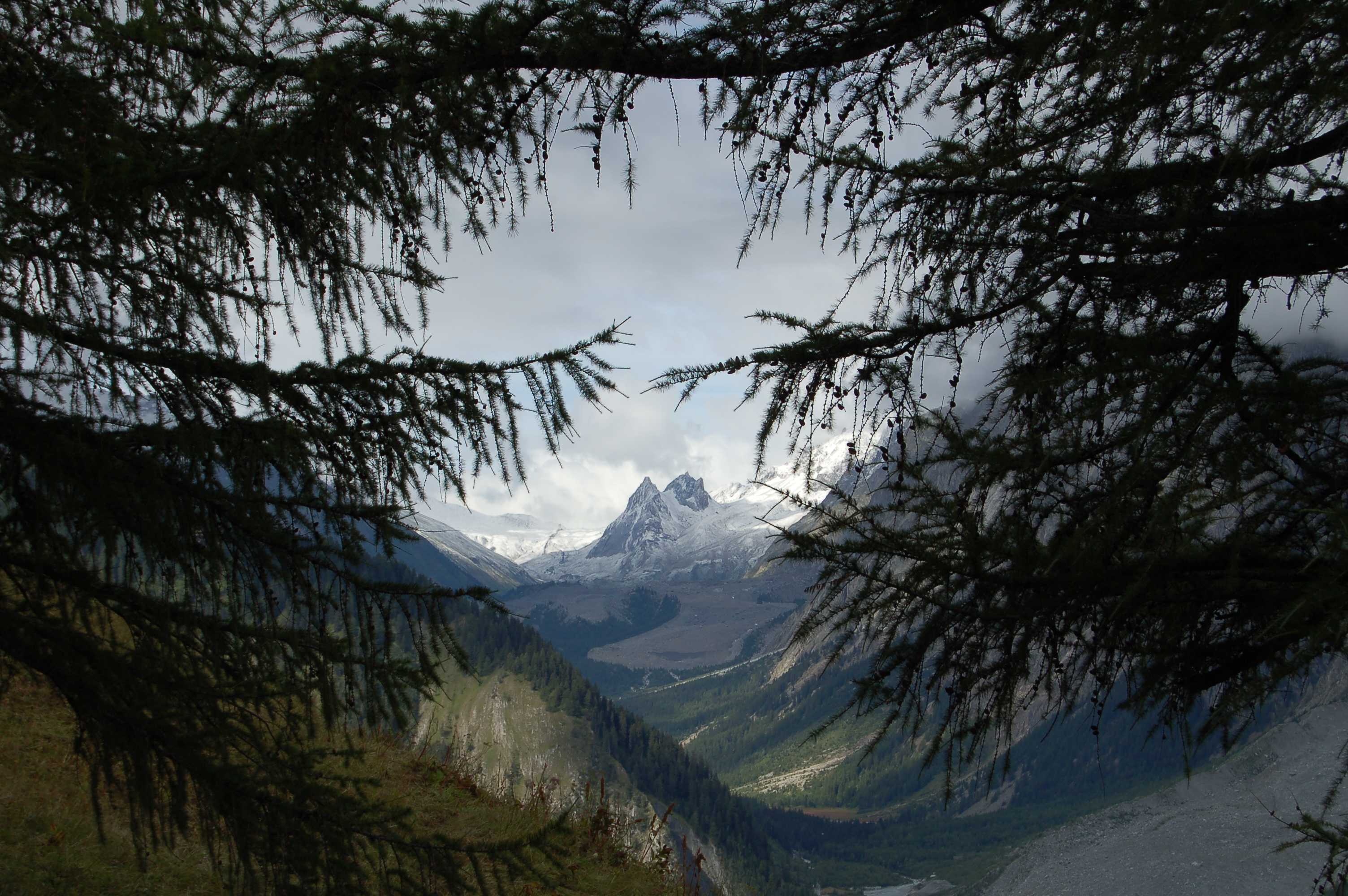
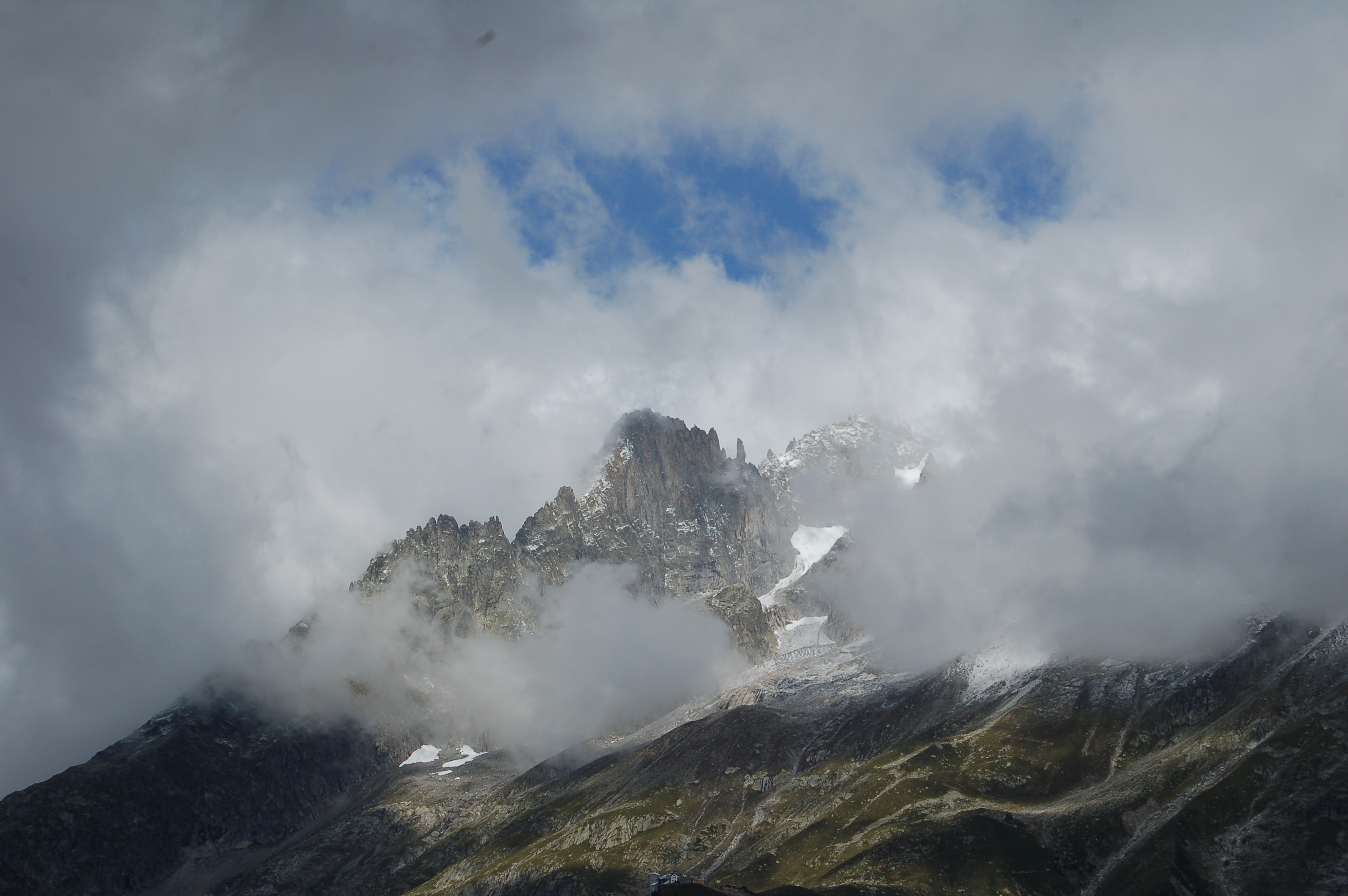
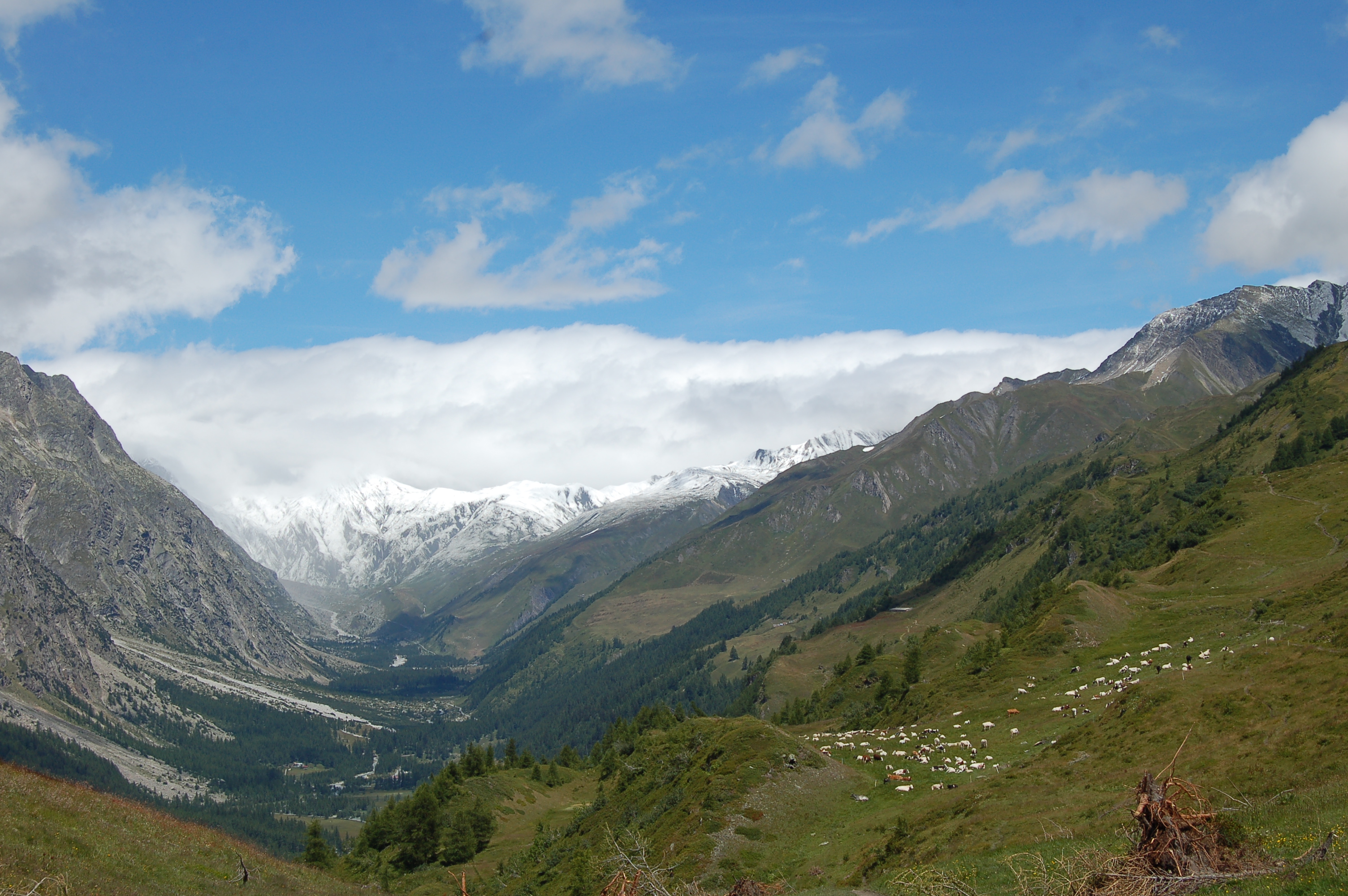
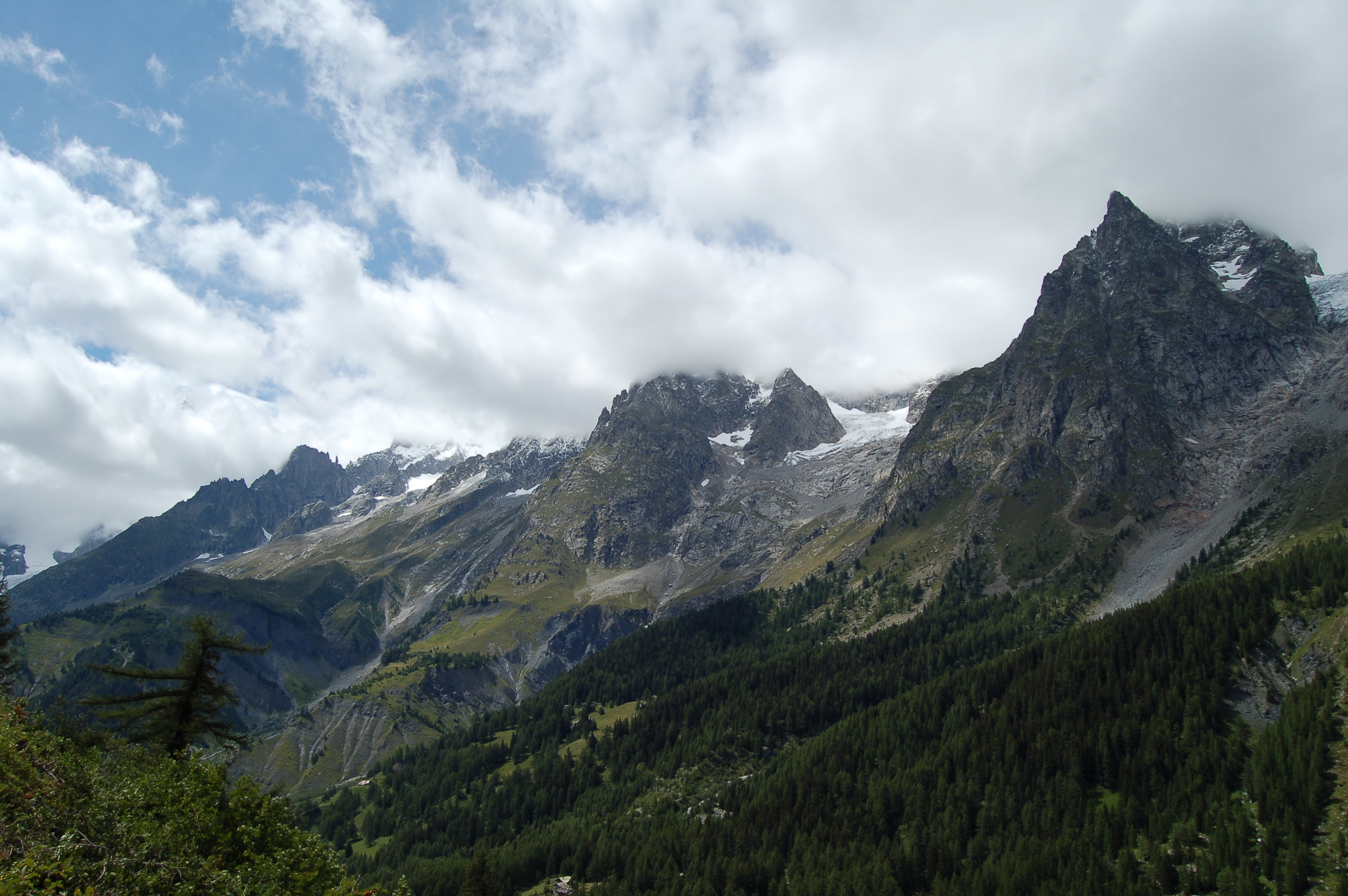
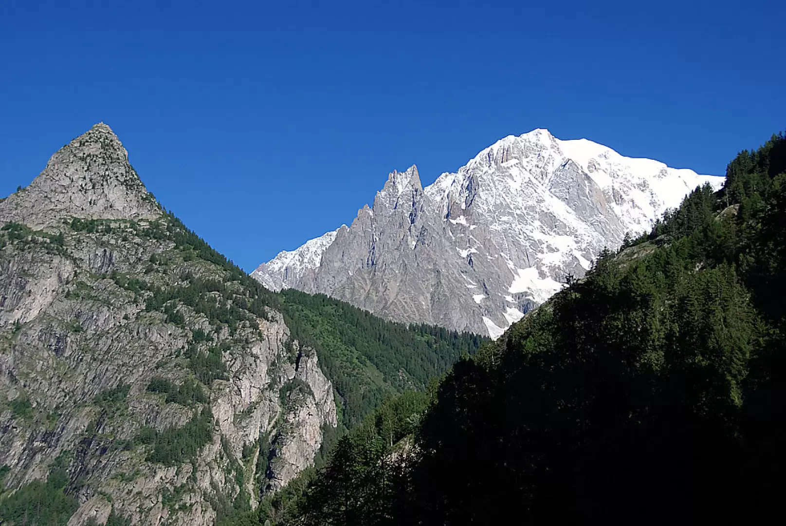
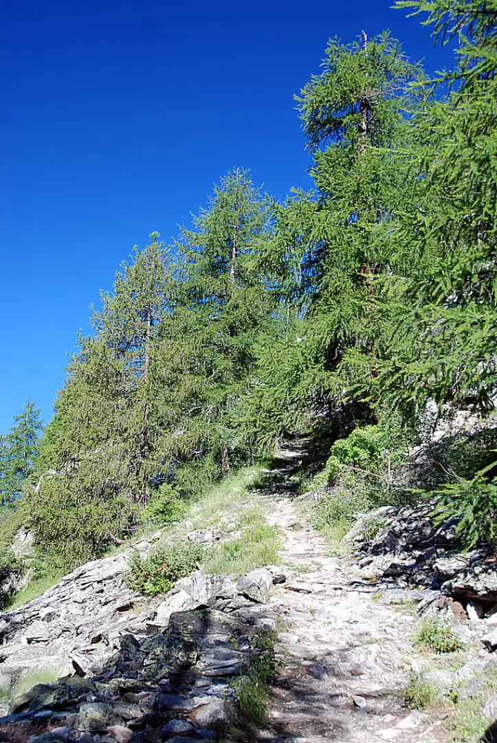
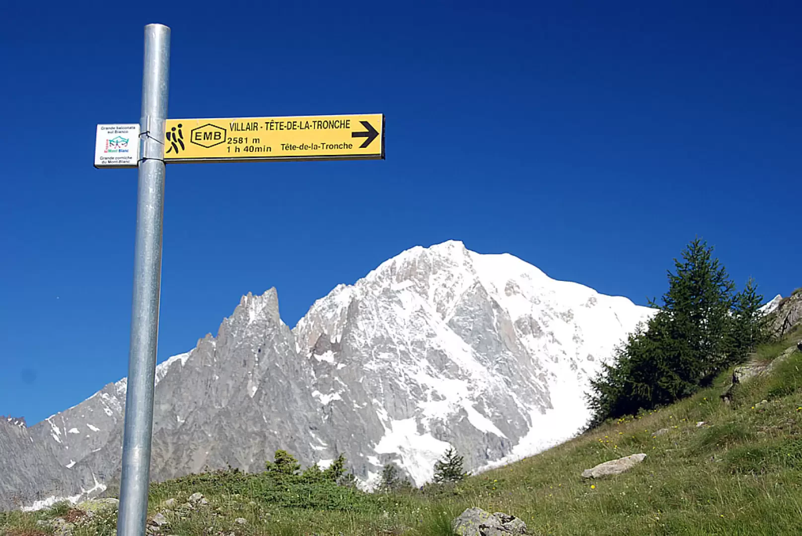
We continue the ascent through the forest, enjoying sudden panoramic views of the surrounding mountains: in the distance the mountains of La Thuile and in the foreground the mighty Mont Crammont. After about an hour's walk, the path flattens out slightly as it heads south and then begins to climb again on the last stretch of the route. Having passed a rudimentary stone bench, we finally leave the last strip of larch woodland and after 1h 25' we reach a signpost at the foot of the hut: in front of us emerges in all its splendour Mont Blanc and the unmistakable silhouette of Mont Chetif: from here we reach the hut in five minutes.
Just above the Refuge we find the alpine pastures of Le Pré (2000m) and an orientation board to enjoy the fantastic panorama of the entire Mont Blanc Massif.
General Information
Signposts: -
Type of route: a/r
Recommended period: May, June, July, August, September, October
Sun exposure: south (but very shady)
Objective Danger:none
Exposed Trails:none
Useful Equipment:
Water: Rifugio Bertone
Riferimenti Bibliografici
- Le Valli del Monte Bianco - Zavatta Luca -
- Monte Bianco Courmayeur, Carta dei sentieri, foglio 1 - L'Escursionista Editore -
Galleria fotografica
We have been there

Edited by:
Ivo Giansetto
Rifugio Bertone
Giornata molto fredda con vento discreto. Nella notte tra sabato e domenica una prima nevicata ha imbiancato le cime.