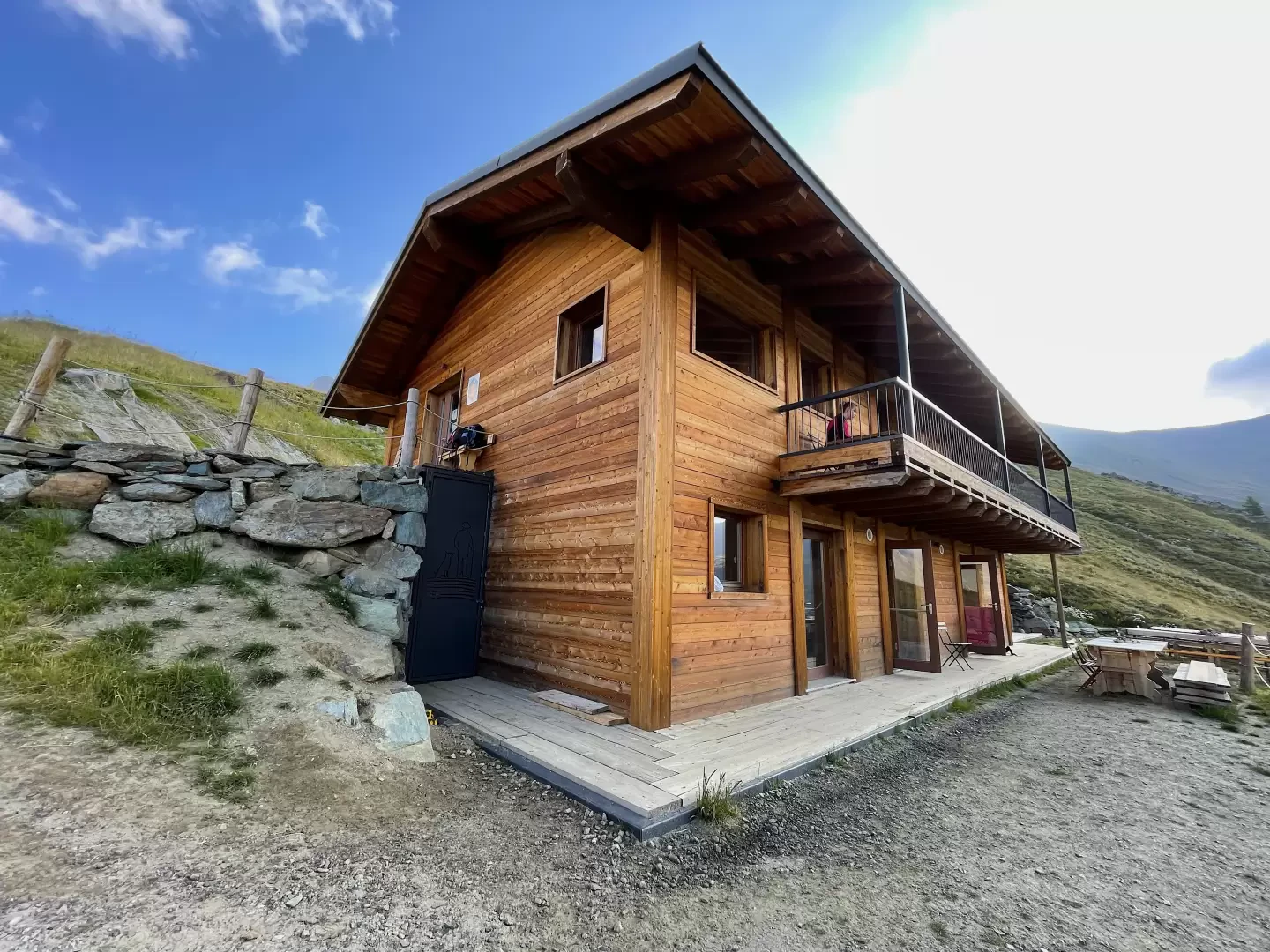
Grauson Refuge, from Gimillan

Access
Leaving the motorway at the Aosta West exit, turn right and take the regional road for the Cogne valley. After passing through the village of Aymavilles, the road enters the valley, passing through the villages of Vieyes, Epinel and Crétaz until you reach a roundabout 20 km after the motorway exit: take the second exit to continue on for 1.1 km to a new roundabout. Take the third exit following the signs for Gimillan. Continue up the communal road for about 1.5 kilometres passing the village of Montroz and, once in Gimillan, continue by turning right onto the small road where, about 200m further on, you can park in the large car park on the edge of the road.
[0h35'] - [24.1km]
- How to get there with GMAPS
- How to get there with Apple Maps
These directions are based on direct verification carried out at the time of surveying the route, so the information should be checked before embarking on the hike. We recommend using a GPS navigator or map app on your smartphone to get up-to-date and detailed directions.
Introduction
The Grauson Refuge in Gimillan, Cogne, is opened on Saturday 1 August 2020. It is newly built and is run by Francesca Zanivan, a local native, together with her family. It can accommodate up to 30 people overnight (it has a room for two people, one for four, one for six and a large room for eighteen, with a shared bathroom) and about 60 at the restaurant, where they eat typical Valdostan food. It is also a good starting point for numerous hikes, such as the Lussert Lakes, the Col de Laures, the Col de Saint-Marcel or the Punta Tersiva.
.Description
0h00' Climb up the wide path between terraced pastures until you come to the little farm road leading to Plan de Cretetta, which you should follow as far as the signpost. Along this first section of the walk, you can appreciate interesting views of the glaciers at the head of Valnontey, the Lillaz plain and, turning around, the village of Gimillan and the Pousset peak.
0h10' At the marker take the path to the right that goes almost level above Tarabouc (1831m) and the characteristic chapel dedicated to Saint-Bernard. Past the power line, the trail veers slightly to the left and enters the Vallon de Grauson. After skirting a ruin, you will come to a votive shrine and a new marker indicating the junction with path coming from Montroz (1895m).
0h20' Continue straight on for a short distance until you come to the fork for the variant to Tchezeu (1915m), which should be ignored.
0h25' The path begins to descend the eastern slope of the Truc Cretetta halfway down the valley and leads to the bottom of the valley where a small wooden bridge (1889m) allows you to cross the Torrent de Grauson near Encloseur.
0h40' After crossing the bridge, you will come to the fork between path and path to Colonna (1903m). Turn left and continue up the pastureland, keeping to the orographic left of the valley on the easy path that soon reaches the end of the Tchezeu variant (1967m).
0h50' Crossing a short strip of larch (Larix decidua), you will come to the Pila pastureland, which remains below on the left. Disregard the signs for the Cascate di Pila waterfalls, marker , and continue straight ahead, following the obvious path around the northern ridge of Mont Creya. A few bends allow you to gain height and lead to a peculiar cairn composed of stacked wooden logs. Cross another larch grove by keeping halfway up the steep slope, leaving the Torrent de Grauson gorge to the left. Past the larch forest, the Crouzet farmstead appears on the left and, shortly afterwards, the pleasant plateau of Grauson dèsot is reached. After reaching the cross, which remains on the left, you will come to the junction for path leading to Lake Money and Mont Creya: continue on path along a short downhill stretch on the lovely green plateau where it joins path , which is the winter access route to the gorge and the cottages of Grauson dèsot (2273m).