Refuge de la Barma, from Coumarial

Edited by:
Maurizio Loconti
Updated at: 10/03/2025
Access
Leaving the motorway at the Pont-Saint-Martin exit, after 100m turn right and you will come to a first roundabout, take the second exit. A little further on you come to a second roundabout: take the third exit, and you enter the town of Pont-Saint-Martin. After a few hundred metres you come to the start of the road to the Valle del Lys: turn right and follow it for 10.2km, passing the villages of Lillianes and Fontainemore. About one kilometre after the village, turn right and follow the signs for Pian Coumarial. Cross the Lys and climb up the communal road for about 7.3 km, passing in sequence the villages of Colombit, Pacoulla, Pianpervero, Jugeo, Chouchal, Pra Dou Sas, Cios, Challasc, Colla, Grange, Savaroy, Goy and Coumarial until you reach the large car park at the end of the road. In the adjoining picnic area there is a fountain 💧 for refilling water: there are no other water points along the route.
[0h30'] - [18.9km]
How to get there with GMaps
How to get there with Apple Maps
The information provided here has been verified on the date of the survey of the route. Before setting off, it is advisable to ensure that no substantial changes have occurred on the route to the starting point. We therefore recommend the use of the satellite navigation apps provided by Google or Apple for up-to-date and detailed directions.
Introduction
The trip to Valle d'Aosta is a long way from Liguria in terms of kilometres, but in terms of timing it is not dissimilar to several trips made in the past (for example, to Malga Zanoni the car journey, a little onerous for the driver, took almost two hours, one way or another...). And that's how you get out at the first tollbooth in Valle d'Aosta at Pont S. Martin (1h50 of travel respecting the limits, no effort to drive because after Ovada and up to Ivrea it's almost all three lanes + emergency, straight, with no bends, tunnels, bridges, zero traffic - which is all backwards...). Even motorway costs are still almost acceptable.
Description
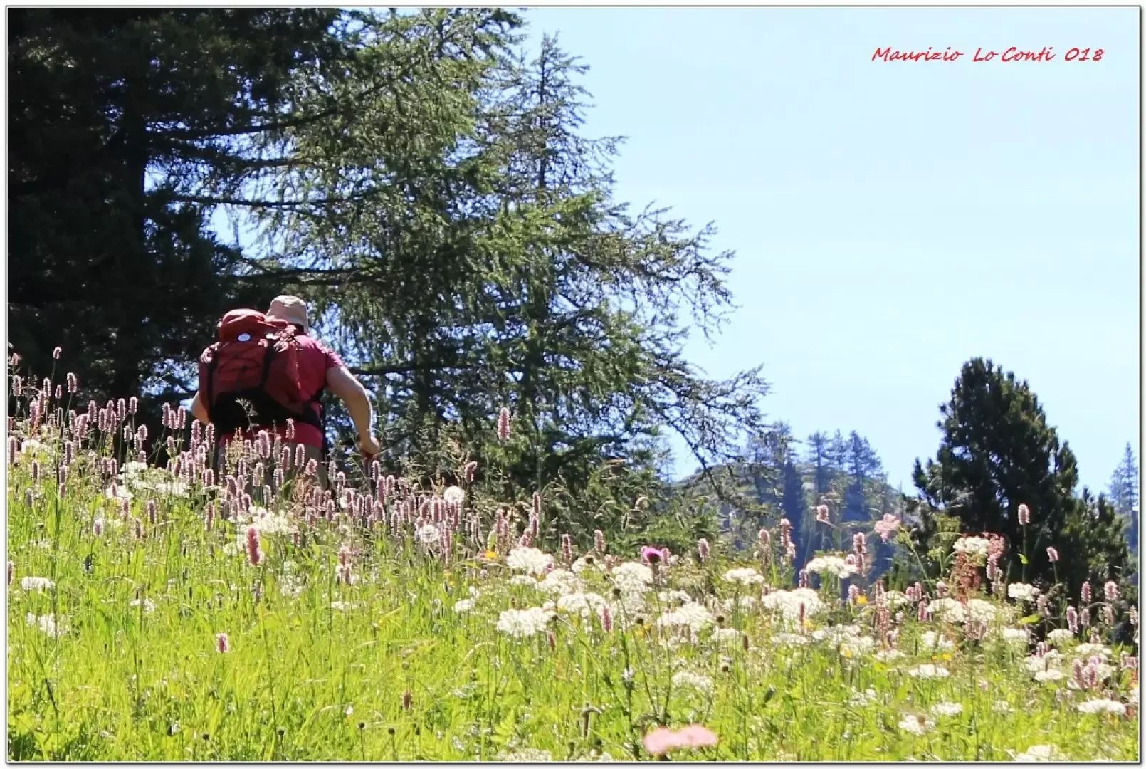
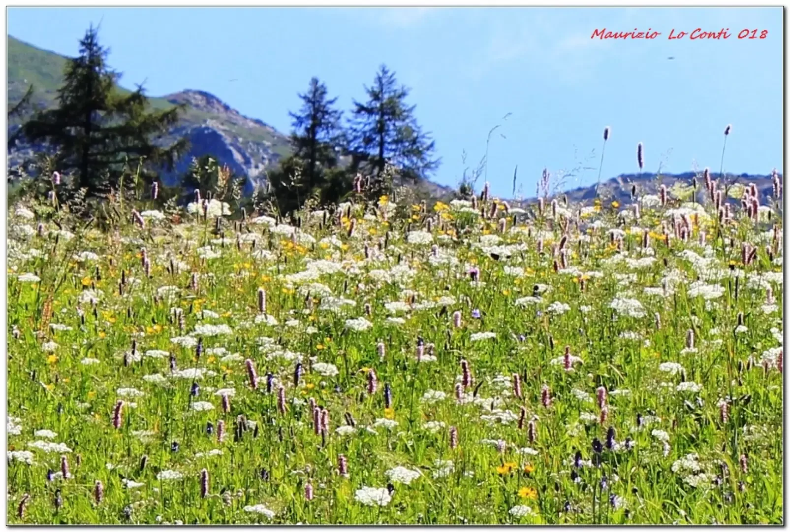
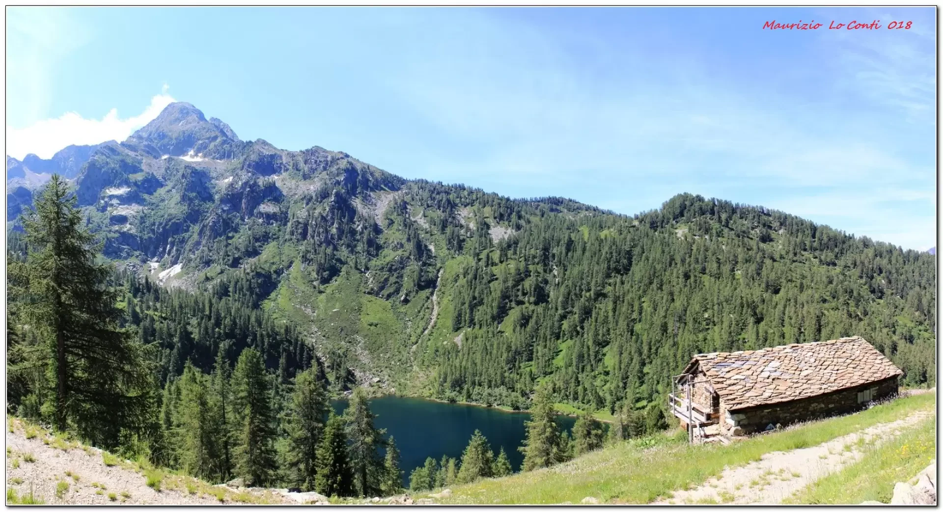
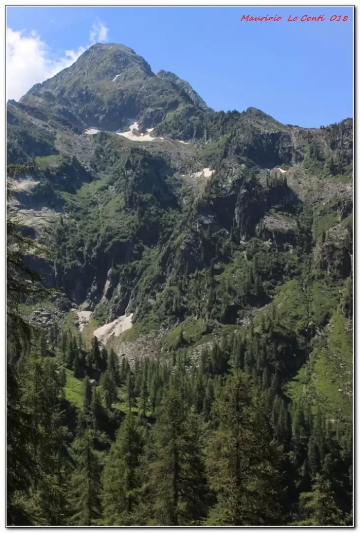
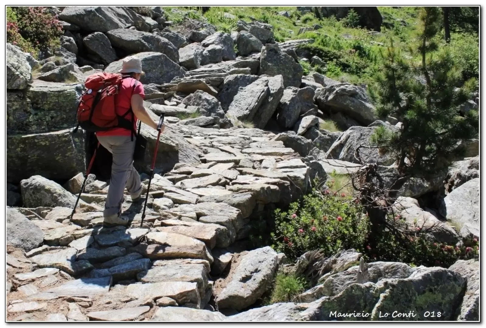
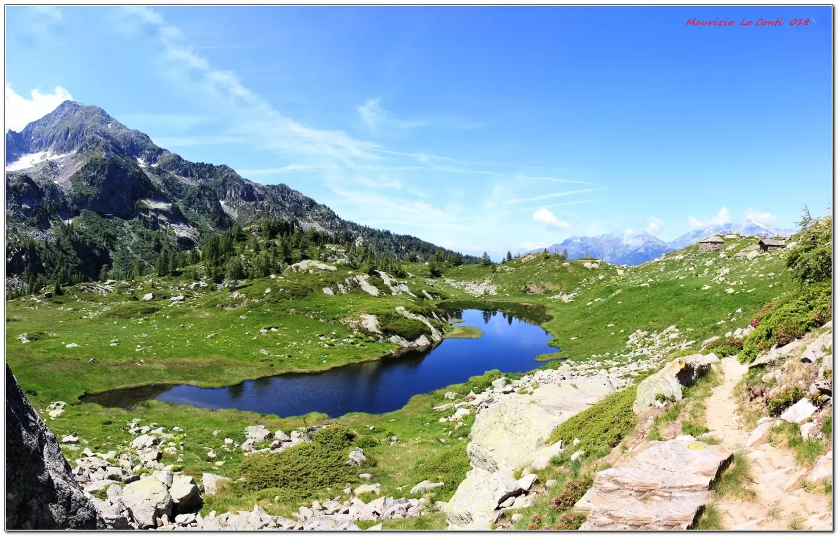
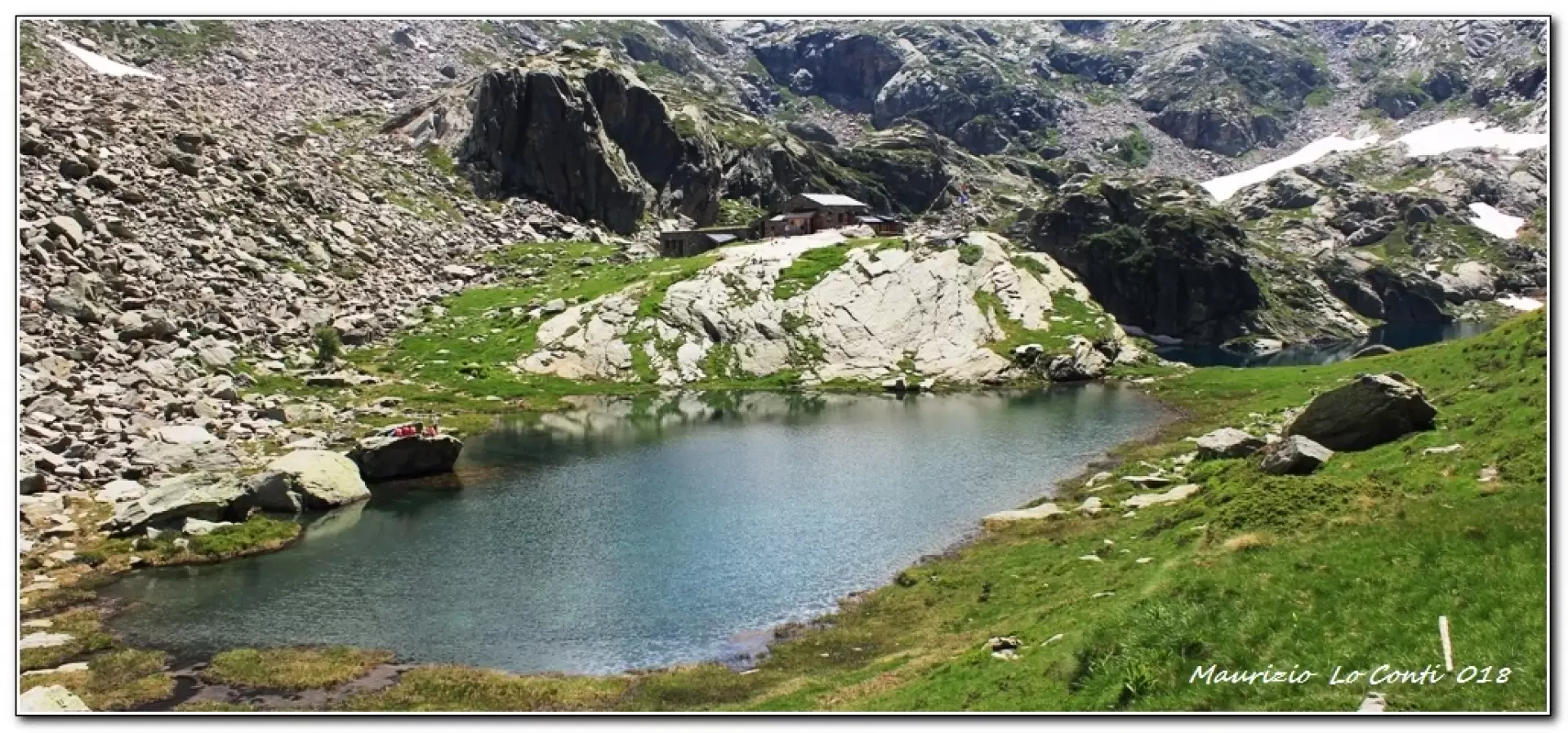
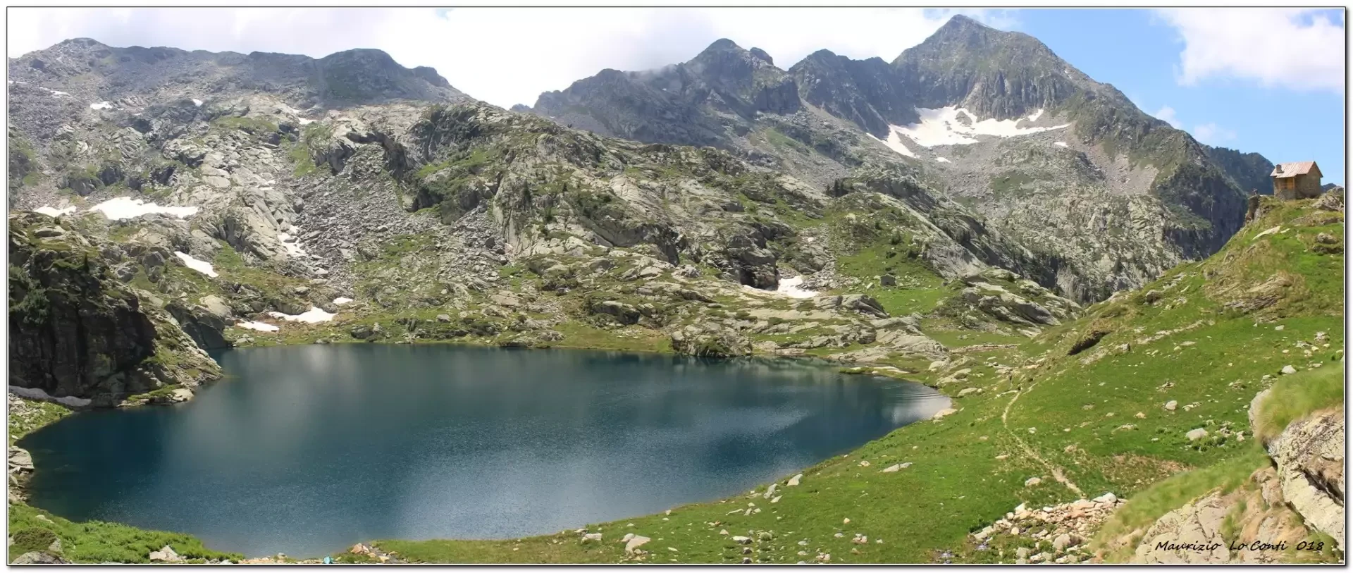
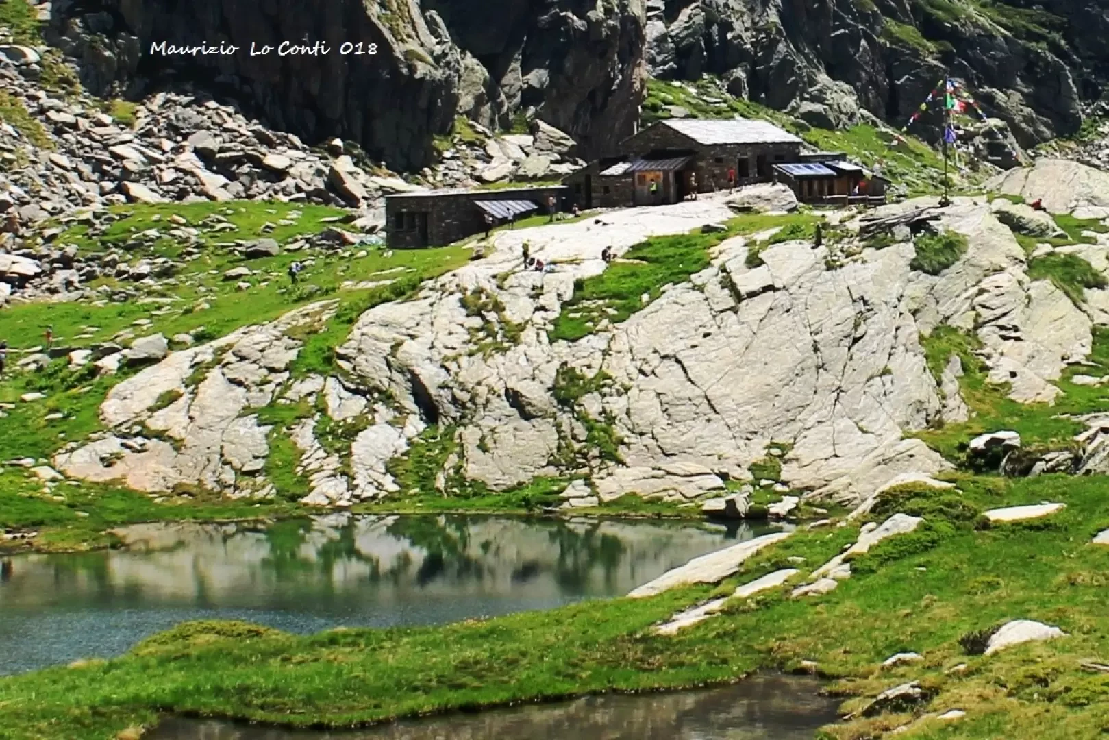
Finally, we set off on foot, at first following the asphalt road (1450 m) and then a beautiful forest track in the forest that occasionally has wooden gymnastic equipment at its edges. In less than 30 minutes, losing a little altitude, you join the dirt track that climbs from Pillaz. You thus enter the Pecoulla valley and climb up to Lake Vargno. Here you leave the track and ascend through flower-filled meadows, passing several mountain huts. Further on, you proceed on a nice paved road and reach Lac de Lé Lounc. You now face the most strenuous point of the hike, having to climb a path that in hairpin bends gains about 100 metres in altitude, passing an imposing rocky spur. You will then reach the Barma lakes and the brand new hut of the same name, which was only opened a few weeks ago (3h in all on the outward journey - 2040m - low diff. until the first lake, then medium).
The hut is very beautiful and it is a pleasant place to rest and eat.
The return journey takes about 2h15.
The total difference in altitude is almost 800m (680m ascent and 110m return). T/E about 5h15 Tot. + all breaks to see the various sights.
http://www.rifugiobarma.it/ - rifugiobarma@gmail.com - tel. 393311087009 (advisable always to give advance notice of arrival...)
Photo file pdf:
http://cralgalliera.altervista.org/RifugioBarmaAo018.pdf
Other outings 2018:
http://cralgalliera.altervista.org/altre2018.htm
http://cralgalliera.altervista.org/anno2018.htm
Other trips in the Aosta Valley
http://www.cralgalliera.altervista.org/GiteValleDAostaC.htm
NB: in case of an excursion, always check with FIE, Cai, eventual Park Authority or other institutions, pro loco, etc., that there have been no changes that have increased the difficulties! No liability is accepted. The present text is purely indicative and not exhaustive.
Info Hiking Section Cral Galliera: http://www.cralgalliera.altervista.org/esc.htm
Trips 2018 at link: http://www.cralgalliera.altervista.org/gite2018.pdf
General information
Path:from Pian Coumarial
Signposts:
Type of route: a/r
Recommended period: June, July, August, September
Exposure to the sun:West
Objective Danger:none
Exposed Trails:none
Useful Equipment:normal equipment for day hiking
Water: Pian Coumarial
Galleria fotografica