Piazza Cavrèe, from Nogaredo

Edited by:
Marco Bonati
Updated at: 02/12/2025
Access
From Milan to Novate Mezzola along the state road . At the beginning of the village, on the left and under the railway, take the provincial road 'Trivulzia' that leads through the various hamlets of the municipality of Samòlaco. You reach the village of Nogaredo and follow it uphill until you find a car park near a road marked as "blind".
Introduction
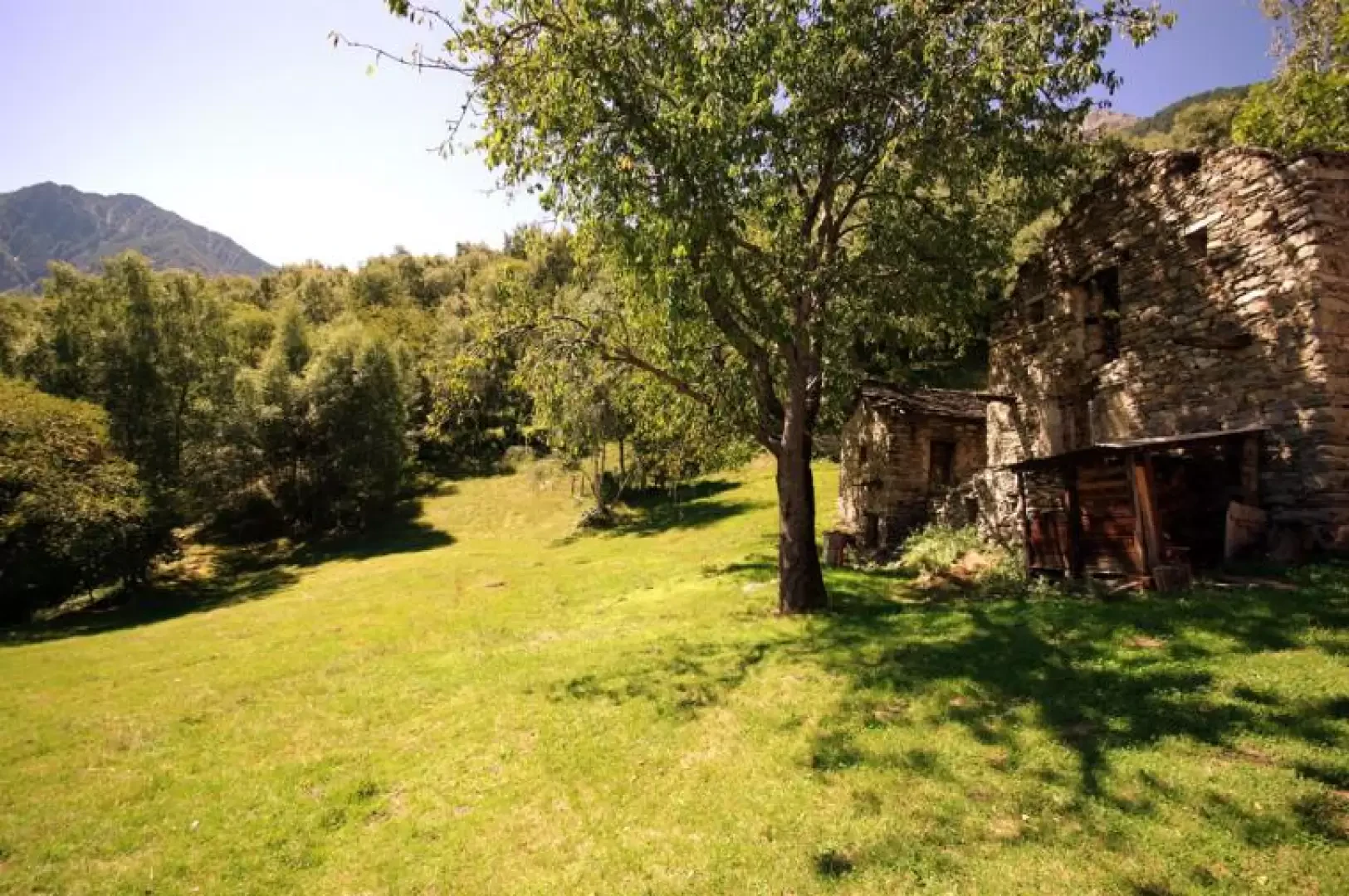
This is a completely circuitous hike that takes us to two of the area's main maggenghi. Along the ascent, we come across an erratic boulder well known in local myths and legends: el sas de la sc'tria (the witch's stone) has on its sides the evident marks left by the chain used by the witch herself in an attempt to roll it over the villagers who did not please her.
Description
We climb up the dead-end road 220 m and continue briefly when it becomes a dirt track, until we come to a mule track on the left, marked with yellow paint - we are on the Via Francisca, in the intermediate section (between Via Spluga and Via Regina) of the Como-Coira route -. We follow the track to the left for a few metres and come to the Sasèl huts 240 m; next to the most restored one starts the path - marked white/red) that we must follow. It immediately climbs steeply and stony in the depths of the abandoned centuries-old chestnut grove: in what must have been clearings, we encounter frequent ruins of huts, each with its own cherry and walnut tree for the family's traditional supply. In the vicinity of the largest cluster of disused huts 370m wide, the path tends to get lost, but it turns uphill to the left and begins to climb briskly again. You pass among gigantic chestnut tree trunks that have collapsed over the decades, near the aforementioned sass de la sc'tria and climb up to an exposed and panoramic hump over the Valchiavenna (Mot de la Mugnina 576m). The ascent continues on the rocky and gravel path that leads to a Capèla di cresc'ton chapel leaning against the ridge overlooking the gorge of the Bolgadregna stream. A few hundred metres along the edge of the crest lead to the meadows of Piazza Cavrèe. Having crossed the clearing, down towards the south, one notices a very wide and well-maintained path that, in ups and downs, ends up among birch woods on an asphalted road (Era - Paiedo municipal toll road). Follow it uphill for a few bends to reach the centre of Paiedo. Taking it instead downhill, with a long, monotonous and inevitable (lack of shortcuts) series of hairpin bends, we arrive at the car park of the church of Sant'Andrea al Mot. Before continuing on towards the valley floor, it is worth making a diversion to the church and its cemetery, which was abandoned in 1812; there are also the battered ruins of a castle/lookout tower. Back on the tarmac road, immediately leave it to the left to take the stony mule track equipped as a via crucis that leads to Era. Here - watch out for the yellow signs - you will find the Via Francisca again, which, with a flat route between clusters of abandoned houses, takes you back to Sasèl, just a few steps away from the car.