Forno Pass and Muretto Pass, from Chiareggio

Edited by:
Marco Bonati
Updated at: 03/09/2024
Access
From Milan to Sondrio along State roads 36 and 38; at the roundabout at the entrance to the town turn left towards Valmalenco. Go up the provincial road to the roundabout at Chiesa Valmalenco where you continue in the direction of Chiareggio. On reaching the small hamlet, there is ample parking by the stream.
.Introduction
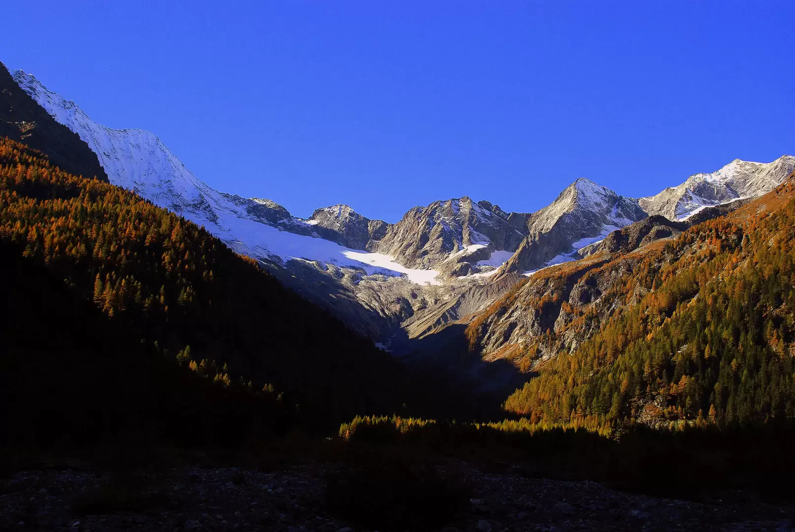
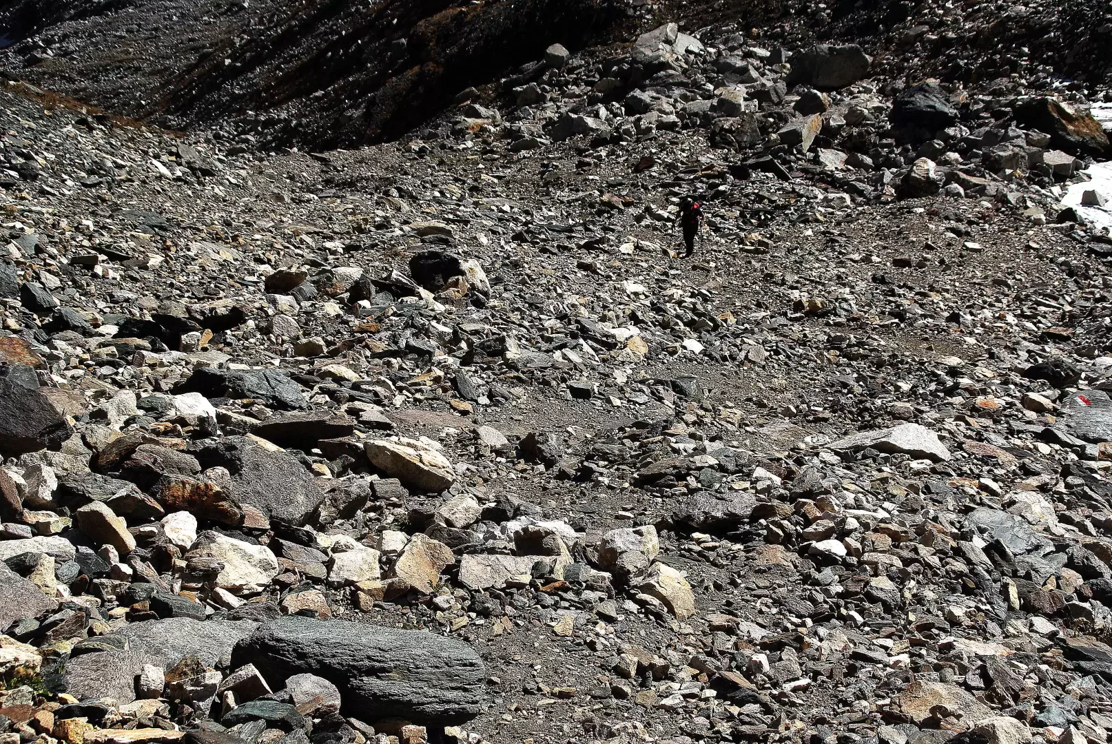
Long hike over strenuous high-altitude terrain: you walk for several hours over multi-coloured scree (an area of great petrographic and mineralogical interest) to unite the two most accessible passes linking the Valmalenco with the Canton of Grisons in a single outing. The route is recently and clearly signposted and takes place in Italian territory or near the border line. It was equipped by Swiss guides and at present (autumn 2010) some hemp handrail cables are sheared by stone discharges at the most exposed point of the route. The panorama is quite extensive over the peaks surrounding the upper Valamlenco, but the focus of attention is drawn to the dark glaciers of the north face of Monte Disgrazia. The descent from the Passo del Muretto to Chiareggio takes place along a beautiful mule track - of military construction dating back to the early 1900s in its current appearance - that has been in use since at least the Middle Ages.
Description
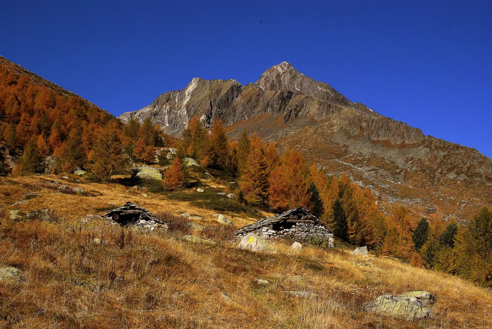
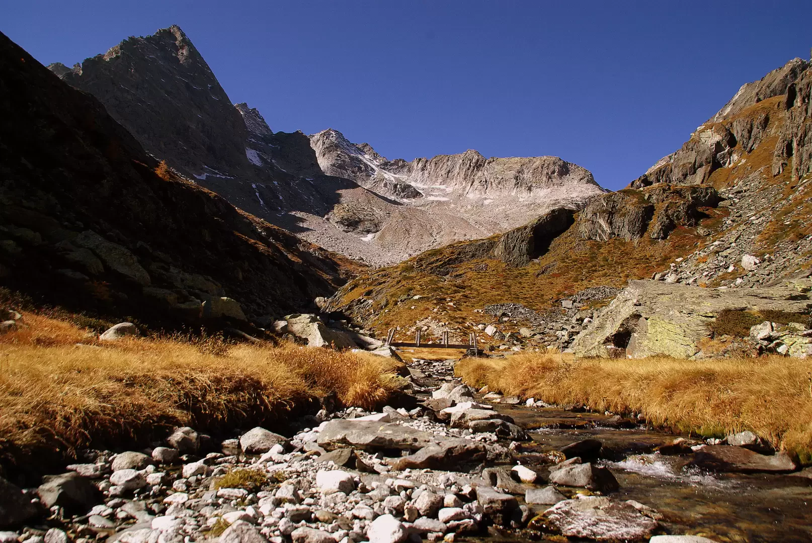
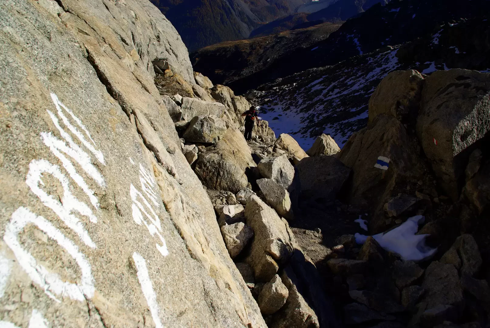
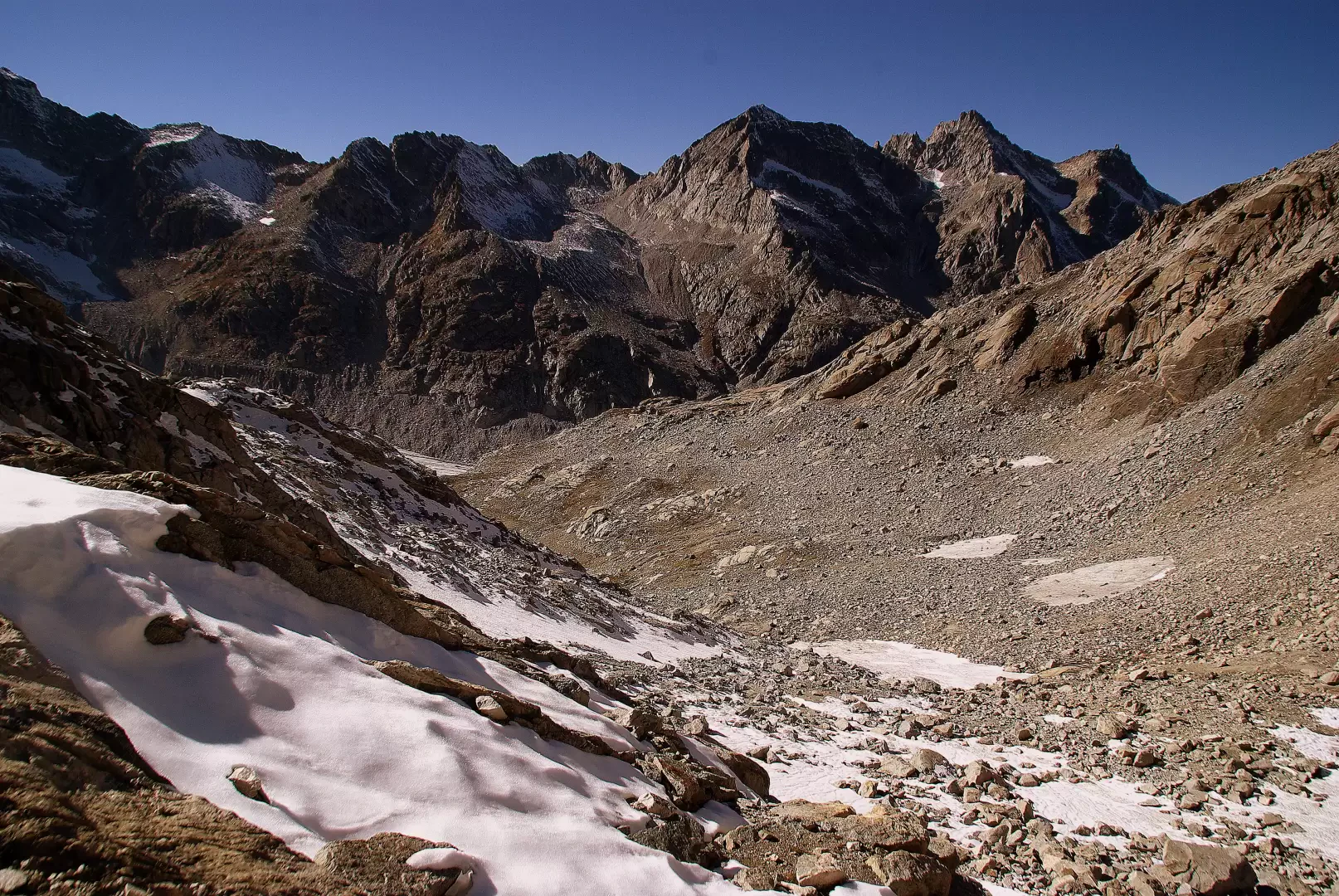
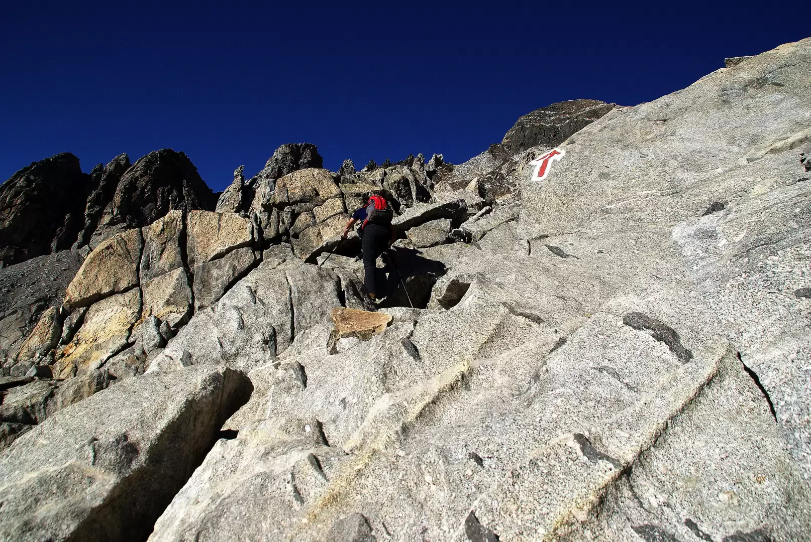
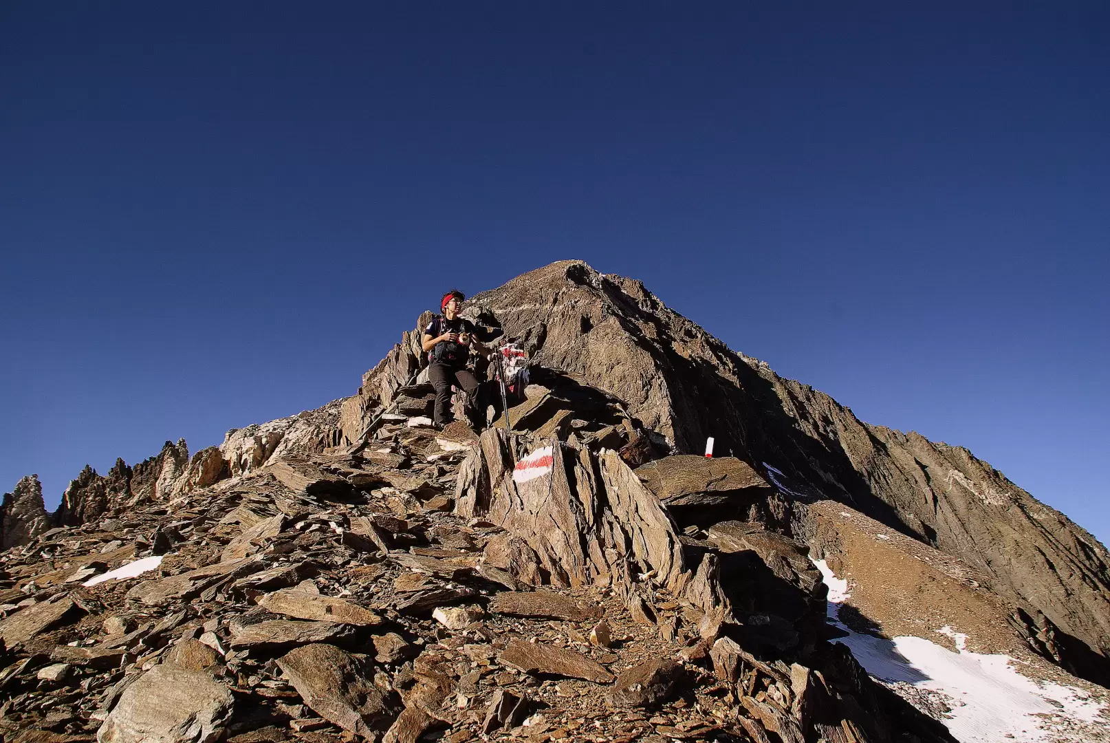
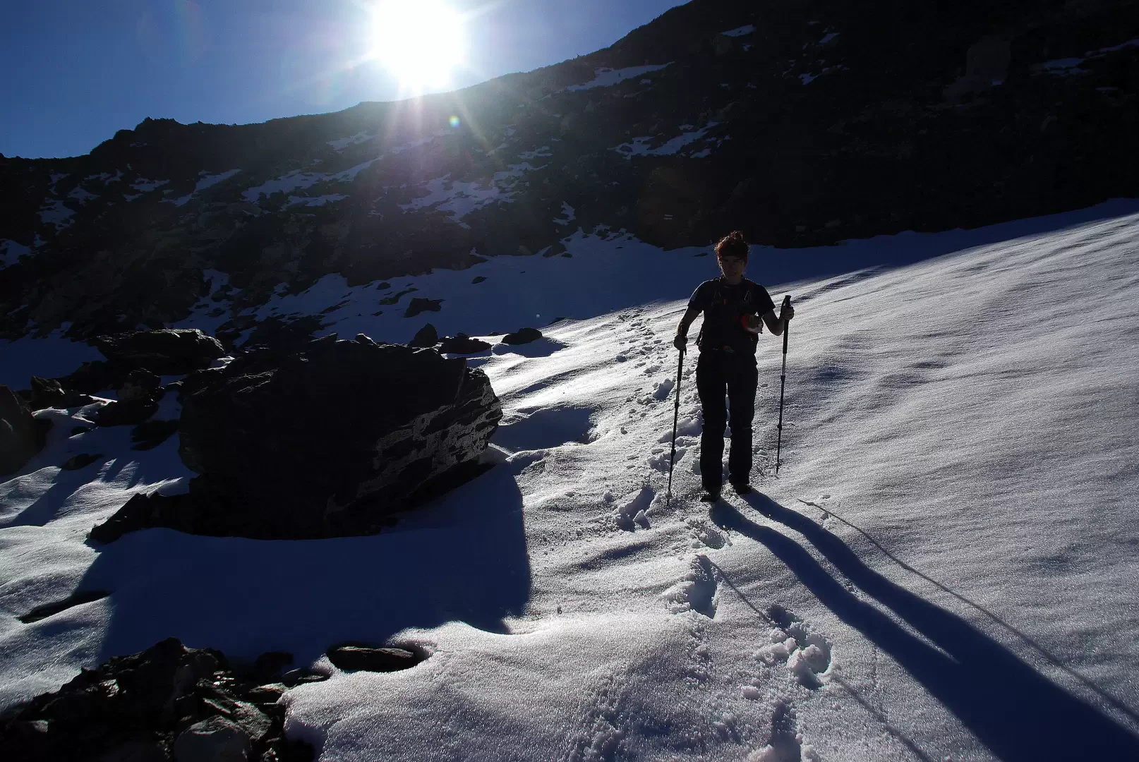
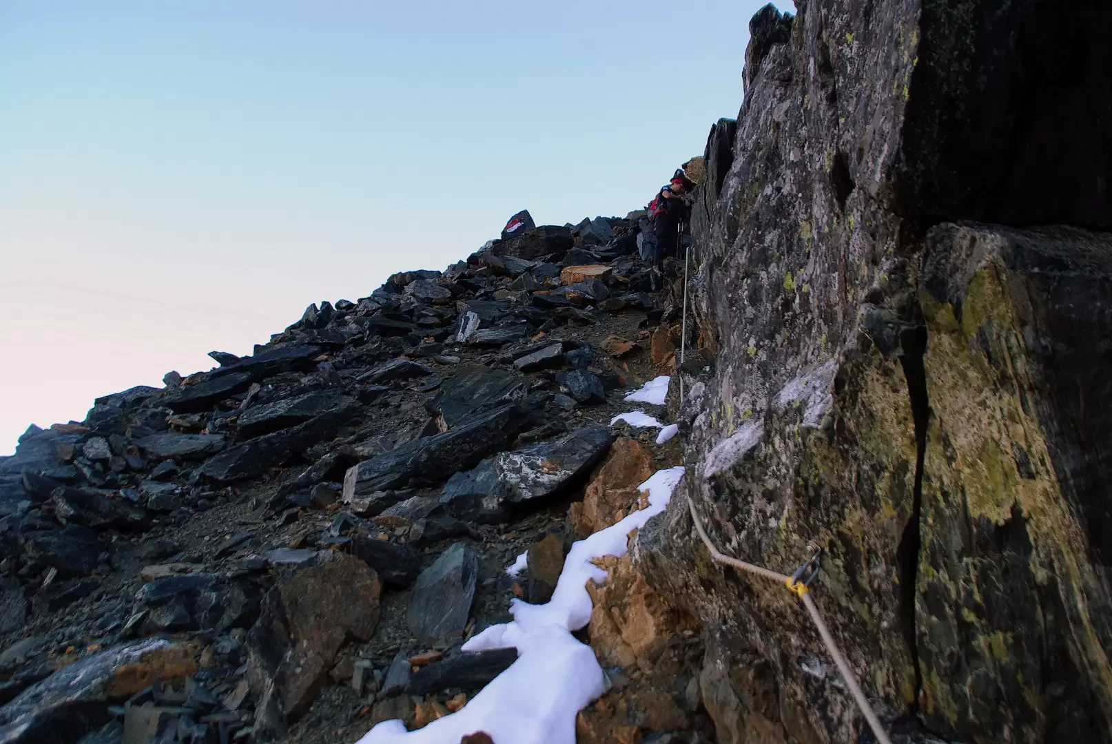
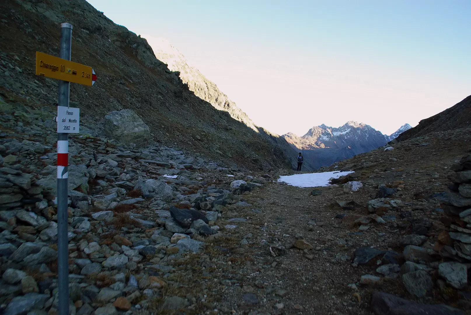
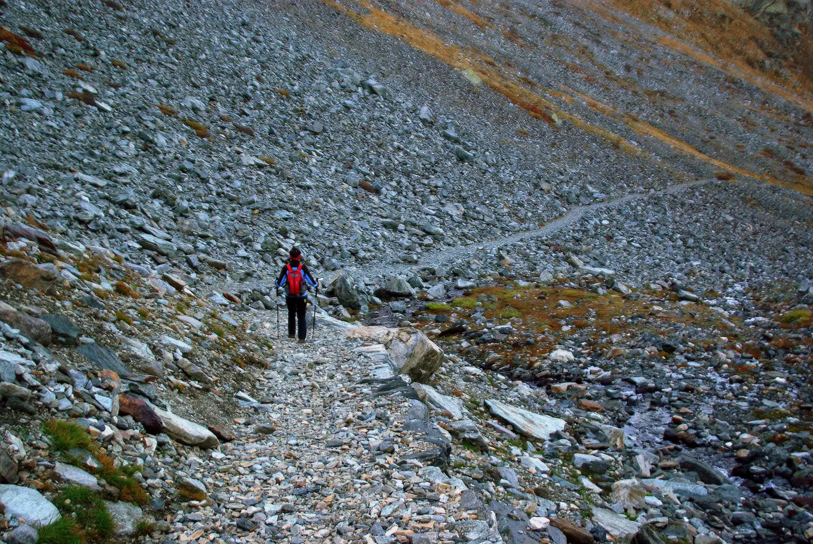
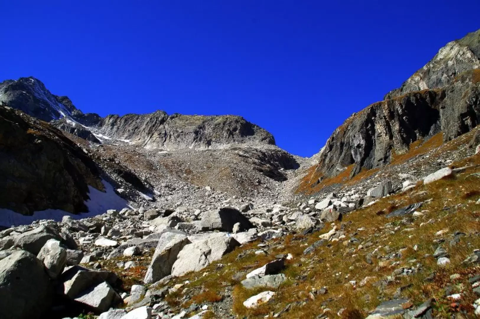
From the bottom of the valley at Chiareggio 1612 m, continue along a dirt track until you cross a bridge not far from the Forbesina huts 1656 m; on the other bank - well signposted - a path branches off that climbs up through a wide larch wood and soon leads to the pastures of Alpe Vazzeda Inferiore 1832 m. A path with similar characteristics also leads to the above-mentioned and abandoned Alpe Vazzeda Superiore 2033 m. From here, still ascending on a good path, we begin to cross with a long diagonal towards the Val Bona furrow, descending from the Passo del Forno and lying between the buttresses of Monte del Forno and Monte Rosso. Before reaching the bottom stream, the branch of the trail that returns to Chiareggio via Alpe Monterosso Inferiore is left to the right. Cross the Val Bona stream and leave - again on the right - the path for Alpe Monterosso Superiore and Val Muretto. From this point, the pass is clearly visible and the real ascent among the stones begins: you walk on rocks of all types (schist, limestone, gneiss, granite) and of all sizes (from sands to boulders). The last stretch - more comfortably - can be followed a short distance from the signs along an innocuous ice slab of modest inclination. The arrival at the Passo del Forno 2775 m does not open up an exceptional panorama to the eye: a section of glacier can be seen at the bottom of the valley and a rocky backdrop conceals the building of the Capanna del Forno. Right at the pass (clear markings), the signposted route for the Passo del Muretto branches off: at the start, a few short steps on granite slabs lead to a stony ascent of the wide SSE shoulder of Monte del Forno. When you reach the border ridge at 2944 m (the so-called "Belvedere del Disgrazia", at the junction with the normal route to Monte del Forno), go back down: new interminable rocks to cross, guided by marker pegs, until you reach a short series of very exposed and unstable landslide channels (equipment with bolts and hemp cables, not particularly reassuring). From here, a faint trace in the stony pastureland leads to a small valley (presence on a hump of a modern masonry building, always closed) that precedes the arrival at the Passo del Muretto 2562 m, the main point of communication between Valmalenco and the Canton of Grisons. For the return to Chiareggio, all that remains is to follow the beautiful military mule track that begins at the pass for a good 8 km: very long traverses interrupted by short series of hairpin bends for the regular loss of altitude lead to the level of the larch woods at the junction (left) for Alpe dell'Oro 2010 m. The route continues with numerous wide hairpin bends (here the military road is used as a private forest track) through dense woodland until reaching the first houses in Chiareggio.
General information
Trail signposts:yellow, red/white, white/blue/white
Type of route:circular
Recommended period of time:July, August, September
Mountaineering grade I
Objective Danger: unstable rocks, landslide gullies
Sun exposure: southeast
Exposed sections:with dubious equipment
Galleria fotografica