Oratory of Blessed Emeric, from the Castle of Quart

Edited by:
Massimo Martini
Updated at: 04/03/2025
Access
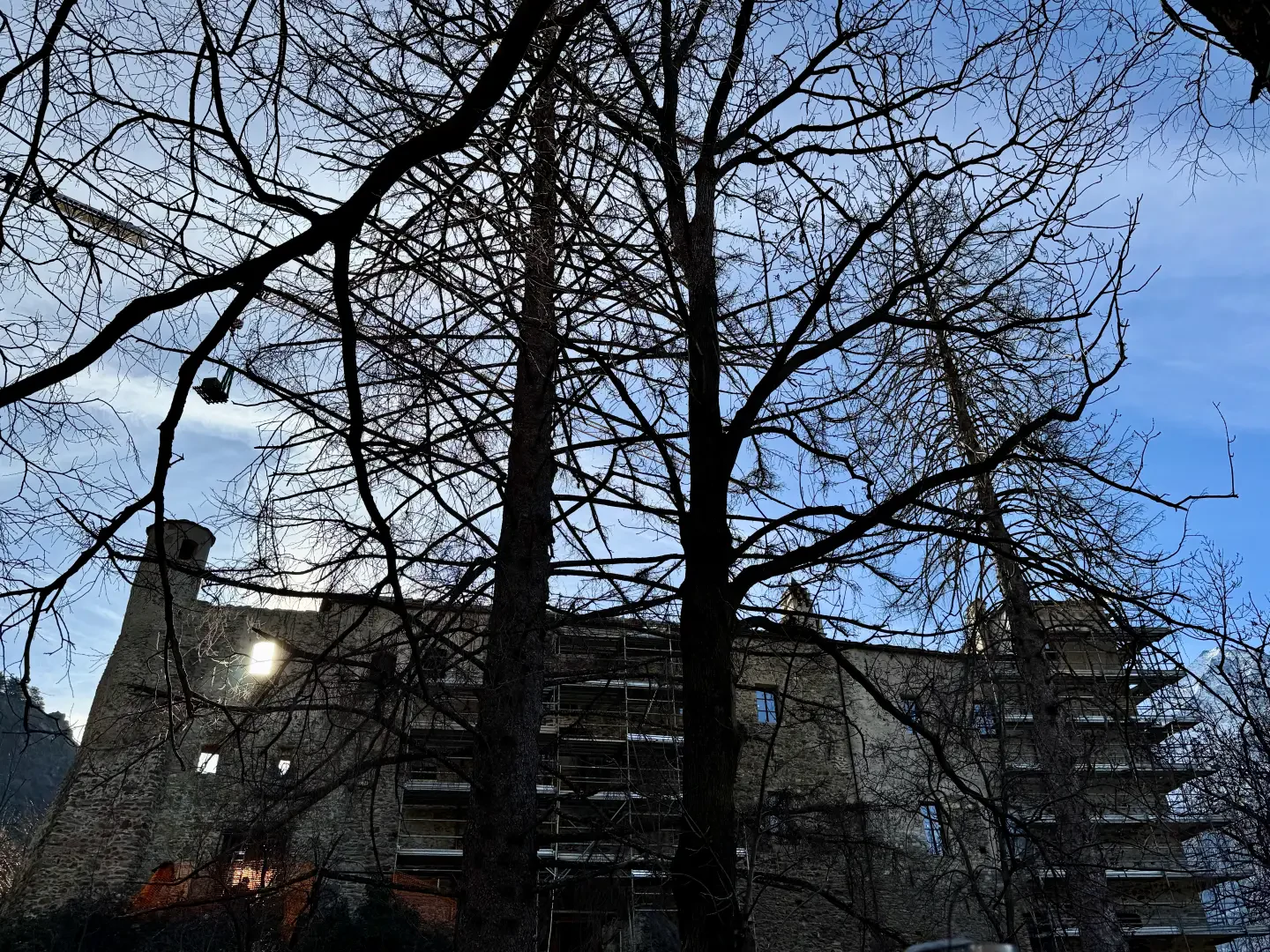
Leave the motorway junction Aosta East, turn right and enter the roundabout. Take the fourth exit, then continue for 100 metres to the next roundabout. Take the first exit to join the Regional Road . Drive 1.6 km along the regional road, crossing Villair, until you reach a junction located shortly after the Unité des Communes du Mont-Émilius. Turn left, cross the village of Vianoz and, after about 400 metres, keep right to continue on a narrower road. Pass through the village of Valerod, then turn right and continue out of the village. Continue along the narrow road for 800 metres until you reach the free car park 🅿️ of Quart Castle. 🚧 The car park is currently unavailable due to renovation work on the castle.
Turn left, drive up the narrow road for 200 metres until you reach the Ru Souverou and Prévôt information board. You can leave your car on the roadside, where a couple of parking spaces are available.
Distance and travel time
🕒 Travel time: 8 minutes
📏 Distance: 4.2 km
GPS navigation
📍 How to get there with Google Maps
📍 How to get there with Apple Maps
Important note
The information provided has been checked on the date of the survey of the route. Prior to departure, it is advisable to check any changes to the route. For up-to-date and detailed directions, we recommend the use of Google Maps or Apple Maps.
.Introduction
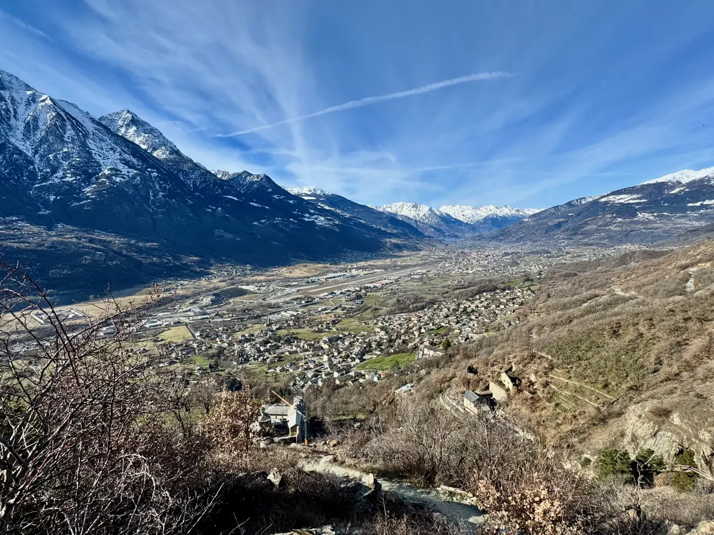
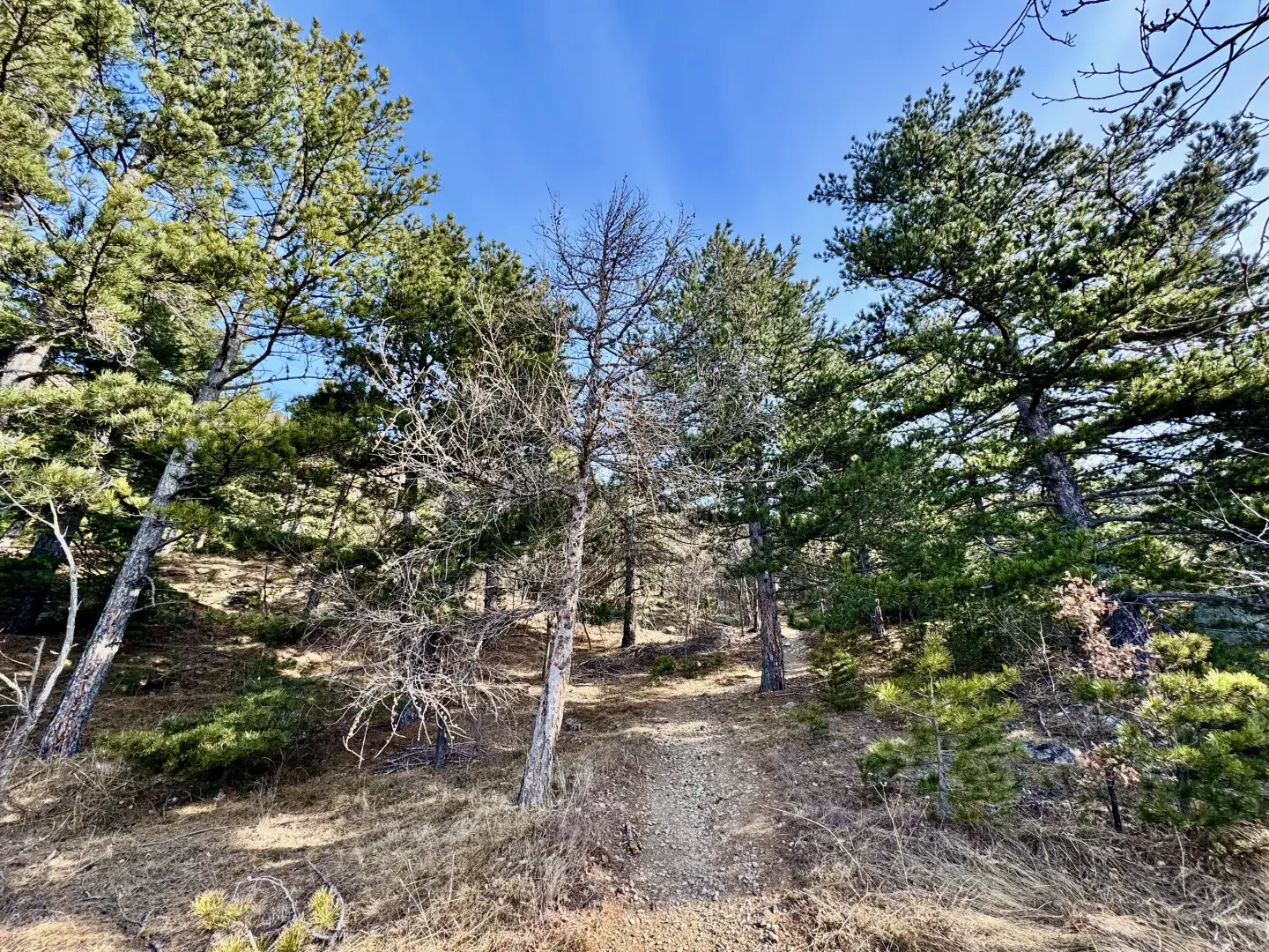
The excursion to the Oratory of the Blessed Emeric of Quart is a suggestive itinerary that starts from the medieval Quart Castle, leading the visitor through a fascinating alternation of woods and panoramic clearings. The final destination is the Oratory of the Blessed Emeric, a small place of worship immersed in nature and linked to the figure of the Blessed Emericus of Quart, making the route not only a naturalistic experience, but also a journey into the history and spirituality of the territory. The trail covers a distance of 4.5 km with a difference in altitude of about 400 metres, crossing environments characterised by broadleaf forests, pastures and panoramic viewpoints offering splendid views of the Aosta Valley. Along the way, several information boards illustrate the historical and naturalistic aspects of the area, enriching the excursion with interesting insights. Among the typical flora, one can admire the black pine (Pinus nigra), the Scots pine (Pinus sylvestris) the downy oak (Quercus pubescens) and the common juniper (Juniperus communis), the latter being particularly present in the sunnier areas.
This hike is recommended in all seasons: in autumn, the landscape is tinged with warm golden hues, while in winter the path can be walked with snowshoes in case of snow. According to tradition, the Blessed Emeric used to go to this very spot to pray, leaving the imprints of his knees impressed in the rock, a detail that adds an aura of mystery and charm to the site.
⚠ WARNING: Due to the renovation work being carried out at Quart Castle, access to the path has been temporarily modified.
Description
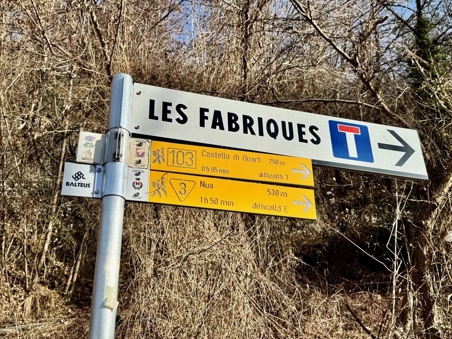
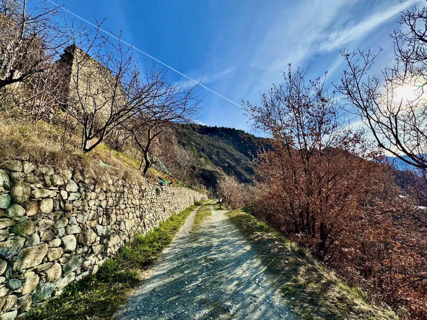
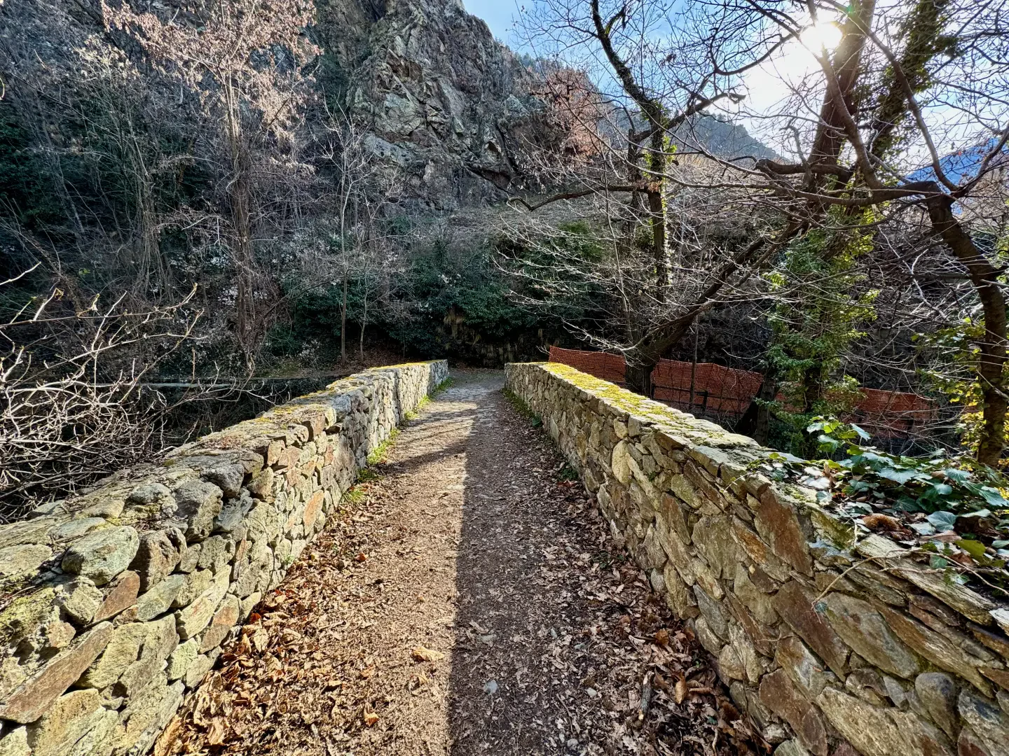
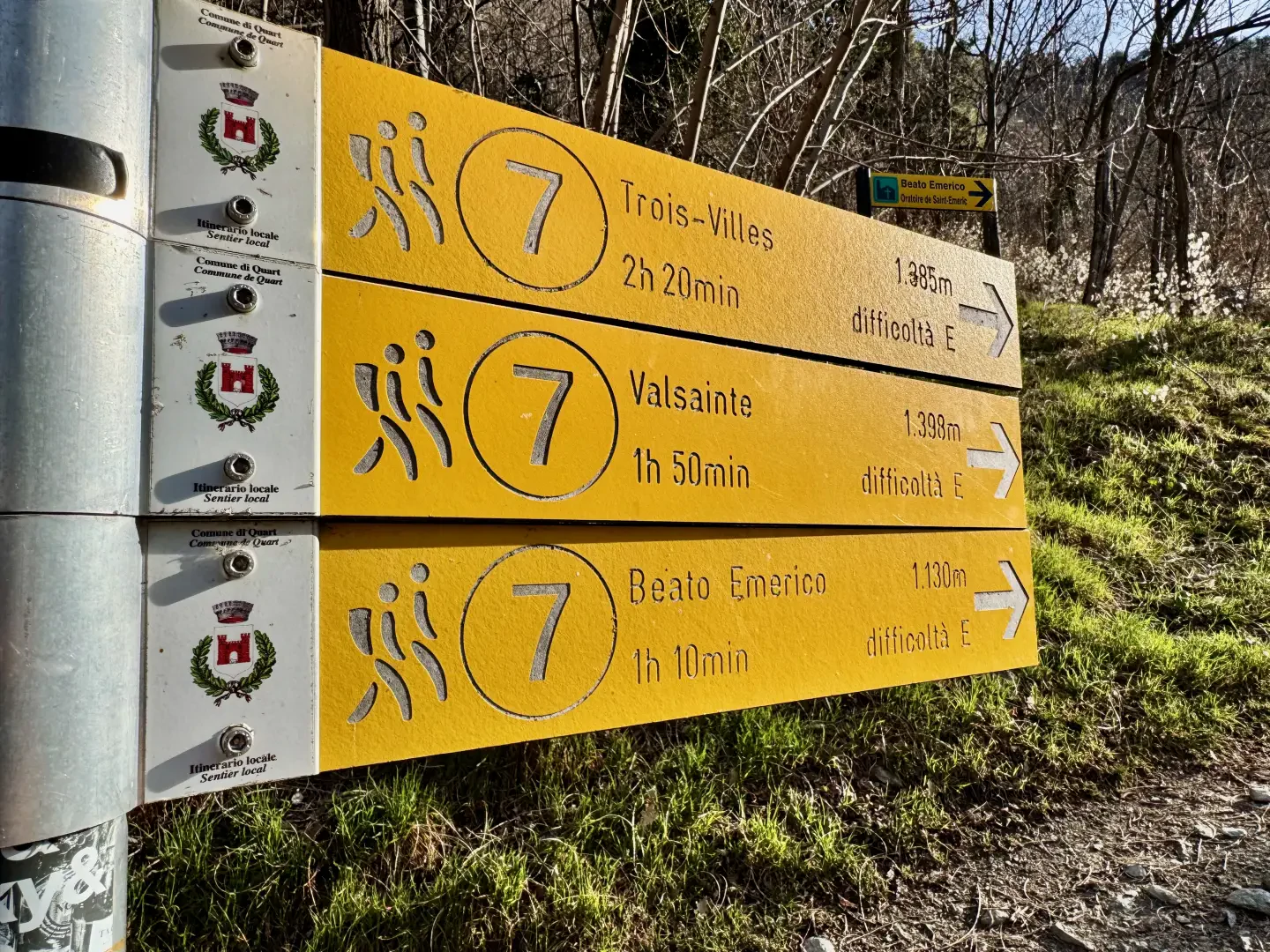
0h00' 0.00km Take the dirt track that climbs slightly to the right of the municipal road. Continue to the vegetable gardens, where the path flattens out, and reach the junction of a path on the right. Walk down the path to a picturesque stone bridge, cross it and turn right, passing the castle mill and a signpost. Turn left onto a dirt road and walk along it for about one hundred metres until you come to another marker post, which points the way to your final destination.
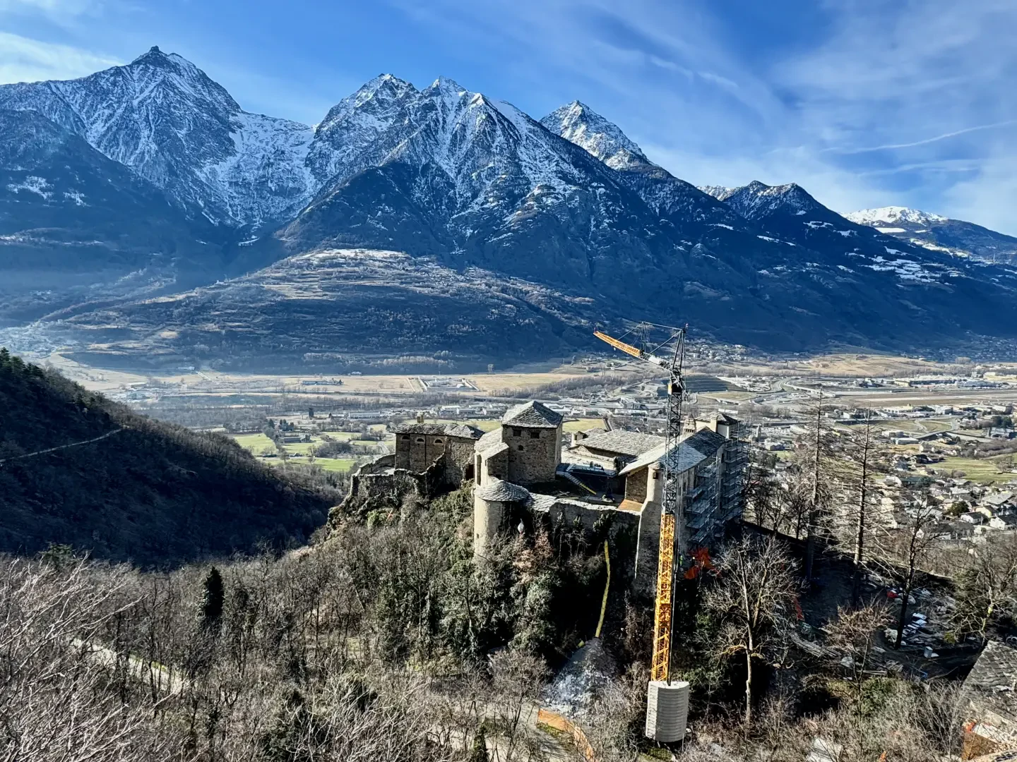
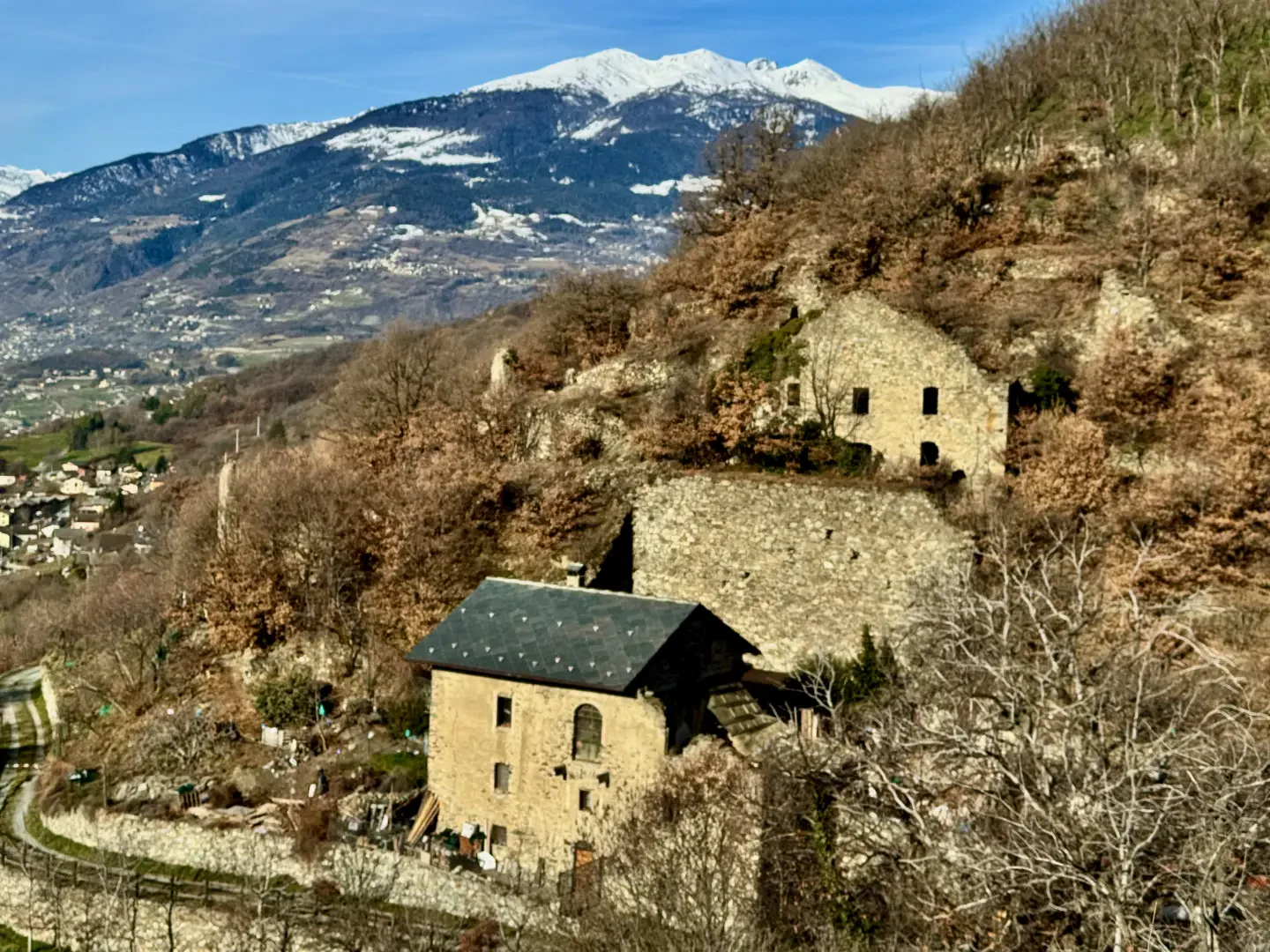
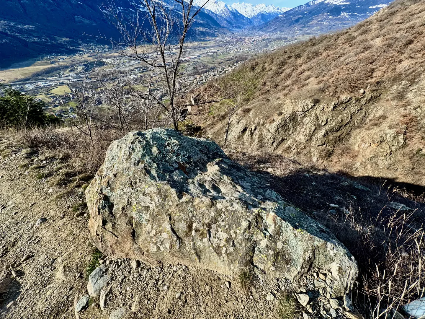
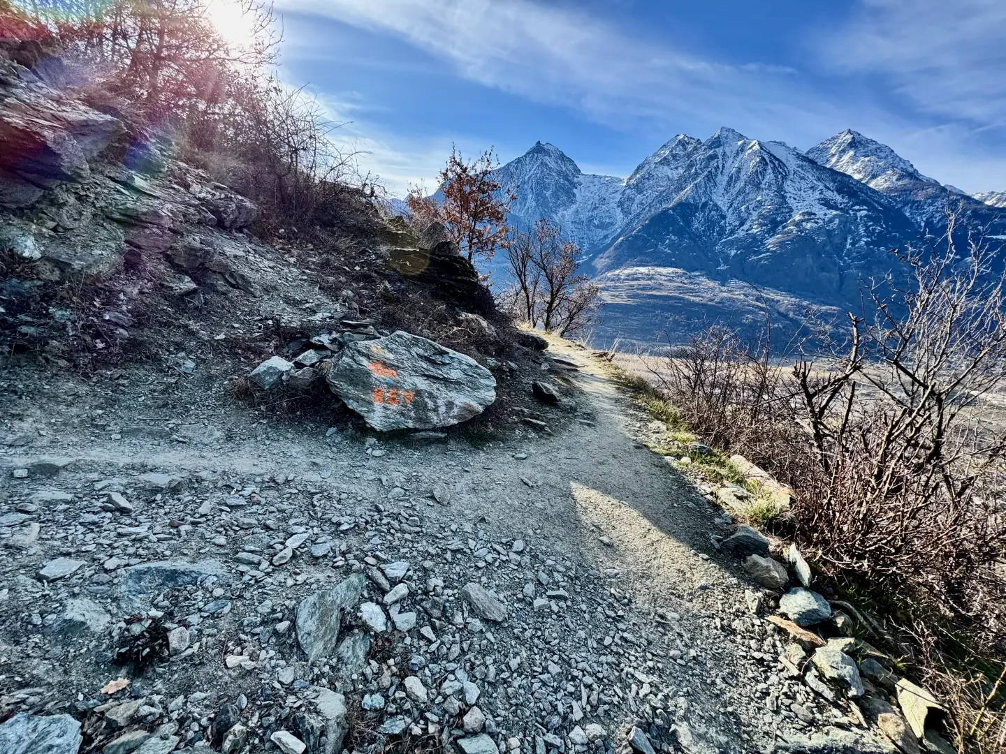
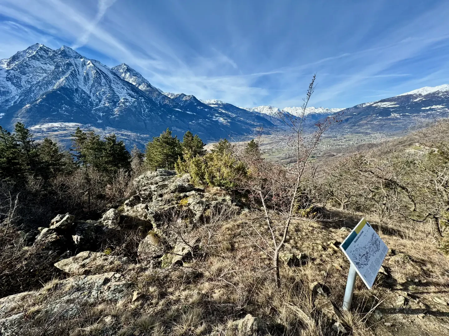
0h05' 0.36km Take the path on the left, which climbs steadily up a slope that is initially barren, with scattered shrubs and alpine grassland. After a few hairpin bends, leave the sparse vegetation and reach a vantage point with a view of Quart Castle, where there is a wooden bench and an explanatory panel on the history of the castle. After a short stop, continue along the path that veers to the right, keeping to the orographic left of the Vallon du Château de Quart. Along the way, one can observe downy oaks (Quercus pubescens) and juniper trees (Juniperus communis L.), typical species of xerothermal environments. A few bends soften the slope, allowing us to reach a solitary boulder with prehistoric cup-marks and rock carvings dating back to the Bronze Age. Next to it, there is a second information panel dedicated to the Fabriques, ancient structures clearly visible opposite.
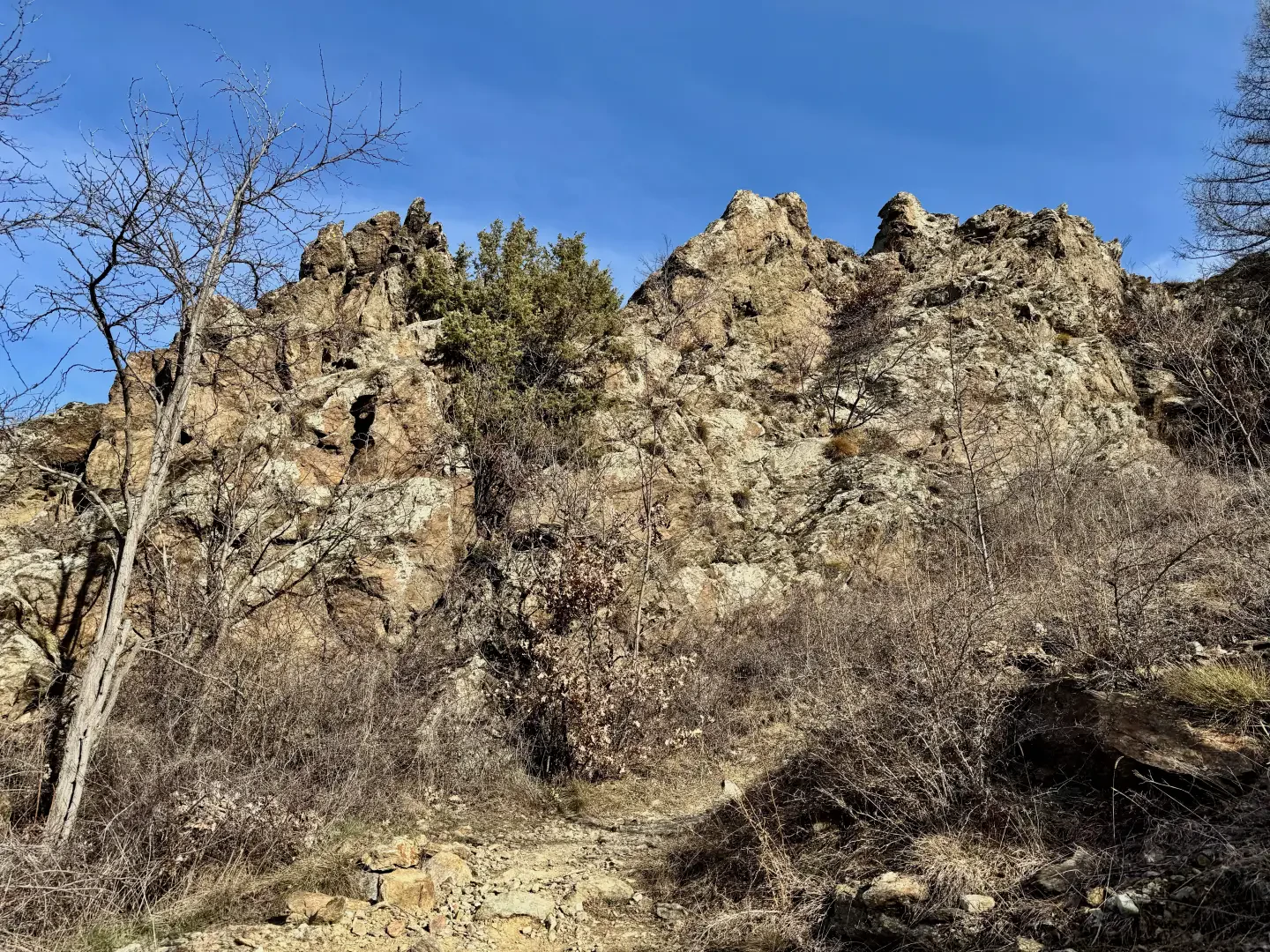
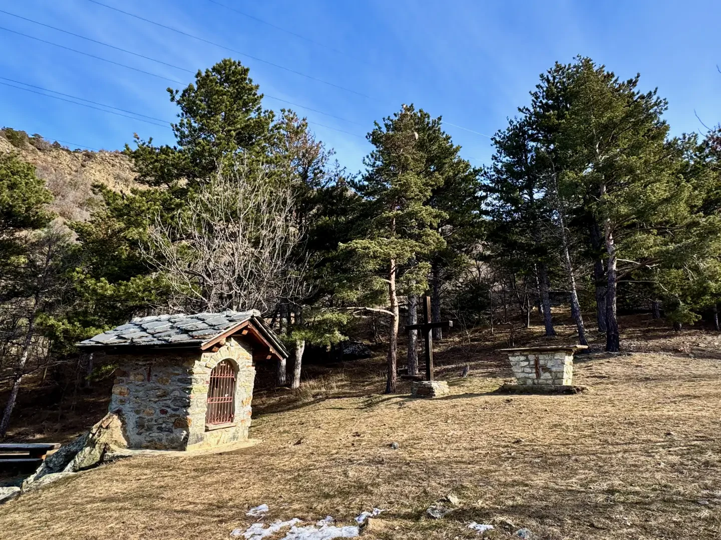
0h30' 1.00km Ignore the path on the right that leads to the village of Éclou and continue along the main route, climbing the slope, which gradually increases its forest cover. Suggestive views of the Aosta Plain open up among the trees. Explanatory panels and splendid specimens of black pine (Pinus nigra) are encountered along the way. The path flattens out, follows a few long hairpin bends and then begins to climb again near a rocky section. After a few twists and turns, a small clearing is reached, where the Oratory of the Blessed Emeric (1,125m) 1h10' 2.24km is located, immersed in the silence of the mountain and accompanied by a cross, an altar and a series of benches with tables, ideal for a rest after the climb.
The return trip follows the same route as the outward journey, retracing the path until returning to the starting point 1h10' 2.24km .
Points of Interest
Collections
Galleria fotografica