Bocchetta della Crocetta, from Bodengo

Edited by:
Marco Bonati
Updated at: 20/02/2026
Access
Da Milano a Novate Mezzola lungo la statale 36; poco oltre la stazione ferroviaria svoltare a sinistra sottopassando i binari e imboccando la provinciale "Trivulzia". Proseguire fino a Gordona e comprare il pass (attualmente 5 euro) per la Val Bodengo in vendita presso il Bar "Doc" e il bar "La Füs". All'uscita dal paese svoltare a sinistra seguendo le indicazioni turistiche per la val Bodengo. Proseguire fino al villaggio di Bodengo, dove si trovano ampi piazzali di parcheggio.
Introduction
Beautiful excursion around the terminal cirque of the Val Bodengo on a route that joins three contiguous pastoral areas: the Swiss Val di Cama, the Como Val Darengo and the Chiavenna Val Bodengo. The cross-border route - long and in winter very dangerous - was much frequented by smugglers; now that those times are long gone, the route is about to be made easier by the construction of a luxurious bivouac at the Avert del Nodar.
Description
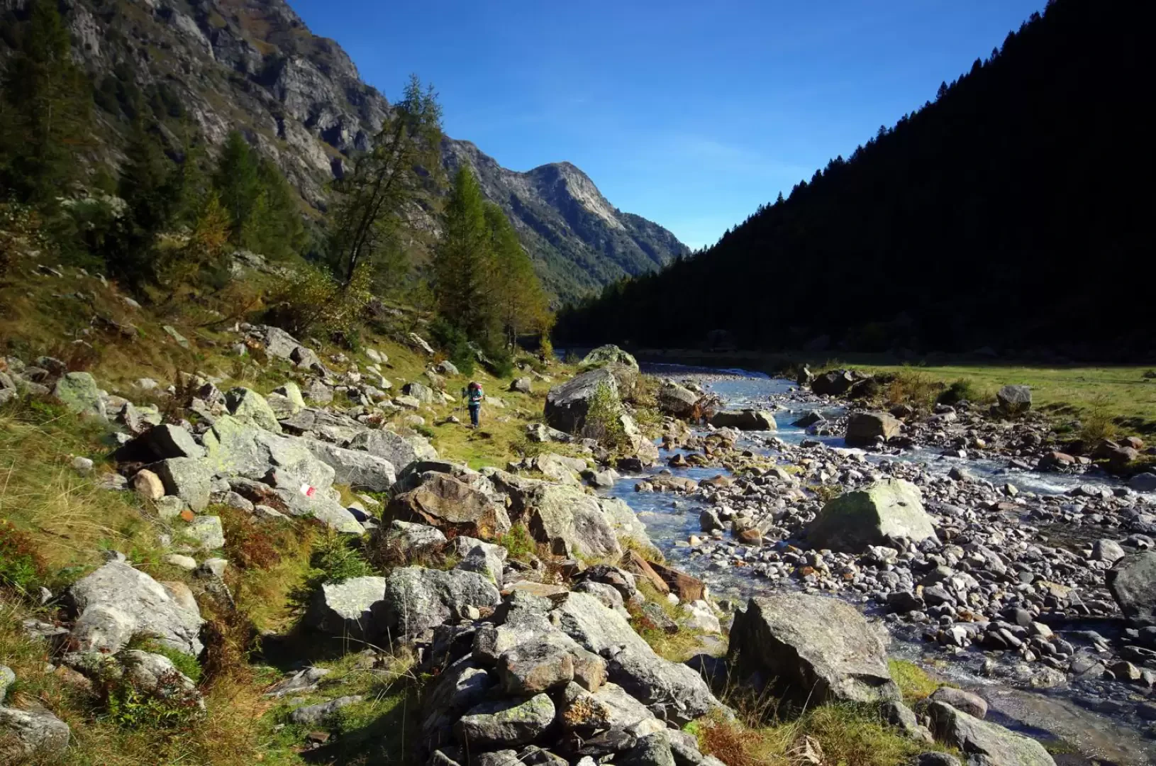
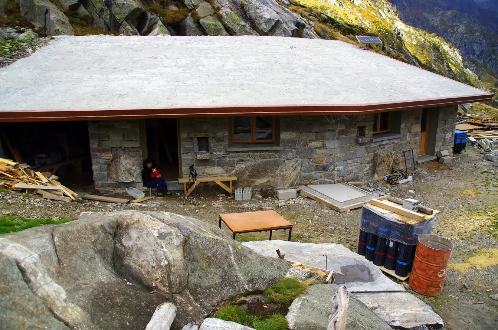
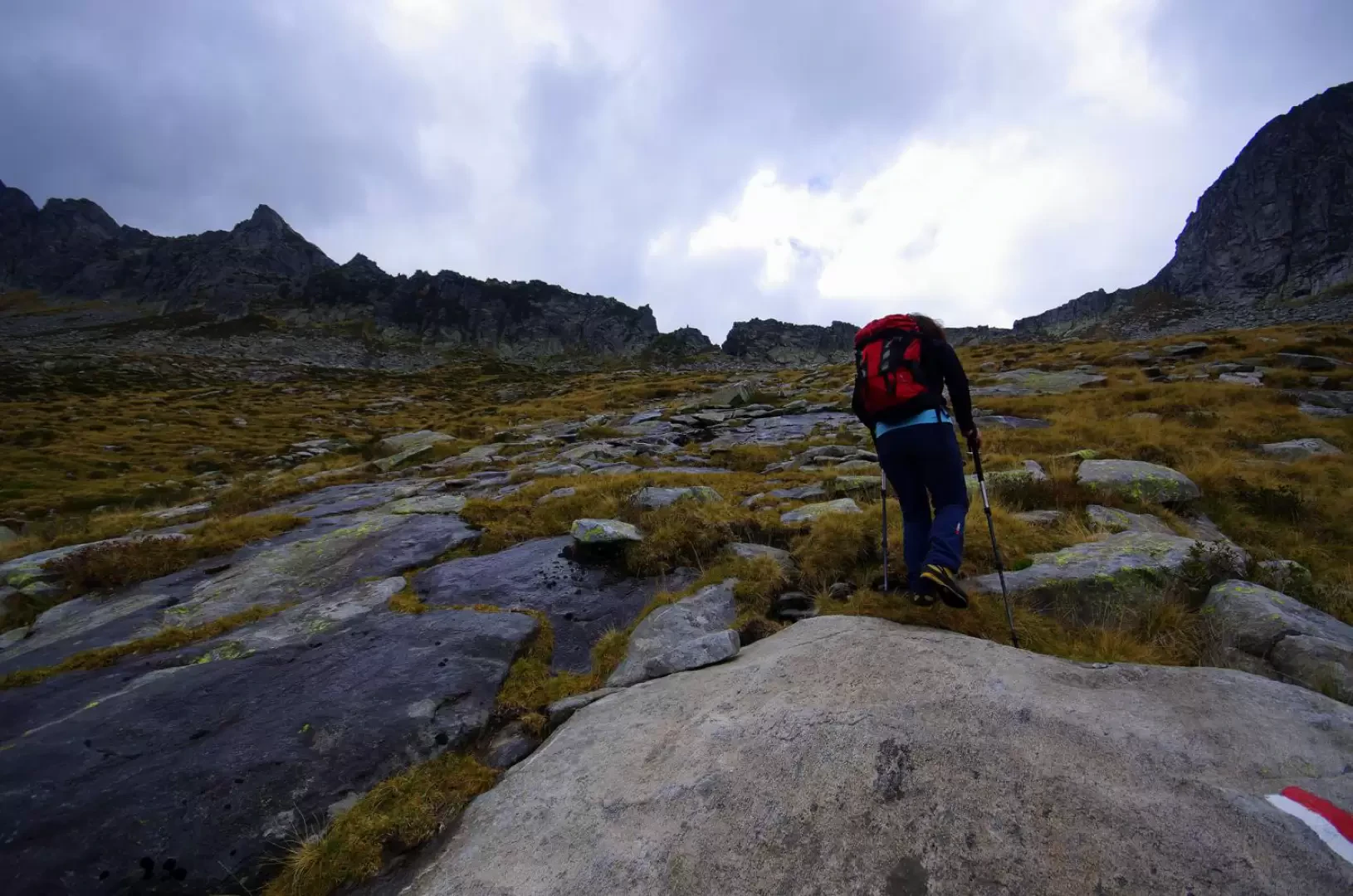
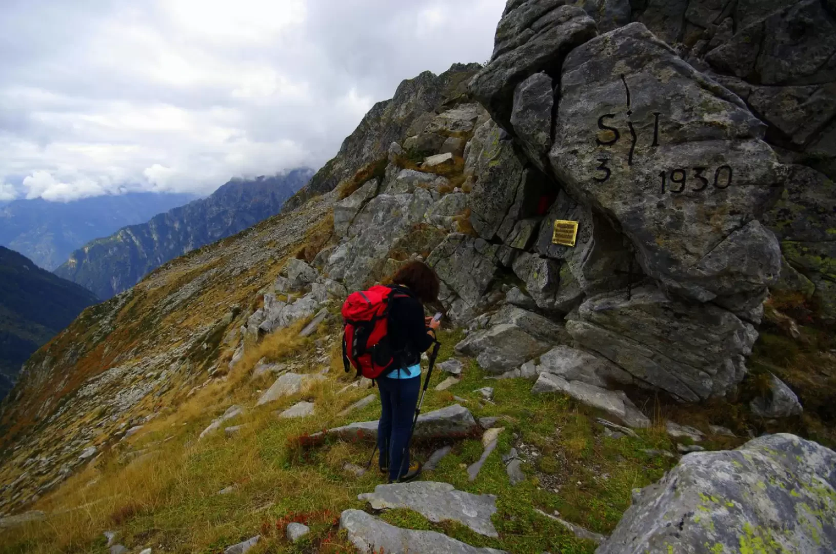
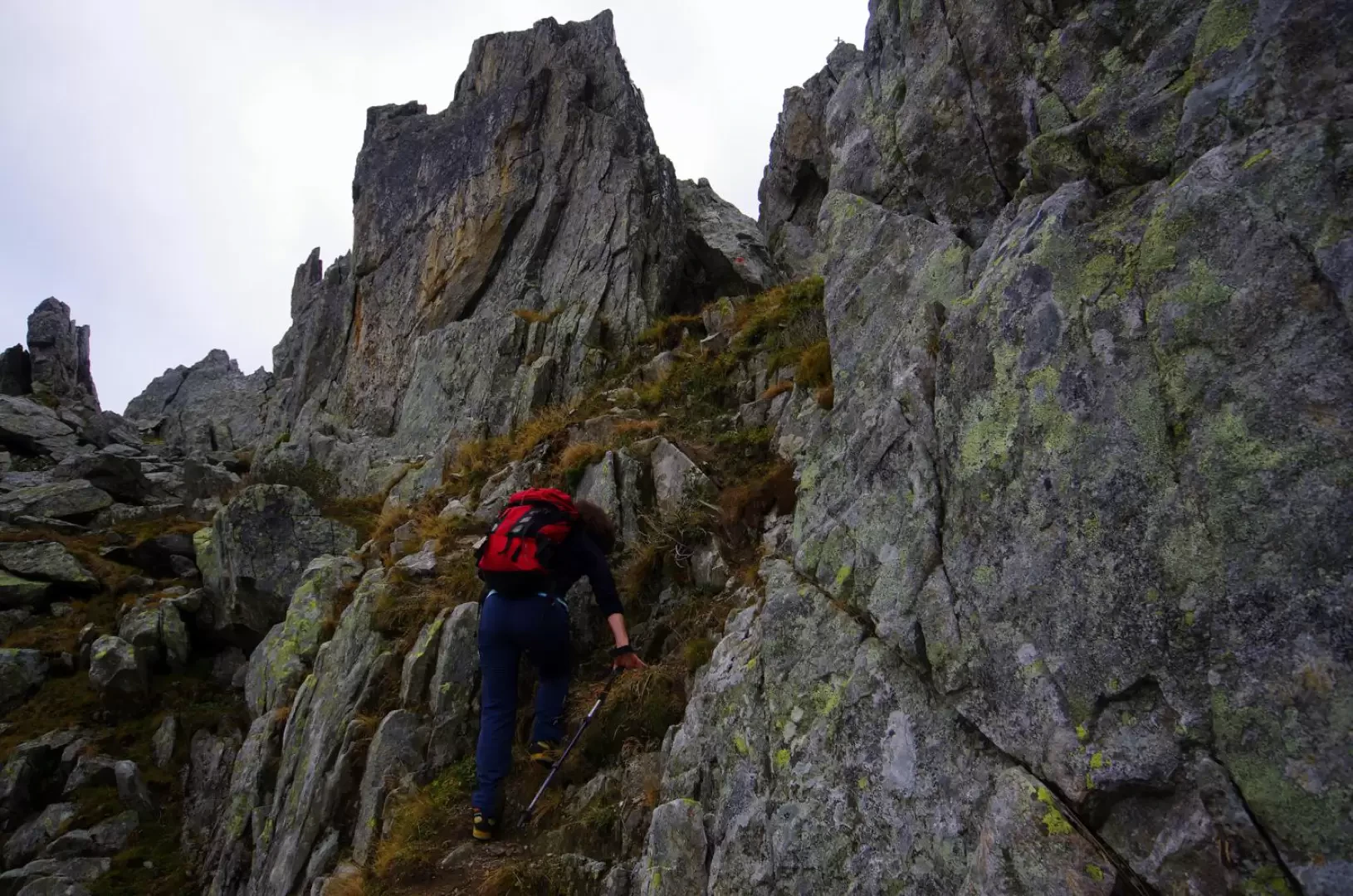
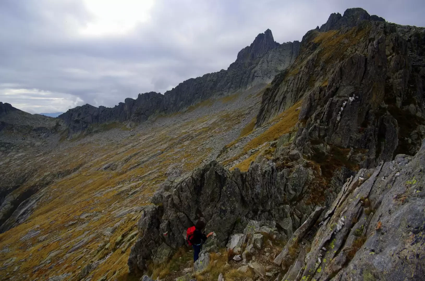
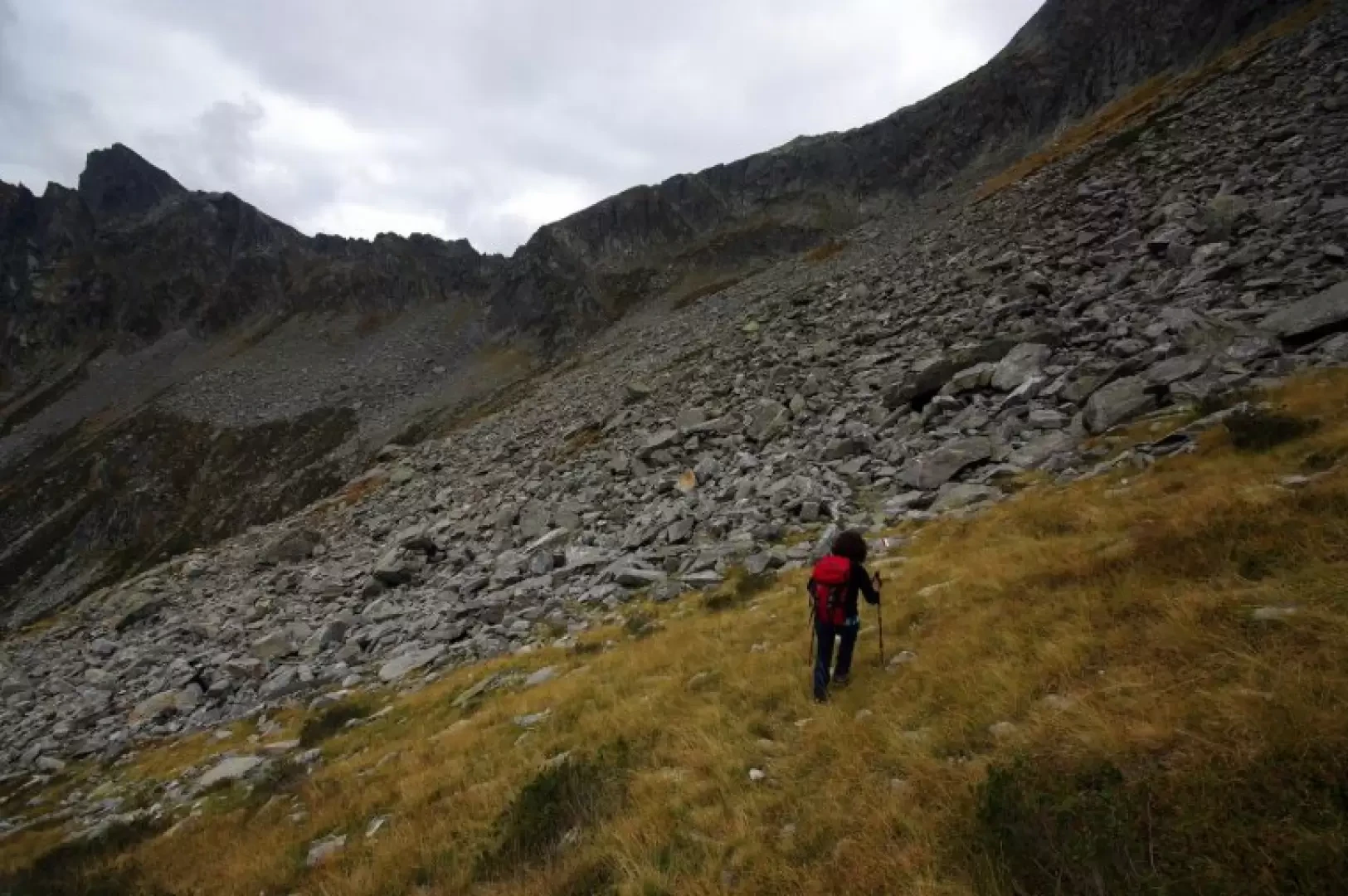
From Bodengo 1030m, continue for a very long time along the forest track at the bottom of the valley, passing the hamlet of Cort'Ärza 1190m (Corte arsa, arid; incorrectly mapped everywhere as Corte Terza) and reaching the few stables of Alpe del Nodar 1389m (mapped, in obvious analogy, as Corte Seconda). Here, the track gives way to a grassy track at an aqueduct hut that climbs up an old conoid and, crossing the stream, approaches the two huts of Stabi Nööv 1540m (Corte Prima). The terrain becomes very stony and the path - always very well signposted - climbs up the valley in the direction of the Bocchetta della Crocetta until it reaches a slab of rock where a fork in the path is marked: continue to the right towards the Forcellino del Nodar. A flat traverse goes back until reaching the base of a very steep gully ("Caürghia di vach") traversed at the same time by the remains of a flight of steps and a small stream; at the exit onto the upper pastures, the traverse continues up and down, reaching the terrace of the Avert del Nodar 1882m. A large masonry bivouac is currently in the final stages of construction on site. From the building, the signs lead you up the steep slope towards the base of the ridge ("Fil d'Urìa") above, amidst sparse pastureland, boulders and slabs of rock: at a new fork, take a right and in a few dozen metres you reach the narrow opening of the Forcellino del Nodar 2092m (limited panorama towards the Val di Cama, in Canton Grisons). In a narrow crevice of the wall is the 'summit book', which testifies to the not many passages. Back at the last fork, the trail continues up and down at the base of the walls, heading across a wide scree slope; on a slight descent, the smooth slabs of the Sasso Bodengo are flanked and the pass vertical is reached. The track, amidst grassy ledges that are a little crumbly and a few fairly exposed easy climbing steps (I+), finally creeps into the very narrow crack of the Bocchetta della Crocetta 2174m. The opposite slope, slightly less steep, descends steeply for about 500 metres to the picturesque Lago Darengo with the nearby Capanna Como. The little cross of the place-name - about 20cm high - is located on the summit of the rock forming the right side of the pass. For the return trip, it is necessary to descend the last exposed section of the route, until you find yourself at the base of the prominence; then the - here scarce and old - painted markings induce you to descend through a vast scree slope with large blocks. Continue along the faster line to find a track that soon converges on the first fork encountered on the ascent. From here, take the outward route.
Galleria fotografica