Monte San Martino, on the Pizzetti Trail

Edited by:
Rita Tarussello
Updated at: 03/09/2024
Access
SS 36 to Lecco. Exit at Lecco centre and take via Santo Stefano near the Capuchin church.
.Introduction
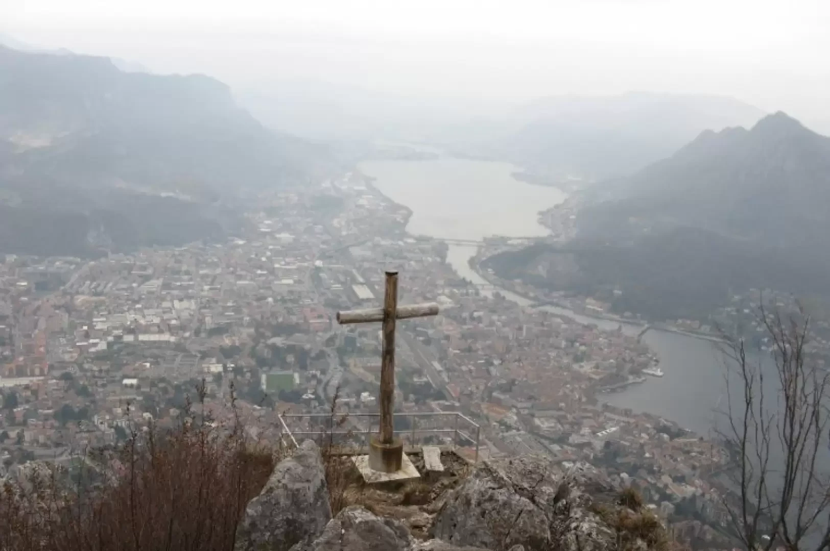
Monte San Martino (1048 m) with its rocky ramparts towers above Lecco in a north-westerly direction and is the last elevation south of the Grigne group. The Monte San Martino ridge rises steeply from the eastern side of Lake Como and comprises a group of peaks that are not very high but definitely imposing, the main ones being Monte Coltiglione and Corno Medale, whose walls have made Italian mountaineering history. The Pizzetti trail is a short but fairly demanding itinerary on an equipped path that, with a height difference of 500 m, connects Lecco with the Piazza hut, passing between the first two peaks overlooking the lake, known as the Pizzetti.Description
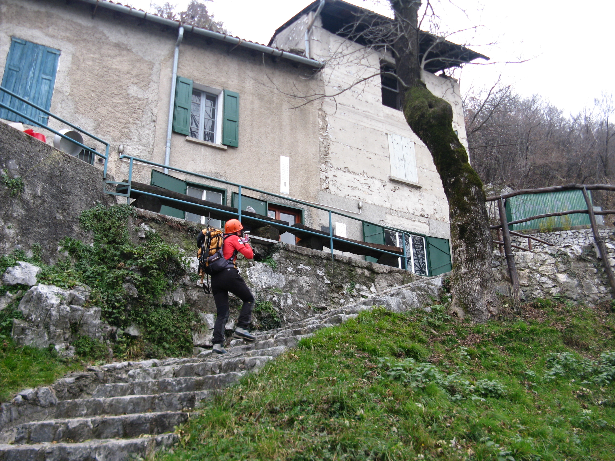
From Lecco take via Santo Stefano, near the church of San Francesco (church of the Capuchins) where you can park.
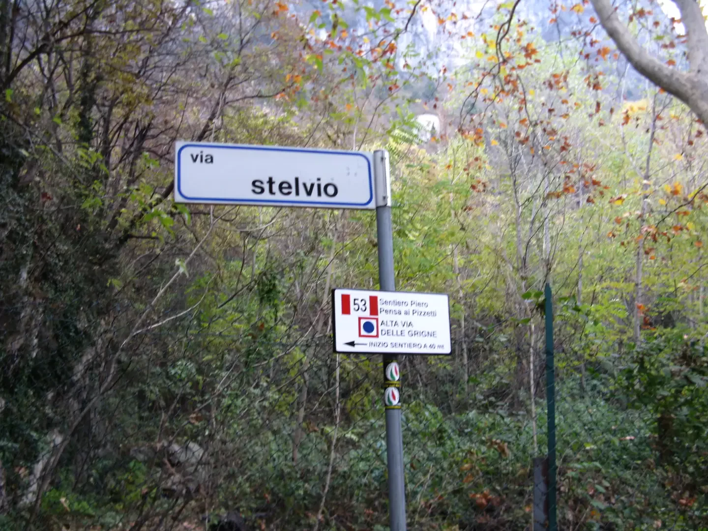
At the end of via Santo Stefano turn onto via Stelvio where you will immediately see the signs for the
path. Follow the road that curves to the left and, a little further on, near a gate and a courtyard, the path starts (signpost on the right). Further on, follow a concrete road that passes between rockfall nets. At a pylon (marker
), go uphill to the left into the forest on a stepped and well-marked path. At a first fork, continue to the right then, at a second fork, turn left into a steep gully which you climb up on slabs with the help of a chain. You will reach a saddle from which, to the left, you will soon reach the summit of Pizzetto Meridionale. Continuing instead towards the right, go round the Pizzetto Settentrionale and, on an ever-exposed path often helped by chains, turn left towards a gully between overhanging walls until having to overcome an area of exposed rocks helped by a chain and some stirrups. Now continue along the path, which is always very exposed, until it enters a beautiful grassy plateau on which the Piazza hut is located, adjacent to the San Martino chapel (767 m).
At the side of the chapel, a signpost indicates, among others, path 57. This is taken by climbing steeply into the forest above the hut with several hairpin bends to the right and following the red marks on the stones. Subsequently, the path flattens out, leading to a shoulder. Continue to a small hut and continue along the ridge. Turn right towards the Bocchetta di San Martino and from here, following a faint track, you will soon reach the summit of the mountain.
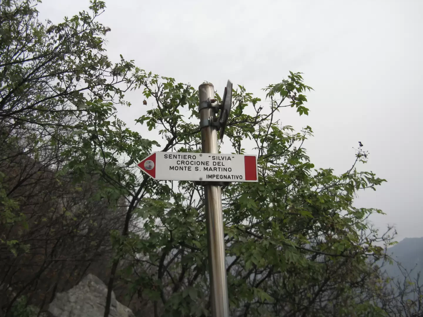
The descent is from path no. 52 (Sentiero Silvia), which leads to the Carmine chapel with an initially very steep route over small rocks and flat traverses, with a few stretches of chain to help you avoid slipping from an area of moving stones. After the chapel, an easy mule track leads back down to the valley until you find the concrete road with rockfall nets, from which you return to the start of path no. 53 and the car park
Galleria fotografica
We have been there

Edited by:
Ermanno Panara
Monte San Martino, Sentiero dei Pizzetti
gita breve anche a causa del tempo variabile. è possibile allungarla a piacere facendo anche delle belle traversate.