Mount Lavagnola

Edited by:
Maurizio Loconti
Updated at: 09/10/2024
Access
Da Genova, si segue la strada per Piacenza fino ad incontrare la diramazione che conduce a Torriglia; prima della chiesa si piega a destra per gli ampi parcheggi, in parte a pagamento.
Introduction
Il giro odierno ha una difficoltà turistica nel suo sviluppo andata e ritorno; sarebbe possibile fare una anello ma ciò porta la difficoltà ad un livello EE ed è possibile che in futuro diventi sempre più complicato. Nel testo viene comunque fornita traccia di questa soluzione…
Description
Introduction
Today's round trip has a tourist difficulty in its round trip development; it would be possible to make a loop, but this brings the difficulty to an EE level and it is possible that it will become more and more complicated in the future. In the text, however, a trace of this solution is provided...
Description
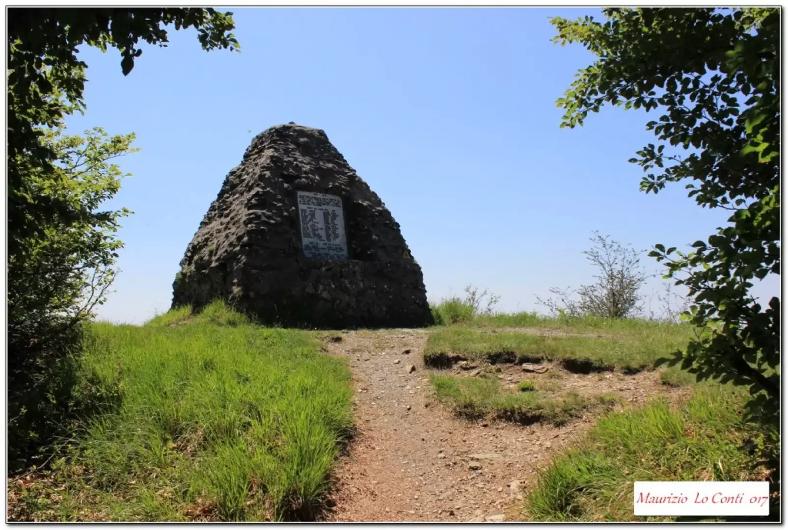
From the church of Torriglia (769 m), follow a small road that descends to the left to a car park; a wash-house on the opposite side indicates the start of the uphill route that then crosses the provincial road, always keeping to the left at the various crossroads. A wide, cobbled mule track thus emerges from the Cappella della Costa 882 m - 15'. Here, turn right onto a wide track that, for a short stretch, also follows the tarmac. One then faces a cool forest that accompanies one to a fork where one goes left (to the right the possible return EE) - 55'. In less than 5', you cross the Alta Via, at an important crossroads (Colle Nord Lavagnola), and climbing to the right, in 5', you are at the panoramic peak at 1118 m (characterised by a stone pyramid, erected in memory of the CAI members who fell during the First World War - tot. and. 1h20 diff. T).
The outward route is also recommended for the return (1h10 the return - tot. 2h30), but, for those who wish to measure themselves with a higher difficulty, here are some indications (diff. almost EE):
After the break, descend to the pass and to the fork in the forest below (5'), bending to the left onto a wide path, which is level at first. Shortly afterwards (3'), there is a fork where you turn right onto a marked but somewhat steep downhill track. Afterwards (5'), there is a sharp right turn and, continuing to lose altitude, you arrive on a paved road (35'). Here you go to the right and if you want to avoid the difficulties, there is a second possibility and you can continue on to Casaleggio and finally return to Torriglia, just beware of the vehicular traffic, which is probably low. Otherwise, after about a hundred metres, turn left descending into the woods. You pass a couple of bridges, testimony to the fact that in the past this was a not insignificant communication route, and approach the stream. Here, a couple of landslides make it very difficult to get through: from the first one, there are so many trees (a wall) that it is impossible to climb over them... the only way is to go up to the right, a few metres before, very steeply (with wet ground that is not at all trivial) and without any trace among the trees, branches and whatnot... turn over the landslide and once you spot a track going downhill, take it until you find the trail marker from the ruins of a house. Further on, from the second one, at the moment, you can still pass under the trees and, deviating to the left, return to the main track, but the grass has already grown... in time this too will be a problem.... The last critical point is the crossing of the Laccetto stream, as the footbridge was washed away by the 2014 flood. Carefully, we cross the wide watercourse with some makeshift tricks... now we climb up and at the end we are between the houses of a hamlet of Torriglia (1h10). Here, if you go left, you end up on the road that soon leads to the village, while if you turn right, you descend, passing under the viaducts of the SS45. You cross the stream and, with a final climb, you pass the Equestrian Centre and arrive at the car park (25'- tot return 2h30 diff. EE).
Trip photos:
http://cralgalliera.altervista.org/Lavagnola017.pdf
http://cralgalliera.altervista.org/altre2017.htm
individual shots, some of which differ from the pdf:
http://cralgalliera.altervista.org/1705C1Guardiani.jpg
http://cralgalliera.altervista.org/1705Cb2VettaLavagnola.jpg
NB: In the event of an excursion, always check with FIE, Cai, any park authority or other institutions, pro loco, etc., that there have been no changes that have increased the difficulties! No liability is accepted. This text is purely indicative and not exhaustive.
Info Hiking Section Cral Galliera: http://www.cralgalliera.altervista.org/esc.htm
outings 2017 at the link: http://www.cralgalliera.altervista.org/gite2017.pdf
General information
Street:
Trail signage: Fie-marked trails
Type of route: Route and return (optional loop with EE diff.)
Recommended period: April, May, September, October
Exposure to the sun:
Objective Danger:
Exposed Tracts:
Useful equipment:
Water:
Bibliographic references
Road access
From Genoa, follow the road to Piacenza until you come to the junction that leads to Torriglia; before the church, turn right for the large car parks, some of which you have to pay for.
Photo gallery
Foto gita:
http://cralgalliera.altervista.org/Lavagnola017.pdf
http://cralgalliera.altervista.org/altre2017.htm
scatti singoli, in parte diversi dal pdf:
http://cralgalliera.altervista.org/1705C1Guardiani.jpg
http://cralgalliera.altervista.org/1705Cb2VettaLavagnola.jpg
NB: in caso di gita, verificare, sempre, con FIE, Cai, eventuale Ente parco o altre Istituzioni, pro loco, ecc., che non ci siano state variazioni che abbiano aumentato le difficoltà! Si declina ogni responsabilità. Il presente testo ha solo carattere puramente indicativo e non esaustivo.
Info Sezione Escursionismo Cral Galliera: http://www.cralgalliera.altervista.org/esc.htm
gite 2017 al link: http://www.cralgalliera.altervista.org/gite2017.pdf
Informazioni generali
Via:
Segnavia: sentieri con marcatura Fie
Tipologia percorso: andata e ritorno (anello facoltativo con diff. EE)
Periodo consigliato: aprile, maggio, settembre, ottobre
Esposizione al sole:
Pericolo Oggettivo:
Tratti esposti:
Attrezzatura utile:
Acqua: