Mount Jupiter, from Canza

Edited by:
Mario Pin
Updated at: 16/06/2024
Access
SS33 del Sempione, exit for the Formazza valley, reach the village of Canza, enter the village, cross a small bridge and arrive at a car park, from here by obvious signs (signposts) you begin the trip.
Introduction
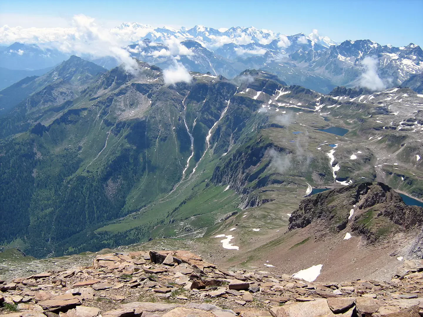
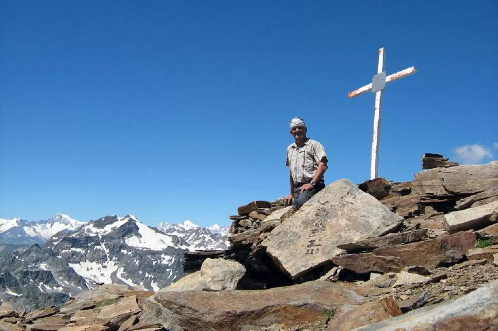
Beautiful excursion in the heart of Val Formazza, demanding both in terms of development and height difference, also because from the Busin pass you lose 100m that you then have to take back on the return journey, so the actual height difference of the excursion is 1800m. From the top of Mount Giove you can enjoy one of the most beautiful panoramic views of Val Formazza and the Lepontine Alps.
.Description
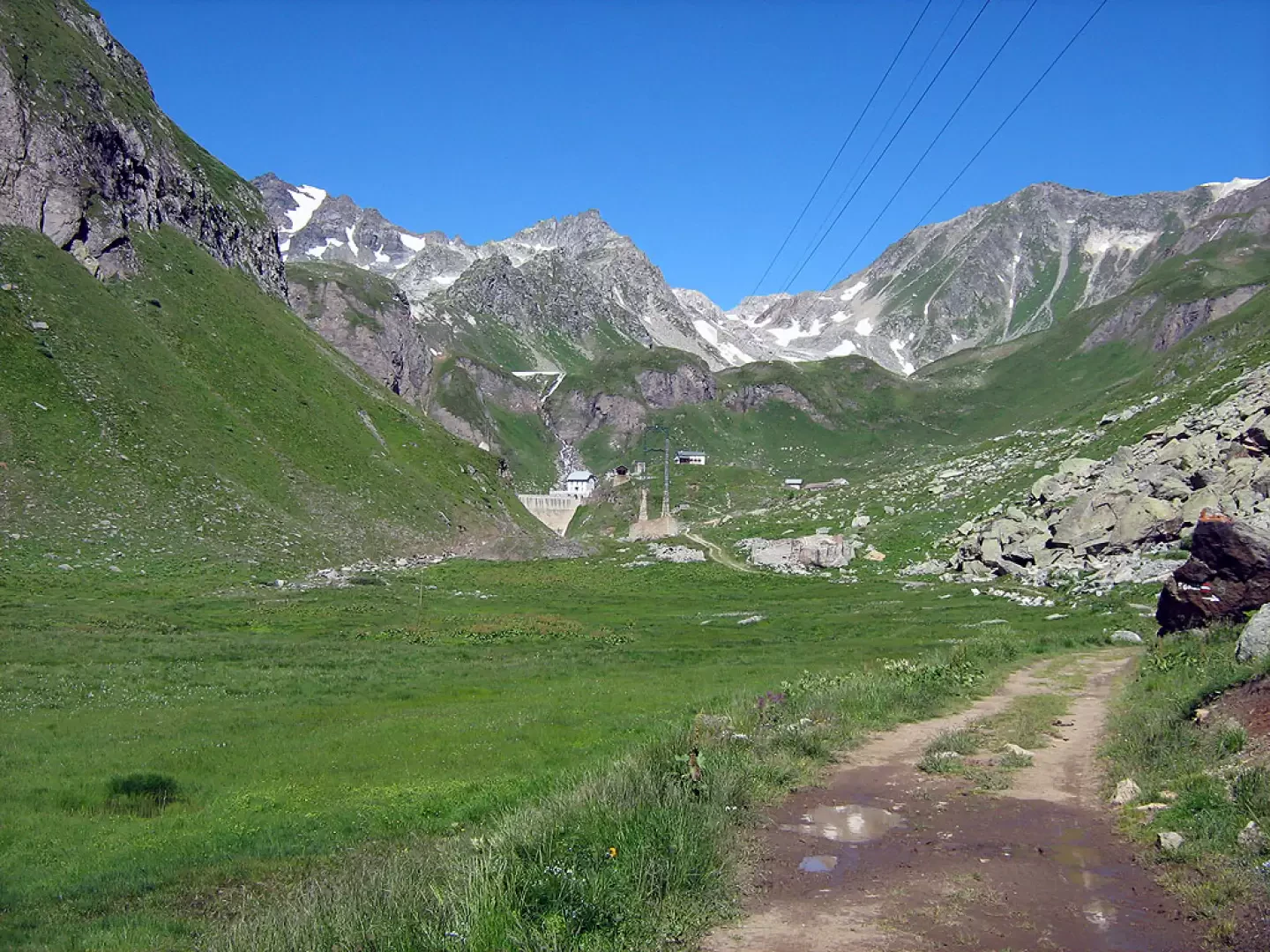
From the car park in Canza take the carriage road to Sagersboden (arrival of the chairlift from Valdo) after the first few bends of the carriage road and a long straight stretch, I recommend taking the alpine path that leads into the woods (marked on an old trunk) avoiding the numerous bends of the same carriage road.
From Sagersboden continue on the carriage road that with a steep climb first and then a pleasant valley, will take you to the Vannino dam.
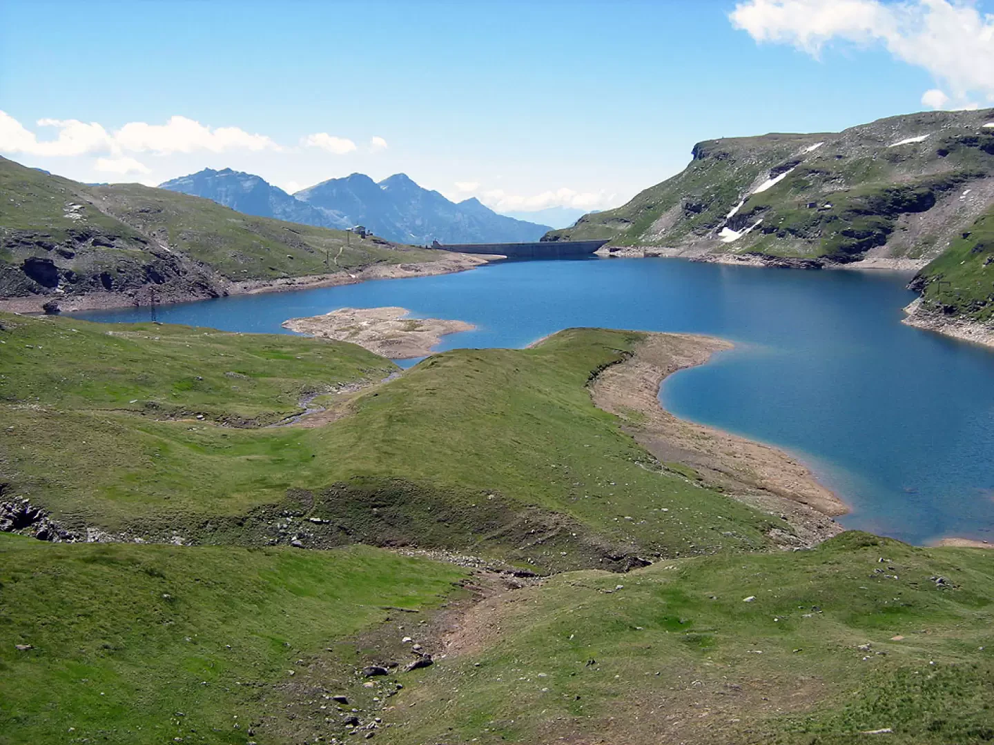
Cross the dam wall and take the obvious path that climbs halfway up the hillside to the Busin Pass, the path allows you to gain height gradually and with less effort, however it is a bit exposed because it crosses steep meadows diagonally, the alternative is to follow the path along the lake to the left and climb into the final little valley to reach the Busin Pass.
From the Busin pass, descend along an obvious path to the house of the keepers of the Busin dam, from here pointing decisively to the left (east), climb up the large meadows in the direction of the summit. The route is marked with characteristic stone cairns and red paint markings.
The last part of the ascent is on loose but easy rock.
The summit is reached by pointing to a large overhanging boulder and then on the ridge towards the north.
Galleria fotografica