Monte Generoso, from Orimento

Edited by:
Marco Bonati
Updated at: 27/05/2025
Access
From Como to Argegno, where you ascend the provincial road to Val d'Intelvi. From San Fedele take the road to Casasco and, just before entering the village, turn right towards Alpe di Orimento. Small parking area in front of the hut. Parking by the side of the road is prohibited.
Introduction
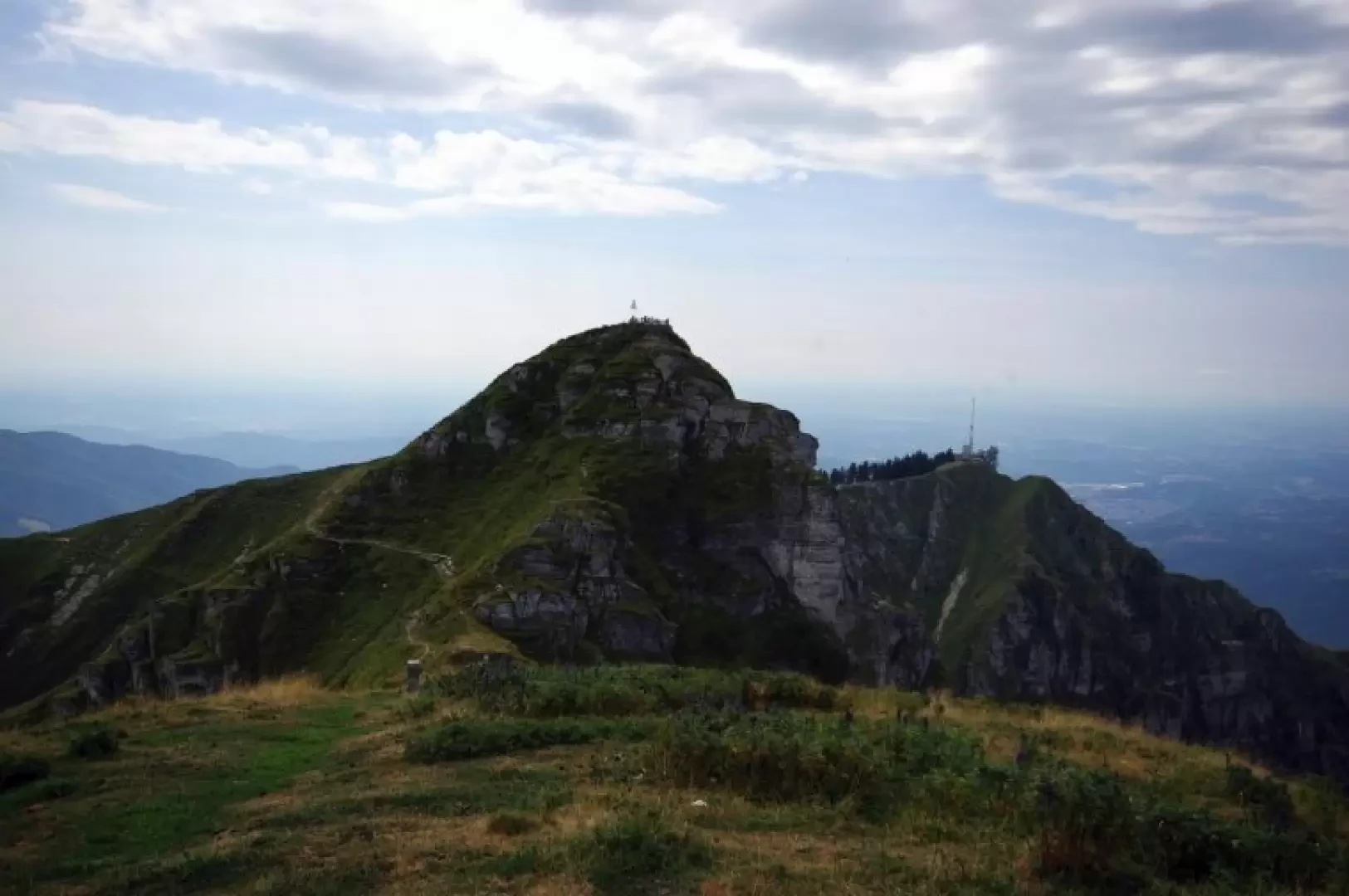
An additional possibility to reach the summit - which is very popular - of the most famous vantage point in the Ticino Pre-Alps. It is a very short, technically easy ferrata that takes on interest because of the variety of the landscape it crosses: running precisely on the border line between Italy and Switzerland, it dominates the vast pastures of the Val d'Intelvi on the left and the precipice of stratified rock towers overlooking Lake Lugano on the right.
Description
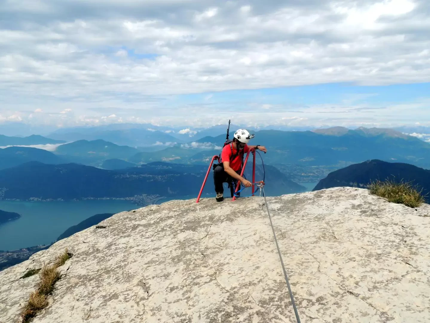
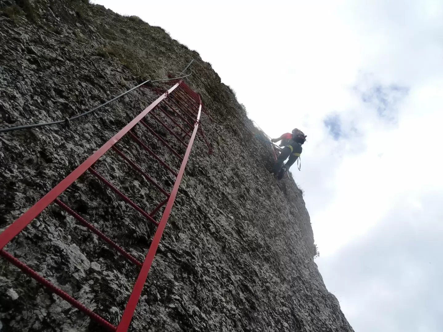
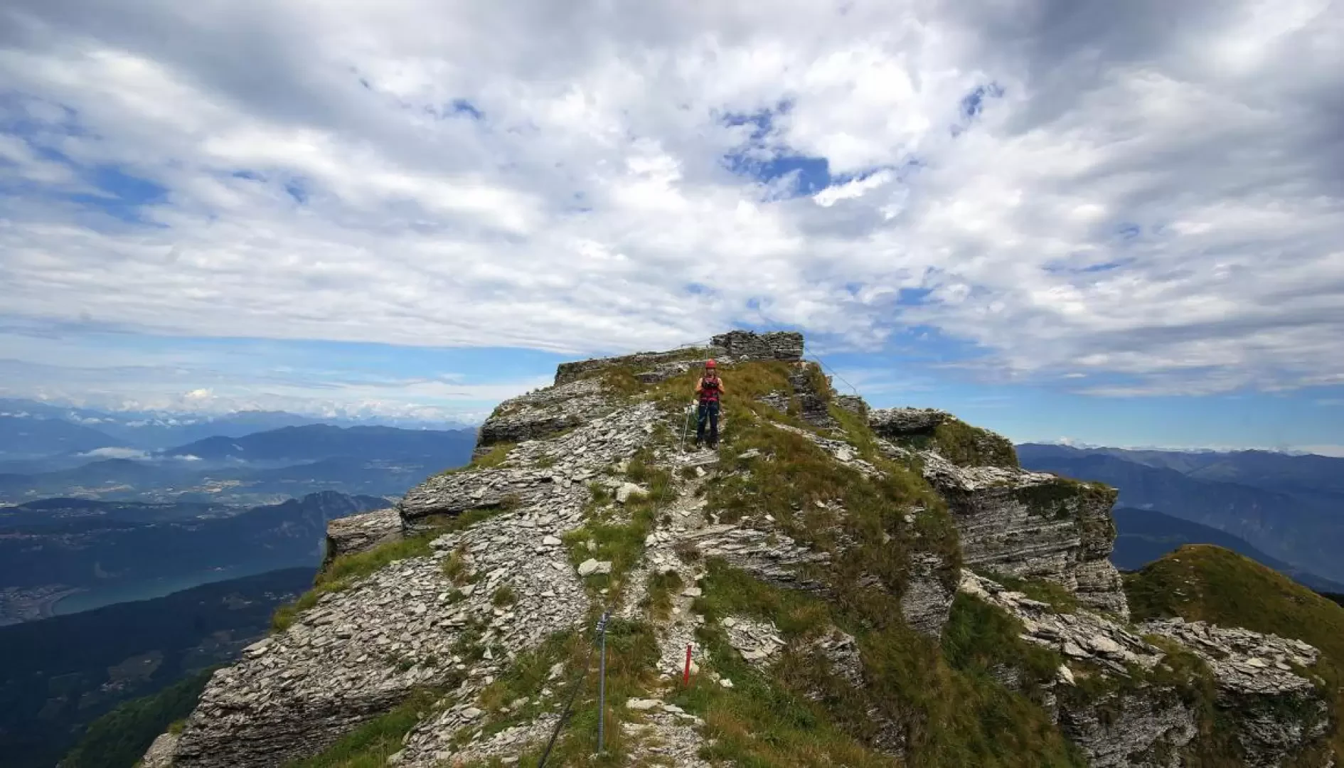
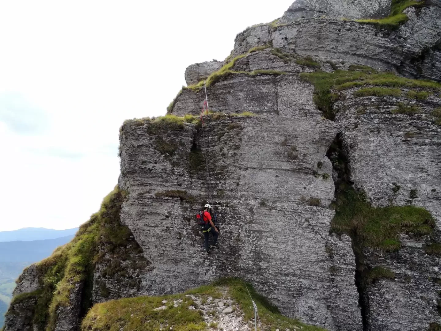
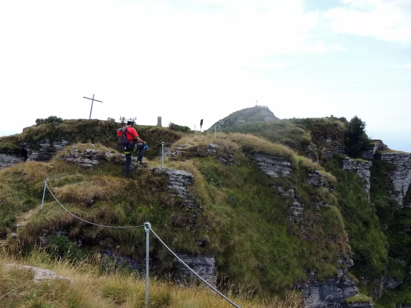
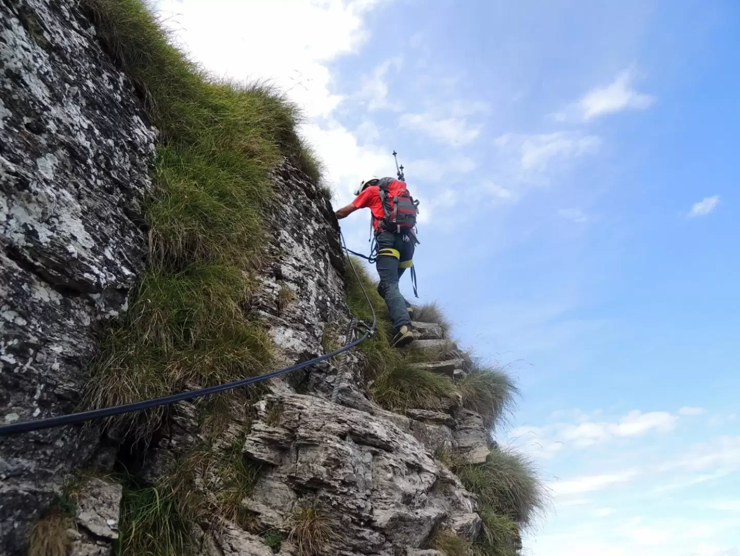
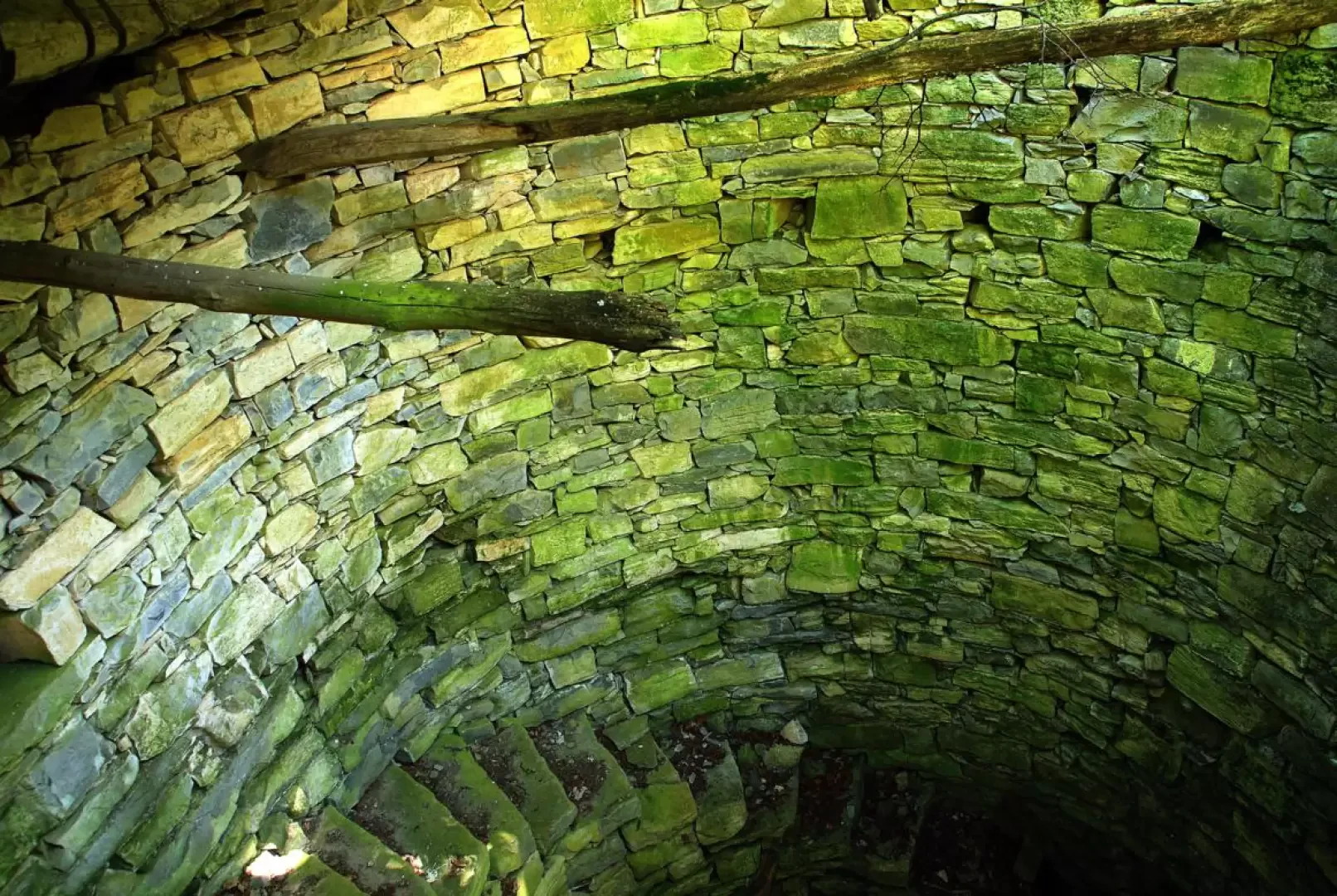
Acrossing the few houses of Alpe di Orimento 1275m on the right, take a wide track that enters into the small valley where the source of the Breggia river is located. When you reach a wooden bridge (junction with the return route), continue along a small path in the woods that, after passing a few clearings, reaches the bubble (an artificial pond for watering cattle) of Alpe Bol 1333m. Continue on the grassy track to the left (ex-military road) to the Barco dei Montoni saddle 1363m, where you enter a wide path in the Monte Generoso State Forest: no leaving the beaten path. In a short time, climb up to a wide ridge with a dry stone wall that marks the boundary between the forest and the pastures of the Alpe Pesciò below; halfway up, cross the slopes of the Cima della Piancaccia 1610m and reach the nearby Sella della Piancaccia 1599m (state boundary stone); climb over Q1645 and reach the Sella Squadrina 1621m at the beginning of the equipped section: a stone cairn with a crucifix and other religious symbols. From the pastureland shelf, a vertical of stratified rock rises abruptly, crossed by a first metal ladder; beyond a rocky terrace you descend into a cleft where you climb the second ladder that leads - key passage - to a third and final ladder. Continue on the exposed ridge with ups and downs until you reach a small wall that leads to the ruins of an old sentry box; descend easily to a short bridge that allows you to cross a deep gully and finally climb up on traces of a path to the grassy summit of Monte Baraghetto 1694m, at the end of the ferrata. A nice downhill path leads to a grassy saddle (memorial stone and confluence of paths) where the equipped path (handrail cable) to the summit of Monte Generoso 1701m starts: just a few slightly steep hairpin bends and you reach the fenced-in culminating square, which houses some orientation boards, benches and a high trigonometric sign. You descend rapidly to the east (boundary line), leaving the summit facilities (farm, restaurants, railway station and radio and television antennas) to the right. At a saddle with a depot of disused railway material, you turn left and, via the "low path", cross the slopes of Monte Generoso again. Leave the signposted junction for the Grotta dell'Orso (Bear Cave) and continue on a slight descent to the next junction, where a stairway to the right takes you to the ruins of the Alpe Pesciò di mezzo 1368 (beautiful nevera); the descent continues to the wooden bridge signposted during the ascent and from here along the outward path to Orimento.
.Galleria fotografica