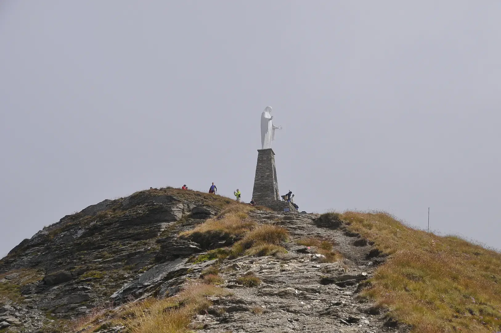
Mont Zerbion, from Panorama

Access
Leaving the [A5] motorway at the Châtillon/Saint-Vincent exit, turn right heading towards the spa town. After passing a set of traffic lights, continue straight on for about 400m before reaching the locality of Panorama and meeting, on the right, a large free car park where you can leave your car.
[0h03'] - [1.8km]
- How to get there with GMAPS
- How to get there with Apple Maps
Description
0h00' From the car park, go up the pavement for about a hundred metres until you come to a pedestrian crossing: cross the road and take the lane to the right of Hotel Sylcri. A signpost indicates that you are starting on path to Domianaz. Follow the path briefly past a few houses before reaching a clearing at Remelaz, where a yellow marker directs you back onto a short stretch of path that joins a farm track.
0h05' Turn left and walk along the little road for a few dozen metres before turning right onto a path which, after a short stretch that is almost flat, begins to climb up through the wood with a series of hairpin bends until it crosses the Ru de la Plaine path.
0h10' Continue following the signs for the Balteo Path to La Magdeleine and, after a short ascent, join a small road that crosses the village of Verlex 💧. Follow the little road until the next crossroads with the hill road and, near the chapel dedicated to saints Fabian and Sebastian, turn right to take the little road that leads to the village of La Tour.
0h20' Climb up the little road that crosses the village of La Tour 💧 to its summit where it turns right and leads to the start of the path. A new bollard of the Camino Balteo indicates the correct direction. Climb up the path in front of the Tour Decré d'Emarèse. After an initial ascent, the path flattens out slightly as it crosses a pleasant pastureland with the village of Domianaz now in sight. The path keeps to the right of the pastureland and amidst some chestnut scrub leads close to the village, which is reached by a small ramp. At the height of a votive shrine 💧 dating from 1871, turn left to follow the little road through the village to the little square in front of the chapel dedicated to Saint-Roch (736m).
0h35' From the car park, walk back a few metres until you come back onto the communal road: keep to the right and walk for a few hundred metres along the little tarmac road until you reach the first bend, after which, on the left, you will see a signpost indicating the direction to take.
0h40' We begin to climb up a beautiful mule track, marker , paved in places and bordered by dry stone walls. The ascent is steady, but the work of man in the past has made it never excessively steep. We head westwards, in some places with wooden railings, until we come to a cross: here the path changes direction, heading north towards the rocky massif below Nissod. This first section of the path is immersed in a forest of downy oaks (Quercus pubescens) and a few sporadic firs, which occasionally open up to allow interesting panoramic views of Saint-Vincent. After a series of twists and turns, the path crosses the waters of the Saint-Vincent stream and leads to its orographic right and after a short while you reach a large building: this is the Rivaz Factory
0h40' The itinerary takes on a decidedly higher altitude with a series of hairpin bends in the coniferous forest, which is decidedly more shady. You reach a clearing (1105m, 0h50'), accompanied by a railing and a bench, from which there is an interesting view of the mountains to the south of the Dora Baltea: from Mont Lyan to the Becca di Salé.
1h30' The trail starts to climb again and soon crosses the stream again, near a pretty little waterfall. Shortly afterwards, we come to a farmhouse near an old marble quarry. Continue uphill until you come to a rocky outcrop with white patches: by now the path softens, passes near the marble quarry and soon reaches a beautiful votive shrine. The forest now gives way to the pastureland below Nissod and leads close to some vegetable gardens before becoming a small farm track. Below the imposing mass of Monte Zerbion, the path joins the tarmac road: follow it for a few hundred metres until you come to a panel indicating the arrival at Nissod. We follow the road by turning left and, after a few metres, turn right onto a small path that enters the village. We pass by a beautiful rural building with an attached barn and finally reach the chapel of Saint-Bernard, patron saint of the village (1,382m) and shortly afterwards the village fountain 💧1h45' .
We take the mule track, marked with the
sign, and begin to climb the pastures above Nissod. Cross the farm road and continue along the mule track into the forest. The ascent is rather steep and, as a result, you quickly gain altitude. The route tends to the right, passing near a ruin in the woods. Shortly afterwards, a second ruin is encountered and we begin to proceed to the left. It continues to climb with a series of turns until it emerges from the forest. Continue diagonally to the left, crossing pastures, until reaching the Deviaz pastures (1689m, 0h35'). Here, take the farm track again and head to the left, following the signs of the yellow arrows. Follow the track for a few hundred metres until you reach the pleasant village of Cheney (1734m, 0h45'). At the fountain, turn right, leave the track and climb up the mule track until entering the forest again. At the first fir trees, leave the mule track to follow a farm track that climbs up the forest with a series of slight bends until you reach an area of pastureland again: here, you begin to get a clear view of the Madonna on the summit. After a slightly uphill stretch in the direction of the summit, you cross path
coming from the Col di Joux: at the post, turn left and start walking up a rather steep stretch. The steep ascent is short, however, and you quickly reach the plateau that precedes Francou: on the plateau there is a bench that suggests you stop for a moment to enjoy the stupendous panorama.
On a rock you can see the marks of the paths Sentiero
and
, which fork at this point. We ascend to the right through a strip of sparse forest until we reach the characteristic ridge. The ascent does not let up; as you ascend, the panorama opens up and becomes more and more grandiose. Slowly one reaches the summit where a small Christ on the Cross is placed. The march continues along the wide ridge that tapers off to become a beautiful crest. The path, always easy and evident, goes up the ridge and joins the one coming from Col Portola: the summit is now reached... a few metres and you arrive at the foot of the majestic statue of the Madonna that marks the summit of Mont Zerbion (2,720m, 3h00').
The descent can be along the same path as the outward journey (1h30') or, for the more undaunted, you can descend towards Col Portola following the wide path accompanied by the Stations of the Cross. When you reach Col Portola (2414m, 0h30'), turn left and meet the signs for path
. One descends the prairie following the path, which is quite evident and leads to a short plateau. It curves to the left and leads to the edge of a small forest. Follow the yellow arrows around a rocky knoll, taking care not to confuse the path with cattle tracks (always find the yellow arrows). Once around the knoll, descend through the forest until reaching the pastures of Francou Damon (2044m, 1h00') and, shortly afterwards, reaching Francou Desot (2021m, 1h05'). Here, follow the farm track briefly before rejoining the path again, which leads through the pastures to the bench encountered during the ascent. From here, follow the same route as on the outward journey until reaching Nissod (1382m, 2h00'), the starting point of the hike.
We have been there
Mont Zerbion, da Saint-Vincent
Report della gita
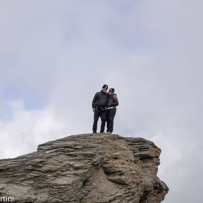
Gran bella sgroppata con partenza da Saint-Vincent (Via Chanoux) e arrivo dopo 2160m di salita sulla vetta del Mont Zerbion. La discesa l'abbiamo fatta su Barmasc.
Informazioni generali
Condizioni via o sentiero: Nei pressi di Devies un albero sul sentiero manda un po' fuori traccia; aggirare l'albero e proseguire la salita in diagonale sino alle case.
Pericolo Oggettivo: nessuno
Tratti esposti: nessuno
Condizioni meteo
Cielo: parzialmente nuvoloso
Temperatura: calda in partenza, fresco fra le nuvole in vetta
