Mont Emilius, from Pila

Edited by:
Massimo Martini
Updated at: 04/03/2025
Description
Leaving the car park, go up the metal steps leading to the arrival point of the gondola lift and, after crossing the little meadow in front of it, take a small road, turning right. After a few metres, ignore the road to the left that leads to the hermitage of San Grato, and shortly afterwards you come to a temporary signpost indicating to turn left in the direction of the Chamolé mountain pasture. We climb up a dirt track that in a few minutes first leads to an alpine pasture and after a few metres ends at a signpost indicating Alpe Chamolé (1851m, 0h10').
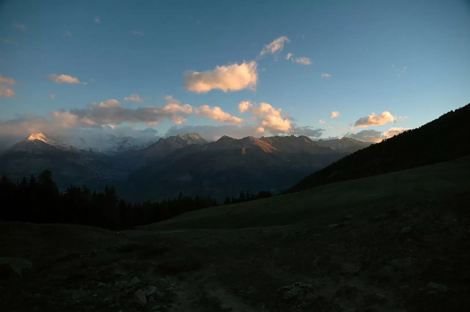
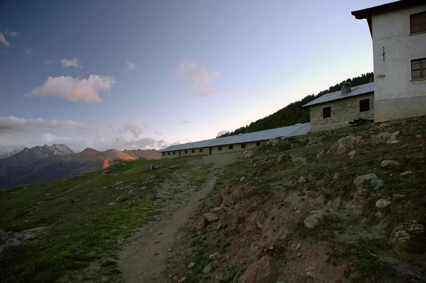
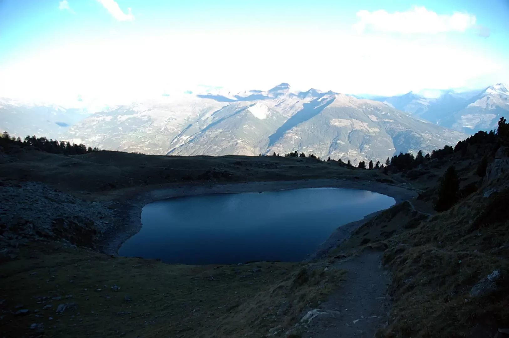
The path climbs up a deforested strip among the fir trees, populated by rowan and alder trees, to an altitude of about 2000m where the deforested section becomes wider and leaves room for a little grassland. You soon reach a wider path (2062m, 0h30') and turn left up a beautiful trail that quickly crosses the forest and leads to the beautiful pastureland clearing below the Chamolé alpine pasture. The path, in a wide semicircle to the left, first approaches a ruin and finally reaches the Chamolé alpine pasture (2154m, 0h50'): from here, the view is already exemplary, with Mont Blanc looming in the distance and in front of us, the view of the Fallère group and the Grand Combin is unmissable... especially at the first dawn.
At the back of the alpine pasture, we take a small road, still following the signpost Trail No. 19a, near a fountain.
We first climb up a small road that becomes a path and enters a wooded area. After a few minutes you come to a fork in the path: both lead to Lake Chamolé, the path [102] on the left goes directly to the lake, while the path (19A) on the right leads up a small valley to the arrival point of the Chamolé chairlift (2,310m, 1h 20') with a refreshment point.
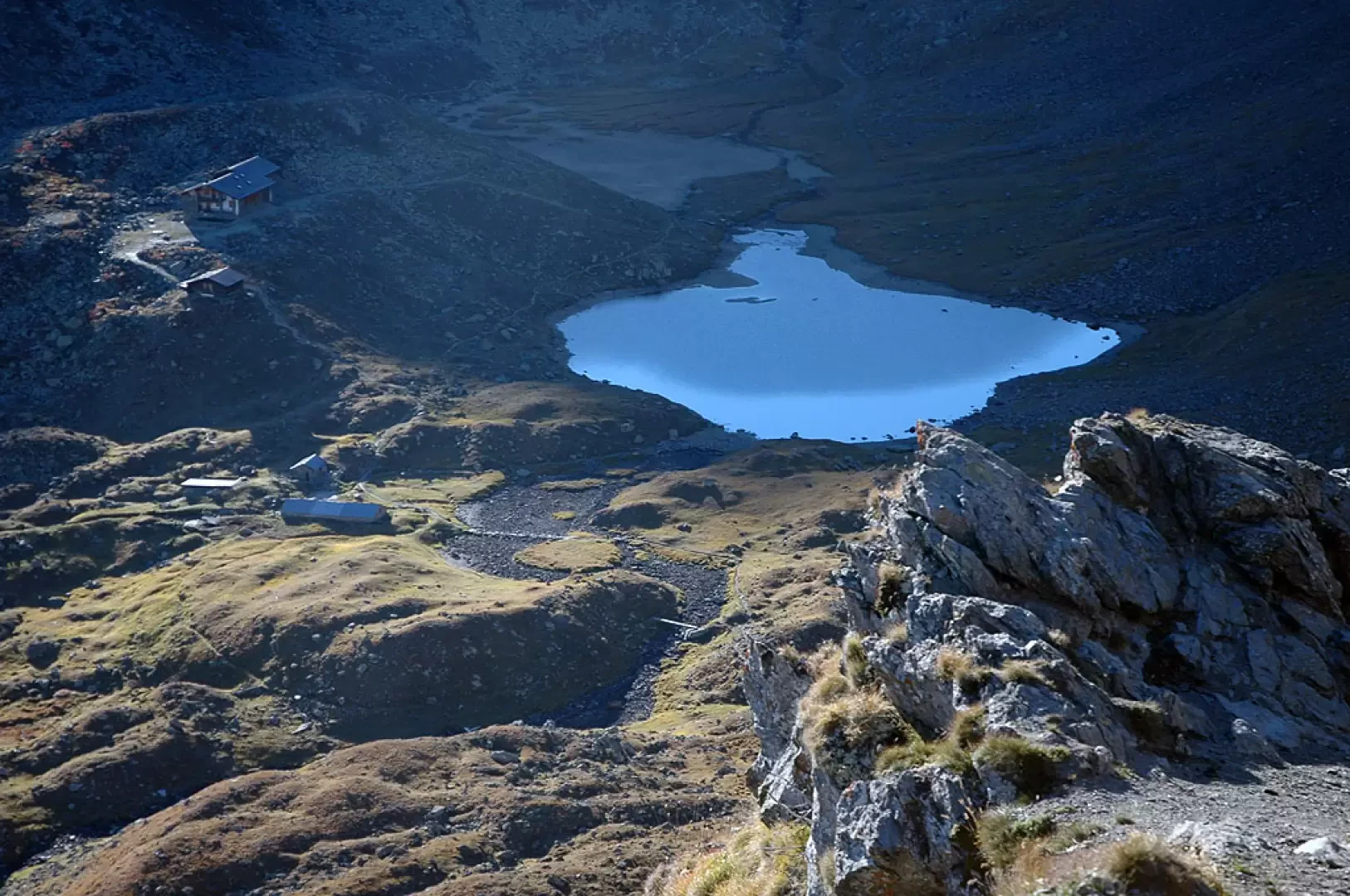
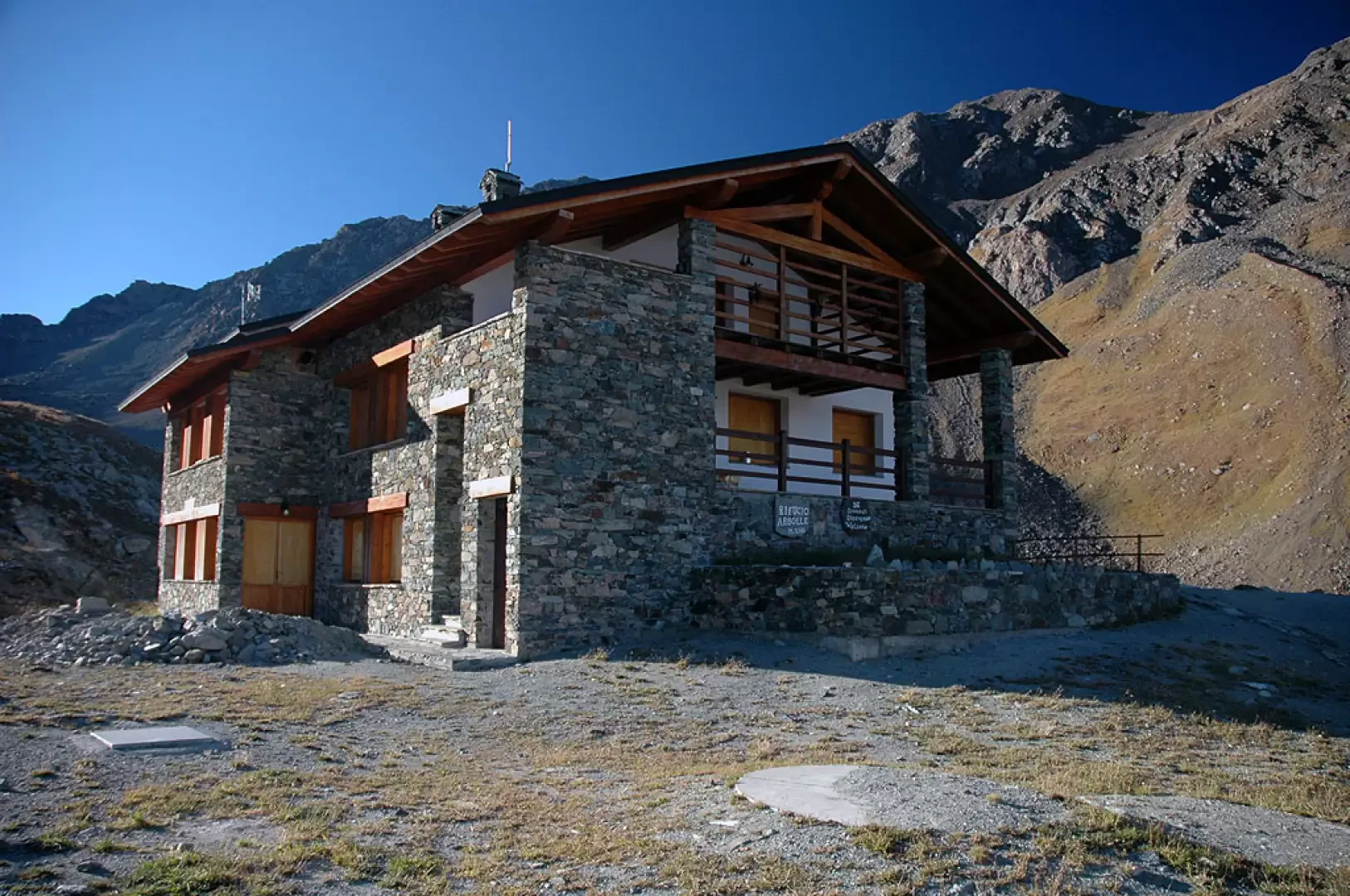
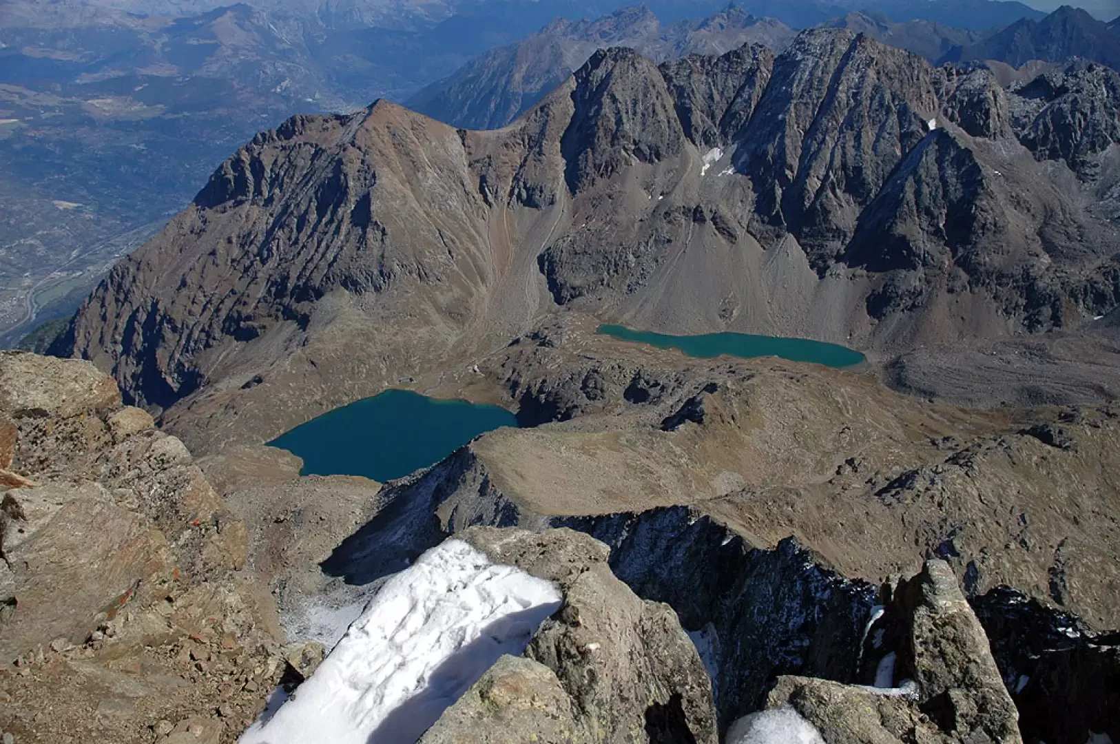
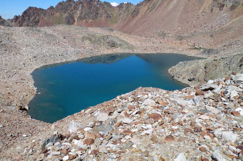
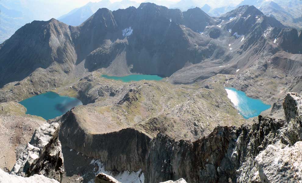
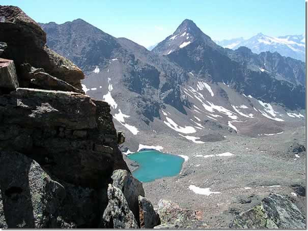
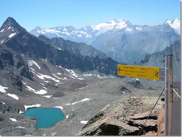
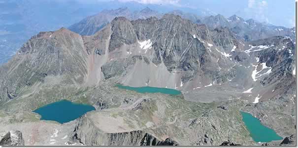
From here we begin to climb the ridge that leads to Col Chamolé: the path, which is very popular, climbs comfortably up the grassy ridge below the Tête Noire; as we ascend it, the panorama becomes more captivating and the view of the lake below becomes more and more impressive. At the end of the innumerable hairpin bends, the pass is finally reached and the Arbolle comba opens up before us with the refuge and the two small lakes located near it. The marker placed on the pass (2655m, 2h10') indicates that the path for Punta Valletta starts on the right; we ignore it and begin the descent of about 150m until we reach the plateau that precedes the refuge. We cross the stream with the runoff from the Arbolle lakes and reach the Rifugio Arbolle (2523 m, 2h30').
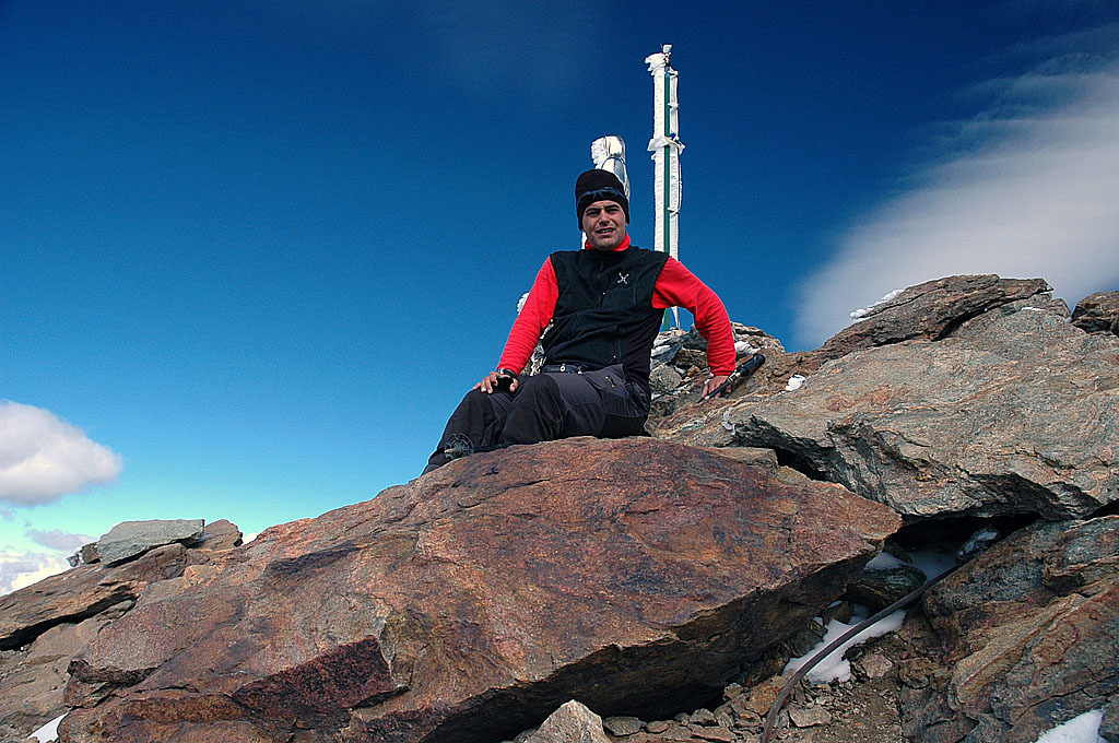
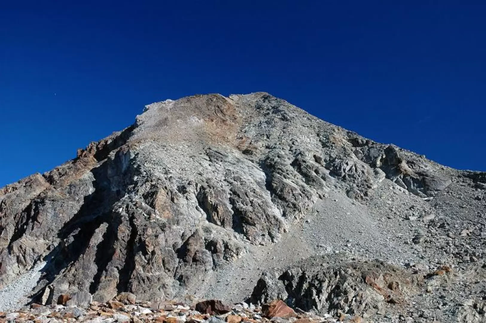
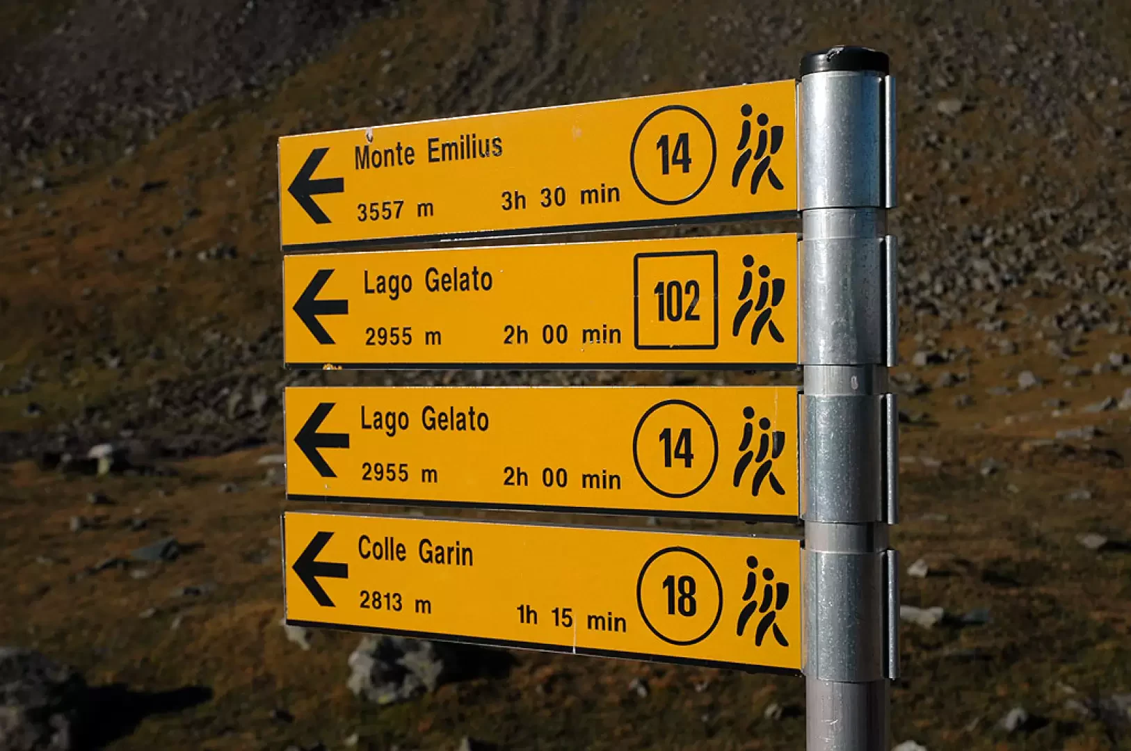
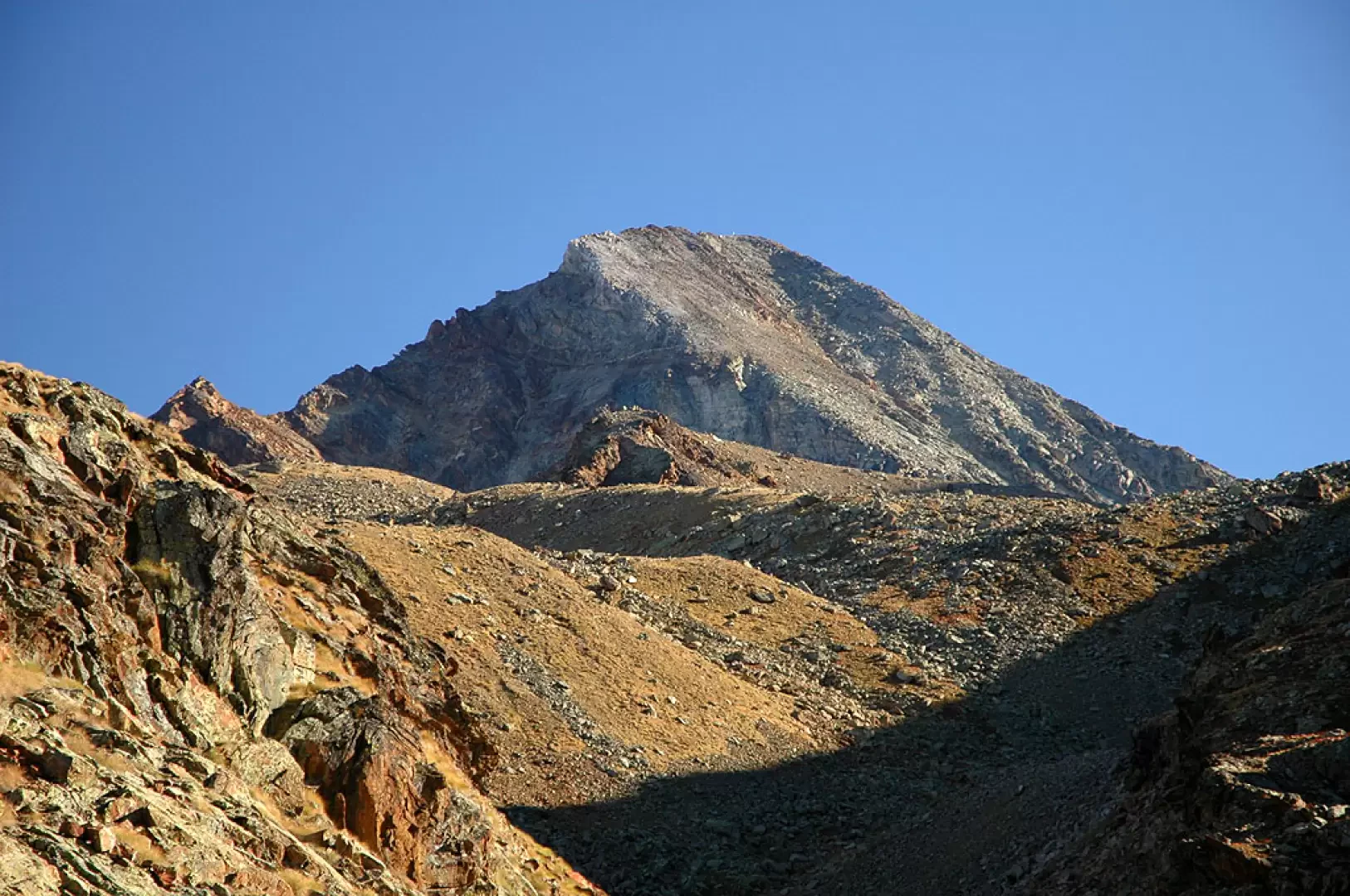
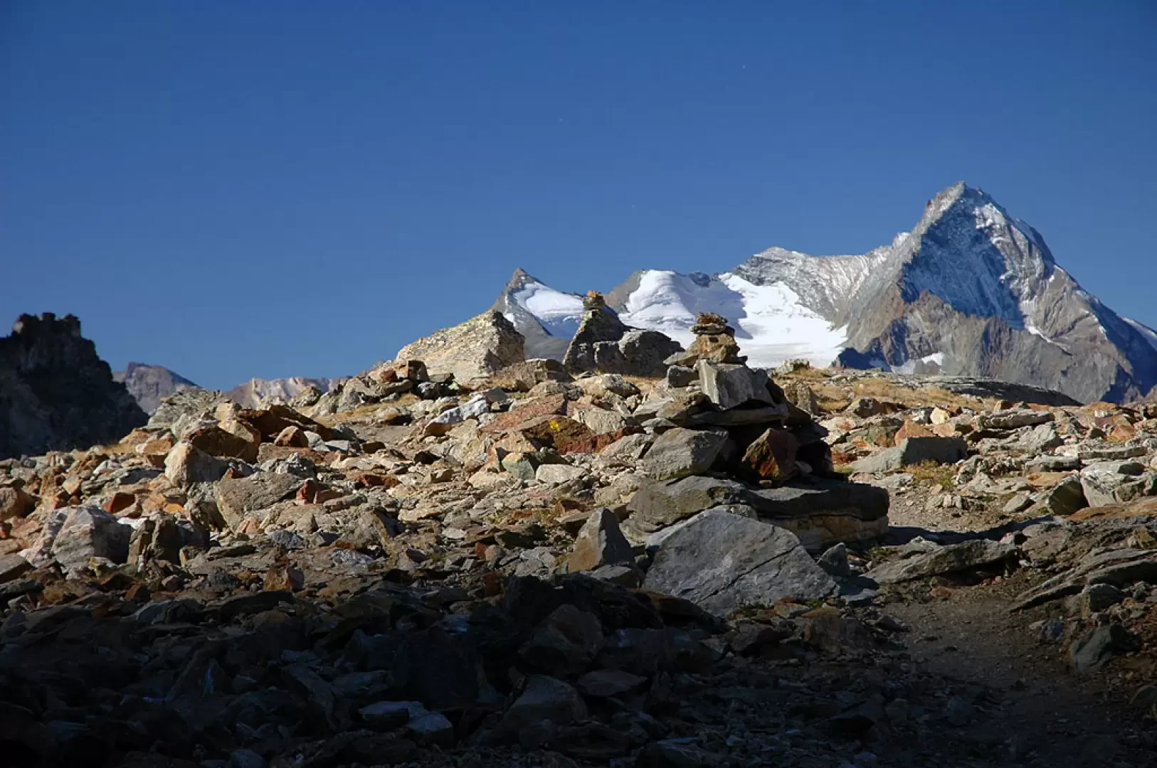
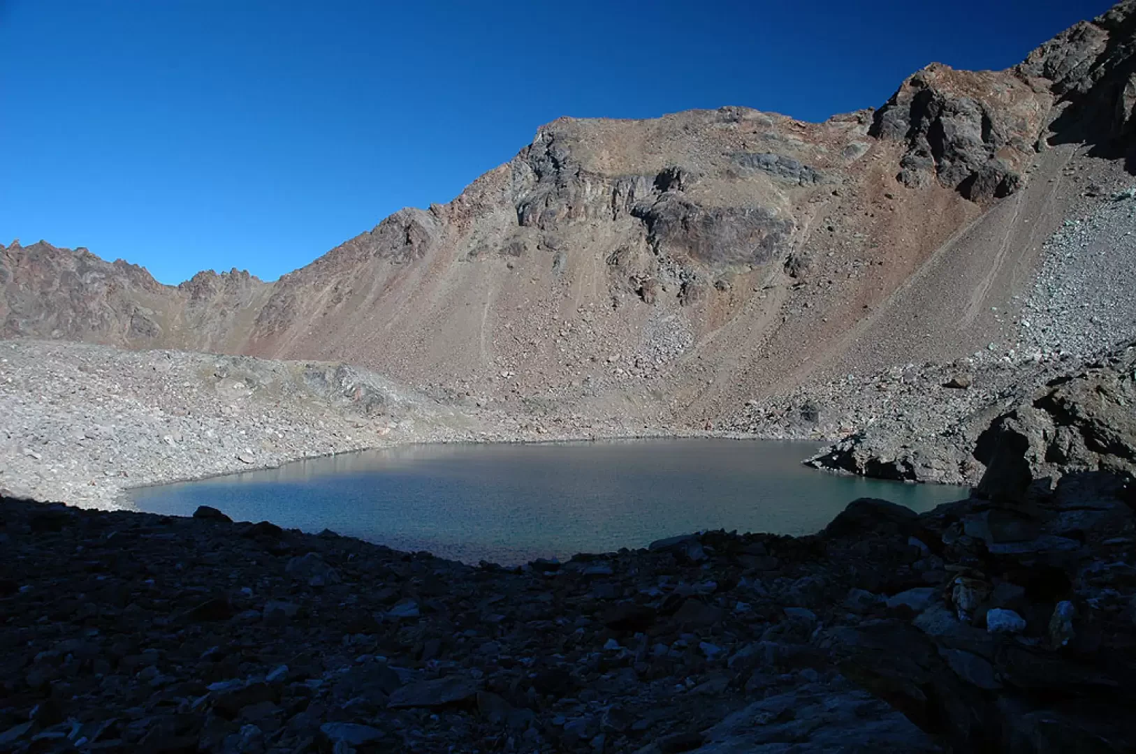
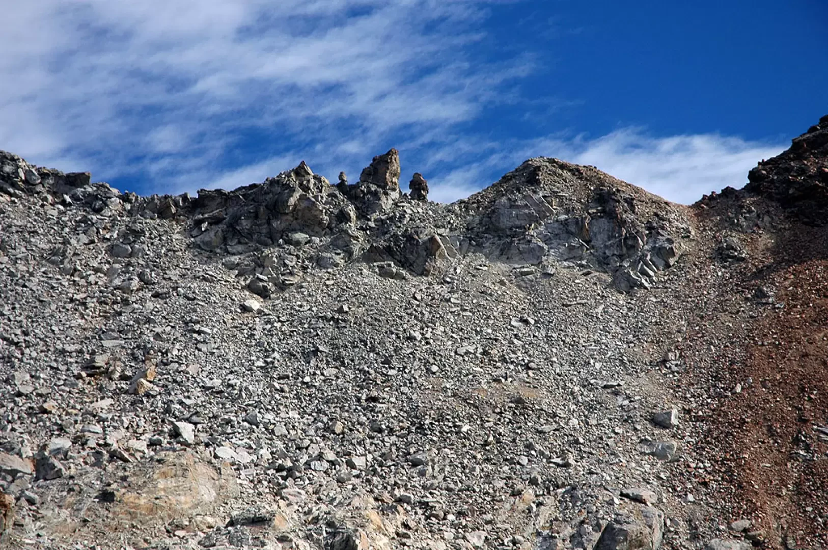
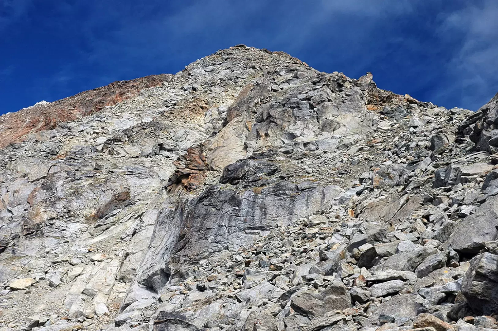
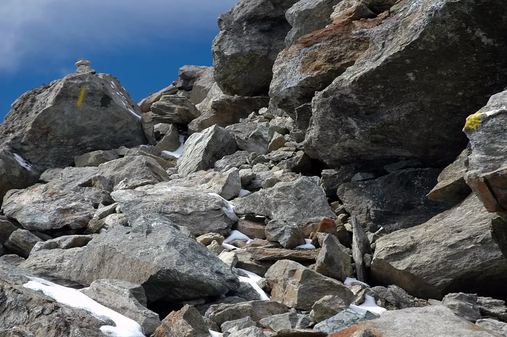
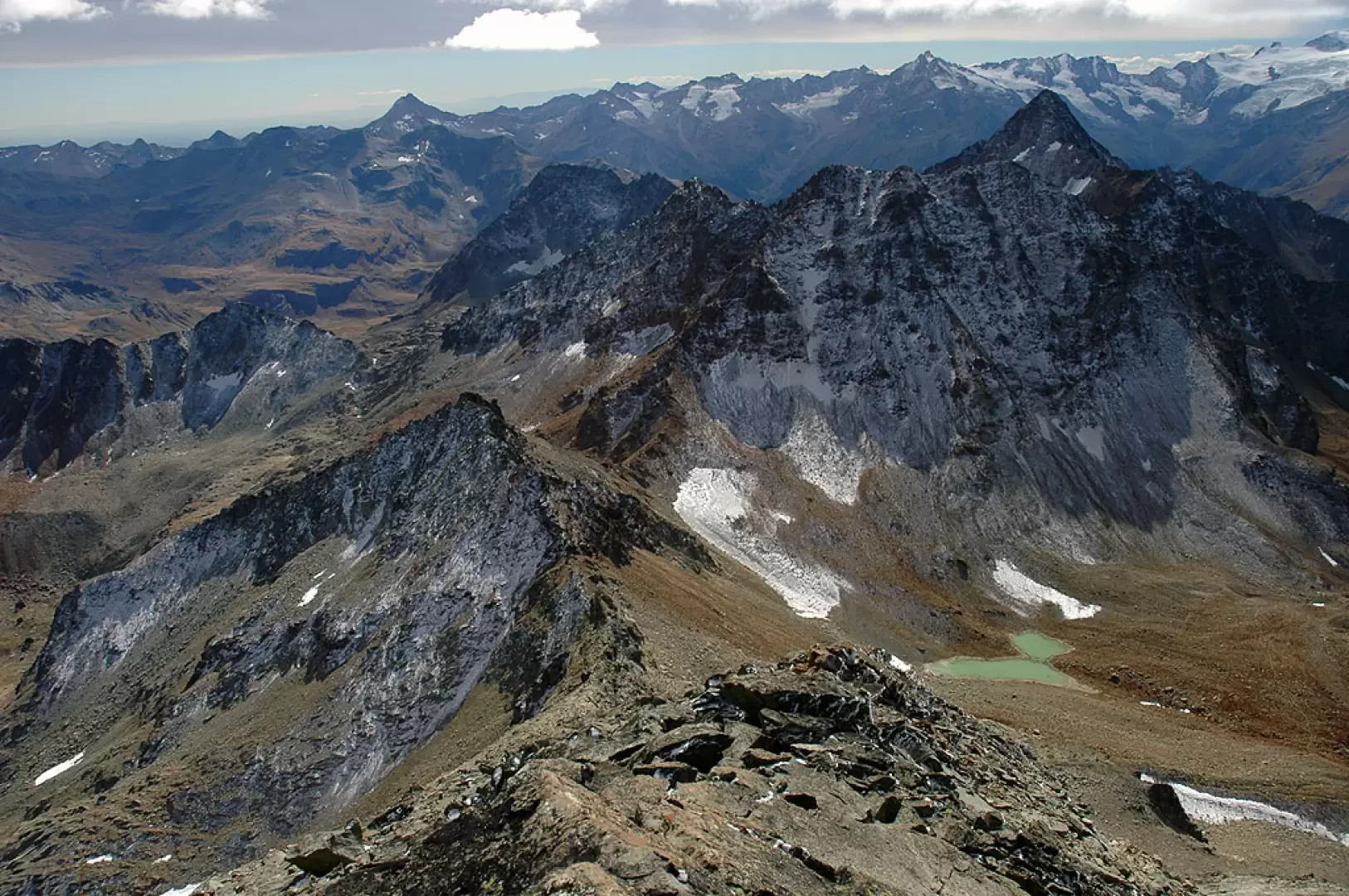
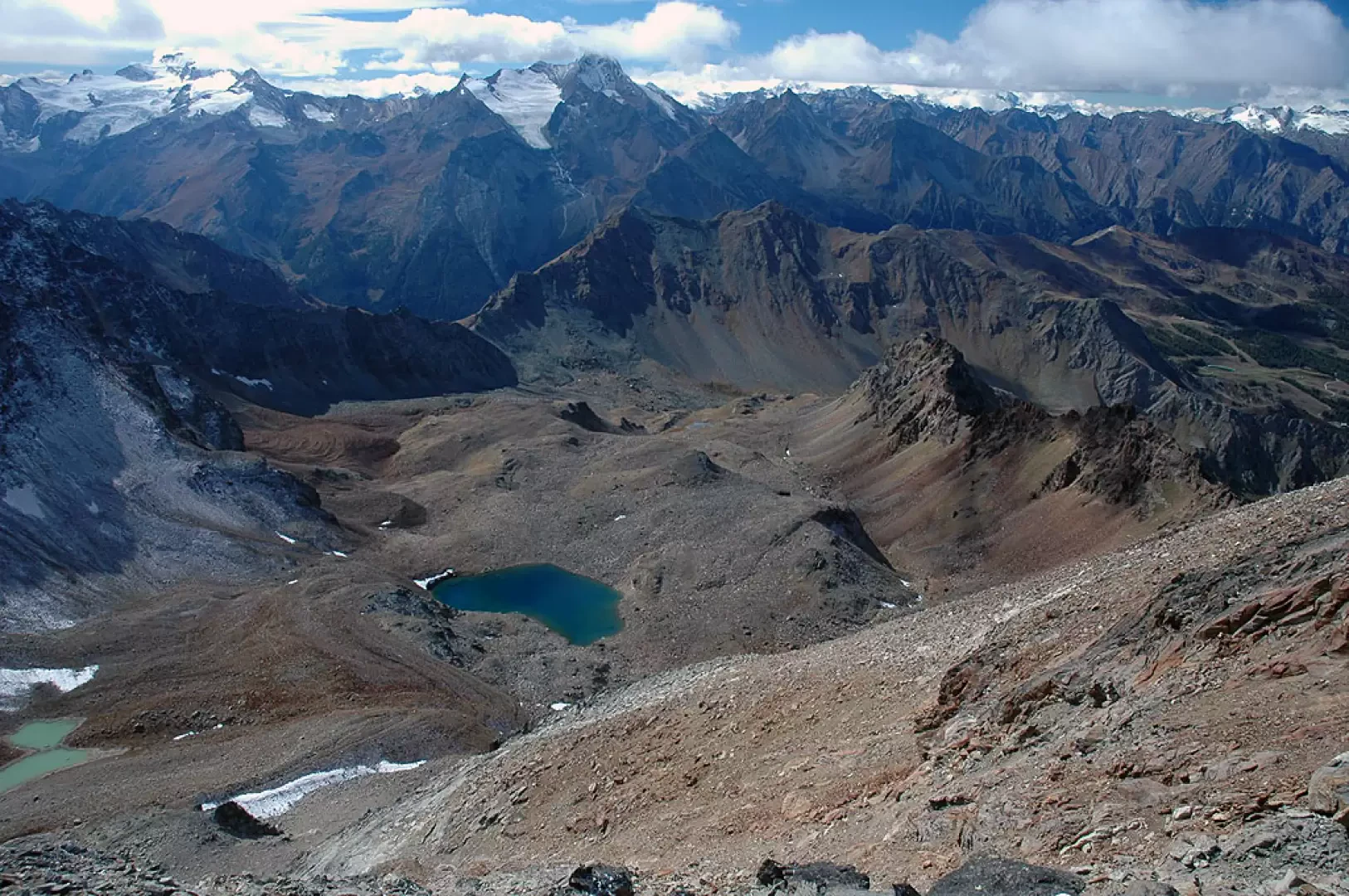
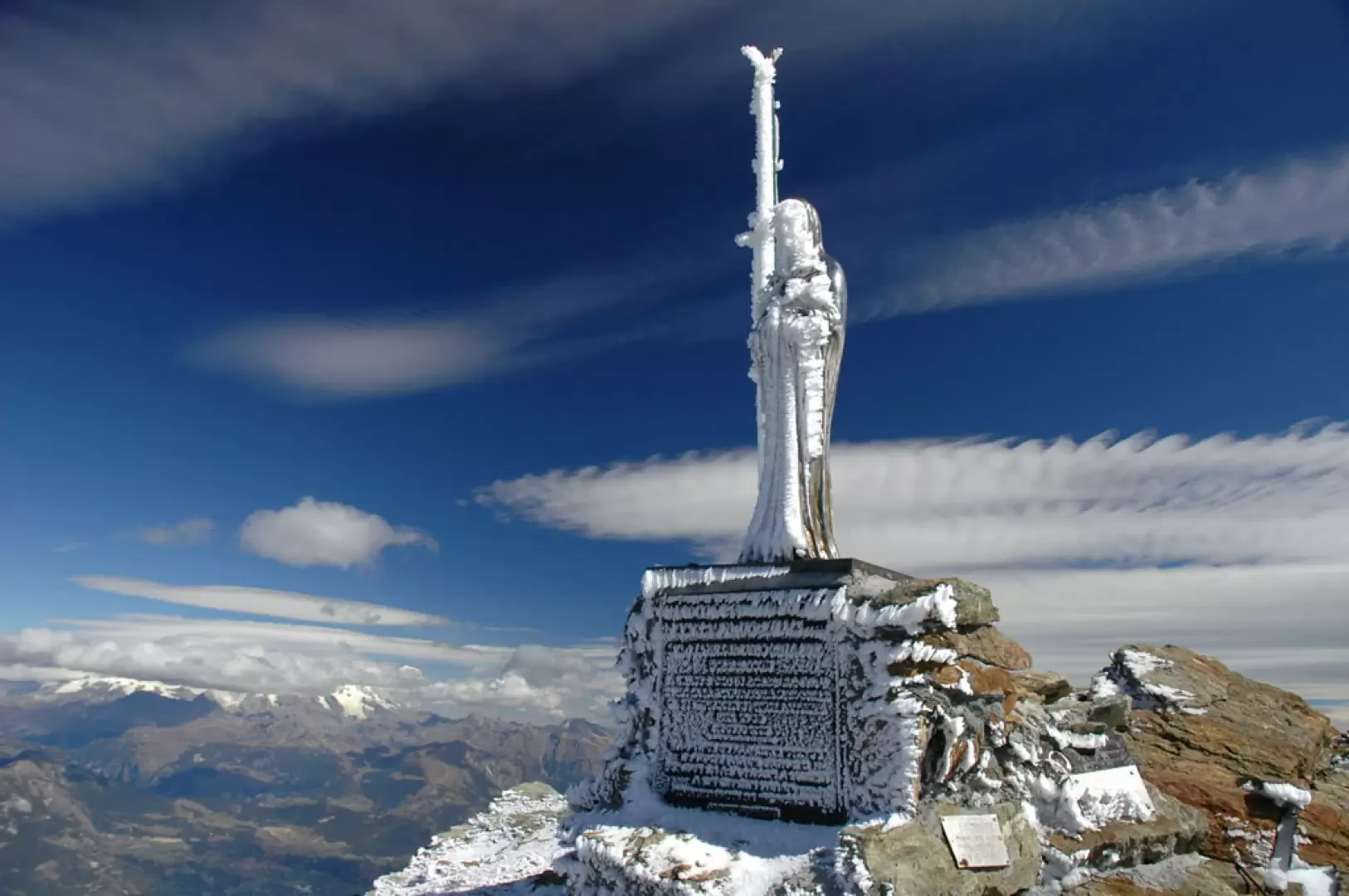
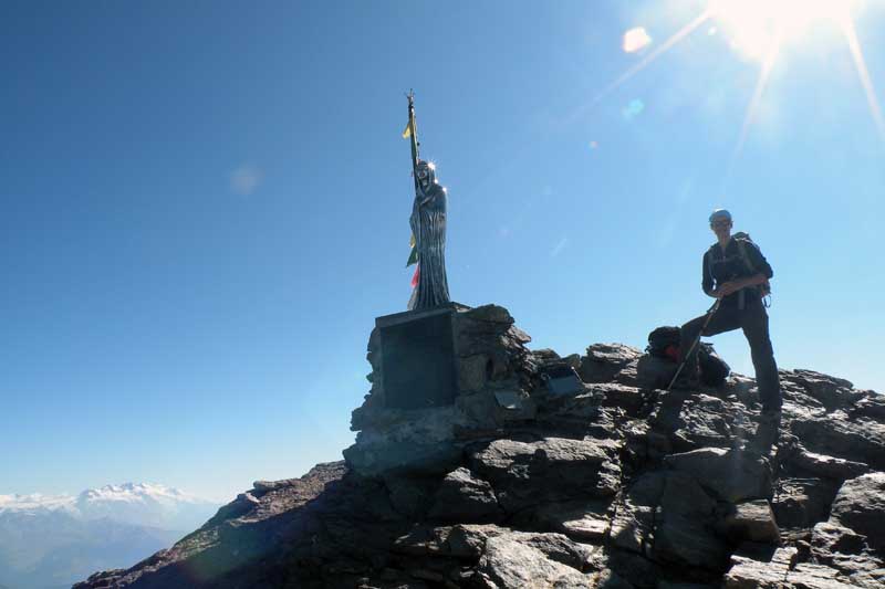
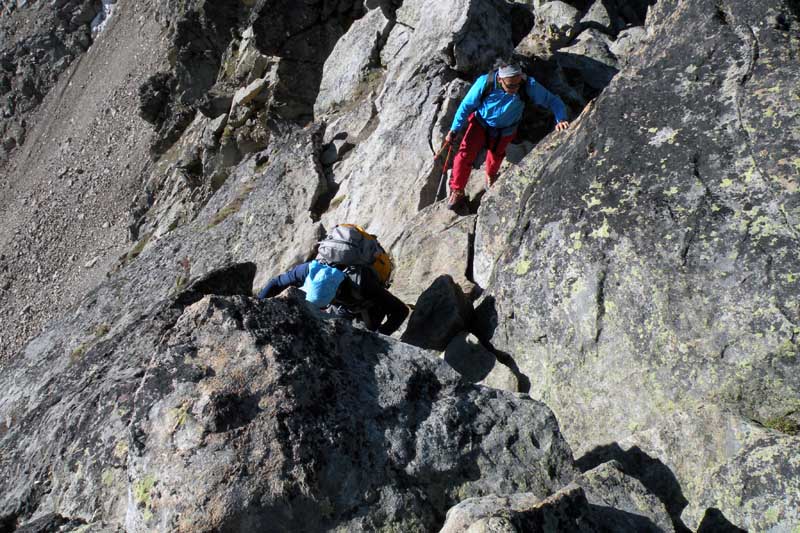
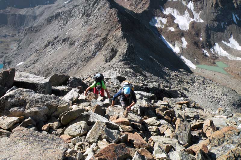
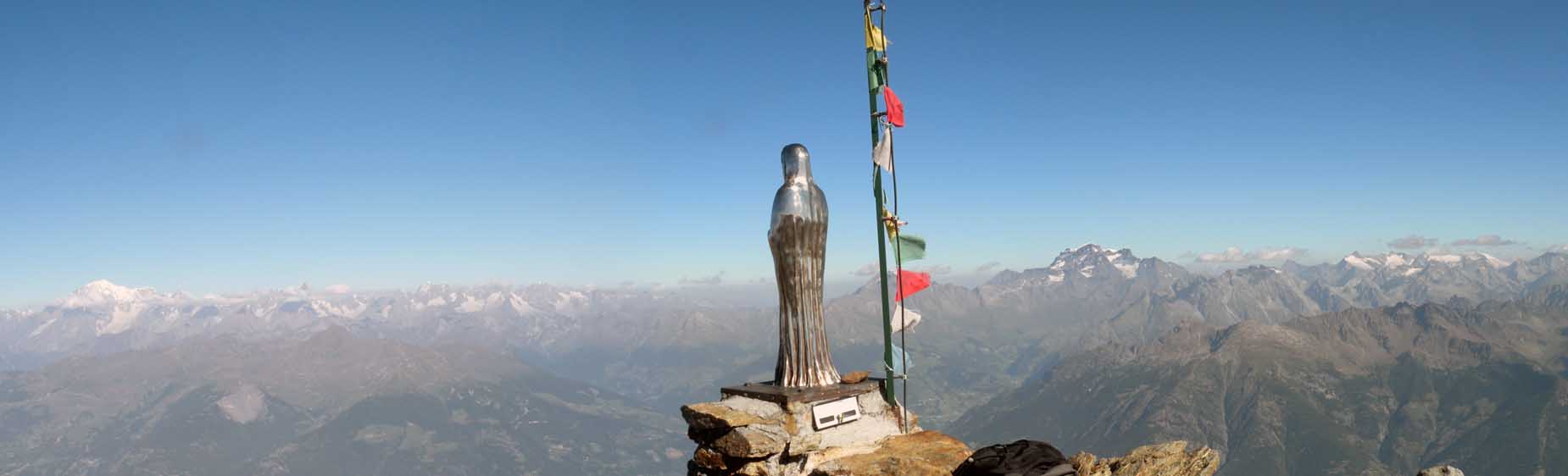
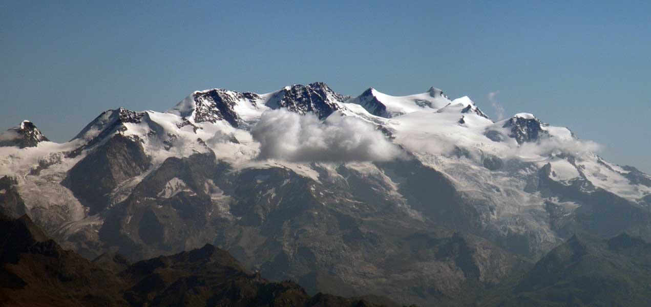
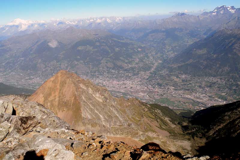
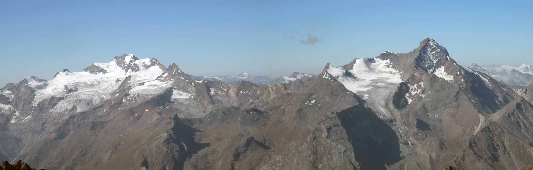
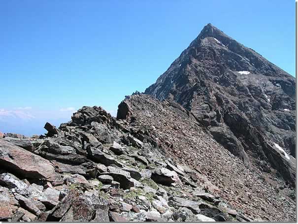
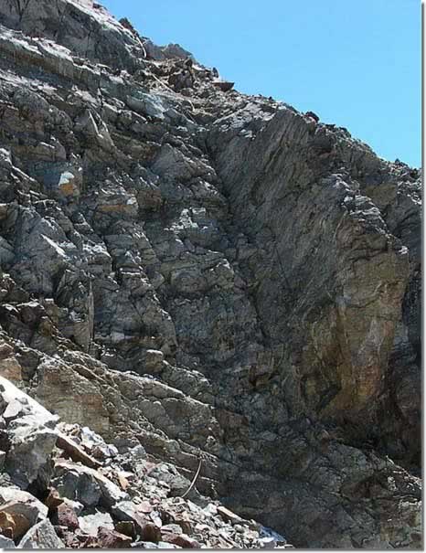
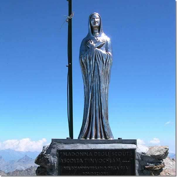
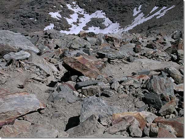
In front of the refuge, a path starts and shortly after rejoins the one below, which runs alongside the two small lakes and begins to climb up the wide Arbolle valley; in front of us the Punta Garin (3451m) begins to appear and a little to the left we can glimpse the notch of the pass of the same name. The path flanks the stream until it reaches a wide plateau where it dissipates, widening out: from here we begin to climb halfway up its orographic left, almost immediately meeting the fork for Col Garin (2583m, 2h50'). At this point, the path gains altitude, crosses the small outflow stream of Lago de l'Echo and with a couple of hairpin bends takes us to a small ridge dividing the hollows that descend from the Tre Capuccini and d'Arbolle hills. The environment is now that of the high mountains, the prairie thinning out more and more, leaving room for immense stony ground: every now and then it is worth pausing to admire the beautiful panorama behind, from the ridge of Punta Valletta the Grivola and Mont Blanc emerge imperiously. The walk continues steadily uphill without, for now, excessive steepness until reaching the Lago Gelato (2970m, 3h40'). We ascend a scree section and reach the junction for Col d'Arbolle (3033m, 3h50'): we now continue on the left-hand fork (14), which will lead us to our destination. After a short ascent, we descend a depression for a few tens of metres, near a small meltwater lake, and then climb back up towards the Col dei Tre Cappuccini. We are walking under the south face of the Mont Emilius on a trail that crosses the enormous stony face: yellow arrows assist us on the ascent of the col, engaging us a little in finding the correct passages until we reach the summit of the Colle dei Tre Capuccini (3246m, 4h30'). After casting a glance over the beautiful Laures valley and the distant, but not too distant, Becca di Salé, Petite and Grande Roèse and Tersiva, we begin to climb the so-called 'south ridge'. You pass an initial passage on rocks that does not present any difficulty but which nevertheless requires due attention, and ascend following the trail. Some yellow signs (not always evident) make us quickly ascend the difference in height that separates us from the summit. With a bit of effort, we finally reach the summit (3559m, 5h30'), a viewpoint of absolute beauty: in fact, its central position with respect to the Aosta Valley territory allows a 360° view of all the main peaks in the region. A cross and a Madonnina are positioned on the summit.
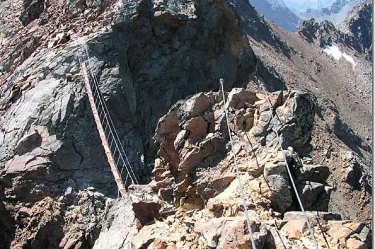
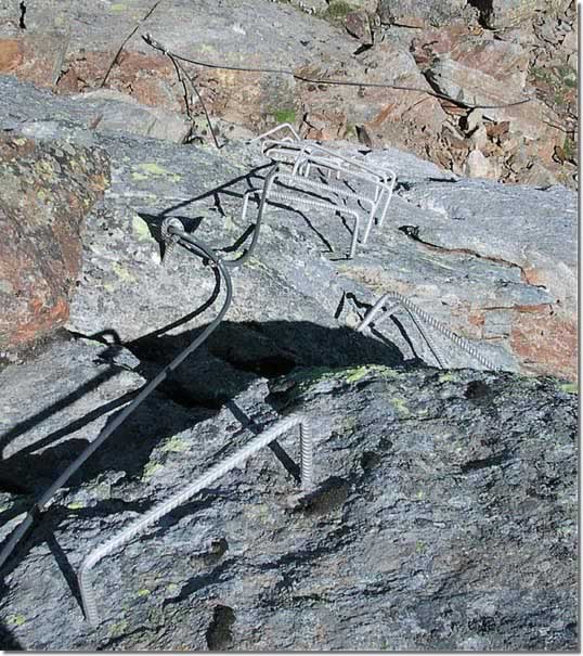
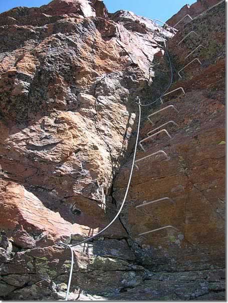
Just below the Madonnina, in the direction of the west ridge, is the start of the via ferrata that leads to the Federigo Zullo Bivouac in about 5h00'.
Galleria fotografica
We have been there

Edited by:
leverogne
Notturna al Monte Emilius


Edited by:
furs
Mont Emilius
Salita per la normale in 5 ore da Pila (soste comprese) domenica 5/9/2005. Ambiente molto bello. Attenzione ai segni gialli vecchi nella parte alta dai Tre Cappuccini alla punta - è molto più sicuro in diversi punti seguire le evidenti tracce di passaggio piu' verso la cresta.
Edited by:
Gian Mario Navillod
Mont Emilius
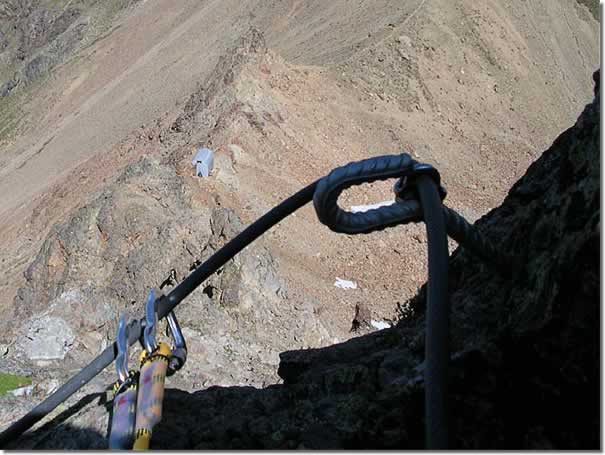
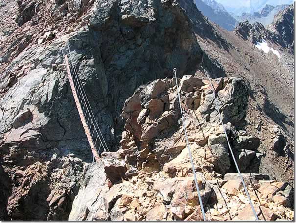
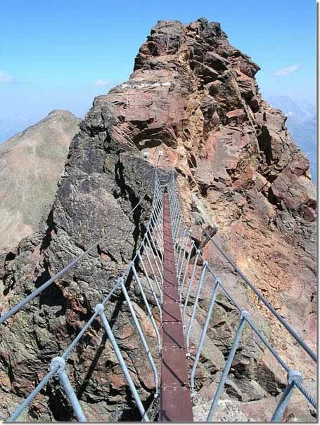
E' senz'alteo la via ferrata più panoramica che offra l'intera Valle d'Aosta, lo sguardo spazia sulle più belle montagne delle alpi e intorno alla cima scintillano una decina di laghi grandi e piccoli. Le difficoltà non sono eccessive, rari tratti verticali si alternano a lunghi saliscendi sulla cresta, quasi mai esposti. Il ponte sospeso lungo una ventina di metri offre un pizzico di adrenalina ad una salita lunga e poco impegnativa. Purtroppo l'ultimo tratto di ferrata, proprio sotto il torrione sommitale, presenta un paio di metri verticali che non sono stati attrezzati con i consueti gradini, le rocce su cui si arrampica non sono stabili e vi sono numerosi sassi in precario equilibrio proprio all'uscita del passaggio chiave.
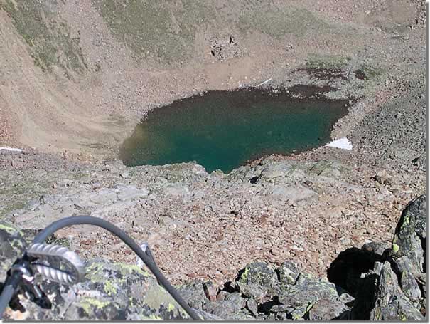
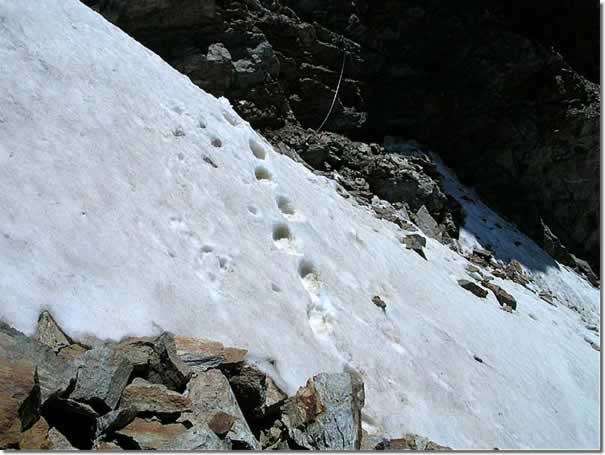
Dal Col Carrel si percorre la cresta in direzione del ponte tibetano ben visibile durante l'avvicinamento al Bivacco Federigo e ora nascosto dalle rocce. Si procede lungo una traccia di sentiero non protetta per una cinquantina di metri di dislivello fino a raggiungere l'inizio del tratto attrezzato. Il cavo è in acciaio inox rivestito di materiale plastico, la guaina oppone una leggera resistenza allo scorrere dei moschettoni e rende la progressione un poco più faticosa rispetto alle ferrate realizzate con il cavo non rivestito. Si prende gradualmente quota seguendo il filo della cresta, lasciandosi alle spalle la costruzione metallica del bivacco Federigo e poi lo specchio d'acqua del lago Carrel e dopo aver percorso alcuni gradini si arriva al gendarme dal quale parte il ponte tibetano lungo una ventina di metri (1h00'). Da questo punto lo sguardo spazia sul ghiacciaio del Trajoz e la Grivola, che si stagliano contro il cielo sulla destra, verso sud ovest. Proseguendo in senso orario si vedono in lontananza il massiccio del Monte Bianco e il Grand Combin, il Monte Cervino e il massiccio del Monte Rosa. Si scende sul ponte tibetano e lo si percorre sulle tavole di legno larghe una spanna per poi riprendere la cresta fino a raggiunger lo spartiacque tra il vallone di Arbolle e quello di Comboé superato il quale compare il Lago Gelé con alla destra la sagoma slanciata del Pic Garin. Si superano con alcuni saliscendi il Mont Ross di Comboé e il piccolo Emilius e si raggiunge l'uscita della ferrata che scende al rifugio Arbolle (2h00'). Fino a questo punto le difficoltà sono modeste e il percorso non presenta alcun pericolo. Proseguendo verso la cima si incontra un breve tratto verticale ben attrezzato superato il quale si arriva proprio sotto il gendarme sommitale del Monte Emilius dove si devono attraversare pochi metri di nevaio ripido ed esposto dove inspiegabilmente non vi è traccia di protezione. Seguono un paio di metri verticali che non sono stati attrezzati con i consueti gradini ma sono protetti con il solo cavo d'acciaio. Le rocce su cui si arrampica sono ben manigliate ma non ancora ripulite. Ci sono dagli appigli che si muovono e all'uscita del passaggio chiave restano ancora numerosi sassi in precario equilibrio che rischiano di cadere in testa a chi sta salendo. Superato questo brutto passaggio la ferrata prosegue ancora per una decina di minuti su pietraia, poi malgrado vi siano ancora dei passaggi esposti si interrompe e occorre proseguire per un'altra decina di minuti lungo la cresta, senza protezione, fino a raggiungere la vetta (3h00'). Il Monte Emilius é posto al centro della Valle d'Aosta è ed forse il migliore belvedere su tutti i principali quattromila delle alpi. Nelle giornate limpide si possono vedere il Gran Paradiso con ai sui piedi il ghiacciaio della Tribolazione, alla sua destra la Grivola (3969 m) e proseguendo in senso orario il massiccio del Monte Bianco, con il Dente del Gigante e le Grandes Jorasses, il Grand Combin, il Monte Cervino e il massiccio del Monte Rosa. Volgendo gli occhi in basso si domina la conca di Aosta parzialmente nascosta dalla Becca di Nona e il vallone della Laures con i laghi omonimi, sulla destra, separato dal Colle dei Tre Cappuccini il vallone di Arbolle con il lago Gelato.
Discesa al rifugio Arbolle
Dalla vetta si scende lungo il sentiero esposto e a tratti difficile che porta al Colle dei Tre Cappuccini (0h30'). Dal colle seguendo il segnavia si percorre il piacevole sentiero restaurato dagli operai forestali che raggiunge prima il Lago Gelato poi il lago di Arbolle e l'omonimo rifugio. Il Monte Emilius deve il suo nome alla signorina Emilie Argentier che nell'ottocento ne salì la cima. Il Pic Carrel, così battezzato in onore del famoso Canonico Georges Carrel, detto l'amico degli inglesi per le sue numerose conoscenze nell'ambito scientifico ed alpinistico, riprese dopo pochi anni l'antico appellativo di Becca di Nona che porta ancor oggi. Resta a ricordare l'insigne intellettuale solo il Col Carrel dove è stato costruito dal CAI il Bivacco Federigo Zullo. Cartografia
- [[Conca di Aosta, Pila Mont Emilius]], Carta dei sentieri foglio 4, 1:25000, L'Escursionista Editore, 2008
Galleria fotografica
Edited by:
Massimo Martini
Mont Emilius e dintorni
Ho raggiunto la vetta dell'Emilius partendo da Pila. Giornata splendida anche se in vetta il freddo si è fatto sentire. Consiglio vivamente questa escursione!!!! Ma intraprendetela solo in ottime condizioni meteo...