Mont de la Saxe, from Raffort

Edited by:
Massimo Martini
Updated at: 11/02/2026
Access
Navigazione stradale
Lasciare lo svincolo autostradale di Aosta Ovest e procedere in direzione nord-est per 35m (0,04km). Prendere lo svincolo per la e proseguire per 900m (0,94km) fino alla rotatoria. Alla rotatoria, prendere la seconda uscita e imboccare la strada statale della Valle d’Aosta. Proseguire per 4,3km (5,24km) fino alla successiva rotatoria. Alla rotatoria, prendere la prima uscita e rimanere sulla per 550m (5,79km). Svoltare leggermente a destra per rimanere sulla e proseguire per 3,7km (9,49km). Alla rotatoria, prendere la prima uscita e continuare sulla per 2,2km (11,69km). Alla rotatoria successiva, prendere la seconda uscita e rimanere sulla per 14,1km (25,79km). Proseguire dritto sulla e continuare per 4,4km (30,19km) fino a raggiungere una rotatoria. Alla rotatoria, prendere la seconda uscita e rimanere sulla per 800m (30,99km). Svoltare leggermente a destra e imboccare Vicolo Dolonne, proseguire per 140m (31,13km) attraversando la rotatoria. Mantenere la sinistra e continuare su Strada Margherita per 42m (31,17km). Svoltare a sinistra e imboccare Via Circonvallazione, proseguire per 210m (31,38km). Continuare su Viale Monte Bianco per 300m (31,68km). Alla rotatoria, prendere la seconda uscita e imboccare Strada Sergio Viotto, proseguire per 170m (31,85km). Svoltare a destra e imboccare Strada Adolphe Rey, proseguire per 160m (32,01km). Continuare su Strada Grand Ru per 260m (32,27km). Svoltare a sinistra e imboccare Strada del Villair, proseguire per 600m (32,87km). Continuare su Via – Rue Val Sapin per 550m (33,42km) fino a raggiungere la località Raffort, dove si trova il parcheggio.
Descrizione del parcheggio
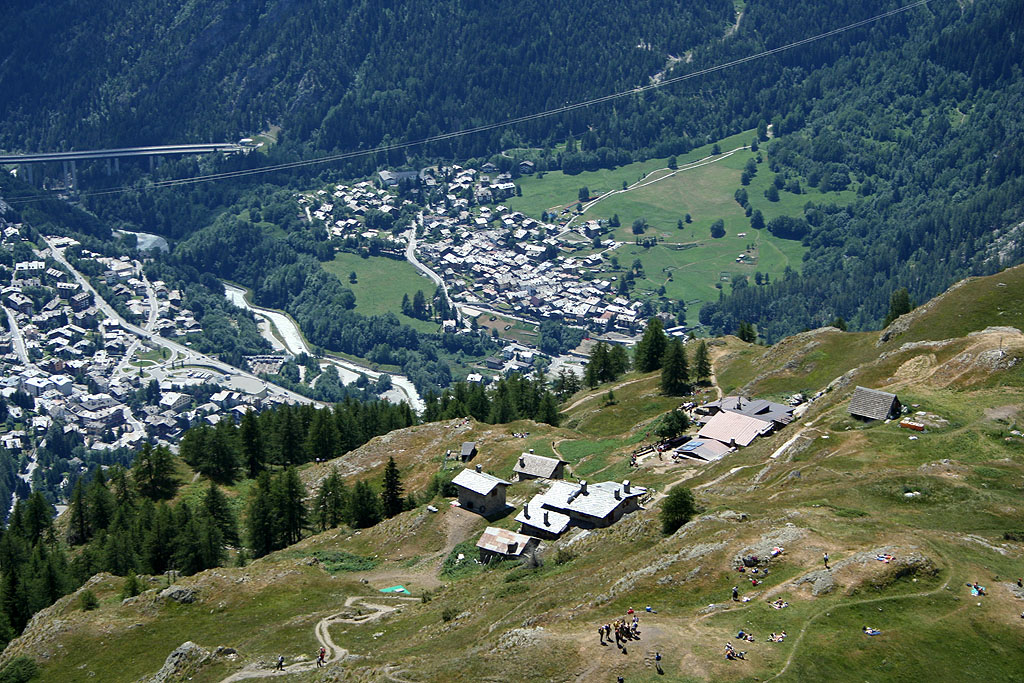
In località Raffort si trova un parcheggio 🅿️ gratuito al termine della strada comunale, nei pressi dell’abitato. Il parcheggio costituisce il punto di partenza dell’itinerario. La disponibilità di posti è limitata; si raccomanda di parcheggiare senza intralciare la viabilità locale.
Accesso con mezzi pubblici
La località di Courmayeur è servita da autobus di linea gestiti da Arriva Valle d’Aosta. Raffort non è tuttavia direttamente servita da fermate dedicate; prevedere un trasferimento a piedi dal centro di Courmayeur. Verificare preventivamente orari e frequenze, che possono variare nei periodi festivi o stagionali.
Distanza e tempo di percorrenza
🕒 Tempo di percorrenza: 42 minuti
📏 Distanza: 33,42km
Navigazione GPS
📍 Come arrivare con Google Maps
📍 Come arrivare con Apple Maps
ℹ️ Nota importante
Le indicazioni fornite sono state verificate alla data del rilievo dell’itinerario. Prima della partenza si consiglia di verificare possibili variazioni del percorso o delle condizioni stradali. Per informazioni aggiornate si raccomanda di consultare Google Maps o Apple Maps.
Description
0h00' Leaving the car in a small car park after the village (note: there are not many parking spaces, so it is advisable to park further down to avoid obstructing residents), continue along a small road that is first asphalted and then, at a chalet on the left, unpaved. Take a tree-lined lane up the orographic left of the Val Sapin stream. After about 5 minutes, you come to a panel with a thematic map of the paths in the Espace Mont Blanc and a signpost indicating the itinerary to follow to reach our destination: path
.
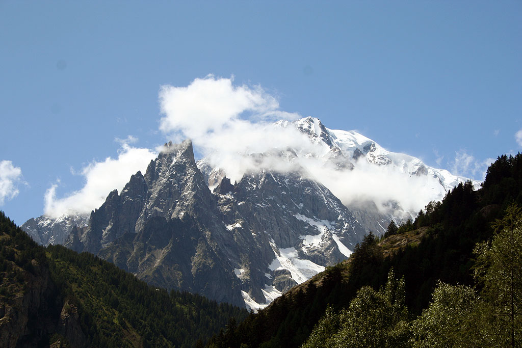
You pass a bar and continue on the dirt road; after a few metres, cross the stream on a small concrete bridge and climb up this stretch of road without too much of a slope, which offers beautiful views of Mont Blanc, the Aiguille Noire de Peuterey and Mont Chetif. After a 20-minute walk, on the bend in the farm road, we come to the crossroads for Belvedere (1580m, 0h45'), trail (37), and for La Saxe (1226m, 0h30'), trail (34). We continue along the road, which crosses a Scots pine and birch forest without any particular difference in altitude and enters the Val Sapin. After about 25 minutes we come to the junction for the refuge, following path
.
We turn left and begin to climb up a beautiful path through a verdant forest; after 0h40' we come to a monument dedicated to the Aosta Battalion and its unmistakable motto!
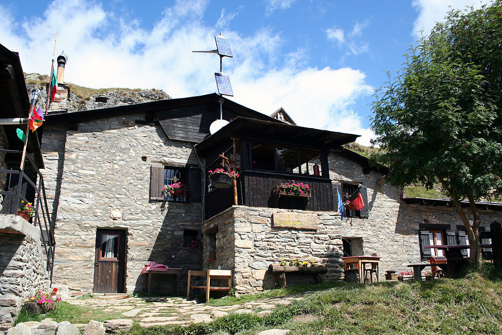
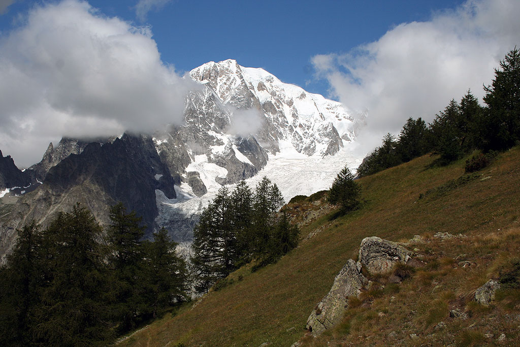
We continue up into the forest, enjoying sudden panoramic views of the surrounding mountains: in the distance the mountains of La Thuile and in the foreground the mighty Mont Crammont. After about an hour's walk, the path flattens out slightly, heading south and then starts to climb again on the last stretch of the route. Having passed a rudimentary stone bench, we finally leave the last strip of larch woodland and after 1h 25' we reach a signpost at the foot of the hut: in front of us emerges in all its splendour Mont Blanc and the unmistakable silhouette of Mont Chetif: from here we reach the hut in five minutes.
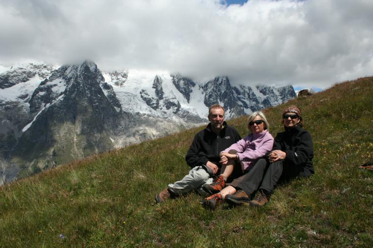
Just above the hut we find the alpine pastures of Le Pré (2000m) and an orientation panel to enjoy the fantastic panorama of the entire Mont Blanc Massif.
From the col, go up the grassy slope following the signs for Testa Bernarda until you reach the characteristic grassy ridge at the foot of the Mont Blanc Massif
.We have been there

Edited by:
Ermanno Panara
Mont de la Saxe
Gita al Rifugio Bertone con prolungamento sino al sovrastante Mont de la Saxe, difficile da individuare esattamente perchè non c'è una vera e propria cima, ma è un lungo crinale che porta a Testa Bernarda. Noi ci siamo fermati a quota 2220. Un vero peccato le nuvole che cingevano tutta la catena del Bianco. Si tratta di una località che merita di essere raggiunta con condizioni meteo perfette, per godere di uno dei panorami più belli delle Alpi. Ora è possibile parcheggiare molto più avanti rispetto alle indicazioni della relazione. C'è un parcheggio sterrato (una ventina di posti) poco prima del ponte, dove ci sono le paline e il tabellone. C'è una strada sterrata ma carrozzabile (che non ricordavo) che prosegue ben oltre il ponte; la si segue per un breve tratto e poi si trova, sulla destra, il sentiero. Dopo una ventina di minuti la si incrocia nuovamente; la si percorre pochi metri verso destra e si riprende il sentiero che riparte sulla sinistra. Per il resto è tutto sentiero ben descritto nella relazione.