Unghiasse Lakes, from Chialamberto

Edited by:
ATL_canavese_valli_di_lanzo
Updated at: 29/05/2025
Introduction
The route takes place in one of the most evocative and unspoilt places in Val Grande: the Vallone di Vercellina and the Cinghiasse basin. The route runs almost entirely on the GTA (Grande Traversata delle Alpi) - SI (Sentiero Italia) path and is suitable for an average hiker as it has a considerable difference in height.
Description
Take the tarmac track that begins upstream from the church. Follow it for about 10 minutes until you reach a larch wood, near which the road becomes a dirt track; once you have passed the tall vegetation, take the path on the right that leads into the Vallone di Vercellina, once the site of numerous iron and silver mines. Past the Invers huts (1647m), you enter a wooded area again, after which you walk halfway up the hillside among blueberries and rhododendrons. In a short time, we reach the pastures of Gias di Mezzo (2092m) and, moving to the right of the valley, we arrive at the Gias Nuovo alpine pasture (2322m): the path becomes steeper until we come in sight of the small Vercellina Lake (2484m, 3h00'), situated in an amphitheatre scattered with mountain rocks and erratic boulders, the remains of the glacier that once occupied the plateau. From this point, the pastures give way to an area characterised by gneiss, a rock that can easily be divided into parallel planes and exploited to make loze (stone slabs used to cover roofs).
In a short time we reach the panoramic Colle della Crocetta (2641m), situated on the watershed ridge between Val Grande and Valle Orco; the view from this pass is unforgettable; below is the deep blue of Lake Ceresole, in front the Gran Paradiso massif with the Ciarforon and Becca di Monciair on the left the Levanne, Colle Perduto and the head of Val Grande. The Colle della Crocetta also has considerable importance from a historical point of view, as it was at the centre of fighting for partisan liberation during the Second World War.
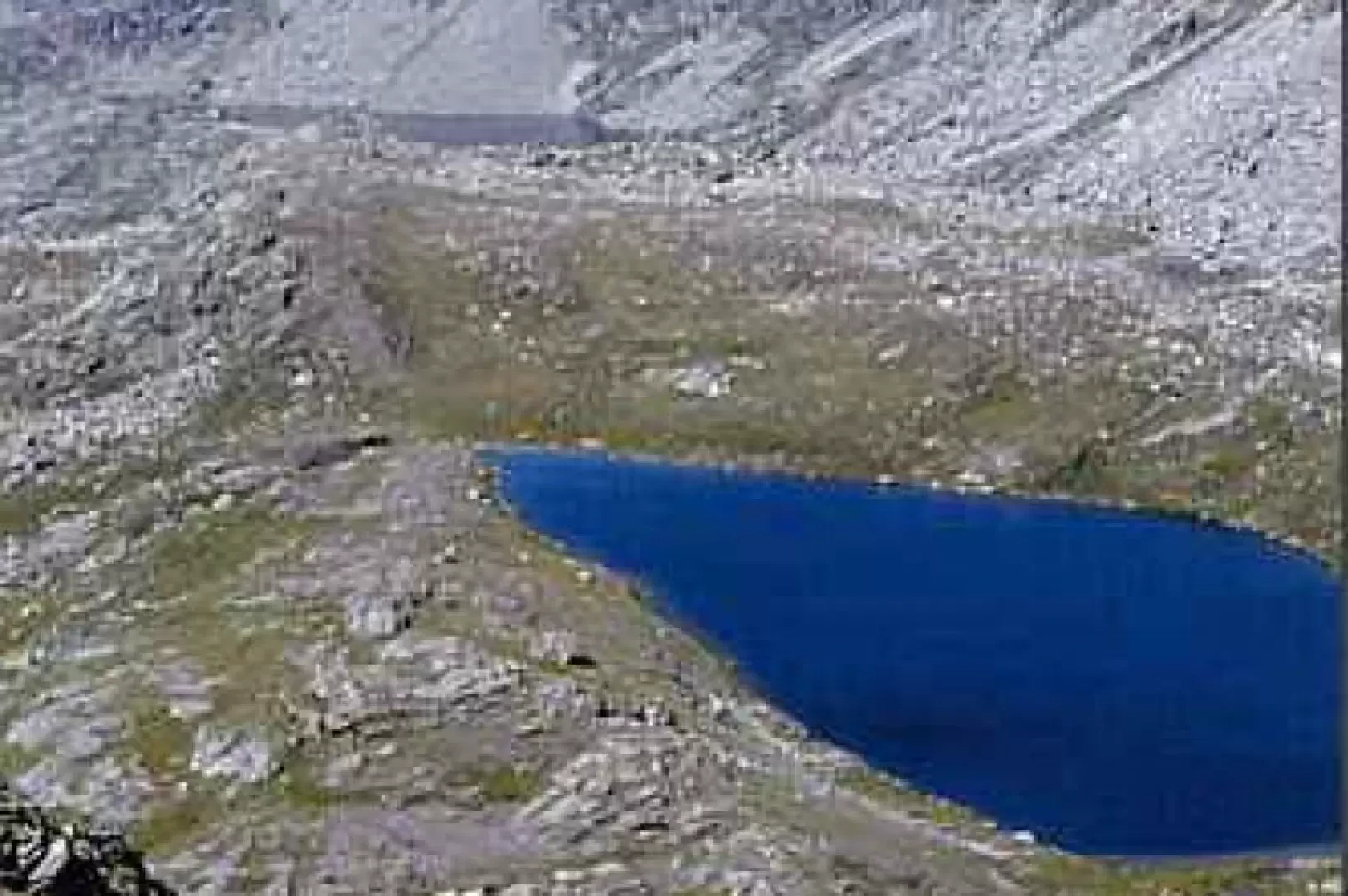
Continuing halfway up the hillside to the right, we briefly reach Colle della Terra (2723m), which connects the Vallone di Vercellina with the wild Unghiasse basin, a typical glacial cirque in which there are three lake basins: Lago Fertà (2557m), Gran Lago di Unghiasse (2494m, the largest in the Lanzo Valleys) and Lago di Unghiasse (2468m). In the flowering season it is a riot of marsh violets and plumes of the characteristic cottony white flakes.
The descent starts either by the ascent route or from the Vallone di Unghiasse. Crossing the Colle della Terra d'Unghiasse (in the opposite direction to the ascent route), you reach the adjacent Vallone di Vassola and the Laghi del Seone, the destination of the Seone Lakes route.
It is possible to combine the two hikes, spending the night in a tent or in a disused mountain pasture.