Pizzo Tracciora di Cervatto, from Rossa

Edited by:
Paolo Erba
Updated at: 29/01/2025
Description
With boots on our feet, we climb up to the town hall square where we encounter a historical signpost with indications of the paths in the area and immediately afterwards a panel on the Partisans and from where on the right the itinerary for Pizzo Tracciora begins.
From here we then climb up the paved road, with comfortable hairpin bends quickly gaining height until we reach two forks in quick succession. We ignore the first, turning right at the second, following the signpost for the Madonna del Purgatorio chapel.
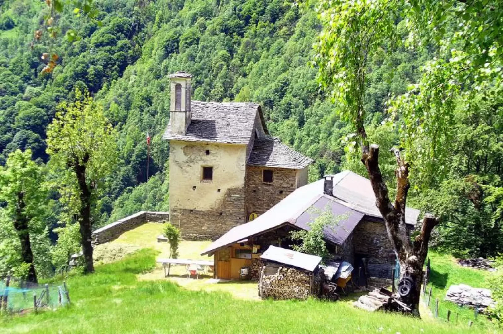
We now pass under the meadows and pastures of Rainero, where we will pass on our return journey, and the hamlet of Piana, where there is a lovely group of mountain huts with a sundial and the suggestive oratory of San Giovanni not far away. Between the two houses in the middle of the village, we find the sign indicating Pizzo Tracciora, the destination of our ascent and the highest peak in the area, from where we can enjoy a vast panorama.
Paying attention to the sometimes unclear track, we continue to climb with a constant gradient, passing some abandoned huts until we come to the pastures of Selletto. We climb up the fields first going all the way to the right and then straight uphill to another little chapel, evidence of how alive the Christian faith was in these places not far from where Fra' Dolcino was born and preached.
Behind the little chapel we find some rather confusing signs! Leaving aside the left-hand path that we will take on the return journey, we turn right uphill. Here we are in an area that alternates between beech, oak, chestnut and pastureland, with several modernised huts on the left that form the Campello alpine pasture.
At the last fork, we continue straight ahead to the edge of the forest, then we come out into the higher pastures from where we can see the summit of Tracciora. Leaving the last beech we head towards the alpine pasture and then steeply uphill, along a path that is no longer maintained, towards the last visible hut. From here, with no obligatory path, we ascend slightly to the left until we cross the path coming from Cervatto and then shortly reach the summit cross. The panorama is 360°, ranging from the plains to the peaks of Monte Rosa.
From Pizzo Tracciora it is possible to descend to Alpe Oro and reconnect with the first itinerary. This is a section for those seeking adventure because it is substantially devoid of signposts and tracks, which first runs along the ridge opposite the direction of arrival, i.e. heading north-west, and then descends into the valley that leads to Alpe Oro after touching the Alpe delle Balme.
Our return route, on the other hand, follows the outward route to the little chapel already mentioned. Here we continue straight on for a few dozen metres until we pay attention to an inconspicuous marker on a tree that makes us turn left. We are now in the splendid beech forest that overlooks Rainero. Carefully following the markers on the trunks, in the absence of a real path, we descend into the forest, always going slightly to the left. After a few tens of minutes we meet the track that descends from Madonna del Sasso and then in a short time we are in Rainero at Signora Ebe's ready to enjoy, hungry and happy, her thousands of delicacies.
To return to Rossa we take the mule track that starts downhill, passing in front of a fountain, on the opposite side of the village from the agriturismo.