Lac de Tsantelèina, from Thumel

Edited by:
Giancarlo Beretta
Updated at: 03/09/2024
Introduction
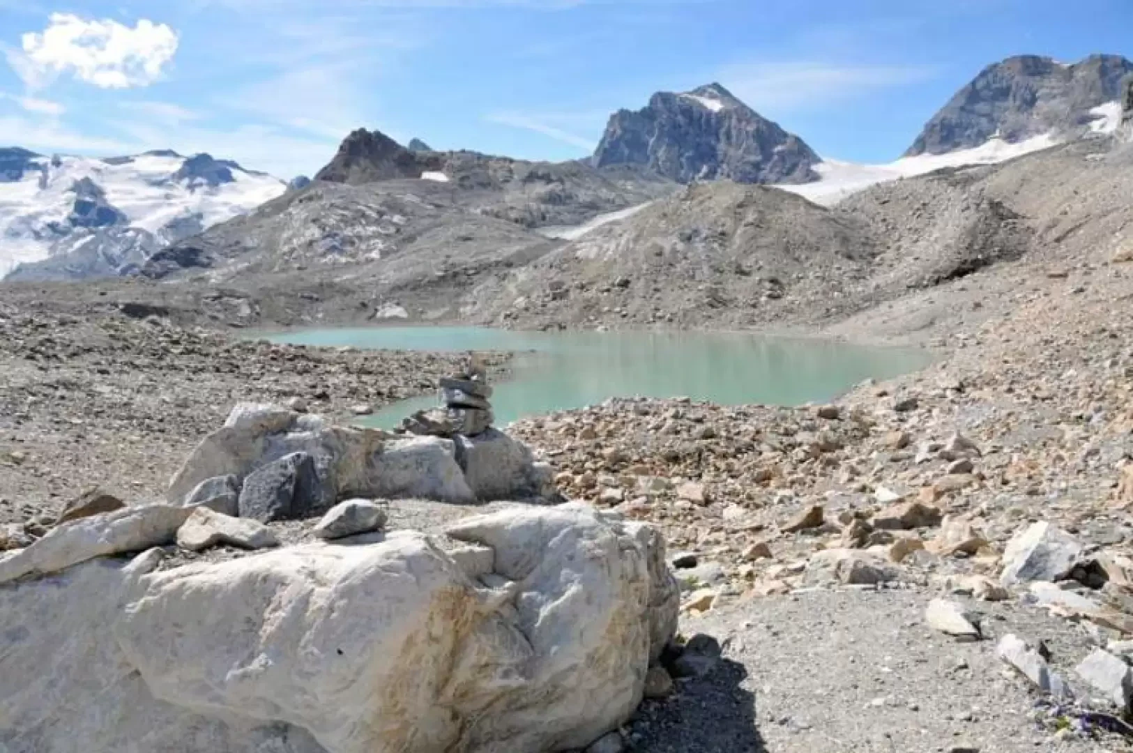
Despite its low altitude, this lake is located in a fascinating high-mountain environment nestled between moraines and vast scree slopes at the end of the tongue of the glacier of the same name and at the foot of the imposing south face of Granta Parei. The path is very busy as far as the Benevolo refuge and the junction for Lake Goletta, while further on you walk in increasingly solitary environments where it is easy to encounter specimens of alpine fauna. The view from the lake is somewhat closed in, but there are also beautiful glimpses of the Fond and Lavassey glaciers and the closer Roc du Fond and Punta Calabre.
Description
Leaving the car behind, continue a little further to the left along the road, passing the signposts for the itinerary and approaching a mountain hut from where, just to the left of the hut, the path begins, while to the right begins the farm road, which is forbidden to pass. After a few metres of ascent, we pass a mountain hut and continue uphill until we come to a stream that we cross with the aid of concrete steps and a chain to be used in the event of icy or otherwise slippery ground. Continue to walk pleasantly over the green pastures of the valley floor alongside the rushing Dora di Rhȇmes, gradually rising to the right and passing by the ruins of the Barmaverain alp. In a narrowing of the valley, near a gorge of the Dora, one crosses another stream and then climbs up towards the side of the mountain to reach the track coming from Thumel. Turning left and continuing on the track, you pass a high waterfall and, just past a bridge, take the path that starts to the right of it. The ascent becomes slightly steeper and, cutting further across the farmstead with the short cuts in the path, we arrive at the panoramic promontory where the Benevolo refuge (2287m) is situated. Passing in front of it, descend a little to cross a stream and move to the right, heading for the ruined huts of Sauches (2316m); now make a sharp turn to the left to climb, with the slope becoming a little steeper, up the side of the mountain and arrive, near a small plateau, at a junction at which you turn left, following the trail markers. The path approaches some small rocks that are bordered by a narrow ledge that is somewhat exposed and to protect it, a steel cable has been placed as a handrail. Once past this section, you come to a hollow and pass by a kind of peat bog and head towards a low rampart of light-coloured rocks, which you pass on the lower part on the right with a short climb, and above these the path ends on grassy ground and the stony path begins. In fact, you immediately take the edge of a moraine following the yellow marks and stone cairns, climb up the ridge and, after passing through a wide, flat scree slope, you arrive at the solitary lake.
For the descent, you can either return along the ascent route or, alternatively, go round the loop by returning to the end of the moraine and, instead of taking the path, turn right at the base of the moraine, walking a little on the stones and, after a short, almost flat stretch, you quickly lose altitude to descend into the valley below and contour the Truc de Tsantelèina to its lower foothills near a stream (2476m). In this section, a high and imposing waterfall can be seen on the right of the scree slope, descending from a rocky bastion and coming from the lake. When you reach the stream, turn left again following the obvious path and walk again through the high pastures past the Fond mountain pasture and soon return to the hut.