Lac de Sereina, from Planaval to Bonalex

Edited by:
Giancarlo Beretta
Updated at: 20/10/2025
Access
Lasciare l'autostrada al casello e, dopo 500 metri, uscire dallo svincolo immettendosi a destra sulla strada regionale per la valle di Cogne. Dopo 450 metri, alla rotonda, prendere la seconda uscita entrando sulla strada statale , da seguire per 18,4 chilometri, attraversando i paesi di Saint-Pierre, Villeneuve, Arvier, Avise e Derby, fino a raggiungere una rotonda. Prendere la prima uscita ed imboccare Via Corrado Gex, seguendo le indicazioni per il centro di La Salle. Dopo 350 metri, svoltare a sinistra su Via dei Romani e, poco dopo, alla biforcazione, girare a destra su Via Col Serena, seguendo le indicazioni per Chaffieron. Proseguire lungo la strada comunale, superando i villaggi di Chaffieron, Chateau, Vilarisson, Remondey, Cheverel e Morge, fino a raggiungere, dopo circa 9,3 chilometri, il villaggio di Planaval. Arrivati davanti alla Baita Jolie Bergère, scendere per una stradina asfaltata fino al ponticello sul Torrent Grand Eau, superare il ponte e svoltare a destra per risalire un breve tratto di strada sterrata. Poco dopo, si troverà un piccolo spiazzo erboso adibito a parcheggio (🅿️) nei pressi del torrente.
Distanza e tempo di percorrenza
🕒 Tempo di percorrenza: 38 minuti
📏 Distanza: 30,6 chilometri
Navigazione GPS
📍 Come arrivare con Google Maps
📍 Come arrivare con Apple Maps
Nota importante
Le indicazioni fornite sono state verificate alla data del rilievo dell’itinerario. Prima della partenza, è consigliabile verificare eventuali variazioni del percorso. Per ottenere indicazioni aggiornate e dettagliate, si consiglia l’uso di Google Maps o Apple Maps.
Introduction
The loop itinerary proposed here allows you to explore, first in its lower section and then in the verdant upper balcony, the splendid and solitary Comba de Planaval as far as Col Serena, with a small diversions to the moraine lake of the same name. The hike is popular in the section leading up to the pass, but for the rest only nature and... marmots.
Description
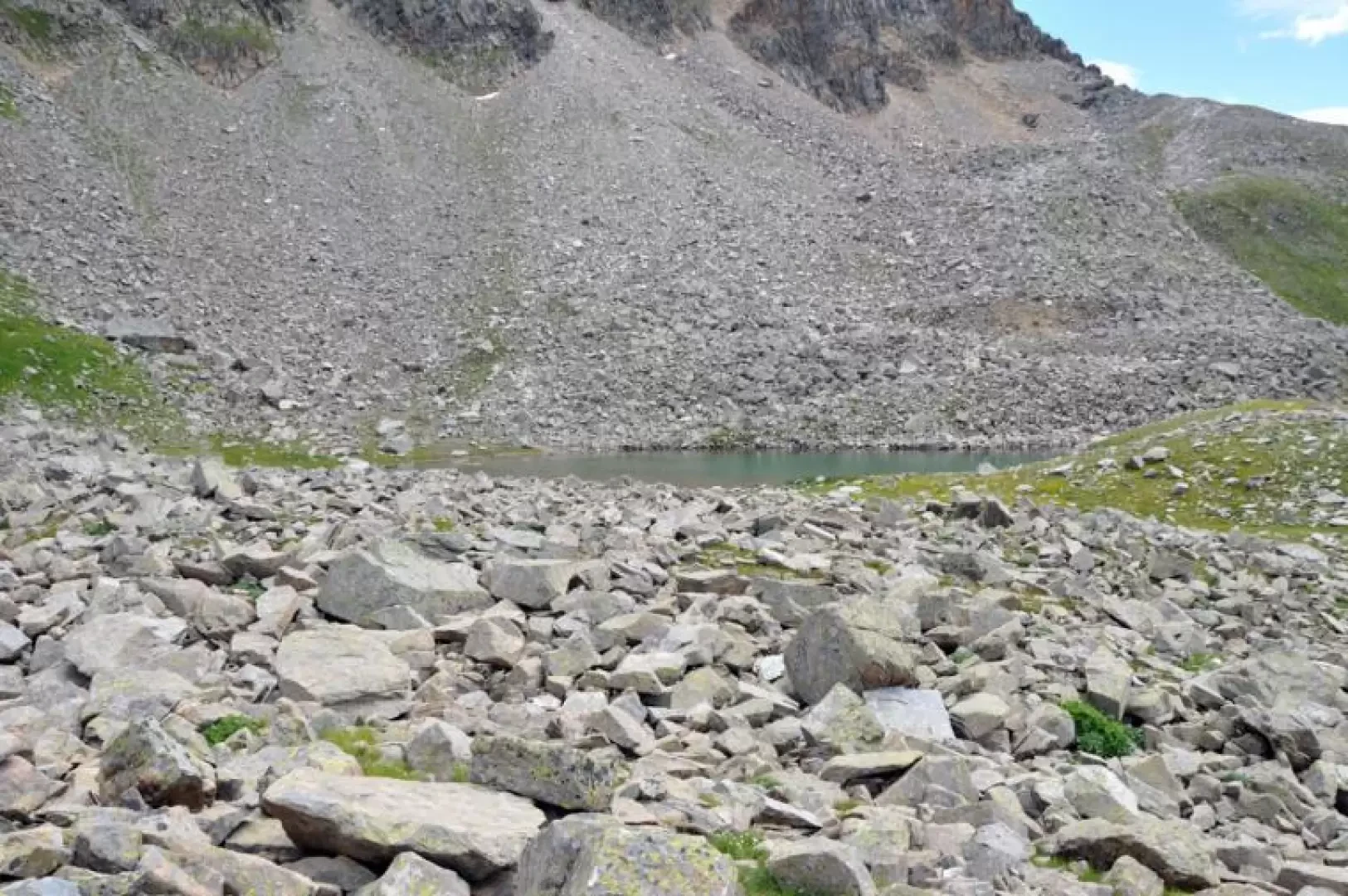
From the car park, take the mule track that goes slightly uphill into the combe and follows it along the left (orographic right) side of the Planaval stream until you reach the Eculés mountain pasture (1887m) where it ends. Shortly before the alpine pasture, follow the track of the path that branches off to the right and continues northwards, passing by a water intake with a boulder with a yellow arrow next to it. Following the tracks and the few signs (the route is, however, logical and intuitable), you reach an altitude of about 2080 m where, on the opposite side of the torrent, you will spot a clearly visible boulder with the inscription "Bonale". Cross it and follow the arrow that indicates that you should ascend, to the right of a small stream, into a steep grassy cone. We climb it laboriously in narrow hairpin bends until we come to some grassy bumps and continue for a few minutes to reach the plain where the beautiful Bonalex pastureland (2340m) is situated. We now take the track that branches off to the right of the latter and, walking on a magnificent, panoramic balcony, we pass the ruins of Praz-Barlet (2358m) and arrive at the alpine pasture of Rantin (2333m). Shortly after the alpine pasture, near a bend, there is a fork in the path, marked by signs indicating to turn left; the path first climbs gently and then increases in gradient until it reaches a small plateau where there is another fork in the path. Here, continue along the track to the left, which passes a stone with a military engraving and continues between grassy rises to give a final climb before reaching the gentle slopes before the pass. From here, take the ascent route for a few tens of metres to then head, without a fixed route, in the direction of the visible lake located on the northern slopes of the Tête de Serena, just beyond a band of large boulders that can be crossed without difficulty, aiming for its banks. On the way back, as soon as you have crossed the rocky strip, turn onto a track that starts out near a ruin and just below reaches the clearly visible uphill path, which you retrace as far as the Rantin crossroads. Descend to the left along the easy farm track with hairpin bends that quickly make you lose altitude until the last stretch that cuts slightly downhill along the side of the mountain, reaching the Planaval hotel and from here, after crossing the bridge, the car park.