Lac de Fond, from Planaval

Edited by:
Massimo Martini
Updated at: 03/09/2024
Access
From the motorway barrier at Aosta-West, keep left and follow the signs for Aosta - Saint-Pierre. After one kilometre, at the roundabout, take the second exit to join the main road. Continue on the state road for 4.3 kilometres, passing the village of Saint-Pierre until you reach a new roundabout with the Gran Paradiso National Park sign. Take the first exit and continue on the state road for 4.2 km until reaching Arvier and its roundabout dedicated to cyclist Maurice Garin. Take the second exit and continue on Via Corrrado Gex until you reach the village of Leverogne, one kilometre further on, where, at the fork, keep left and take the regional road [SR25]. Go up the regional road for 9.3 kilometres until you come to a crossroads: turn right and follow the signs for Planaval. Continue for another 550 metres until you reach, on the right, the free car park 🅿️ of Planaval where you can leave your car.
[0h27'] - [20,3km]
How to get there with GMaps
How to get there with Apple Maps
Introduction
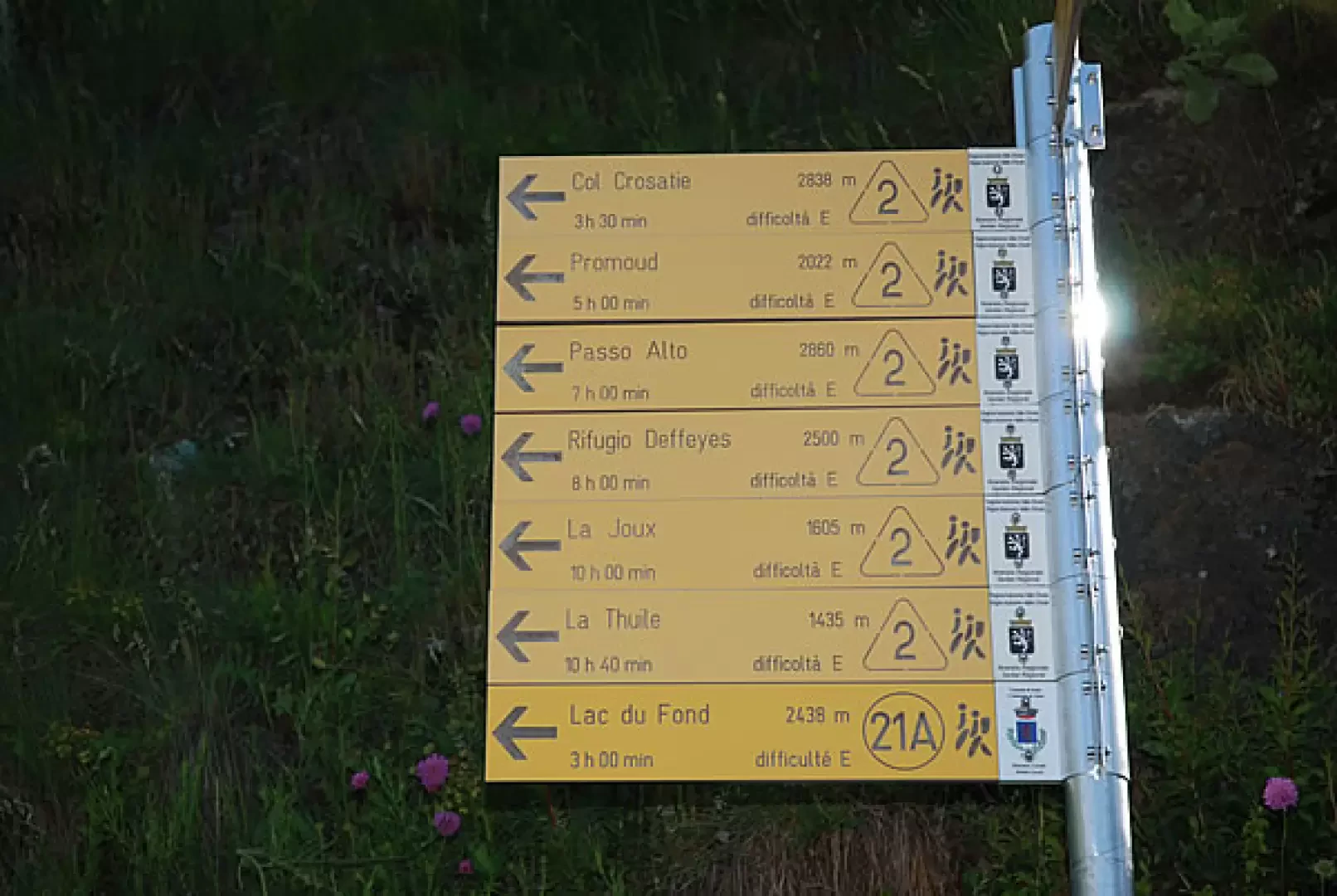
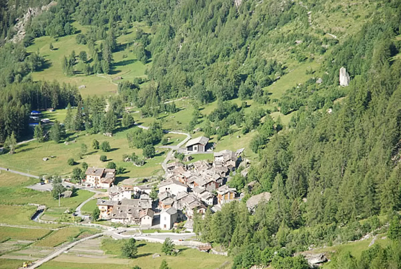
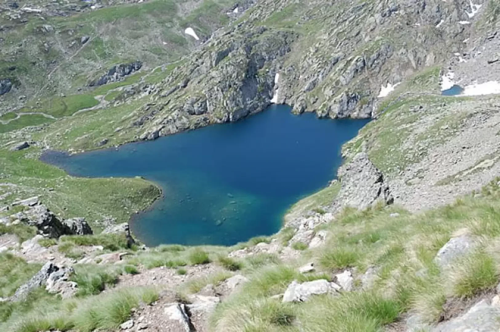
Along the Aosta Valley's Alta Via 2, above Planaval in the Valgrisenche, you can encounter a small oasis of peace that is extremely beautiful from a landscape point of view: in this context, we encounter the Lac du Fond, an emerald glimpse with the Rutor in the background... not to be missed!
Description
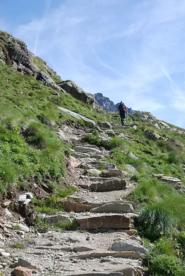
From La Clusaz, we climb briefly up the small road to a hairpin bend to the right: shortly afterwards, on the left, the path for our destination begins. Following the indications on the signposts, we take a wide mule track marked as Alta Via , in fact in past years Col Planaval was a passage on the route in question, but since 2002 it has been diverted towards Lac du Fond; however, the first section can still be considered part of the Alta Via itself.
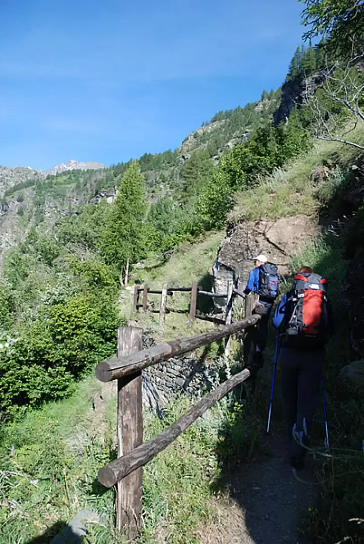
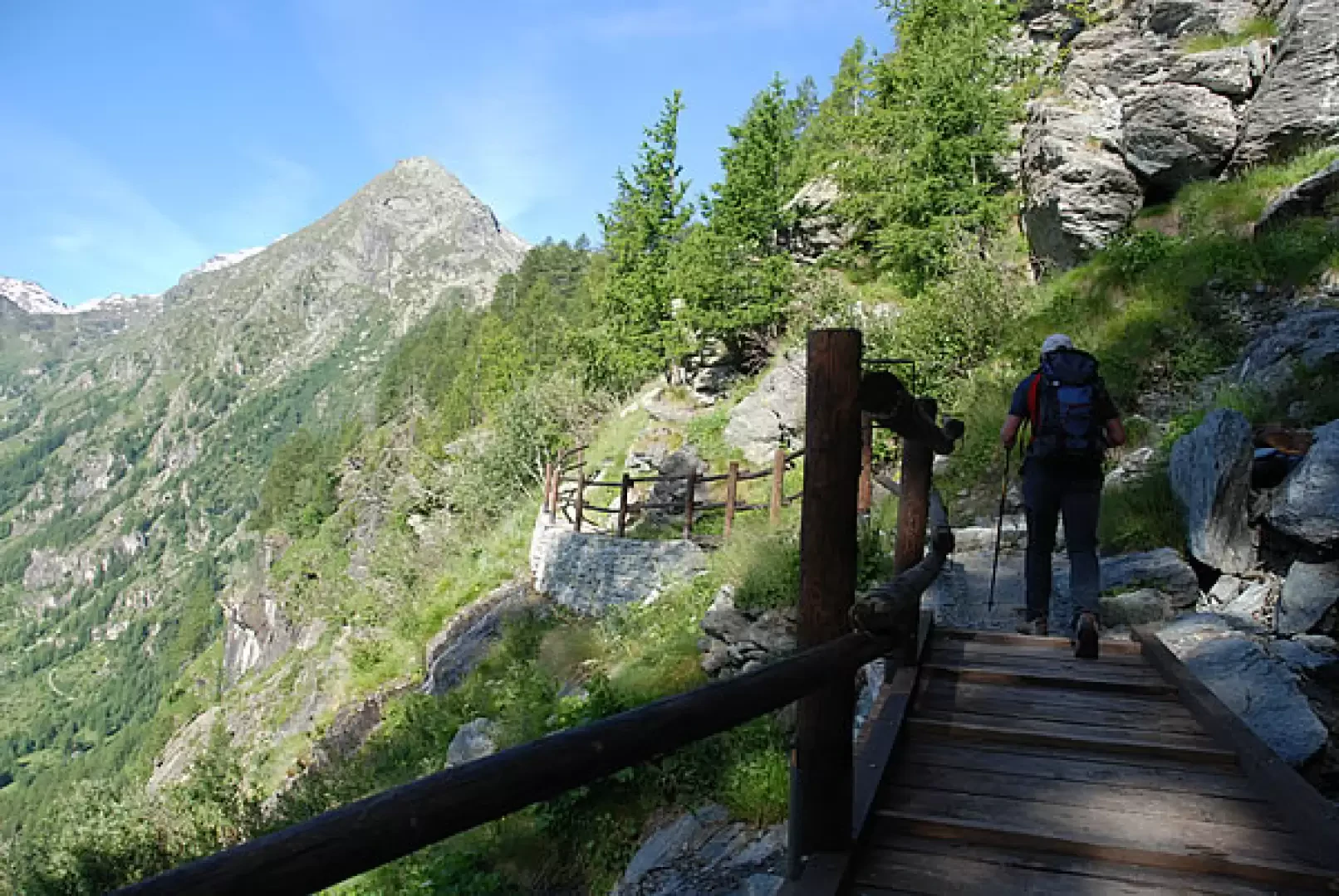
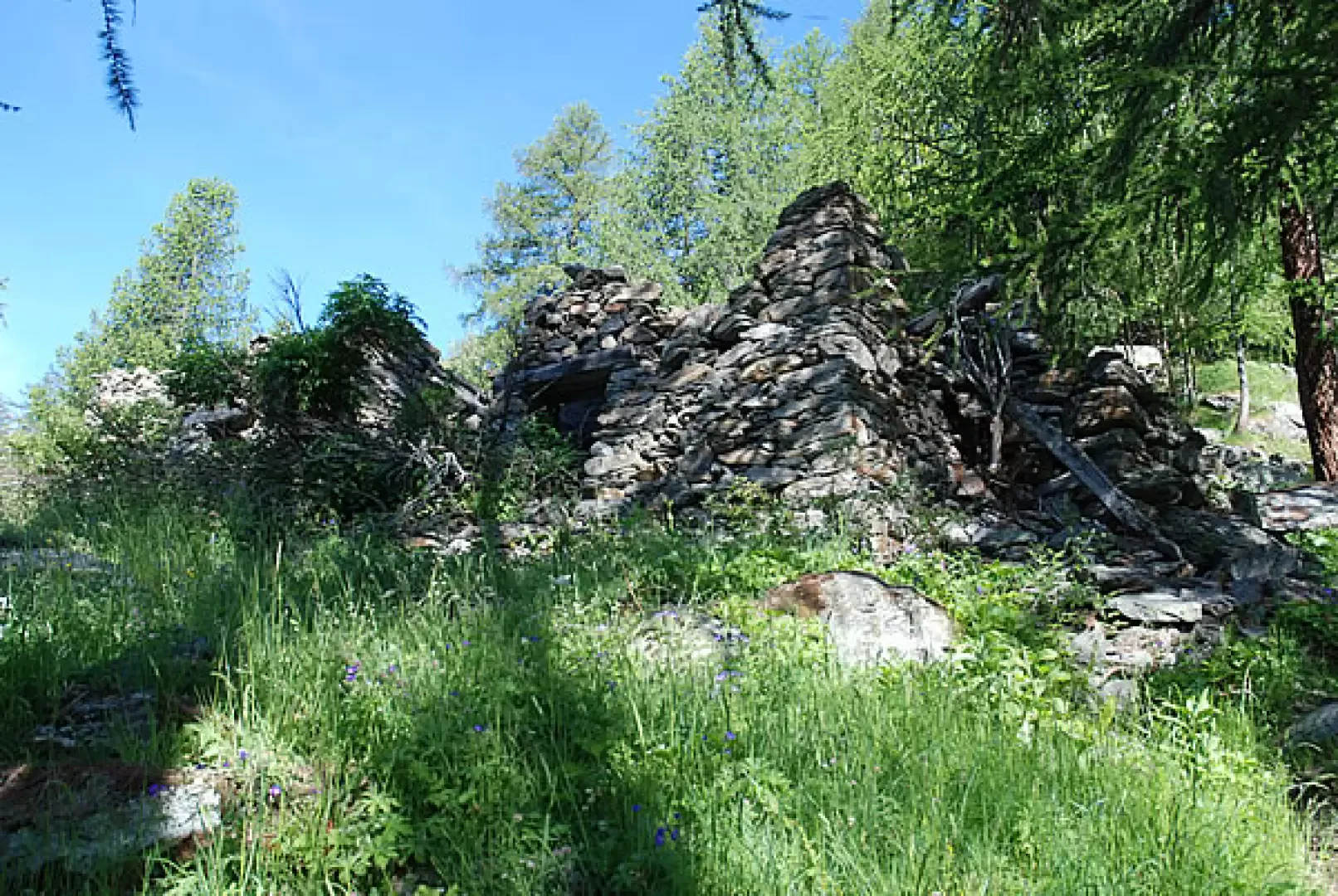
We climb up the ridge along the beautiful mule track that rapidly gains altitude while the panorama opens out over the bottom of Valgrisenche and the village of Planaval below. We leave behind the last broad-leaved trees, including a few wild cherry trees (Prunus avium), and enter a not very dense larch forest; the path crosses a few steep sections of slope on a ledge, at times with protective railings, and climbs halfway up the slope on a clear, partially stepped path surrounded by juniper bushes. After about 0h10', it passes under a rocky rampart and, after a few hairpin bends, becomes slightly flat: in this section, some small streams are crossed on convenient footbridges, while in the background, the peculiar silhouette of Mont Orfeuille stands out. This scenery is repeated a few times until reaching, after about 0h35', a section of sparser woodland where the ruins of Bénévy (1950m, 1h00') are found surrounded by vegetation. Shortly afterwards, the prairie opens up, the remains of another old rural dwelling are left on the right, and the path approaches a rocky section with a series of hairpin bends, on our right, reaching a water intake after about 1h10'. Continue the ascent, leaving the lush Planaval stream and the last alder bushes, as well as a few scattered larch trees, on the left. After 1h20' you reach Alpe Glacier (2161m) and shortly afterwards you come to the fork for Runaz
(2174m): follow the signpost for Col Planaval
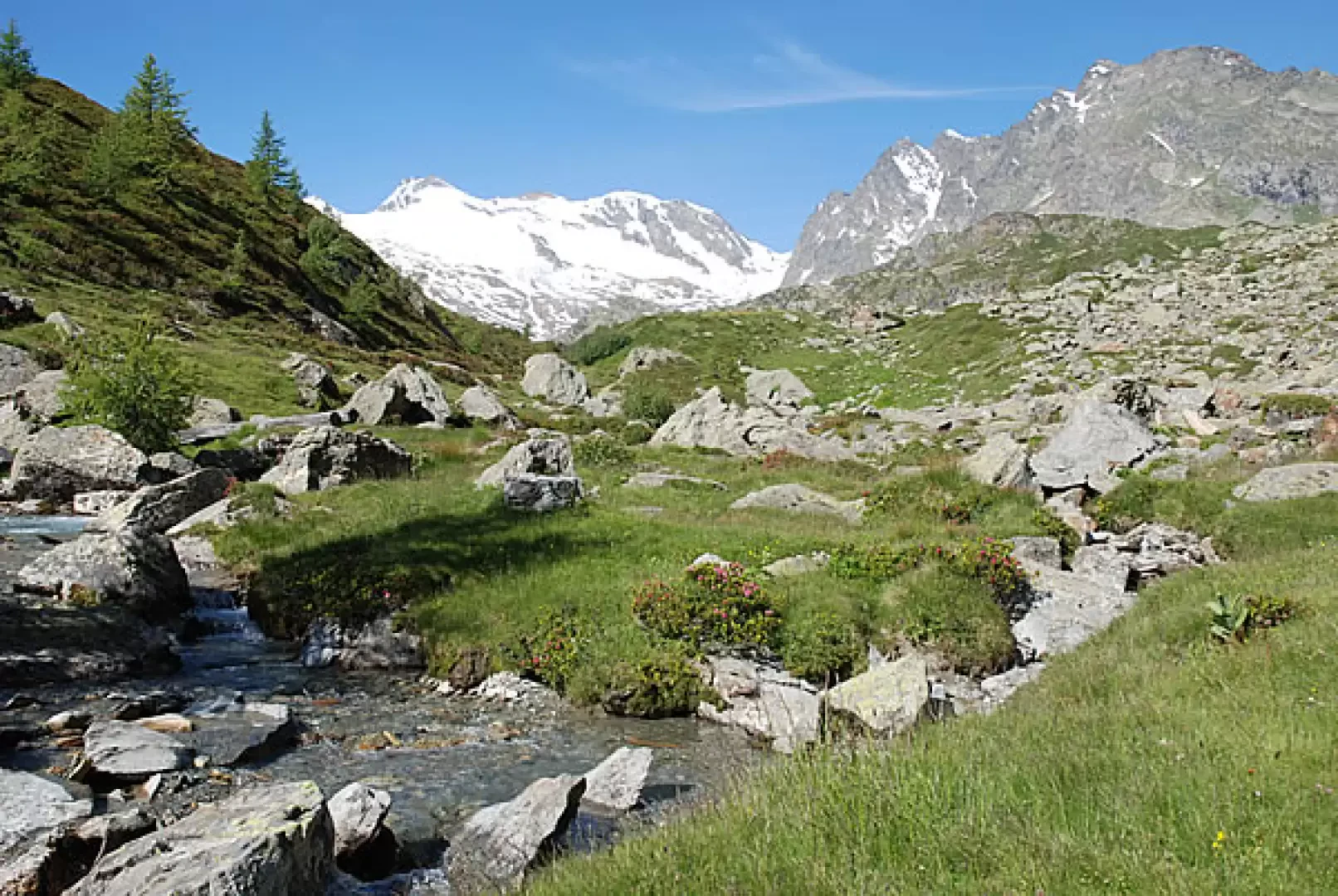
, however, which is 3 hours away. From the panel you cross a beautiful stretch of the valley without any particular gradients in which the torrent flows placidly: certainly a little known corner of the Aosta Valley but extremely suggestive.
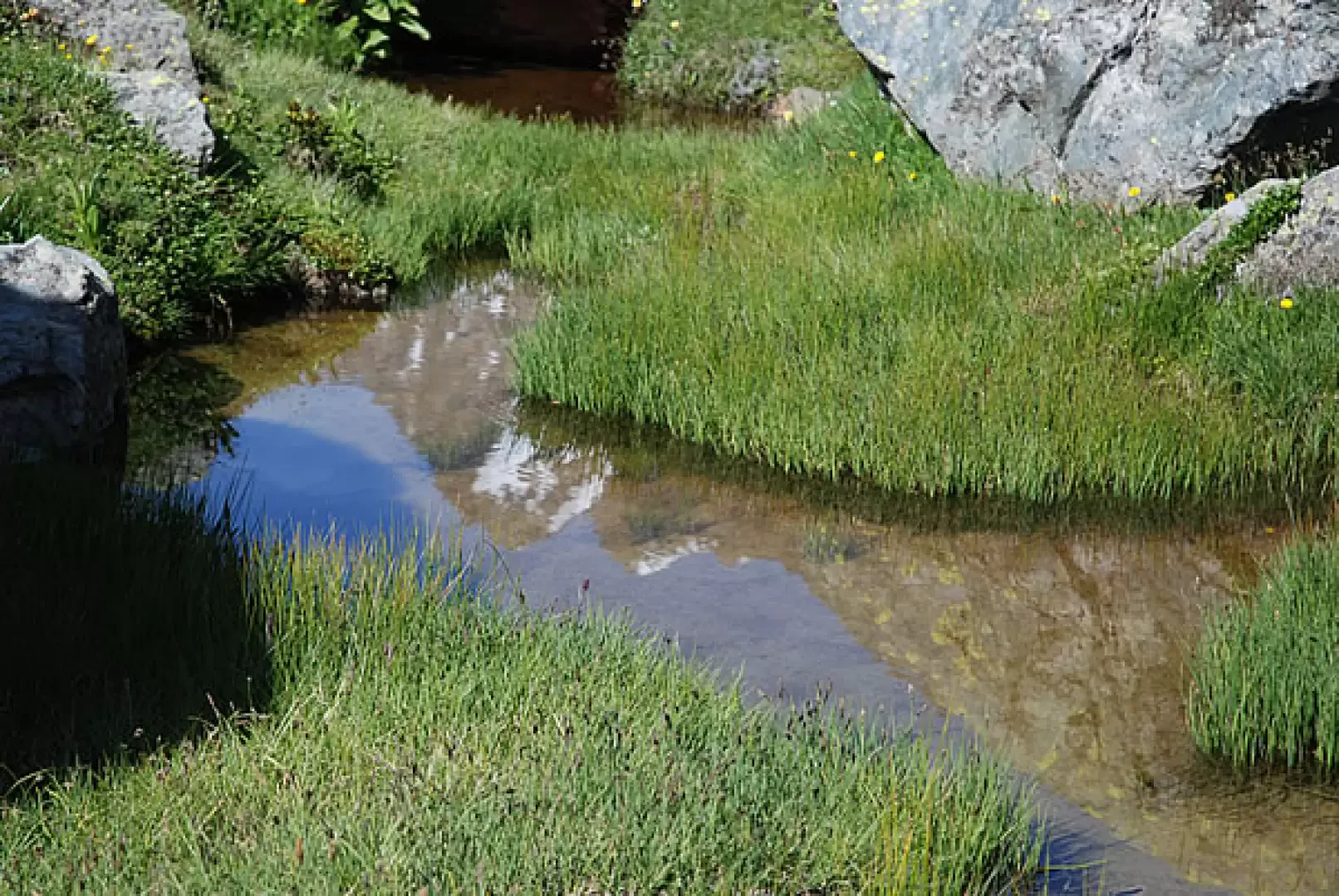
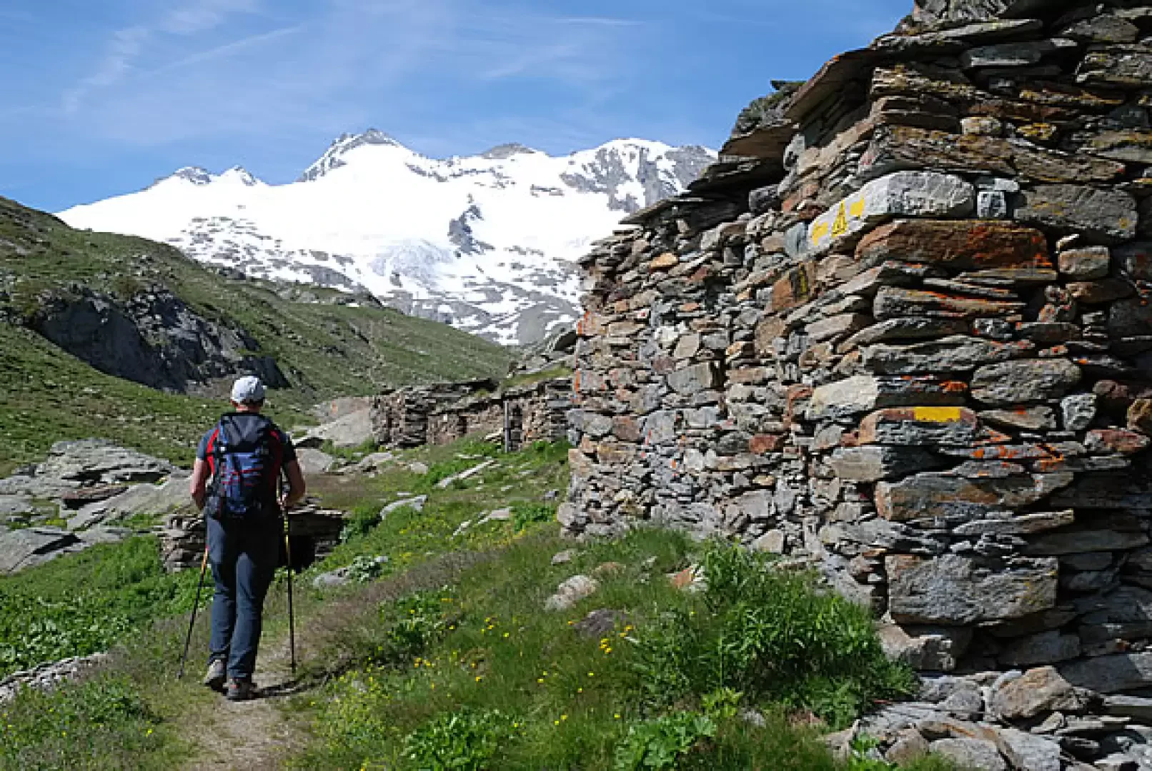
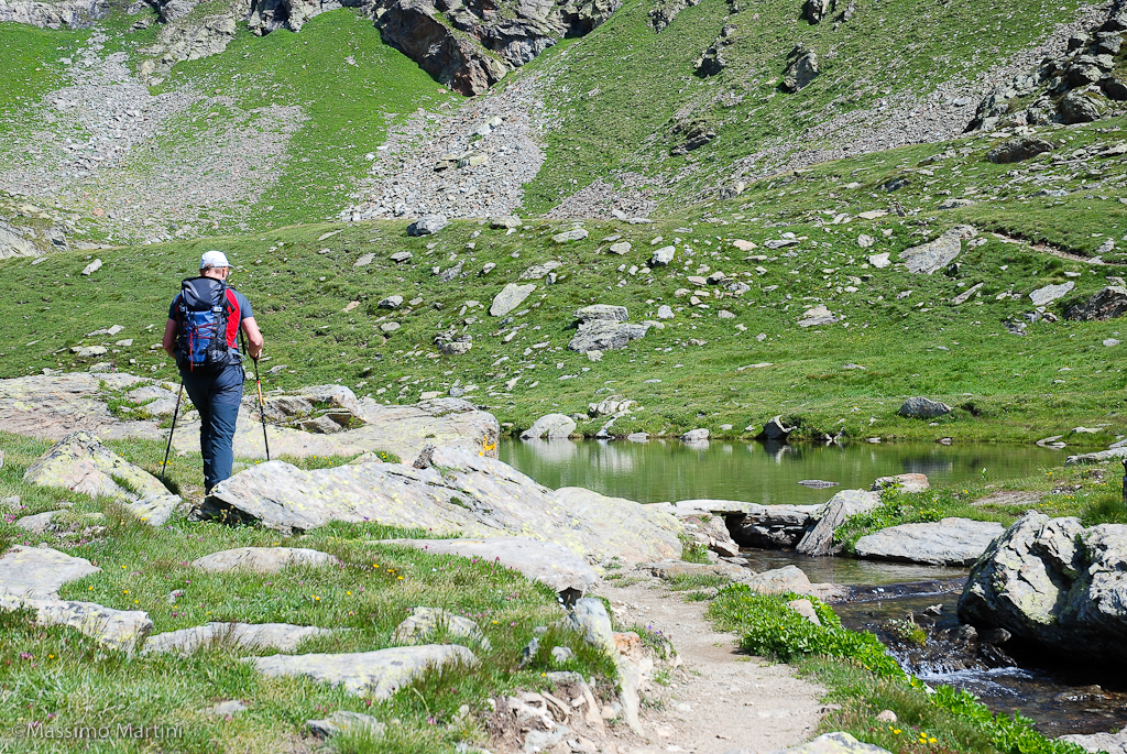
You continue walking in the valley, after about 1h30' you cross a small wooden bridge, go around a large boulder and start climbing again on the easy path. Later the path crosses a marshy clearing where the stream meanders placidly between large boulders: a few steps away from us we observe a group of grazing mules. A little further on, after a tiny pond at the foot of a rocky promontory, the path bends to our left and Col Planaval appears in the background for the first time. After circumventing the above-mentioned promontory, we continue on to the Baraques du Fond (2337m, 2h00') topped by a picturesque little waterfall.
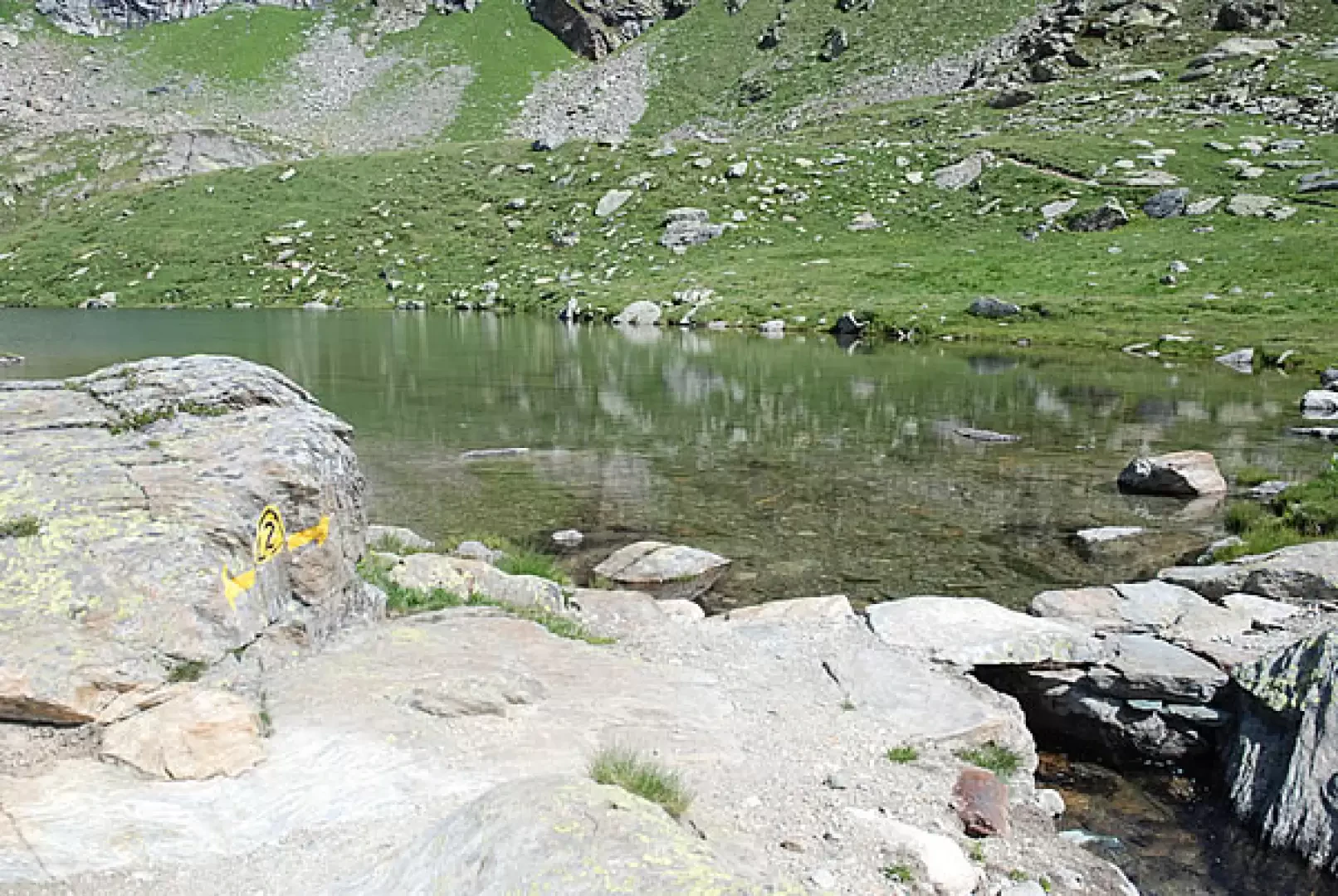
After a few minutes, we come to the fork for the Lac du Fond
: turn right and climb up the ridge, on the pretty mule track. With a series of twists and turns you finally reach Lac du Fond (2439m, 2h15').
The descent follows the same route as the ascent (1h15').
Riferimenti Bibliografici
- Alte Vie della Valle d'Aosta - Martini Massimo e Zavatta Luca -
Galleria fotografica