Lac de Cortina, from Moulin dessus


Edited by:
Massimo Martini
Updated at: 04/05/2025
Description
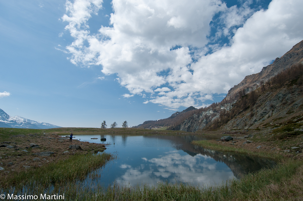
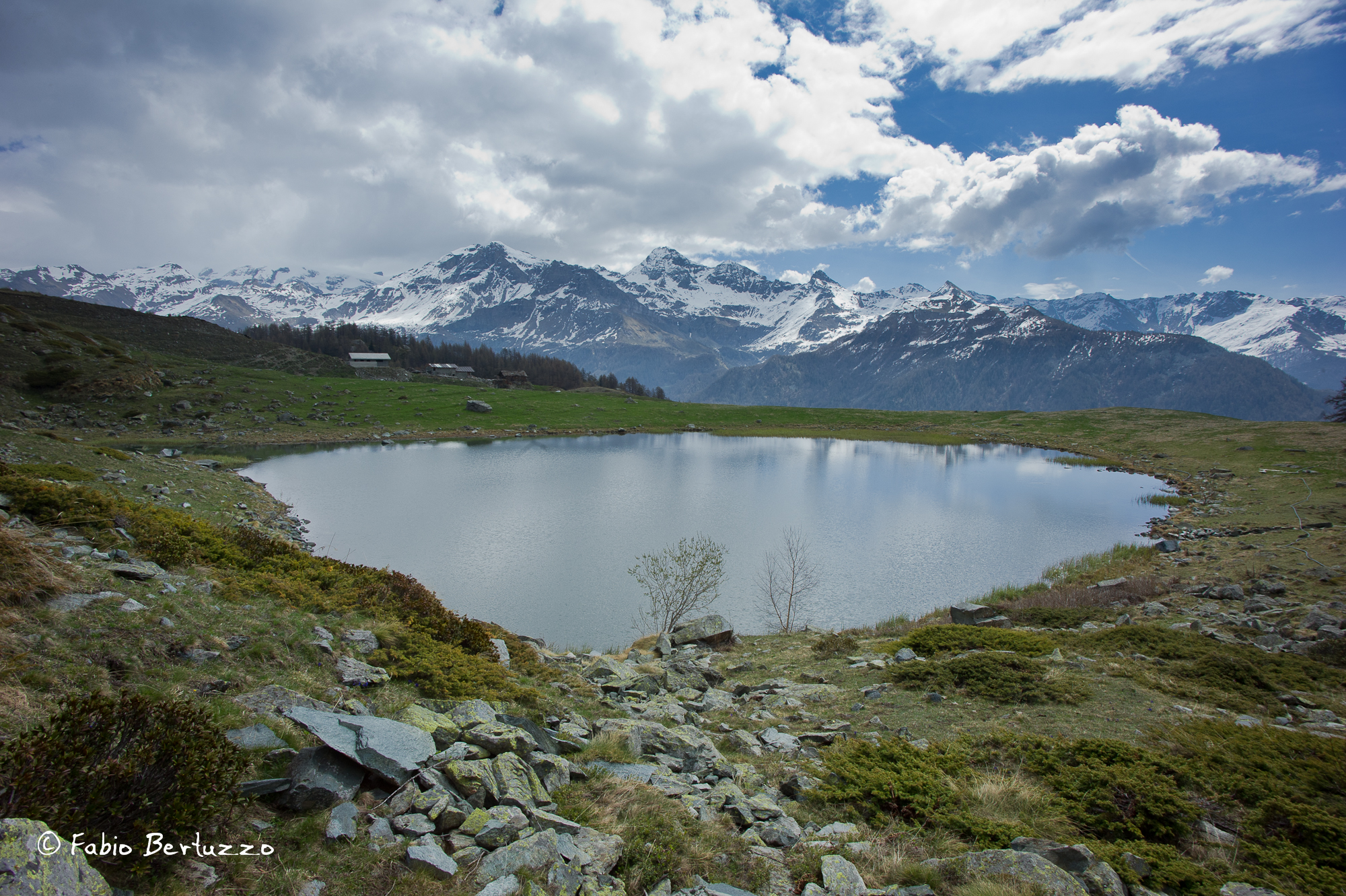
From Moulin, take the path Go back along the communal road and take the path, which runs almost level for a stretch parallel to the asphalt, and you can see on the right a characteristic niche carved out of the wall above, once used by shepherds to shelter from the weather. The slope becomes steeper and we enter the forest, after a few bends the path continues almost level in the middle of the meadows, downstream we can observe a characteristic cantilevered staircase, formed by stone slabs embedded in the retaining wall. The slope increases again and after a few sharp bends, we arrive at the chapel of the village of Mont Mené, founded in 1747 and recently restored; it bears on its façade three frescoes dedicated to the Immaculate Conception, St Grato and St Germain. Go around the village on the left and, at the last little garden at the crossroads, take the path on the right that climbs up, pass between the last houses of the village, which have partially collapsed, and after a steep stretch, you will find yourself among the gently sloping meadows opposite the Grand and Petit Tournalin. One enters the forest passing alongside four large larches and under the rocks follows the route of the old irrigation channel, crosses a gully devastated by the flood of 2000 and passing under some eagle-billed rocks one arrives at the viewpoint over Valtournenche with a few steep zig-zags of the path. Starting from the north, you can admire the Corno del Teodulo, the Plateau Rosa, the Roisetta, the Becca d'Aran, the Grand and Petit Tournalin, the Becca Trecaré, which hides the Nana pass, and below, the Maen lake. Continue until you emerge from the forest at the base of a scree slope, then the path alternates between flat stretches and slight ascents in the midst of a sparse larch grove. If you listen carefully, you will begin to hear the roar of the Cignana torrent in the distance, and high up in the trees you will catch a glimpse of the abandoned houses of the village of Falegnon. We then reach the junction for the Cortina lakes and, having crossed the wooden bridge over the stream, continue until we reach the route of the Alta Via 1, which climbs from Valmartin. Follow the trail marker and descend for a few dozen metres until you reach the bottom of the valley, cross a small wooden bridge and take the little path that climbs to the right, leaving the main trail that heads towards the village of Mont Perron. Climb a steep slope cut by several hairpin bends and then enter the gorge carved by the Cignana stream. On the other side of the gorge, the Alta Via 1 trail up to the Cignana dam is clearly visible. For a stretch, the two paths climb parallel, then, after crossing the band of rocks that plunge down to the stream below, we come to a wide clearing where the path swerves abruptly to the south, plunging into the shade of the forest. In the light shade of the larches, lush undergrowth grows in which blueberries, rhododendrons and mountain flowers fill the eyes with colour and the nose with fragrance. After a short stretch of false ground, the trail gradually begins to climb. At the exit of the forest, we encounter the fairy ponds, two ephemeral lakes that fill with clear water at the thaw or after heavy rains, but empty and become muddy at the end of the summer and after prolonged periods of drought. We cross the flat pastures that welcome the small village of Cortina: a handful of abandoned rural houses that time and human neglect will reduce to ruins in a few decades. The most interesting house has, or rather, had on its east façade two openings with lintels carved from a curved larch trunk forming an almost perfect vault. Lake Cortina is just a few minutes from the village, and can be reached by crossing the meadows in a southerly direction. From its shores, you can enjoy a splendid panorama of the mountains that divide Valtournenche from the Ayas Valley: behind the village you can see the Gran Sommetta then, clockwise, the white ice cap that covers the Gobba di Rollin, the Roisetta, the Grand Tournalin and gradually all the peaks that almost end at the horizon with Mont Tantané and the Zerbion. In the heart of summer, the silence that permeates these places is interrupted only by the distant barking of the shepherd dogs and the grave sound of the cowbells of the grazing herds. However, this bucolic picture has a downside: towards the end of summer, the improper practice of fertirrigation makes the shores of the lake unapproachable, covered with a layer of stinking slurry shot from the tractors.
We have been there
Edited by:
Fabio Bertuzzo
Lago di Cortina
Avvistamenti faunistici: Capra ibex, Rupicapra rupicapra, Marmota marmota Avvistamenti floristici: Orchis sambucina viola
Edited by:
Massimo Martini
Lago di Cortina
Avvistamenti faunistici: Marmota marmota. Capra ibex, Rupicapra rupicapra Avvistamenti floristici: Gentiana kochiana, Pulsatilla Montana