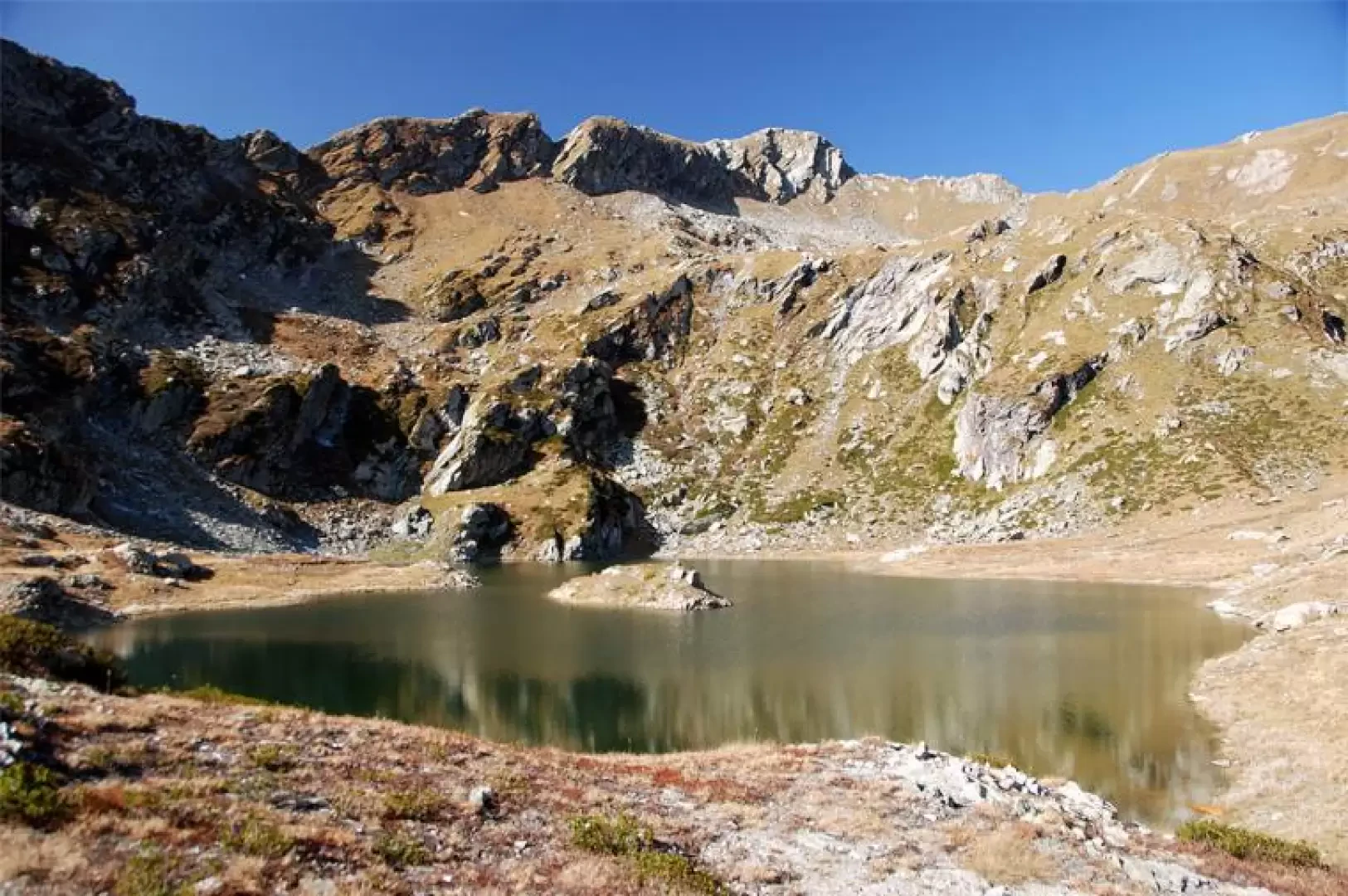
Lac Chilet, from Outrelève

Edited by:
Gian Mario Navillod
Updated at: 28/10/2025
Introduction
A pleasant route along a valley that has not yet been defaced by dirt roads, digger tracks, power lines or ski lifts. Enjoy this leap into the past along the mule track travelled by generations of mountaineers, safe in the knowledge that there are no traces of plastic, combustion engines or concrete. From 1800 metres up on a clear day, you can enjoy a splendid panorama of the Monte Rosa glaciers.
Description
We set off along the path that climbs up parallel to the asphalt road. When we reach the village chapel, whose façade is decorated with a pleasant fresco, we turn right and head towards the forest among clumps of ferns. You come to a first wayside shrine with a statue of the Madonna and shortly afterwards the path widens into a comfortable paved mule track. You pass a second wayside shrine and reach the base of an old landslide. A stream still used today for irrigating the meadows runs alongside the mule track and occasionally crosses it. A feeling of peace and quiet permeates these places, the murmur of the stream can be heard in the distance while the silence of the forest is only broken by the chirping of birds. A small group of houses, now almost reduced to ruins, is gathered at the side of the path, the characteristic wooden structure of a rascard stands out in the middle of it. When you reach the clearing where the path for the Trome alpine meadow branches off to the left, continue straight ahead, passing a beautiful rural building made of dry stone, which you leave to the right. After walking for about ten minutes in the sparse shade of the larch trees, you cross a small stream on two stone slabs. Note, about a metre downstream of the little bridge, some stones laid with a knife that prevent the water from flowing down the mule track in the event of a flood. Leave the turnoff for Bec Monpey on the right and shortly afterwards a short, almost level stretch brings you within sight of the stream flowing at the bottom of the gorge. Start climbing again in the forest and, having arrived at a bend near the water, you will notice a tiny mountain pasture on the other side of the valley, nestling in a green glade; immediately afterwards, a large larch shadows the path, cross it and pass over the rock smoothed by the ancient glacier that covered the valley to arrive at the large glade dominated by the Cresta di Voréa, where the splendid pastures are dotted with the piles of stones that the shepherds have patiently gathered to increase the productive surface. Keeping to the left, you arrive at the bridge with two wooden spans across the stream. Immediately afterwards, follow the slender track that climbs to the right parallel to the stream, crosses the entire pastureland and re-enters the forest (be careful not to continue straight ahead along the more marked track that ends at the Ourty pasture). The path rises a little unevenly following the crags of the stream and after about a quarter of an hour regains the dignity of a mule track. On the right, a huge expanse of rhododendrons covers the slope up to the clear waters flowing at the bottom of the gorge. One continues to climb, approaching the watercourse until passing it on a stretch paved with large stone slabs. At the exit of the bottleneck dominated by some gigantic rocks, one crosses the green meadowland that covers the bottom of the valley. After crossing the plateau, the section of the path restored by the region's workers begins. Behind the large boulders that close off the bottom of the basin, one begins to see the whiteness of the eternal snows and at the end of the steep staircase, one follows a level section from which one enjoys a splendid view of the Monte Rosa massif. After about ten minutes, we arrive at the 1800 metres of the Case Vecchie nucleus, located at the beginning of a splendid valley furrowed in the middle by the lazy meanders of the torrent. In the middle of the ruins, a small shrine houses an original wooden statue. One crosses the stream on the bridge and after a short flight of steps, one sets off along the track that crosses the pastures. Near the stream, an almost level clearing, with fine grass worthy of an English carpet, seems to be waiting to accommodate a bivouac, some visitors have already set up the stone circle and wood for the bonfire. We ascend the right side of the valley along a fairly steep section of path strewn with scree. Once in sight of the Case Nuove alpine pasture, the path takes a sharp bend away from it and plunges back into the forest. You walk amidst flowering rhododendrons in the light shade of the larches until you reach the steep meadows downstream of the Perosa alpine pasture, where a small alpine hut stands out suspended between the blue of the sky and the green of the pastures. Cross the stream that cascades down and continue through the tall grass along the track that meanders below the huts until reaching the col that offers a beautiful view of the natural amphitheatre of the valley. Climb up following the numerous tracks that lead to Alpe Perosa, from which there is a splendid panorama of the Monte Rosa chain. Leaving the stables, head southwards, halfway up the slope, following a well-paved mule track that crosses the stony area almost level. Gradually, the path narrows to a thin track that must be followed in the direction of the cross that can be seen at the top of the valley. When you come in sight of the saddle, just below the cross, follow the cairns and in a few minutes, having crossed the grassy knoll, you arrive at the lake.
.