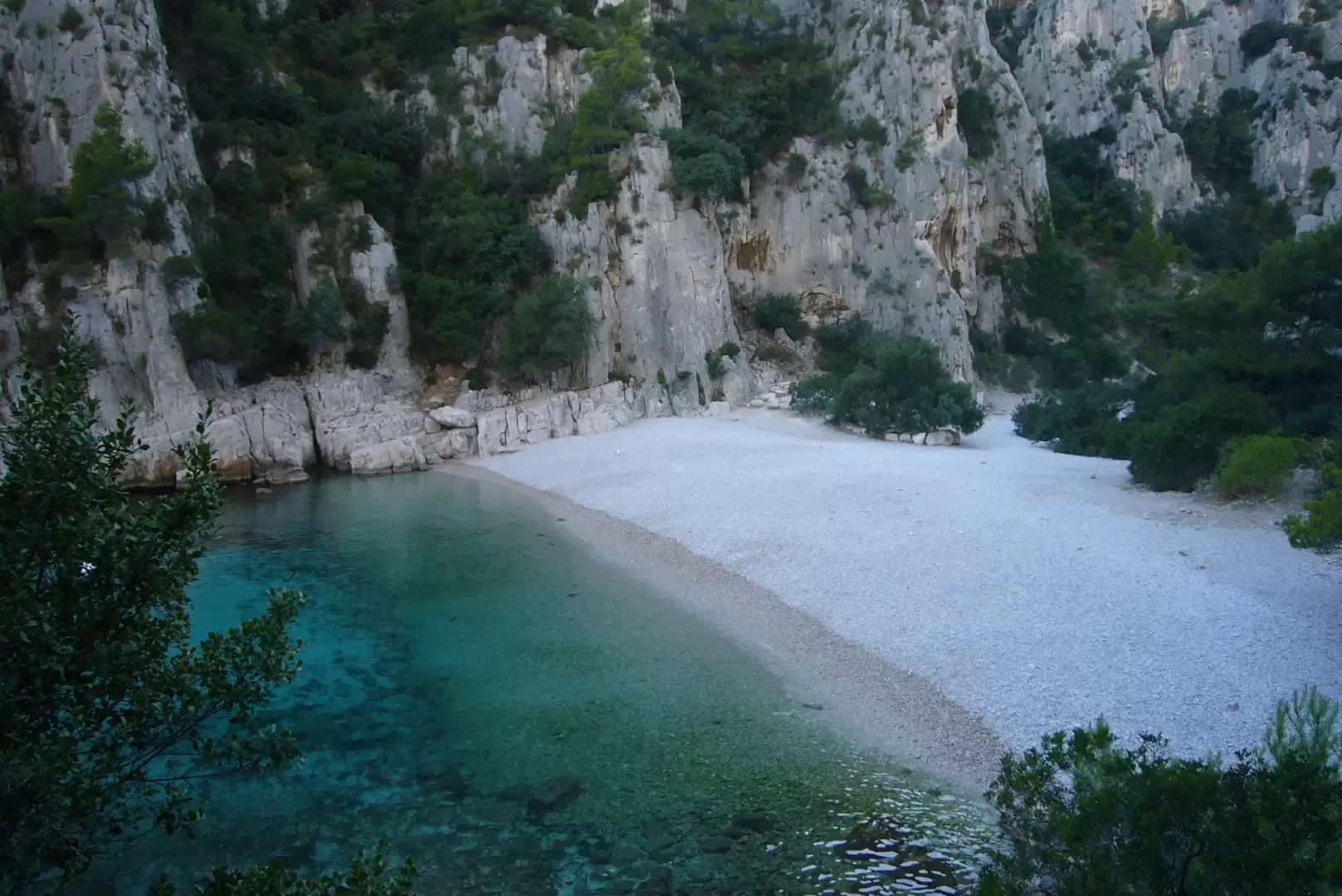
the Calanque d'En Vau

Edited by:
Maurizio Bergamini
Updated at: 17/01/2025
Access
Breathtaking walk in a protected site: the Calanques park.
Regulated access due to weather conditions and fire danger: check accessibility the evening before
http://www.bouches-du-rhone.gouv.fr/files/massif/
Introduction
Come raggiungere una delle 100 spiagge più belle del mondo. Splendida passeggiata in un luogo protetto: il parco delle Calanques. Con circa un'ora e mezza di facile camminata (salvo un breve quarto d'ora sul finale) si raggiunge una delle spiagge più belle del mondo, anche se formata da pietre e non da sabbia fine e rovente... Sentiero sdrucciolevole nell'ultimo tratto (all'inizio per quanto riguarda il ritorno).
Accesso regolamentato in ragione delle condizioni meteo e del pericolo di incendio: verificare l'accessibilità la sera precedente
www.calanques-parcnational.fr/fr/acces-calanques-risque-incendie
Description
About an hour and a half's easy walk (except for a short quarter of an hour at the end) takes you to one of the most beautiful beaches in the world, even if it is made up of stones and not of fine, hot sand...
From the port of Cassis, proceed south-west, continue up a flight of steps and down a busy road. Take the shortcut "Traverse du soleil" steeply uphill, then follow the Avenue des Calanques and then the sign "Port-Miou" on a green signpost with a pedestrian.
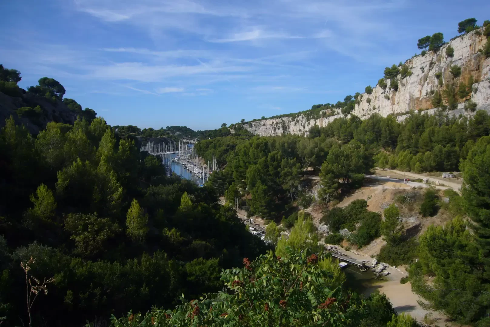
You will then reach the first calanque, that of Port-Miou, which is nothing more than a former quarry converted into a busy harbour for small pleasure boats.
Rescend the west side of the calanque following a wide path. Shortly afterwards, a signposted fork in the path points in the direction of 'Port-Pin' and warns you that you must be equipped (footwear, clothes, water...) to continue.
In the Calanques, there are no refreshment points or fountains and the Mistral, the icy north wind that often reaches 100 km/h, can blow strongly. You also need to be prepared against too much sun, as shade is scarce and sunburns lurk.
Port-Pin can be reached in 30 minutes. And it is already a pleasant destination.
There are two routes to choose from: on the right the GR 98, on the left the more 'adventurous' Green Trail No. 8, which goes around the tip, to end up at the same place: the plateau (plateau) de Cadeiron. With the GR 98, which is more direct, it takes 20 minutes.
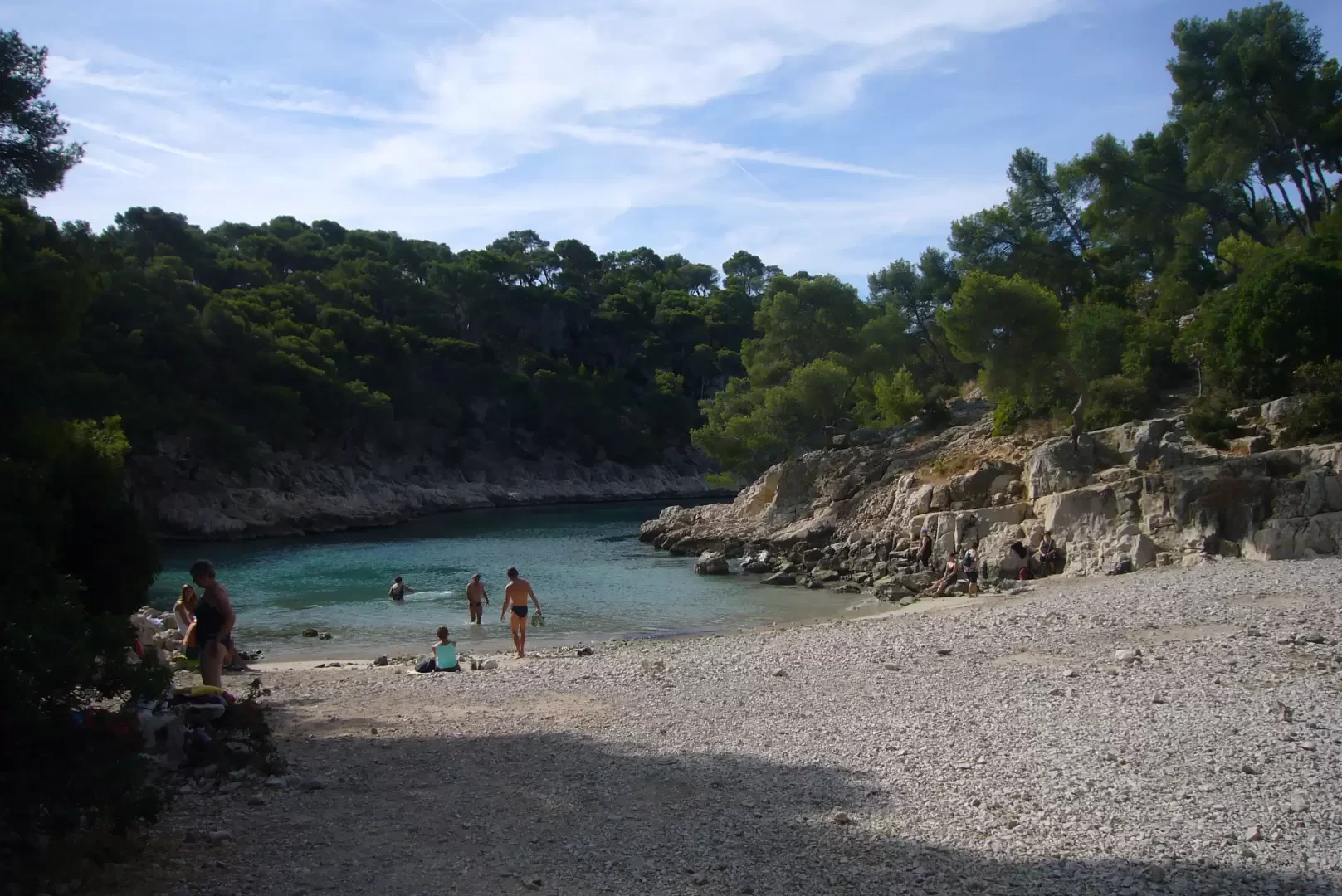
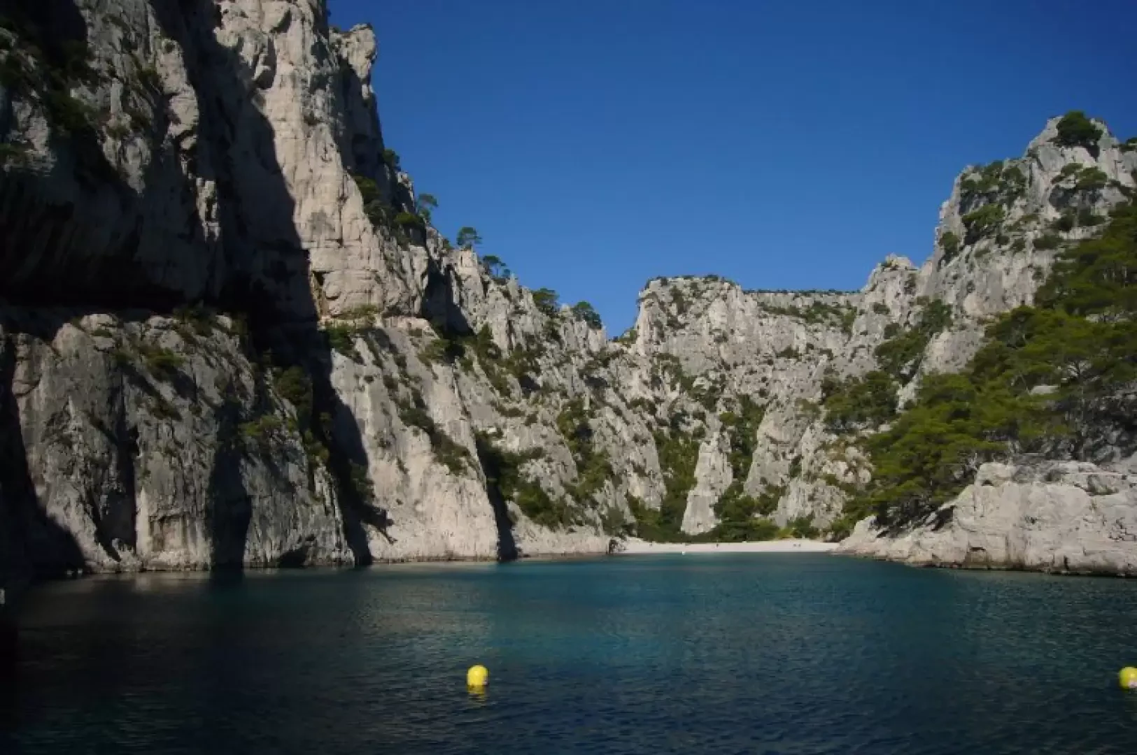
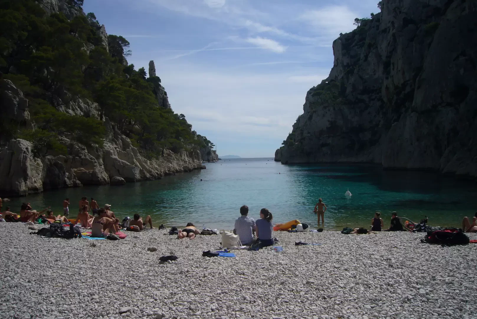
At the intersection of the two paths there is a large cairn, very slender. It indicates the start of the descent towards the calanque: it is a very steep and often slippery path, both because of the smooth stones and the very small scree that covers sections of it. Once you reach the bottom of the descent, it only takes a few minutes to reach the beach between high rock walls, often the site of climbing routes.
On the beach, take into account the rotation of the sun, which, due to the high rock walls, may force you to move camp: it is better to keep to the east, where you will gradually be joined by the rest of the company Forget loneliness: it is a popular destination for holiday crowds and can also be reached by sea with rented canoes.
On the way back, you can take the alternative path to the one on the way out.
Halfway up the steep slope, the signs on the path suggest keeping to the left. The climb is actually less steep, but a little longer, because you move quite a bit to the left. On the plateau, bend to the right as soon as possible and return to the small crossroads (30 min from the beach).
Type of Route:
Partially Circular
Physical Commitment:
Moderate
Equipment:
Light trekking shoes, provisions and water for the day
Recommended Period:
all year round (in summer there's the world)
Overall Time:
1h30'
Exposure:
South
Starting Height:
0 m
Ending Height:
0 m
Maximum Height:
180 m
Distance Travelled:
5.00 km
Objective Hazard:
Slippery path in the last section (at the beginning as far as the return journey goes)
Water:
absent
Access:
subtitle:
how to reach one of the 100 most beautiful beaches in the world
Author:
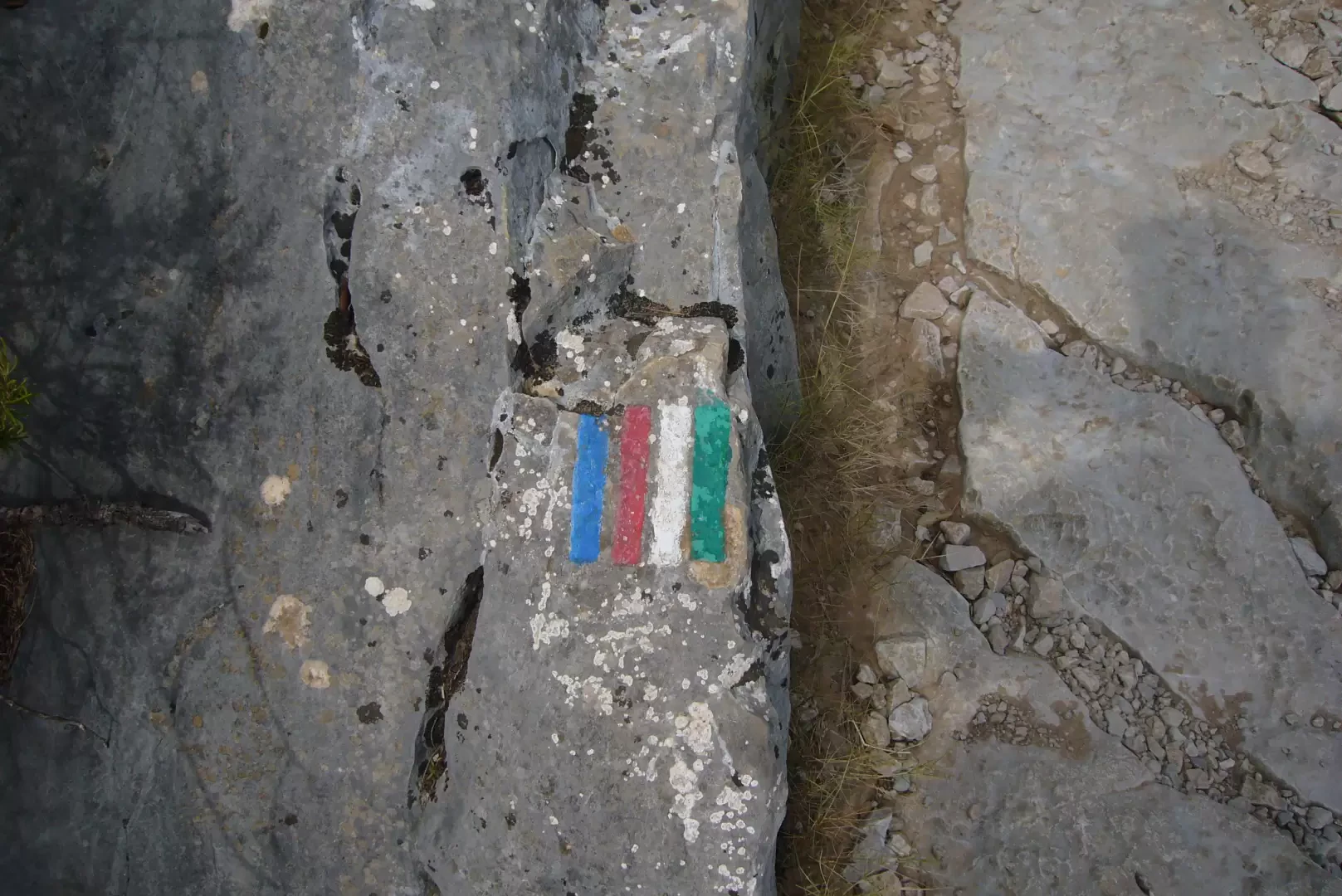
Signpost:
multicolour: white, red, blue
Date of survey:
13/09/2013
Galleria fotografica