Ivery, from Pont-Saint-Martin

Edited by:
Massimo Martini
Updated at: 23/10/2025
Access
After 150m from the motorway junction exit at Pont-Saint-Martin, turn right and take the second exit at the first roundabout. A little further on at the second roundabout: take the third exit, and enter the town of Pont-Saint-Martin. After a few hundred metres, turn right onto for the Valle del Lys. Continue through the village of Pont-Saint-Martin for another 500 metres before turning right off the regional road. Continue straight on for about a hundred metres, cross the Lys at the Roman Bridge and leave your car in the car park in Piazza IV Novembre 🅿️. There are other free car parks nearby.
[0h03'] - [1.4km]
How to get there with GMaps
How to get there with Apple Maps
Pont-Saint-Martin can also be reached by bus 🚌 with the company Vita Group, with the Aosta - Pont-Saint-Martin line: stop at the point of departure and by train 🚊, with Trenitalia, line Turin - Aosta.
The information provided here has been verified on the date of the survey of the itinerary. Before setting off, you should make sure that there are no substantial changes to the route. Therefore, to obtain up-to-date and detailed directions, we recommend the use of the satellite navigation apps provided by Google or Apple.
.Introduction
Interesting itinerary at the entrance to the Aosta Valley. Along the way, you can breathe in the air of the past as you march along a splendid paved mule track.
Description
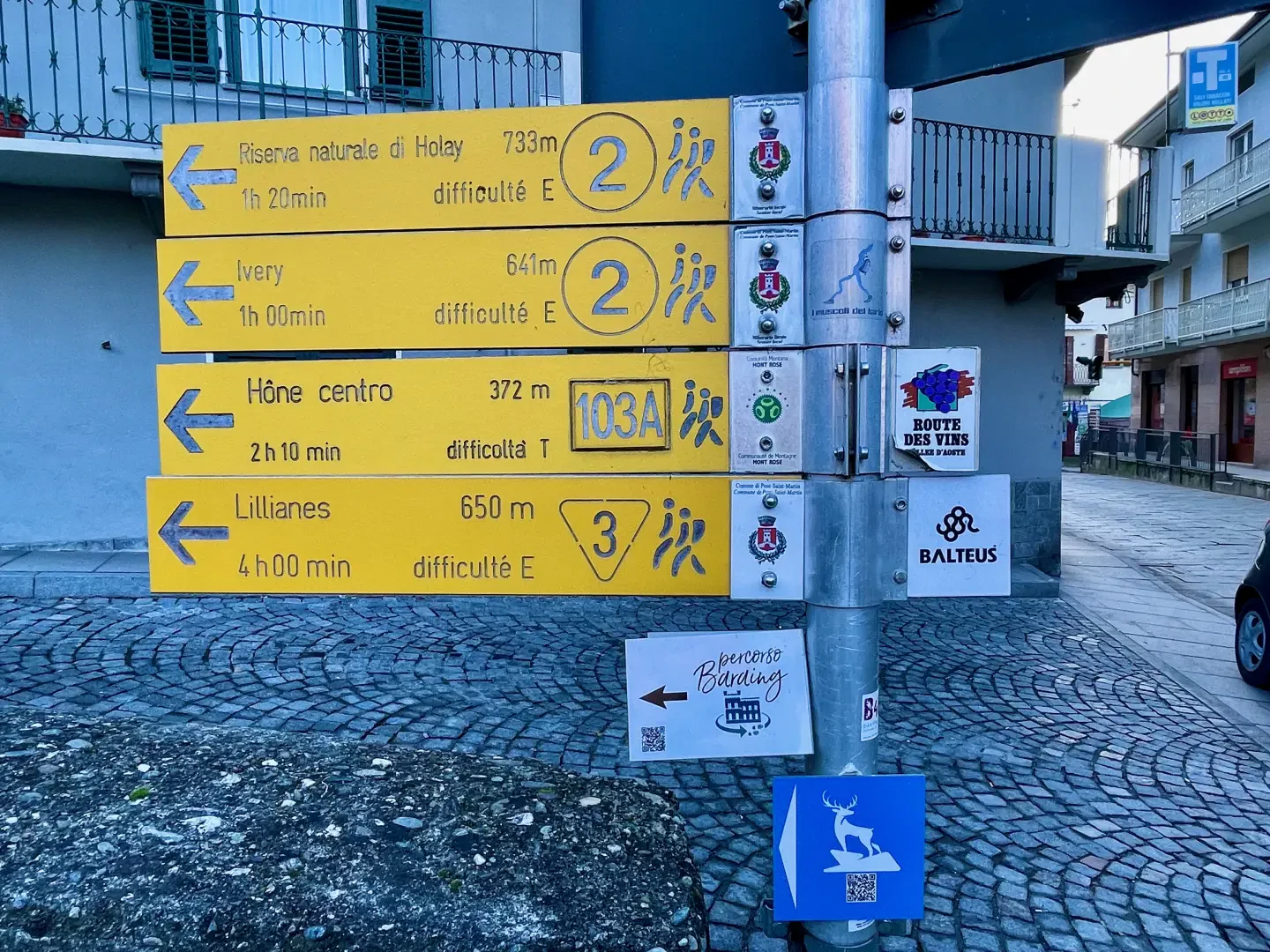
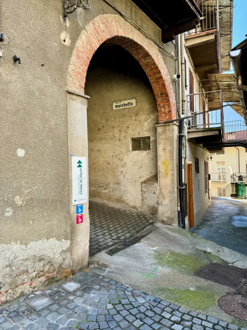
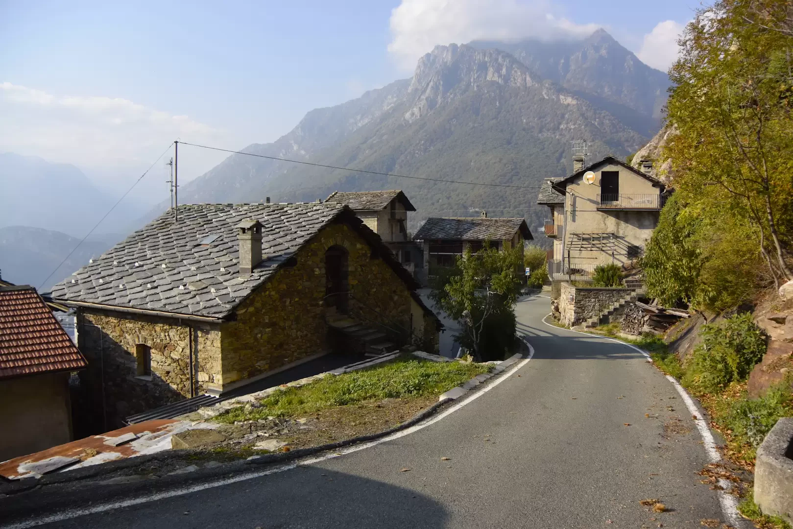
0h00' 0.00km Cross the bridge and, at the end of it, turn left onto the paved road that climbs up the orographic left of the Lys stream until you reach the characteristic Roman bridge. Turn right and climb up a narrow lane that, having passed a portico, soon emerges from the built-up area. On reaching the last dwelling, the lane turns into a mule track and begins to climb up towards the former power station above the village. The path is very wide and well-maintained and, with a series of hairpin bends, reaches the building of the former power station and joins the regional road for Gressoney. Once you have reached the road, follow it, continuing to the left, for about fifty metres until you come to the beginning of an agricultural track that after a few metres reaches the carriage road for Ivery: follow it, continuing to the right until you come to the start of a new stretch of mule track. One begins to ascend the beautiful paved mule track through the beech and chestnut forest. After an initial uphill section, the route encounters a short flat section bordered by a metal railing and then begins to climb again on the long steps created in past centuries to facilitate the journey from the villages above. Along the way, one also encounters the characteristic pergolas on which the vineyards were planted: they are now in a state of abandonment but still exude toil and history, recalling the times when people tried to make the most of these impervious territories to obtain relatively low yields, only for subsistence. Slowly the mule track climbs up the forest until it reaches an oratory: by now the forest has thinned out, and pastures can be glimpsed; the path climbs up to the village of Ivery (670m) 0h50' 1.56km 💧.
The return journey is along the same route as the outward journey 0h30' 1.56km .
Punti di interesse
Collections
Galleria fotografica