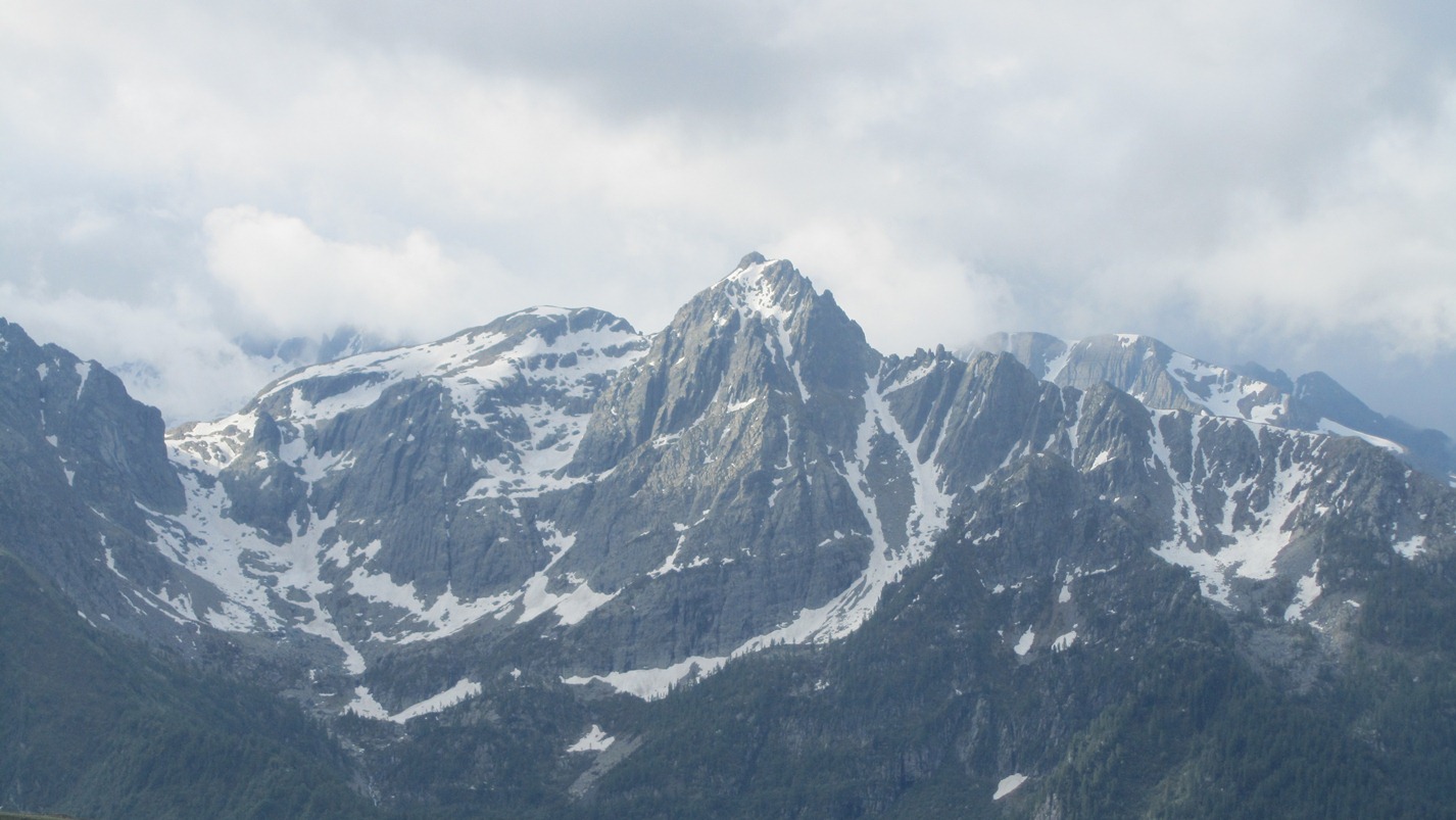
Corno Stella, from Foppolo

Edited by:
Rita Tarussello
Last survey: 27/06/2011
Updated at: 02/08/2024
Updated at: 02/08/2024
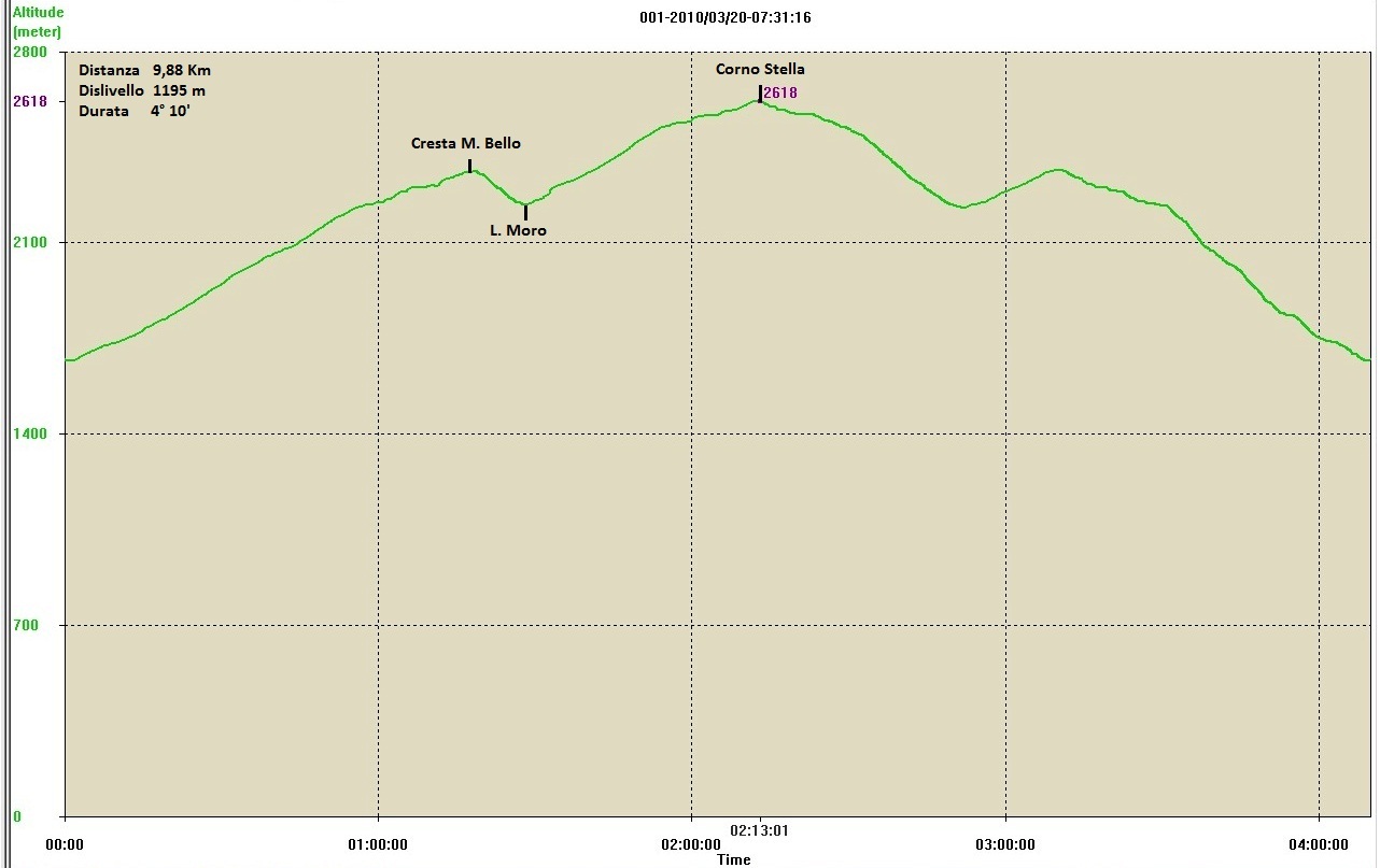
Length
0.00 Km
Departure altitude
1600 m
Arrival height
2620 m
Positive difference in height
1020 m
Round trip time
02h30'
Return time
03h00'
Recommended period
Access
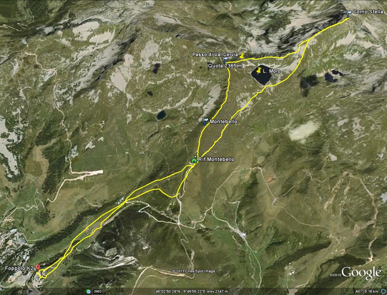
A4 Milano-Venezia exit Dalmine. At the roundabout take the SS470 - Val Brembana - San Pellegrino Terme. Follow the road to Lenna - Piazza Brembana and from here continue right to Foppolo. Leave your car at the car park in the cable car yard.
.Introduction
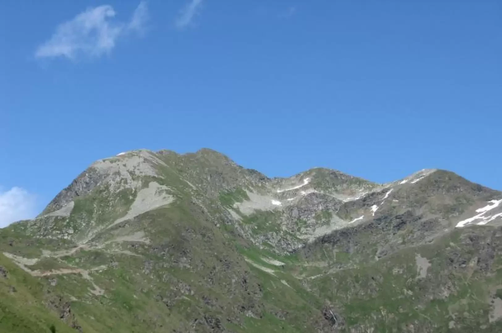
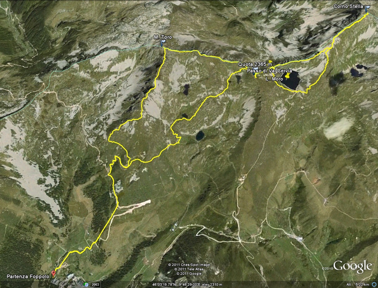
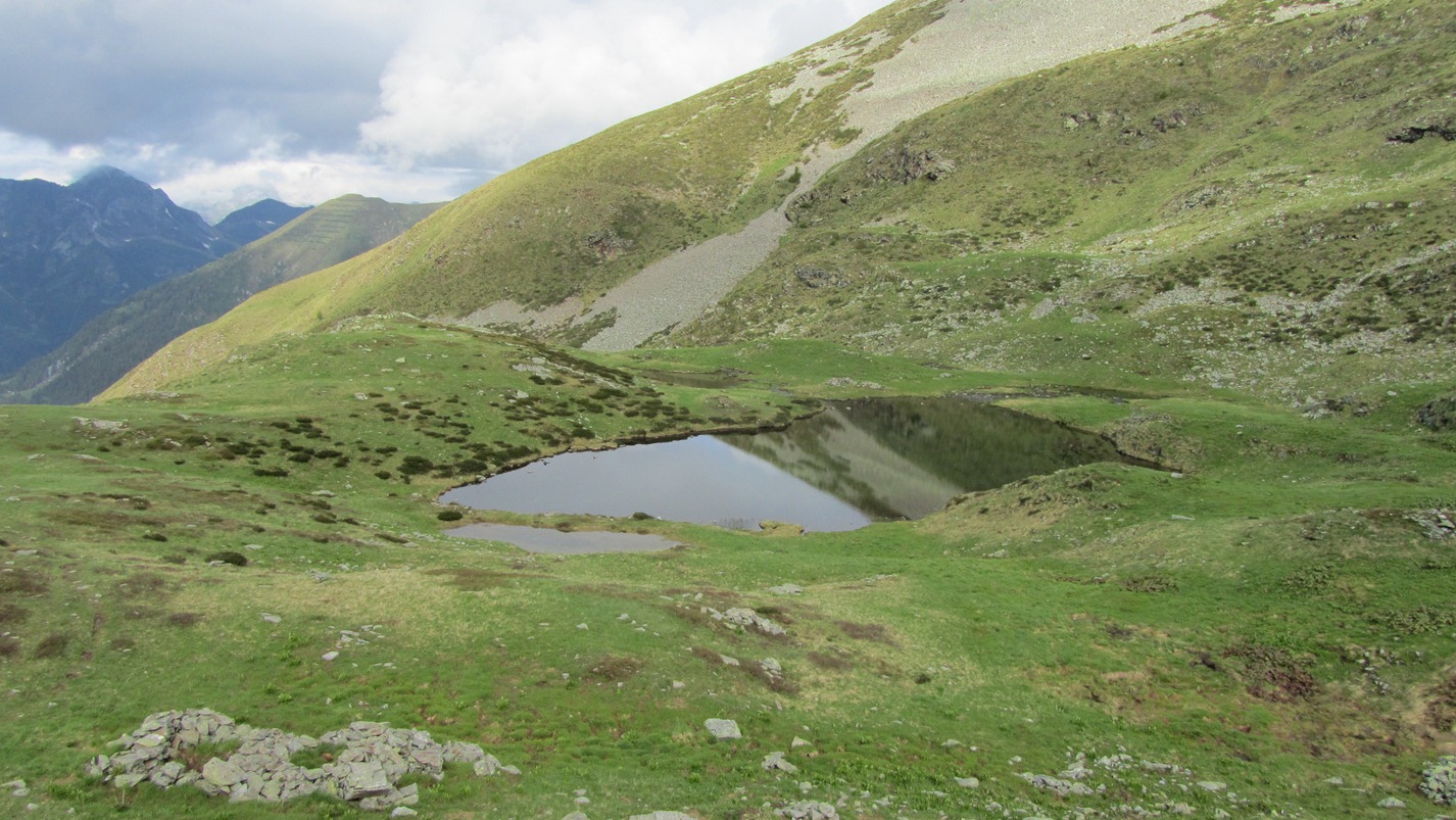
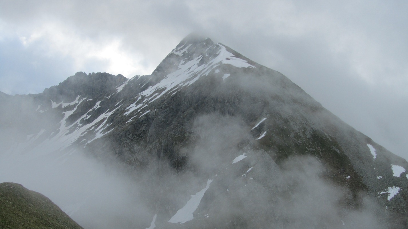
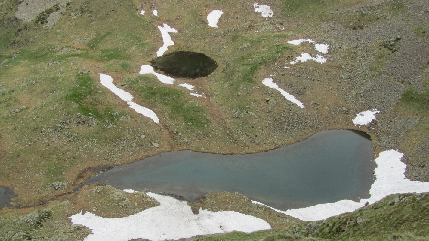
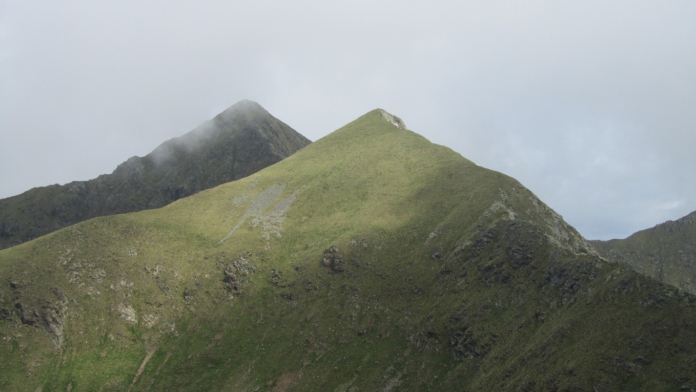
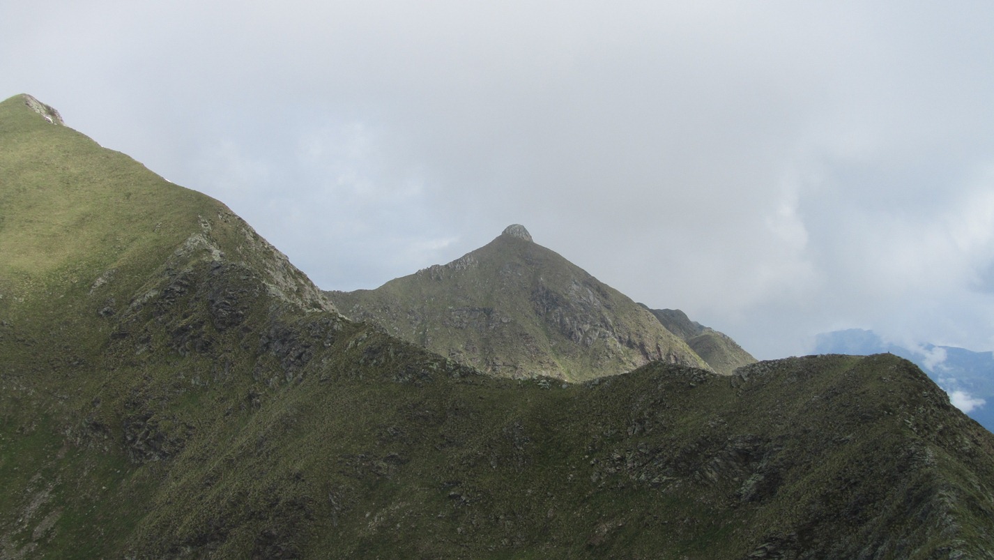
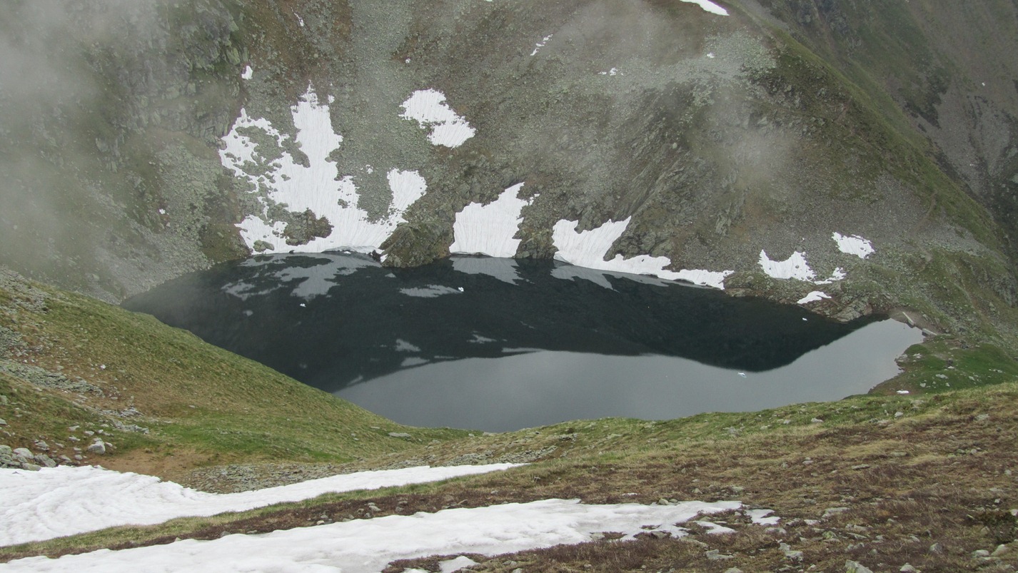
Corno Stella is a well-known peak in the centre of the Orobic Alps. Located on the watershed between the Bergamo and Valtellina sides, it is a popular destination, especially in summer. Its central position offers the hiker a splendid view of all the Lombardy Alps: from the Orobie chain to the highest peaks of Valtellina. The normal route starts from Foppolo and, from an altitude of 2200 m, encounters a series of delightful lakes of glacial origin that satisfy the eye.Description
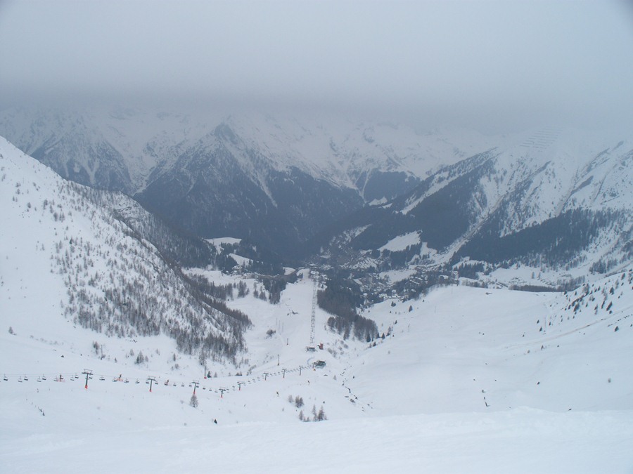
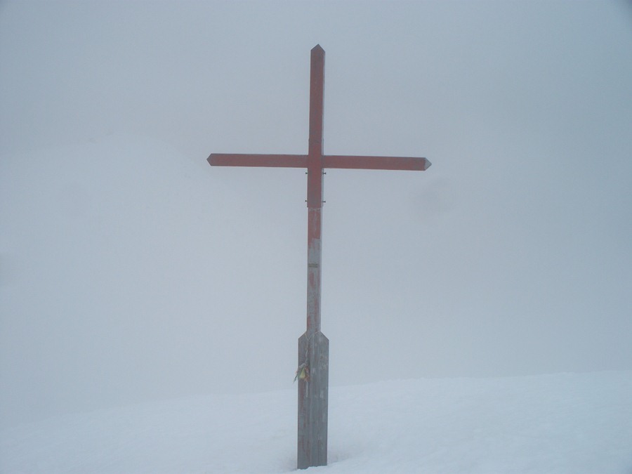
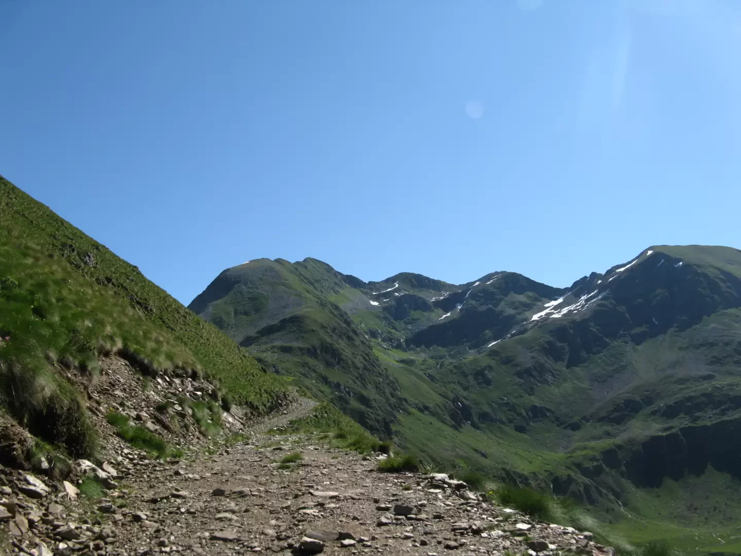
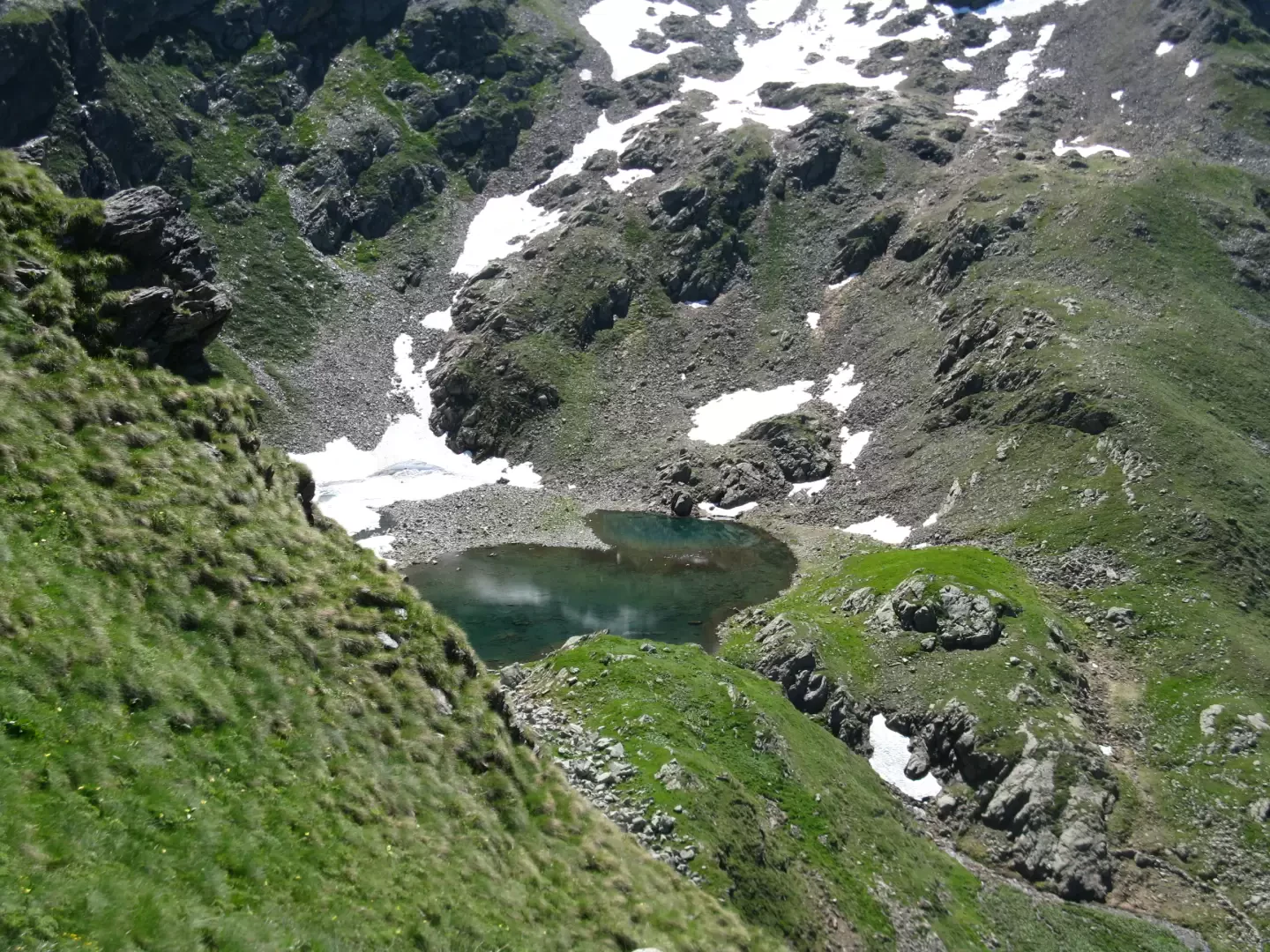
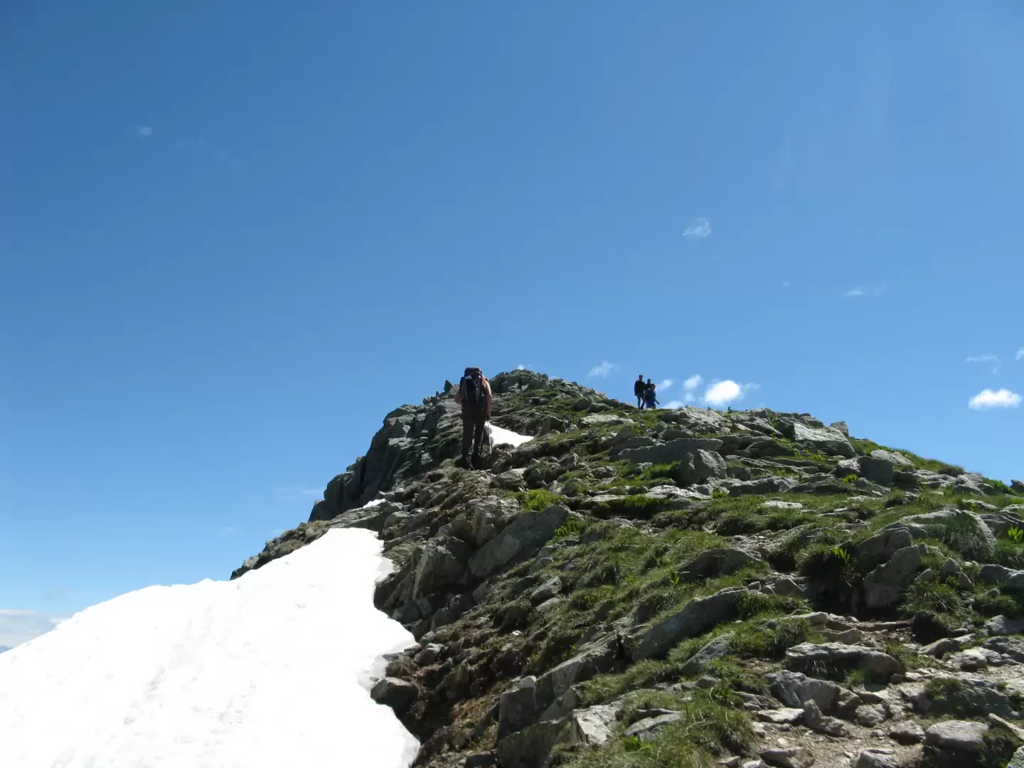
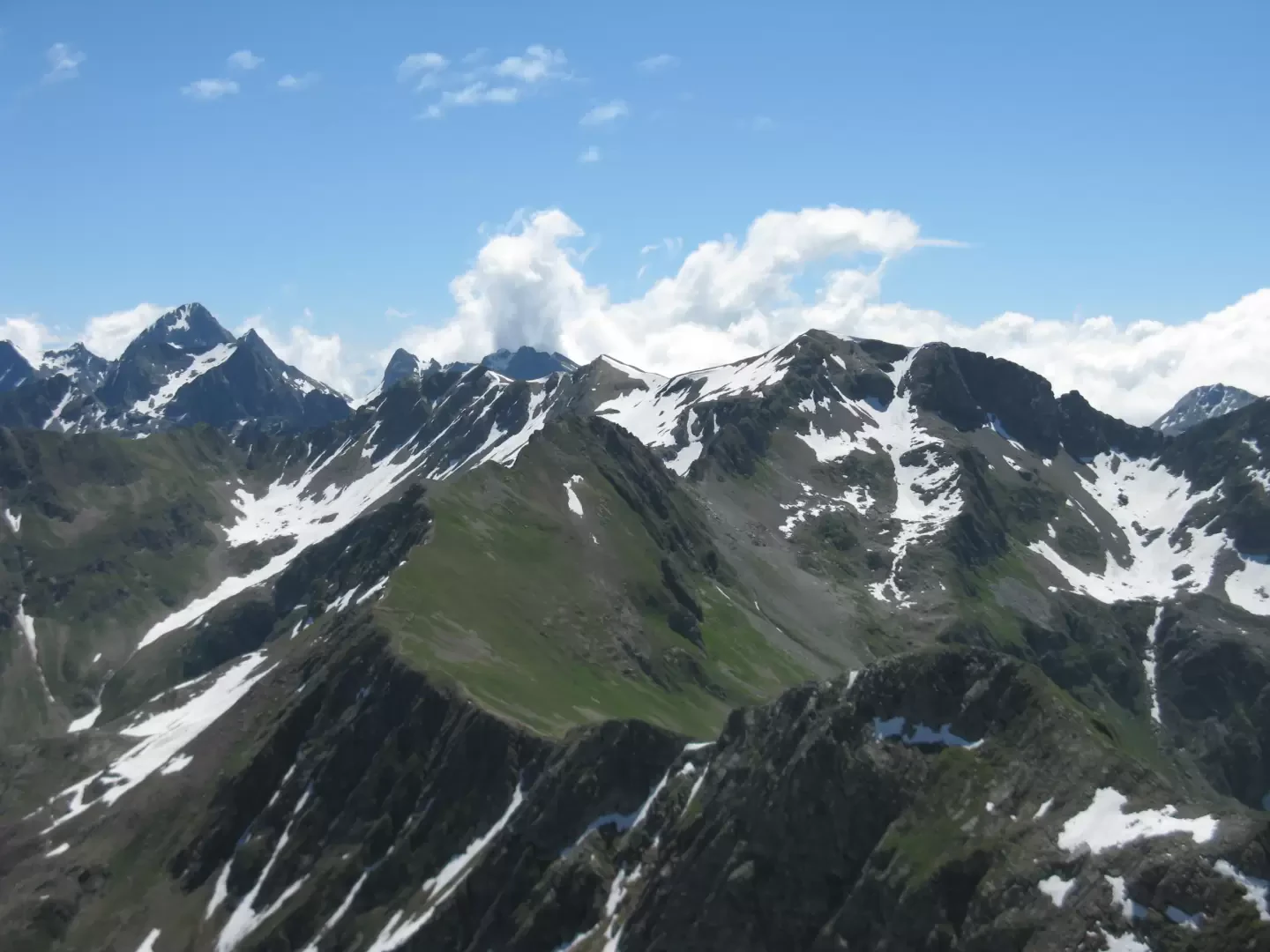
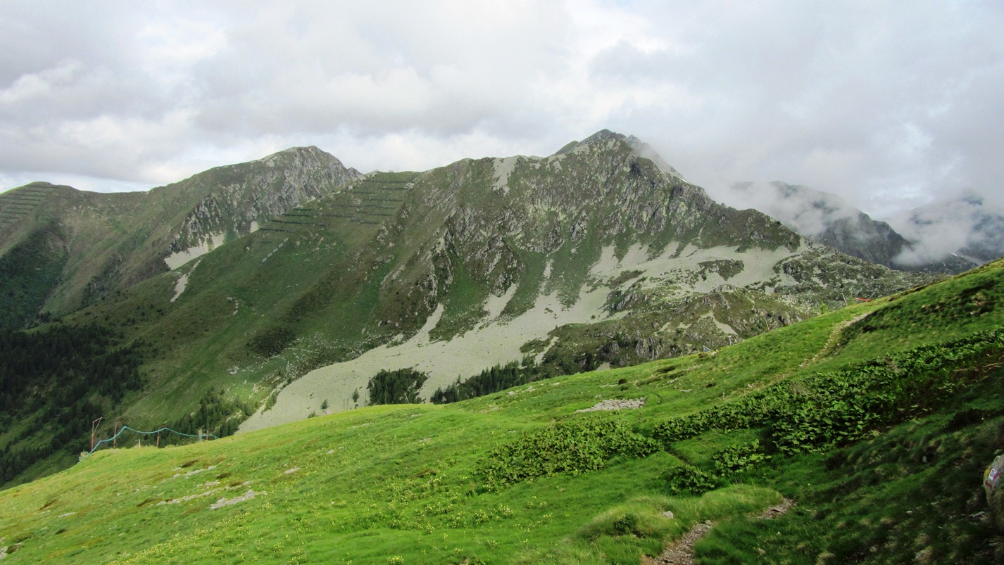
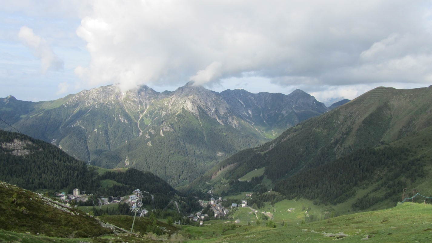
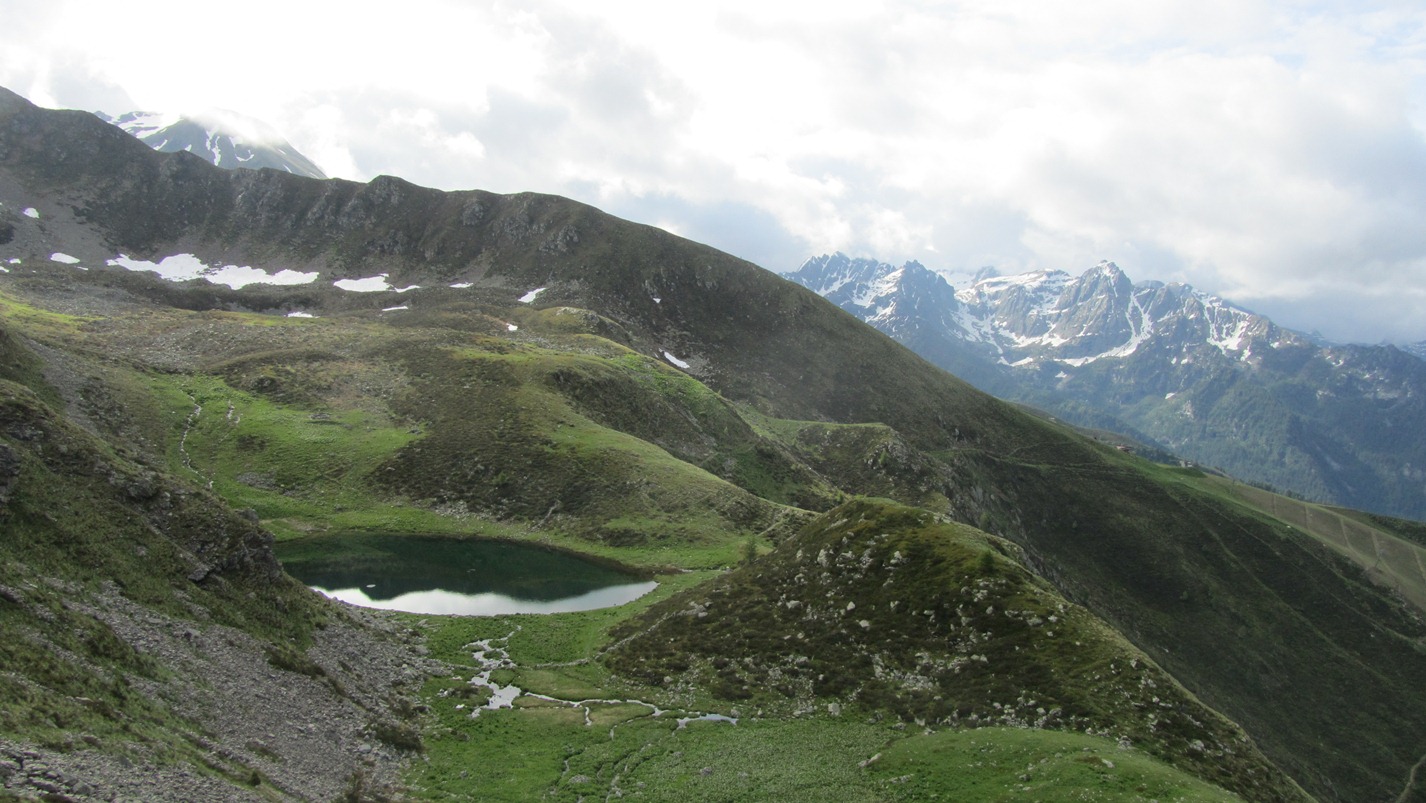
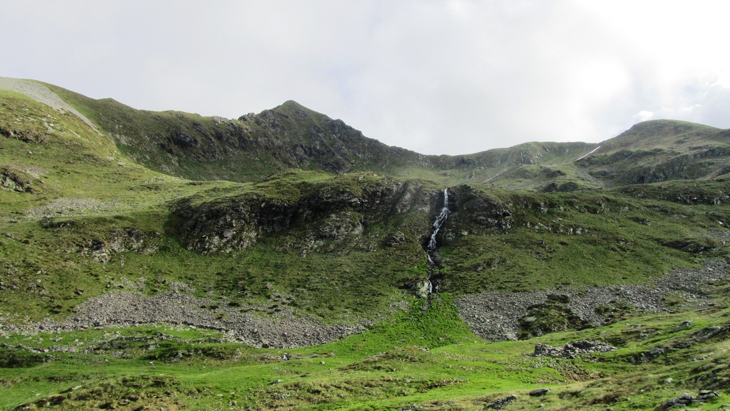
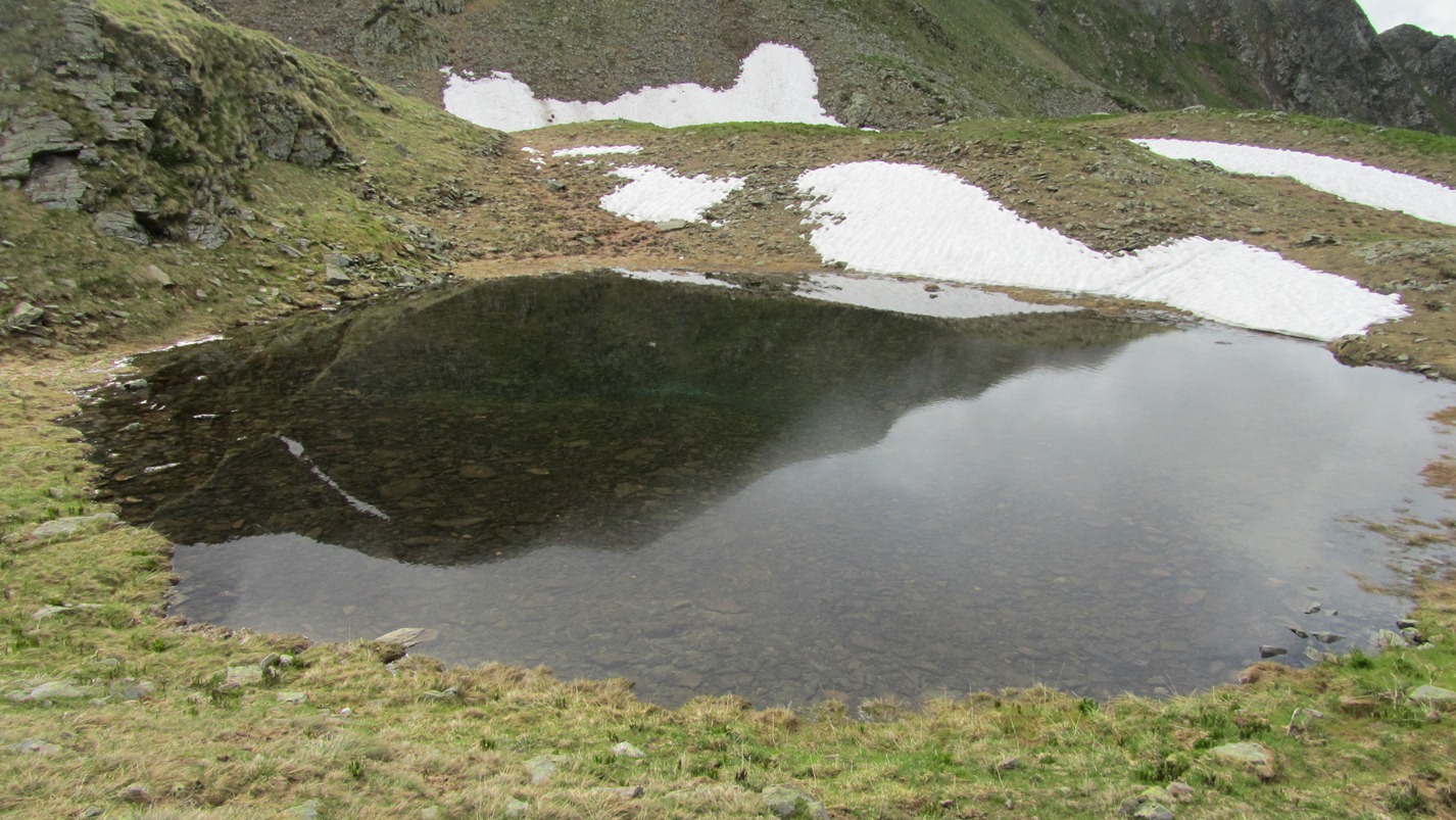
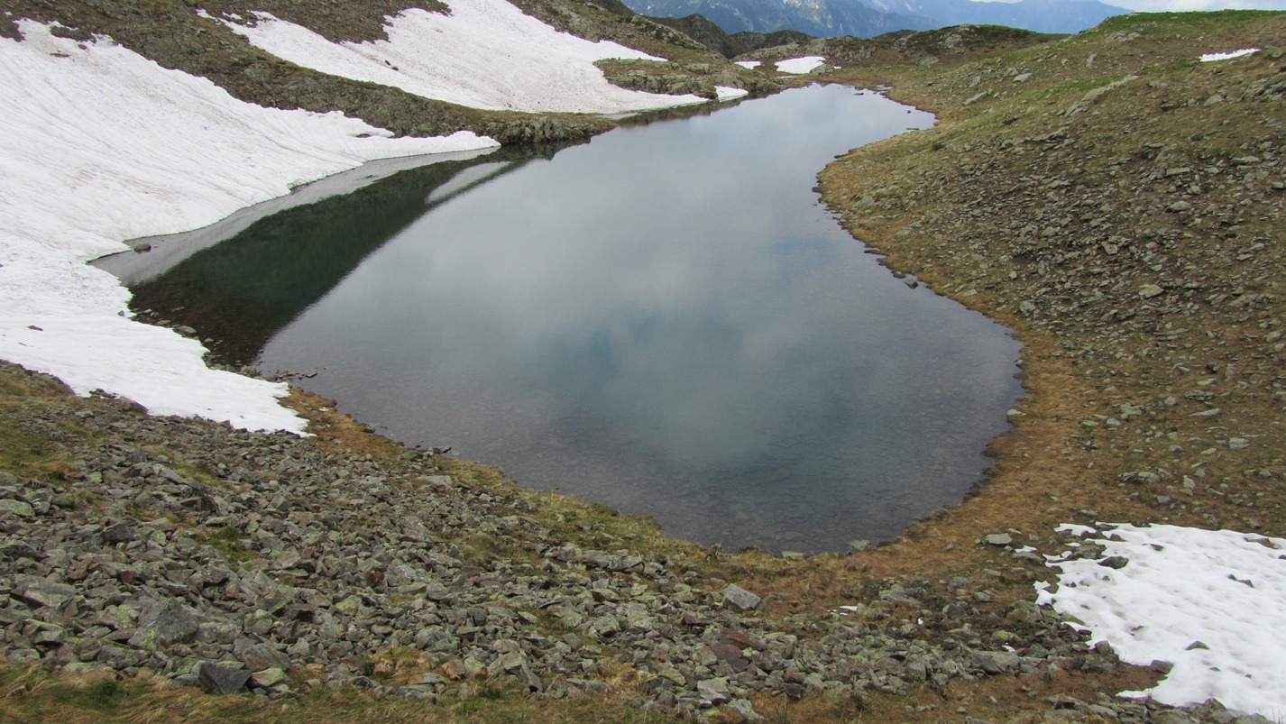
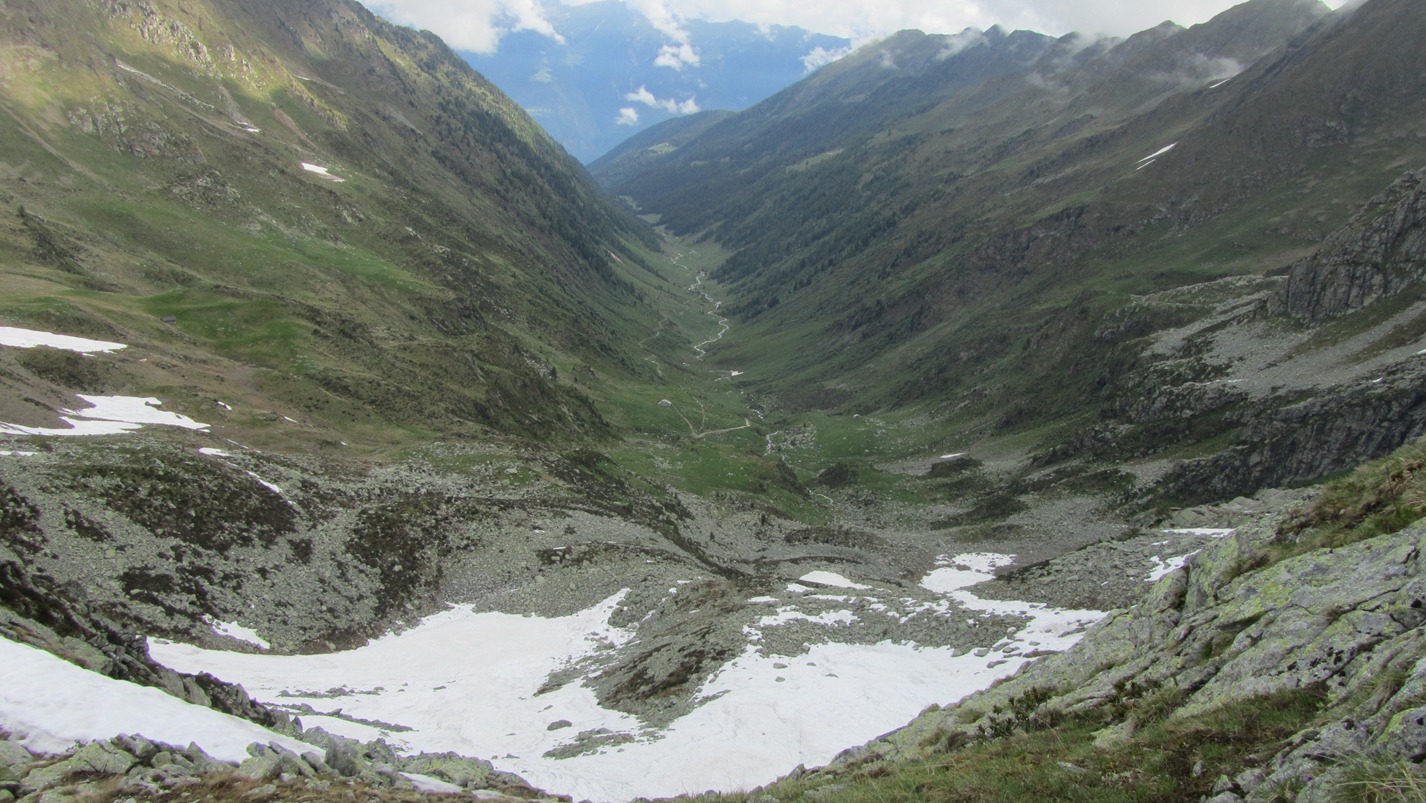
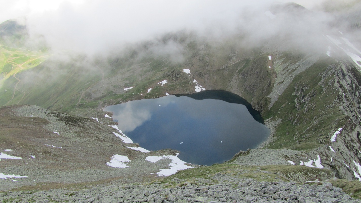
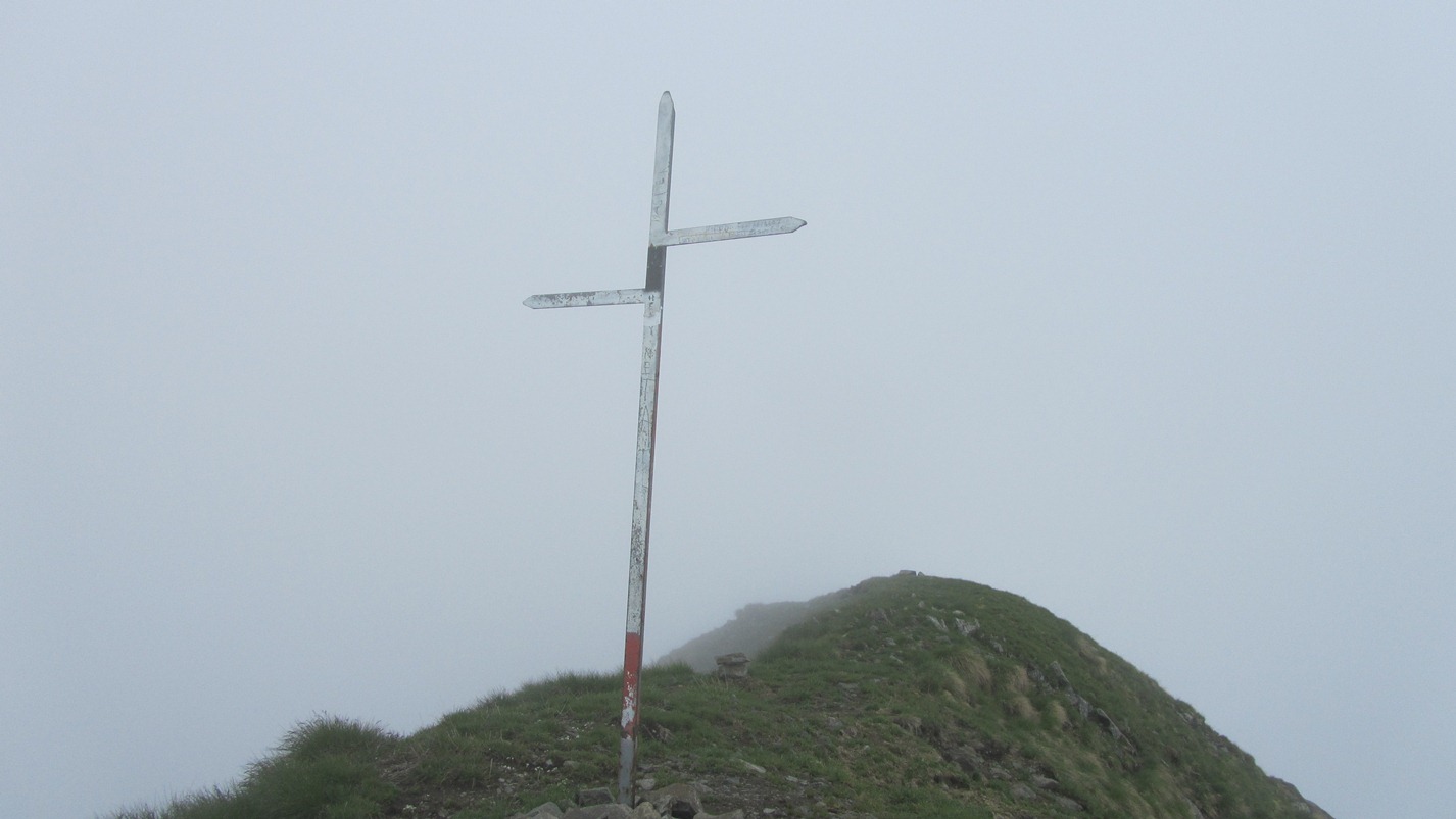
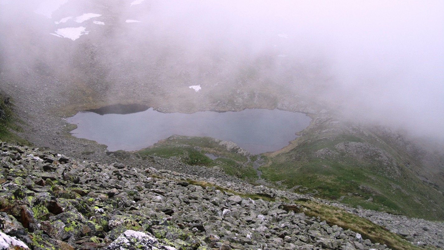
Corno Stella is a well-known peak in the centre of the Orobic Alps. Located on the watershed between the Bergamo and Valtellina sides, it is a popular destination, especially in summer. Its central position offers the hiker a splendid view of all the Lombardy Alps: from the Orobie chain to the highest peaks of Valtellina. The normal route starts from Foppolo and, from an altitude of 2200 m, encounters a series of delightful lakes of glacial origin that satisfy the eye. From the car park, the first destination to reach is Montebello, the arrival station of the ski lifts. To get there, you can either walk along path no. 204, a dirt road that climbs to the left of the chair lift and then crosses the ski slope to the right in the direction of the Croce pass and finally climbs with a few bends to the top station, or you can climb directly up the ski slope under the chair lift, saving time. From the top station, take a wide path to the right that climbs up the southern slope of Montebello and reaches the mouth of Lake Moro, 2235 m, located in a very pleasant position between the Valcervia pass and the Corno Stella ridge. At this point it is easy to encounter groups of ibex grazing, not at all intimidated by human presence. After crossing the outlet of the lake, take trail 204 again, which climbs steeply up a stony area and then stretches further on to climb steeply up the western ridge of Corno Stella. On reaching the summit, walk along a section of ridge, then return to the south side along an exposed section of path and finally zigzag up to the summit cross (2620 m). From the summit, the Orobic peaks of Pizzo del Diavolo di Tenda, Cime dello Scoltador, Pizzo dell'Omo to the east; Monte Pradella, Pizzo Farno and Pizzo Arera to the south. To the north, Monte Disgrazia, Il Cengalo and Il Badile are clearly visible. To the west are the mountains of the Lecco area: the Grigne and Resegone. But one of the most beautiful things is the presence of magnificent lakes set among the mountains. These include Lake Publino with its dam, located below the Scoltador peaks; the aforementioned Lake Moro; the small lake of Corno Stella, partly still snow-covered, the view of which accompanies us along the ledge-path below the summit; and finally the lakes of the Carisole valley and the lake of Valle Sambuzzo. For the descent, it is advisable to retrace the outward path to Lake Moro and from here take the path that skirts the western shore of the lake and climbs with a moderate gradient to the Valcervia Pass (2319 m), on the watershed coast with the Valtellina, from where there is a magnificent panorama. It climbs further to the left along the western ridge and at an altitude of 2368 m descends to the south on the Bergamo side in a bucolic setting sprinkled with other magnificent lakes. We descend to the Alto e Basso delle Foppe lake, then over meadows to the Laghetti and finally descend again, and when the path turns left we reach Lago delle Trote. Along the southern shore of this latter body of water the path heads south until, after about ten minutes, you catch a glimpse of the upper station of the chairlift (Montebello) from where you return to Foppolo on the dirt track taken on the way up.Galleria fotografica
© 2021 - Rita Tarussello
© 2011 - Rita Tarussello
© 2011 - Rita Tarussello
© 2011 - Rita Tarussello
© 2011 - Rita Tarussello
We have been there

Edited by:
ser59
Corno Stella M. Toro
Gita veloce sia per evitare probabili piovaschi pomeridiani sia per mangiare a casa Prendo la strada per il passo Dordona giunto quasi all'arrivo della seggiovia del M. Toro piego a destra e col sentiero 202 passando vicino ai laghi delle Trote arrivo al Passo di Val Cervia e alla vicina Q. 2365 m. Per non perdere ulteriore quota proseguo in cresta sino a riprendere il sentiero che sale al Corno Stella quasi in cresta, in breve sono in vetta immerso nelle nebbie. Ridiscendo questa volta per sentiero sino al L. Moro anche per prendere un pò di acqua, ritorno al passo di val Cervia e da li percorrendo la bella cresta sud del M. Toro segnata con frecce bianche, arrivo in vetta anche qui nelle nebbie. Discesa dalla cresta Ovest sino a riprendere il sentiero di salita nei pressi dell'arrivo della seggiovia del M. Toro Due gocce le ho beccate ugualmente nonostante alle 12.30 fossi alla macchina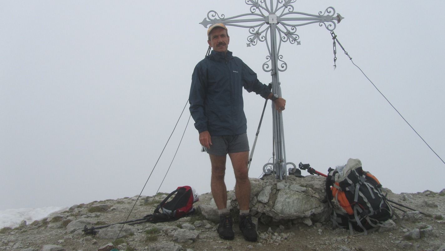

Edited by:
ser59
Foppolo Monte Bello, Corno Stella con neve
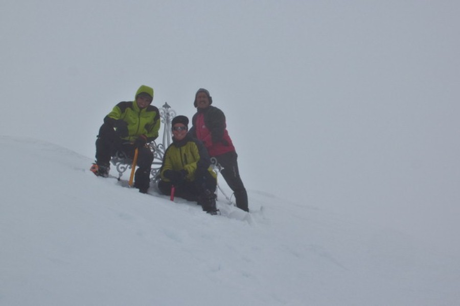
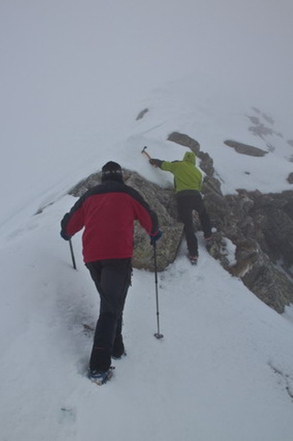
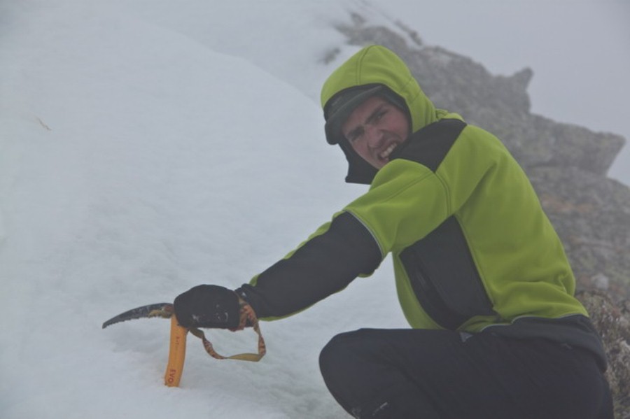
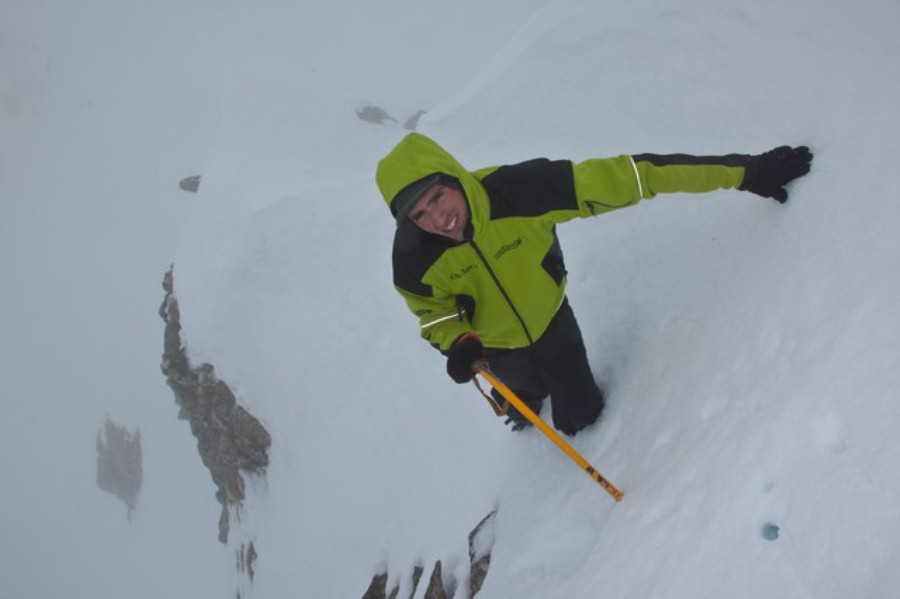
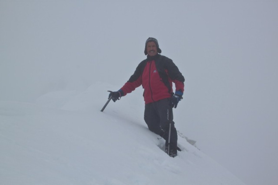
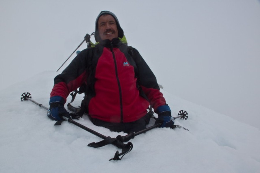
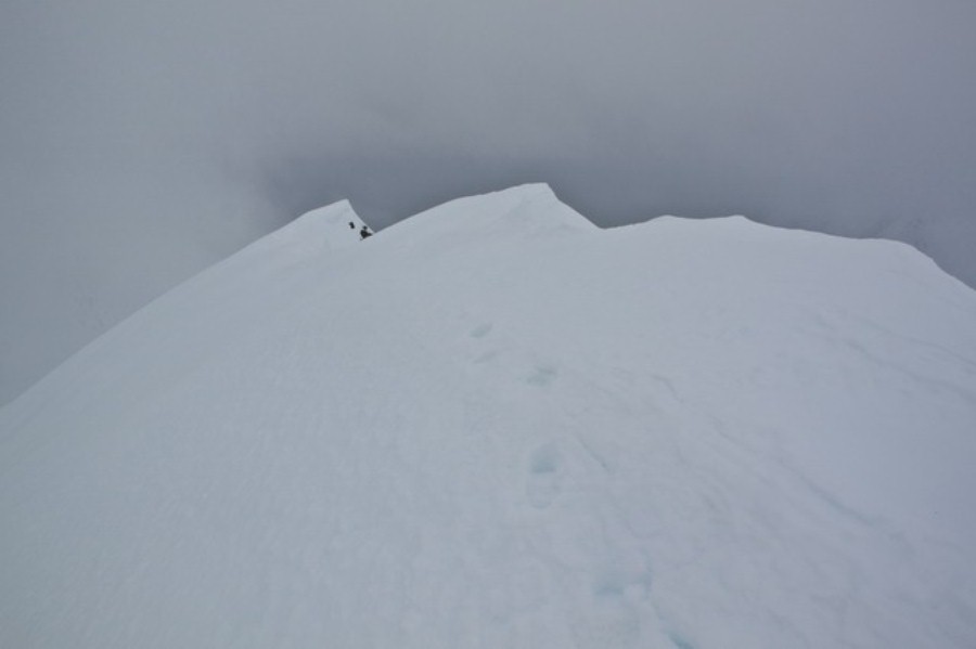
Oggi visto la giornata grigia con Marco e Mattia decidiamo di Salire al Corno Stella. Partenza da Foppolo alle 7.31 con già +2°C saliamo lungo le piste sino al Rif. Montebello, sin lì tutto bene come usciamo dalle piste la neve è pessima sotto la croce del Montebello troviamo 7 skialp che rinunciano alla salita al Corno stella per neve pessima noi proseguiamo lungo la lunga cresta che porta sopra il passo di Val Cervia e poi al L. Moro ci fermiamo più volte per togliere e mettere ciaspole e ramponi (Mattia a avuto la brillante idea di lasciare in macchina le ciaspole poi se ne pentirà) Arrivati allo spallone del Corno Stella a circa 2520 m di quota lasciamo zaini e ciaspole e con picca e ramponi percorriamo con cautela la parte finale tenendo sempre il filo di cresta stando attenti alle cornici Breve sosta per foto di rito e poi si ritorna sulle nostre peste e alle 12 siamo al lago Moro per un veloce panino. Altra ravanata in neve sempre più marcia sino a raggiungere le piste di sci che Mattia questa volta ha proprio benedetto Bella sgambata di allenamento peccato per il tempo e la neve marcia