Tour of Val Toàte, from Ledin

Edited by:
Marco Bonati
Updated at: 02/12/2025
Access
From Milan to Morbegno along State roads 36 and 38; at the traffic lights at the entrance to the town, turn left towards "Costiera dei Cech". After the bridge over the Adda, take the provincial road to the right and, at the hairpin bend, immediately to the left; go up the Rhaetian slope for a few kilometres in the direction of "Pòira" until you reach a dirt square with a small church and football pitch. It is possible to continue on a somewhat uneven dirt track through the beautiful pine forest to an agritourism in the locality of Ledìn. Limited parking possibilities.
Introduction
A wide-ranging hike in areas unknown to most non-local hikers. It is an excursion that can be done practically all year round, as the southern exposure does not allow for excessive snow accumulation (in winter, a pair of snowshoes is largely sufficient, limited to reaching the bivouac). The only 'problems' are the age of the painted signs and the total inaccuracy (or, rather, inexactness) of the cartography at the altitudes above the last pastures.
Description
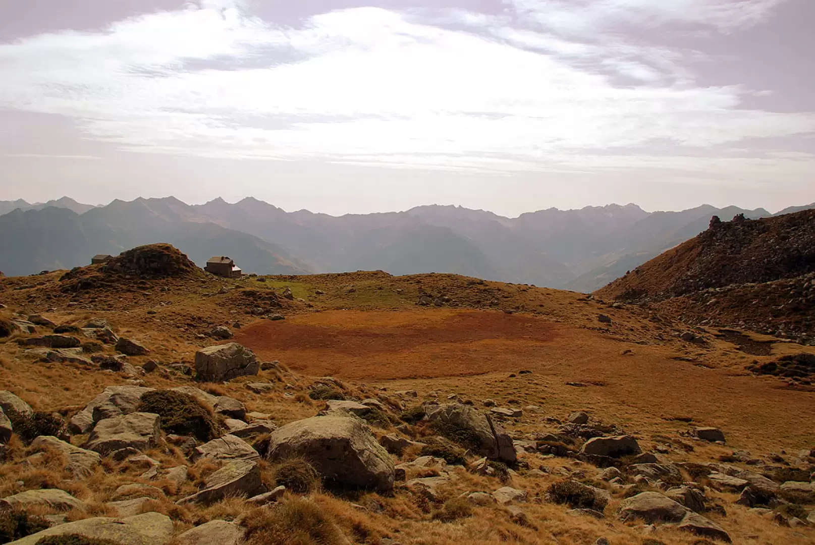
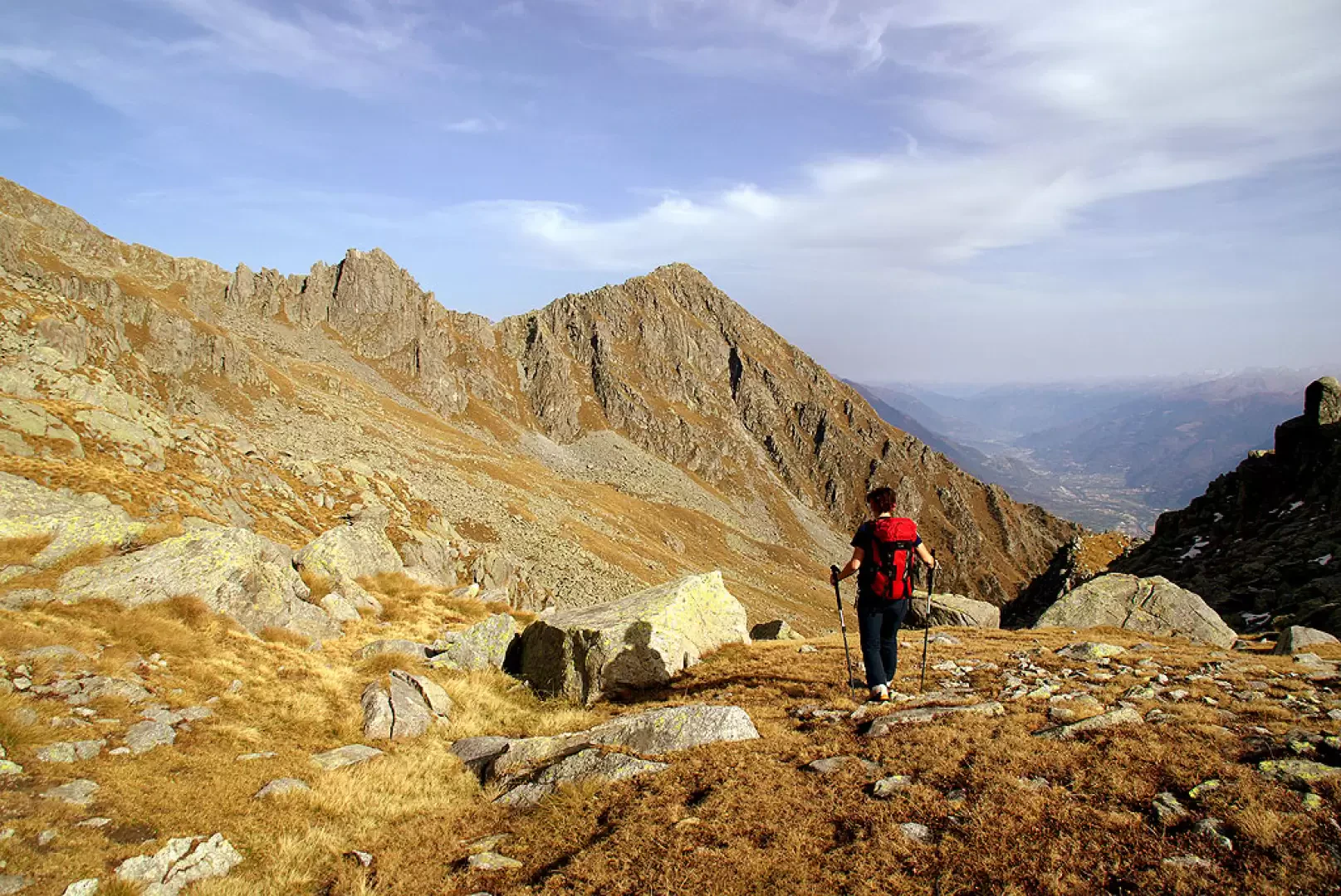
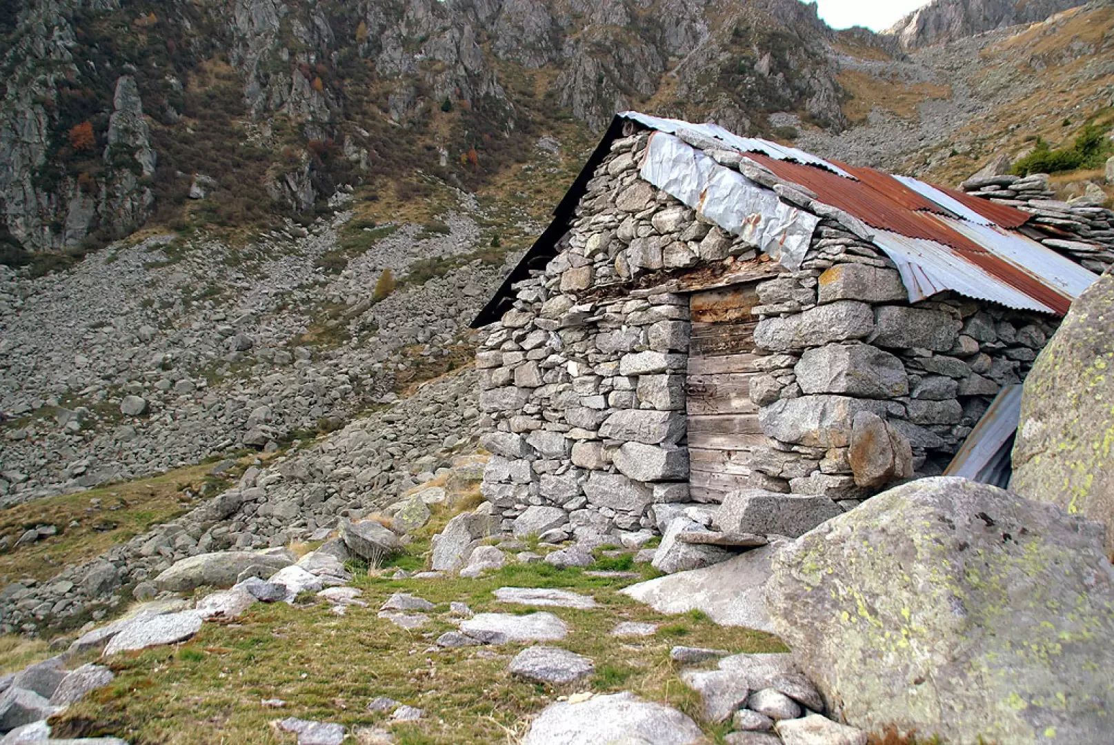
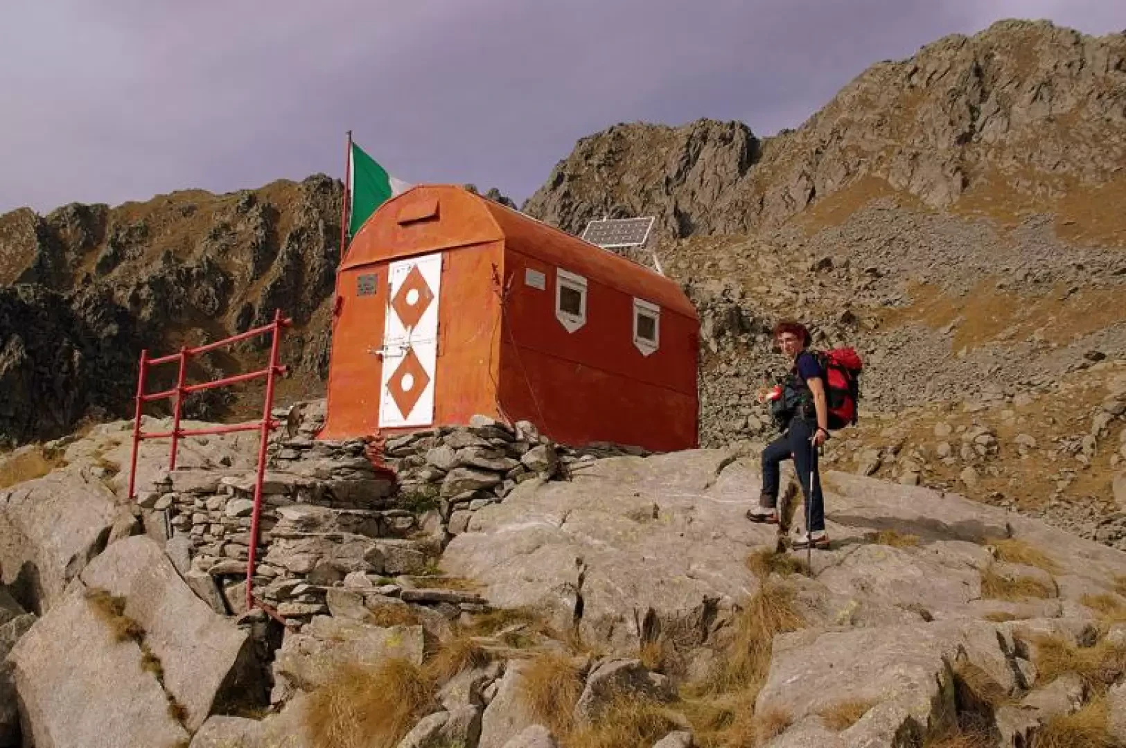
From Ledìn 1270 m approx. (Ledino, on the maps) you head towards the pine forest to the north and immediately find the start of a wide path; follow it along the comfortable hairpin bends until you come to a fork dominated by a cincèt (chapel): take a left and, in a short time, you will come to a recent (2006-2007) firebreak. One ignores, right in front of us, the continuation of the path (this is the way back) and heads left until one notices, high up on a log, the sign 'Tre Cornini'. Take this path and ascend in easy hairpin bends through the pine and birch forest; then a traverse among the gorse leads us to the maggengo di Prà Succ 1647m (Presòccio, on the maps) where the path gets lost. To find it again, it is necessary to observe the last huts at the top on the left and reach a marker with a yellow arrow behind them; continue through ugly vegetation dominated by the skeletons - erected and also felled - of the many pine trees burnt in the various fires that occurred in the 1980s and 1990s. Once past the forest level, you come to a very stony pastureland esplanade, where the path again disappears: in an anti-instinctive manner, you must ignore the small valley in front of you, in order to look for the track on the slope to the left; having found it (but there is more than one), you arrive at the shoulder above, in view of Alpe Vesògn 2003 m (Visògno, on the maps). From here, the Bottàni-Cornaggia bivouac is already visible above, which we will reach in less than an hour. Passing through the remains of ancient lakes that are now buried, look for the sparse and faded white/red painted signs on the left side of the gully (a little towards the Tre Cornini, a characteristic triple accumulation of boulders), which you should follow carefully: at this point the bivouac is no longer visible and there is a great risk of wandering uselessly up the slope. We reach the rocky pulpit that supports the construction (always closed; keys on request in the restaurants of Pòira) by going round it on the right. The continuation of the tour is made by heading sharply eastwards with a slight ascent in a corridor between the granite boulders, aiming at an apparent opening: in reality it is only the access to a short rocky plateau. At its end - and still in the same direction - at Bocchetta Toàte 2400m or so (not named or listed on the maps), we find ourselves entering a gully cluttered with large piled boulders; a slight grassy track, to be followed carefully, spares us the effort of progressing from rock to rock. From the bivouac to the lower end of the gully, there are vague arrows in old blue paint: they are certainly not clearly visible from a distance, but their finding confirms the rightness of the logically chosen route. At the end of the gully, all traces disappear: it is then necessary to locate, about 200 m downstream, the tin roof of the Baita Colino 1937m and to reach it by descending among stones, creeping junipers and rhododendrons. Just downstream from the hut, the signs and a nice path resume, and, avoiding some ancient landslides, lead us (at the end, pay close attention to the little stone cairns) to the western huts of the Pesc 1613m (Peccio, on the maps). From the alpine pasture, dominated to the north by the Bering Tower and the Corno del Colino 2504m, we re-enter the forest and the path quickly descends to the firebreak: on the other side of the little road, we pick up the path we took on the way up, which takes us back to Ledìn in about twenty minutes.
.Galleria fotografica