Gilliarey, from Buisson

Edited by:
Gian Mario Navillod
Updated at: 15/07/2025
Access
Lasciare lo svincolo autostradale di Châtillon. Svoltare a sinistra e proseguire per circa 300 metri fino alla rotonda. Alla rotonda, prendere la terza uscita e immettersi su Via Emile Chanoux. Percorrere la via attraversando il centro storico per circa 600 metri, quindi svoltare leggermente a destra su Via Menabreaz. Continuare per 450 metri fino alla rotatoria caratterizzata dal monumento del Cervino al centro. Prendere la seconda uscita per immettersi sulla Strada Regionale in direzione della Valtournenche. Proseguire lungo la per circa 7,6 chilometri, superando le frazioni di Champlong e Chessin. All’ingresso di Antey-Saint-André, mantenere la sinistra alla biforcazione per restare sulla e seguire le indicazioni per Buisson. Continuare per ulteriori 3,1 chilometri, risalendo la valle fino a raggiungere il villaggio. Poco prima delle prime abitazioni di Buisson, sulla destra, è disponibile un piccolo parcheggio gratuito 🅿️.
Distanza e tempo di percorrenza
🕒 Tempo di percorrenza: 20 minuti
📏 Distanza: 12,5 km
Navigazione GPS
📍 Come arrivare con Google Maps
📍 Come arrivare con Apple Maps
ℹ️ Nota importante
Le indicazioni fornite sono state verificate alla data del rilievo dell’itinerario. Prima della partenza, è consigliabile verificare eventuali variazioni del percorso. Per ottenere indicazioni aggiornate e dettagliate, si consiglia l’uso di Google Maps o Apple Maps.
Introduction
A hike to discover the abandoned village of Levaz with arrival at the exceptional Gilliarey viewpoint.
Description
Following the regional road to Cervinia in the direction of Valtournenche, 200m from the Fiernaz rockfall tunnel, leave your car on the left, in the small car park created almost on the edge of the stream.
After a few steps along the regional road at the height of the first house in Buisson, above the road to Cervinia, take the tractor-track that climbs up through the meadows and after about three minutes you will reach the track that follows the wall protecting the village. Follow it for a few tens of steps to the left until you come to the path that climbs up the rampart, walk along it until you reach the cairn and descend on the other side, entering the forest to the right of a small boulder embedded in the ground in a vertical position.
Continue along the path amidst the tangled vegetation and after about ¼ of an hour you will find the stump of a larch tree broken by heavy snowfall on the right.
Continuing along the path, you will find the marker (7) marked on a boulder on the left, with a small group of small fir trees on the right.
About half an hour from the start, you cross a stretch of woodland carpeted with ivy, at the base of a rock face from which you turn off to the left. A little further on you cross the path coming up from Fiernaz (which is not passable at the moment).
You climb further out of the wood, until you reach a ridge overlooking the plain of Antey. You can see the villages of Chamois on the other side of the valley, and near the path a beautiful carpet of ursine grapes, some larches, and juniper. At this point, you are about half way up the difference in altitude between the village of Levaz and the starting point, and if you continue along the path, you need to pay a little attention to where you are walking, because this is where the reptile-rich area around the abandoned village begins.
The ascent zig-zags through the dry grasses, and after about ten minutes, you pass under a slender group of broad-leaved trees growing stuntedly on the arid slope. Another 10 minutes and you cross a more substantial group of trees in which a particularly fine specimen of larch stands out. At the side of the path, a small spring provides the water necessary for the growth of the surrounding plants.
A little further on, you arrive at the foot of the rocky spur that supports the Levaz pastureland; at the side of the path, there is a plank that acts as a bench and attached to the rock face are two small wooden oratories with the Madonna and Child Jesus: it is advisable not to stop for long at this point because of the danger of falling stones.
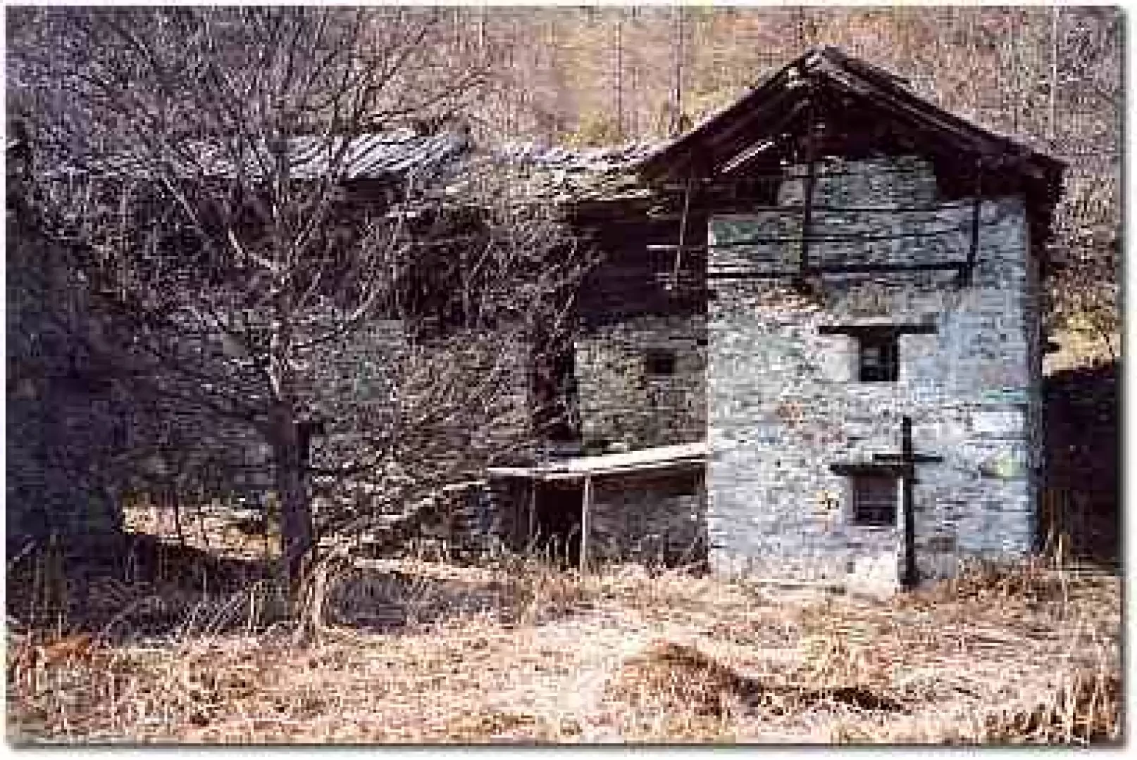
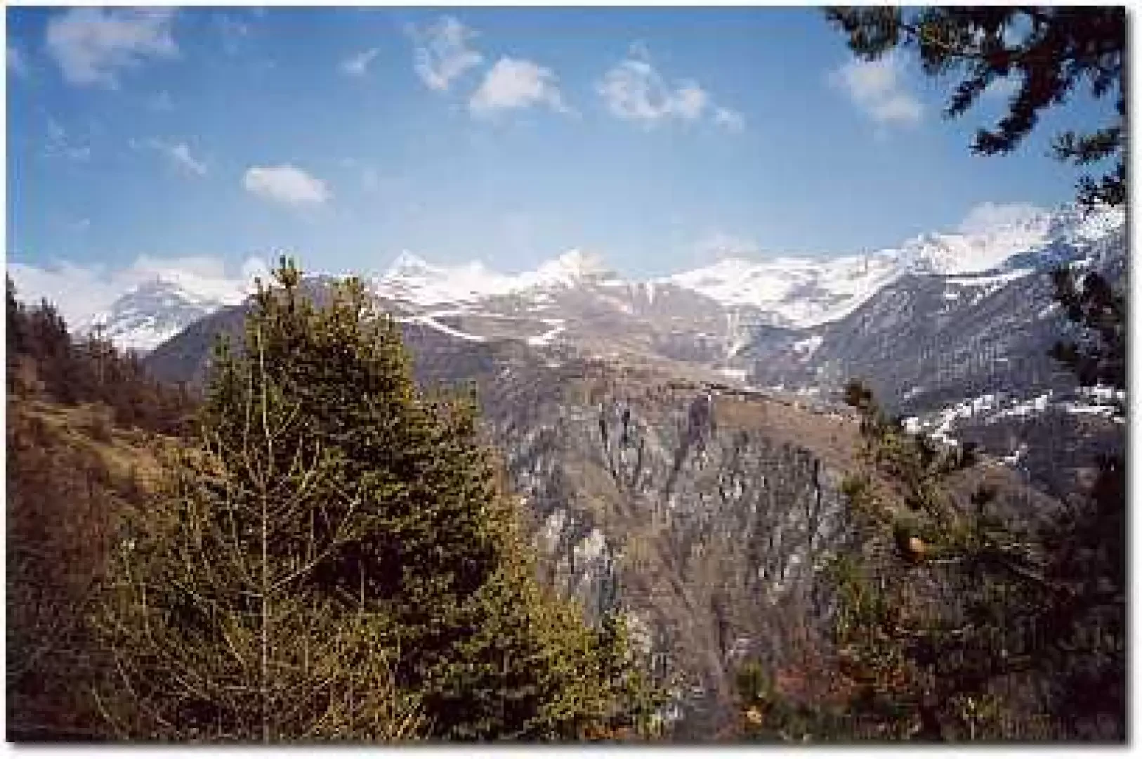
We continue along the path until we reach a short stretch of wooden fence at the end of which the Levaz plateau begins. From this point, there is a splendid panorama of the Antey plain, with the Cima Nera in the distance to the south. Looking towards the upper Valtournenche, you can see the panettone of the Roisetta, the pyramids of the Grand and Petit Tournalin, the little church of Chamois, Mount Tantané and, behind the dense larch forest separating Chamois from La Magdeleine, you can make out the Zerbion peak in the distance, with the white dot of the statue of the Madonna. A few more steps and you arrive at the village of Levaz, abandoned for decades, which used to host numerous families from Antey in the summer. Time has not affected the charm of these houses, leaning against each other, with their characteristic masonry alternating between dry stone and wooden beams. Many roofs are covered with larch boards due to the lack of lose, the stone slabs commonly used in Valle d'Aosta as roof coverings. In the houses, one can still find here and there things left behind by the inhabitants who descended to the valley floor for the last time. They have remained for years patiently waiting for their rightful owners, a chest, a table, a pair of shoes, the wood stove that for years cooked the food of young and old. With these objects before our eyes, it is easy to imagine the fervour of activity that animated this sun-warmed village from early morning to late afternoon. Now it is all silence in Levaz, interrupted only by the hoofbeats of a few chamois or the rustle of snakes.
To reach the Gilliarey chapel, one crosses the village following the yellow arrows on the trail marker and takes the path that, after a sharp bend, rises above the houses. The first wide carpets of bearberry trees cover the slope dotted with sparse conifers. On the right, the villages of Chamois stand out in the centre of the rocky amphitheatre that surrounds them.
You soon come to a scrub of larch trees dotted with rhododendron bushes, and go round it on the left, keeping to the ridge until you reach the top of the valley, which offers a pleasant view of the roofs of Levaz. After a short flat section, at the top of the spur that dominates the village, the trail zigzags its way up through the dry grass, crosses a marker and heads left into a narrow valley where the snow remains until late spring.
Step to the right up the ridge, pass a marker at which, turning around, you can admire the majestic mass of the Tantané and, a little further on to the right, the south-west shoulder of Monte Zerbion.
You pass over a rocky bank that emerges from the ground on which a cairn has been placed, you pass an isolated group of larch trees helped by some stone steps and shortly afterwards you will find the trail marker on a rock to the left.
You pass at the foot of a steep wall from which clusters of icicles hang during the thaw and after crossing a small scree slope, you head northwards and meet the first retaining walls of the Gilliarey pastures.
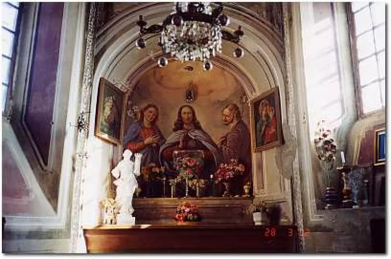
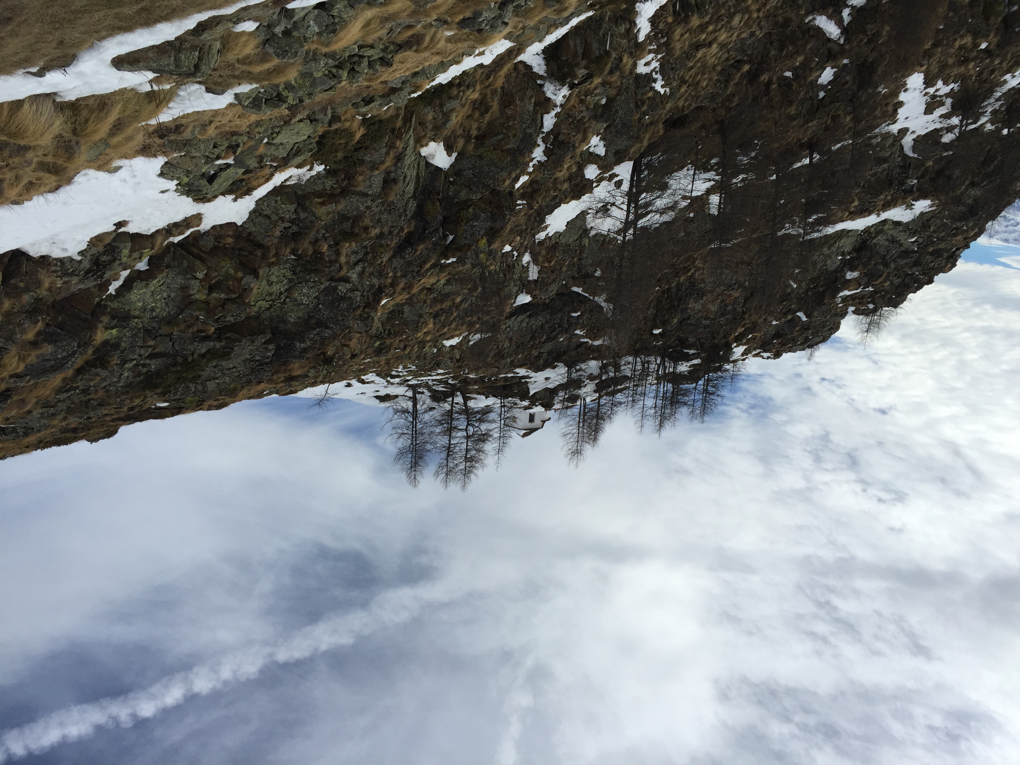
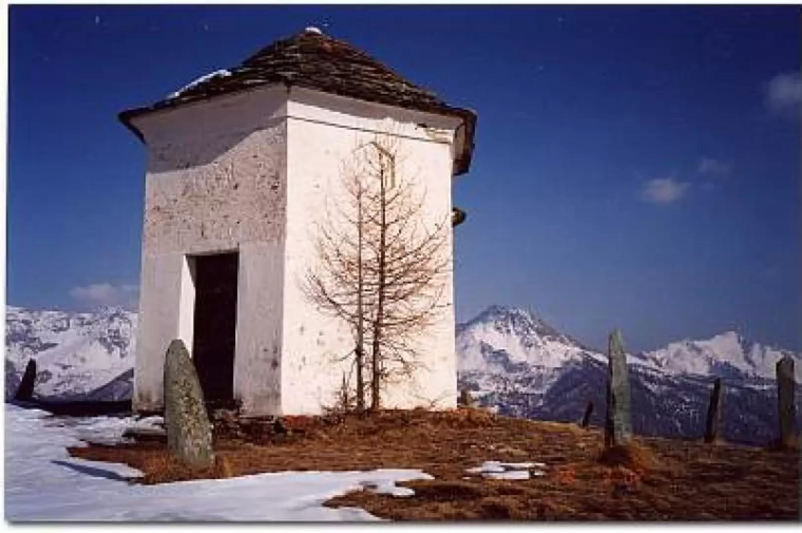
When you come in sight of the chapel, climb up to the left at the edge of the meadows and soon arrive at the oratory surrounded by 12 stones embedded in the ground. From the chapel, founded in 1866 by Canon Luigi Gorret, you can enjoy a unique panorama of Valtournenche, with a 360-degree view from the Matterhorn to the [[Grand Tournalin]], from Tantané to Monte Zerbion, to the south on the other side of the valley the squat mass of Barbeston and to the right the Nera peak and in the distance the pyramid of [[Mont Emilius]] peeping out behind the Becca d'Aver. Then always clockwise the antecima and the [[Mont Meabé]], the [[Cima Bianca]] and the sharp blades of the [[Punta Tsan]].
Galleria fotografica