Eva Verda, from Plout

Edited by:
Gian Mario Navillod
Updated at: 03/09/2024
Access
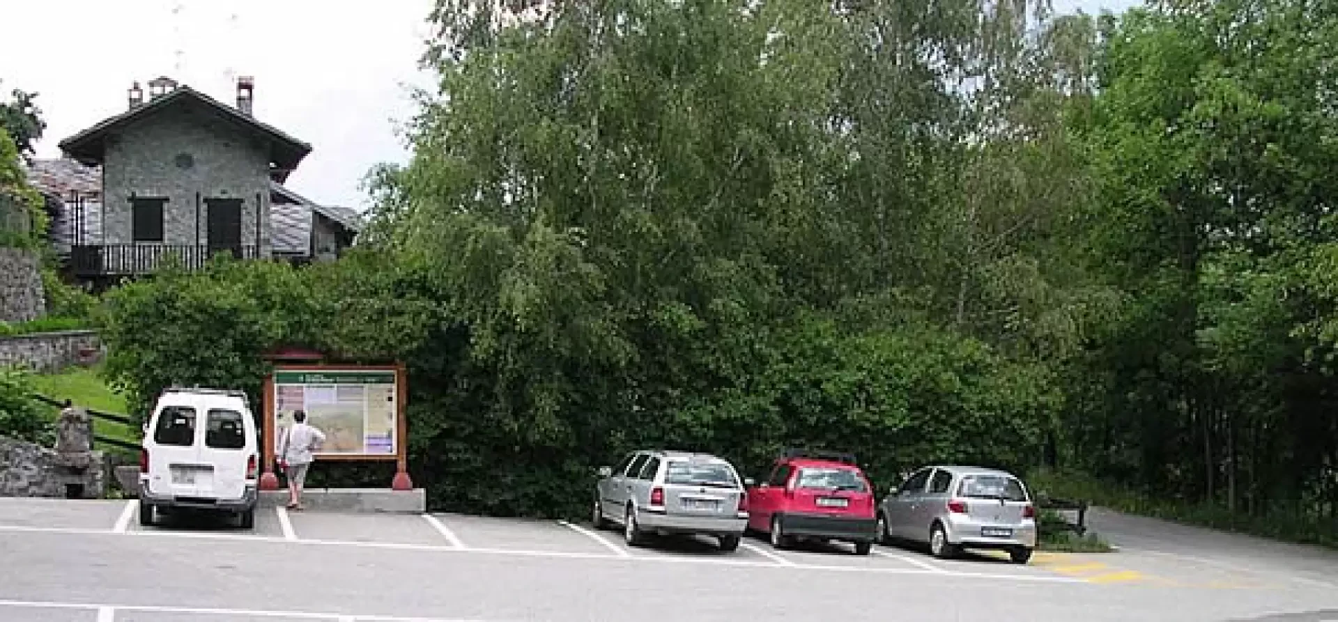
Leaving the motorway at the Nus exit, turn right and follow the signs for Nus and Aosta. Continue left on the main road following the signs for Aosta. At the roundabout, cross the Dora Baltea river following the signs for Saint-Marcel and the Plout Sanctuary. Cross the bridge over the Dora Baltea and continue, first following the signs towards the centre of the village and then in the direction of the Druges: when you reach Plout you can leave your car in the large car park in front of the Sanctuary (9.9km).
.Introduction
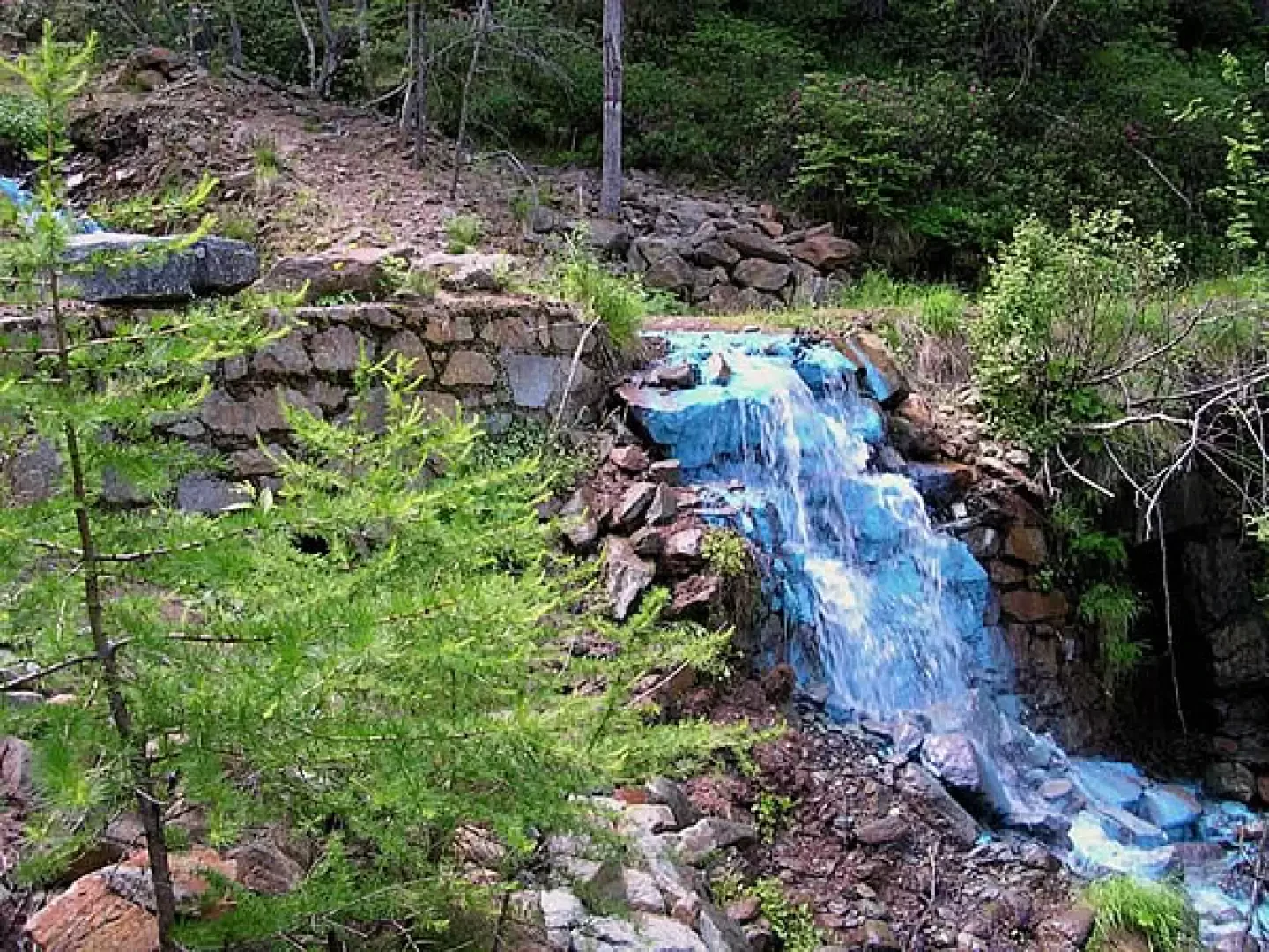
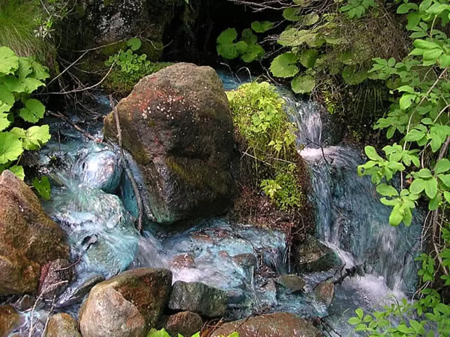
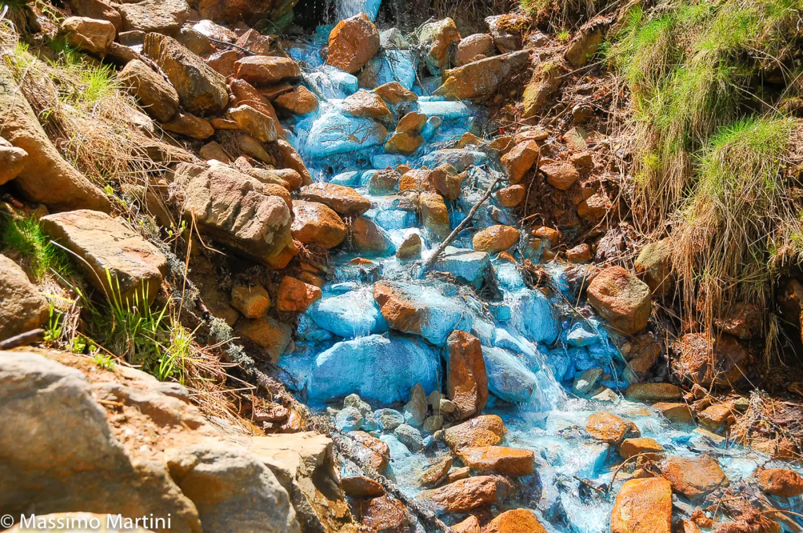
Beautiful hike in the Saint-Marcel valley to discover the green water, a curious spring that colours the entire course of the stream in which it flows green or turquoise.
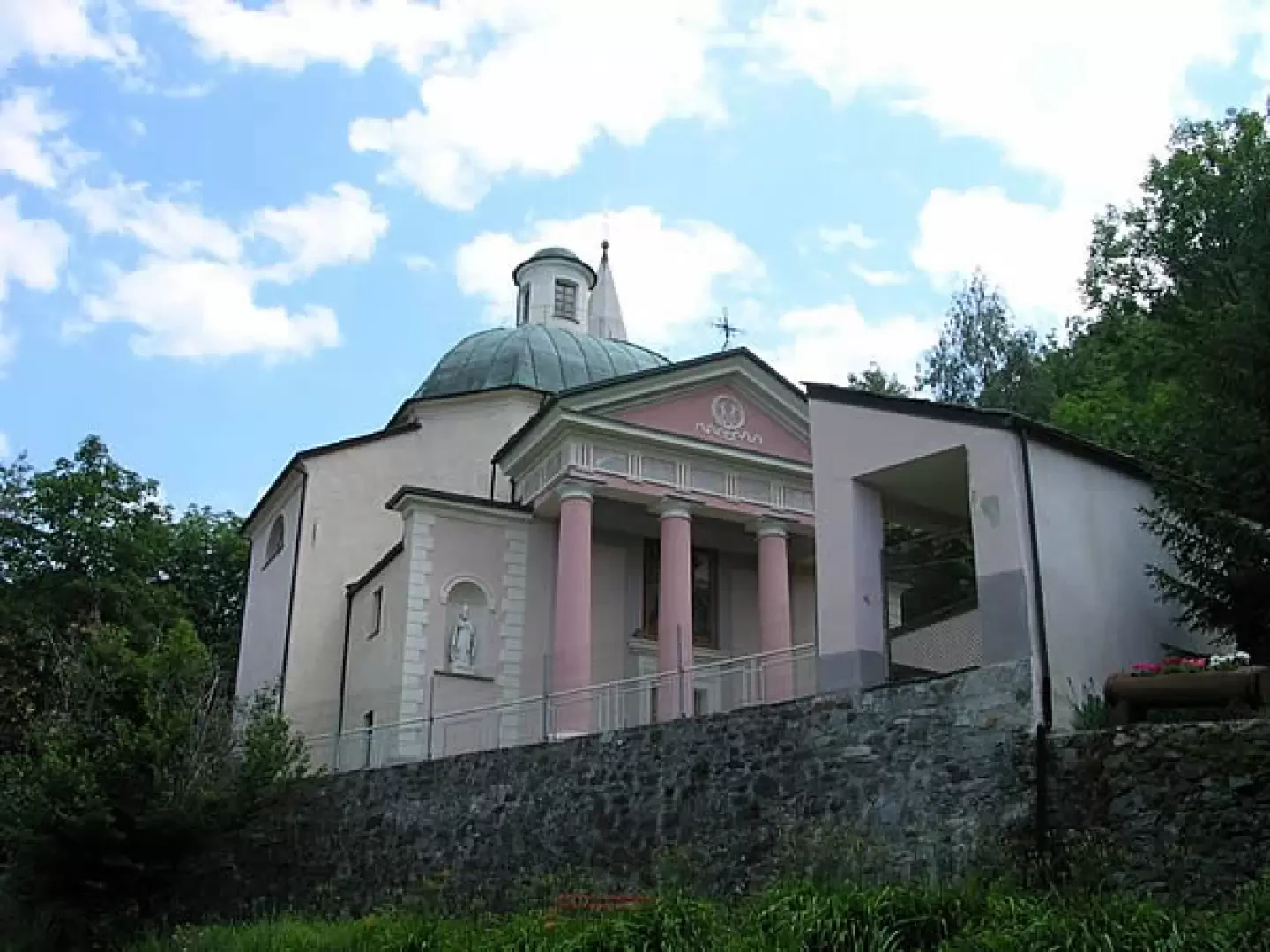
The colour of the green water stream varies from an intense turquoise, due to the woodwardite deposits of the spring that gushes from the paleophane, to green due to the mixing of these waters with those that come down from the Servette mine, which leave yellow-brown deposits. The Plout sanctuary was rebuilt in the neoclassical style between 1850 and 1853. The portico in front depicts the mysteries of the rosary painted in 1841 by Lorenzo Toso, works in which theology certainly wins out over art.
Description
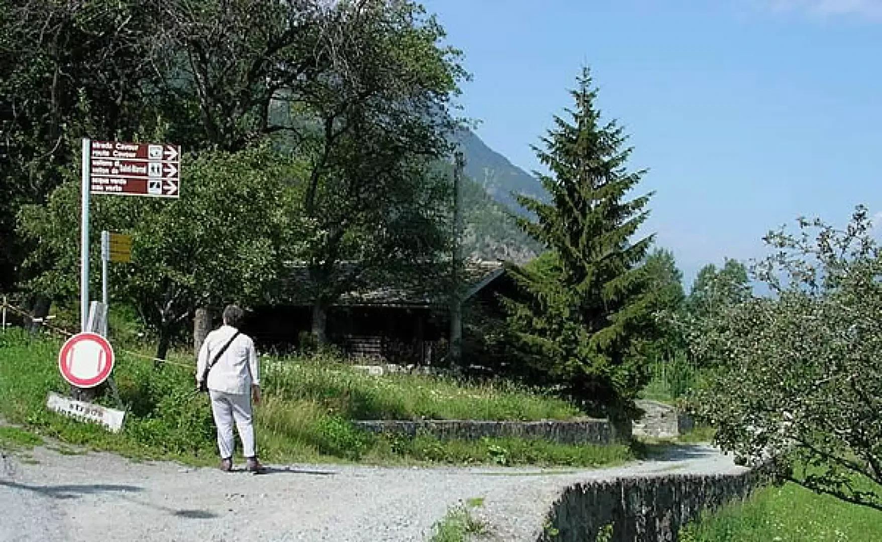
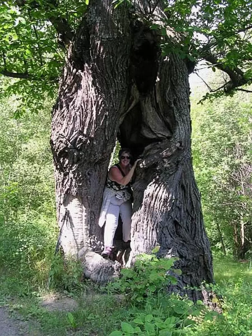
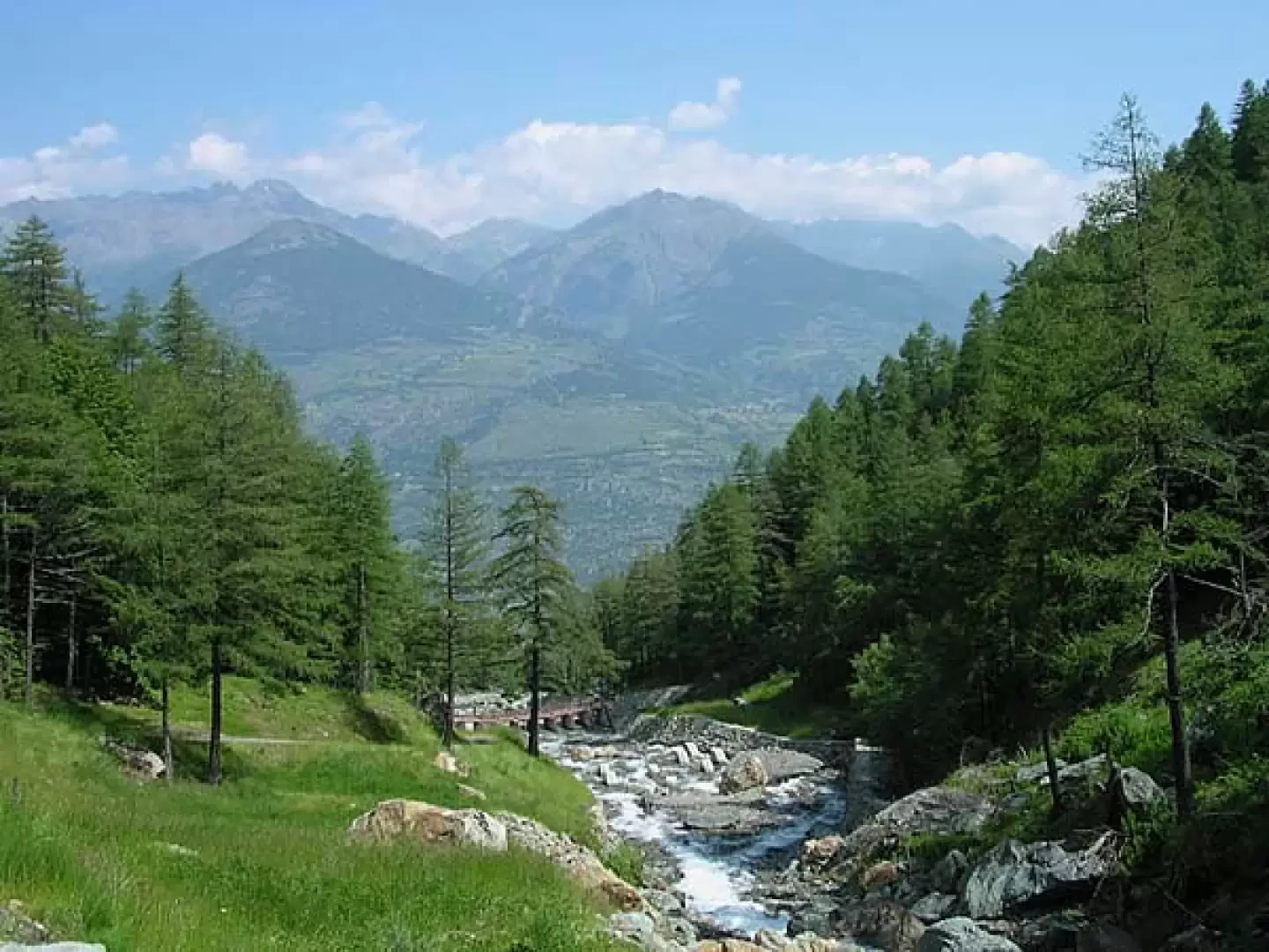
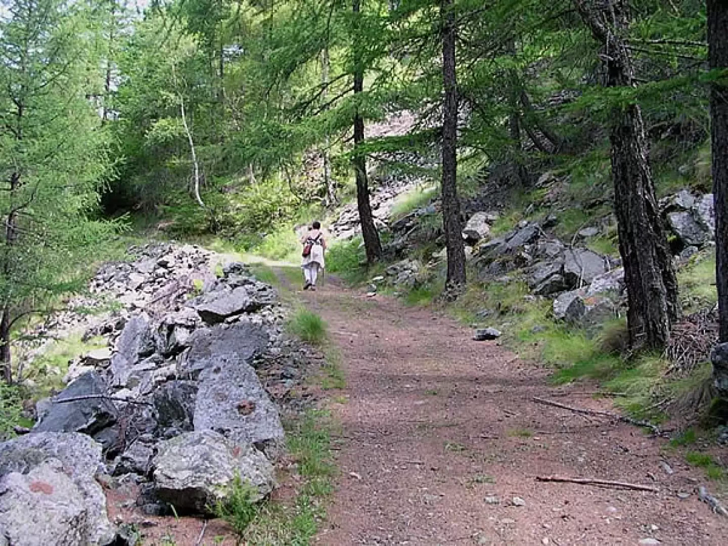
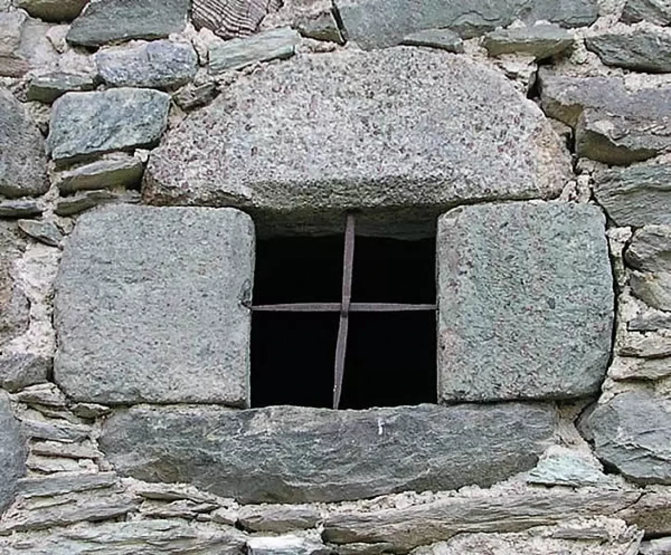
From the car park of the Plout sanctuary, one continues for a few minutes along the tarmac road, passing downstream from the village. A few small, carved stone windows can still be seen on the old stone walls. On the right, the dirt road that leads to the green water starts slightly downhill. The start is well signposted by both hiking and tourist signposts. We walk on level ground, passing through some broadleaf scrub. On either side are a few arboreal meadows in which one can see old fruit trees, especially apple and walnut trees. At the side of the road, a large chestnut tree with a twisted trunk can comfortably accommodate an adult inside its hollow trunk. One travels along a stretch protected downstream by a wooden fence. Upstream, between the raspberry bushes and wild strawberry seedlings, runs a stream used for irrigation. You cross a clearing from which you can see a small piece of the valley floor furrowed by the Dora Baltea. Below are nestled among the greenery the two small lakes of the Iles di Brissogne, on the other side of the river the penstocks of the Saint Marcel hydroelectric power station descend. Entering the valley, the conifers increase, especially larches and spruces. After a few uphill stretches in which the road is paved, we arrive at the fork for Moulin below the Morge pasture. Climb up close to the bottom of the valley, on the right you can hear the Saint Marcel stream rushing along and its foamy white waters can be seen among the trees.
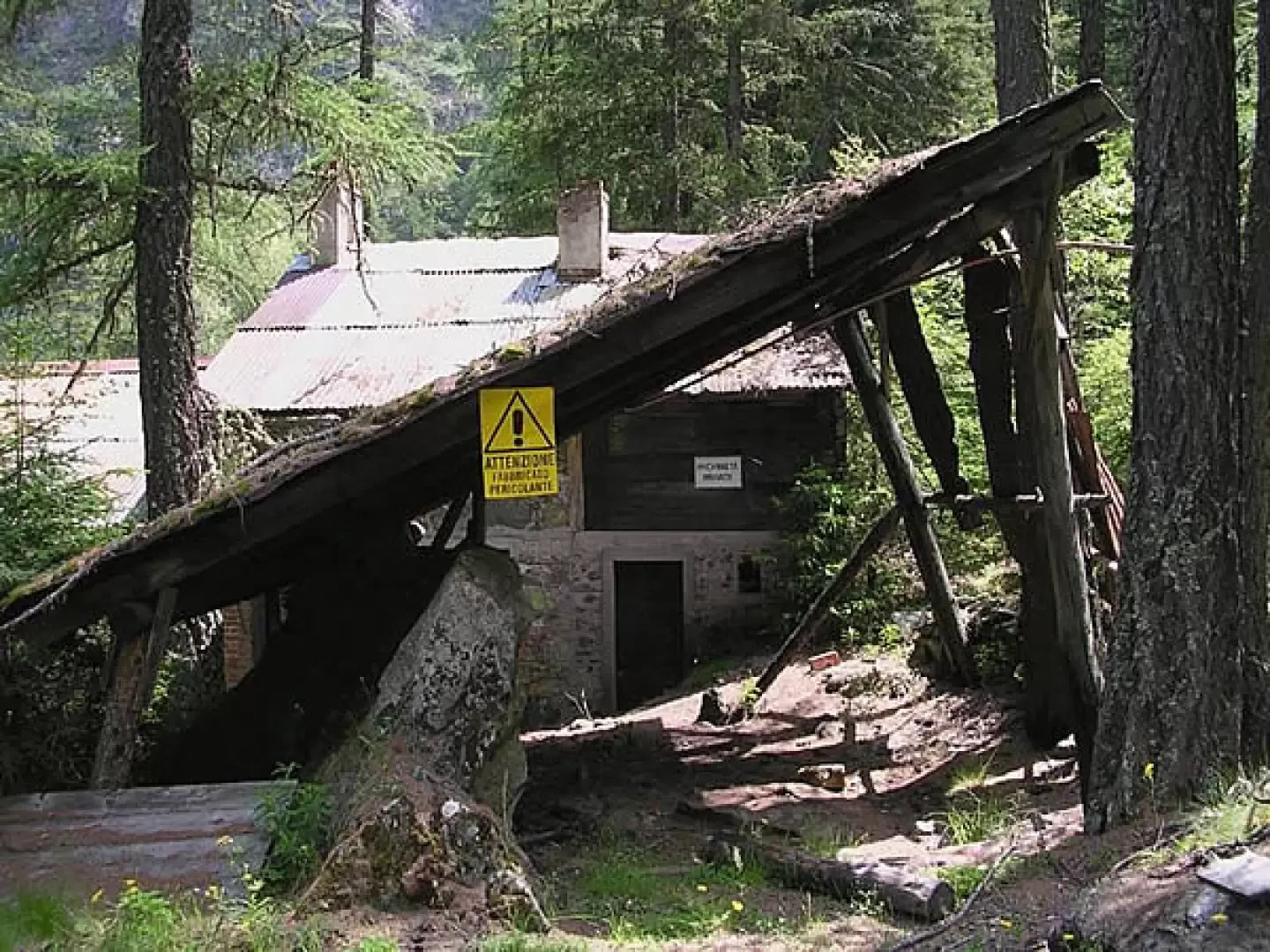
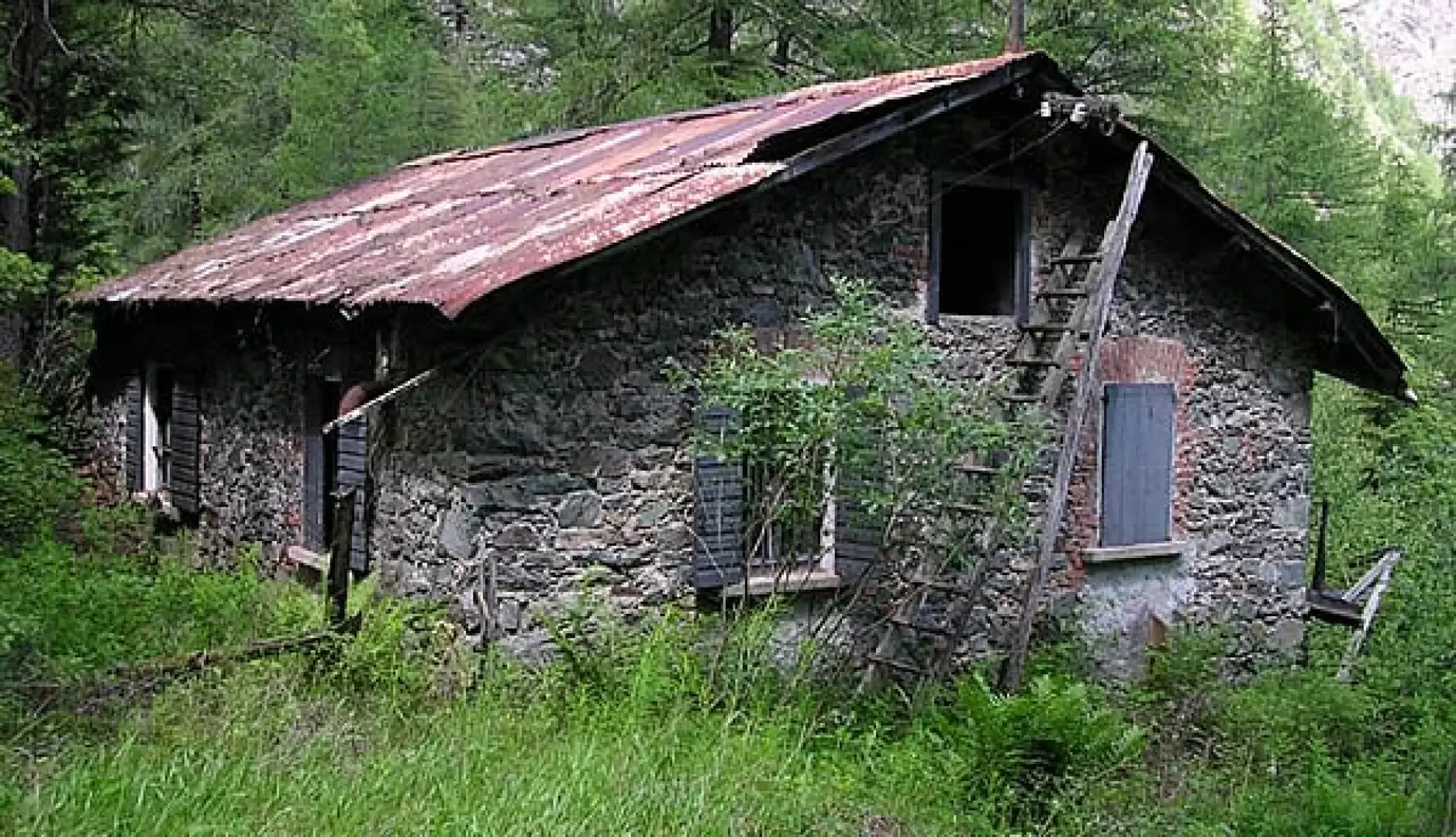
At about 1160 m altitude, cross the stream on a long wooden bridge, after reaching the other bank continue along the dirt road following the signs for Eve Verda, ignoring the start of trail number 13. Here the valley opens up, the stream bed has been widened to slow down the flow of water and to allow for the storage of heavier materials. Some concrete spurs have been built inside the banks to stop the larger debris. After about fifty metres of difference in height, we cross the stream again, on a smaller bridge, returning to the orographic right. At a glance, one can embrace all the hydraulic defence works built on the stream. The road passes only a few metres from the watercourse, for a short distance it is carved almost into the bare rock. You walk through rose bushes and raspberry bushes, through dense, damp woodland, where the rocks are covered with moss. At an altitude of about 1,300 metres, the remains of some mining-related industrial buildings can be seen on the other side of the stream. A little higher up, an insecure footbridge provides access to the old, unsafe buildings: one can clearly distinguish the wooden tower used by the cableway and the main building built of stone. Behind it there are still a few abandoned trolleys.
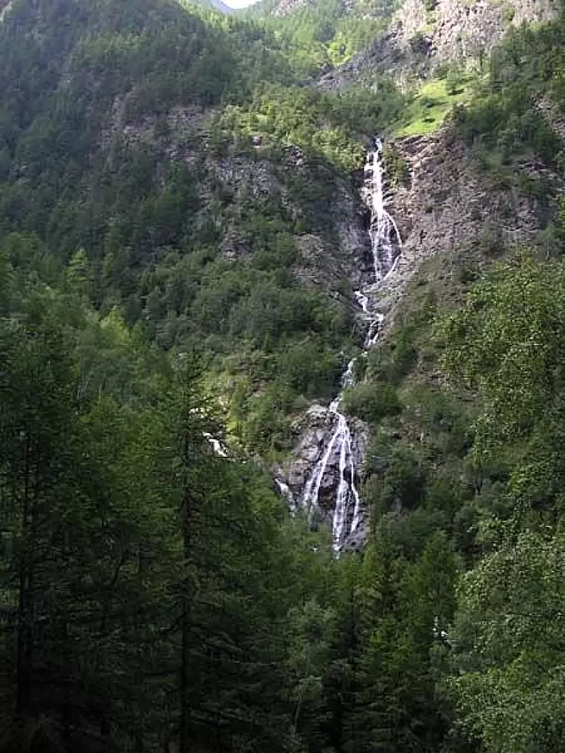
You walk a few hairpin bends into the forest, on the old paved road supported by moss-covered dry stone walls, amidst the red blossom of the rhododendrons. One moves away from the stream, crosses some stony ground that is all that remains of ancient landslides, then one's gaze is drawn to the other side of the valley where a beautiful waterfall cascades down, tracing long white lines of foam that split and intersect on the dark rocks. Then between the trees one begins to see flashes of turquoise, the colour of which is so intense that it looks as if they have thrown pieces of pool into the middle of the forest. All of a sudden, one arrives at the crossing of the Eve Verta stream, where one seems to be in front of a work of modern art: a fruit of landscape art. The transparent water of a mountain stream descends on a bed of deep turquoise colour, the stones, woods and leaves that are immersed in this magical spring lose their original colour and become charged with this unreal blue. A few dozen steps up the course of the stream lead to the spring, a pool of water gushing from the boulders of a palaeo-landslide. Continuing along the road in a few minutes you reach the buildings of the old mine, which are in a poor state of repair. In the lower building, the shower rooms, kitchen and dormitories are still discernible.
A little higher up, the road curves through a damp and shady undergrowth, where the pavement is completely covered with mining slag.
General Information
Path:from Plout
Signposts:
Type of route: a/r
Recommended period: April, May, June, July, August, September, October
Exposure to the sun: north
Objective danger:none
Exposed sections:none
Useful equipment:normal hiking equipment
Water:at the start
Galleria fotografica