Crossing from Riva Trigoso to Moneglia

Introduction
The beautiful crossing from Riva Trigoso to Moneglia.
Description
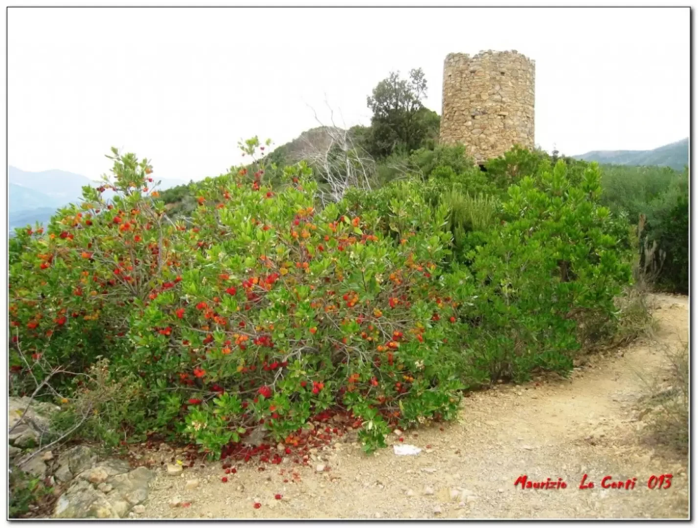
The trail starts shortly after the Riva Trigoso railway station: from the building, you exit, going right, and ignore a first street that climbs uphill; you pass a subway and leave the main road, to turn left uphill (signs). Theoretically, the whole area should be furrowed by a fair number of paths marked by the Fie, but, in reality, there is nothing on the ground, except for a few signposts at crossroads! However, the track is wide and, almost, without possibility of error, with beautiful views in all directions (the sea, Mount Zatta inland and, turning back, Riva Trigoso, Punta Manara and the promontory of Portofino). You gain height until you reach the fork to the right for the Punta Baffe Tower (272m - 1h15'), amidst many strawberry trees, laden with fruit in autumn. All along the way, one crosses a veritable sea of plants of this type, which repopulate the land nicely after fires (in fact, years ago, the area was devastated by a vast fire and, now, nature is slowly reasserting itself). Nearby, there are several wonderful viewpoints! Then, instead of following the signpost for 'Moneglia', it is better to continue on to 'Monte Moneglia', climbing up towards the colle del Lago. After about 15', you arrive at an important crossroads with two small tables. Here, you turn right, neglecting the path to the summit, and the route, at first, is almost flat. Afterwards, you face several ups and downs until you reach a new crossroads, where you can stop for a lunch break (1h00'). After the stop, you lose metres towards Moneglia, ignoring several forks in the road and continuing on the main track (1h30' - return by train).
All in all: beautiful day disl approx. 400 mt Dif. T/E almost 4h Tot. plus all the breaks to see the various sights.
Trip photos, pdf files and individual shots partly different from those in the document, at the corresponding link http://www.cralgalliera.altervista.org/anno2015.htm
Images of the November 2013 inspection: http://www.cralgalliera.altervista.org/PuntaBaffe.jpg
http://www.cralgalliera.altervista.org/RivaTMoneglia013.pdf
NB: In the event of an excursion, always check with FIE, Cai, any park authorities or other institutions, pro loco, etc., that there have been no changes that have increased the difficulties! No liability is accepted. This text is purely indicative and not exhaustive.
Info Hiking Section Cral Galliera: http://www.cralgalliera.altervista.org/esc.htm
trips 2015 at link: http://www.cralgalliera.altervista.org/gite015.jpg