Col de la Porta, from Col Nivolet

Edited by:
Ivano Ruffoni
Updated at: 04/05/2025
Access
At the Ivrea exit of the A5 motorway, take the Pedemontana, State Road 565, and at Castellamonte, State Road 460 of Ceresole Reale. Arriving in Ceresole Reale, you skirt the lake of the same name and continue along Provincial Road 50 of the Colle del Nivolet, where access, in the summer months, is regulated or permitted only by the convenient shuttle bus. Pass Lake Serrù and Lake Agnel and park a few hairpin bends before Colle del Nivolet, near the signs indicating route marker 550 and the small lake at an altitude of 2461 m, a few dozen metres before the signpost for km 16.
.Introduction
Classic excursion in the Gran Paradiso Park. The itinerary follows the Royal Hunting Route through lakes, streams, stony ground, moraines and pastures. There is a good chance of encountering the park's typical fauna.
.Description
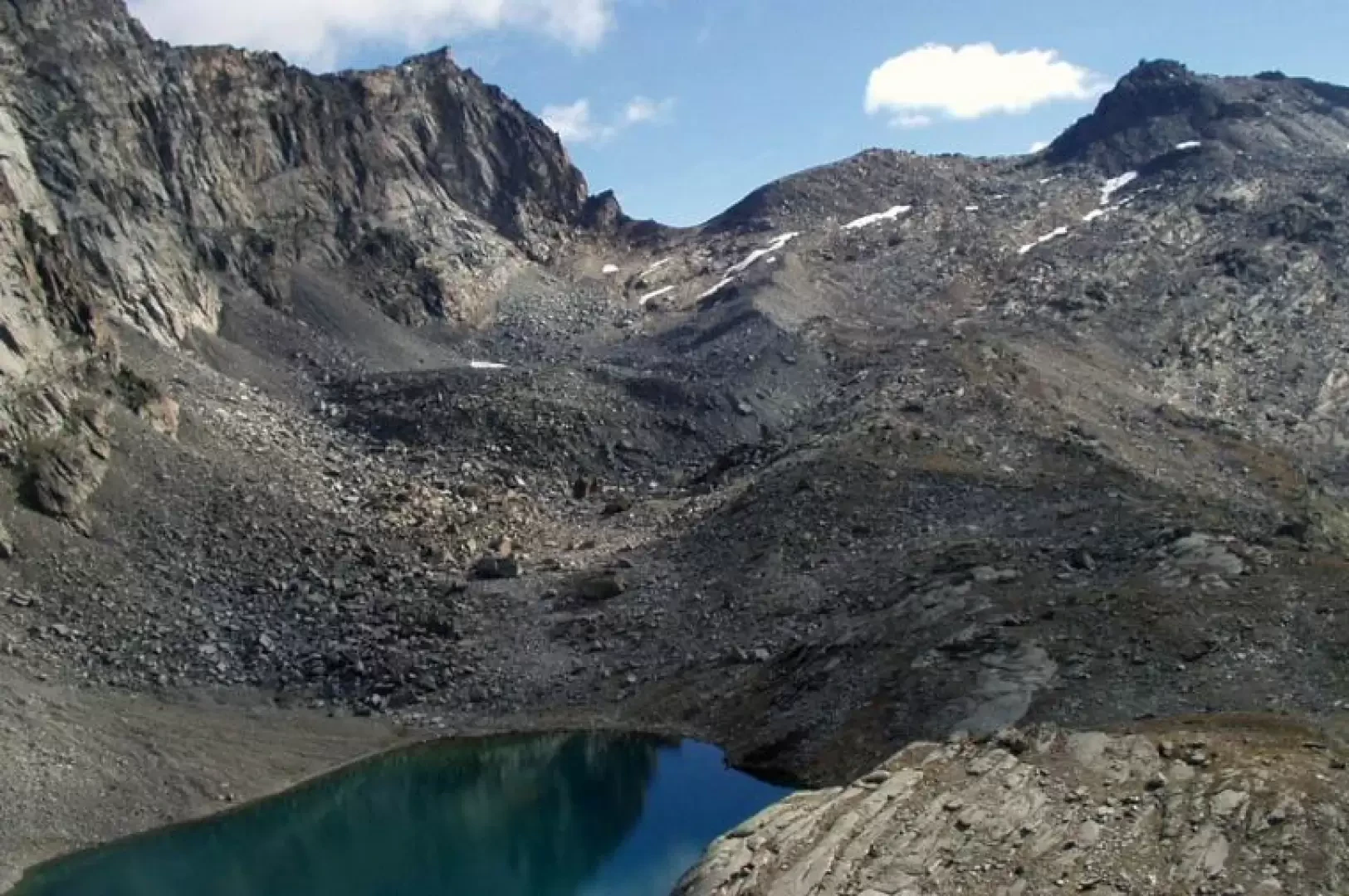
Take the royal hunting mule-track, marker , which immediately leads to a beautiful little lake and immediately afterwards to another set among the stones and pebbles of the Costa della Civetta above. A few minutes' walk and the Serrù and Agnel lakes are immediately visible to the right. To the south, the Rio del Carro valley begins to appear, overlooked by the glacier of the same name and the Aiguille Rousse. The mule track now winds like a panoramic balcony over the upper Orco valley, passes above the Bastalon hut, which can be reached by a short path to the right of the mule track, and then, with slightly descending and then ascending stretches, crosses the streams that descend from the small lakes below the Punta della Violetta and the Comba lakes. Near Alpe di Comba (2549m), the Videsott path for Chiapili di Sopra crosses to the right. To the south, on the other orographic side of the valley, the Levanne, the Nel glacier and the [[Jervis refuge]] are clearly visible. The mule track enters the plane of the Rio della Percià stream and, now a path, climbs diagonally between scree and gullies. It is very easy in this area to witness stone pelting, sometimes triggered by local fauna which, perhaps frightened by human presence, moves about in a disorderly fashion: so watch out for ibexes or chamois wandering above the track. The last stretch, over small stones and reddish detritus, leads directly to Colle della Terra (2911m), where a clear track to the south soon leads to the modest Punta della Rocchetta (2922m), marked by a conspicuous cairn: a splendid view of the Ceresole Reale lake below, the Levanne and the Nel glacier. Go over the pass, signposted , on the level on a slightly exposed path and, shortly afterwards, there is an incredible view of Lake Lillet (2765m), a body of water nestling at the foot of the steep south face of Mare Percia. With a few hairpin bends, on a path that is in places landslide, you reach Lake Lillet, right near its outlet, the Rio Pisson. Nearby, it is very common to encounter the classic fauna of the Gran Paradiso National Park. Climb a modest rise, meet the path to the right that leads to the Mua hamlet, and reach the edge of the moraine of the Porta glacier. Follow the moraine and, further up, you will come across a second path, now disused, that points directly to the Colle della Porta glacier. However, it is better to proceed, just a little further, on the main track, which soon leads a few metres above Colle della Porta (3002m). The saddle, well marked by a large cairn, is then reached by descending a short, steep track. The descent is by the same route.
.