Col de Malatra, from the car park after Lavachey

Edited by:
Ivano Ruffoni
Updated at: 04/05/2025
Access
Leaving the motorway at the Courmayeur exit, continue to the village of Entrèves where you take the Val Ferret road. After passing the villages of Planpincieux, Pont, Praz Sec and Lavachey, park after two more hairpin bends, near the bridge over the Malatrà stream, right in front of the overhanging Glacier de Frébouge (or of Fréboudze).
If you can't find parking, you can leave your car a little way from Lavachey.
⚠ In summertime access to Val Ferret is restricted, so you can only access by a shuttle bus provided by the municipality.
For information see the commune website.
- How to get there with GMAPS
- How to get there with Apple Maps
Introduction
The Col de Malatrà is a narrow opening connecting the Comba des Merdeux (from the patois "merze", "place of larches") with the Vallone di Malatrà. The toponym 'malatrà' probably derives from the late Latin 'malastrà', meaning 'bad, uncomfortable passage'. The itinerary, with sweeping views of Mont Blanc and Les Grandes Jorasses, climbs up to the Walter Bonatti hut, traverses the pretty Vallone di Malatrà in the direction of the north face of the Grande Rochère and turns north-east towards the Col de Malatrà. From the pass, the view also opens up towards the Grand Combin.
Description
From the car park, walk back along the communal road until you come to the marker signposting the start of the itinerary.
0h00' A few metres downstream from the bridge (1695m) the signpost for the Col de Malatrà starts (alternatively, about a hundred metres upstream from the bridge, near a car park, the road for Giué starts). Climb up along a wide dirt track that twists and turns through a larch forest and leads decisively (with the possibility of even steeper shortcuts) to the crossroads for Val Arminaz and Alpage Sécheron. Continue uphill to the left, leave the forest and climb up green pastures to the Walter Bonatti hut (2025m, 💧), a splendid panoramic balcony over Les Grandes Jorasses and Mont Blanc.
0h45' To the right of the hut, the track leads to the ruins of the lower Malatrà alpine pasture and, still across meadows, to the upper Malatrà alpine pasture (2213m, 1h10').
1h10'Neglecting the diversions to the right, marker
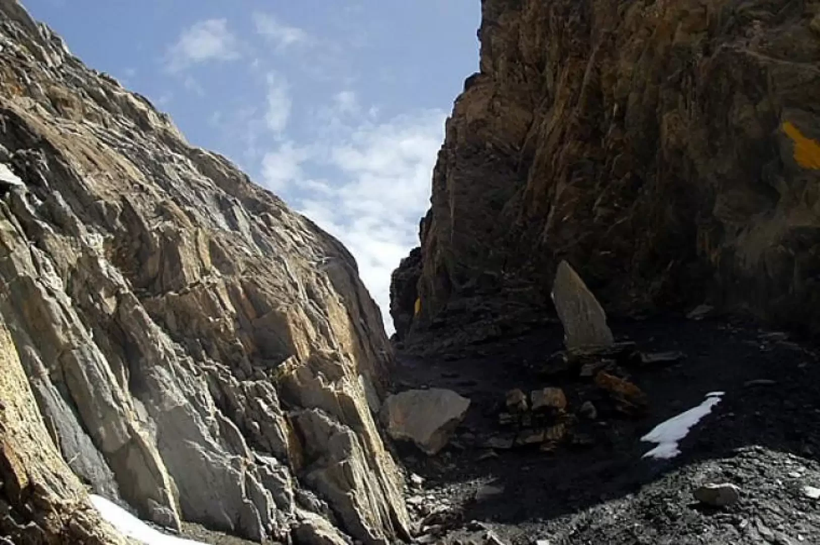
, for the Pas entre deux Sauts, now in view of the upper Giué mountain pasture, cross the stream on a wooden footbridge and come out onto the vast plain of the Malatrà valley. The path continues on the orographic right towards the head of the valley, in the direction of the north face of the Grande Rochère. At the bottom of the basin, climb up a grassy crag to the left until you come to a ledge. Bending left again, one crosses the last pastures and, in the distance, the debris, scree and final scree appear. A long traverse under the slopes of Mont Tsichette (or Trichette) and you are at Col de Malatrà (2925m, 3h20'), a narrow opening between the rocky ridge.
The return is by the same route: descend to Malatrà Superiore (2213m, 1h30'), then to the Walter Bonatti hut (2025m, 1h50') and, following the numerous shortcuts, descend to the starting bridge (1695m, 2h20').
General information
Path:normal from Val Ferret
Signposts:
and
Type of route: a/r
Recommended period: June, July, August, September
Exposure to the sun:West
Objective Danger:none
Exposed Trails:none
Useful Equipment:normal equipment and clothing for day hiking
Water:Bonatti Refuge
Galleria fotografica


