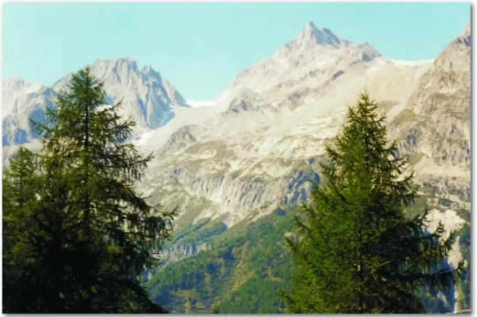
Chüebodenhorn, from All'Acqua

Edited by:
luca_bettosini
Updated at: 14/03/2025
Introduction
The ascent to the Chüebodenhorn is one of the few easily accessible peaks (where the magical three-thousand-metre altitude is surpassed), which affords a splendid view of the numerous glaciers around it as well as the Cernese Alps and Pizzo Rotondo.
Description
When you reach the village, take the marked path to the left of the restaurant, which immediately begins to climb through the dense woodland and leads in about an hour to the old Piansecco hut (1980 m). To the right is the path that leads to the new Piansecco hut (1988 m), nestling among larch and rhododendron trees and marking the edge of the forest. From here, climb upwards in a northerly direction, following the path that crosses the Ri dell'Acqua in a dreamlike location; the ascent begins to be steep but the path is always visible and clear up to an altitude of 2075 m, from where you can already enjoy an excellent panoramic view of the Bedretto Valley. Continue on the steep grassy slope until you reach a large block terrace and after about an hour and a half's walk from the hut, you come to an isolated, closed farmstead at an altitude of about 2360 metres; once around it, you enter the vast scree slope on the south-east side of the Chüebodenhorn. This is an immense scree slope that must be climbed to reach the Gerenpass, a pass that allows passage between the Poncione di Cassina di Baggio and the Chüebodenhorn; it connects the wild and solitary Geretal with the Val Bedretto. After about 45 minutes of ascent, the great clacial mass of the glacier appears, an approximately 4 metre high wall of ice that seems to block the entrance to the Gerenpass; we go to the left of it and then continue all the way to the right until we reach the first rocks of the Chüebodenhorn. The small lakes, formed by the melting of the glacier, are just to the west of the pass and are located in the Valais; but if the glacier continues to retreat in a few years, they would be right on the Ticino border. The view is stupendous and the glacier vast enough to arouse wonder; having reached the rocks, continue to the left in a north-westerly direction for a few metres and then begin to climb up the icy slope with large boulders in the direction of the ridge to finally reach the summit; it is a beautiful climb among the large boulders without any danger. The summit of the Chüebodenhorn provides a magnificent panoramic view; there is a cross and the summit book on it. Now from the summit, descend to the old Piansecco hut in approx. 2 hours, following the marked trail, and climb up, still on the marked trail, towards the Pigne lake (2278 m). The walk is pleasant and at last you can see flora worthy of respect among the vast meadows and pastures. When you reach the small Pigne lake, you can make a detour to the Cave delle Pigne (approx. 2350 m). Back at the pond, where you can admire the peak of Poncione di Maniò (2924.5 metres), descend along the marked path to Maniò di sopra (about 2116 metres) and continue on a long plain with panoramic views, enjoying the rich flora. In about 1 hour from the small lake we reach the cantonal road leading to the Passo della Novena at an altitude of about 2099 m., and then descend to the Alpe di Cruina (2003 m.) where a small refreshment bar awaits us for a short break. For the return journey to Acqua or Airolo there is the possibility of taking the postbus, which stops right at Alpe di Cruina, but you should enquire about the timetable at the Airolo post office; otherwise at Alpe di Cruina you can leave your car in the car park.
Huts and refuges
Capanna Piansecco (new) (1988 m)Coordinates: 679.300 - 149.750 This is a new construction (1994-1995) in brickwork and wood. It has a living room for 48 persons with two wood-burning kitchens. There are 44 beds spread over 4 dormitories with 10 beds and 1 with 4 beds. The hut is open all year round. There is the possibility of receiving meals prepared by the hut warden. It is a beautiful hut surrounded by larch and rhododendron trees at the foot of magnificent ridges that exceed the magical Ticino altitude of three thousand metres. Reservations: Swiss Alpine Club - Section Leventina - Casella Postale 1282 - 6501 Bellinzona. Hut telephone: 091-869 12 14. Rifugio Piansecco (old) (1980 m)Coordinates: 678,900 - 149,550 This is an old hut converted from a military building in 1972. It has two refectories with a wood cooker and two dormitories with 40 beds. It is located a short distance from the new hut.
Trekking Lakes
Laghetto delle Pigne (1614 m) It is a small lake located under the rocks that join Poncione di Manìo (2924.5m) and Poncione di Cassina di Baggio (2860 m). It is of glacial origin with a surface area of 5000 m2. In fact, the name of the lake derives from the ancient Cava delle Pigne (2350m), located just above the lake, where soapstone was quarried and used for the construction of pine cones, i.e. stoves that, due to the particularity of this stone, lasted a long time. Chüebodenhorn Lake (approx. 2600 metres) This lake was formed recently due to the retreat of the Chüebodenhorn glacier and can be admired in summer on the NORD side. Pizzo Rotondo Lake (approx. 2700 metres) It is a small lake that was recently formed due to the retreat of the Pizzo Rotondo glacier. It is situated in a grandiose area.
Summits to know
Pizzo Rotondo (approx. 3192 metres)It is the highest mountain between the Furkapass and the Novena. It is well known as it allows various hiking, mountaineering and ski touring routes. Three glaciers surround it, making it even more fascinating. At its foot, on the NORTH-WEST slope, a small lake has recently formed due to the retreat of the glacier. It can be reached in about 3 ½ hours from the Piansecco hut; in about 3 hours from the Rotondo hut. Poncione di Ruino, Torre (2669 m) It is a wonderful pyramid that lends itself very well to dream climbing. A description of its routes can be found on page 507 of the book 'Guida delle Alpi ticinesi Ovest' by Brenna. Gerenhorn (3078 m) It is a small, jagged elevation rising from the ridge of the Pizzo Rotondo. It can be reached in about five hours from Ronco or Bedretto. Poncione di Cassina Baggio (2860 m and 2814 m) The entire summit of this climbers' paradise is on Ticino territory; in fact, the border does not follow the ridge but remains below it by cutting across the Chüebodengletscher glacier. There are many climbing routes and they are all listed in Brenna's book 'Guide to the Ticino Alps West'. Poncione di Maniò (2834 m - 2919 m - 2924 m - 2880 m) It has no less than four peaks that offer climbers dream climbs. All its routes are always described in the book "Guida delle Alpi ticinesi Ovest" (Guide to the Western Ticino Alps) by Brenna.
Alps still loaded
Alpe di Cruina (2003 m) loaded on 27 June 1996. The cheese produced is "nostrano semiduro grasso", which bears the name "CRUINA". For information, please contact: Simoni Augusto, 6742 Pollegio, Tel. 091/862 49 91.
Map: * CN 1:25000 1251 Val Bedretto
Itinerary
All'Acqua (1614 m) - Piansecco old hut (1980 m) - Piansecco new hut (1988 m) - altitude 2075 m - farmstead at approx. 2300 metres - Gerenpass 2701 m - Chüebodenhorn (3069,9 m) - Gerenpass 2701 m - farmstead at an altitude of approx. 2300 m - altitude 2075 m - Piansecco hut new (1988 m) - Piansecco hut old (1980 m) - Laghetto delle Pigne 2278 m - Maniò di Sopra 2116 m - road at an altitude of 2099 m - Alpe di Cruina 2003 m.