Veronica Cave

Edited by:
Marco Bonati
Updated at: 09/12/2025
Access
From Milan to Sondrio along state roads 36 and 38; at the roundabout at the entrance to the town turn left in the direction of Valmalenco and go up the whole valley as far as Dighe di Campomoro. At the exit of the last tunnel, near the Campomoro hut and the small church, take a dirt track on the left which, between some small houses, descends to the base of the dam; at a subsequent fork turn left again and park in the lay-by at the end of the road, near some sheds.
Introduction
Beautiful excursion that, through the bucolic Alpe Musella and the suggestive Vallone di Scerscen, leads to the conspicuous limestone bank that constitutes the extreme eastern offshoot of the Pizzo Tremogge-Pizzo Malenco-Sassa d'Entova chain. Up here, reached by a small path that is exposed in places, there is a cave - discovered in 1986 - that is interesting and easy to walk through up to the siphoning micro-pit at the bottom. [In the area there are two other caves that, due to their peculiarities, are not made known to the public: the first has structural characteristics that require a technical progression that remains risky; the second, which is technically accessible, has such a wealth of concretions that it could be subject to vandalism]. Along the route of the Vallone di Scerscen, the remains of asbestos quarries, which remained active until the 1950s, come into view. The flora, differentiated in its characteristics according to the calcareous or serpentine substrate, is also very interesting.
Description
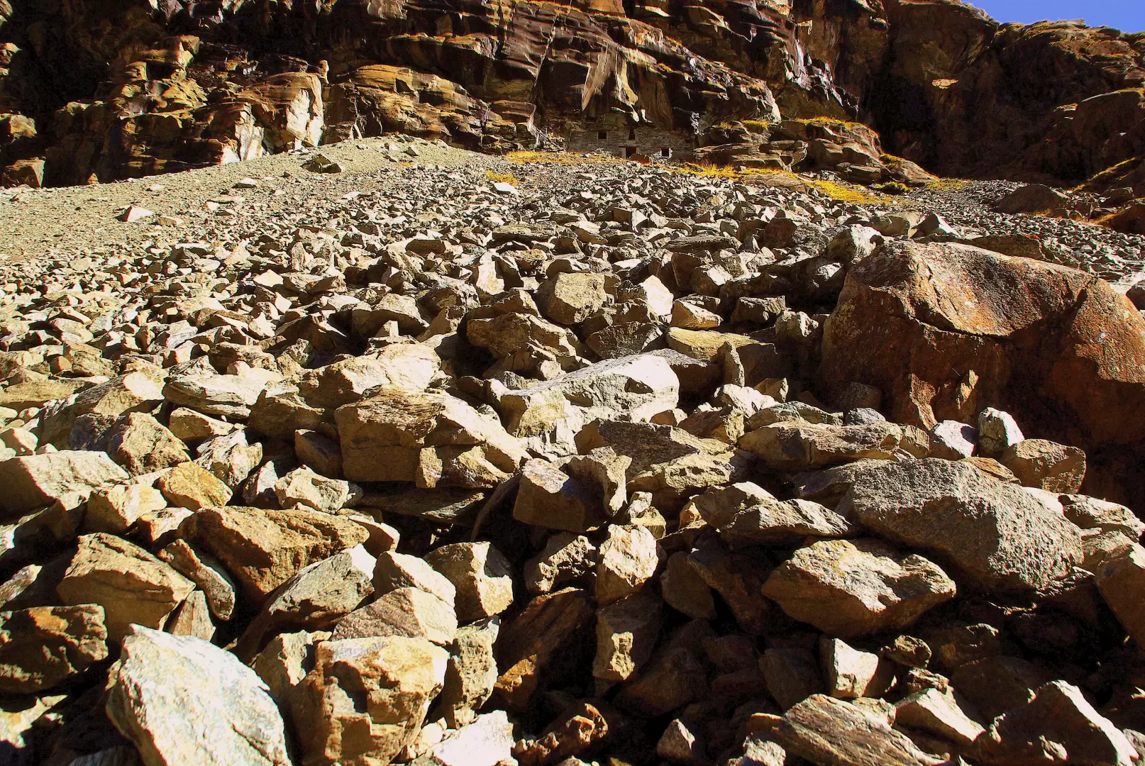
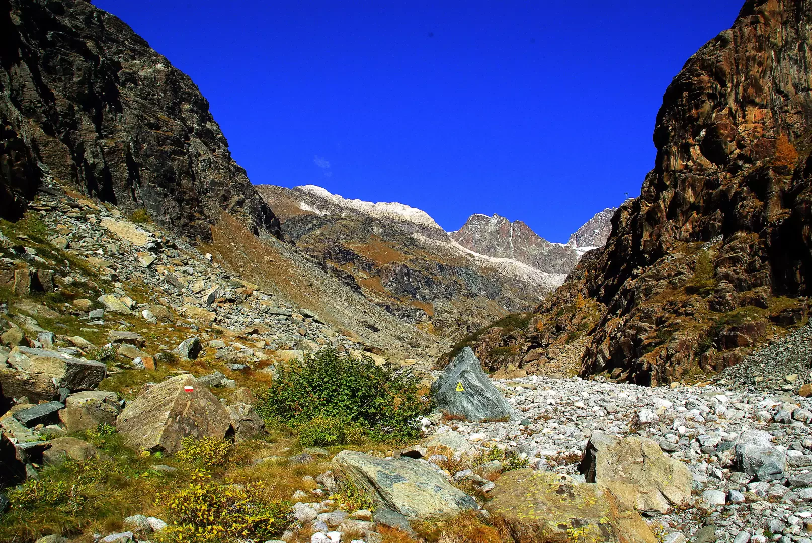
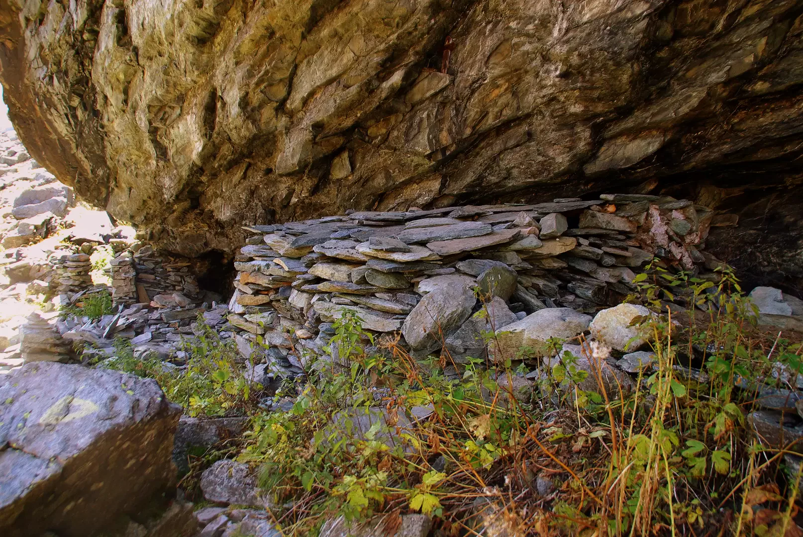
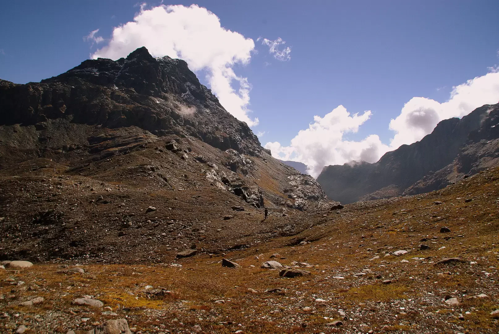
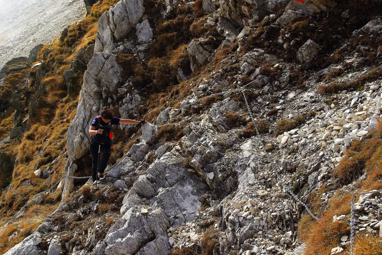
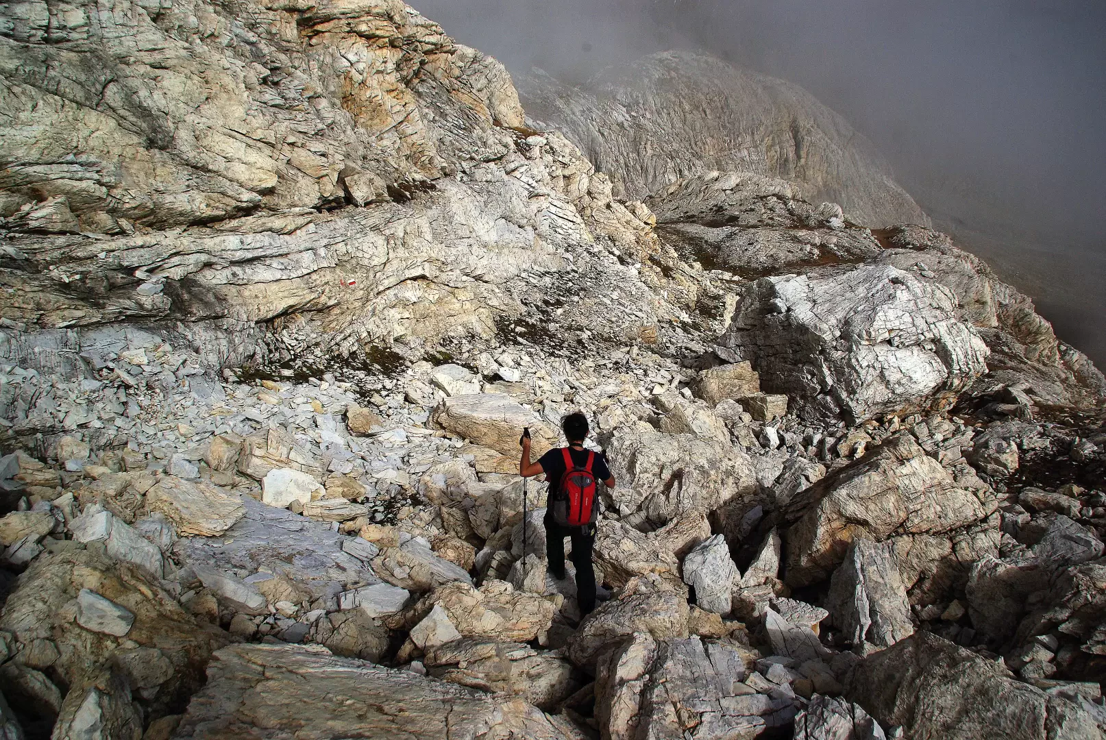
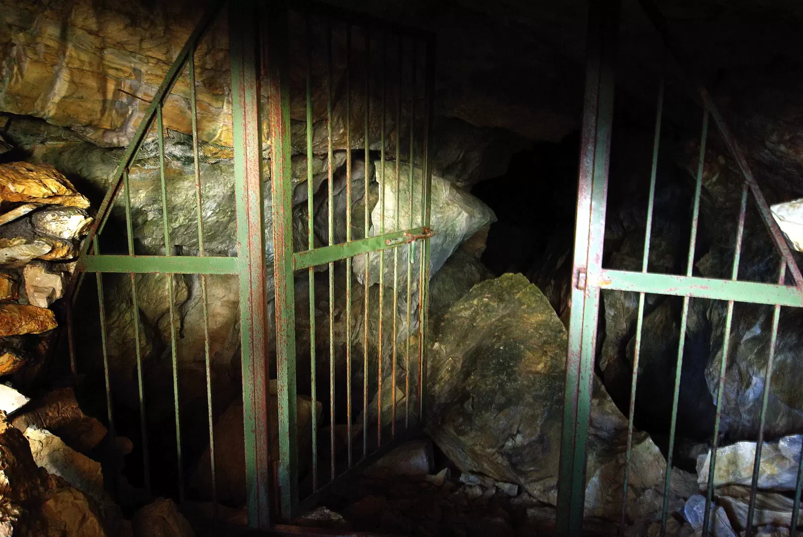
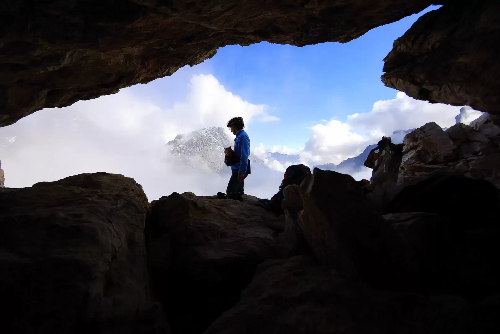
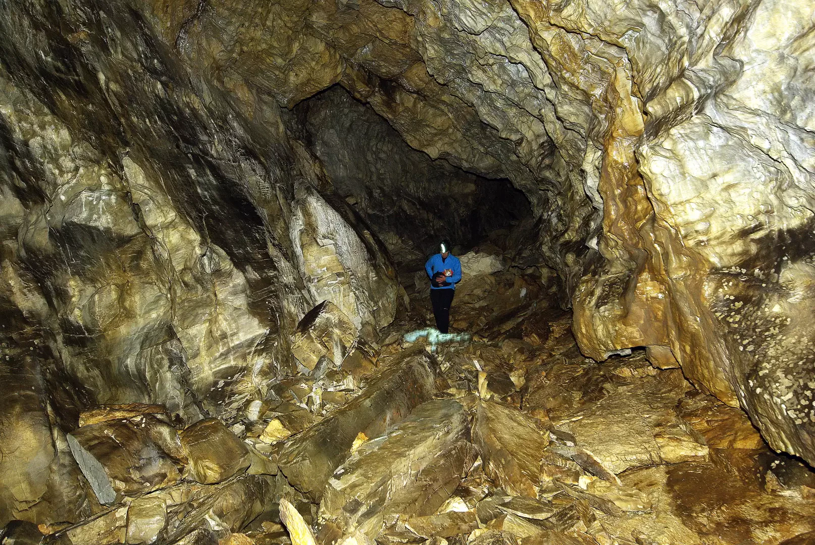
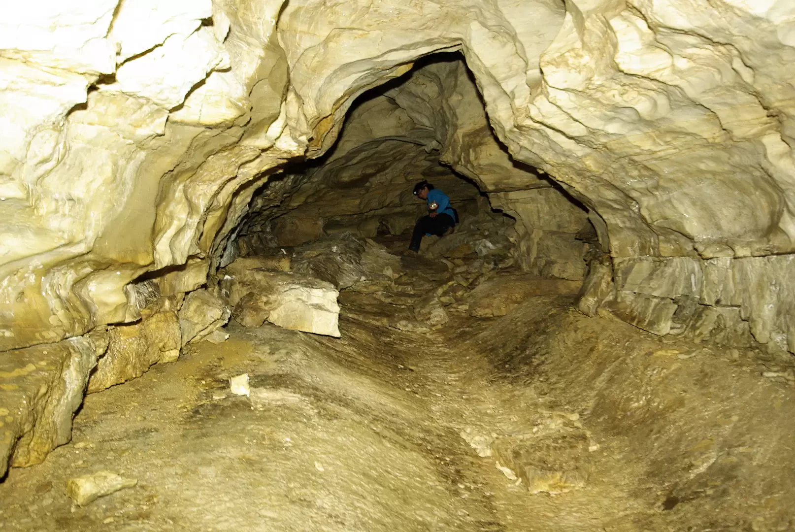
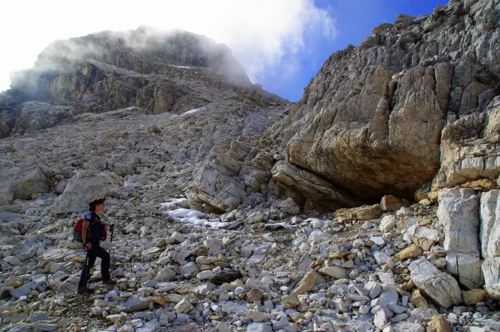
From the parking area, about 1900 m, take the dirt track that, after a barrier, climbs to the right (ignoring a mule track to the left that goes back to Campo Franscia) skirting a wall of black, serpentine rocks; shortly after, leave the dirt track for a mule track that, coming off to the right, begins to climb up a splendid mixed conifer forest to reach the vast Alpe Musella plateau, 2020 m. Cross the stream on a footbridge to arrive at the ridge with many renovated huts (including the Mitta and Musella refuges); continue past a small church to the westernmost huts: a signpost of the Alta Via della Valmalenco indicates the direction for the Vallone di Scerscen. The path, which initially loses height, after crossing a bright larch wood, enters among the black and red rocks of the Vallone; at Q 2143 m, it is possible to visit the external structures of the disused asbestos quarries, just before finally crossing the stream. The route continues alternating between flat stretches on the gravel bed and ascents to higher terraces: at 2285 m, the few perimeter stones of the Alpe Scerscen, abandoned at the beginning of the 19th century due to the advance of ice during the Little Ice Age. A last steep section leads to a sort of small mouth with a signpost indicating various destinations, at about 2400 m: take the direction to the left which, amidst stones and a few steep tracks in the grass, leads to the Forcella d'Entova: you will not reach it, because at a signpost without indications, at about 2600 m, you turn back and cross the entire slope. It is a well-marked path across gravel and limestone boulders that leads to the bottom of the Scerscen amphitheatre and to the Marinelli Refuge; two stretches of chains help in crossing exposed, landslide-prone gullies: a little less than a hundred metres from the last equipment, in view of a slightly grassy hanging valley, you abandon the signs to climb briefly up the steepest slope. A few dozen metres and, at the base of a compact rock wall, the entrance to the Veronica Cave can be seen (to the side, a memorial plaque commemorating the discoverer). A gate that can be opened allows one - with adequate lighting - to enter the wide descending conduit: amidst large boulders and some icy drips, one reaches a limpid siphoning pool on diameters that are no longer passable. Extreme cleanliness is recommended. Return along the outward route.
Galleria fotografica