Waterfalls of Vallesinella

Edited by:
Androcolo
Updated at: 09/06/2025
Access
To get to Madonna di Campiglio follow the directions below.
By car
Milan (Km 220): Brescia Est exit-Lago d'Idro-Tione-Pinzolo-Madonna di Campiglio Modena-Brenner: Exit Rovereto Sud-Mori-Arco-Sarche-Tione-Pinzolo-Madonna di Campiglio (Km 92) Exit TRENTO CENTRO-Sarche-Tione-Pinzolo-Madonna di Campiglio (Km 73) Exit San Michele all'Adige- Mezzolombardo-Cles-Dimaro-Madonna di Campiglio-Pinzolo (Km 78)
Bus
- From Trento: Trentino Trasporti - Atesina
- From Milan-Brescia: Autostradale Viaggi
- Società Italiana Autoservizi
- From Toscana-Emila: Lorenzini Tel. 0187.66804-66805
- From Liguria-Lombardy: Stat Turismo
Introduction
It is a beautiful route to do comfortably with your family as the difference in altitude is slight and the paths are easily accessible to everyone, even children.
Description
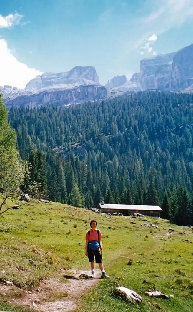
You can drive up to Madonna di Campiglio in the locality of Palù, from here a road leads to the Vallesinella Refuge, which is located inside the Brenta-Adamello park. During the high season, which usually runs from the beginning of June to the end of September, access to the road is regulated, so it is possible to enter and park in the hut's forecourt, subject to availability, paying the €5 entrance fee. Otherwise it is possible to leave the car near the park entrance and take the bus at a cost of 2 € (return) that takes us to the hut.
I recommend leaving the car at the park entrance and proceeding in the direction of the Vallesinella hut on foot. We therefore head towards the asphalt road leading to the hut and take the start of the Bear Trail on the left, which will take us to the first stage of the hike.
The path is very beautiful as it winds its way through a stupendous and dense coniferous forest, its development is gentle and pleasant to walk along, until we reach a junction from where it is possible to take a path that leads to the Segantini Pass and another to the Tuckett Refuge; we, however, take the one that will take us to the Vallesinella Refuge.
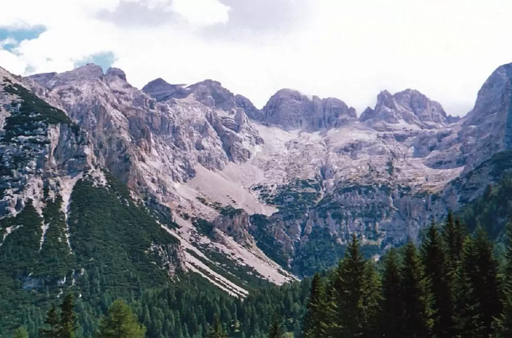
We arrive at the refuge after about an hour's walk, to give us an extra shot of adrenalin we stop for a coffee. Once refreshed, we head towards the start of path 382 Malga Vallesinella, the path immediately begins to climb gently upwards until it begins a climb made of steps carved out of tree roots and stones. This section lasts about 15 minutes until a splendid plateau with the Brenta peaks in the background opens up before our eyes.
We are curious to visit the building at the end of the malga, which is a bivouac where it is possible to eat and sleep in a large room with a fireplace and tables.
We are looking for a comfortable and secluded place to stock up on the comforts we have brought with us.
Once our stomachs are refreshed, we dedicate ourselves to restoring our spirits and bodies, abandoning ourselves to the warming rays of the sun and the chattering of the meadow with the thousands of crickets and cicadas.
From this plateau, path 382 continues, which took us up to the alpine hut, with the destination being the Giorgio Graffer hut and the Grosté pass, but as per the planned itinerary we head for the high waterfalls.
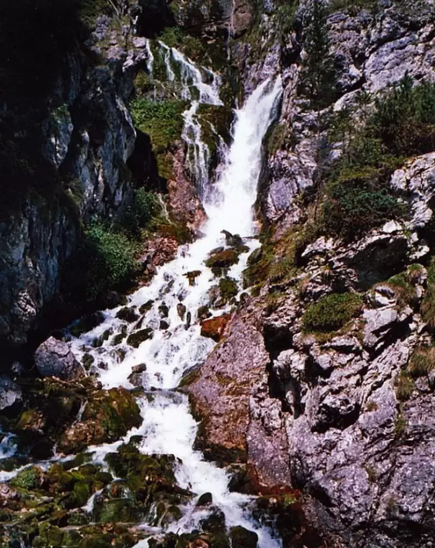
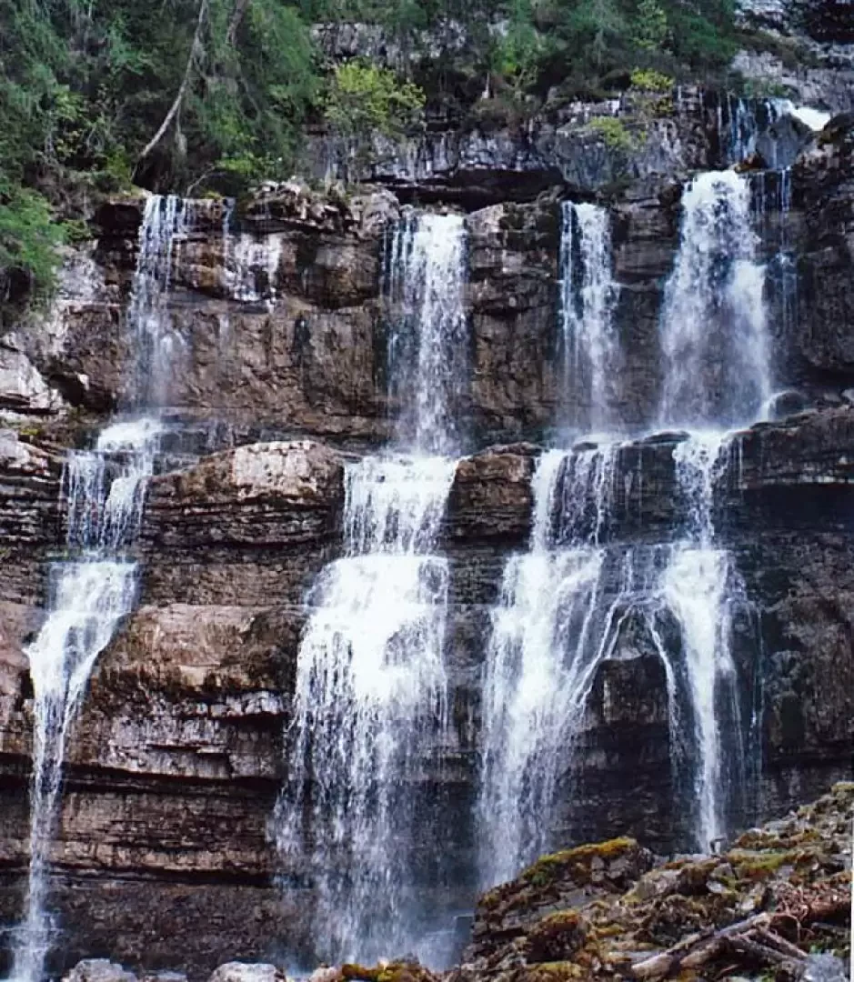
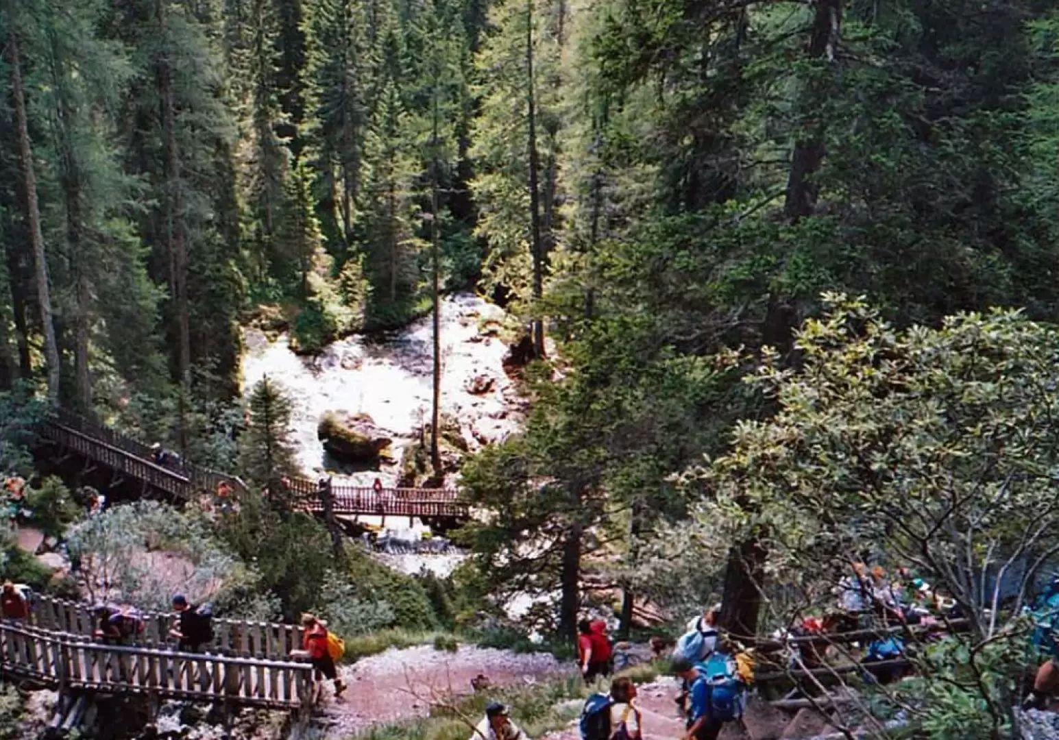
We start our descent on a path jammed with people, if they had been almond-eyed I would have thought it was a busload of Japanese from how many people there were. The path is quite impassable but very beautiful as from above we could see bridges and small bridges that we would later find ourselves crossing. After we managed to pass a group of people in a double rope (read stout woman held back by the waistband of her trousers to facilitate the descent) the main waterfall presents itself to us, from the little bridge it is possible to admire its leap to the base, where it forms a small basin of blue-green water.
The quantity of people stopping at the base of the waterfall is worthy of how many one can find admiring the cathedral of the city on a visit. We continue on the path that now runs alongside the stream generated by the falls in a descending manner until we enter a forest. In less than 30 minutes we find ourselves at the Vallesinella Refuge, where, as we have been very good, a delicious slice of carrot cake awaits us.
Once the 'children' have had their snack, we set off again to descend to the valley, first crossing the Middle Falls Refuge and then the Archduke's Path, which will take us back to Madonna.
The path winds its way through a beautiful forest with some fairly steep points made of rock steps and roots.
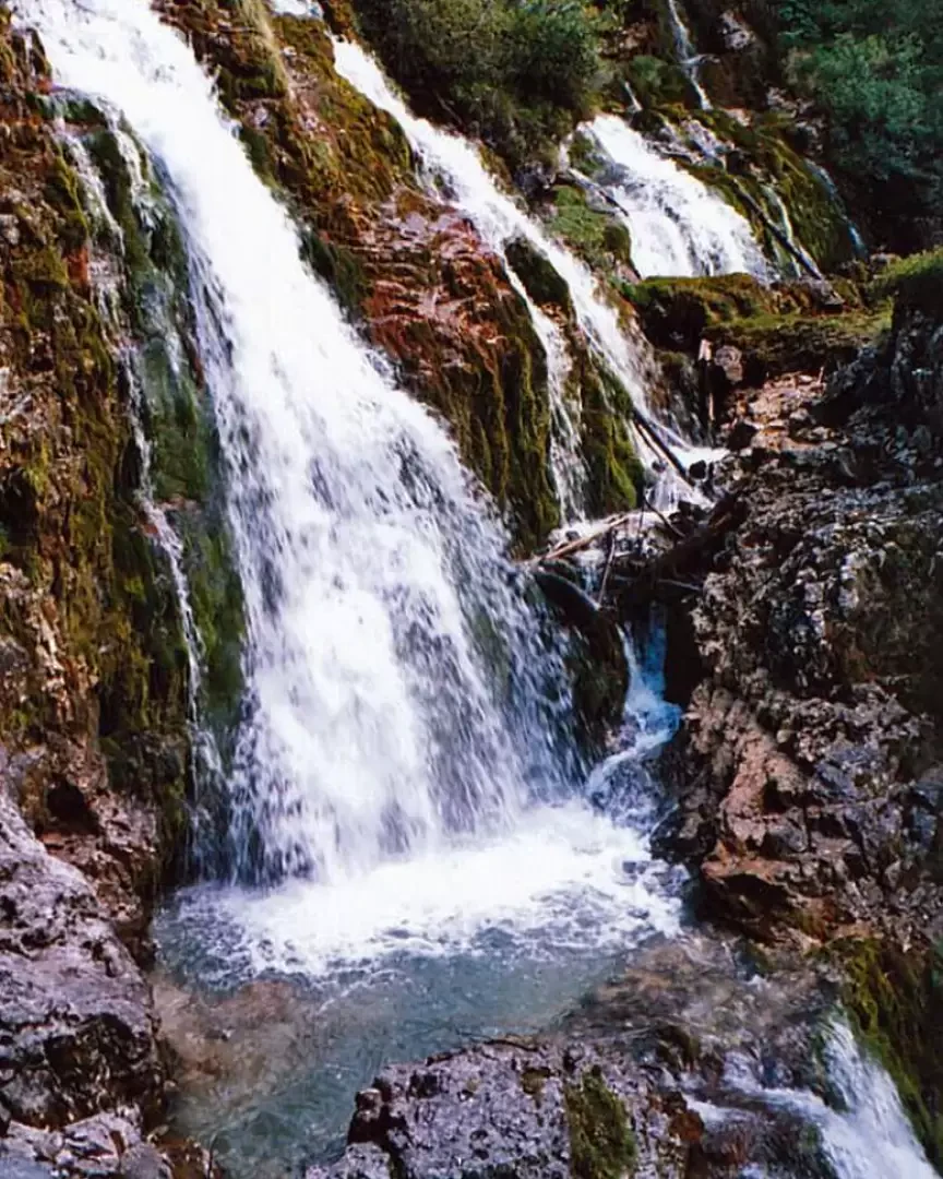
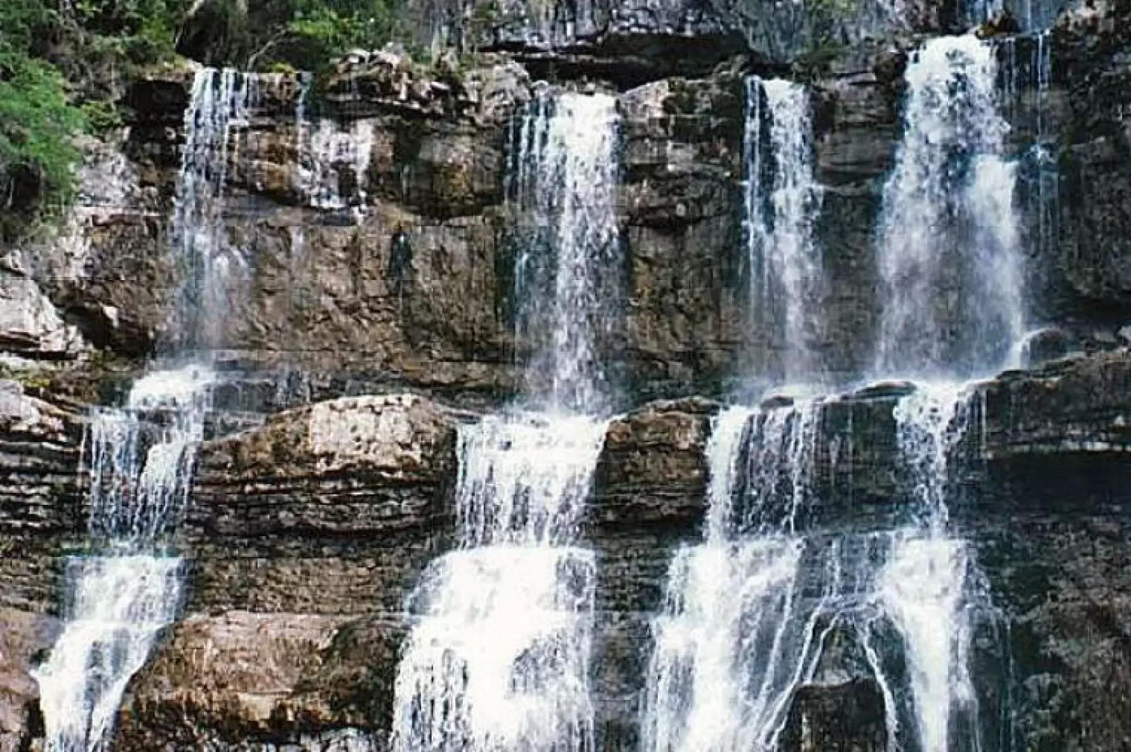
After about 40 minutes we arrive at the Cascate di Mezzo waterfalls, which we had already seen on the excursion to Lago di Valagola, from here we take the forest road that leads to the Vivaio del Brenta and after about thirty metres we find the signpost for the path that will take us back to our starting point.
The path called "dell'Arciduca" winds through a beautiful forest with the scent of mushrooms, it has a gentle and pleasant slope but... in all paths there is a but... in fact the catch is at the end where the path climbs up a fairly steep slope lasting about 15 minutes until we reach the Maroni car park which was at the beginning of the toll road.
Returning to the car we return to Pinzolo exhausted but happy with the wonderful walk we have done.
Galleria fotografica